Greenham Barton

Heritage Site in Somerset Somerset West and Taunton

England

Greenham Barton

Direction Sign – Signpost near White Ball in Sampford Arundel parish Located on the west side of a crossroads northeast of White Ball in Sampford Arundel parish. 4 arms and pyramid finial. See also <a title="https://www.geograph.org.uk/photo/2154974" href="https://www.geograph.org.uk/photo/2154974">Link</a>.

Milestone Society National ID: SO_ST1019A
Direction Sign – Signpost near White Ball in Sampford Arundel parish Credit: J Browne

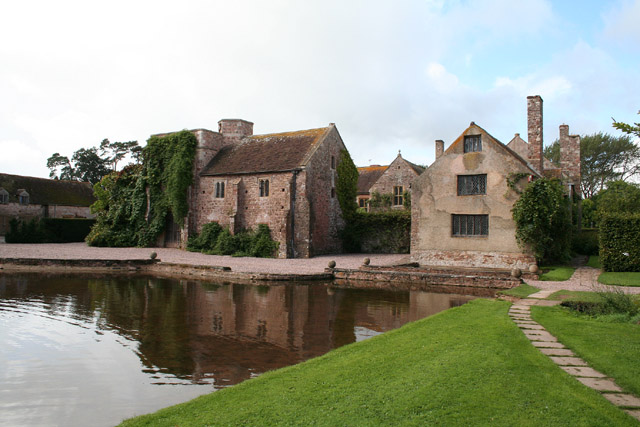
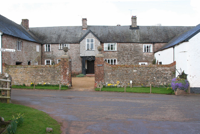
Greenham Barton is a historic site located in Somerset, England. It is an example of a traditional English Barton, which is a type of farmstead that was common in the region during the medieval and early modern periods. The site is believed to date back to the 14th century, although some parts may be even older.

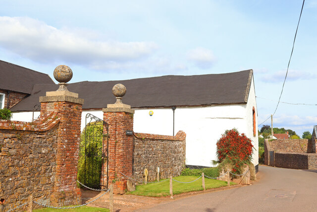
At the heart of Greenham Barton is a large farmhouse, which has been well-preserved and retains many original features. The house is built in a traditional local style, with a thatched roof and stone walls. It has a symmetrical design and features a central porch and a large chimney.

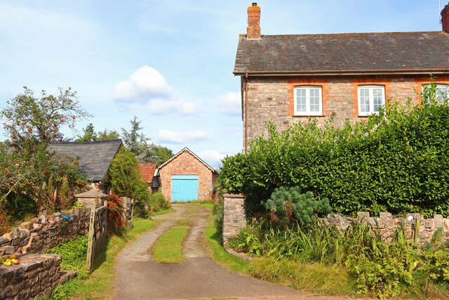
Surrounding the farmhouse are a number of outbuildings, including barns, stables, and a granary. These buildings provide insight into the agricultural practices of the time and the self-sufficiency of the farm.

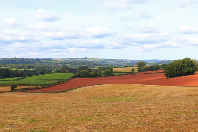
Greenham Barton is set within a picturesque landscape, surrounded by rolling hills and fields. The site is also home to a small orchard, which is believed to have been planted in the 18th century.

The Barton has been recognized for its historical and architectural significance and is listed as a heritage site. It offers visitors a glimpse into the past and serves as a reminder of the agricultural heritage of the region. Greenham Barton is open to the public and guided tours are available, providing an opportunity to explore the rich history and beauty of the site.

If you have any feedback on the listing, please let us know in the comments section below.

Greenham Barton Images

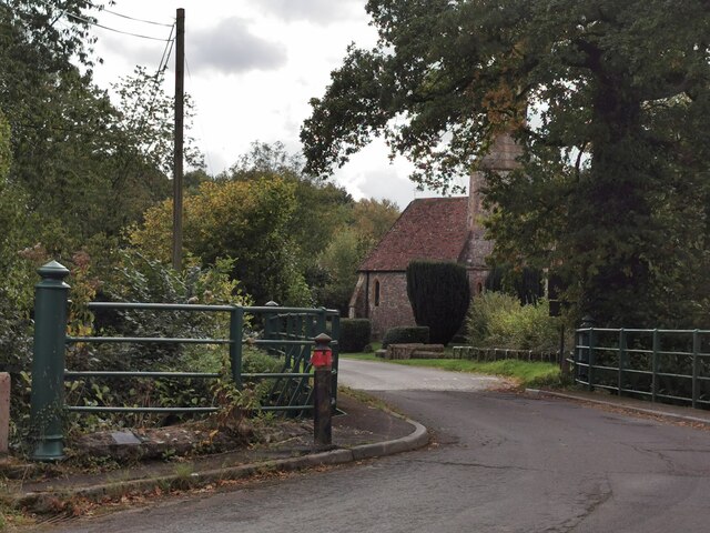
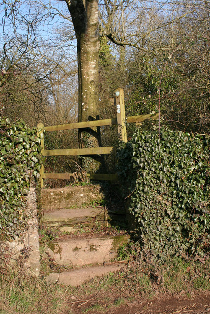
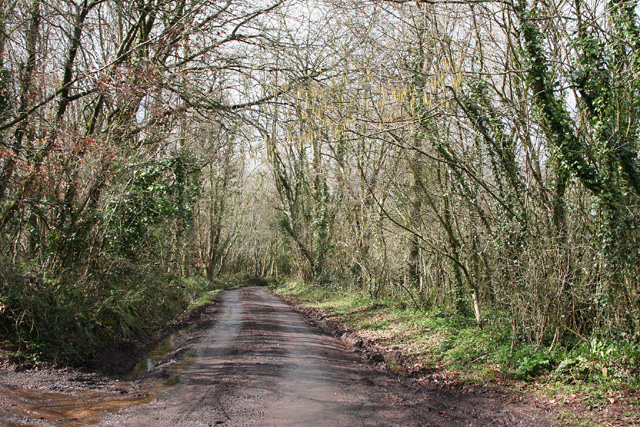
Images are sourced within 2km of 50.967/-3.303 or Grid Reference ST0819. Thanks to Geograph Open Source API. All images are credited.

Direction Sign – Signpost near White Ball in Sampford Arundel parish Located on the west side of a crossroads northeast of White Ball in Sampford Arundel parish. 4 arms and pyramid finial. See also <a title="https://www.geograph.org.uk/photo/2154974" href="https://www.geograph.org.uk/photo/2154974">Link</a>.

Milestone Society National ID: SO_ST1019A
Direction Sign – Signpost near White Ball in Sampford Arundel parish
Located on the west side of a crossroads northeast of White Ball in Sampford Arundel parish. 4 arms and pyramid finial. See also Link. Milestone Society National ID: SO_ST1019A
Old Milestone in Sampford Arundel parish, west of Beam Bridge Metal plate attached to concrete post by the UC road, in parish of SAMPFORD ARUNDEL (TAUNTON DEANE District), West of Beam Bridge, in bank, on West side of road. Wiveliscombe iron plate, erected by the Wiveliscombe turnpike trust in the 19th century.

Inscription reads:-
WIVELISCOMBE
6
MILES

Grade II listed.
List Entry Number: 1344594 <span class="nowrap"><a title="https://historicengland.org.uk/listing/the-list/list-entry/1344594" rel="nofollow ugc noopener" href="https://historicengland.org.uk/listing/the-list/list-entry/1344594">Link</a><img style="margin-left:2px;" alt="External link" title="External link - shift click to open in new window" src="https://s1.geograph.org.uk/img/external.png" width="10" height="10"/></span>

Milestone Society National ID: SO_WVSP06.
Old Milestone in Sampford Arundel parish, west of Beam Bridge
Metal plate attached to concrete post by the UC road, in parish of SAMPFORD ARUNDEL (TAUNTON DEANE District), West of Beam Bridge, in bank, on West side of road. Wiveliscombe iron plate, erected by the Wiveliscombe turnpike trust in the 19th century. Inscription reads:- WIVELISCOMBE 6 MILES Grade II listed. List Entry Number: 1344594 LinkExternal link Milestone Society National ID: SO_WVSP06.
Entrance to Manor Farm Manor Farm, near Thorne St Margaret.
Entrance to Manor Farm
Manor Farm, near Thorne St Margaret.
Greenham Village Houses in Greenham.
Greenham Village
Houses in Greenham.
Higher Greenham Road junction on Fisher's Hill.
Higher Greenham
Road junction on Fisher's Hill.
View across fields View from Fishers Hill.
View across fields
View from Fishers Hill.
Greenham : Bishop's Hill Looking along Bishop's Hill in Greenham.
Greenham : Bishop's Hill
Looking along Bishop's Hill in Greenham.
Stawley: Cothay Manor The manor gardens are open on Wednesdays, Thursdays and Sundays from April through to September. Also on bank holidays. Admission in 2005 – £4: no dogs. The manor house dates from the late 15th century
Stawley: Cothay Manor
The manor gardens are open on Wednesdays, Thursdays and Sundays from April through to September. Also on bank holidays. Admission in 2005 – £4: no dogs. The manor house dates from the late 15th century
Stawley: footpath at Greenham The old towpath of the Grand Western Canal – not restored on this section – has now become a public footpath. Here it heads north east towards Cothay Manor
Stawley: footpath at Greenham
The old towpath of the Grand Western Canal – not restored on this section – has now become a public footpath. Here it heads north east towards Cothay Manor
Thorne St Margaret: lane through Piley Copse Looking north west. Small ponds by the lane have recently been cleared of surrounding trees
Thorne St Margaret: lane through Piley Copse
Looking north west. Small ponds by the lane have recently been cleared of surrounding trees
Thorne St Margaret: Thorne Manor Earlier known as Manor Farm, it dates from the 16th century. A horse engine was used for thrashing wheat here in the 19th century
Thorne St Margaret: Thorne Manor
Earlier known as Manor Farm, it dates from the 16th century. A horse engine was used for thrashing wheat here in the 19th century
Thorne St Margaret: limekiln near Piley Copse On the edge of a field with access permitted under DEFRA’s farm conservation scheme – until September 2011. Looking south west
Thorne St Margaret: limekiln near Piley Copse
On the edge of a field with access permitted under DEFRA’s farm conservation scheme – until September 2011. Looking south west
Stawley: path at Greenham By the bed of the Grand Western Canal in which the saplings on the right grow. Looking north east
Stawley: path at Greenham
By the bed of the Grand Western Canal in which the saplings on the right grow. Looking north east
Stawley: canal bed at Greenham The remains of the Grand Western Canal at Greenham. Looking east from the adjoining public footpath, which runs to Cothay Manor
Stawley: canal bed at Greenham
The remains of the Grand Western Canal at Greenham. Looking east from the adjoining public footpath, which runs to Cothay Manor
Marsh Marigolds, near Greenham On an abandoned stretch of the Grand Western Canal.
Marsh Marigolds, near Greenham
On an abandoned stretch of the Grand Western Canal.
Canalside path, near Greenham
Drive, to Greenham Hall
Greenham Hall
Greenham Hall
Show me another place!

Greenham Barton is located at Grid Ref: ST0819 (Lat: 50.967, Lng: -3.303)

Administrative County: Somerset

District: Somerset West and Taunton

Police Authority: Avon and Somerset

What 3 Words

///composed.detriment.dwelled. Near Uffculme, Devon

Related Wikis

Greenham Barton

Greenham Barton is a 13th-century manor house in the civil parish of Stawley, Somerset, England (at Greenham, west of Wellington in Somerset). Built in...

Greenham Hall

Greenham Hall is a country house at Wellington in Somerset. It was once the home of Admiral of the Fleet Sir John Kelly. It is a Grade II listed building...

Wellington Bank, Somerset

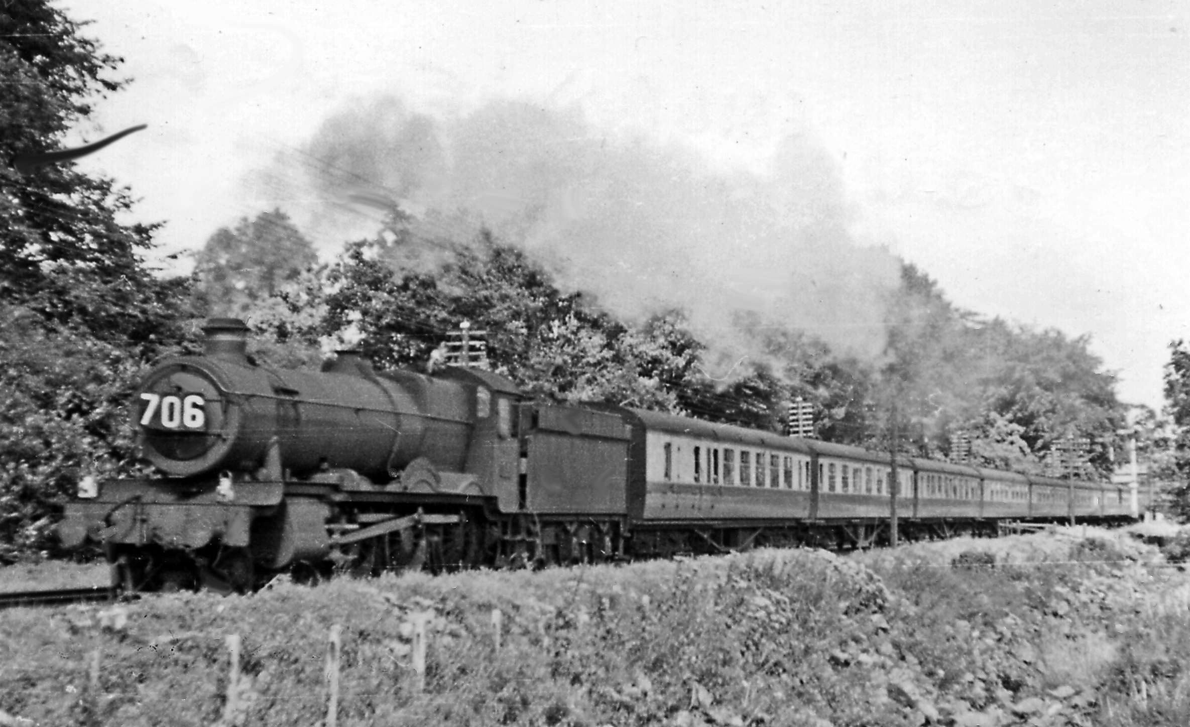
Wellington Bank is a steep railway embankment and associated climb located on the Bristol to Exeter line, that climbs from just northeast of Wellington...
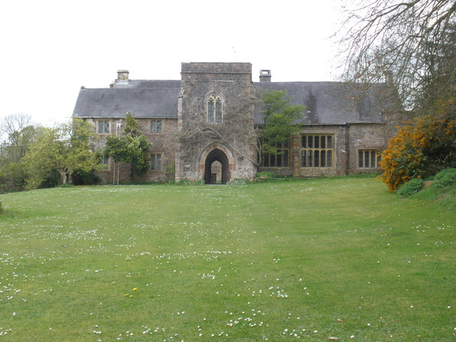
Cothay Manor

Cothay Manor is a grade one listed medieval house and gardens, in Stawley, near Wellington, Somerset. The manor grounds consist of almost 40 acres and...

Thorne St Margaret

Thorne St Margaret is a village in the civil parish of Wellington Without in the Taunton Deane district of Somerset, England. It is situated 3 miles west...

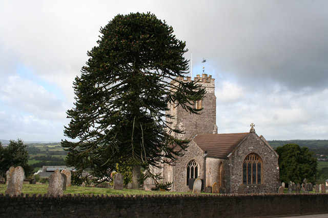
Church of St Margaret, Thorne St Margaret

The Anglican Church of St Margaret in Thorne St Margaret, Somerset, England was built in the 15th century. It is a Grade II* listed building. == History... ==

Sampford Arundel

Sampford Arundel is a village and civil parish in Somerset, England. It is situated near Wellington and 10 miles (16.1 km) south west of Taunton. The village...

Burlescombe

Burlescombe (, bur-LES-kəm) is a village and civil parish in the Mid Devon district of Devon, England. The parish is surrounded, clockwise from the north...

Nearby Amenities

Located within 500m of 50.967,-3.303
Design: three-level
Power: tower
Lat/Long: 50.9668445/-3.2970123
Design: three-level
Power: tower
Lat/Long: 50.9630987/-3.3054948
Design: three-level
Power: tower
Lat/Long: 50.9653843/-3.3003421
The data included in this document is from www.openstreetmap.org. The data is made available under ODbL.

Have you been to Greenham Barton?

Leave your review of Greenham Barton below (or comments, questions and feedback).