Godstow Abbey

Heritage Site in Oxfordshire

England

Godstow Abbey

Autumnal trees along the A40 Trees turning yellow along the A40 near Oxford.
Autumnal trees along the A40 Credit: Pebble

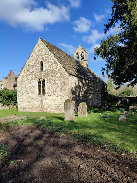
Godstow Abbey is a historic heritage site located in Oxfordshire, England. It was founded in the 12th century and served as a Benedictine nunnery until its dissolution in the 16th century. The abbey is situated on the banks of the River Thames, about three miles northwest of the city of Oxford.

The abbey initially started as a retreat for a group of hermits, but was later established as a proper religious community by Edith, the Dowager Queen of England. Over the centuries, Godstow Abbey grew in size and importance, becoming an influential institution in the region.

The abbey's architecture showcases a mix of Romanesque and Gothic styles, reflecting the changes and expansions made throughout its existence. Visitors to the site can explore the ruins of the abbey, which include the remains of the church, cloisters, chapter house, and other buildings. The remnants of the church display intricate details, such as decorative arches and carved stone fragments, giving insight into the craftsmanship of the time.

One of the most notable features of Godstow Abbey is its association with the legendary figure of Rosamund Clifford, also known as "Fair Rosamund." She was a mistress of King Henry II and is said to have been buried within the abbey grounds. This connection has added to the abbey's allure and intrigue.

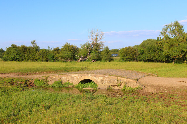
Today, Godstow Abbey is a popular tourist attraction, drawing visitors who are interested in exploring its rich history and enjoying the tranquil riverside setting. The site offers a serene and picturesque environment, making it an ideal spot for picnics or leisurely walks along the riverbank.

If you have any feedback on the listing, please let us know in the comments section below.

Godstow Abbey Images

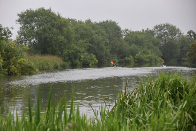
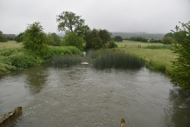
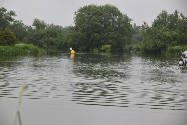
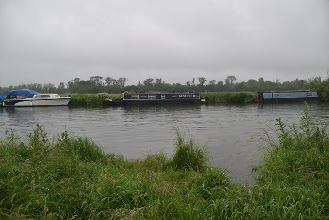
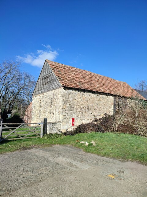
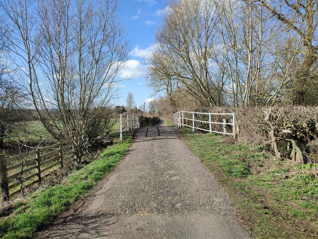
Images are sourced within 2km of 51.782/-1.297 or Grid Reference SP4809. Thanks to Geograph Open Source API. All images are credited.

Autumnal trees along the A40 Trees turning yellow along the A40 near Oxford.
Autumnal trees along the A40
Trees turning yellow along the A40 near Oxford.
Inn at Night The view of the Holiday Inn hotel on the Service area at Peartree Hill roundabout for the A34, Oxford.
Inn at Night
The view of the Holiday Inn hotel on the Service area at Peartree Hill roundabout for the A34, Oxford.
Car Park View The view on the car park of the Oxford Travelodge on the Service area next to the Peartree Hill roundabout on the A34.
Car Park View
The view on the car park of the Oxford Travelodge on the Service area next to the Peartree Hill roundabout on the A34.
River Thames The River Thames rises at Thames Head in Gloucestershire on the slopes of the Cotswolds and flows generally eastward to its mouth near Southend in Essex. At 215 miles long it is one of the longest rivers in Britain, and the longest entirely within England. It is one of the most important rivers in Britain. <span class="nowrap"><a title="http://en.wikipedia.org/wiki/River_Thames" rel="nofollow ugc noopener" href="http://en.wikipedia.org/wiki/River_Thames">Link</a><img style="margin-left:2px;" alt="External link" title="External link - shift click to open in new window" src="https://s1.geograph.org.uk/img/external.png" width="10" height="10"/></span>
River Thames
The River Thames rises at Thames Head in Gloucestershire on the slopes of the Cotswolds and flows generally eastward to its mouth near Southend in Essex. At 215 miles long it is one of the longest rivers in Britain, and the longest entirely within England. It is one of the most important rivers in Britain. LinkExternal link
University Farm
University Farm
Footbridge, Thames Path This National Trail is 184 miles (294 km) long, following the River Thames from its source in the Cotswolds almost to the sea, finishing at the Thames Barrier in Greenwich.
The trail keeps to the banks of the river most of the route.
Website: <span class="nowrap"><a title="http://www.nationaltrail.co.uk/ThamesPath/" rel="nofollow ugc noopener" href="http://www.nationaltrail.co.uk/ThamesPath/">Link</a><img style="margin-left:2px;" alt="External link" title="External link - shift click to open in new window" src="https://s1.geograph.org.uk/img/external.png" width="10" height="10"/></span>
Footbridge, Thames Path
This National Trail is 184 miles (294 km) long, following the River Thames from its source in the Cotswolds almost to the sea, finishing at the Thames Barrier in Greenwich. The trail keeps to the banks of the river most of the route. Website: LinkExternal link
Wytham Stream
Wytham Stream
River Thames
River Thames
River Thames The River Thames rises at Thames Head in Gloucestershire on the slopes of the Cotswolds and flows generally eastward to its mouth near Southend in Essex. At 215 miles long it is one of the longest rivers in Britain, and the longest entirely within England. It is one of the most important rivers in Britain. <span class="nowrap"><a title="http://en.wikipedia.org/wiki/River_Thames" rel="nofollow ugc noopener" href="http://en.wikipedia.org/wiki/River_Thames">Link</a><img style="margin-left:2px;" alt="External link" title="External link - shift click to open in new window" src="https://s1.geograph.org.uk/img/external.png" width="10" height="10"/></span>
River Thames
The River Thames rises at Thames Head in Gloucestershire on the slopes of the Cotswolds and flows generally eastward to its mouth near Southend in Essex. At 215 miles long it is one of the longest rivers in Britain, and the longest entirely within England. It is one of the most important rivers in Britain. LinkExternal link
Oxford Canal near Duke's Lock
A34 Oxford bypass crossing the railway
Wolvercote Common near Oxford
Barn, Binsey
Barn, Binsey
Bridge, Lane to Binsey Church
St Margaret's Church, Binsey
Wolvercote Common Bridge over the brook.
Wolvercote Common
Bridge over the brook.
Memorial Stone John Thompson stone, in Burgess Field, Oxford.
Memorial Stone
John Thompson stone, in Burgess Field, Oxford.
Horses in Thames amused by dinghy sailors Commoners' horses graze on Port Meadow, dinghy from Medley sailing club the other side of the Thames.
Horses in Thames amused by dinghy sailors
Commoners' horses graze on Port Meadow, dinghy from Medley sailing club the other side of the Thames.
Show me another place!

Godstow Abbey is located at Grid Ref: SP4809 (Lat: 51.782, Lng: -1.297)

Police Authority: Thames Valley

What 3 Words

///slows.jungle.expect. Near Wolvercote, Oxfordshire

Related Wikis

Wolvercote Meadows

Wolvercote Meadows is a 7.1-hectare (18-acre) biological Site of Special Scientific Interest north of Oxford in Oxfordshire. Part of it is owned by the...

St Edward's School Boat Club

St Edward's School Boat Club is a rowing club on the River Thames based at St Edwards School Boathouse on Godstow Road, Oxford, Oxfordshire. It is the...

Headington School Oxford Boat Club

Headington School Oxford Boat Club (HSOBC for short) is a rowing club on the River Thames currently based in rented premises at St Edwards School Boathouse...
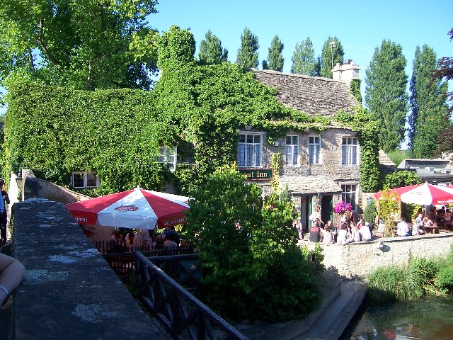
The Trout Inn

The Trout Inn (often simply referred to as The Trout) is a historic pub in Lower Wolvercote north of Oxford, close to Godstow Bridge, directly by the River...

Nearby Amenities

Located within 500m of 51.782,-1.297
Mini Roundabout
Direction: clockwise
Lat/Long: 51.7837402/-1.2931188
Turning Circle
Turning Circle: y-head
Lat/Long: 51.7825017/-1.2927517
Turning Circle
Turning Circle: square
Lat/Long: 51.7831659/-1.2902911
Lower Wolvercote
Place: neighbourhood
Lat/Long: 51.7836441/-1.2917643
Waterway: weir
Lat/Long: 51.7813868/-1.2962864
Barrier: bollard
Bicycle: yes
Bollard: fixed
Foot: yes
Vehicle: no
Lat/Long: 51.7834887/-1.2927171
Pub
The White Hart
Addr City: Oxford
Addr Housenumber: 126
Addr Postcode: OX2 8PQ
Addr Street: Godstow Road
Fhrs Id: 268655
Outdoor Seating: yes
Source Addr: FHRS Open Data
Wikidata: Q26410012
Lat/Long: 51.7838053/-1.2931619
Kerb: no
Lat/Long: 51.7793993/-1.2998993
Barrier: entrance
Lat/Long: 51.7780636/-1.2999011
Barrier: entrance
Lat/Long: 51.7782596/-1.2993175
Source: yahoo imagery
Lat/Long: 51.7782124/-1.2981833
Post Box
Brand: Royal Mail
Brand Wikidata: Q638098
Brand Wikipedia: en:Royal Mail
Collection Times: Mo-Fr 17:00; Sa 10:00
Mapillary: 338875574383714
Operator: Royal Mail
Operator Type: private
Operator Wikidata: Q638098
Post Box Mounting: wooden_post
Post Box Type: lamp
Ref: OX2 809
Survey Date: 2021-05-05
Lat/Long: 51.7824209/-1.2949884
Maxspeed: 20 mph
Maxspeed Note: Oxford 20 mph zone
Maxspeed Spec: a point 386m SW of its junction w/ Webbs Close
Lat/Long: 51.780405/-1.2991832
Bus Stop
Home Close
Bus: yes
Check Date Shelter: 2021-10-23
Local Ref: adj
Naptan AtcoCode: 340001008SOU
Naptan Bearing: S
Naptan CommonName: Home Close
Naptan Indicator: Godstow Road
Naptan Landmark: Home Close
Naptan NaptanCode: oxfadtgp
Naptan PlusbusZoneRef: OXFD
Naptan Street: Home Close
Public Transport: platform
Route Ref: 6
Shelter: yes
Source: naptan_import
Lat/Long: 51.7838349/-1.292007
Maxheight: 2.3
Source: survey
Lat/Long: 51.7817038/-1.2951316
Bench
Lat/Long: 51.7804496/-1.2998893
Bench
Lat/Long: 51.7804263/-1.2999149
Man Made: water_well
Lat/Long: 51.7804185/-1.2998861
Recycling
Recycling Cans: yes
Recycling Cartons: yes
Recycling Clothes: yes
Recycling Glass: no
Recycling Paper: yes
Recycling Plastic: yes
Lat/Long: 51.7837883/-1.2933583
012
Ele: 60.688477
Wpt Description: X
Wpt Symbol: Trail Head
Lat/Long: 51.7819648/-1.2904083
Barrier: kissing_gate
Lat/Long: 51.781235/-1.2957794
Barrier: bollard
Bollard: fixed
Fixme: so how do the cars get in?
Lat/Long: 51.7833715/-1.2930588
Drinking Water
Fixme: suspect these are redundant as similar info on pub object
Wheelchair: yes
Lat/Long: 51.7799897/-1.2990325
Toilets
Access: customers
Fee: no
Fixme: suspect these are redundant as similar info on pub object
Wheelchair: yes
Lat/Long: 51.779982/-1.2989081
Godstow
Place: hamlet
Lat/Long: 51.7790896/-1.2998625
Barrier: kissing_gate
Lat/Long: 51.780413/-1.2955222
Ford: yes
Lat/Long: 51.7816238/-1.2928144
In memory of Ewan Agnew
Artist Wikipedia: https://en.wikipedia.org/wiki/Eric_Gill
Artist Name: Eric Gill
Historic: memorial
Inscription: THIS LAND WAS ACQUIRED BY THE OXFORD PRESERVATION TRUST IN 1934 THROUGH A GIFT OF PHILIP LESLIE AGNEW IN MEMORY OF HIS SON EWAN SIEGFRIED AGNEW NEW COLLEGE OXFORD 1912–1914 PRO PATRIA
Material: stone
Memorial: plaque
Lat/Long: 51.7801723/-1.2995687
Bus Stop
Paper Mill
Bus: yes
Local Ref: W-Bound
Naptan AtcoCode: 340021003PMS
Naptan Street: Baynhams Drive
Public Transport: platform
Route Ref: 6
Shelter: yes
Lat/Long: 51.7845706/-1.2942278
Leisure: picnic_table
Lat/Long: 51.7811161/-1.2958939
Leisure: picnic_table
Lat/Long: 51.7809536/-1.2958584
Leisure: picnic_table
Lat/Long: 51.7808029/-1.2958152
Leisure: picnic_table
Lat/Long: 51.7806483/-1.2957683
Bench
Lat/Long: 51.7808272/-1.2955957
Bench
Lat/Long: 51.7805309/-1.3002188
Addr Housenumber: 13
Addr Street: Webbs Close
Lat/Long: 51.7818616/-1.295912
Addr Housenumber: 18
Lat/Long: 51.7819797/-1.2962588
Addr Housenumber: 26
Addr Street: Webbs Close
Lat/Long: 51.782354/-1.2956744
Addr Housenumber: 29
Addr Street: Webbs Close
Lat/Long: 51.7824245/-1.2958916
Addr Housenumber: 19
Addr Street: Webbs Close
Lat/Long: 51.7820678/-1.2956784
Addr Housenumber: 25
Addr Street: Webbs Close
Lat/Long: 51.7822113/-1.2961035
Addr Housenumber: 30
Addr Street: Webbs Close
Lat/Long: 51.7826099/-1.2955416
Addr Housenumber: 32
Addr Street: Webbs Close
Lat/Long: 51.7826608/-1.2956956
Addr Housenumber: 33
Addr Street: Webbs Close
Lat/Long: 51.7827958/-1.2952498
Addr Housenumber: 37
Addr Street: Webbs Close
Lat/Long: 51.7828954/-1.2955355
Board Type: notice
Information: board
Tourism: information
Lat/Long: 51.7823612/-1.2950483
RFC/RAF Airfield Memorial
Historic: memorial
Inscription: Per ardua ad astra [...] // In grateful memory of those who served in or with the Royal Flying Corps and later the Royal Air Force, and who died [...]
Man Made: obelisk
Material: granite
Memorial: war_memorial
Start Date: 2018-05-23
Lat/Long: 51.7804626/-1.2956833
Port Meadow Aerodrome
Board Type: history
Direction: 0
Information: board
Tourism: information
Lat/Long: 51.7804084/-1.2956092
Bench
Lat/Long: 51.7855428/-1.2953689
Bench
Lat/Long: 51.7855145/-1.2953744
Direction: 170
Generator Method: photovoltaic
Generator Output Electricity: yes
Generator Solar Modules: 2
Generator Source: solar
Generator Type: solar_photovoltaic_panel
Location: roof
Power: generator
Lat/Long: 51.7842466/-1.2913049
Direction: 165
Generator Method: photovoltaic
Generator Output Electricity: yes
Generator Solar Modules: 9
Generator Source: solar
Generator Type: solar_photovoltaic_panel
Location: roof
Power: generator
Lat/Long: 51.7845345/-1.2923395
Direction: 255
Generator Method: photovoltaic
Generator Output Electricity: yes
Generator Solar Modules: 8
Generator Source: solar
Generator Type: solar_photovoltaic_panel
Location: roof
Power: generator
Lat/Long: 51.7845511/-1.2923829
Direction: 255
Generator Method: photovoltaic
Generator Output Electricity: yes
Generator Solar Modules: 6
Generator Source: solar
Generator Type: solar_photovoltaic_panel
Location: roof
Power: generator
Lat/Long: 51.7850575/-1.2921177
Direction: 75
Generator Method: photovoltaic
Generator Output Electricity: yes
Generator Solar Modules: 6
Generator Source: solar
Generator Type: solar_photovoltaic_panel
Location: roof
Power: generator
Lat/Long: 51.7850654/-1.2920462
Direction: 135
Generator Method: photovoltaic
Generator Output Electricity: yes
Generator Solar Modules: 6
Generator Source: solar
Generator Type: solar_photovoltaic_panel
Location: roof
Power: generator
Lat/Long: 51.7827268/-1.2914863
Direction: 225
Generator Method: photovoltaic
Generator Output Electricity: yes
Generator Solar Modules: 6
Generator Source: solar
Generator Type: solar_photovoltaic_panel
Location: roof
Power: generator
Lat/Long: 51.7826867/-1.291522
Direction: 155
Fixme: survey for panel counts & types
Generator Method: photovoltaic
Generator Output Electricity: yes
Generator Solar Modules: 5
Generator Source: solar
Generator Type: solar_photovoltaic_panel
Location: roof
Power: generator
Lat/Long: 51.7824019/-1.2923047
Direction: 245
Generator Method: photovoltaic
Generator Output Electricity: yes
Generator Solar Modules: 4
Generator Source: solar
Generator Type: solar_photovoltaic_panel
Location: roof
Power: generator
Lat/Long: 51.7824131/-1.2923514
Direction: 230
Generator Method: photovoltaic
Generator Output Electricity: yes
Generator Solar Modules: 6
Generator Source: solar
Generator Type: solar_photovoltaic_panel
Location: roof
Power: generator
Lat/Long: 51.7829189/-1.2938957
Direction: 250
Generator Method: photovoltaic
Generator Output Electricity: yes
Generator Solar Modules: 4
Generator Source: solar
Generator Type: solar_photovoltaic_panel
Location: roof
Power: generator
Lat/Long: 51.7829524/-1.2939692
Direction: 75
Fixme: survey for panel count
Generator Method: photovoltaic
Generator Output Electricity: yes
Generator Solar Modules: 8
Generator Source: solar
Generator Type: solar_photovoltaic_panel
Location: roof
Power: generator
Lat/Long: 51.7821233/-1.2933835
Fixme: solar panels?
Lat/Long: 51.7844924/-1.2954272
Life Ring
Emergency: life_ring
Lat/Long: 51.7855947/-1.2953906
Waste Basket
Lat/Long: 51.7855659/-1.2953679
Leisure: playground
Lat/Long: 51.7847995/-1.2954751
Life Ring
Emergency: life_ring
Lat/Long: 51.7848837/-1.2951329
Life Ring
Emergency: life_ring
Lat/Long: 51.7839474/-1.295611
Bicycle Parking
Lat/Long: 51.7845211/-1.2943007
Bench
Lat/Long: 51.7845163/-1.2940803
Bench
Lat/Long: 51.7845487/-1.2940483
Bench
Lat/Long: 51.7844726/-1.2942637
Entrance: main
Lat/Long: 51.7800209/-1.2994867
Bus Stop
Home Close
Bus: yes
Local Ref: opp
Public Transport: platform
Lat/Long: 51.7837305/-1.2918419
Addr Housenumber: 183
Addr Street: Godstow Road
Lat/Long: 51.7820243/-1.2947179
Addr Housenumber: 181
Addr Street: Godstow Road
Lat/Long: 51.7820595/-1.2947378
Addr Housenumber: 177
Addr Street: Godstow Road
Lat/Long: 51.7821892/-1.294734
Addr Housenumber: 175
Addr Street: Godstow Road
Lat/Long: 51.7822349/-1.2947454
Addr Housenumber: 173
Addr Street: Godstow Road
Lat/Long: 51.7823077/-1.2947435
Addr Housenumber: 171
Addr Street: Godstow Road
Lat/Long: 51.7823447/-1.2947568
Addr Housenumber: 163
Addr Street: Godstow Road
Lat/Long: 51.7827207/-1.2946003
Addr Housenumber: 151
Addr Street: Godstow Road
Lat/Long: 51.7828105/-1.294458
Addr Housenumber: 46
Addr Street: Webbs Close
Lat/Long: 51.7834973/-1.2948713
Addr Housenumber: 47
Addr Street: Webbs Close
Lat/Long: 51.7834973/-1.2947842
Addr Housenumber: 48
Addr Street: Webbs Close
Lat/Long: 51.7833859/-1.2946066
Addr Housenumber: 56
Addr Street: Webbs Close
Lat/Long: 51.7831115/-1.2948012
Addr Housenumber: 166
Addr Street: Godstow Road
Lat/Long: 51.7828943/-1.2946305
Addr Housenumber: 164
Addr Street: Godstow Road
Lat/Long: 51.7829253/-1.2945651
Addr Housenumber: 160
Addr Street: Godstow Road
Lat/Long: 51.7830196/-1.2944301
Addr Housenumber: 158
Addr Street: Godstow Road
Lat/Long: 51.7830554/-1.2943233
Addr Housenumber: 144
Addr Street: Godstow Road
Lat/Long: 51.7832919/-1.2937819
Addr Housenumber: 146
Addr Street: Godstow Road
Lat/Long: 51.7832916/-1.2938392
Addr Housenumber: 148
Addr Street: Godstow Road
Lat/Long: 51.7832811/-1.2938985
Addr Housenumber: 1
Addr Street: Mill Road
Lat/Long: 51.78368/-1.2938194
Addr Housenumber: 11
Addr Street: Mill Road
Lat/Long: 51.7836686/-1.2947683
Addr Housenumber: 11A
Addr Street: Mill Road
Lat/Long: 51.7836675/-1.2948563
Addr Housenumber: 12
Addr Street: Mill Road
Lat/Long: 51.7838227/-1.2947658
Addr Housenumber: 15
Addr Street: Mill Road
Lat/Long: 51.7838269/-1.2945177
Leisure: bird_hide
Lat/Long: 51.786283/-1.2952405
Addr Housenumber: 1
Addr Street: Meadow Prospect
Lat/Long: 51.7834235/-1.2917147
Addr Housenumber: 3
Addr Street: Meadow Prospect
Lat/Long: 51.7833698/-1.2916969
Addr Housenumber: 5
Addr Street: Meadow Prospect
Lat/Long: 51.78328/-1.2916615
Addr Housenumber: 7
Addr Street: Meadow Prospect
Lat/Long: 51.7832361/-1.2916456
Addr Housenumber: 9
Addr Street: Meadow Prospect
Lat/Long: 51.7831583/-1.2916261
Addr Housenumber: 11
Addr Street: Meadow Prospect
Lat/Long: 51.7831046/-1.2916119
Addr Housenumber: 13
Addr Street: Meadow Prospect
Lat/Long: 51.7830378/-1.2915482
Addr Housenumber: 15
Addr Street: Meadow Prospect
Lat/Long: 51.7829863/-1.2915393
Addr Housenumber: 17
Addr Street: Meadow Prospect
Lat/Long: 51.7829129/-1.2914649
Addr Housenumber: 19
Addr Street: Meadow Prospect
Lat/Long: 51.7828603/-1.2914472
Addr Housenumber: 21
Addr Street: Meadow Prospect
Lat/Long: 51.782765/-1.2914862
Addr Housenumber: 23
Addr Street: Meadow Prospect
Lat/Long: 51.7827336/-1.2915435
Addr Housenumber: 25
Addr Street: Meadow Prospect
Lat/Long: 51.7826683/-1.2916493
Addr Housenumber: 27
Addr Street: Meadow Prospect
Lat/Long: 51.7826452/-1.291737
Addr Housenumber: 29
Addr Street: Meadow Prospect
Lat/Long: 51.7826256/-1.2918842
Addr Housenumber: 31
Addr Street: Meadow Prospect
Lat/Long: 51.7826076/-1.291966
Addr Housenumber: 33
Addr Street: Meadow Prospect
Lat/Long: 51.7825346/-1.2920408
Addr Housenumber: 35
Addr Street: Meadow Prospect
Lat/Long: 51.7825078/-1.2921495
Addr Housenumber: 37
Addr Street: Meadow Prospect
Lat/Long: 51.7824565/-1.2922056
Addr Housenumber: 39
Addr Street: Meadow Prospect
Lat/Long: 51.7824305/-1.2923154
Addr Housenumber: 41
Addr Street: Meadow Prospect
Lat/Long: 51.7823574/-1.2924124
Addr Housenumber: 43
Addr Street: Meadow Prospect
Lat/Long: 51.7823384/-1.2924791
Addr Housenumber: 45
Addr Street: Meadow Prospect
Lat/Long: 51.7822584/-1.2925865
Addr Housenumber: 47
Addr Street: Meadow Prospect
Lat/Long: 51.7822447/-1.2926823
Addr Housenumber: 49
Addr Street: Meadow Prospect
Lat/Long: 51.7822059/-1.2928112
Addr Housenumber: 51
Addr Street: Meadow Prospect
Lat/Long: 51.7822185/-1.292914
Addr Housenumber: 53
Addr Street: Meadow Prospect
Lat/Long: 51.7822844/-1.2930235
Addr Housenumber: 55
Addr Street: Meadow Prospect
Lat/Long: 51.7823278/-1.2930784
Addr Housenumber: 44
Addr Street: Meadow Prospect
Lat/Long: 51.7824153/-1.2931509
Addr Housenumber: 42
Addr Street: Meadow Prospect
Lat/Long: 51.7824688/-1.2931848
Addr Housenumber: 40
Addr Street: Meadow Prospect
Lat/Long: 51.7825606/-1.2932222
Addr Housenumber: 38
Addr Street: Meadow Prospect
Lat/Long: 51.7826155/-1.2931953
Addr Housenumber: 36
Addr Street: Meadow Prospect
Lat/Long: 51.7826654/-1.2930714
Addr Housenumber: 34
Addr Street: Meadow Prospect
Lat/Long: 51.7827008/-1.2929768
Addr Housenumber: 28
Addr Street: Meadow Prospect
Lat/Long: 51.7827579/-1.2925912
Addr Housenumber: 26
Addr Street: Meadow Prospect
Lat/Long: 51.7827811/-1.2925129
Addr Housenumber: 24
Addr Street: Meadow Prospect
Lat/Long: 51.7828093/-1.2923691
Addr Housenumber: 22
Addr Street: Meadow Prospect
Lat/Long: 51.782844/-1.2922862
Addr Housenumber: 20
Addr Street: Meadow Prospect
Lat/Long: 51.7828606/-1.2921682
Addr Housenumber: 18
Addr Street: Meadow Prospect
Lat/Long: 51.7828931/-1.292084
Addr Housenumber: 16
Addr Street: Meadow Prospect
Lat/Long: 51.7829596/-1.2919602
Addr Housenumber: 14
Addr Street: Meadow Prospect
Lat/Long: 51.783029/-1.29198
Addr Housenumber: 12
Addr Street: Meadow Prospect
Lat/Long: 51.7831179/-1.2920163
Addr Housenumber: 10
Addr Street: Meadow Prospect
Lat/Long: 51.783175/-1.2920268
Addr Housenumber: 8
Addr Street: Meadow Prospect
Lat/Long: 51.7832553/-1.2920536
Addr Housenumber: 6
Addr Street: Meadow Prospect
Lat/Long: 51.7833124/-1.2920642
Defibrillator
Defibrillator Location: Outside wall right of entrance
Emergency: defibrillator
Indoor: no
Lat/Long: 51.7838705/-1.2934329
The data included in this document is from www.openstreetmap.org. The data is made available under ODbL.

Have you been to Godstow Abbey?

Leave your review of Godstow Abbey below (or comments, questions and feedback).