Godwick Village
Heritage Site in Norfolk Breckland
England
Godwick Village
Godwick Village is a historic village located in the county of Norfolk, England. Situated in the heart of the picturesque Wensum Valley, it is renowned for its rich heritage and scenic beauty. The village is designated as a Heritage Site due to its historical significance.
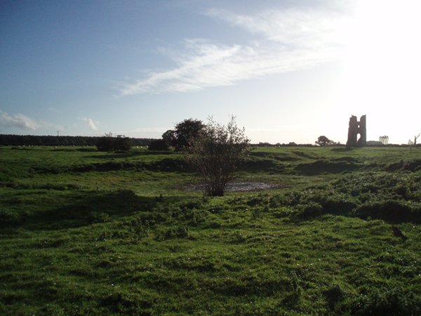
Dating back to the Domesday Book of 1086, Godwick has a long and fascinating history. The village was once a thriving medieval settlement and played a significant role in the region's agricultural economy. The remains of the medieval manor house are one of the main attractions, showcasing the architectural grandeur of that era. Visitors can explore the ruins and imagine life in the medieval times.
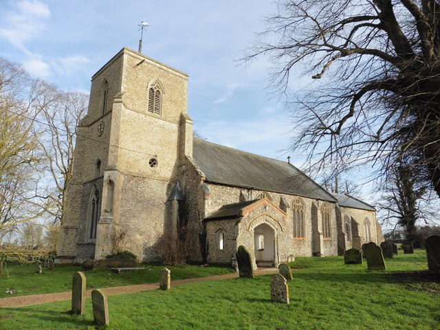
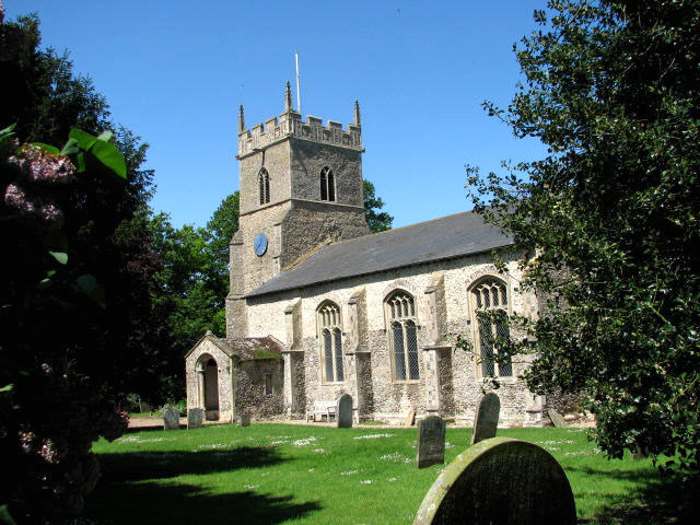
The village is also home to the beautiful St. Mary's Church, a classic example of Norman architecture. This ancient place of worship dates back to the 12th century and boasts stunning stained glass windows and intricate stone carvings. It serves as a testament to the religious and cultural heritage of the area.
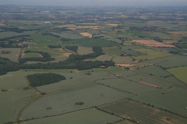
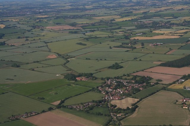
Aside from its historical landmarks, Godwick Village offers breathtaking natural landscapes. The surrounding countryside is characterized by rolling hills, lush meadows, and the meandering River Wensum. This makes it a popular destination for nature lovers, hikers, and photographers.
Today, Godwick Village continues to thrive as a small, close-knit community. Its rich heritage, combined with its idyllic location, draws tourists from near and far. Whether exploring the historic ruins, admiring the architectural marvels, or simply enjoying the tranquility of the countryside, a visit to Godwick Village is a truly enriching experience.
If you have any feedback on the listing, please let us know in the comments section below.
Godwick Village Images
Images are sourced within 2km of 52.767/0.823 or Grid Reference TF9022. Thanks to Geograph Open Source API. All images are credited.
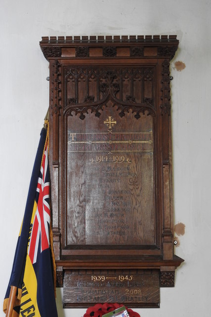
![Battlefield Cross of Private Lionel Kenelm Digby The cross bears the following words "R.I.P. - In Loving Memory of - 38456 Pte. L. K. DIGBY - 7th Norfolk Regiment - Killed in Action - October 20th 1918."
On the foot it records "Erected by IIII Hallamshires."
Although he was in the Norfolk Regiment he was fighting alongside the 4th Hampshires at the time he was killed.
Son of Reginald and Caroline Grace Digby, of Geashill Castle, King's Co. Rector of Tittleshall.
[The barons Digby were the largest landowners in King's County at the time, with 29,722 acres]
The Cross stands on what was the stairs to the Rood Loft against the north wall.](https://s2.geograph.org.uk/geophotos/06/61/02/6610262_0d82b17a.jpg)


Godwick Village is located at Grid Ref: TF9022 (Lat: 52.767, Lng: 0.823)
Administrative County: Norfolk
District: Breckland
Police Authority: Norfolk
What 3 Words
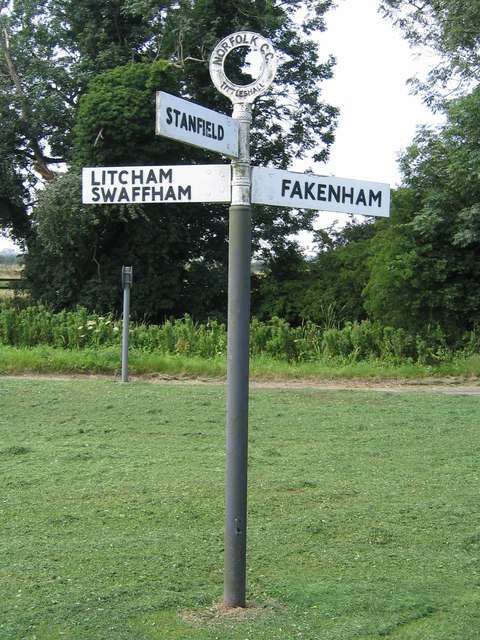
///resorting.jumpy.ordeals. Near Fakenham, Norfolk
Nearby Locations
Related Wikis
Godwick
Godwick is a deserted village in the county of Norfolk. Its location was south of Fakenham between the villages of Tittleshall and Whissonsett. There are...

River Wensum SSSI
The River Wensum SSSI is a 'whole river' Site of Special Scientific Interest located on the River Wensum that flows through the English county of Norfolk...

Pattesley
Pattesley is a village in the English county of Norfolk, about one mile (1.6 km) south of the village of Oxwick. It consists of a few scattered houses...
Whissonsett
Whissonsett is a village and a civil parish in the English county of Norfolk. The village is 5.0 miles (8.0 km) south of Fakenham, 23 miles (37 km) west...
Nearby Amenities
Located within 500m of 52.767,0.823Have you been to Godwick Village?
Leave your review of Godwick Village below (or comments, questions and feedback).