Lower Wolvercote

Settlement in Oxfordshire Oxford

England

Lower Wolvercote

Houses on Elsfield Way, Cutteslowe
Houses on Elsfield Way, Cutteslowe Credit: David Howard

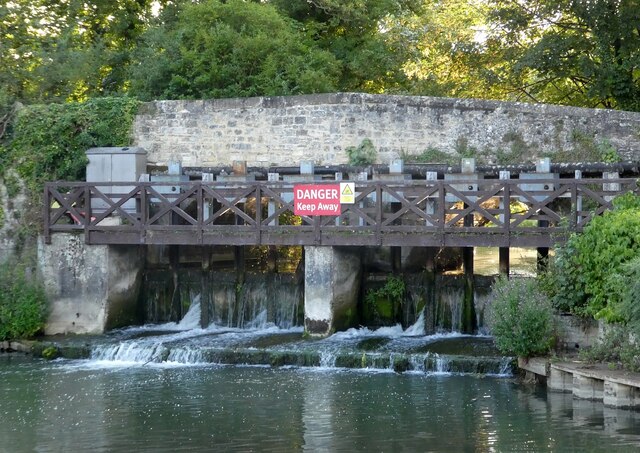
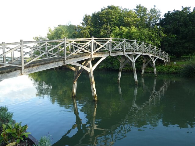
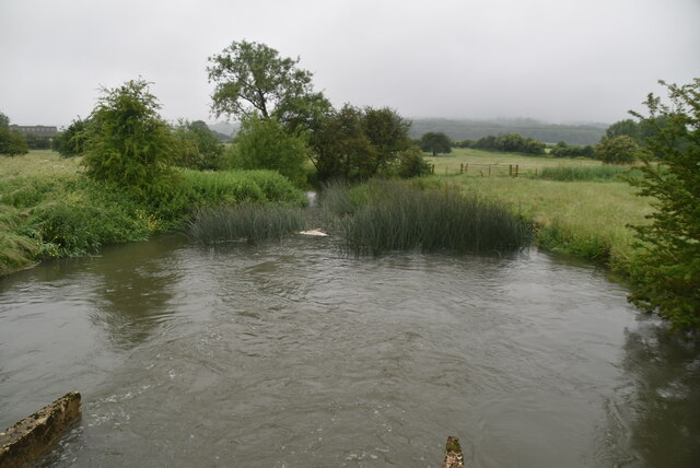
Lower Wolvercote is a charming village located in Oxfordshire, England. Situated about 3 miles north of the city of Oxford, it is nestled along the banks of the River Thames and enjoys a picturesque setting. The village is part of the larger Wolvercote area, which also includes Upper Wolvercote and Wytham.

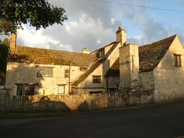
Lower Wolvercote is known for its idyllic countryside, dotted with traditional stone cottages and historic buildings. The village has a rich history, dating back to the Domesday Book of 1086, where it was recorded as "Wluricote." Its name is believed to derive from the Old English words "wulf" and "cot," meaning "wolf cottage."

One of the notable landmarks in Lower Wolvercote is the Church of St. Peter, a Norman-style church dating back to the 12th century. The church features magnificent stained glass windows and a tranquil churchyard, providing a peaceful spot for reflection.

The village is also home to the popular turreted Perch Inn, a historic pub that dates back to the 17th century. With its thatched roof and riverside location, it offers visitors a delightful setting to enjoy a meal or a drink while soaking in the scenic views.

Lower Wolvercote benefits from its proximity to the bustling city of Oxford, with its world-renowned university, cultural attractions, and shopping opportunities. However, it also provides a serene escape from the city's hustle and bustle, offering residents and visitors a quiet and picturesque retreat in the heart of the English countryside.

If you have any feedback on the listing, please let us know in the comments section below.

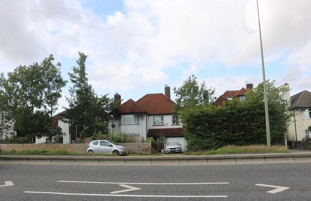
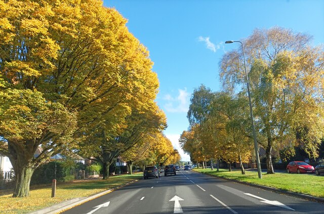
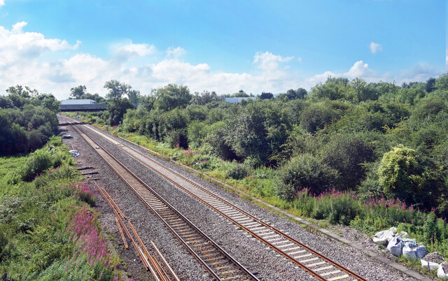
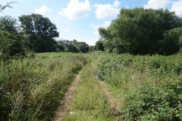
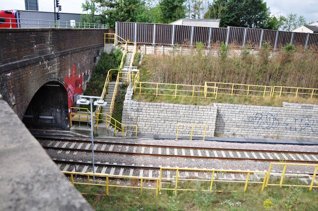
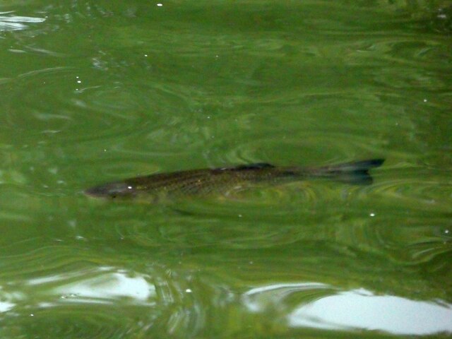
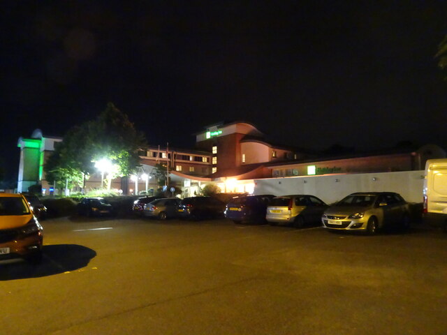
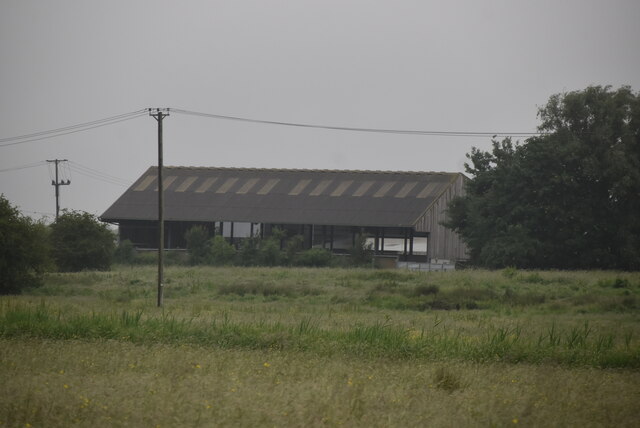
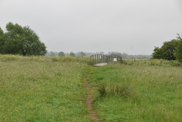
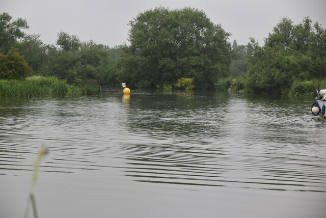
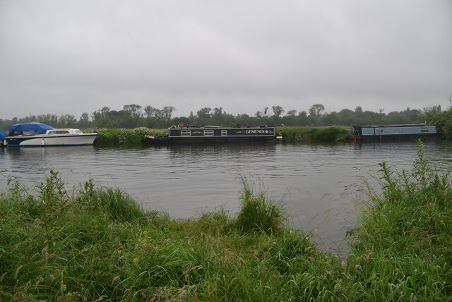
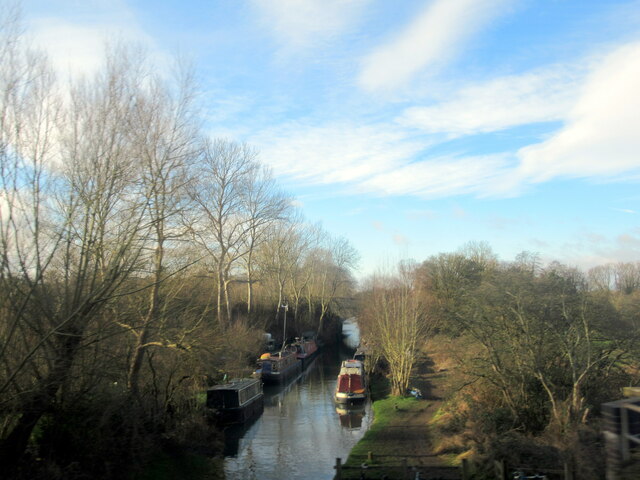
Lower Wolvercote Images

Images are sourced within 2km of 51.781735/-1.2951529 or Grid Reference SP4809. Thanks to Geograph Open Source API. All images are credited.

Houses on Elsfield Way, Cutteslowe
Autumnal trees along the A40 Trees turning yellow along the A40 near Oxford.
Autumnal trees along the A40
Trees turning yellow along the A40 near Oxford.
Railway near Wolvercote Railways, roads, river and canal. There's a lot going on transport wise in SP4810.
Railway near Wolvercote
Railways, roads, river and canal. There's a lot going on transport wise in SP4810.
Track to the Canal A short track over waste ground between the A40 and Oxford Canal. Probably for waterways work vehicles.
Track to the Canal
A short track over waste ground between the A40 and Oxford Canal. Probably for waterways work vehicles.
Wolvercote Tunnel north entrance Wolvercote Tunnel passes under Wolvercote Roundabout in the north of Oxford.  The ex LNWR Bletchley to Oxford railway passes through the tunnel.  When the line became less used, it made a perfect roosting place for bats.  On reconstruction of the line for the Chiltern Railways new services to Oxford, the tunnel was refurbished and equipped with 'Bat Lights' which are triggered by the passing of trains.  This is to persuade the nocturnal animals to remain at roost when a train passes and not fly off and possibly get injured in the process.  The 'Bat lights' are fitted along the tunnel walls and on posts at the entrances to the tunnel, as seen here.
Wolvercote Tunnel north entrance
Wolvercote Tunnel passes under Wolvercote Roundabout in the north of Oxford. The ex LNWR Bletchley to Oxford railway passes through the tunnel. When the line became less used, it made a perfect roosting place for bats. On reconstruction of the line for the Chiltern Railways new services to Oxford, the tunnel was refurbished and equipped with 'Bat Lights' which are triggered by the passing of trains. This is to persuade the nocturnal animals to remain at roost when a train passes and not fly off and possibly get injured in the process. The 'Bat lights' are fitted along the tunnel walls and on posts at the entrances to the tunnel, as seen here.
The Trout Inn, Wolvercote The old stones of the picturesquely situated Trout Inn seen here bathed in late evening sunlight.
The pub is situated immediately adjacent to a branch of the Thames as it flows past Oxford through the village of Wolvercote, though a weir under the bridge next to the pub prevents this arm being navigable.
The pub's own website here <span class="nowrap"><a title="https://www.thetroutoxford.co.uk" rel="nofollow ugc noopener" href="https://www.thetroutoxford.co.uk">Link</a><img style="margin-left:2px;" alt="External link" title="External link - shift click to open in new window" src="https://s1.geograph.org.uk/img/external.png" width="10" height="10"/></span>
Dating mostly from the C17th, it is EH Grade II listed <span class="nowrap"><a title="https://historicengland.org.uk/listing/the-list/list-entry/1369372" rel="nofollow ugc noopener" href="https://historicengland.org.uk/listing/the-list/list-entry/1369372">Link</a><img style="margin-left:2px;" alt="External link" title="External link - shift click to open in new window" src="https://s1.geograph.org.uk/img/external.png" width="10" height="10"/></span>
The Trout Inn, Wolvercote
The old stones of the picturesquely situated Trout Inn seen here bathed in late evening sunlight. The pub is situated immediately adjacent to a branch of the Thames as it flows past Oxford through the village of Wolvercote, though a weir under the bridge next to the pub prevents this arm being navigable. The pub's own website here LinkExternal link Dating mostly from the C17th, it is EH Grade II listed LinkExternal link
Trout at The Trout Why the pub is called what it is!
The Trout Inn (see <a href="https://www.geograph.org.uk/photo/6938018">SP4809 : The Trout Inn, Wolvercote</a>) is immediately adjacent to a branch of the River Thames (or Isis as it is known in this locality). There were eight good sized Brown Trout swimming in the river beside the outside seating area - this is one of them.
Trout at The Trout
Why the pub is called what it is! The Trout Inn (see SP4809 : The Trout Inn, Wolvercote) is immediately adjacent to a branch of the River Thames (or Isis as it is known in this locality). There were eight good sized Brown Trout swimming in the river beside the outside seating area - this is one of them.
Little Godstow Bridge & Weir, Wolvercote Little Godstow Bridge is situated immediately to the south of <a href="https://www.geograph.org.uk/photo/6938018">SP4809 : The Trout Inn, Wolvercote</a> and carries the lane to Wolvercote over a branch of the River Thames (or Isis) with a weir built into its arches dropping the river level by about 4' (1.2m) I would estimate. A navigable arm of the Thames flows under a second bridge (Godstow Bridge) immediately south of this one. 
The bridge, which is mediæval in origin, but was reconstructed in 1892 is EH Grade II listed <span class="nowrap"><a title="https://historicengland.org.uk/listing/the-list/list-entry/1116442" rel="nofollow ugc noopener" href="https://historicengland.org.uk/listing/the-list/list-entry/1116442">Link</a><img style="margin-left:2px;" alt="External link" title="External link - shift click to open in new window" src="https://s1.geograph.org.uk/img/external.png" width="10" height="10"/></span>
Little Godstow Bridge & Weir, Wolvercote
Little Godstow Bridge is situated immediately to the south of SP4809 : The Trout Inn, Wolvercote and carries the lane to Wolvercote over a branch of the River Thames (or Isis) with a weir built into its arches dropping the river level by about 4' (1.2m) I would estimate. A navigable arm of the Thames flows under a second bridge (Godstow Bridge) immediately south of this one. The bridge, which is mediæval in origin, but was reconstructed in 1892 is EH Grade II listed LinkExternal link
Trout Inn Footbridge, Wolvercote This graceful Chinese-style wooden footbridge spans an arm of the River Thames from the patio of <a href="https://www.geograph.org.uk/photo/6938018">SP4809 : The Trout Inn, Wolvercote</a> across to a tiny islet created by the two branches of the Thames (or Isis) here.
It dates from the late C19th/early C20th and is EH Grade II listed <span class="nowrap"><a title="https://historicengland.org.uk/listing/the-list/list-entry/1047307" rel="nofollow ugc noopener" href="https://historicengland.org.uk/listing/the-list/list-entry/1047307">Link</a><img style="margin-left:2px;" alt="External link" title="External link - shift click to open in new window" src="https://s1.geograph.org.uk/img/external.png" width="10" height="10"/></span>
Trout Inn Footbridge, Wolvercote
This graceful Chinese-style wooden footbridge spans an arm of the River Thames from the patio of SP4809 : The Trout Inn, Wolvercote across to a tiny islet created by the two branches of the Thames (or Isis) here. It dates from the late C19th/early C20th and is EH Grade II listed LinkExternal link
Inn at Night The view of the Holiday Inn hotel on the Service area at Peartree Hill roundabout for the A34, Oxford.
Inn at Night
The view of the Holiday Inn hotel on the Service area at Peartree Hill roundabout for the A34, Oxford.
Car Park View The view on the car park of the Oxford Travelodge on the Service area next to the Peartree Hill roundabout on the A34.
Car Park View
The view on the car park of the Oxford Travelodge on the Service area next to the Peartree Hill roundabout on the A34.
University Farm
University Farm
Footbridge, Thames Path This National Trail is 184 miles (294 km) long, following the River Thames from its source in the Cotswolds almost to the sea, finishing at the Thames Barrier in Greenwich.
The trail keeps to the banks of the river most of the route.
Website: <span class="nowrap"><a title="http://www.nationaltrail.co.uk/ThamesPath/" rel="nofollow ugc noopener" href="http://www.nationaltrail.co.uk/ThamesPath/">Link</a><img style="margin-left:2px;" alt="External link" title="External link - shift click to open in new window" src="https://s1.geograph.org.uk/img/external.png" width="10" height="10"/></span>
Footbridge, Thames Path
This National Trail is 184 miles (294 km) long, following the River Thames from its source in the Cotswolds almost to the sea, finishing at the Thames Barrier in Greenwich. The trail keeps to the banks of the river most of the route. Website: LinkExternal link
Wytham Stream
Wytham Stream
River Thames
River Thames
River Thames The River Thames rises at Thames Head in Gloucestershire on the slopes of the Cotswolds and flows generally eastward to its mouth near Southend in Essex. At 215 miles long it is one of the longest rivers in Britain, and the longest entirely within England. It is one of the most important rivers in Britain. <span class="nowrap"><a title="http://en.wikipedia.org/wiki/River_Thames" rel="nofollow ugc noopener" href="http://en.wikipedia.org/wiki/River_Thames">Link</a><img style="margin-left:2px;" alt="External link" title="External link - shift click to open in new window" src="https://s1.geograph.org.uk/img/external.png" width="10" height="10"/></span>
River Thames
The River Thames rises at Thames Head in Gloucestershire on the slopes of the Cotswolds and flows generally eastward to its mouth near Southend in Essex. At 215 miles long it is one of the longest rivers in Britain, and the longest entirely within England. It is one of the most important rivers in Britain. LinkExternal link
Oxford Canal near Duke's Lock
A34 Oxford bypass crossing the railway
Show me another place!

Lower Wolvercote is located at Grid Ref: SP4809 (Lat: 51.781735, Lng: -1.2951529)

Administrative County: Oxfordshire

District: Oxford

Police Authority: Thames Valley

What 3 Words

///bring.stacks.club. Near Wolvercote, Oxfordshire

Related Wikis

Wolvercote Meadows

Wolvercote Meadows is a 7.1-hectare (18-acre) biological Site of Special Scientific Interest north of Oxford in Oxfordshire. Part of it is owned by the...

St Edward's School Boat Club

St Edward's School Boat Club is a rowing club on the River Thames based at St Edwards School Boathouse on Godstow Road, Oxford, Oxfordshire. It is the...

Headington School Oxford Boat Club

Headington School Oxford Boat Club (HSOBC for short) is a rowing club on the River Thames currently based in rented premises at St Edwards School Boathouse...
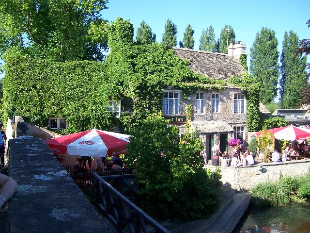
The Trout Inn

The Trout Inn (often simply referred to as The Trout) is a historic pub in Lower Wolvercote north of Oxford, close to Godstow Bridge, directly by the River...

Nearby Amenities

Located within 500m of 51.781735,-1.2951529
Mini Roundabout
Direction: clockwise
Lat/Long: 51.7837402/-1.2931188
Turning Circle
Turning Circle: y-head
Lat/Long: 51.7825017/-1.2927517
Turning Circle
Turning Circle: square
Lat/Long: 51.7831659/-1.2902911
Lower Wolvercote
Place: neighbourhood
Lat/Long: 51.7836441/-1.2917643
Waterway: weir
Lat/Long: 51.7813868/-1.2962864
Barrier: bollard
Bicycle: yes
Bollard: fixed
Foot: yes
Vehicle: no
Lat/Long: 51.7834887/-1.2927171
Pub
The White Hart
Addr City: Oxford
Addr Housenumber: 126
Addr Postcode: OX2 8PQ
Addr Street: Godstow Road
Fhrs Id: 268655
Outdoor Seating: yes
Source Addr: FHRS Open Data
Wikidata: Q26410012
Lat/Long: 51.7838053/-1.2931619
Kerb: no
Lat/Long: 51.7793993/-1.2998993
Barrier: entrance
Lat/Long: 51.7782596/-1.2993175
Source: yahoo imagery
Lat/Long: 51.7782124/-1.2981833
Post Box
Brand: Royal Mail
Brand Wikidata: Q638098
Brand Wikipedia: en:Royal Mail
Collection Times: Mo-Fr 17:00; Sa 10:00
Mapillary: 338875574383714
Operator: Royal Mail
Operator Type: private
Operator Wikidata: Q638098
Post Box Mounting: wooden_post
Post Box Type: lamp
Ref: OX2 809
Survey Date: 2021-05-05
Lat/Long: 51.7824209/-1.2949884
Post Box
Brand: Royal Mail
Brand Wikidata: Q638098
Brand Wikipedia: en:Royal Mail
Collection Times: Mo-Fr 17:00; Sa 12:00
Operator: Royal Mail
Operator Type: private
Operator Wikidata: Q638098
Ref: OX2 321
Royal Cypher: GVIR
Lat/Long: 51.7840741/-1.2901705
Crossing: uncontrolled
Crossing Ref: zebra
Lat/Long: 51.7840612/-1.289822
Bus Stop
Elmthorpe Road
Bench: no
Bin: yes
Bus: yes
Lit: yes
Local Ref: opp
Naptan AtcoCode: 340001010OPP
Naptan Bearing: W
Naptan CommonName: Elmthorpe Road
Naptan Indicator: opposite
Naptan Landmark: Elmthorpe Road
Naptan NaptanCode: oxfadtgm
Naptan PlusbusZoneRef: OXFD
Naptan Street: Godstow Road
Public Transport: platform
Route Ref: 6;6C;218
Shelter: no
Source: naptan_import
Tactile Paving: no
Lat/Long: 51.7840907/-1.2891006
Maxspeed: 20 mph
Maxspeed Note: Oxford 20 mph zone
Maxspeed Spec: a point 386m SW of its junction w/ Webbs Close
Lat/Long: 51.780405/-1.2991832
Bus Stop
Home Close
Bus: yes
Check Date Shelter: 2021-10-23
Local Ref: adj
Naptan AtcoCode: 340001008SOU
Naptan Bearing: S
Naptan CommonName: Home Close
Naptan Indicator: Godstow Road
Naptan Landmark: Home Close
Naptan NaptanCode: oxfadtgp
Naptan PlusbusZoneRef: OXFD
Naptan Street: Home Close
Public Transport: platform
Route Ref: 6
Shelter: yes
Source: naptan_import
Lat/Long: 51.7838349/-1.292007
Bus Stop
Elmthorpe Road
Bench: no
Bin: yes
Bus: yes
Lit: yes
Local Ref: adj
Naptan AtcoCode: 340001010OUT
Naptan Bearing: E
Naptan CommonName: Elmthorpe Road
Naptan Indicator: Corner
Naptan Landmark: Elmthorpe Road
Naptan NaptanCode: oxfadtgj
Naptan PlusbusZoneRef: OXFD
Naptan Street: Godstow Road
Public Transport: platform
Route Ref: 6;6C;218
Shelter: no
Source: naptan_import
Tactile Paving: no
Lat/Long: 51.7841386/-1.289359
Maxheight: 2.3
Source: survey
Lat/Long: 51.7817038/-1.2951316
Bench
Lat/Long: 51.7804496/-1.2998893
Bench
Lat/Long: 51.7804263/-1.2999149
Man Made: water_well
Lat/Long: 51.7804185/-1.2998861
Doctors
Wolvercote Surgery
Healthcare: doctor
Lat/Long: 51.7839287/-1.2899751
Port Meadow Convenience Store
Addr City: Oxford
Addr Housenumber: 82
Addr Postcode: OX2 8NY
Addr Street: Godstow Road
Shop: convenience
Lat/Long: 51.7841832/-1.2902405
Recycling
Recycling Cans: yes
Recycling Cartons: yes
Recycling Clothes: yes
Recycling Glass: no
Recycling Paper: yes
Recycling Plastic: yes
Lat/Long: 51.7837883/-1.2933583
012
Ele: 60.688477
Wpt Description: X
Wpt Symbol: Trail Head
Lat/Long: 51.7819648/-1.2904083
Barrier: kissing_gate
Lat/Long: 51.781235/-1.2957794
Barrier: bollard
Bollard: fixed
Fixme: so how do the cars get in?
Lat/Long: 51.7833715/-1.2930588
Drinking Water
Fixme: suspect these are redundant as similar info on pub object
Wheelchair: yes
Lat/Long: 51.7799897/-1.2990325
Toilets
Access: customers
Fee: no
Fixme: suspect these are redundant as similar info on pub object
Wheelchair: yes
Lat/Long: 51.779982/-1.2989081
Turning Circle
Turning Circle: square
Lat/Long: 51.7837012/-1.2892746
Godstow
Place: hamlet
Lat/Long: 51.7790896/-1.2998625
Barrier: kissing_gate
Lat/Long: 51.780413/-1.2955222
Ford: yes
Lat/Long: 51.7816238/-1.2928144
In memory of Ewan Agnew
Artist Wikipedia: https://en.wikipedia.org/wiki/Eric_Gill
Artist Name: Eric Gill
Historic: memorial
Inscription: THIS LAND WAS ACQUIRED BY THE OXFORD PRESERVATION TRUST IN 1934 THROUGH A GIFT OF PHILIP LESLIE AGNEW IN MEMORY OF HIS SON EWAN SIEGFRIED AGNEW NEW COLLEGE OXFORD 1912–1914 PRO PATRIA
Material: stone
Memorial: plaque
Lat/Long: 51.7801723/-1.2995687
Bus Stop
Paper Mill
Bus: yes
Local Ref: W-Bound
Naptan AtcoCode: 340021003PMS
Naptan Street: Baynhams Drive
Public Transport: platform
Route Ref: 6
Shelter: yes
Lat/Long: 51.7845706/-1.2942278
Leisure: picnic_table
Lat/Long: 51.7811161/-1.2958939
Leisure: picnic_table
Lat/Long: 51.7809536/-1.2958584
Leisure: picnic_table
Lat/Long: 51.7808029/-1.2958152
Leisure: picnic_table
Lat/Long: 51.7806483/-1.2957683
Bench
Lat/Long: 51.7808272/-1.2955957
Bench
Lat/Long: 51.7805309/-1.3002188
Addr Housenumber: 13
Addr Street: Webbs Close
Lat/Long: 51.7818616/-1.295912
Addr Housenumber: 18
Lat/Long: 51.7819797/-1.2962588
Addr Housenumber: 26
Addr Street: Webbs Close
Lat/Long: 51.782354/-1.2956744
Addr Housenumber: 29
Addr Street: Webbs Close
Lat/Long: 51.7824245/-1.2958916
Addr Housenumber: 19
Addr Street: Webbs Close
Lat/Long: 51.7820678/-1.2956784
Addr Housenumber: 25
Addr Street: Webbs Close
Lat/Long: 51.7822113/-1.2961035
Addr Housenumber: 30
Addr Street: Webbs Close
Lat/Long: 51.7826099/-1.2955416
Addr Housenumber: 32
Addr Street: Webbs Close
Lat/Long: 51.7826608/-1.2956956
Addr Housenumber: 33
Addr Street: Webbs Close
Lat/Long: 51.7827958/-1.2952498
Addr Housenumber: 37
Addr Street: Webbs Close
Lat/Long: 51.7828954/-1.2955355
Board Type: notice
Information: board
Tourism: information
Lat/Long: 51.7823612/-1.2950483
RFC/RAF Airfield Memorial
Historic: memorial
Inscription: Per ardua ad astra [...] // In grateful memory of those who served in or with the Royal Flying Corps and later the Royal Air Force, and who died [...]
Man Made: obelisk
Material: granite
Memorial: war_memorial
Start Date: 2018-05-23
Lat/Long: 51.7804626/-1.2956833
Port Meadow Aerodrome
Board Type: history
Direction: 0
Information: board
Tourism: information
Lat/Long: 51.7804084/-1.2956092
Bench
Lat/Long: 51.7855428/-1.2953689
Bench
Lat/Long: 51.7855145/-1.2953744
Direction: 75
Generator Method: photovoltaic
Generator Output Electricity: yes
Generator Solar Modules: 6
Generator Source: solar
Generator Type: solar_photovoltaic_panel
Location: roof
Power: generator
Lat/Long: 51.7850375/-1.2905766
Direction: 255
Fixme: survey for panel count
Generator Method: photovoltaic
Generator Output Electricity: yes
Generator Solar Modules: 5
Generator Source: solar
Generator Type: solar_photovoltaic_panel
Location: roof
Power: generator
Lat/Long: 51.7850299/-1.2906387
Direction: 165
Generator Method: photovoltaic
Generator Output Electricity: yes
Generator Solar Modules: 3
Generator Source: solar
Generator Type: solar_photovoltaic_panel
Location: roof
Power: generator
Lat/Long: 51.7850592/-1.2905369
Direction: 170
Generator Method: photovoltaic
Generator Output Electricity: yes
Generator Solar Modules: 2
Generator Source: solar
Generator Type: solar_photovoltaic_panel
Location: roof
Power: generator
Lat/Long: 51.7842466/-1.2913049
Direction: 165
Generator Method: photovoltaic
Generator Output Electricity: yes
Generator Solar Modules: 9
Generator Source: solar
Generator Type: solar_photovoltaic_panel
Location: roof
Power: generator
Lat/Long: 51.7845345/-1.2923395
Direction: 255
Generator Method: photovoltaic
Generator Output Electricity: yes
Generator Solar Modules: 8
Generator Source: solar
Generator Type: solar_photovoltaic_panel
Location: roof
Power: generator
Lat/Long: 51.7845511/-1.2923829
Direction: 255
Generator Method: photovoltaic
Generator Output Electricity: yes
Generator Solar Modules: 6
Generator Source: solar
Generator Type: solar_photovoltaic_panel
Location: roof
Power: generator
Lat/Long: 51.7850575/-1.2921177
Direction: 75
Generator Method: photovoltaic
Generator Output Electricity: yes
Generator Solar Modules: 6
Generator Source: solar
Generator Type: solar_photovoltaic_panel
Location: roof
Power: generator
Lat/Long: 51.7850654/-1.2920462
Direction: 135
Generator Method: photovoltaic
Generator Output Electricity: yes
Generator Solar Modules: 6
Generator Source: solar
Generator Type: solar_photovoltaic_panel
Location: roof
Power: generator
Lat/Long: 51.7827268/-1.2914863
Direction: 225
Generator Method: photovoltaic
Generator Output Electricity: yes
Generator Solar Modules: 6
Generator Source: solar
Generator Type: solar_photovoltaic_panel
Location: roof
Power: generator
Lat/Long: 51.7826867/-1.291522
Direction: 155
Fixme: survey for panel counts & types
Generator Method: photovoltaic
Generator Output Electricity: yes
Generator Solar Modules: 5
Generator Source: solar
Generator Type: solar_photovoltaic_panel
Location: roof
Power: generator
Lat/Long: 51.7824019/-1.2923047
Direction: 245
Generator Method: photovoltaic
Generator Output Electricity: yes
Generator Solar Modules: 4
Generator Source: solar
Generator Type: solar_photovoltaic_panel
Location: roof
Power: generator
Lat/Long: 51.7824131/-1.2923514
Direction: 230
Generator Method: photovoltaic
Generator Output Electricity: yes
Generator Solar Modules: 6
Generator Source: solar
Generator Type: solar_photovoltaic_panel
Location: roof
Power: generator
Lat/Long: 51.7829189/-1.2938957
Direction: 250
Generator Method: photovoltaic
Generator Output Electricity: yes
Generator Solar Modules: 4
Generator Source: solar
Generator Type: solar_photovoltaic_panel
Location: roof
Power: generator
Lat/Long: 51.7829524/-1.2939692
Direction: 75
Fixme: survey for panel count
Generator Method: photovoltaic
Generator Output Electricity: yes
Generator Solar Modules: 8
Generator Source: solar
Generator Type: solar_photovoltaic_panel
Location: roof
Power: generator
Lat/Long: 51.7821233/-1.2933835
Fixme: solar panels?
Lat/Long: 51.7844924/-1.2954272
Life Ring
Emergency: life_ring
Lat/Long: 51.7855947/-1.2953906
Waste Basket
Lat/Long: 51.7855659/-1.2953679
Leisure: playground
Lat/Long: 51.7847995/-1.2954751
Life Ring
Emergency: life_ring
Lat/Long: 51.7848837/-1.2951329
Life Ring
Emergency: life_ring
Lat/Long: 51.7839474/-1.295611
Bicycle Parking
Lat/Long: 51.7845211/-1.2943007
Bench
Lat/Long: 51.7845163/-1.2940803
Bench
Lat/Long: 51.7845487/-1.2940483
Bench
Lat/Long: 51.7844726/-1.2942637
Entrance: main
Lat/Long: 51.7800209/-1.2994867
Bus Stop
Home Close
Bus: yes
Local Ref: opp
Public Transport: platform
Lat/Long: 51.7837305/-1.2918419
Addr Housenumber: 183
Addr Street: Godstow Road
Lat/Long: 51.7820243/-1.2947179
Addr Housenumber: 181
Addr Street: Godstow Road
Lat/Long: 51.7820595/-1.2947378
Addr Housenumber: 177
Addr Street: Godstow Road
Lat/Long: 51.7821892/-1.294734
Addr Housenumber: 175
Addr Street: Godstow Road
Lat/Long: 51.7822349/-1.2947454
Addr Housenumber: 173
Addr Street: Godstow Road
Lat/Long: 51.7823077/-1.2947435
Addr Housenumber: 171
Addr Street: Godstow Road
Lat/Long: 51.7823447/-1.2947568
Addr Housenumber: 163
Addr Street: Godstow Road
Lat/Long: 51.7827207/-1.2946003
Addr Housenumber: 151
Addr Street: Godstow Road
Lat/Long: 51.7828105/-1.294458
Addr Housenumber: 46
Addr Street: Webbs Close
Lat/Long: 51.7834973/-1.2948713
Addr Housenumber: 47
Addr Street: Webbs Close
Lat/Long: 51.7834973/-1.2947842
Addr Housenumber: 48
Addr Street: Webbs Close
Lat/Long: 51.7833859/-1.2946066
Addr Housenumber: 56
Addr Street: Webbs Close
Lat/Long: 51.7831115/-1.2948012
Addr Housenumber: 166
Addr Street: Godstow Road
Lat/Long: 51.7828943/-1.2946305
Addr Housenumber: 164
Addr Street: Godstow Road
Lat/Long: 51.7829253/-1.2945651
Addr Housenumber: 160
Addr Street: Godstow Road
Lat/Long: 51.7830196/-1.2944301
Addr Housenumber: 158
Addr Street: Godstow Road
Lat/Long: 51.7830554/-1.2943233
Addr Housenumber: 144
Addr Street: Godstow Road
Lat/Long: 51.7832919/-1.2937819
Addr Housenumber: 146
Addr Street: Godstow Road
Lat/Long: 51.7832916/-1.2938392
Addr Housenumber: 148
Addr Street: Godstow Road
Lat/Long: 51.7832811/-1.2938985
Addr Housenumber: 1
Addr Street: Mill Road
Lat/Long: 51.78368/-1.2938194
Addr Housenumber: 11
Addr Street: Mill Road
Lat/Long: 51.7836686/-1.2947683
Addr Housenumber: 11A
Addr Street: Mill Road
Lat/Long: 51.7836675/-1.2948563
Addr Housenumber: 12
Addr Street: Mill Road
Lat/Long: 51.7838227/-1.2947658
Addr Housenumber: 15
Addr Street: Mill Road
Lat/Long: 51.7838269/-1.2945177
Addr Housenumber: 1
Addr Street: Meadow Prospect
Lat/Long: 51.7834235/-1.2917147
Addr Housenumber: 3
Addr Street: Meadow Prospect
Lat/Long: 51.7833698/-1.2916969
Addr Housenumber: 5
Addr Street: Meadow Prospect
Lat/Long: 51.78328/-1.2916615
Addr Housenumber: 7
Addr Street: Meadow Prospect
Lat/Long: 51.7832361/-1.2916456
Addr Housenumber: 9
Addr Street: Meadow Prospect
Lat/Long: 51.7831583/-1.2916261
Addr Housenumber: 11
Addr Street: Meadow Prospect
Lat/Long: 51.7831046/-1.2916119
Addr Housenumber: 13
Addr Street: Meadow Prospect
Lat/Long: 51.7830378/-1.2915482
Addr Housenumber: 15
Addr Street: Meadow Prospect
Lat/Long: 51.7829863/-1.2915393
Addr Housenumber: 17
Addr Street: Meadow Prospect
Lat/Long: 51.7829129/-1.2914649
Addr Housenumber: 19
Addr Street: Meadow Prospect
Lat/Long: 51.7828603/-1.2914472
Addr Housenumber: 21
Addr Street: Meadow Prospect
Lat/Long: 51.782765/-1.2914862
Addr Housenumber: 23
Addr Street: Meadow Prospect
Lat/Long: 51.7827336/-1.2915435
Addr Housenumber: 25
Addr Street: Meadow Prospect
Lat/Long: 51.7826683/-1.2916493
Addr Housenumber: 27
Addr Street: Meadow Prospect
Lat/Long: 51.7826452/-1.291737
Addr Housenumber: 29
Addr Street: Meadow Prospect
Lat/Long: 51.7826256/-1.2918842
Addr Housenumber: 31
Addr Street: Meadow Prospect
Lat/Long: 51.7826076/-1.291966
Addr Housenumber: 33
Addr Street: Meadow Prospect
Lat/Long: 51.7825346/-1.2920408
Addr Housenumber: 35
Addr Street: Meadow Prospect
Lat/Long: 51.7825078/-1.2921495
Addr Housenumber: 37
Addr Street: Meadow Prospect
Lat/Long: 51.7824565/-1.2922056
Addr Housenumber: 39
Addr Street: Meadow Prospect
Lat/Long: 51.7824305/-1.2923154
Addr Housenumber: 41
Addr Street: Meadow Prospect
Lat/Long: 51.7823574/-1.2924124
Addr Housenumber: 43
Addr Street: Meadow Prospect
Lat/Long: 51.7823384/-1.2924791
Addr Housenumber: 45
Addr Street: Meadow Prospect
Lat/Long: 51.7822584/-1.2925865
Addr Housenumber: 47
Addr Street: Meadow Prospect
Lat/Long: 51.7822447/-1.2926823
Addr Housenumber: 49
Addr Street: Meadow Prospect
Lat/Long: 51.7822059/-1.2928112
Addr Housenumber: 51
Addr Street: Meadow Prospect
Lat/Long: 51.7822185/-1.292914
Addr Housenumber: 53
Addr Street: Meadow Prospect
Lat/Long: 51.7822844/-1.2930235
Addr Housenumber: 55
Addr Street: Meadow Prospect
Lat/Long: 51.7823278/-1.2930784
Addr Housenumber: 44
Addr Street: Meadow Prospect
Lat/Long: 51.7824153/-1.2931509
Addr Housenumber: 42
Addr Street: Meadow Prospect
Lat/Long: 51.7824688/-1.2931848
Addr Housenumber: 40
Addr Street: Meadow Prospect
Lat/Long: 51.7825606/-1.2932222
Addr Housenumber: 38
Addr Street: Meadow Prospect
Lat/Long: 51.7826155/-1.2931953
Addr Housenumber: 36
Addr Street: Meadow Prospect
Lat/Long: 51.7826654/-1.2930714
Addr Housenumber: 34
Addr Street: Meadow Prospect
Lat/Long: 51.7827008/-1.2929768
Addr Housenumber: 28
Addr Street: Meadow Prospect
Lat/Long: 51.7827579/-1.2925912
Addr Housenumber: 26
Addr Street: Meadow Prospect
Lat/Long: 51.7827811/-1.2925129
Addr Housenumber: 24
Addr Street: Meadow Prospect
Lat/Long: 51.7828093/-1.2923691
Addr Housenumber: 22
Addr Street: Meadow Prospect
Lat/Long: 51.782844/-1.2922862
Addr Housenumber: 20
Addr Street: Meadow Prospect
Lat/Long: 51.7828606/-1.2921682
Addr Housenumber: 18
Addr Street: Meadow Prospect
Lat/Long: 51.7828931/-1.292084
Addr Housenumber: 16
Addr Street: Meadow Prospect
Lat/Long: 51.7829596/-1.2919602
Addr Housenumber: 14
Addr Street: Meadow Prospect
Lat/Long: 51.783029/-1.29198
Addr Housenumber: 12
Addr Street: Meadow Prospect
Lat/Long: 51.7831179/-1.2920163
Addr Housenumber: 10
Addr Street: Meadow Prospect
Lat/Long: 51.783175/-1.2920268
Addr Housenumber: 8
Addr Street: Meadow Prospect
Lat/Long: 51.7832553/-1.2920536
Addr Housenumber: 6
Addr Street: Meadow Prospect
Lat/Long: 51.7833124/-1.2920642
Defibrillator
Defibrillator Location: Outside wall right of entrance
Emergency: defibrillator
Indoor: no
Lat/Long: 51.7838705/-1.2934329
The data included in this document is from www.openstreetmap.org. The data is made available under ODbL.

Have you been to Lower Wolvercote?

Leave your review of Lower Wolvercote below (or comments, questions and feedback).