Fountains Abbey

Heritage Site in Yorkshire

England

Fountains Abbey

Ornate Gates at Studley Royal These gates are on the northern edge of Studley Royal Park next to the B6265.
Ornate Gates at Studley Royal Credit: Andy Beecroft

Fountains Abbey is a renowned heritage site located in Yorkshire, England. It is a ruined Cistercian monastery, situated near the town of Ripon. The abbey was founded in 1132 by a group of monks who were seeking a more austere way of life. It remained in operation for over 400 years before being dissolved during the English Reformation in 1539.

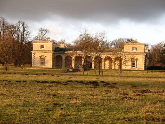
The ruins of Fountains Abbey are a testament to the architectural brilliance of the Cistercian order. The site covers a vast area, with the remains of the church, chapter house, cloisters, and other buildings still standing. The abbey’s distinctive features, such as the elegant rib vaulting and pointed arches, showcase the mastery of medieval craftsmanship.

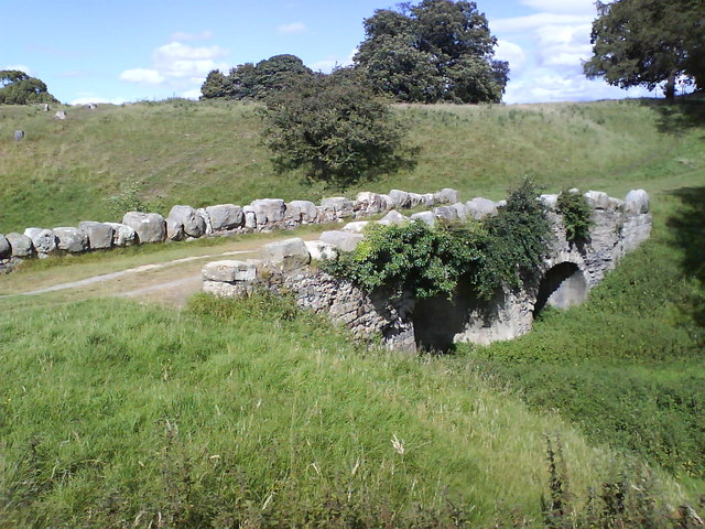
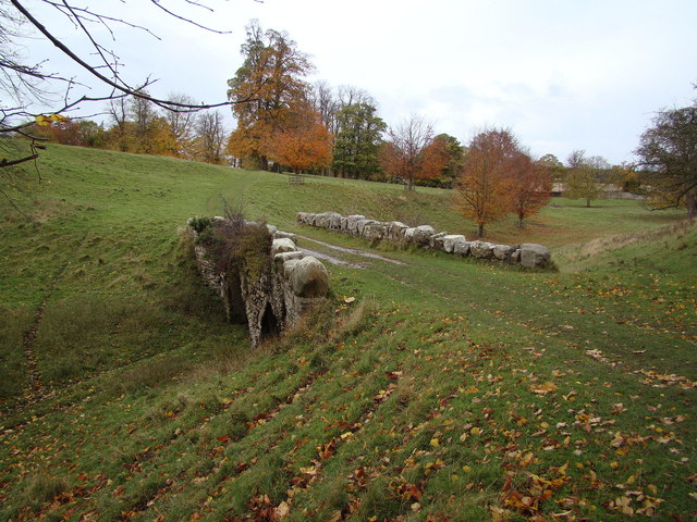
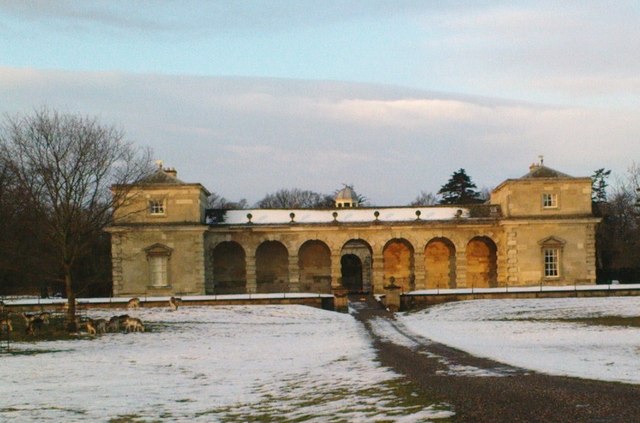
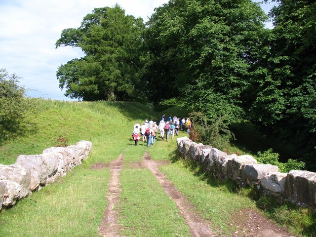
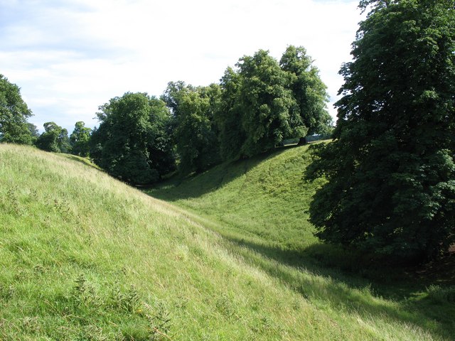
The abbey is set in a picturesque landscape, surrounded by beautiful gardens and a water garden known as Studley Royal Park. This park, which includes a series of ponds, cascades, and canals, was designed in the 18th century and is considered a masterpiece of Georgian landscaping. It provides a tranquil setting for visitors to explore and enjoy.

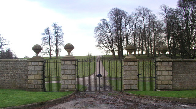
Fountains Abbey and Studley Royal Park were collectively designated as a UNESCO World Heritage site in 1986. The site attracts thousands of visitors each year who are drawn to its historical and architectural significance. There is also a visitor center that offers informative displays and exhibitions about the abbey's history, as well as a gift shop and café for visitors to enjoy.

In summary, Fountains Abbey is a remarkable heritage site in Yorkshire, offering a glimpse into the rich history of the Cistercian order and providing visitors with a serene and awe-inspiring experience.

If you have any feedback on the listing, please let us know in the comments section below.

Fountains Abbey Images

Images are sourced within 2km of 54.1096/-1.5812 or Grid Reference SE2768. Thanks to Geograph Open Source API. All images are credited.
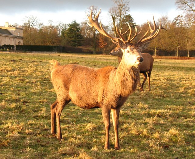
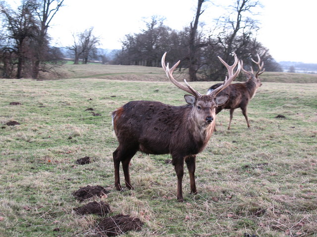
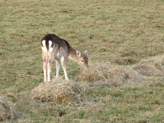
Ornate Gates at Studley Royal These gates are on the northern edge of Studley Royal Park next to the B6265.
Ornate Gates at Studley Royal
These gates are on the northern edge of Studley Royal Park next to the B6265.
Rough Bridge, Studley Park Made to look older than it is, Rough Bridge is another one of Aisaby's follies. It crosses the top of "the Dale", but leads no-where.
Rough Bridge, Studley Park
Made to look older than it is, Rough Bridge is another one of Aisaby's follies. It crosses the top of "the Dale", but leads no-where.
Red deer stag, Studley Park Mature adult stag with 14 or 16 points, which should make him a 'royal'.
Red deer stag, Studley Park
Mature adult stag with 14 or 16 points, which should make him a 'royal'.
Sika deer stag, Studley Park Studley park is well populated with deer, though the sikas are often overlooked. There are about 60 sikas in the park, and from a distance they can be confused with red deer.  Close up one can spot the differences. The sika is only about half the size of the red and had more rounded ears. This male is in its winter coat, but in summer they are a lighter tan with spots.
Sika deer stag, Studley Park
Studley park is well populated with deer, though the sikas are often overlooked. There are about 60 sikas in the park, and from a distance they can be confused with red deer. Close up one can spot the differences. The sika is only about half the size of the red and had more rounded ears. This male is in its winter coat, but in summer they are a lighter tan with spots.
Waiting for the feed truck Group of deer [mostly red] awaiting the arrival of the winter feed truck.  The deer in the park get a regular feed of hay and sheep nuts.  The nuts are particularly popular and it is usually the red stags that get the biggest share, being able to bully the others out of the way.  The deer here are far larger and in better condition than their cousins in the Scottish Highlands thanks to good grass and extra feed through the winter.
Waiting for the feed truck
Group of deer [mostly red] awaiting the arrival of the winter feed truck. The deer in the park get a regular feed of hay and sheep nuts. The nuts are particularly popular and it is usually the red stags that get the biggest share, being able to bully the others out of the way. The deer here are far larger and in better condition than their cousins in the Scottish Highlands thanks to good grass and extra feed through the winter.
Sweet tasting hay Fallow deer hind enjoying the hay provided as winter feed in Studley Park. This individual must be one of the smallest deer in the park and is probably one of the young from the summer of 2007.
Sweet tasting hay
Fallow deer hind enjoying the hay provided as winter feed in Studley Park. This individual must be one of the smallest deer in the park and is probably one of the young from the summer of 2007.
Studley Royal stable block The stable block is neatly bisected by the '70 northing' grid line, but this side is largely within this square.  The building dates from c1730 and was built in the fashionable Palladian style. See also <a href="https://www.geograph.org.uk/photo/543800">SE2769 : The Stables, Studley Royal</a> for more details.
Studley Royal stable block
The stable block is neatly bisected by the '70 northing' grid line, but this side is largely within this square. The building dates from c1730 and was built in the fashionable Palladian style. See also SE2769 : The Stables, Studley Royal for more details.
Wintertime sunrise Lime trees devoid of leaves stand out against the early morning glow in Studley Park.
Wintertime sunrise
Lime trees devoid of leaves stand out against the early morning glow in Studley Park.
Tree Puzzle Weird patterns in an old stump on the Oak Avenue, Studley Park.
Tree Puzzle
Weird patterns in an old stump on the Oak Avenue, Studley Park.
Rough Bridge Folly near the head of The Dale at Studley Deer Park.
Rough Bridge
Folly near the head of The Dale at Studley Deer Park.
Snowy Morning Fallow Deer looking for grass under the snow in Studley Park in front of the Stables, now also known as the Coach House by its present owner.
Snowy Morning
Fallow Deer looking for grass under the snow in Studley Park in front of the Stables, now also known as the Coach House by its present owner.
Track over Rough Bridge In an area of 18th century landscaped parkland, this track is a remnant of earlier times as beyond the bridge it briefly becomes a sunken lane. This was part of the former route between Sutton Magna - a medieval village within the current park which has long since vanished, and Ripon.
Track over Rough Bridge
In an area of 18th century landscaped parkland, this track is a remnant of earlier times as beyond the bridge it briefly becomes a sunken lane. This was part of the former route between Sutton Magna - a medieval village within the current park which has long since vanished, and Ripon.
The Dale, Studley Park The Dale is the name given to this small steep sided dry valley within Studley Park. The valley marks the course of a glacial meltwater channel, of which there are several within the local area.
The Dale, Studley Park
The Dale is the name given to this small steep sided dry valley within Studley Park. The valley marks the course of a glacial meltwater channel, of which there are several within the local area.
Studley Bench Mark Cut mark in wall bounding the Studley Royal Garden Centre on the Ripon to Pateley Bridge Road; height 100.8185, 0.3 metres above the ground and last verified in 1972. <a href="https://www.geograph.org.uk/photo/2027428">SE2770 : Studley Royal Garden Centre</a>
Studley Bench Mark
Cut mark in wall bounding the Studley Royal Garden Centre on the Ripon to Pateley Bridge Road; height 100.8185, 0.3 metres above the ground and last verified in 1972. SE2770 : Studley Royal Garden Centre
Studley Royal Garden Centre A bench mark is located in the front wall of the garden centre which is beside the Ripon to Pateley Bridge Road. <a href="https://www.geograph.org.uk/photo/2026396">SE2770 : Studley Bench Mark</a>
Studley Royal Garden Centre
A bench mark is located in the front wall of the garden centre which is beside the Ripon to Pateley Bridge Road. SE2770 : Studley Bench Mark
Deer at Studley Looking across parkland towards a large group of deer.
Deer at Studley
Looking across parkland towards a large group of deer.
Deer in the park Looking towards a group of deer at Studley Royal.
Deer in the park
Looking towards a group of deer at Studley Royal.
Deer and Ripon Minster Looking towards some deer in the parkland at Studley Royal.
Deer and Ripon Minster
Looking towards some deer in the parkland at Studley Royal.
Show me another place!

Fountains Abbey is located at Grid Ref: SE2768 (Lat: 54.1096, Lng: -1.5812)

Division: West Riding

Police Authority: North Yorkshire

What 3 Words

///perky.verge.debut. Near Ripon, North Yorkshire

Related Wikis

Fountains Abbey

Fountains Abbey is one of the largest and best preserved ruined Cistercian monasteries in England. It is located approximately 3 miles (5 km) south-west...
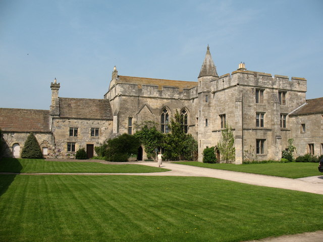
Fountains Hall

Fountains Hall is a country house near Ripon in North Yorkshire, England, located within the World Heritage Site at Studley Royal Park which include the...

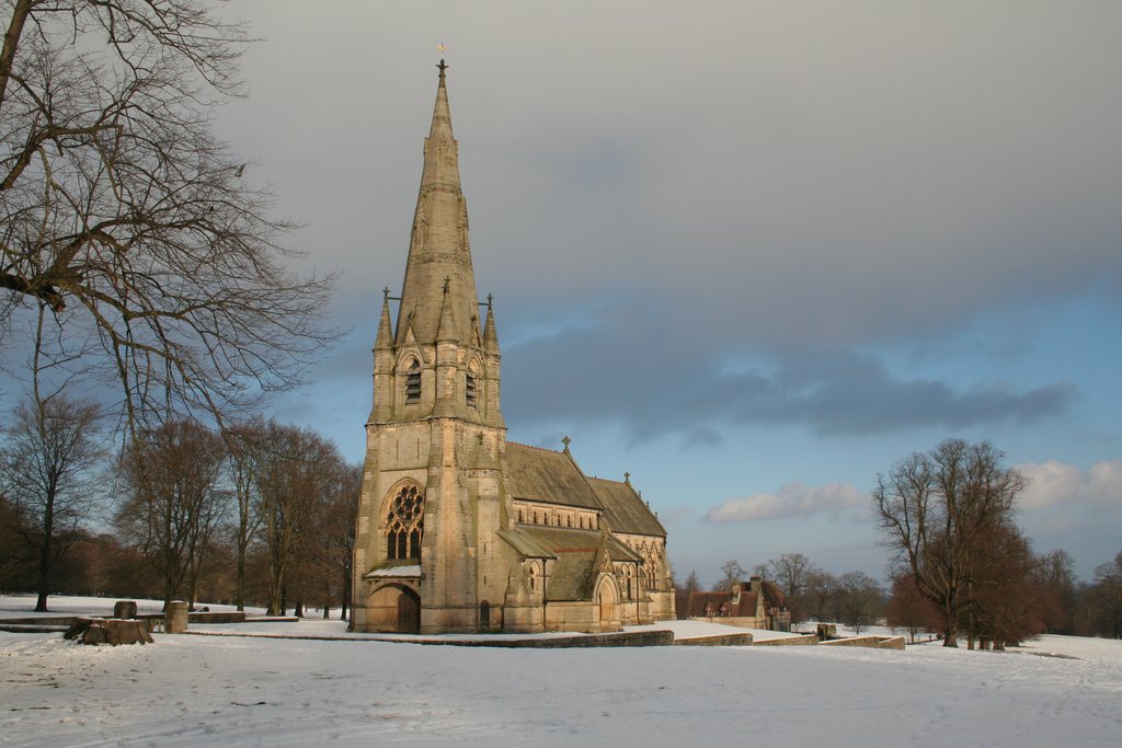
St Mary's, Studley Royal

The Church of St Mary, Studley Royal, is a Victorian Gothic Revival church built in the Early English style by William Burges. It is located in the grounds...
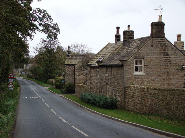
Aldfield

Aldfield is a village and civil parish in the former Harrogate district of North Yorkshire, England, about three miles west of Ripon. It is the closest...

Markenfield Hall

Markenfield Hall is an early 14th-century moated manor house about 3 miles (5 km) south of Ripon, North Yorkshire, England. It is in the civil parish of...

Studley Roger

Studley Roger is a small village and civil parish in the Harrogate district of North Yorkshire, England, and it is about 1 mile west of the historical...

Sawley, North Yorkshire

Sawley is a village and civil parish in the Harrogate district of North Yorkshire, England. It is about 4 miles (6.4 km) west of Ripon. From this position...

Risplith

Risplith is a village in the civil parish of Sawley, in the Harrogate district of North Yorkshire, England. It is about 4 miles (6.4 km) west of Ripon...

Related Videos

A Week at Wren Cottage 2023 - Walking to Fountains Abbey - National Trust

In August 2023 we spent a week in a National Trust Cottage close to Fountains Abbey in North Yorkshire. This comfortable base ...

Walking Outside Fountain Abbeys in Ripon England #walkingoutsidefountainsabbey

Walking Outside Fountain Abbeys in Ripon England #walkingoutsidefountainsabbey 00:01 Walking outside Fountain Abbey's ...

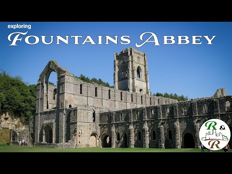
Exploring Fountains Abbey - stunning and beautiful medieval ruin near Ripon in Yorkshire

abbey #ruin #history #ruins #yorkshire Join us as we explore the stunning medieval ruins of Fountains Abbey, located three miles ...

Nearby Amenities

Located within 500m of 54.1096,-1.5812
Cafe
Addr City: Ripon
Addr Postcode: HG4 3DZ
Addr Suburb: Fountains Abbey
Fhrs Id: 224811
Indoor Seating: yes
Outdoor Seating: yes
Source Addr: FHRS Open Data
Lat/Long: 54.1129038/-1.5848297
Bell
Lat/Long: 54.108773/-1.5844938
Shop: ticket
Lat/Long: 54.1130235/-1.5843519
Shop: gift
Lat/Long: 54.1131473/-1.5843983
Toilets
Changing Table: yes
Changing Table Location: wheelchair_toilet
Fee: no
Female: yes
Male: yes
Wheelchair: yes
Lat/Long: 54.113163/-1.5849669
Post Box
Brand: Royal Mail
Brand Wikidata: Q638098
Collection Times: Mo-Fr 16:00; Sa 12:30
Operator: Royal Mail
Operator Wikidata: Q638098
Post Box Type: wall
Ref: HG4 14
Royal Cypher: VR
Royal Cypher Wikidata: Q33102356
Lat/Long: 54.1094595/-1.5872047
Entrance: main
Lat/Long: 54.1097383/-1.5864572
Entrance: main
Lat/Long: 54.1107159/-1.5842209
Bicycle Parking
Bicycle Parking: stands
Capacity: 12
Lat/Long: 54.1131649/-1.5854039
Information: map
Tourism: information
Lat/Long: 54.1132101/-1.5849583
Bicycle Parking
Bicycle Parking: stands
Lat/Long: 54.1133031/-1.5846999
Information: map
Tourism: information
Lat/Long: 54.1133464/-1.5847547
Image: https://www.geograph.org.uk/photo/947290
Waterway: weir
Wikidata: Q26468254
Lat/Long: 54.1103934/-1.5752668
Bin: yes
Tourism: picnic_site
Lat/Long: 54.1122752/-1.5842942
Fountains Abbey & Studley Royal
Information: map
Tourism: information
Lat/Long: 54.1087888/-1.5875331
Access: customers
Entrance: exit
Wheelchair: yes
Lat/Long: 54.1129647/-1.5843172
Entrance: yes
Lat/Long: 54.1130162/-1.5844443
Entrance: yes
Lat/Long: 54.1130878/-1.5844678
Entrance: yes
Lat/Long: 54.1129666/-1.5847604
Entrance: yes
Lat/Long: 54.109699/-1.5838199
Bench
Backrest: no
Lat/Long: 54.1102769/-1.5752829
Bench
Lat/Long: 54.1099782/-1.577162
Fountains Abbey Visitor Centre
Bus: yes
Public Transport: stop_position
Lat/Long: 54.1136371/-1.5844975
Entrance: yes
Level: 1
Lat/Long: 54.1090351/-1.5847115
Entrance: yes
Lat/Long: 54.1090933/-1.5846572
Entrance: yes
Lat/Long: 54.1088255/-1.5845111
Entrance: yes
Lat/Long: 54.1088999/-1.5845356
Elevator
Level: 0;1;2
Lat/Long: 54.1089806/-1.5846545
Bench
Lat/Long: 54.1103638/-1.5814474
Robin Hood's Well
Disused Man Made: water_well
Image: https://www.geograph.org.uk/photo/7089063
Wikidata: Q26442693
Lat/Long: 54.10979/-1.5781583
Waterway: weir
Wikidata: Q26583909
Lat/Long: 54.1098989/-1.5788904
The data included in this document is from www.openstreetmap.org. The data is made available under ODbL.

Have you been to Fountains Abbey?

Leave your review of Fountains Abbey below (or comments, questions and feedback).