Rye Bank Wood

Wood, Forest in Yorkshire Harrogate

England

Rye Bank Wood

The edge of Studley Royal deer park It is National Trust land but there is no restriction on entering this part. The Fountains Abbey site adjoining requires proper admission.
The edge of Studley Royal deer park Credit: Bill Boaden

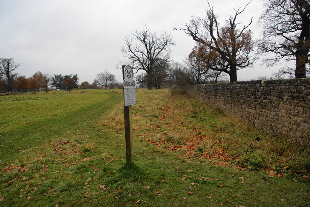
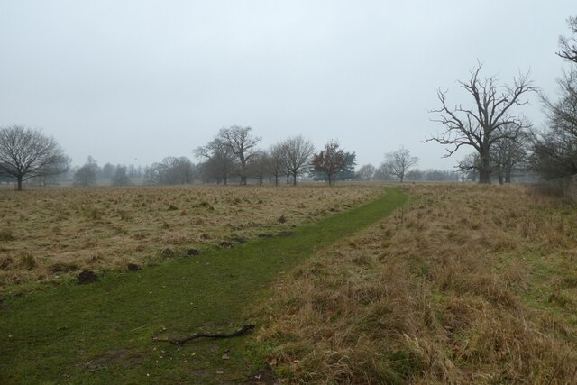
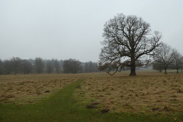
Rye Bank Wood, located in the picturesque county of Yorkshire, England, is a charming woodland area that stretches across approximately 10 acres. Situated near the town of Huddersfield, this enchanting forest is a beloved destination for nature enthusiasts, hikers, and photographers alike.

The wood is predominantly made up of a variety of deciduous trees, including oak, beech, and birch, which create a stunning canopy of foliage during the summer months. In the autumn, the forest transforms into a palette of vibrant reds, oranges, and yellows, making it a popular spot for capturing the beauty of the changing seasons.

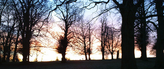
Tranquility is at the heart of Rye Bank Wood, with its peaceful atmosphere and the gentle rustling of leaves providing a soothing ambiance for visitors. As you wander through the forest, you may come across a babbling brook that adds to the serenity, creating an idyllic setting for a leisurely stroll.

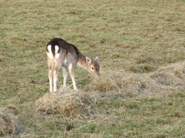
Wildlife thrives within this natural habitat, with a variety of bird species, such as woodpeckers and owls, making their homes in the trees. Squirrels and rabbits can often be spotted darting amongst the undergrowth, while if you're lucky, you may catch a glimpse of a deer gracefully roaming through the woodland.

Rye Bank Wood is open to the public year-round, offering an escape from the hustle and bustle of everyday life. Whether you're seeking a peaceful walk, a place to reconnect with nature, or simply a beautiful backdrop for photography, this enchanting forest is sure to captivate all who visit.

If you have any feedback on the listing, please let us know in the comments section below.

Rye Bank Wood Images

Images are sourced within 2km of 54.110857/-1.5783793 or Grid Reference SE2768. Thanks to Geograph Open Source API. All images are credited.
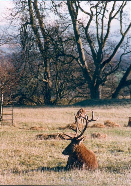
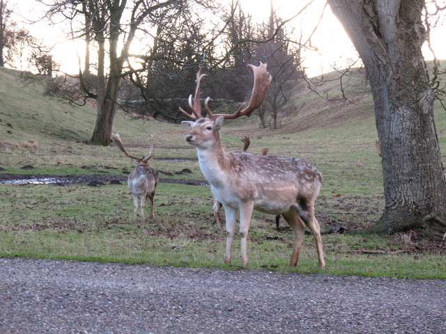
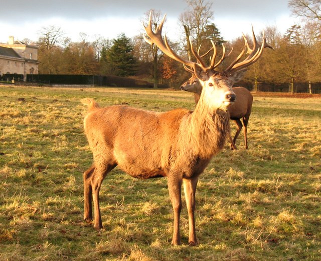
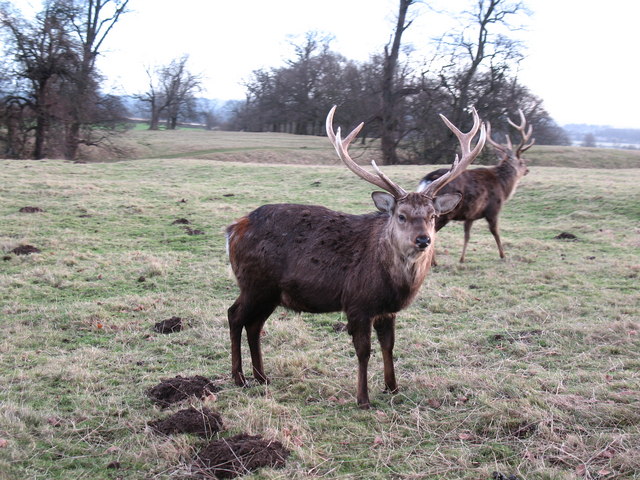
The edge of Studley Royal deer park It is National Trust land but there is no restriction on entering this part. The Fountains Abbey site adjoining requires proper admission.
The edge of Studley Royal deer park
It is National Trust land but there is no restriction on entering this part. The Fountains Abbey site adjoining requires proper admission.
Path on the edge of the deer park Looking along a path on the perimeter of the deer park where the path from Studley Roger enters the park.
Path on the edge of the deer park
Looking along a path on the perimeter of the deer park where the path from Studley Roger enters the park.
Path over the deer park Looking along a path across the deer park from where the footpath from Studley Roger enters the park.
Path over the deer park
Looking along a path across the deer park from where the footpath from Studley Roger enters the park.
Ornate Gates at Studley Royal These gates are on the northern edge of Studley Royal Park next to the B6265.
Ornate Gates at Studley Royal
These gates are on the northern edge of Studley Royal Park next to the B6265.
A quiet corner of Studley Park Red deer resting in Studley Park.
A quiet corner of Studley Park
Red deer resting in Studley Park.
Rough Bridge, Studley Park Made to look older than it is, Rough Bridge is another one of Aisaby's follies. It crosses the top of "the Dale", but leads no-where.
Rough Bridge, Studley Park
Made to look older than it is, Rough Bridge is another one of Aisaby's follies. It crosses the top of "the Dale", but leads no-where.
The Old Studley Royal Cricket Ground Now no more than a training pitch after the owners moved closer to Ripon and built a flashier clubhouse.
The Old Studley Royal Cricket Ground
Now no more than a training pitch after the owners moved closer to Ripon and built a flashier clubhouse.
Slaughter House & Barns Positioned against the Park wall, the Slaughter House is where culled deer are prepared for local butchers, and would originally have been used to prepare meat for the big house (now long since demolished). The attached barns once stored tractors and other machinery, but have been converted back to hay barns, to store winter feed for the deer.
The clock on the end of the building is correct twice a day, as it stopped working many years ago.
Slaughter House & Barns
Positioned against the Park wall, the Slaughter House is where culled deer are prepared for local butchers, and would originally have been used to prepare meat for the big house (now long since demolished). The attached barns once stored tractors and other machinery, but have been converted back to hay barns, to store winter feed for the deer. The clock on the end of the building is correct twice a day, as it stopped working many years ago.
Loading winter feed at the barn. NT staff loading winter feed for the Studley Park deer herd at the barns next to the slaughterhouse.
Loading winter feed at the barn.
NT staff loading winter feed for the Studley Park deer herd at the barns next to the slaughterhouse.
Fallow Buck, Studley Park Handsome looking fallow buck. There is a large herd of fallow deer in Studley Park.
Fallow Buck, Studley Park
Handsome looking fallow buck. There is a large herd of fallow deer in Studley Park.
Red deer stag, Studley Park Mature adult stag with 14 or 16 points, which should make him a 'royal'.
Red deer stag, Studley Park
Mature adult stag with 14 or 16 points, which should make him a 'royal'.
The Game Larder, Studley Park This small building in the park was used for the hanging of game such as pheasant, duck or deer before being prepared for the Aislabie's table.
The Game Larder, Studley Park
This small building in the park was used for the hanging of game such as pheasant, duck or deer before being prepared for the Aislabie's table.
Sika deer stag, Studley Park Studley park is well populated with deer, though the sikas are often overlooked. There are about 60 sikas in the park, and from a distance they can be confused with red deer.  Close up one can spot the differences. The sika is only about half the size of the red and had more rounded ears. This male is in its winter coat, but in summer they are a lighter tan with spots.
Sika deer stag, Studley Park
Studley park is well populated with deer, though the sikas are often overlooked. There are about 60 sikas in the park, and from a distance they can be confused with red deer. Close up one can spot the differences. The sika is only about half the size of the red and had more rounded ears. This male is in its winter coat, but in summer they are a lighter tan with spots.
Waiting for the feed truck Group of deer [mostly red] awaiting the arrival of the winter feed truck.  The deer in the park get a regular feed of hay and sheep nuts.  The nuts are particularly popular and it is usually the red stags that get the biggest share, being able to bully the others out of the way.  The deer here are far larger and in better condition than their cousins in the Scottish Highlands thanks to good grass and extra feed through the winter.
Waiting for the feed truck
Group of deer [mostly red] awaiting the arrival of the winter feed truck. The deer in the park get a regular feed of hay and sheep nuts. The nuts are particularly popular and it is usually the red stags that get the biggest share, being able to bully the others out of the way. The deer here are far larger and in better condition than their cousins in the Scottish Highlands thanks to good grass and extra feed through the winter.
Sweet tasting hay Fallow deer hind enjoying the hay provided as winter feed in Studley Park. This individual must be one of the smallest deer in the park and is probably one of the young from the summer of 2007.
Sweet tasting hay
Fallow deer hind enjoying the hay provided as winter feed in Studley Park. This individual must be one of the smallest deer in the park and is probably one of the young from the summer of 2007.
Studley Royal stable block The stable block is neatly bisected by the '70 northing' grid line, but this side is largely within this square.  The building dates from c1730 and was built in the fashionable Palladian style. See also <a href="https://www.geograph.org.uk/photo/543800">SE2769 : The Stables, Studley Royal</a> for more details.
Studley Royal stable block
The stable block is neatly bisected by the '70 northing' grid line, but this side is largely within this square. The building dates from c1730 and was built in the fashionable Palladian style. See also SE2769 : The Stables, Studley Royal for more details.
Wintertime sunrise Lime trees devoid of leaves stand out against the early morning glow in Studley Park.
Wintertime sunrise
Lime trees devoid of leaves stand out against the early morning glow in Studley Park.
Hoar Frost in Studley Park White, frost covered trees stand out in the deerpark at Studley Royal, mid morning.
Hoar Frost in Studley Park
White, frost covered trees stand out in the deerpark at Studley Royal, mid morning.
Show me another place!

Rye Bank Wood is located at Grid Ref: SE2768 (Lat: 54.110857, Lng: -1.5783793)

Division: West Riding

Administrative County: North Yorkshire

District: Harrogate

Police Authority: North Yorkshire

What 3 Words

///pelted.poetic.disbanded. Near Ripon, North Yorkshire

Related Wikis

Fountains Abbey

Fountains Abbey is one of the largest and best preserved ruined Cistercian monasteries in England. It is located approximately 3 miles (5 km) south-west...
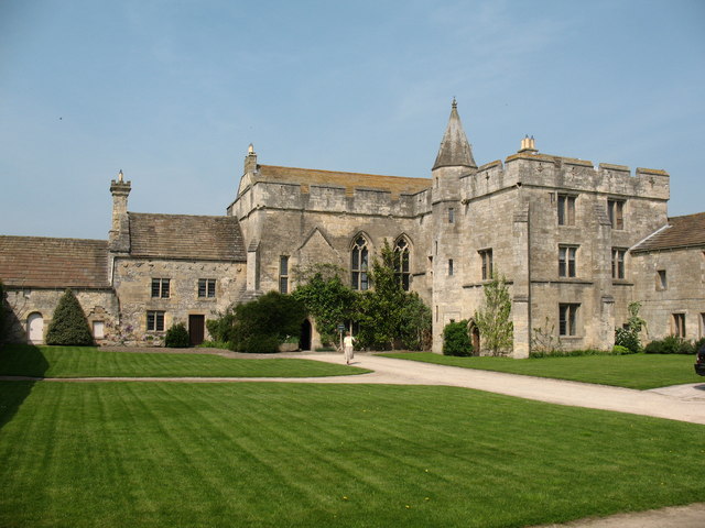
Fountains Hall

Fountains Hall is a country house near Ripon in North Yorkshire, England, located within the World Heritage Site at Studley Royal Park which include the...

St Mary's, Studley Royal

The Church of St Mary, Studley Royal, is a Victorian Gothic Revival church built in the Early English style by William Burges. It is located in the grounds...

Aldfield

Aldfield is a village and civil parish in the former Harrogate district of North Yorkshire, England, about three miles west of Ripon. It is the closest...

Studley Roger

Studley Roger is a small village and civil parish in the Harrogate district of North Yorkshire, England, and it is about 1 mile west of the historical...

Markenfield Hall

Markenfield Hall is an early 14th-century moated manor house about 3 miles (5 km) south of Ripon, North Yorkshire, England. It is in the civil parish of...

Ingerthorpe

Ingerthorpe is a hamlet and former civil parish about 7 miles (11 km) from Harrogate, now in the parish of Markington with Wallerthwaite, in the Harrogate...

Sawley, North Yorkshire

Sawley is a village and civil parish in the Harrogate district of North Yorkshire, England. It is about 4 miles (6.4 km) west of Ripon. From this position...

Nearby Amenities

Located within 500m of 54.110857,-1.5783793
Waterway: weir
Lat/Long: 54.1122776/-1.5729537
Image: https://www.geograph.org.uk/photo/7029247
Waterway: weir
Lat/Long: 54.1110444/-1.5723592
Cafe
Addr City: Ripon
Addr Postcode: HG4 3DZ
Addr Suburb: Fountains Abbey
Fhrs Id: 224811
Indoor Seating: yes
Outdoor Seating: yes
Source Addr: FHRS Open Data
Lat/Long: 54.1129038/-1.5848297
Bell
Lat/Long: 54.108773/-1.5844938
Artwork Type: statue
Tourism: artwork
Wikidata: Q26443434
Lat/Long: 54.1138644/-1.5736174
Shop: ticket
Lat/Long: 54.1130235/-1.5843519
Shop: gift
Lat/Long: 54.1131473/-1.5843983
Toilets
Changing Table: yes
Changing Table Location: wheelchair_toilet
Fee: no
Female: yes
Male: yes
Wheelchair: yes
Lat/Long: 54.113163/-1.5849669
Tent Hill
Description: A Tent was placed on top of the hill as it was the fashion at the time the gardens were created.
Source: gps;National_Trust
Tourism: viewpoint
Lat/Long: 54.1115936/-1.5720852
Entrance: main
Lat/Long: 54.1107159/-1.5842209
Bicycle Parking
Bicycle Parking: stands
Lat/Long: 54.1133031/-1.5846999
Information: map
Tourism: information
Lat/Long: 54.1133464/-1.5847547
Drum Fall
Waterway: weir
Lat/Long: 54.1135337/-1.574234
Image: https://www.geograph.org.uk/photo/947290
Waterway: weir
Wikidata: Q26468254
Lat/Long: 54.1103934/-1.5752668
Bin: yes
Tourism: picnic_site
Lat/Long: 54.1122752/-1.5842942
Access: customers
Entrance: exit
Wheelchair: yes
Lat/Long: 54.1129647/-1.5843172
Entrance: yes
Lat/Long: 54.1130162/-1.5844443
Entrance: yes
Lat/Long: 54.1130878/-1.5844678
Entrance: yes
Lat/Long: 54.1129666/-1.5847604
Entrance: yes
Lat/Long: 54.109699/-1.5838199
Bench
Backrest: no
Lat/Long: 54.1107543/-1.573093
Bench
Backrest: no
Lat/Long: 54.1102769/-1.5752829
Bench
Lat/Long: 54.1099782/-1.577162
Bench
Lat/Long: 54.1145775/-1.5747509
Hercules wrestling Anteus
Artwork Type: statue
Image: https://www.geograph.org.uk/photo/6674369
Tourism: artwork
Wikidata: Q26468700
Lat/Long: 54.1125805/-1.5737379
Entrance: yes
Level: 1
Lat/Long: 54.1090351/-1.5847115
Entrance: yes
Lat/Long: 54.1090933/-1.5846572
Entrance: yes
Lat/Long: 54.1088255/-1.5845111
Entrance: yes
Lat/Long: 54.1088999/-1.5845356
Quebec Monument
Historic: monument
Image: https://www.geograph.org.uk/photo/616487
Wikidata: Q26468711
Lat/Long: 54.1126654/-1.5725389
Cave: grotto
Historic: folly
Image: https://www.geograph.org.uk/photo/7029263
Natural: cave_entrance
Wikidata: Q26443436
Lat/Long: 54.1126788/-1.5717758
Artwork Type: sculpture
Tourism: artwork
Lat/Long: 54.1134972/-1.5740778
Artwork Type: sculpture
Image: https://www.geograph.org.uk/photo/6674380
Tourism: artwork
Lat/Long: 54.113551/-1.5744178
Elevator
Level: 0;1;2
Lat/Long: 54.1089806/-1.5846545
Bench
Lat/Long: 54.1103638/-1.5814474
Robin Hood's Well
Disused Man Made: water_well
Image: https://www.geograph.org.uk/photo/7089063
Wikidata: Q26442693
Lat/Long: 54.10979/-1.5781583
Waterway: weir
Wikidata: Q26583909
Lat/Long: 54.1098989/-1.5788904
Hiking: yes
Information: guidepost
Tourism: information
Lat/Long: 54.1120247/-1.5735139
The data included in this document is from www.openstreetmap.org. The data is made available under ODbL.

Have you been to Rye Bank Wood?

Leave your review of Rye Bank Wood below (or comments, questions and feedback).