Metal Bridge

Settlement in Durham

England

Metal Bridge

Roundabout at Amazon Warehouse
Roundabout at Amazon Warehouse Credit: Anthony Parkes

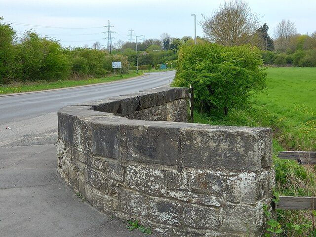
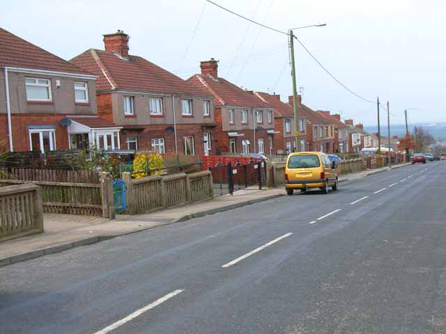
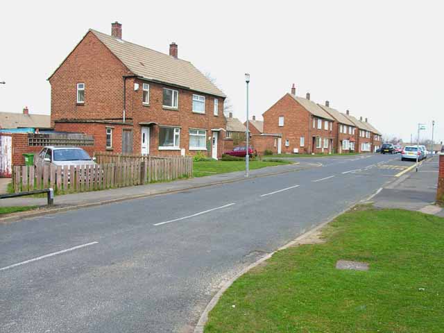
Metal Bridge is a small village located in County Durham, England. Situated about 6 miles southeast of the city of Durham, it lies along the A688 road, near the River Wear. The village gets its name from the bridge that crosses the river, which was historically made of metal, distinguishing it from other nearby bridges.

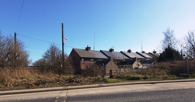
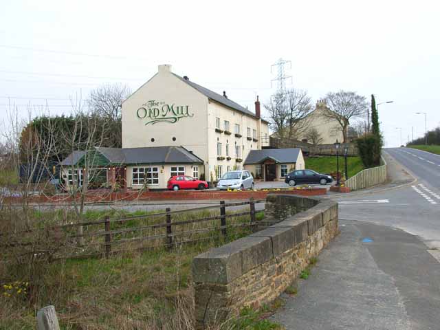
The population of Metal Bridge is relatively small, with around 400 residents. The village mainly consists of residential properties, with a few local businesses and amenities scattered throughout. The community has a close-knit feel and is known for its friendly and welcoming atmosphere.

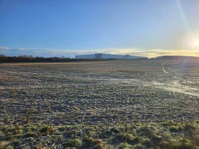
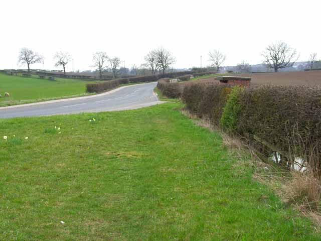
The area surrounding Metal Bridge is characterized by picturesque countryside, offering beautiful views and plenty of opportunities for outdoor activities. The nearby River Wear provides opportunities for fishing and boating, attracting both locals and tourists alike.

Despite its small size, Metal Bridge benefits from its proximity to Durham City. Residents have easy access to a wider range of amenities, including shops, restaurants, and cultural attractions. The city's vibrant nightlife and rich history, including the iconic Durham Cathedral and Castle, are just a short drive away.

Overall, Metal Bridge offers a peaceful and scenic setting for residents, while still providing convenient access to nearby urban amenities. Its charming atmosphere and natural beauty make it an attractive place to live for those seeking a rural lifestyle with close proximity to a lively city.

If you have any feedback on the listing, please let us know in the comments section below.
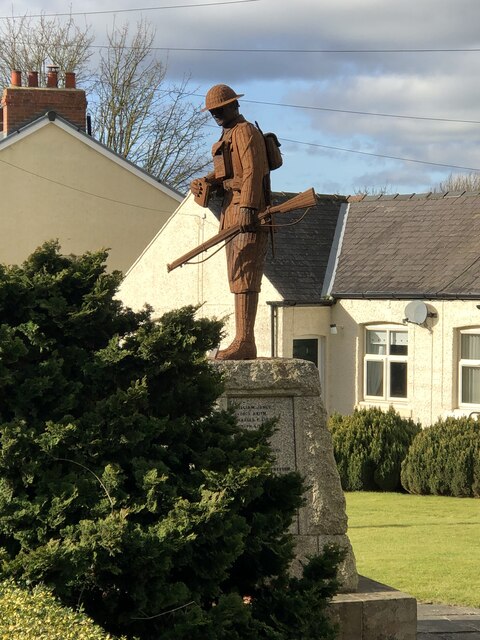
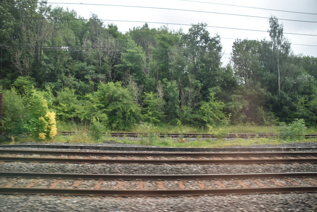
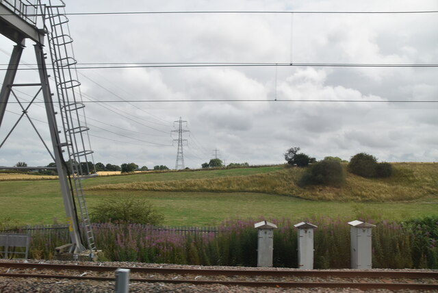
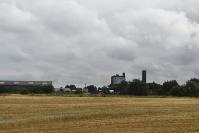
Metal Bridge Images

Images are sourced within 2km of 54.707893/-1.538244 or Grid Reference NZ2934. Thanks to Geograph Open Source API. All images are credited.

Roundabout at Amazon Warehouse
Tursdale
Tursdale
Metal Bridge, old mill bridge The rivet benchmark is cut into the top of the parapet on the north side of Thinford Road.
Metal Bridge, old mill bridge
The rivet benchmark is cut into the top of the parapet on the north side of Thinford Road.
Metal Bridge, old mill bridge There is a rivet benchmark is cut into the top of the parapet on the north side of Thinford Road. It is on the second stone from the right.
Metal Bridge, old mill bridge
There is a rivet benchmark is cut into the top of the parapet on the north side of Thinford Road. It is on the second stone from the right.
Intermodal train at site of former Coxhoe Junction Coxhoe junction formerly had several lines including a flyover across the lines in the image. These former lines included early railways such as the Clarence Railway's branches to Coxhoe & collieries in the Spennymoor area, and the splendidly named Great North of England, Clarence & Hartlepool Junction Railway (GNEC&HJR) which linked the Clarence Railway to Hartlepool Docks. In addition local collieries, quarries, and ironworks at Cornforth, Mainsforth, and Ferryhill were also connected here or close by.

The two remaining tracks on the left are the East Coast Main line, while the two nearest tracks serve as a passing loop, with onward running to Stockton via Stillington in the southerly direction, and formerly running to Gateshead via Leamside in the northerly direction.
Intermodal train at site of former Coxhoe Junction
Coxhoe junction formerly had several lines including a flyover across the lines in the image. These former lines included early railways such as the Clarence Railway's branches to Coxhoe & collieries in the Spennymoor area, and the splendidly named Great North of England, Clarence & Hartlepool Junction Railway (GNEC&HJR) which linked the Clarence Railway to Hartlepool Docks. In addition local collieries, quarries, and ironworks at Cornforth, Mainsforth, and Ferryhill were also connected here or close by. The two remaining tracks on the left are the East Coast Main line, while the two nearest tracks serve as a passing loop, with onward running to Stockton via Stillington in the southerly direction, and formerly running to Gateshead via Leamside in the northerly direction.
The Old Mill, near Tursdale This building dates from 1813 when it opened as a paper mill; it was later also used as a corn mill. That business ceased in 1890 after which it had a variety of uses including as a pub. It is now an up-market inn with 12 en-suite rooms. In this view taken on a dismal December day the external lights are still on even though it is about 9-30am.
The Old Mill, near Tursdale
This building dates from 1813 when it opened as a paper mill; it was later also used as a corn mill. That business ceased in 1890 after which it had a variety of uses including as a pub. It is now an up-market inn with 12 en-suite rooms. In this view taken on a dismal December day the external lights are still on even though it is about 9-30am.
Fire damaged farm machinery Burned out farm equipment
Fire damaged farm machinery
Burned out farm equipment
Tamping machine crossing Tursdale Beck Railway tamping machine - self propelled railway vehicle used to pack the track ballast - heading to its next work area, seen crossing Tursdale Beck on the East Coast Main Line.
Tamping machine crossing Tursdale Beck
Railway tamping machine - self propelled railway vehicle used to pack the track ballast - heading to its next work area, seen crossing Tursdale Beck on the East Coast Main Line.
Tursdale War Memorial Sculpture Sculpture 'Not Much To Ask' by Ray Lonsdale. The sculpture replaced an earlier stone figure that was removed in the 1970s due to damage. The new sculpture was erected and the memorial re-dedicated in 2018.

The artist's work can be found throughout the northeast, often portraying people involved in the regions historic industries.
Tursdale War Memorial Sculpture
Sculpture 'Not Much To Ask' by Ray Lonsdale. The sculpture replaced an earlier stone figure that was removed in the 1970s due to damage. The new sculpture was erected and the memorial re-dedicated in 2018. The artist's work can be found throughout the northeast, often portraying people involved in the regions historic industries.
Multiple lines
Multiple lines
Mixed land use
Mixed land use
Tursdale Works
Tursdale Works
Amazon Warehouse at Bowburn The Amazon warehouse at Bowburn from the West Bowburn Way
Amazon Warehouse at Bowburn
The Amazon warehouse at Bowburn from the West Bowburn Way
Cornforth Road, Metal Bridge
The Old Mill, Tursdale See <span class="nowrap"><a title="http://www.theoldmill.uk.com" rel="nofollow ugc noopener" href="http://www.theoldmill.uk.com">Link</a><img style="margin-left:2px;" alt="External link" title="External link - shift click to open in new window" src="https://s1.geograph.org.uk/img/external.png" width="10" height="10"/></span>
The Old Mill, Tursdale
See LinkExternal link
A688 at Metal Bridge The A688 bypasses the old road at Metal Bridge on a high embankment. The blue lorry is crossing the East Coast Main Line
A688 at Metal Bridge
The A688 bypasses the old road at Metal Bridge on a high embankment. The blue lorry is crossing the East Coast Main Line
Linden Road, Cornforth
Lichfield Road, Cornforth
Show me another place!

Metal Bridge is located at Grid Ref: NZ2934 (Lat: 54.707893, Lng: -1.538244)

Unitary Authority: County Durham

Police Authority: Durham

What 3 Words

///magpie.crunching.smashes. Near West Cornforth, Co. Durham

Nearby Locations

Metal Bridge East Howle

Related Wikis

Metal Bridge, County Durham

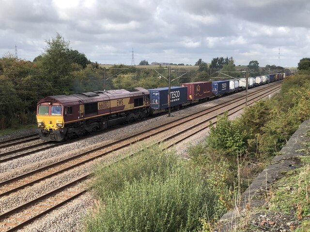
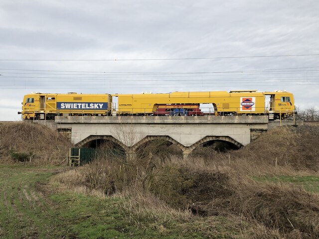
Metal Bridge is a hamlet in County Durham, England, situated a few miles south of Durham. The East Coast Main Line runs directly through Metal Bridge but...

West Cornforth railway station

West Cornforth railway station served the village of West Cornforth, County Durham, England, from 1866 to 1952 on the Great North of England, Clarence...

Tursdale

Tursdale is a hamlet in County Durham, England. It is situated in rural landscape about two miles to the west of Coxhoe, two miles North of Cornforth and...

Cornforth

Cornforth is a village in County Durham, England. It is adjacent to the village of West Cornforth, situated a short distance to the north-east of Ferryhill...

Nearby Amenities

Located within 500m of 54.707893,-1.538244
Metal Bridge
Place: hamlet
Wikidata: Q6822585
Wikipedia: en:Metal Bridge, County Durham
Lat/Long: 54.7088409/-1.5371316
Ele: 94.0
Lat/Long: 54.7085394/-1.5390848
Railway: switch
Lat/Long: 54.7101419/-1.5350341
Post Box
Ele: 86.1632080
Ref: DH6 337
Lat/Long: 54.708977/-1.5365117
Fixme: Check to see if there's a barrier=stile, barrier=entrance or anything else here.
Lat/Long: 54.7086947/-1.5405182
Railway: switch
Lat/Long: 54.7091492/-1.5351342
Bus Stop
Cornforth Lane
Bus: yes
Naptan AtcoCode: 13006714C
Naptan Bearing: E
Naptan CommonName: Cornforth Lane
Naptan Indicator: east bound
Naptan Landmark: Landmark not known
Naptan NaptanCode: durdptgj
Naptan Notes: on bridge street 50m east of railway bridge- durham- dh6 5ld
Naptan Street: Bridge Street
Naptan Verified: no
Public Transport: platform
Shelter: yes
Source: naptan_import
Lat/Long: 54.7092745/-1.5343168
Bus Stop
Cornforth Lane
Bus: yes
Naptan AtcoCode: 13006714H
Naptan Bearing: NW
Naptan CommonName: Cornforth Lane
Naptan Indicator: north west bound
Naptan Landmark: Landmark not known
Naptan NaptanCode: durdptgm
Naptan Notes: on road leading to cornforth bypass- approaching junction with bridge street- durham- dh6 5ld
Naptan Street: Cornforth Lane
Naptan Verified: no
Public Transport: platform
Shelter: yes
Source: naptan_import
Lat/Long: 54.7089694/-1.5328908
Bus Stop
Church
Bus: yes
Naptan AtcoCode: 13006715B
Naptan Bearing: NE
Naptan CommonName: Church
Naptan Indicator: north east bound
Naptan Landmark: Landmark not known
Naptan NaptanCode: durdptgp
Naptan Notes: Bridge Street- between 5 and 32 Thinford Street- Metal Bridge- NW of Cornforth.
Naptan Street: Bridge Street
Naptan Verified: no
Public Transport: platform
Shelter: yes
Source: naptan_import
Lat/Long: 54.708855/-1.537588
Bus Stop
Church
Bus: yes
Naptan AtcoCode: 13006715F
Naptan Bearing: SW
Naptan CommonName: Church
Naptan Indicator: south west bound
Naptan Landmark: Landmark not known
Naptan NaptanCode: durdptgt
Naptan Notes: Bridge Street- between 5 and 32 Thinford Street- Metal Bridge- NW of Cornforth.
Naptan Street: Bridge Street
Naptan Verified: no
Public Transport: platform
Shelter: yes
Source: naptan_import
Lat/Long: 54.7086595/-1.5379867
Location Transition: yes
Power: pole
Transformer: distribution
Lat/Long: 54.709193/-1.5406887
Power: pole
Lat/Long: 54.7090856/-1.5419806
Post Box
Collection Times: Mo-Fr 16:15; Sa 10:30
Drive Through: no
Operator: Royal Mail
Ref: DL17 176
Lat/Long: 54.7035602/-1.5398266
Power: pole
Lat/Long: 54.7089702/-1.5432338
Power: pole
Lat/Long: 54.711743/-1.534453
Power: pole
Transformer: distribution
Lat/Long: 54.7103734/-1.5367171
Power: pole
Lat/Long: 54.7087738/-1.5455516
Location Transition: yes
Power: pole
Lat/Long: 54.7111431/-1.5364292
Power: pole
Lat/Long: 54.7088682/-1.544492
Railway: switch
Lat/Long: 54.7105293/-1.5350261
Railway: switch
Lat/Long: 54.7086165/-1.5351921
Power: tower
Lat/Long: 54.7066431/-1.541626
Railway: signal
Railway Signal Direction: forward
Railway Signal Main: GB-NR:main
Railway Signal Main Design: combined
Railway Signal Main Form: light
Railway Signal Main Height: normal
Railway Signal Main States: red;green;yellow;flashing_yellow;double_yellow;flashing_double_yellow
Railway Signal Operator: Network Rail
Railway Signal Position: bridge
Ref: T 421
Lat/Long: 54.7064447/-1.5353848
Railway: signal
Railway Signal Direction: backward
Railway Signal Main: GB-NR:main
Railway Signal Main Design: combined
Railway Signal Main Form: light
Railway Signal Main Height: normal
Railway Signal Main States: red;green
Railway Signal Operator: Network Rail
Railway Signal Position: bridge
Railway Signal Route: GB-NR:junction
Railway Signal Route Design: feather
Railway Signal Route Form: light
Railway Signal Route States: position_1;off
Ref: T 425
Lat/Long: 54.7064486/-1.535312
Railway: switch
Lat/Long: 54.7097205/-1.5350969
Tursdale Junction
Railway: junction
Lat/Long: 54.7093349/-1.5351462
Railway: signal
Railway Signal Direction: backward
Railway Signal Main: GB-NR:main
Railway Signal Main Design: combined
Railway Signal Main Form: light
Railway Signal Main Height: normal
Railway Signal Main States: red;green
Railway Signal Operator: Network Rail
Railway Signal Position: bridge
Railway Signal Route: GB-NR:junction
Railway Signal Route Design: feather
Railway Signal Route Form: light
Railway Signal Route States: position_1;off
Lat/Long: 54.706448/-1.5352401
Man Made: mast
Tower Type: communication
Lat/Long: 54.7101492/-1.5364793
Power: tower
Lat/Long: 54.7068341/-1.5358967
Leisure: outdoor_seating
Operator: The Poachers
Lat/Long: 54.7093179/-1.5356907
Crossing
Crossing: unmarked
Lat/Long: 54.7085693/-1.5388414
Give Way
Direction: forward
Lat/Long: 54.7085501/-1.5389974
The data included in this document is from www.openstreetmap.org. The data is made available under ODbL.

Have you been to Metal Bridge?

Leave your review of Metal Bridge below (or comments, questions and feedback).