Merton

Settlement in Norfolk Breckland

England

Merton

Crow's Lane A charming narrow road with nice views of Norfolk countryside.
Crow's Lane Credit: David Bremner

Merton is a village located in the county of Norfolk, England. Situated approximately 11 miles southwest of the city of Norwich, it falls within the district of Breckland. With a population of around 600 residents, Merton is a small and close-knit community.

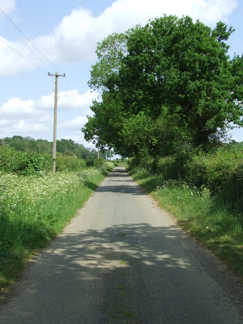
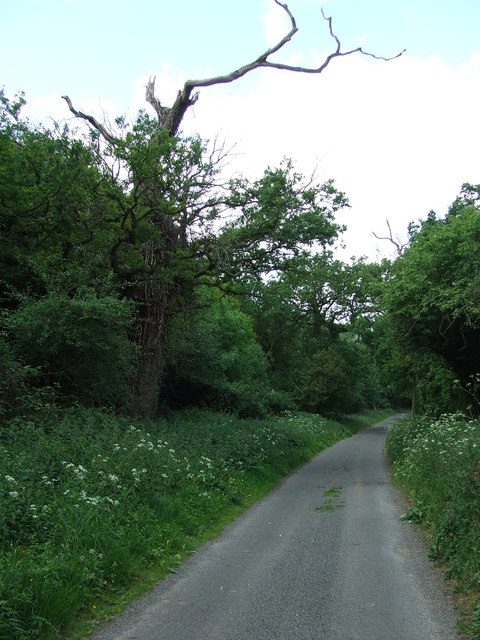
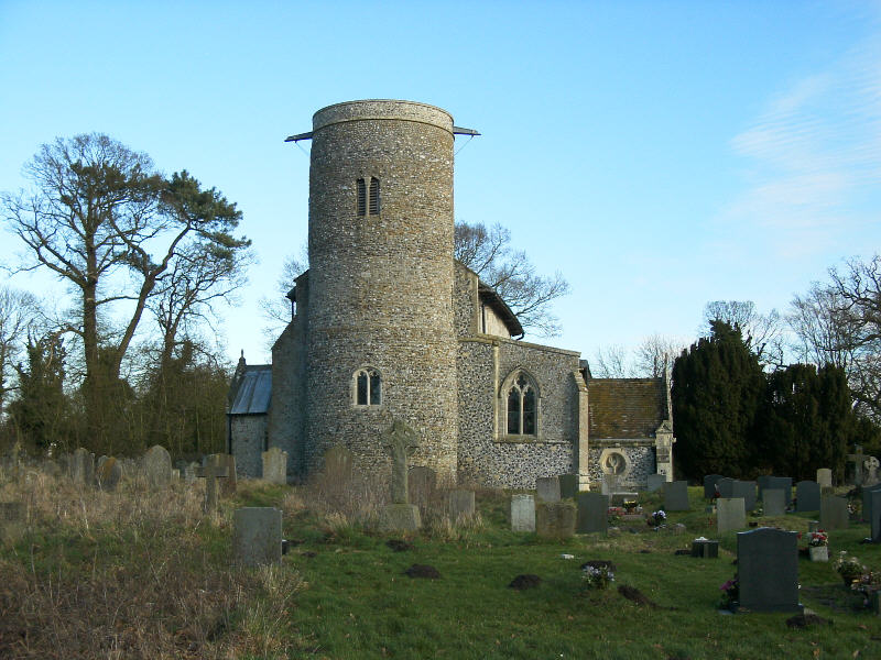
The village has a long history, dating back to the Domesday Book in 1086. It is known for its picturesque countryside, which includes rolling hills, open fields, and charming rural landscapes. The village itself is characterized by traditional English cottages and historic buildings, such as the St Peter's Church, which dates back to the 14th century.

Merton offers a range of amenities to its residents. The village has a primary school, Merton Church of England Primary School, providing education for children aged 4 to 11. There is also a village hall that serves as a community hub, hosting various events and activities throughout the year.

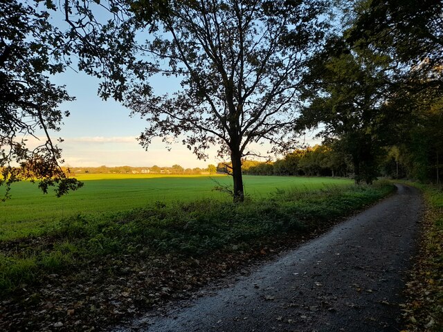
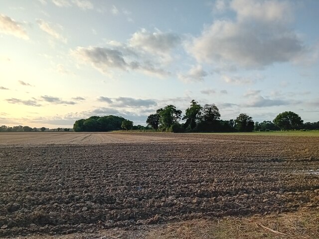
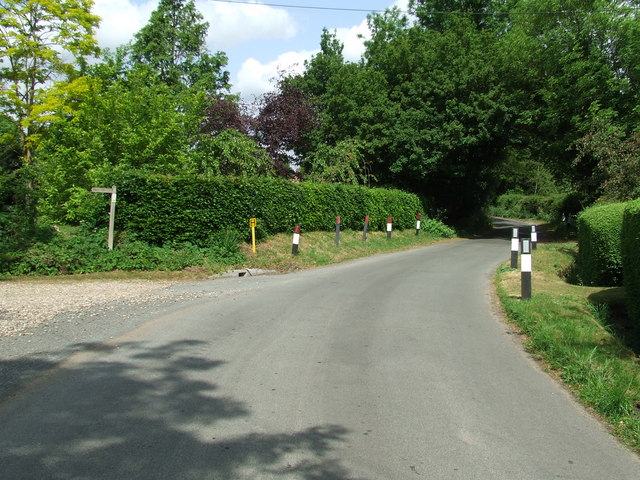
For those seeking outdoor activities, Merton is surrounded by beautiful countryside, offering opportunities for walking, cycling, and exploring nature. The village is also within close proximity to Thetford Forest Park, a popular destination for outdoor enthusiasts.

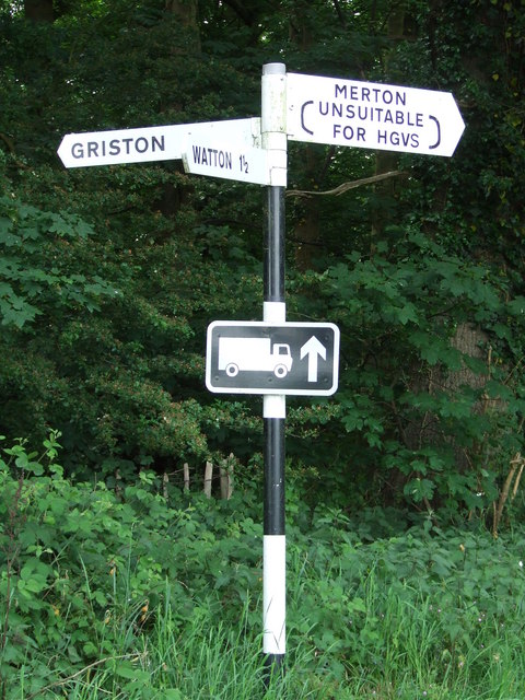
Transport links in Merton are relatively limited, with the nearest train station located in Attleborough, approximately 8 miles away. However, the village is well-connected by road, with the A11 running nearby, providing easy access to Norwich and other major cities in the region.

Overall, Merton is a peaceful and scenic village, ideal for those seeking a tranquil rural lifestyle within easy reach of urban amenities.

If you have any feedback on the listing, please let us know in the comments section below.

Merton Images

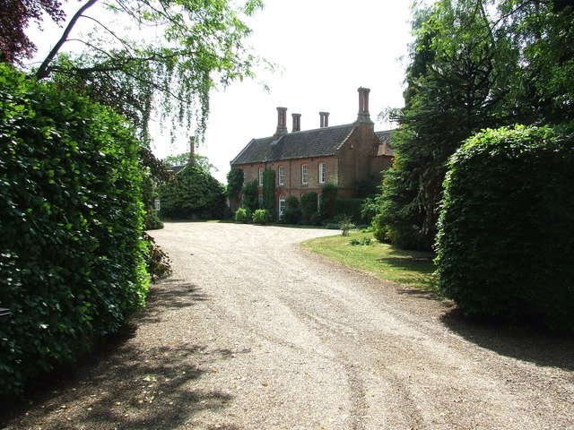
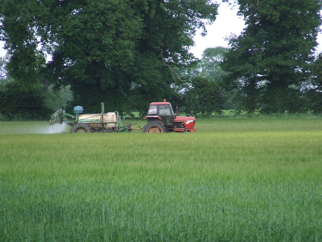
Images are sourced within 2km of 52.55432/0.81203497 or Grid Reference TL9098. Thanks to Geograph Open Source API. All images are credited.

Crow's Lane A charming narrow road with nice views of Norfolk countryside.
Crow's Lane
A charming narrow road with nice views of Norfolk countryside.
The Retreat Near Merton.
The Retreat
Near Merton.
Track Entrance Near Merton.
Track Entrance
Near Merton.
Farmland near Merton Taken in the late afternoon.
Farmland near Merton
Taken in the late afternoon.
Ploughed Field Taken from the road from Merton to Watton.
Ploughed Field
Taken from the road from Merton to Watton.
Former Brewery Building formerly Watton Brewery on the High Street Watton, Norfolk. Production ceased in about 1912 after it had been taken over by Morgans Brewery of Norwich.
Former Brewery
Building formerly Watton Brewery on the High Street Watton, Norfolk. Production ceased in about 1912 after it had been taken over by Morgans Brewery of Norwich.
Watton Brewery Sign Old name on former brewery building at Watton, Norfolk for view of the building see <a title="https://www.geograph.org.uk/photo/4308213" href="https://www.geograph.org.uk/photo/4308213">Link</a>
Watton Brewery Sign
Old name on former brewery building at Watton, Norfolk for view of the building see Link
Post Box, Watton, Norfolk IP25 3326. Royal Mail list this box as 'IP25 Harvey Street Watton Thetford'.
Post Box, Watton, Norfolk
IP25 3326. Royal Mail list this box as 'IP25 Harvey Street Watton Thetford'.
Postbox at Watton IP25 3344. Royal Mail list this box as 'IP25 West End'.
Postbox at Watton
IP25 3344. Royal Mail list this box as 'IP25 West End'.
Study of a Gasoline Station Esso, Watton.

 This photograph is part of a series taken in homage to the American artist Ed Ruscha's 1963 publication of 'Twentysix Gasoline Stations'.
 More properly known as filling stations in the UK, I am attempting to photograph as many as possible to mark the sixty year anniversary.
Study of a Gasoline Station
Esso, Watton. This photograph is part of a series taken in homage to the American artist Ed Ruscha's 1963 publication of 'Twentysix Gasoline Stations'. More properly known as filling stations in the UK, I am attempting to photograph as many as possible to mark the sixty year anniversary.
Study of a Gasoline Station Jet, Watton.

 This photograph is part of a series taken in homage to the American artist Ed Ruscha's 1963 publication of 'Twentysix Gasoline Stations'.
 More properly known as filling stations in the UK, I am attempting to photograph as many as possible to mark the sixty year anniversary.
Study of a Gasoline Station
Jet, Watton. This photograph is part of a series taken in homage to the American artist Ed Ruscha's 1963 publication of 'Twentysix Gasoline Stations'. More properly known as filling stations in the UK, I am attempting to photograph as many as possible to mark the sixty year anniversary.
Country Road Country road near to Thompson, Norfolk.
Country Road
Country road near to Thompson, Norfolk.
Silverdell Silverdell house near to Thompson, Norfolk.
Silverdell
Silverdell house near to Thompson, Norfolk.
Road Junction Road junction near to Thompson, Norfolk.
Road Junction
Road junction near to Thompson, Norfolk.
Country Lane Country lane near to Thompson, Norfolk.
Country Lane
Country lane near to Thompson, Norfolk.
Crop Spraying Crop spraying near to Thompson, Norfolk.
Crop Spraying
Crop spraying near to Thompson, Norfolk.
Finger Post Finger post road sign near to Thompson, Norfolk.
Finger Post
Finger post road sign near to Thompson, Norfolk.
Footpath And Road Footpath leading to Merton Church as seen leaving Crows Lane at Merton, Norfolk.
Footpath And Road
Footpath leading to Merton Church as seen leaving Crows Lane at Merton, Norfolk.
Show me another place!

Merton is located at Grid Ref: TL9098 (Lat: 52.55432, Lng: 0.81203497)

Administrative County: Norfolk

District: Breckland

Police Authority: Norfolk

What 3 Words

///udder.slightly.crucially. Near Watton, Norfolk

Related Wikis

Merton, Norfolk

Merton is a civil parish in the English county of Norfolk. It covers an area of 5.94 km2 (2.29 sq mi) and had a population of 113 in 50 households at the...

Merton Hall, Norfolk

Merton Hall is a 19th century country house in Merton, Norfolk, England. The extant north-west wing is a Grade II listed building. The 17th-century gatehouse...

Wayland Academy, Watton

Wayland Academy (formerly Wayland Community High School) is a small mixed secondary school located in Watton in the English county of Norfolk. It is part...

Wayland Wood

Wayland Wood is a 31.7-hectare (78-acre) biological Site of Special Scientific Interest near to Watton in Norfolk. It is a Nature Conservation Review...

Nearby Amenities

Located within 500m of 52.55432,0.81203497
Post Box
Collection Times: Mo-Fr 17:30; Sa 09:05
Operator: Royal Mail
Post Box Mounting: brick_pillar
Post Box Type: wall
Ref: IP25 3314
Royal Cypher: EIIR
Royal Cypher Wikidata: Q33102113
Lat/Long: 52.554048/0.811883
Merton
Place: village
Source: OS_OpenData_StreetView
Lat/Long: 52.5534262/0.8116361
Bus Stop
Lat/Long: 52.5537043/0.8118721
Merton
Man Made: village_sign
Material: metal
Lat/Long: 52.5540529/0.811848
Telephone
Booth: K6
Covered: booth
Listed Status: Grade II
Lat/Long: 52.5543403/0.8115498
Information: map
Tourism: information
Lat/Long: 52.5543877/0.811384
The data included in this document is from www.openstreetmap.org. The data is made available under ODbL.

Have you been to Merton?

Leave your review of Merton below (or comments, questions and feedback).