Dùn Bàn

Heritage Site in Inverness-shire

Scotland

Dùn Bàn

Ocean on the west side of the causeway to North Uist
Ocean on the west side of the causeway to North Uist Credit: Gordon Brown

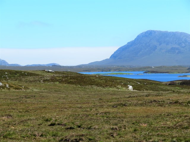
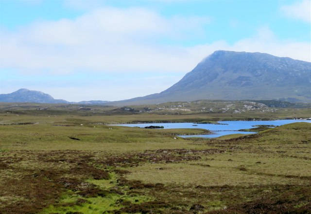
Dùn Bàn is a historic heritage site located in Inverness-shire, Scotland. Situated on a rocky promontory overlooking the Cromarty Firth, this ancient site holds significant archaeological and historical importance. The name "Dùn Bàn" translates to "white fort" in Gaelic, referring to the distinctive white sandstone that comprises the fort's remains.

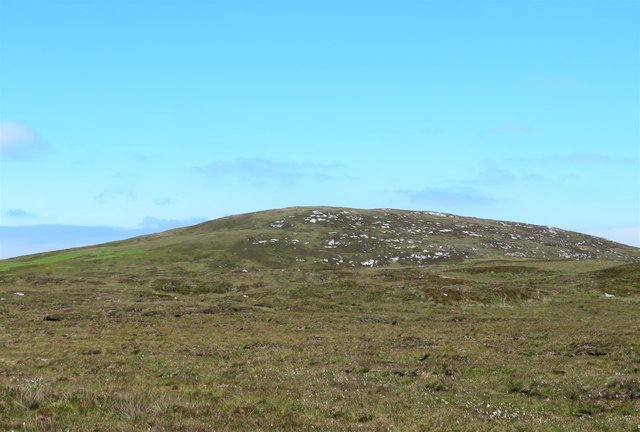
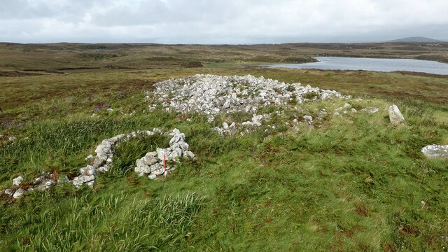
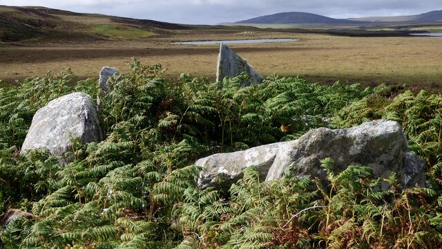
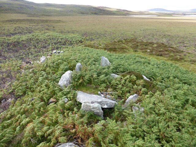
Believed to have been constructed during the Iron Age, Dùn Bàn is an example of a broch, a unique type of roundhouse found only in Scotland. The fort consists of a central tower surrounded by a double-walled enclosure, measuring approximately 20 meters in diameter. The walls, built with massive stone blocks, rise to an impressive height and provide a glimpse into the architectural prowess of the ancient inhabitants.

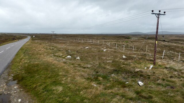
Exploring Dùn Bàn allows visitors to immerse themselves in the fascinating history of the region. The fort's strategic location offers breathtaking views of the surrounding landscape, including the Cromarty Firth and the Black Isle. It provides insights into the ancient inhabitants' way of life, their defensive strategies, and their social structure.

Archaeological excavations have revealed artifacts such as pottery, tools, and even human remains, shedding light on the daily lives and customs of the people who once inhabited Dùn Bàn. The site is managed by Historic Environment Scotland and features informative displays that educate visitors about its historical significance and ongoing research.

Dùn Bàn stands as a testament to Scotland's rich ancient heritage, captivating visitors with its mystical ambiance and archaeological wonders. Its picturesque setting, combined with the well-preserved remains, make it a must-visit destination for history enthusiasts and those seeking to connect with the past.

If you have any feedback on the listing, please let us know in the comments section below.
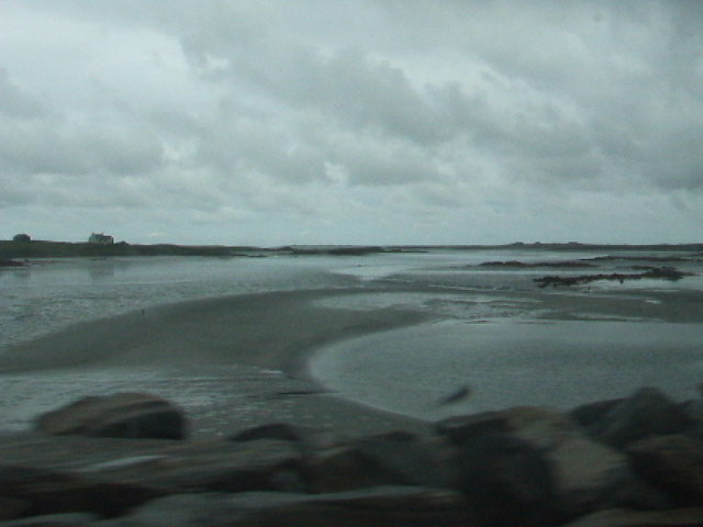
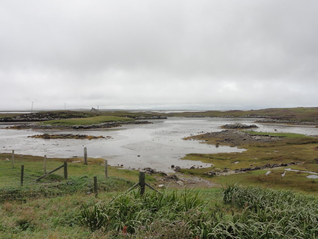
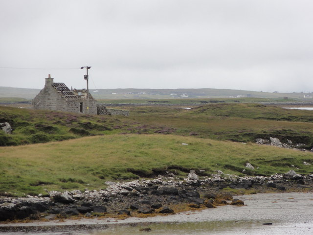
Dùn Bàn Images

Images are sourced within 2km of 57.525/-7.272 or Grid Reference NF8460. Thanks to Geograph Open Source API. All images are credited.

Ocean on the west side of the causeway to North Uist
Gairbh-eilean
Gairbh-eilean
Barp Hacklett Cairn One cannot be absolutely sure if this is the cairn as the OS map doesn't give a detailed site, but as it is the only pile of stones on a green protuberance on an otherwise rather squelchy moor, then one would suggest that this is it.
Barp Hacklett Cairn
One cannot be absolutely sure if this is the cairn as the OS map doesn't give a detailed site, but as it is the only pile of stones on a green protuberance on an otherwise rather squelchy moor, then one would suggest that this is it.
Moorcroft Campsite at low tide
A not very useful gate A rusty old metal gate at the point where a fence once crossed the track.
A not very useful gate
A rusty old metal gate at the point where a fence once crossed the track.
Track above Loch Creag nan Speireag This track, which is indistinct in places, forms part of the Hebridean Way, a relatively new walking route through the Western Isles.
Track above Loch Creag nan Speireag
This track, which is indistinct in places, forms part of the Hebridean Way, a relatively new walking route through the Western Isles.
Cotton grass, Creag nan Speireag Looking over cotton grass towards Loch nan Speireag and the houses at Gearraidh Cladach.
Cotton grass, Creag nan Speireag
Looking over cotton grass towards Loch nan Speireag and the houses at Gearraidh Cladach.
East from Creag nan Speireag Some 200m from the Hebridean Way path which probably cuts the corner of this square and provides some very 'soft' walking over damp moors. This diversion to a low rise gives a view eastwards towards the oddly shaped Loch Carabhat and distant Eabhal.
East from Creag nan Speireag
Some 200m from the Hebridean Way path which probably cuts the corner of this square and provides some very 'soft' walking over damp moors. This diversion to a low rise gives a view eastwards towards the oddly shaped Loch Carabhat and distant Eabhal.
View towards Beinn na Coille Although this view is across the tiny Loch na Meirle, it remains hidden from sight in a small fold of the moor. Further progress into this square was made difficult by soft ground through old peat workings.
View towards Beinn na Coille
Although this view is across the tiny Loch na Meirle, it remains hidden from sight in a small fold of the moor. Further progress into this square was made difficult by soft ground through old peat workings.
View towards Loch nan Garbh Chlachan Peat and heather moorland stretch away towards the shores of Loch nan Garbh Chlachan where a line of stepping stones are visible, beyond which in an adjoining square is Dun Ban on an islet. Magnifying the image brings up what looks like some remains of walls at the dun. In the distance is the familiar outline of Eabhal.
View towards Loch nan Garbh Chlachan
Peat and heather moorland stretch away towards the shores of Loch nan Garbh Chlachan where a line of stepping stones are visible, beyond which in an adjoining square is Dun Ban on an islet. Magnifying the image brings up what looks like some remains of walls at the dun. In the distance is the familiar outline of Eabhal.
Caravat Barp chambered cairn and shieling Large Neolithic long cairn and later historic shieling or shelter (Scale 1m). <span class="nowrap"><a title="https://canmore.org.uk/site/10254/north-uist-carinish-caravat-barp" rel="nofollow ugc noopener" href="https://canmore.org.uk/site/10254/north-uist-carinish-caravat-barp">Link</a><img style="margin-left:2px;" alt="External link" title="External link - shift click to open in new window" src="https://s1.geograph.org.uk/img/external.png" width="10" height="10"/></span>
Caravat Barp chambered cairn and shieling
Large Neolithic long cairn and later historic shieling or shelter (Scale 1m). LinkExternal link
Carinish stone circle Sadly the road cuts through this stone circle. <span class="nowrap"><a title="https://canmore.org.uk/site/10249/north-uist-carinish" rel="nofollow ugc noopener" href="https://canmore.org.uk/site/10249/north-uist-carinish">Link</a><img style="margin-left:2px;" alt="External link" title="External link - shift click to open in new window" src="https://s1.geograph.org.uk/img/external.png" width="10" height="10"/></span>
Carinish stone circle
Sadly the road cuts through this stone circle. LinkExternal link
Oban Nam Fiadh chambered cairn Large stones forming part of the chamber. <span class="nowrap"><a title="https://canmore.org.uk/site/10252/north-uist-oban-nam-fiadh" rel="nofollow ugc noopener" href="https://canmore.org.uk/site/10252/north-uist-oban-nam-fiadh">Link</a><img style="margin-left:2px;" alt="External link" title="External link - shift click to open in new window" src="https://s1.geograph.org.uk/img/external.png" width="10" height="10"/></span>
Oban Nam Fiadh chambered cairn
Large stones forming part of the chamber. LinkExternal link
Oban Nam Fiadh chambered cairn View from above showing the character of the chamber. <span class="nowrap"><a title="https://canmore.org.uk/site/10252/north-uist-oban-nam-fiadh" rel="nofollow ugc noopener" href="https://canmore.org.uk/site/10252/north-uist-oban-nam-fiadh">Link</a><img style="margin-left:2px;" alt="External link" title="External link - shift click to open in new window" src="https://s1.geograph.org.uk/img/external.png" width="10" height="10"/></span>
Oban Nam Fiadh chambered cairn
View from above showing the character of the chamber. LinkExternal link
Cladach Carinish: postbox № HS6 13 This small postbox is emptied at 2 o'clock on weekday afternoons and at half past nine on Saturday mornings.
Cladach Carinish: postbox № HS6 13
This small postbox is emptied at 2 o'clock on weekday afternoons and at half past nine on Saturday mornings.
Beach from the causeway between Garbh eilean and North Uist
Bay Craavat View from the caravan and camping site out towards the abandoned dwelling.
Bay Craavat
View from the caravan and camping site out towards the abandoned dwelling.
Abandoned dwelling Abandoned dwelling and power lines in Bay Craavat.
Abandoned dwelling
Abandoned dwelling and power lines in Bay Craavat.
Show me another place!

Dùn Bàn is located at Grid Ref: NF8460 (Lat: 57.525, Lng: -7.272)

Unitary Authority: Na h-Eileanan an Iar

Police Authority: Highlands and Islands

What 3 Words

///dugouts.somewhere.chambers. Near Balivanich, Na h-Eileanan Siar

Related Wikis

Carinish

Carinish (Scottish Gaelic: Càirinis), is a hamlet on North Uist, in the Outer Hebrides, Scotland. It is in the south of the island, about two miles (three...

Battle of Carinish

The Battle of Carinish was a Scottish clan battle fought in North Uist in 1601. It was part of a year of feuding between Clan MacLeod of Dunvegan and the...

Fraoch-Eilean

Fraoch-eilean is a small island with an uncertain population north of Benbecula in the Outer Hebrides of Scotland. It is about 55 hectares (140 acres...

Teampull na Trionaid

Teampull na Trionaid ("trinity church") is a ruined 13th-century Augustinian nunnery at Carinish, on North Uist, in the Outer Hebrides of Scotland. �...

Nearby Amenities

Located within 500m of 57.525,-7.272
The data included in this document is from www.openstreetmap.org. The data is made available under ODbL.

Have you been to Dùn Bàn?

Leave your review of Dùn Bàn below (or comments, questions and feedback).