Eilean Dubh

Island in Inverness-shire

Scotland

Eilean Dubh

Barp Hacklett Cairn One cannot be absolutely sure if this is the cairn as the OS map doesn't give a detailed site, but as it is the only pile of stones on a green protuberance on an otherwise rather squelchy moor, then one would suggest that this is it.
Barp Hacklett Cairn Credit: Gordon Hatton

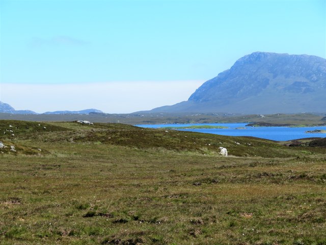
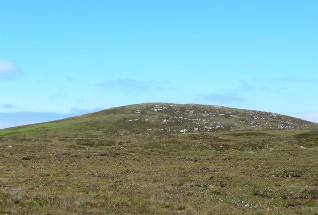
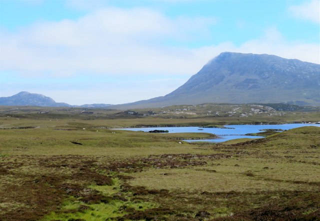
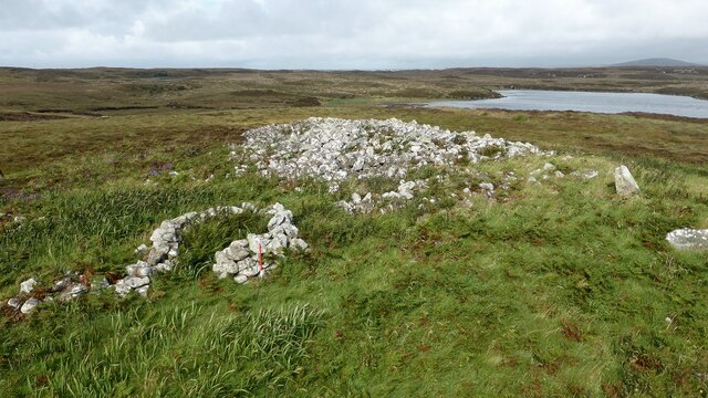
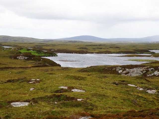
Eilean Dubh is a small island located in the Inverness-shire region of Scotland. It is situated in the middle of Loch Morar, which is the deepest freshwater loch in the British Isles. The island is approximately 250 meters long and 100 meters wide, with a rocky terrain and sparse vegetation.

Eilean Dubh is uninhabited and has no permanent structures on it. However, it is a popular destination for tourists and wildlife enthusiasts due to its scenic beauty and abundant wildlife. Visitors to the island can enjoy stunning views of the surrounding loch and mountains, as well as the opportunity to spot a variety of bird species, including eagles and ospreys.

Access to Eilean Dubh is typically by boat, with several tour companies offering trips to the island from nearby towns such as Mallaig and Fort William. Visitors can also explore the island on foot, taking in the rugged landscape and peaceful atmosphere.

Overall, Eilean Dubh is a picturesque and tranquil island that offers a unique opportunity to experience the natural beauty of the Scottish Highlands.

If you have any feedback on the listing, please let us know in the comments section below.
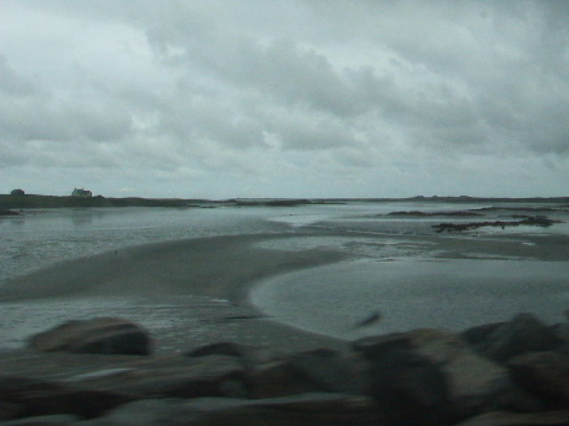
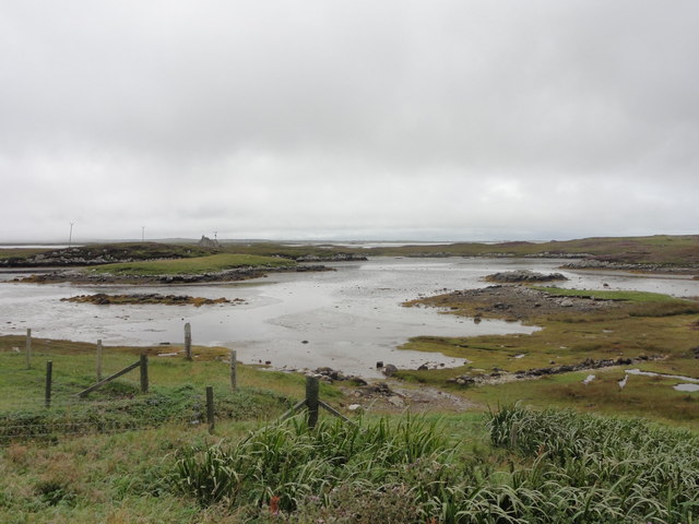
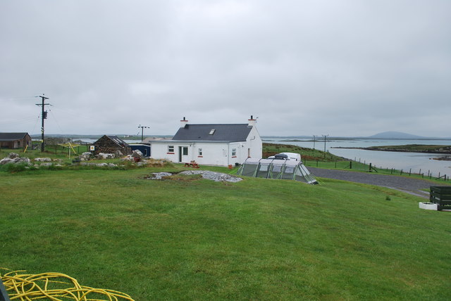
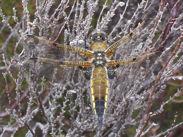
Eilean Dubh Images

Images are sourced within 2km of 57.527654/-7.2647099 or Grid Reference NF8460. Thanks to Geograph Open Source API. All images are credited.

Barp Hacklett Cairn One cannot be absolutely sure if this is the cairn as the OS map doesn't give a detailed site, but as it is the only pile of stones on a green protuberance on an otherwise rather squelchy moor, then one would suggest that this is it.
Barp Hacklett Cairn
One cannot be absolutely sure if this is the cairn as the OS map doesn't give a detailed site, but as it is the only pile of stones on a green protuberance on an otherwise rather squelchy moor, then one would suggest that this is it.
Moorcroft Campsite at low tide
East from Creag nan Speireag Some 200m from the Hebridean Way path which probably cuts the corner of this square and provides some very 'soft' walking over damp moors. This diversion to a low rise gives a view eastwards towards the oddly shaped Loch Carabhat and distant Eabhal.
East from Creag nan Speireag
Some 200m from the Hebridean Way path which probably cuts the corner of this square and provides some very 'soft' walking over damp moors. This diversion to a low rise gives a view eastwards towards the oddly shaped Loch Carabhat and distant Eabhal.
View towards Beinn na Coille Although this view is across the tiny Loch na Meirle, it remains hidden from sight in a small fold of the moor. Further progress into this square was made difficult by soft ground through old peat workings.
View towards Beinn na Coille
Although this view is across the tiny Loch na Meirle, it remains hidden from sight in a small fold of the moor. Further progress into this square was made difficult by soft ground through old peat workings.
View towards Loch nan Garbh Chlachan Peat and heather moorland stretch away towards the shores of Loch nan Garbh Chlachan where a line of stepping stones are visible, beyond which in an adjoining square is Dun Ban on an islet. Magnifying the image brings up what looks like some remains of walls at the dun. In the distance is the familiar outline of Eabhal.
View towards Loch nan Garbh Chlachan
Peat and heather moorland stretch away towards the shores of Loch nan Garbh Chlachan where a line of stepping stones are visible, beyond which in an adjoining square is Dun Ban on an islet. Magnifying the image brings up what looks like some remains of walls at the dun. In the distance is the familiar outline of Eabhal.
Caravat Barp chambered cairn and shieling Large Neolithic long cairn and later historic shieling or shelter (Scale 1m). <span class="nowrap"><a title="https://canmore.org.uk/site/10254/north-uist-carinish-caravat-barp" rel="nofollow ugc noopener" href="https://canmore.org.uk/site/10254/north-uist-carinish-caravat-barp">Link</a><img style="margin-left:2px;" alt="External link" title="External link - shift click to open in new window" src="https://s1.geograph.org.uk/img/external.png" width="10" height="10"/></span>
Caravat Barp chambered cairn and shieling
Large Neolithic long cairn and later historic shieling or shelter (Scale 1m). LinkExternal link
Carinish stone circle Sadly the road cuts through this stone circle. <span class="nowrap"><a title="https://canmore.org.uk/site/10249/north-uist-carinish" rel="nofollow ugc noopener" href="https://canmore.org.uk/site/10249/north-uist-carinish">Link</a><img style="margin-left:2px;" alt="External link" title="External link - shift click to open in new window" src="https://s1.geograph.org.uk/img/external.png" width="10" height="10"/></span>
Carinish stone circle
Sadly the road cuts through this stone circle. LinkExternal link
Oban Nam Fiadh chambered cairn Large stones forming part of the chamber. <span class="nowrap"><a title="https://canmore.org.uk/site/10252/north-uist-oban-nam-fiadh" rel="nofollow ugc noopener" href="https://canmore.org.uk/site/10252/north-uist-oban-nam-fiadh">Link</a><img style="margin-left:2px;" alt="External link" title="External link - shift click to open in new window" src="https://s1.geograph.org.uk/img/external.png" width="10" height="10"/></span>
Oban Nam Fiadh chambered cairn
Large stones forming part of the chamber. LinkExternal link
Oban Nam Fiadh chambered cairn View from above showing the character of the chamber. <span class="nowrap"><a title="https://canmore.org.uk/site/10252/north-uist-oban-nam-fiadh" rel="nofollow ugc noopener" href="https://canmore.org.uk/site/10252/north-uist-oban-nam-fiadh">Link</a><img style="margin-left:2px;" alt="External link" title="External link - shift click to open in new window" src="https://s1.geograph.org.uk/img/external.png" width="10" height="10"/></span>
Oban Nam Fiadh chambered cairn
View from above showing the character of the chamber. LinkExternal link
Cladach Carinish: postbox № HS6 13 This small postbox is emptied at 2 o'clock on weekday afternoons and at half past nine on Saturday mornings.
Cladach Carinish: postbox № HS6 13
This small postbox is emptied at 2 o'clock on weekday afternoons and at half past nine on Saturday mornings.
Beach from the causeway between Garbh eilean and North Uist
Bay Craavat View from the caravan and camping site out towards the abandoned dwelling.
Bay Craavat
View from the caravan and camping site out towards the abandoned dwelling.
Moorcroft Holidays Campsite The white house is the hostel, the old blackhouse to the left is the camperskitchen.
Moorcroft Holidays Campsite
The white house is the hostel, the old blackhouse to the left is the camperskitchen.
Loch Carabhat - Dragonfly Four-spotted Chaser resting on the heather near Loch Carabhat
Loch Carabhat - Dragonfly
Four-spotted Chaser resting on the heather near Loch Carabhat
Dun Ban Loch Carabhat A Pictish Dun situated just off the South shore of Loch Carabhat in North Uist, some of the original vitrified wall structure can still be seen from the middle to left hand side of the Dun.
Dun Ban Loch Carabhat
A Pictish Dun situated just off the South shore of Loch Carabhat in North Uist, some of the original vitrified wall structure can still be seen from the middle to left hand side of the Dun.
Loch Carabhat shoreline The shoreline of Carabhat looking east from the area near Dun Ban, with the hill of Eabhal in the distance with its wedge shaped southwest flank.
Loch Carabhat shoreline
The shoreline of Carabhat looking east from the area near Dun Ban, with the hill of Eabhal in the distance with its wedge shaped southwest flank.
Loch Fada Looking west over Loch Fada
Loch Fada
Looking west over Loch Fada
Barpa Charavat This heap of stones not far from the road near Cairinis is the remains of a chambered cairn. Unusually, the cairn was about twice as long as it was wide, 50 metres long by 20 to 25 metres wide.
Barpa Charavat
This heap of stones not far from the road near Cairinis is the remains of a chambered cairn. Unusually, the cairn was about twice as long as it was wide, 50 metres long by 20 to 25 metres wide.
Show me another place!

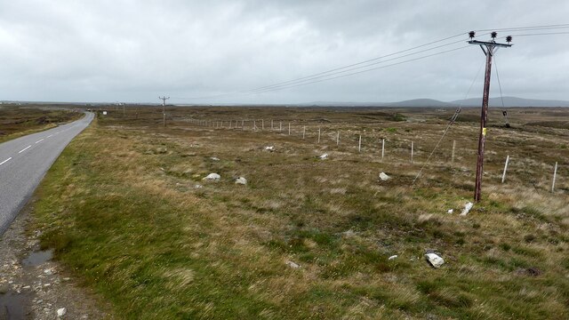
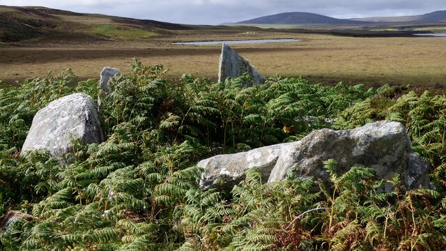
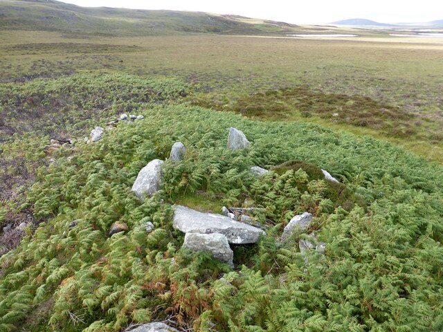
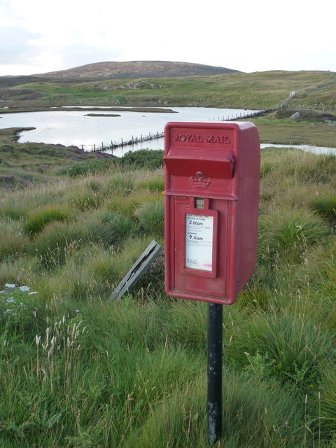
Eilean Dubh is located at Grid Ref: NF8460 (Lat: 57.527654, Lng: -7.2647099)

Unitary Authority: Na h-Eileanan an Iar

Police Authority: Highlands and Islands

What 3 Words

///commuting.blunt.searched. Near Balivanich, Na h-Eileanan Siar

Related Wikis

Fraoch-Eilean

Fraoch-eilean is a small island with an uncertain population north of Benbecula in the Outer Hebrides of Scotland. It is about 55 hectares (140 acres...

Carinish

Carinish (Scottish Gaelic: Càirinis), is a hamlet on North Uist, in the Outer Hebrides, Scotland. It is in the south of the island, about two miles (three...

Battle of Carinish

The Battle of Carinish was a Scottish clan battle fought in North Uist in 1601. It was part of a year of feuding between Clan MacLeod of Dunvegan and the...

Baile Glas

Baile Glas or Ballaglasa (Scottish Gaelic: Am Baile Glas) is a settlement on Grimsay in the Outer Hebrides, Scotland. Ballaglasa is within the parish of...

Have you been to Eilean Dubh?

Leave your review of Eilean Dubh below (or comments, questions and feedback).