Dorchester-On-Thames

Heritage Site in Oxfordshire South Oxfordshire

England

Dorchester-On-Thames

Dorchester Abbey: the south porch At the western end of the south aisle.
Dorchester Abbey: the south porch Credit: Stefan Czapski

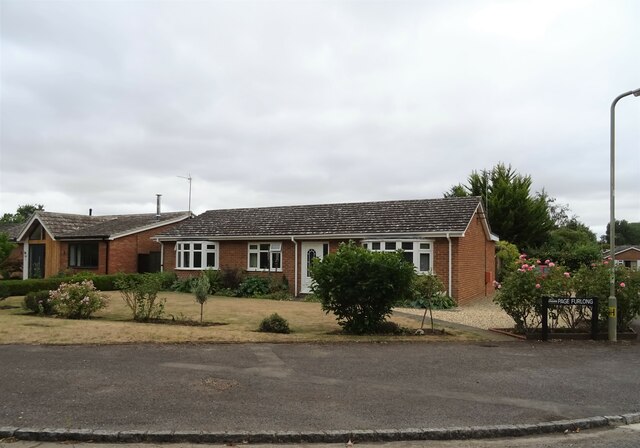
Dorchester-on-Thames is a picturesque village located in the county of Oxfordshire, England. Situated on the banks of the River Thame, it is renowned for its rich heritage and historical significance. The village is home to a number of well-preserved medieval buildings, making it a designated conservation area and a popular destination for history enthusiasts.

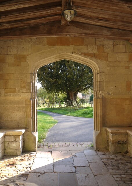
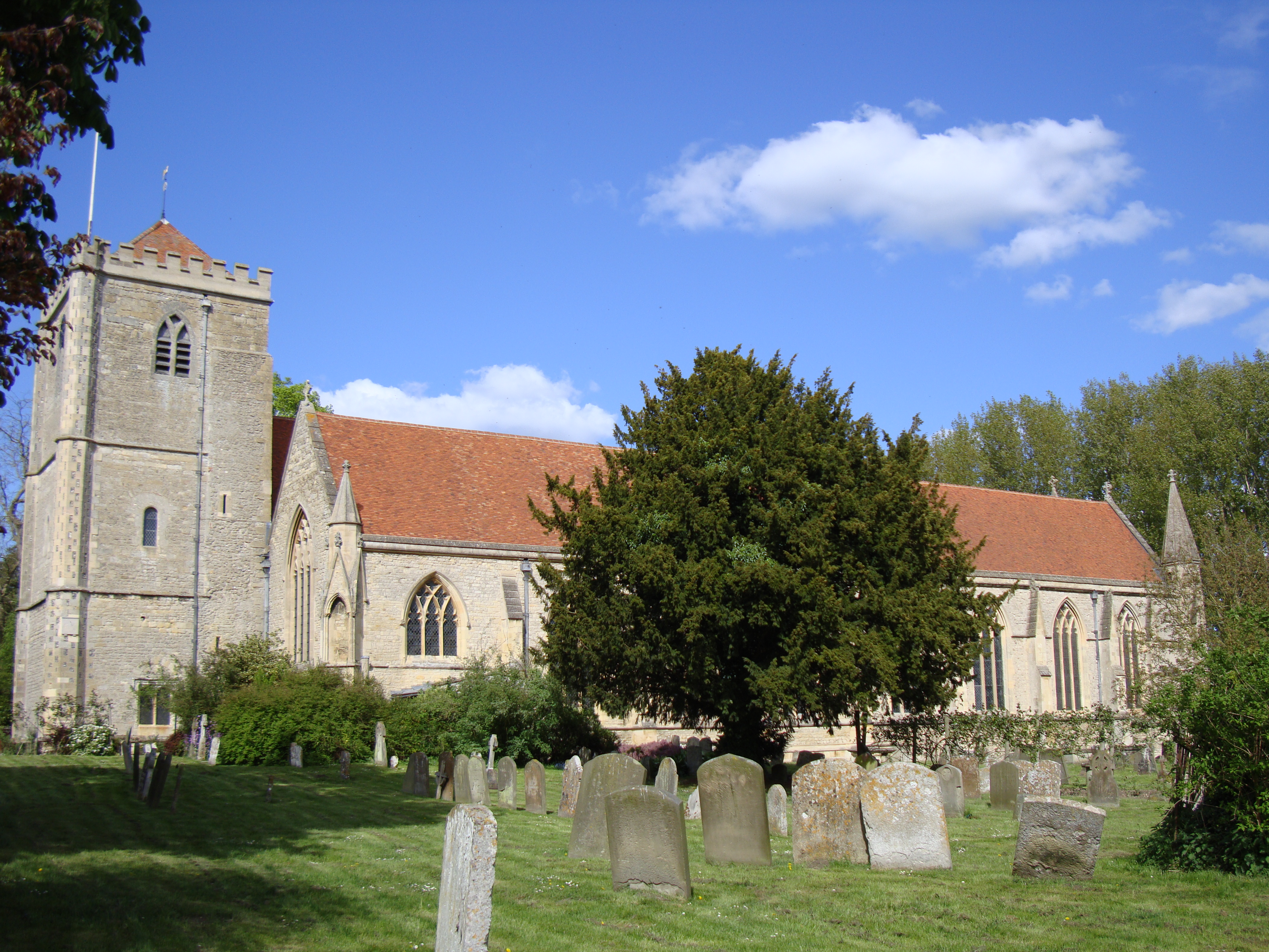
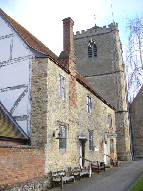
At the heart of Dorchester-on-Thames lies the magnificent Dorchester Abbey, a prime example of Norman architecture. Originally founded as a Saxon cathedral in the 7th century, it was later converted into an abbey by the Normans in the 12th century. The abbey boasts stunning stained glass windows, ornate stone carvings, and a serene cloister garden. It continues to serve as an active place of worship and hosts various cultural events throughout the year.

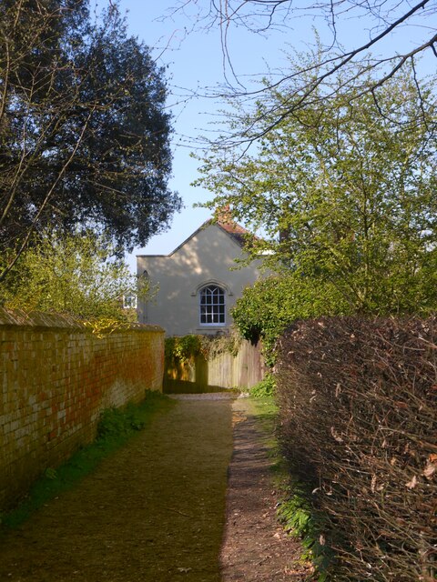
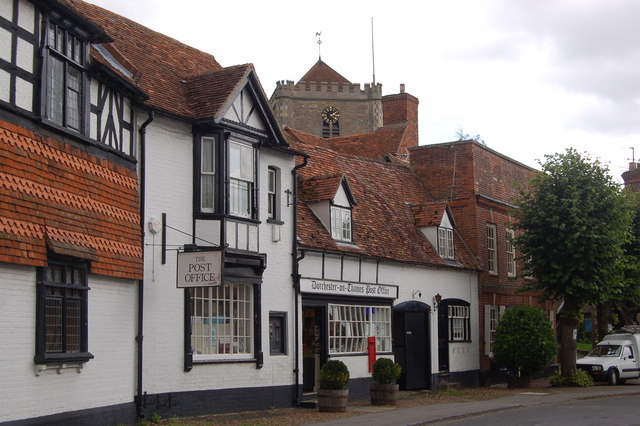
Adjacent to the abbey is the Dorchester Museum, which offers visitors a glimpse into the village's past. The museum exhibits archaeological finds from the Roman and Saxon periods, showcasing the village's early history. Additionally, Dorchester-on-Thames is home to a number of charming thatched-roof cottages, some dating back to the 14th century, further adding to its old-world charm.

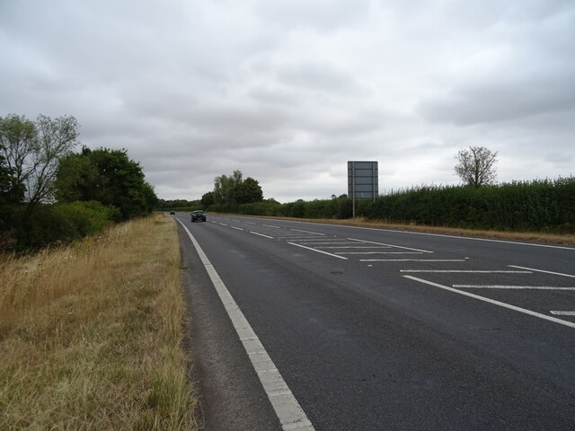
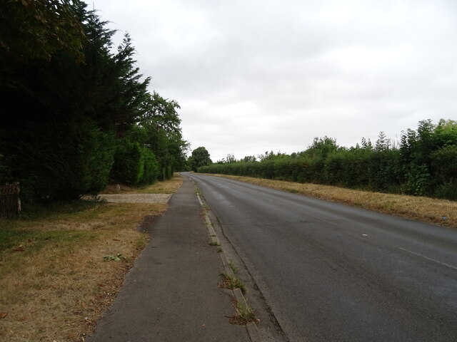
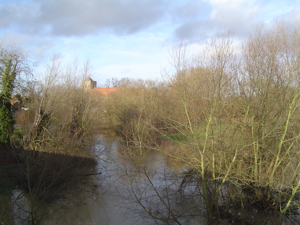
The village is also known for its idyllic countryside setting, with the Thames Path running through it. The path provides walkers and cyclists with the opportunity to explore the scenic riverbank, passing by meadows and charming pubs along the way.

Overall, Dorchester-on-Thames is a captivating heritage site that combines historical significance with natural beauty, offering visitors a unique and immersive experience in the heart of Oxfordshire.

If you have any feedback on the listing, please let us know in the comments section below.

Dorchester-On-Thames Images

Images are sourced within 2km of 51.645/-1.165 or Grid Reference SU5794. Thanks to Geograph Open Source API. All images are credited.

Dorchester Abbey: the south porch At the western end of the south aisle.
Dorchester Abbey: the south porch
At the western end of the south aisle.
Passageway north of Dorchester Abbey Close to the north side of the churchyard, though the location may not be exactly right.  The view must be (roughly) west, with a north-facing wall casting a dense shadow in the early April light.
Passageway north of Dorchester Abbey
Close to the north side of the churchyard, though the location may not be exactly right. The view must be (roughly) west, with a north-facing wall casting a dense shadow in the early April light.
Stubble field near Shillingford  Off the A4074.
Stubble field near Shillingford
Off the A4074.
Henley Road (A4074) Towards Oxford.
Henley Road (A4074)
Towards Oxford.
Crop field near Dorchester Off the A4074.
Crop field near Dorchester
Off the A4074.
Milepost beside Henley Road (A4074) Inscription reads:-OXFORD 10 / ABINGDON 8 
LONDON 48 
HENLEY 13 / WALLING FORD 2 
SHILLINGFORD 
Maker:- T & J PERRY / READING 

Milestone Society National ID: OX_LG48.

See <a href="https://www.geograph.org.uk/photo/7247314">SU5893 : A4074 towards Oxford</a> for context.
Milepost beside Henley Road (A4074)
Inscription reads:-OXFORD 10 / ABINGDON 8 LONDON 48 HENLEY 13 / WALLING FORD 2 SHILLINGFORD Maker:- T & J PERRY / READING Milestone Society National ID: OX_LG48. See SU5893 : A4074 towards Oxford for context.
A4074 towards Oxford At the junction for Dorchester.
Showing position off <a href="https://www.geograph.org.uk/photo/7247312">SU5893 : Milepost beside Henley Road (A4074)</a>
A4074 towards Oxford
At the junction for Dorchester. Showing position off SU5893 : Milepost beside Henley Road (A4074)
Dual use path towards Henley Road
A4074 towards Oxford
River Thame, Dorchester From Abbey Bridge on the A4074.
River Thame, Dorchester
From Abbey Bridge on the A4074.
A4074, Dorchester Towards Oxford.
A4074, Dorchester
Towards Oxford.
Queenford Bridge Over the A4074, Dorchester.
Queenford Bridge
Over the A4074, Dorchester.
Bungalow on Drayton Road, Dorchester
Drayton Road, Dorchester
Former Plough Inn, Dorchester On Abingdon Road - now a private residence.
Former Plough Inn, Dorchester
On Abingdon Road - now a private residence.
Field entrance off Abingdon Road, Dorchester
Abingdon Road, Dorchester Towards Burcot.
Abingdon Road, Dorchester
Towards Burcot.
Parched grazing land near the River Thames Off Abingdon Road.
Parched grazing land near the River Thames
Off Abingdon Road.
Show me another place!

Dorchester-On-Thames is located at Grid Ref: SU5794 (Lat: 51.645, Lng: -1.165)

Administrative County: Oxfordshire

District: South Oxfordshire

Police Authority: Thames Valley

What 3 Words

///digitally.stadium.podcast. Near Benson, Oxfordshire

Related Wikis

Dorchester on Thames

Dorchester on Thames (or Dorchester-on-Thames) is a village and civil parish in Oxfordshire, about 3 miles (5 km) northwest of Wallingford and 8 miles...

Dorchester Abbey

The Abbey Church of St Peter and St Paul, more usually called Dorchester Abbey, is a Church of England parish church in Dorchester on Thames, Oxfordshire...

Dorchester Abbey Museum

Dorchester Abbey Museum is a local museum in the town of Dorchester, Oxfordshire, England. It is attached to Dorchester Abbey. The museum occupies two...

Day's Lock

Day's Lock is a lock on the River Thames near Dorchester-on-Thames, Oxfordshire, England on the Dorchester side of the river. The pound lock was built...

Little Wittenham Bridge

Little Wittenham Bridge is a footbridge across the River Thames in England near Dorchester-on-Thames, Oxfordshire. It is just downstream of Day's Lock...

River Thame

The River Thame is a river in Southern England. A tributary of the River Thames, the river runs generally south-westward for about 40 mi (64 km) from...

Little Wittenham SSSI

Little Wittenham SSSI is a 68.9-hectare (170-acre) biological Site of Special Scientific Interest north-east of Didcot in Oxfordshire. It is also a Special...

Little Wittenham

Little Wittenham is a village and civil parish on the south bank of the River Thames, northeast of Didcot in South Oxfordshire. In 1974 it was transferred...

Nearby Amenities

Located within 500m of 51.645,-1.165
Toilets
Lat/Long: 51.641876/-1.1647351
Post Box
Brand: Royal Mail
Brand Wikidata: Q638098
Collection Times: Mo-Fr 09:00; Sa 07:00
Operator: Royal Mail
Operator Wikidata: Q638098
Post Box Type: lamp
Ref: OX10 657
Royal Cypher: EIIR
Royal Cypher Wikidata: Q33102113
Lat/Long: 51.6408939/-1.1651939
Defibrillator
Booth: K6
Covered: booth
Defibrillator Location: inside old red phone box, Dorchester
Disused Amenity: telephone
Emergency: defibrillator
Listed Status: Grade II
Man Made: telephone_box
Old Phone: +44 1865 340006
Lat/Long: 51.6424502/-1.164783
Parking
The George Hotel
Access: customers
Parking: surface
Lat/Long: 51.6439457/-1.1662692
Dorchester Abbey Museum and Gift Shop
Opening Hours: Open 14:00-17:00 every day from Easter Saturday to 30 Sep
Tourism: museum
Wikidata: Q5297592
Wikipedia: en:Dorchester Abbey Museum
Lat/Long: 51.6437925/-1.1649318
Historic: memorial
Memorial: war_memorial
Lat/Long: 51.6458802/-1.1672008
Bus Stop
Memorial
Bus: yes
Naptan AtcoCode: 340000262WMN
Naptan Bearing: N
Naptan CommonName: Memorial
Naptan Indicator: Opposite
Naptan Landmark: Opp Bus Shelter
Naptan NaptanCode: oxfajpda
Naptan Street: High Street
Naptan Verified: no
Public Transport: platform
Shelter: no
Source: naptan_import
Lat/Long: 51.6460643/-1.16719
Bus Stop
Memorial
Bus: yes
Naptan AtcoCode: 340000262WMS
Naptan Bearing: S
Naptan CommonName: Memorial
Naptan Indicator: Outside
Naptan Landmark: Bus Shelter
Naptan NaptanCode: oxfajpaw
Naptan Street: High Street
Naptan Verified: no
Public Transport: platform
Shelter: yes
Source: naptan_import
Lat/Long: 51.6464222/-1.1671158
Bus Stop
Malthouse Lane
Bus: yes
Naptan AtcoCode: 340000262WN
Naptan Bearing: N
Naptan CommonName: Malthouse Lane
Naptan Indicator: Corner
Naptan Landmark: The White Hart PH
Naptan NaptanCode: oxfajpat
Naptan Notes: Case Only
Naptan Street: High Street
Naptan Verified: no
Public Transport: platform
Shelter: no
Source: naptan_import
Lat/Long: 51.6447387/-1.1665199
Malthouse Lane
Naptan AtcoCode: 340000262WS
Naptan Bearing: S
Naptan BusStopType: CUS
Naptan CommonName: Malthouse Lane
Naptan Indicator: Opposite
Naptan Landmark: The White Hart PH
Naptan NaptanCode: oxfajpap
Naptan Street: High Street
Naptan Verified: no
Source: naptan_import
Lat/Long: 51.6447311/-1.1663654
Bus Stop
Dorchester Abbey
Bus: yes
Naptan AtcoCode: 340000941ABB
Naptan Bearing: NW
Naptan CommonName: Dorchester Abbey
Naptan Indicator: Rotten Row Corner
Naptan Landmark: Dorchester Abbey
Naptan NaptanCode: oxfadwaw
Naptan Notes: Case and Markings Only
Naptan Street: Henley Road
Naptan Verified: no
Public Transport: platform
Shelter: no
Source: naptan_import
Lat/Long: 51.6431792/-1.1653455
Bus Stop
Dorchester Abbey
Bus: yes
Naptan AtcoCode: 340000941ATQ
Naptan Bearing: SE
Naptan CommonName: Dorchester Abbey
Naptan Indicator: Opposite Rotten Row
Naptan Landmark: Dorchester Abbey
Naptan NaptanCode: oxfadtpt
Naptan Street: Henley Road
Naptan Verified: no
Public Transport: platform
Source: naptan_import
Lat/Long: 51.642849/-1.1647091
Turning Circle
Turning Circle: knuckle
Lat/Long: 51.6463145/-1.1660079
Turning Circle
Turning Circle: hammer
Lat/Long: 51.6457497/-1.164138
Townhall
Lat/Long: 51.6448494/-1.1656533
Bicycle Parking
Capacity: 12
Lat/Long: 51.6425246/-1.1648227
Bicycle Parking
Capacity: 4
Lat/Long: 51.6486461/-1.1621193
Information: board
Tourism: information
Lat/Long: 51.6424993/-1.1647897
Bench
Lat/Long: 51.6431417/-1.1650901
Addr Housenumber: 62
Addr Street: High Street
Lat/Long: 51.6459381/-1.1668906
Bench
Backrest: yes
Lat/Long: 51.6465168/-1.1671324
Addr Housenumber: 5, 5A, 5B
Addr Street: Queen Street
Lat/Long: 51.6445468/-1.1656183
Pub
The George Hotel
Real Ale: yes
Lat/Long: 51.6438588/-1.165627
Bench
Backrest: yes
Lat/Long: 51.6445569/-1.1664286
Barrier: bollard
Foot: yes
Lat/Long: 51.6449597/-1.1655148
Cafe
Dorchester Abbey Tea Room
Opening Hours: Open Weds 15:00-17:00, and Thu, Sat, Sun and Bank Holiday Mondays 14:30-17:00 until the end of September (notice doesn't specify month when it first opens)
Lat/Long: 51.6437662/-1.1648114
Entrance: main
Lat/Long: 51.6435457/-1.1645924
Bench
Backrest: yes
Material: wood
Lat/Long: 51.6437198/-1.1648215
Bench
Backrest: yes
Material: wood
Lat/Long: 51.6437293/-1.1648575
Clock
Display: analog
Support: wall_mounted
Lat/Long: 51.6437379/-1.1646982
Bench
Backrest: yes
Material: wood
Lat/Long: 51.6437398/-1.164911
Bench
Backrest: yes
Material: wood
Lat/Long: 51.6437594/-1.1649907
Post Box
Brand: Royal Mail
Brand Wikidata: Q638098
Operator: Royal Mail
Operator Wikidata: Q638098
Post Box Type: wall
Lat/Long: 51.6439992/-1.1654519
Power: pole
Source: Bing
Lat/Long: 51.6472712/-1.1610452
Power: pole
Source: Bing
Lat/Long: 51.6469916/-1.1596397
Power: pole
Source: Bing
Lat/Long: 51.646757/-1.1583764
Power: pole
Source: Bing
Lat/Long: 51.6475874/-1.1625606
Barrier: stile
Lat/Long: 51.6468232/-1.170181
Direction: 170
Generator Method: photovoltaic
Generator Output Electricity: yes
Generator Solar Modules: 8
Generator Source: solar
Generator Type: solar_photovoltaic_panel
Location: roof
Power: generator
Lat/Long: 51.6482571/-1.1634258
Direction: 170
Fixme: survey for panel count
Generator Method: photovoltaic
Generator Output Electricity: yes
Generator Solar Modules: 16
Generator Source: solar
Generator Type: solar_photovoltaic_panel
Location: roof
Power: generator
Lat/Long: 51.6482588/-1.1631602
Direction: 170
Fixme: survey for panel count
Generator Method: photovoltaic
Generator Output Electricity: yes
Generator Solar Modules: 16
Generator Source: solar
Generator Type: solar_photovoltaic_panel
Location: roof
Power: generator
Lat/Long: 51.6483537/-1.1626587
Turning Circle
Turning Circle: knuckle
Lat/Long: 51.6458803/-1.1659617
Direction: 215
Fixme: survey for panel count
Generator Method: photovoltaic
Generator Output Electricity: yes
Generator Solar Modules: 20
Generator Source: solar
Generator Type: solar_photovoltaic_panel
Location: roof
Power: generator
Lat/Long: 51.6444414/-1.1631909
Direction: 180
Generator Method: photovoltaic
Generator Output Electricity: yes
Generator Solar Modules: 12
Generator Source: solar
Generator Type: solar_photovoltaic_panel
Location: roof
Power: generator
Lat/Long: 51.6475502/-1.1670511
Direction: 185
Generator Method: photovoltaic
Generator Output Electricity: yes
Generator Solar Modules: 16
Generator Source: solar
Generator Type: solar_photovoltaic_panel
Location: roof
Power: generator
Lat/Long: 51.6481523/-1.1662621
Direction: 195
Generator Method: photovoltaic
Generator Output Electricity: yes
Generator Solar Modules: 16
Generator Source: solar
Generator Type: solar_photovoltaic_panel
Location: roof
Power: generator
Lat/Long: 51.6476383/-1.163847
Post Office
Dorchester on Thames Mobile Service Post Office
Addr City: Dorchester On Thames
Addr Housename: Layby outside
Addr Housenumber: 43
Addr Postcode: OX10 7HN
Addr Street: High Street
Brand: Post Office
Brand Wikidata: Q1783168
Opening Hours: We 14:15-15:15
Ref Pol Id: 145949
Website: https://www.postoffice.co.uk/branch-finder/762137x/dorchester-on-thames-mobile-service
Lat/Long: 51.6444233/-1.166273
The data included in this document is from www.openstreetmap.org. The data is made available under ODbL.

Have you been to Dorchester-On-Thames?

Leave your review of Dorchester-On-Thames below (or comments, questions and feedback).