Cross Dyke

Heritage Site in Shropshire

England

Cross Dyke

Path to Ashes Hollow. Long Mynd This path runs down hill all the way to Little Stretton.
Path to Ashes Hollow. Long Mynd Credit: Dave Croker

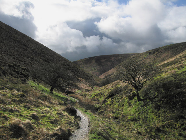
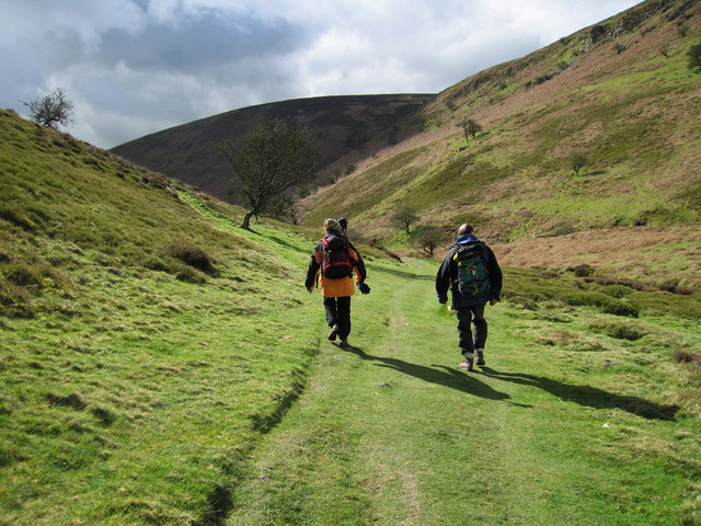
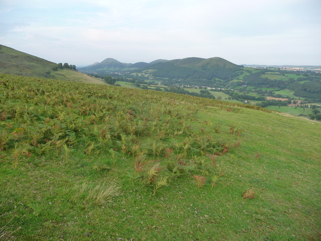
Cross Dyke is an ancient earthwork located in Shropshire, England, and is recognized as a significant heritage site. This historical monument is a linear bank and ditch structure that stretches across the landscape for approximately 900 meters. It is believed to date back to the Iron Age, making it over 2,000 years old.

The earthwork runs in a northwest-southeast direction, following the natural contours of the land. It consists of a prominent bank, which reaches a height of around 2 meters, accompanied by a deep ditch on one side. The earthwork was strategically built to provide a defensive boundary, possibly to protect settlements or control access to important areas.

Cross Dyke is considered an impressive example of Iron Age engineering and is a testament to the skill and labor of the people who constructed it. The monument is of archaeological significance, providing valuable insights into the social, economic, and defensive practices of the Iron Age society in the region.

Today, Cross Dyke is a popular destination for history enthusiasts, hikers, and nature lovers. Its location offers stunning views of the surrounding countryside, allowing visitors to appreciate the strategic placement of the earthwork. The site is easily accessible, with nearby parking and footpaths leading to the monument.

Cross Dyke stands as a tangible reminder of the region's ancient past, serving as a link between the present and the Iron Age civilization that once thrived in Shropshire. Its historical and cultural importance continues to be recognized, ensuring its preservation and enjoyment for future generations.

If you have any feedback on the listing, please let us know in the comments section below.

Cross Dyke Images

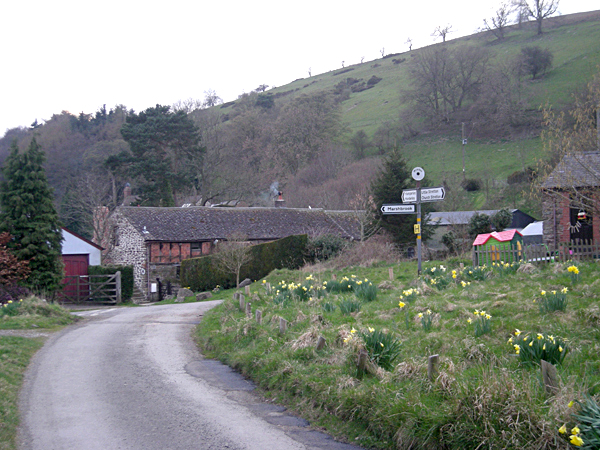
Images are sourced within 2km of 52.527/-2.847 or Grid Reference SO4292. Thanks to Geograph Open Source API. All images are credited.

Path to Ashes Hollow. Long Mynd This path runs down hill all the way to Little Stretton.
Path to Ashes Hollow. Long Mynd
This path runs down hill all the way to Little Stretton.
Walking to Ashes Hollow, Long Mynd
The Portway across The Mynd Part of the (now paved) Portway route, an ancient right of way, that runs the full length of The Mynd. This part of it wasn't surfaced until the early 1970s. There are still a number of tracks, and bridleways, that remain unsealed all across the hill.
The Portway across The Mynd
Part of the (now paved) Portway route, an ancient right of way, that runs the full length of The Mynd. This part of it wasn't surfaced until the early 1970s. There are still a number of tracks, and bridleways, that remain unsealed all across the hill.
Start of the Minton Hill descent Not as well known amongst mountain bikers as Minton Batch, the track via Packetstone Hillis still goo fun on a bike.
Start of the Minton Hill descent
Not as well known amongst mountain bikers as Minton Batch, the track via Packetstone Hillis still goo fun on a bike.
Lane across the top of the Long Mynd The lane cuts right across the high ground to a dramatic descent down the western slope.
Lane across the top of the Long Mynd
The lane cuts right across the high ground to a dramatic descent down the western slope.
Long Mynd Wild Camp Wild camp on the eastern side of Long Synalds on a rare flattish pitch
Long Mynd Wild Camp
Wild camp on the eastern side of Long Synalds on a rare flattish pitch
The Ragleth Inn, Little Stretton The inn dates back to 1663, a typical English Country Inn.
The Ragleth Inn, Little Stretton
The inn dates back to 1663, a typical English Country Inn.
All Saints Church, Little Stretton The attractive black and white church at Little Stretton, with its thatched roof, first opened its doors in 1903
All Saints Church, Little Stretton
The attractive black and white church at Little Stretton, with its thatched roof, first opened its doors in 1903
The Ancient House, Little Stretton A late 16th/early 17th century house, formerly a posting house called The Sun Inn (until C19), which is protected by Grade II Listing.
The Ancient House, Little Stretton
A late 16th/early 17th century house, formerly a posting house called The Sun Inn (until C19), which is protected by Grade II Listing.
The Manor House, Little Stretton Grade II* listed former farm in Little Stretton.
The Manor House, Little Stretton
Grade II* listed former farm in Little Stretton.
Courtyard Cottage Converted farm buildings in Little Stretton.
Courtyard Cottage
Converted farm buildings in Little Stretton.
The Long Mynd, Shropshire
On the Long Mynd The road here is popular with car tourers on nice days - today is thankfully quiet.
On the Long Mynd
The road here is popular with car tourers on nice days - today is thankfully quiet.
Approaching the gliding club on the Long Mynd I can watch gliders all day.
Approaching the gliding club on the Long Mynd
I can watch gliders all day.
Part of the village green in Minton A triangular green stands in the old centre of Minton.
Part of the village green in Minton
A triangular green stands in the old centre of Minton.
Timber framed cottage in  Minton A cottage of some antiquity and a great state of repair.
Timber framed cottage in Minton
A cottage of some antiquity and a great state of repair.
Donkeys in Minton These two friendly donks came over to see if I had snackstuff. They were disappointed I'm afraid.
Donkeys in Minton
These two friendly donks came over to see if I had snackstuff. They were disappointed I'm afraid.
View to the Stretton Hills from the lower slopes of Minton Hill The lovely little chain of rounded hills opposite the Long Mynd look even more rounded and 'Shire-like' from here; Ragleth Hill runs into Hazler Hill and Helmeth Hill, Caer Caradoc and just beyond is the Lawley catching the westering sunshine.
View to the Stretton Hills from the lower slopes of Minton Hill
The lovely little chain of rounded hills opposite the Long Mynd look even more rounded and 'Shire-like' from here; Ragleth Hill runs into Hazler Hill and Helmeth Hill, Caer Caradoc and just beyond is the Lawley catching the westering sunshine.
Show me another place!

Cross Dyke is located at Grid Ref: SO4292 (Lat: 52.527, Lng: -2.847)

Unitary Authority: Shropshire

Police Authority: West Mercia

What 3 Words

///waistcoat.cookers.script. Near Church Stretton, Shropshire

Related Wikis

Little Stretton, Shropshire

Little Stretton is a village and former civil parish, now in the parish of Church Stretton, in the Shropshire district, in the ceremonial county of Shropshire...

Minton, Shropshire

Minton is a hamlet in Shropshire, England. It is located in the parish of Church Stretton, 2+1⁄2 miles (4.0 km) southwest of the market town of Church...

Little Stretton Halt railway station

Little Stretton Halt was a minor railway station on the Welsh Marches Line between Craven Arms and Church Stretton in Shropshire, England. == History... ==

Long Mynd

The Long Mynd (Welsh: Cefn Hirfynydd) is a heath and moorland plateau that forms part of the Shropshire Hills in Shropshire, England. The high ground,...

Nearby Amenities

Located within 500m of 52.527,-2.847
Archaeological Site: tumulus
Historic: archaeological_site
Source: OS 7th Series
Lat/Long: 52.5269806/-2.8433178
Archaeological Site: tumulus
Historic: archaeological_site
Source: OS 7th Series
Lat/Long: 52.5263566/-2.8441761
Archaeological Site: tumulus
Historic: archaeological_site
Source: OS 7th Series
Lat/Long: 52.5287038/-2.842202
Grindle
Ele: 459
Natural: peak
Lat/Long: 52.5287741/-2.8414571
Cross Dyke
Historic: archaeological_site
Lat/Long: 52.5296129/-2.8475042
The data included in this document is from www.openstreetmap.org. The data is made available under ODbL.

Have you been to Cross Dyke?

Leave your review of Cross Dyke below (or comments, questions and feedback).