Crathes Castle, Garden & Estate

Heritage Site in Kincardineshire

Scotland

Crathes Castle, Garden & Estate

Mill Wheel at Milton This is one of two water wheels that drove mill machinery at Milton of Crathes. It is an undershot wheel.
Mill Wheel at Milton Credit: Anne Burgess

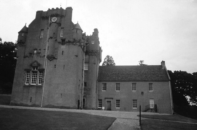
Crathes Castle, Garden & Estate is a historic site located in Kincardineshire, Scotland. The castle, built in the 16th century, is a prime example of Scottish tower house architecture and is known for its intricate turrets, stunning painted ceilings, and ancient yew hedges. The castle has been meticulously preserved and offers visitors a glimpse into the rich history of the region.

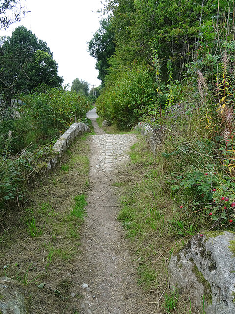
The surrounding garden and estate are equally impressive, covering an expansive 595-acre area. The garden is renowned for its beautifully manicured lawns, colorful flower beds, and peaceful woodland walks. Visitors can wander through the charming walled garden, which features a wide variety of plants and flowers, including rare and exotic species.

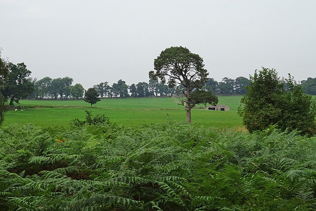
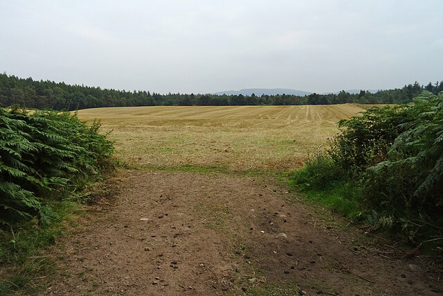
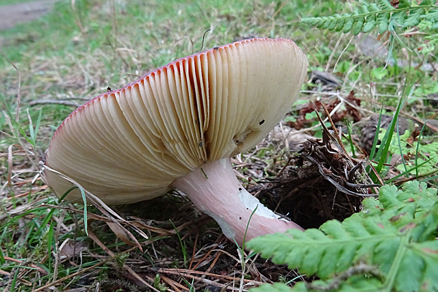
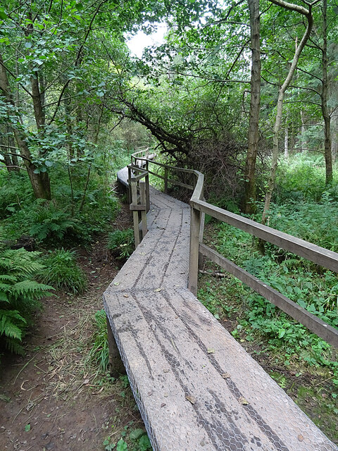
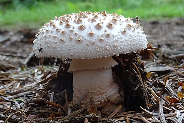
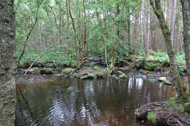
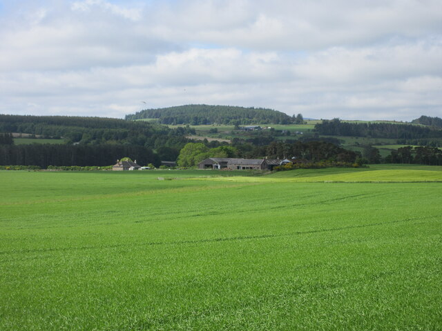
Nature enthusiasts will delight in exploring the estate's extensive woodland, which is home to a diverse range of wildlife and offers breathtaking views of the surrounding countryside. The estate also boasts several walking trails that allow visitors to immerse themselves in the natural beauty of the area.

Crathes Castle, Garden & Estate offers a range of visitor facilities, including a gift shop, café, and ample parking. Guided tours of the castle are available, providing visitors with a detailed insight into its history and architecture. Additionally, the site hosts various events and activities throughout the year, such as garden festivals and outdoor concerts.

Overall, Crathes Castle, Garden & Estate is a must-visit heritage site for history enthusiasts, garden lovers, and nature seekers, providing a unique and immersive experience in the heart of Scotland.

If you have any feedback on the listing, please let us know in the comments section below.

Crathes Castle, Garden & Estate Images

Images are sourced within 2km of 57.061/-2.438 or Grid Reference NO7396. Thanks to Geograph Open Source API. All images are credited.

Mill Wheel at Milton This is one of two water wheels that drove mill machinery at Milton of Crathes. It is an undershot wheel.
Mill Wheel at Milton
This is one of two water wheels that drove mill machinery at Milton of Crathes. It is an undershot wheel.
Ford on the Coy Burn Until the bridge was built a little distance upstream, this was the only way across the Coy Burn.
Ford on the Coy Burn
Until the bridge was built a little distance upstream, this was the only way across the Coy Burn.
Steps at Milton of Crathes The steps lead up to a field where customers can try out fishing rods and casting techniques.
Steps at Milton of Crathes
The steps lead up to a field where customers can try out fishing rods and casting techniques.
Bridges over the Coy Burn The lower bridge is an old packhorse bridge built to allow travellers to avoid having to use the ford. The higher one was built to carry the railway line over the burn. I'm standing on a third one, which is a tatty-looking concrete effort, and behind me are the pillars and arches of the modern A93 road bridge. It was, sadly, impossible to photograph the arch of the old bridge without getting the railway bridge, or the tatty concrete bridge, or the ugly blue-and-white portable building on the nearby sports field, in the picture. Maybe another time I will go wading and see if it is possible.
Bridges over the Coy Burn
The lower bridge is an old packhorse bridge built to allow travellers to avoid having to use the ford. The higher one was built to carry the railway line over the burn. I'm standing on a third one, which is a tatty-looking concrete effort, and behind me are the pillars and arches of the modern A93 road bridge. It was, sadly, impossible to photograph the arch of the old bridge without getting the railway bridge, or the tatty concrete bridge, or the ugly blue-and-white portable building on the nearby sports field, in the picture. Maybe another time I will go wading and see if it is possible.
Pack Horse Bridge The slightly humped bridge was built in the 18th century. It retains the old cobbled surface. It is part of a trio of bridges that are Category B Listed because of how they illustrate the history of crossings of the Coy Burn. A fourth bridge is mentioned briefly as being of insufficient merit to list.
Pack Horse Bridge
The slightly humped bridge was built in the 18th century. It retains the old cobbled surface. It is part of a trio of bridges that are Category B Listed because of how they illustrate the history of crossings of the Coy Burn. A fourth bridge is mentioned briefly as being of insufficient merit to list.
Grounds of Crathes Castle Looking pretty dreary on a dreich day, these fields are east of the castle itself.
Grounds of Crathes Castle
Looking pretty dreary on a dreich day, these fields are east of the castle itself.
Stubble Field This field next to Crathes Castle has already been harvested and the straw baled and removed.
Stubble Field
This field next to Crathes Castle has already been harvested and the straw baled and removed.
Burn of Coy Looking downstream from the point where the 'blue' waymarked walk from the car park reaches the bank of the burn.
Burn of Coy
Looking downstream from the point where the 'blue' waymarked walk from the car park reaches the bank of the burn.
Fungus This is a fairly common fungus with a dark red cap, but I don't know what sort it is.
Fungus
This is a fairly common fungus with a dark red cap, but I don't know what sort it is.
Boardwalk The boardwalk is evidently necessary so that visitors can follow the path alongside the Burn of Coy without plowtering through mud. Today, however, it was dry enough to climb down and look more closely at the plants if one wished to do so.
Boardwalk
The boardwalk is evidently necessary so that visitors can follow the path alongside the Burn of Coy without plowtering through mud. Today, however, it was dry enough to climb down and look more closely at the plants if one wished to do so.
Fungus Recently emerged and still undamaged by whatewver it is that eats holes in the caps of fungi.
Fungus
Recently emerged and still undamaged by whatewver it is that eats holes in the caps of fungi.
Coy Burn A pool formed in a bend of the burn, looking downstream.
Coy Burn
A pool formed in a bend of the burn, looking downstream.
Crathes Castle <span class="nowrap"><a title="https://canmore.org.uk/site/36693/crathes-castle" rel="nofollow ugc noopener" href="https://canmore.org.uk/site/36693/crathes-castle">Link</a><img style="margin-left:2px;" alt="External link" title="External link - shift click to open in new window" src="https://s1.geograph.org.uk/img/external.png" width="10" height="10"/></span>
Crathes Castle
Nether Mills of Crathes A distant view of the Nether Mills of Crathes from the Deeside Way to the north-east.
Nether Mills of Crathes
A distant view of the Nether Mills of Crathes from the Deeside Way to the north-east.
River Dee from Durris Bridge Looking upstream of the River Dee from the A957 Durris Bridge.
River Dee from Durris Bridge
Looking upstream of the River Dee from the A957 Durris Bridge.
Crathes village hall Geocaching is a type of global treasure hunt of people looking for caches, or hidden stashes of objects. Geocaching may also be described as a series of hide-and-seek games, where hiders provide online clues for seekers. Seekers use global positioning system (GPS) devices to find hidden caches
Crathes village hall
Geocaching is a type of global treasure hunt of people looking for caches, or hidden stashes of objects. Geocaching may also be described as a series of hide-and-seek games, where hiders provide online clues for seekers. Seekers use global positioning system (GPS) devices to find hidden caches
Midnight Frolics 
Art Trail 


Hare, there and everywhere!
Clan Cancer Support, the north-east’s leading cancer support charity, has partnered with Wild in Art once again to bring an exciting new art trail to the north-east, Moray, Orkney and Shetland.

The Big Hop Trail will take the public on another cultural tour of the north-east and the islands from July to September 2023, with hare sculptures designed and created by some of the country’s most talented artists.

The trail coincides with Clan’s 40th anniversary, with the 40 hares being the focal point to celebrate the charity’s commitment to supporting people affected by cancer. 

We chose the hare sculpture as they are an indigenous animal found in all parts of Clan’s geography. Much like our clients during their cancer journey, hares have to navigate rough and difficult terrain in order to survive. They are also adaptable, like our services team who deliver support to anyone affected by cancer. Most importantly, hares have incredible hearing. What better way to depict our lifeline listening and support service and the importance of being heard?
Midnight Frolics
Art Trail Hare, there and everywhere! Clan Cancer Support, the north-east’s leading cancer support charity, has partnered with Wild in Art once again to bring an exciting new art trail to the north-east, Moray, Orkney and Shetland. The Big Hop Trail will take the public on another cultural tour of the north-east and the islands from July to September 2023, with hare sculptures designed and created by some of the country’s most talented artists. The trail coincides with Clan’s 40th anniversary, with the 40 hares being the focal point to celebrate the charity’s commitment to supporting people affected by cancer. We chose the hare sculpture as they are an indigenous animal found in all parts of Clan’s geography. Much like our clients during their cancer journey, hares have to navigate rough and difficult terrain in order to survive. They are also adaptable, like our services team who deliver support to anyone affected by cancer. Most importantly, hares have incredible hearing. What better way to depict our lifeline listening and support service and the importance of being heard?
Milton Park shops and café
Show me another place!

Crathes Castle, Garden & Estate is located at Grid Ref: NO7396 (Lat: 57.061, Lng: -2.438)

Unitary Authority: Aberdeenshire

Police Authority: North East

What 3 Words

///aced.magazine.irrigate. Near Banchory, Aberdeenshire

Related Wikis

Crathes Castle

Crathes Castle (pronounced KRATH-iss) is a castle, built in the 16th-century, near Banchory in Aberdeenshire, Scotland. It is in the historic county of...
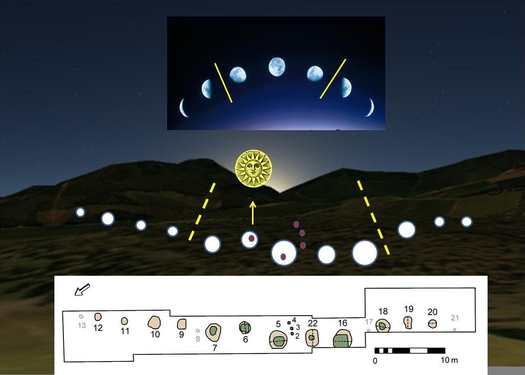
Warren Field

Warren Field is the location of a mesolithic calendar monument built about 8,000 BCE. It includes 12 pits believed to correlate with phases of the Moon...

Milton of Crathes railway station

Milton of Crathes railway station is located at Milton of Crathes, three miles east of Banchory, Royal Deeside, Aberdeenshire, Scotland, United Kingdom...

Royal Deeside Railway

The Royal Deeside Railway is a Scottish heritage railway located at Milton of Crathes railway station on a part of the original Deeside Railway. ��2�...
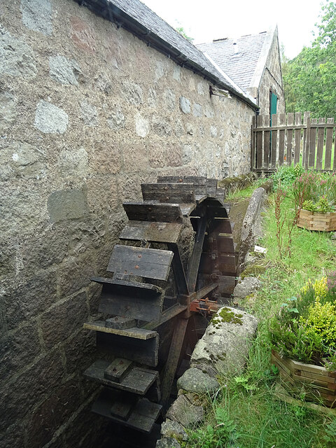
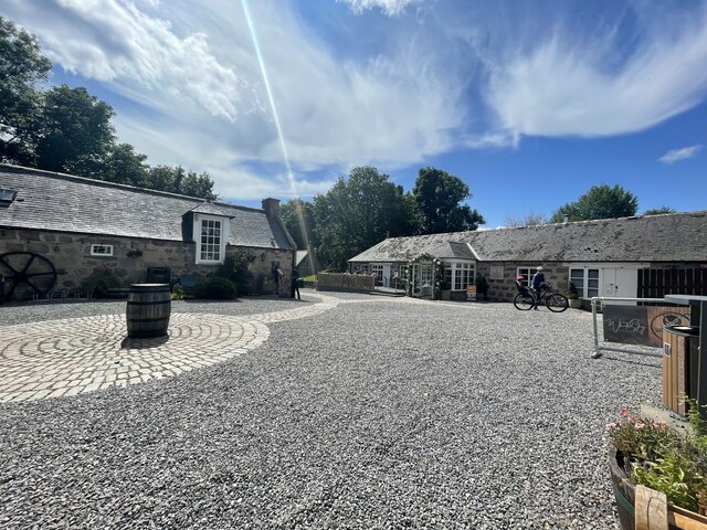
Milton of Crathes

Milton of Crathes is a complex of restored 17th-century stone buildings, associated with, and previously an outlier of, Crathes Castle in Aberdeenshire...
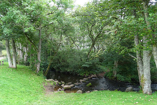
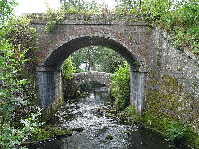
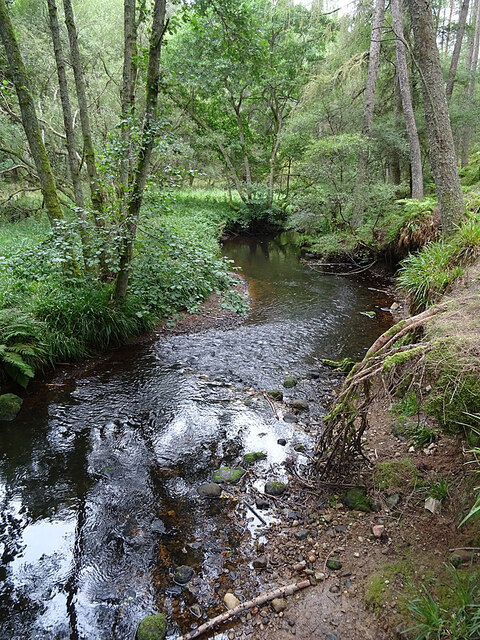
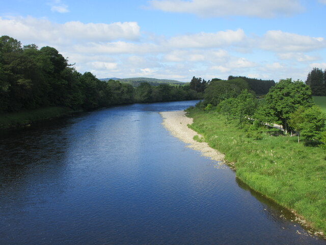
Coy Burn

Coy Burn is a stream that rises in the hills north of Banchory in Aberdeenshire, Scotland. Coy Burn discharges to the River Dee at Milton of Crathes....

Banchory St Ternan F.C.

Banchory St. Ternan Football Club are a Scottish Junior football club based in Crathes, two miles outside the town of Banchory, Aberdeenshire. The club...

Mills of Drum railway station

Mills of Drum railway station was opened in September 1853 by the Deeside Railway and served the rural area around Park House and Crathes estates at the...

Related Videos

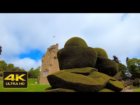
Crathes Castle’s Gardens Walk, Scotland Travel

Crathes Castle's Gardens Walk, Scotland Travel. The video was recorded on location by DJI Pocket 2 and Zoom H5 audio ...

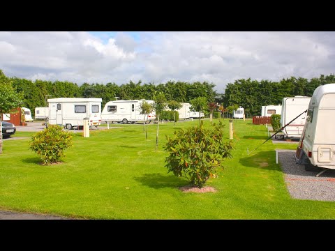
Silverbank Club site

A small site located next to the River Dee and surrounded by splendid countryside. Nearby Banchory is a popular holiday town ...

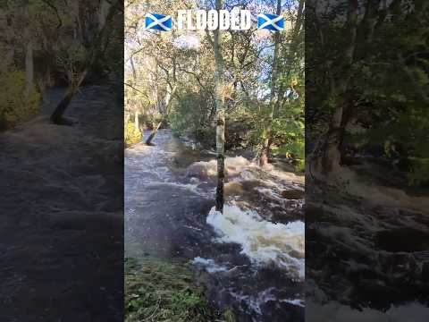
Coy burn and river Dee with very high water levels at Milton of Crathes

very watery rivers in Scotland after the rain and storm.

Nearby Amenities

Located within 500m of 57.061,-2.438
Douglas Fir
Historic: monument
Name En: Douglas Fir
Lat/Long: 57.0597541/-2.433347
Information: map
Map Type: scheme
Tourism: information
Lat/Long: 57.0622029/-2.4403241
Shop: gift
Lat/Long: 57.0621161/-2.4405782
Power: pole
Lat/Long: 57.0580233/-2.4436005
Shelter
Wildlife Hide
Lat/Long: 57.0576459/-2.4344522
Toilets
Fee: no
Survey Date: 2023-07-01
Wheelchair: yes
Lat/Long: 57.0625717/-2.4404713
Clock
Display: sundial
Lat/Long: 57.0614664/-2.4392894
Fountain
Lat/Long: 57.0614999/-2.4385887
The data included in this document is from www.openstreetmap.org. The data is made available under ODbL.

Have you been to Crathes Castle, Garden & Estate?

Leave your review of Crathes Castle, Garden & Estate below (or comments, questions and feedback).