Coker Court

Heritage Site in Somerset South Somerset

England

Coker Court

Helyar Arms Cottages and the Helyar Arms, East Coker.
Helyar Arms Credit: Wayland Smith

Coker Court, located in Somerset, England, is a historically significant heritage site that showcases the architectural and cultural heritage of the region. This Grade II* listed building dates back to the late 15th century, and it has served as a significant residence for many prominent figures throughout its history.

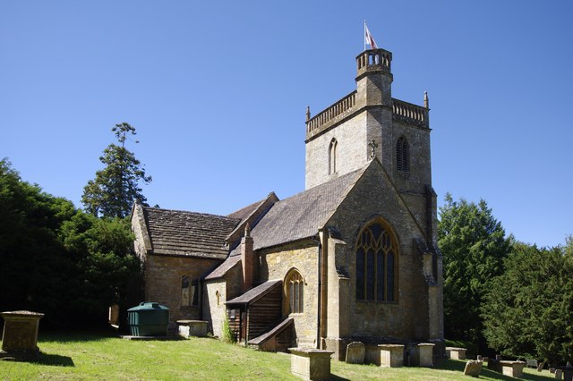
The court is a fine example of Tudor architecture, featuring a stunning timber-framed exterior with intricate carvings and decorative panels. The building has undergone several renovations and alterations over the centuries, but it still retains its original charm and character.

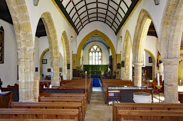
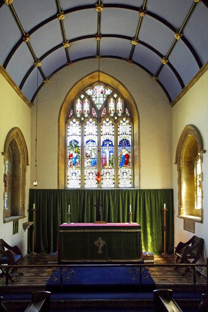
The interior of Coker Court is equally impressive, with many period features and architectural details on display. These include grand fireplaces, ornate plasterwork, and oak-paneled rooms that offer a glimpse into the opulence of the past.

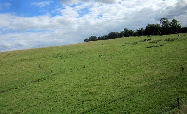
The court is surrounded by beautifully landscaped gardens, which add to the overall aesthetic appeal of the site. The gardens boast manicured lawns, vibrant flower beds, and mature trees, providing a tranquil and picturesque setting for visitors to explore.

Coker Court is a popular destination for history enthusiasts and architectural admirers alike. Guided tours of the property are available, allowing visitors to learn about the court's rich history and understand its significance in Somerset's heritage.

In addition to its historical value, Coker Court also hosts various cultural events and exhibitions throughout the year, attracting a wide range of visitors and ensuring its place as a hub for community engagement.

Overall, Coker Court stands as a testament to the region's architectural heritage and offers a fascinating glimpse into the past for all who visit.

If you have any feedback on the listing, please let us know in the comments section below.

Coker Court Images

Images are sourced within 2km of 50.91/-2.662 or Grid Reference ST5312. Thanks to Geograph Open Source API. All images are credited.

Helyar Arms Cottages and the Helyar Arms, East Coker.
Helyar Arms
Cottages and the Helyar Arms, East Coker.
St Michael and All Angels, East Coker, Somerset
St Michael and All Angels, East Coker, Somerset North-East corner.
St Michael and All Angels, East Coker, Somerset
North-East corner.
St Michael and All Angels, East Coker, Somerset East wall.
St Michael and All Angels, East Coker, Somerset
East wall.
St Michael and All Angels, East Coker, Somerset South-East corner.
St Michael and All Angels, East Coker, Somerset
South-East corner.
St Michael and All Angels, East Coker, Somerset The Nave.
St Michael and All Angels, East Coker, Somerset
The Nave.
St Michael and All Angels, East Coker, Somerset The Altar and East window.
St Michael and All Angels, East Coker, Somerset
The Altar and East window.
St Michael and All Angels, East Coker, Somerset North Chancel window. Dedicated to Alice Troyte-Bullock (1923).
St Michael and All Angels, East Coker, Somerset
North Chancel window. Dedicated to Alice Troyte-Bullock (1923).
St Michael and All Angels, East Coker, Somerset South Chancel window. Dedicated to Alice Troyte-Bullock (1923).
St Michael and All Angels, East Coker, Somerset
South Chancel window. Dedicated to Alice Troyte-Bullock (1923).
St Michael and All Angels, East Coker, Somerset The Font. Whilst the bowl is Norman, dating from the 11th Century, the column and base are probably 19th Century.
St Michael and All Angels, East Coker, Somerset
The Font. Whilst the bowl is Norman, dating from the 11th Century, the column and base are probably 19th Century.
St Michael and All Angels, East Coker, Somerset North-East window. Dedicated to Walter Graham Eliot of New York, a descendent of T.S. Eliot.
St Michael and All Angels, East Coker, Somerset
North-East window. Dedicated to Walter Graham Eliot of New York, a descendent of T.S. Eliot.
St Michael and All Angels, East Coker, Somerset The Royal Coat of Arms painted in 1660. It originally bore the cypher of Charles II but in 1690, following the Second Interregnum, it was altered to reflect the Monarchy of William III and Mary II.
St Michael and All Angels, East Coker, Somerset
The Royal Coat of Arms painted in 1660. It originally bore the cypher of Charles II but in 1690, following the Second Interregnum, it was altered to reflect the Monarchy of William III and Mary II.
Cattle near Sutton Bingham On a hillside, and seen from a passing train on the Waterloo line.
Cattle near Sutton Bingham
On a hillside, and seen from a passing train on the Waterloo line.
Benchmark on East Coker School Ordnance Survey benchmark, described on database at <span class="nowrap"><a title="http://www.bench-marks.org.uk/bm66969" rel="nofollow ugc noopener" href="http://www.bench-marks.org.uk/bm66969">Link</a><img style="margin-left:2px;" alt="External link" title="External link - shift click to open in new window" src="https://s1.geograph.org.uk/img/external.png" width="10" height="10"/></span>.
Benchmark on East Coker School
Ordnance Survey benchmark, described on database at LinkExternal link.
Benchmark on former Post Office, Hardington Moor Ordnance Survey benchmark, described on database at <span class="nowrap"><a title="http://www.bench-marks.org.uk/bm73875" rel="nofollow ugc noopener" href="http://www.bench-marks.org.uk/bm73875">Link</a><img style="margin-left:2px;" alt="External link" title="External link - shift click to open in new window" src="https://s1.geograph.org.uk/img/external.png" width="10" height="10"/></span>. See also <a href="https://www.geograph.org.uk/photo/4849984">ST5112 : Former Post Office, Hardington Moor</a>.
Benchmark on former Post Office, Hardington Moor
Ordnance Survey benchmark, described on database at LinkExternal link. See also ST5112 : Former Post Office, Hardington Moor.
Former Post Office, Hardington Moor The current Post Office seems to be in the one-storey building next door. There is an Ordnance Survey benchmark on the former Post Office. See <a href="https://www.geograph.org.uk/photo/4849981">ST5112 : Benchmark on former Post Office, Hardington Moor</a>.
Former Post Office, Hardington Moor
The current Post Office seems to be in the one-storey building next door. There is an Ordnance Survey benchmark on the former Post Office. See ST5112 : Benchmark on former Post Office, Hardington Moor.
Causeway Across Sutton Bingham Reservoir This causeway carries the minor road from Yeovil to Halstock. It passes under the railway line from Yeovil Junction to Crewkerne on the north side of the reservoir.
Causeway Across Sutton Bingham Reservoir
This causeway carries the minor road from Yeovil to Halstock. It passes under the railway line from Yeovil Junction to Crewkerne on the north side of the reservoir.
All Saints' church, Sutton Bingham Largely twelfth century church.
All Saints' church, Sutton Bingham
Largely twelfth century church.
Show me another place!

Coker Court is located at Grid Ref: ST5312 (Lat: 50.91, Lng: -2.662)

Administrative County: Somerset

District: South Somerset

Police Authority: Avon and Somerset

What 3 Words

///removes.breeze.stream. Near West Coker, Somerset

Related Wikis

Coker Court

Coker Court is a substantial manor house in East Coker, Somerset, England. It was built in the fifteenth and eighteenth centuries and has been designated...

Helyar Almshouses

The Helyar Almshouses were erected between 1640 and 1660 by William Helyar Archdeacon of Barnstable of Coker Court, East Coker, Somerset, England. The...

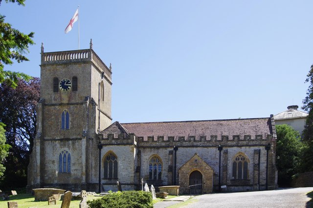
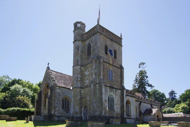
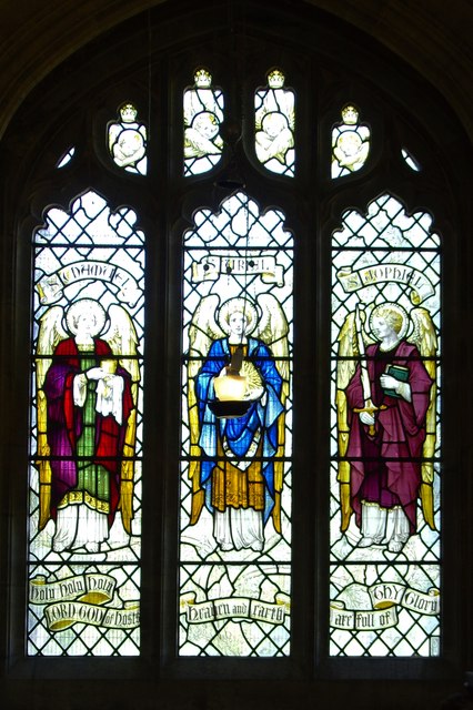
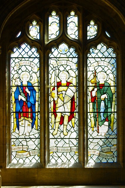
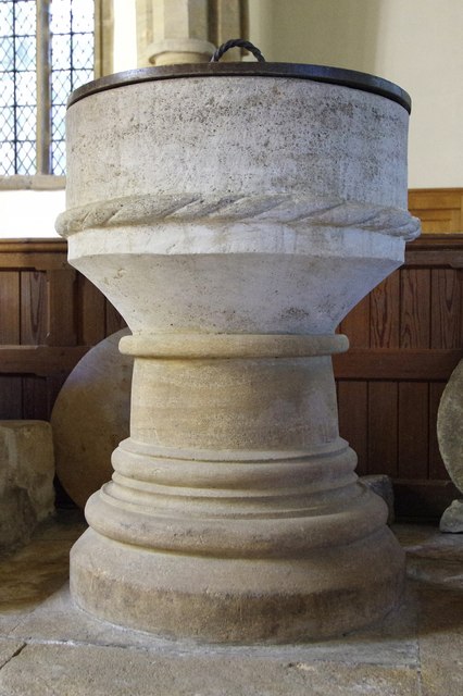
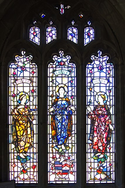
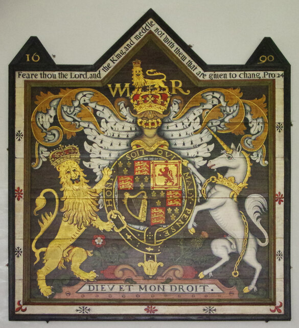
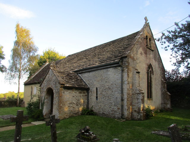
St Michael and All Angels' Church, East Coker

St Michael and All Angels’ Church is a Grade II* listed parish church in the Church of England in East Coker, Somerset. == History == The church dates...

East Coker

East Coker is a village and civil parish in the South Somerset district of Somerset, England. Its nearest town is Yeovil, two miles (3.2 km) to the north...
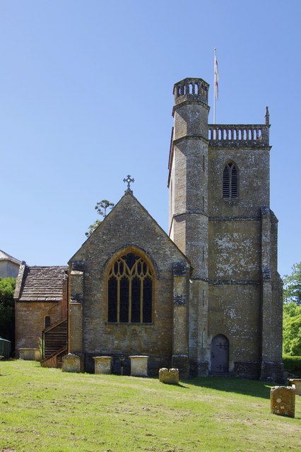
Naish Priory

Naish Priory in East Coker, Somerset, England, contains portions of a substantial house dating from the mid 14th century to around 1400. Emery says the...

Hymerford House

Hymerford House (which has also been known as Grove Farm, Manor House and Bridge Farm) in East Coker, Somerset, England was built in the 15th century and...

Sutton Bingham Halt railway station

Sutton Bingham Halt railway station served the hamlet of Sutton Bingham, South Somerset, England, from 1860 to 1962 on the West of England line. ��2�...

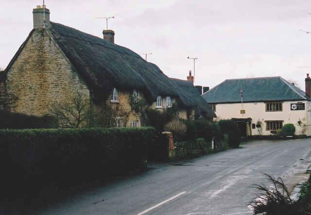
Manor House, West Coker

The Manor House in West Coker, Somerset, England has medieval origins, however the earliest surviving portions of the current building probably date from...

Nearby Amenities

Located within 500m of 50.91,-2.662
Barrier: stile
Lat/Long: 50.9093004/-2.6605868
Historic: memorial
Lat/Long: 50.9120006/-2.6575502
Power: pole
Lat/Long: 50.9126726/-2.6578179
Power: pole
Lat/Long: 50.912702/-2.6591904
Poles: bipole
Power: pole
Lat/Long: 50.912766/-2.6604881
Power: pole
Lat/Long: 50.9127861/-2.6615917
Material: wood
Power: pole
Lat/Long: 50.9128079/-2.6632175
Poles: bipole
Power: pole
Lat/Long: 50.9128782/-2.6651605
Power: pole
Lat/Long: 50.9129577/-2.6668171
Power: pole
Lat/Long: 50.9136981/-2.6650922
Power: pole
Lat/Long: 50.9138102/-2.6650833
Power: pole
Source: bing
Lat/Long: 50.9116003/-2.6652092
Power: pole
Source: bing
Lat/Long: 50.9115597/-2.6667541
Power: pole
Source: bing
Lat/Long: 50.9115352/-2.6676956
Power: pole
Source: bing
Transformer: distribution
Lat/Long: 50.9096436/-2.6663759
Power: pole
Source: bing
Lat/Long: 50.9106143/-2.6656169
Power: pole
Source: bing
Lat/Long: 50.9123613/-2.6561956
Power: pole
Source: bing
Lat/Long: 50.9124095/-2.6579484
Power: pole
Source: bing
Lat/Long: 50.9124518/-2.6592614
Power: pole
Source: bing
Lat/Long: 50.9124797/-2.660577
Power: pole
Source: bing
Lat/Long: 50.9139459/-2.6644434
Power: pole
Source: bing
Lat/Long: 50.9134792/-2.6647183
Power: pole
Source: bing
Lat/Long: 50.91273/-2.6651569
Power: pole
Source: bing
Lat/Long: 50.9121491/-2.6649906
Power: pole
Source: bing
Lat/Long: 50.9116033/-2.664827
Power: pole
Source: bing
Lat/Long: 50.9123842/-2.6630527
Power: pole
Source: bing
Lat/Long: 50.9127655/-2.6627684
Power: pole
Source: bing
Lat/Long: 50.9125144/-2.6617143
Power: pole
Source: bing
Lat/Long: 50.9131308/-2.6624961
Power: pole
Source: bing
Lat/Long: 50.9137717/-2.6633155
The data included in this document is from www.openstreetmap.org. The data is made available under ODbL.

Have you been to Coker Court?

Leave your review of Coker Court below (or comments, questions and feedback).