Catrail

Heritage Site in Roxburghshire

Scotland

Catrail

Philhope Burn A tributary of Borthwick Water. Philhope Farm in the middle distance.
Philhope Burn Credit: Oliver Dixon

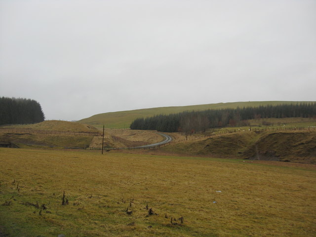
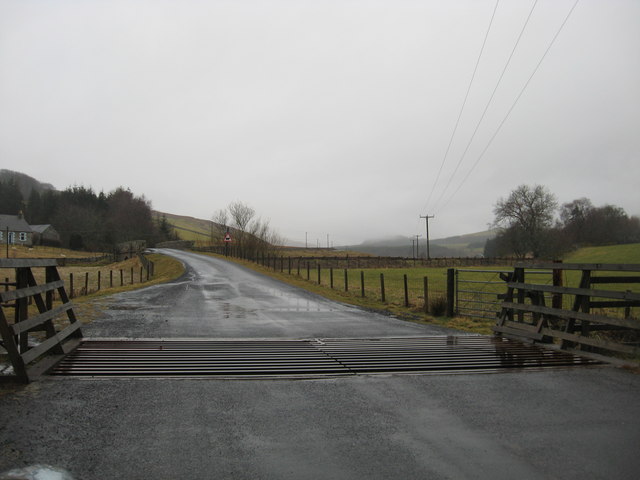
Catrail, located in Roxburghshire, Scotland, is an ancient earthwork that has garnered significant attention as a heritage site. Also known as the Picts' Work Ditch or Graham's Dyke, it is a remarkable feat of engineering that stretches over 40 miles across the rolling hills and valleys of the Scottish Borders region.

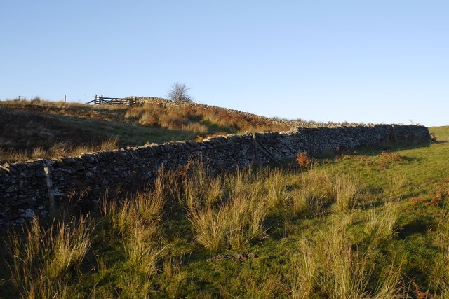
Believed to have been constructed during the early medieval period, Catrail is a man-made ditch and bank that runs in a roughly linear fashion. The earthwork is approximately 6 feet high and 10 feet wide, and its purpose remains a subject of speculation among historians and archaeologists. Some theories propose that it served as a defensive barrier, while others suggest it was a territorial marker or even a boundary for herding livestock.

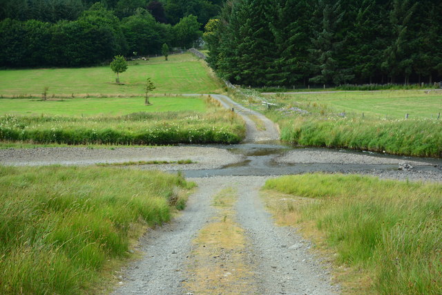
The construction of Catrail is impressive considering the challenging terrain it traverses. It cuts across steep slopes, navigates through dense forests, and crosses rivers, demonstrating the ingenuity and determination of its builders. The structure's precise alignment, which follows the contours of the landscape, adds to its mystique and suggests a remarkable level of planning and engineering skills.

Today, Catrail is a popular destination for both history enthusiasts and outdoor adventurers. Visitors can explore sections of the earthwork on foot, immersing themselves in the ancient landscape and appreciating the remarkable craftsmanship that went into its creation. Its status as a heritage site ensures its preservation and protection for future generations to appreciate and study, providing a tangible link to our past and a glimpse into the lives of those who came before us.

If you have any feedback on the listing, please let us know in the comments section below.

Catrail Images

Images are sourced within 2km of 55.385/-2.938 or Grid Reference NT4010. Thanks to Geograph Open Source API. All images are credited.

Philhope Burn A tributary of Borthwick Water. Philhope Farm in the middle distance.
Philhope Burn
A tributary of Borthwick Water. Philhope Farm in the middle distance.
Countryside in Roxburghshire Grazing and forestry land with the road to the left leading to Outerside.
Countryside in Roxburghshire
Grazing and forestry land with the road to the left leading to Outerside.
The Borthwick Water Near its confluence with the Camp Burn below Broadlea.
The Borthwick Water
Near its confluence with the Camp Burn below Broadlea.
Minor road crossing a cattle grid at  Hosecote Heading south in Roxburghshire
Minor road crossing a cattle grid at Hosecote
Heading south in Roxburghshire
Bridge over Borthwick Water Carrying the side road to Outerside on the edge of Craik Forest.
Bridge over Borthwick Water
Carrying the side road to Outerside on the edge of Craik Forest.
Borthwick Water The side road to Outerside on the edge of Craik Forest can be seen in the middle distance.
Borthwick Water
The side road to Outerside on the edge of Craik Forest can be seen in the middle distance.
Borthwick Water and the road to Craik Looking upstream. The mail van in the middle distance has just delivered to Outerside and Meadshaw (<a href="https://www.geograph.org.uk/gridref/NS3810">NS3810</a>).
Borthwick Water and the road to Craik
Looking upstream. The mail van in the middle distance has just delivered to Outerside and Meadshaw (NS3810).
Borthwick Water and the road to Craik Looking upstream; the long cul-de-sac road to the forestry village of Craik.
Borthwick Water and the road to Craik
Looking upstream; the long cul-de-sac road to the forestry village of Craik.
Ford over the Borthwick Water near Hoscote A grassy track leads down to the ford. Craik Forest beyond.
Ford over the Borthwick Water near Hoscote
A grassy track leads down to the ford. Craik Forest beyond.
Borthwick Water near Hoscote Looking upstream.
Borthwick Water near Hoscote
Looking upstream.
Borthwick Water Looking upstream from the bridge at Muselee.
Borthwick Water
Looking upstream from the bridge at Muselee.
Borthwick Water Looking downstream from the bridge at Muselee.
Borthwick Water
Looking downstream from the bridge at Muselee.
Gates to the Hoscote Estate Sycamore Lodge, on the right, is let out as self-catering holiday accommodation.
Gates to the Hoscote Estate
Sycamore Lodge, on the right, is let out as self-catering holiday accommodation.
Deanburnhaugh A couple of houses in the remote valley of the Borthwick Water. An election poster heralds the forthcoming UK elections on 7 May, 2015 - not that this poster will get much visibility in such a thinly populated area.
Deanburnhaugh
A couple of houses in the remote valley of the Borthwick Water. An election poster heralds the forthcoming UK elections on 7 May, 2015 - not that this poster will get much visibility in such a thinly populated area.
Fields, walls and electricity lines at Deanburnhaugh Not much has changed in nine years since <a href="https://www.geograph.org.uk/photo/105740">NT3912 : Fields Deanburnhaugh.</a>.
Fields, walls and electricity lines at Deanburnhaugh
Not much has changed in nine years since NT3912 : Fields Deanburnhaugh..
Hoscote Ford Another ford on Borthwick Water, this time at Hoscote.
Hoscote Ford
Another ford on Borthwick Water, this time at Hoscote.
Old Milestone south west of Muselee, Roberton Parish By the UC road, in parish of Roberton (Roxburgh District), Muselee, on verge South West of bridge over Borthwick Water, South East side of road.

Surveyed

Milestone Society National ID: BD_HWHP08.
Old Milestone south west of Muselee, Roberton Parish
By the UC road, in parish of Roberton (Roxburgh District), Muselee, on verge South West of bridge over Borthwick Water, South East side of road. Surveyed Milestone Society National ID: BD_HWHP08.
Dykes, Chapel Hill Hill farming upstream of Hawick.
Dykes, Chapel Hill
Hill farming upstream of Hawick.
Show me another place!

Catrail is located at Grid Ref: NT4010 (Lat: 55.385, Lng: -2.938)

Unitary Authority: The Scottish Borders

Police Authority: The Lothians and Scottish Borders

What 3 Words

///cared.trombone.about. Near Teviothead, Scottish Borders

Nearby Locations

Catrail Broadlee Loch

Related Wikis

Burnfoot, Roberton

Burnfoot (Scottish Gaelic: Bun na h-Aibhne) is a hamlet in the Scottish Borders area of Scotland, close to Roberton, by the Borthwick Water. The nearest...

Broadhaugh

Broadhaugh is a hamlet in the Scottish Borders area of Scotland, in the parish of Teviothead, in former Roxburghshire. == See also == List of places in...

Roberton, Scottish Borders

Roberton is a small village in the Scottish Borders area of Scotland, on the B711 and near to the A7, 5 miles (8 kilometres) from Hawick, 22 mi (35 km...

Newmill-on-Teviot

Newmill-on-Teviot, commonly called Newmill, is a hamlet in the Scottish Borders, 7 kilometres (4.3 mi) south of Hawick on the River Teviot. The remains...

Falnash

Falnash (Scots: Fawenesh) is a village in the Scottish Borders of Scotland. It is near Teviothead, in the former Roxburghshire, and in the parish of Teviothead...

Teviothead

Teviothead (Scottish Gaelic: Ceann Tìbhiot) is a small village and civil parish in Teviotdale in the Scottish Borders, known locally as Teviotheid. It...

Alemoor Loch

Alemoor Loch, also known as Alemoor Reservoir, is a small reservoir in the Scottish Borders area of Scotland. It is situated on the Ale Water, 10 kilometres...

Branxholme

Branxholme is a hamlet in the Scottish Borders area of Scotland, overlooking the River Teviot, three miles southwest of Hawick, on the A7 road to Langholm...

Have you been to Catrail?

Leave your review of Catrail below (or comments, questions and feedback).