Broadlee Loch

Lake, Pool, Pond, Freshwater Marsh in Roxburghshire

Scotland

Broadlee Loch

Minor road beside Borthwick Water Looking north-eastward.
Minor road beside Borthwick Water Credit: Peter Wood

Broadlee Loch is a picturesque freshwater loch located in Roxburghshire, Scotland. Nestled amidst the stunning Scottish Borders countryside, the loch covers an area of approximately 12 hectares and is surrounded by lush vegetation and rolling hills.

The loch is popular among nature enthusiasts and birdwatchers due to its rich biodiversity. It provides a haven for a wide range of bird species, including ducks, swans, geese, and herons. The reed beds and freshwater marshes surrounding the loch are important nesting grounds for various waterfowl and wading birds.

The tranquil waters of Broadlee Loch also support a diverse population of fish, making it a popular spot for anglers. Common species found in the loch include brown trout, pike, and perch. Fishing permits are available for visitors who wish to try their luck at catching these elusive creatures.

Surrounded by a network of walking paths, Broadlee Loch offers visitors the opportunity to explore the surrounding countryside. The loch is also home to a variety of plant life, including water lilies and other aquatic vegetation, which adds to its scenic beauty.

The loch is easily accessible, with a car park and picnic area located nearby. It provides a peaceful retreat for those seeking a break from the hustle and bustle of everyday life. Whether it's for a leisurely stroll, birdwatching, fishing, or simply enjoying the tranquility of nature, Broadlee Loch is a hidden gem worth exploring in Roxburghshire.

If you have any feedback on the listing, please let us know in the comments section below.

Broadlee Loch Images

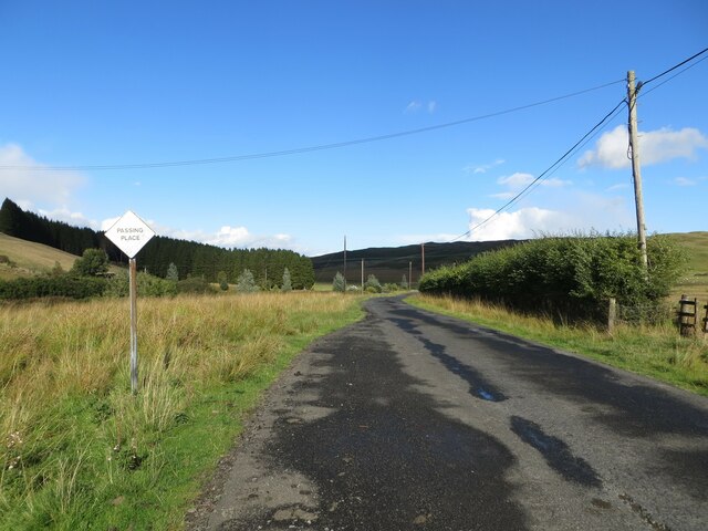
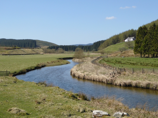
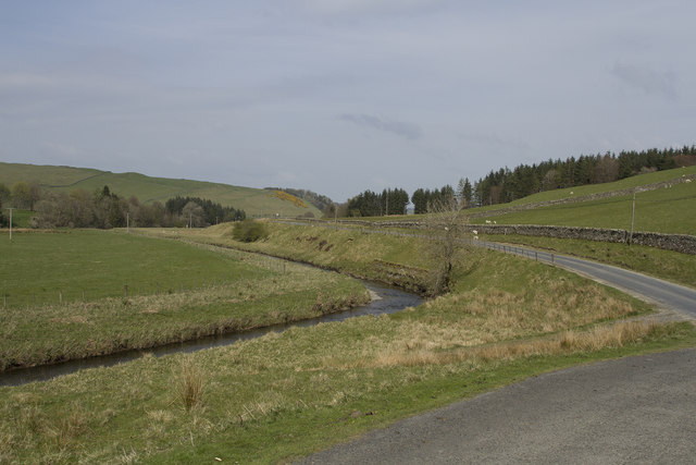
Images are sourced within 2km of 55.380955/-2.943741 or Grid Reference NT4010. Thanks to Geograph Open Source API. All images are credited.

Minor road beside Borthwick Water Looking north-eastward.
Minor road beside Borthwick Water
Looking north-eastward.
Ordnance Survey Cut Mark This mark can be found on top of the parapet of a road bridge that spans Pilhope Burn. At one time the mark had an associated rivet but this is no longer there.
The recorded details give a height of 183.33 metres above sea level.
For more details see : <span class="nowrap"><a title="https://www.bench-marks.org.uk/bm164866" rel="nofollow ugc noopener" href="https://www.bench-marks.org.uk/bm164866">Link</a><img style="margin-left:2px;" alt="External link" title="External link - shift click to open in new window" src="https://s1.geograph.org.uk/img/external.png" width="10" height="10"/></span>
Ordnance Survey Cut Mark
This mark can be found on top of the parapet of a road bridge that spans Pilhope Burn. At one time the mark had an associated rivet but this is no longer there. The recorded details give a height of 183.33 metres above sea level. For more details see : LinkExternal link
Borthwick Water Looking upstream. Meadshaw Farm on the edge of Craik Forest on the slope to the right.
Borthwick Water
Looking upstream. Meadshaw Farm on the edge of Craik Forest on the slope to the right.
Philhope Burn A tributary of Borthwick Water. Philhope Farm in the middle distance.
Philhope Burn
A tributary of Borthwick Water. Philhope Farm in the middle distance.
The fertile river valley This is a quiet fertile river valley. The river is small but extremely clean and has salmon spawning in its upper reaches.
The fertile river valley
This is a quiet fertile river valley. The river is small but extremely clean and has salmon spawning in its upper reaches.
Bridge over Borthwick Water Carrying the side road to Outerside on the edge of Craik Forest.
Bridge over Borthwick Water
Carrying the side road to Outerside on the edge of Craik Forest.
Borthwick Water The side road to Outerside on the edge of Craik Forest can be seen in the middle distance.
Borthwick Water
The side road to Outerside on the edge of Craik Forest can be seen in the middle distance.
Borthwick Water and the road to Craik Looking upstream. The mail van in the middle distance has just delivered to Outerside and Meadshaw (<a href="https://www.geograph.org.uk/gridref/NS3810">NS3810</a>).
Borthwick Water and the road to Craik
Looking upstream. The mail van in the middle distance has just delivered to Outerside and Meadshaw (NS3810).
Borthwick Water and the road to Craik Looking upstream; the long cul-de-sac road to the forestry village of Craik.
Borthwick Water and the road to Craik
Looking upstream; the long cul-de-sac road to the forestry village of Craik.
Ford over the Borthwick Water near Hoscote A grassy track leads down to the ford. Craik Forest beyond.
Ford over the Borthwick Water near Hoscote
A grassy track leads down to the ford. Craik Forest beyond.
Borthwick Water near Hoscote Looking upstream.
Borthwick Water near Hoscote
Looking upstream.
Borthwick Water Looking upstream from the bridge at Muselee.
Borthwick Water
Looking upstream from the bridge at Muselee.
Borthwick Water Looking downstream from the bridge at Muselee.
Borthwick Water
Looking downstream from the bridge at Muselee.
Gates to the Hoscote Estate Sycamore Lodge, on the right, is let out as self-catering holiday accommodation.
Gates to the Hoscote Estate
Sycamore Lodge, on the right, is let out as self-catering holiday accommodation.
Deanburnhaugh A couple of houses in the remote valley of the Borthwick Water. An election poster heralds the forthcoming UK elections on 7 May, 2015 - not that this poster will get much visibility in such a thinly populated area.
Deanburnhaugh
A couple of houses in the remote valley of the Borthwick Water. An election poster heralds the forthcoming UK elections on 7 May, 2015 - not that this poster will get much visibility in such a thinly populated area.
Hoscote Ford Another ford on Borthwick Water, this time at Hoscote.
Hoscote Ford
Another ford on Borthwick Water, this time at Hoscote.
Old Milestone south west of Muselee, Roberton Parish By the UC road, in parish of Roberton (Roxburgh District), Muselee, on verge South West of bridge over Borthwick Water, South East side of road.

Surveyed

Milestone Society National ID: BD_HWHP08.
Old Milestone south west of Muselee, Roberton Parish
By the UC road, in parish of Roberton (Roxburgh District), Muselee, on verge South West of bridge over Borthwick Water, South East side of road. Surveyed Milestone Society National ID: BD_HWHP08.
The Woodburn This small stream, a burn in Scotland, passes right by our holiday cottage. There are Grey Wagtail and many other birds feeding and drinking by the banks of the burn.
The Woodburn
This small stream, a burn in Scotland, passes right by our holiday cottage. There are Grey Wagtail and many other birds feeding and drinking by the banks of the burn.
Show me another place!

Broadlee Loch is located at Grid Ref: NT4010 (Lat: 55.380955, Lng: -2.943741)

Unitary Authority: The Scottish Borders

Police Authority: The Lothians and Scottish Borders

What 3 Words

///observers.look.juicy. Near Teviothead, Scottish Borders

Nearby Locations

Catrail Broadlee Loch

Related Wikis

Burnfoot, Roberton

Burnfoot (Scottish Gaelic: Bun na h-Aibhne) is a hamlet in the Scottish Borders area of Scotland, close to Roberton, by the Borthwick Water. The nearest...

Falnash

Falnash (Scots: Fawenesh) is a village in the Scottish Borders of Scotland. It is near Teviothead, in the former Roxburghshire, and in the parish of Teviothead...

Teviothead

Teviothead (Scottish Gaelic: Ceann Tìbhiot) is a small village and civil parish in Teviotdale in the Scottish Borders, known locally as Teviotheid. It...

Broadhaugh

Broadhaugh is a hamlet in the Scottish Borders area of Scotland, in the parish of Teviothead, in former Roxburghshire. == See also == List of places in...

Have you been to Broadlee Loch?

Leave your review of Broadlee Loch below (or comments, questions and feedback).