Castell Crugerydd

Heritage Site in Radnorshire

Wales

Castell Crugerydd

Llynheilyn pool, near to Llanfihangel- Nant-Melan View looking South-East over Llynheilyn pool from the pull in off the A481 from Llanfihangel-Nant-Melan to Hundred House Road in Powys
Llynheilyn pool, near to Llanfihangel- Nant-Melan Credit: Peter Evans

Castell Crugerydd is a historic heritage site located in Radnorshire, Wales. This ancient hillfort dates back to the Iron Age, making it a significant archaeological site. It sits atop a hill, offering panoramic views of the surrounding landscape.

The fortification consists of a large circular enclosure, measuring approximately 50 meters in diameter. The site is protected by a series of earthworks, including banks and ditches, which were likely constructed for defensive purposes. The ramparts are still visible today, displaying the impressive engineering skills of the Iron Age inhabitants.

Excavations at Castell Crugerydd have revealed evidence of human occupation dating back over 2,000 years. Archaeologists have uncovered a range of artifacts, including pottery fragments, tools, and domestic items, providing valuable insights into the daily lives of the people who once lived here.

The hillfort is believed to have been a significant settlement during the Iron Age, serving as a central hub for the local community. Its strategic location on the hilltop suggests that it may have also played a role in controlling and monitoring the surrounding area.

Today, Castell Crugerydd is a popular destination for history enthusiasts and hikers alike. Visitors can explore the earthworks and walk along the ramparts, imagining what life was like during ancient times. The stunning views from the site make it an ideal spot for picnics and photography, allowing visitors to appreciate both the historical and natural beauty of Radnorshire.

If you have any feedback on the listing, please let us know in the comments section below.

Castell Crugerydd Images

Images are sourced within 2km of 52.227/-3.237 or Grid Reference SO1559. Thanks to Geograph Open Source API. All images are credited.

Llynheilyn pool, near to Llanfihangel- Nant-Melan View looking South-East over Llynheilyn pool from the pull in off the A481 from Llanfihangel-Nant-Melan to Hundred House Road in Powys
Llynheilyn pool, near to Llanfihangel- Nant-Melan
View looking South-East over Llynheilyn pool from the pull in off the A481 from Llanfihangel-Nant-Melan to Hundred House Road in Powys
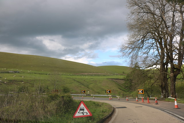
A44 bend near Cornhill Farm
The A44 Road (Llandegley) In my honest opinion, this is one of the greatest views you would get from the A44 road in Wales. The hill in the distance is Fron Goch.
The A44 Road (Llandegley)
In my honest opinion, this is one of the greatest views you would get from the A44 road in Wales. The hill in the distance is Fron Goch.
Old Milestone by the A44, Corn Hill, New Radnor parish Stone post by the A44, in parish of New Radnor (Powys District), in grass verge opposite Corn Hill by field gate, Corn Hill Milestone.

Inscription reads:-
PENYBONT
3 MILES
PRESTEIGN
14½  
Carved bench mark mid face.

Grade II listed by Cadw.
Reference Number: 9236 <span class="nowrap"><a title="https://cadwpublic-api.azurewebsites.net/reports/listedbuilding/FullReport?lang=&id=9236" rel="nofollow ugc noopener" href="https://cadwpublic-api.azurewebsites.net/reports/listedbuilding/FullReport?lang=&id=9236">Link</a><img style="margin-left:2px;" alt="External link" title="External link - shift click to open in new window" src="https://s1.geograph.org.uk/img/external.png" width="10" height="10"/></span>

Surveyed

Milestone Society National ID: RAD_PBPR03
Old Milestone by the A44, Corn Hill, New Radnor parish
Stone post by the A44, in parish of New Radnor (Powys District), in grass verge opposite Corn Hill by field gate, Corn Hill Milestone. Inscription reads:- PENYBONT 3 MILES PRESTEIGN 14½ Carved bench mark mid face. Grade II listed by Cadw. Reference Number: 9236 LinkExternal link Surveyed Milestone Society National ID: RAD_PBPR03
Fron Goch from the A44, Fronddyrys
Fron Goch from the A44
Llanwenny Farm
Llanwenny Farm
The A44 heading for New Radnor Nearing the end of a stretch with many sharp bends.
The A44 heading for New Radnor
Nearing the end of a stretch with many sharp bends.
Llynheilyn Llynheilyn lake near Fforest Inn off the A44
Llynheilyn
Llynheilyn lake near Fforest Inn off the A44
Ford by the lake Till I looked at the map I never realised that this was a ford at Llynheilyn
Ford by the lake
Till I looked at the map I never realised that this was a ford at Llynheilyn
Snow Bridge I think the recent snow formed a snow bridge over the stream that runs off from Llynheilyn
Snow Bridge
I think the recent snow formed a snow bridge over the stream that runs off from Llynheilyn
Water from Llynheilyn The water running off from Llynheilyn lake
Water from Llynheilyn
The water running off from Llynheilyn lake
Water on the track The water running off from Llynheilyn lake across the ford
Water on the track
The water running off from Llynheilyn lake across the ford
Snow on Llyn-Heilyn The snow still left on the side of Llyn-Heilyn
Snow on Llyn-Heilyn
The snow still left on the side of Llyn-Heilyn
A44 bend near Fronddyrys
A44 north of The Van
A44 near Caebanol
A44 near Caebanol
Old Milestone by the A481, near Pool Farm, New Radnor parish Stone post by the A481, in parish of New Radnor (Powys District), near Pool Farm, 25m West of Foice Farm road on embankment behind ditch, in front of telegraph pole.

Inscription reads:-
BUILTH
10
MILES
KINGTON
10
MILES

Grade II listed by Cadw.
Reference Number: 9269 <span class="nowrap"><a title="https://cadwpublic-api.azurewebsites.net/reports/listedbuilding/FullReport?lang=&id=9269" rel="nofollow ugc noopener" href="https://cadwpublic-api.azurewebsites.net/reports/listedbuilding/FullReport?lang=&id=9269">Link</a><img style="margin-left:2px;" alt="External link" title="External link - shift click to open in new window" src="https://s1.geograph.org.uk/img/external.png" width="10" height="10"/></span>

Surveyed

Milestone Society National ID: RAD_BUKT10
Old Milestone by the A481, near Pool Farm, New Radnor parish
Stone post by the A481, in parish of New Radnor (Powys District), near Pool Farm, 25m West of Foice Farm road on embankment behind ditch, in front of telegraph pole. Inscription reads:- BUILTH 10 MILES KINGTON 10 MILES Grade II listed by Cadw. Reference Number: 9269 LinkExternal link Surveyed Milestone Society National ID: RAD_BUKT10
Show me another place!

Castell Crugerydd is located at Grid Ref: SO1559 (Lat: 52.227, Lng: -3.237)

Unitary Authority: Powys

Police Authority: Dyfed Powys

What 3 Words

///glades.agent.specifies. Near Penybont, Powys

Related Wikis

Crug Eryr Castle

Crug Eryr Castle (Castell Crug Eryr) was a motte and bailey-style castle located atop a hill adjacent to the A44 about 2 miles northwest of Llanfihangel...

Radnorshire

Until 1974, Radnorshire (Welsh: Sir Faesyfed) was an administrative county in mid Wales, later classed as one of the thirteen historic counties of Wales...

Llanfihangel Nant Melan

Llanfihangel Nant Melan is a small village in Powys, Wales, in the ancient county of Radnorshire. It is around 7 miles (11 km) from the English border...

Llandegley

Llandegley (Welsh: Llandeglau), is a village near Llandrindod Wells, in the community of Penybont, in Powys, mid Wales, United Kingdom. It is the supposed...

Nearby Amenities

Located within 500m of 52.227,-3.237
Place: farm
Lat/Long: 52.2300468/-3.2405549
Parking
Lat/Long: 52.2292154/-3.2377911
Power: pole
Lat/Long: 52.2284697/-3.2436866
Power: pole
Lat/Long: 52.2278947/-3.2425815
Power: pole
Lat/Long: 52.2272589/-3.2413557
Power: pole
Lat/Long: 52.2262583/-3.2393709
Power: pole
Lat/Long: 52.2256455/-3.2381773
Power: pole
Lat/Long: 52.2252068/-3.2373217
Power: pole
Lat/Long: 52.2248207/-3.2364392
Power: pole
Lat/Long: 52.2243902/-3.2353985
Power: pole
Lat/Long: 52.2240156/-3.2344946
The data included in this document is from www.openstreetmap.org. The data is made available under ODbL.

Have you been to Castell Crugerydd?

Leave your review of Castell Crugerydd below (or comments, questions and feedback).