Castell Bach

Heritage Site in Cardiganshire

Wales

Castell Bach

Lookout Shelter Cardigan Bay Lookout Shelter.
Inside the shelter are identification boards for local wildlife as well as a panorama identifying places on the coast.
Lookout Shelter Credit: Cered

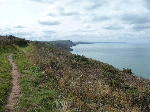
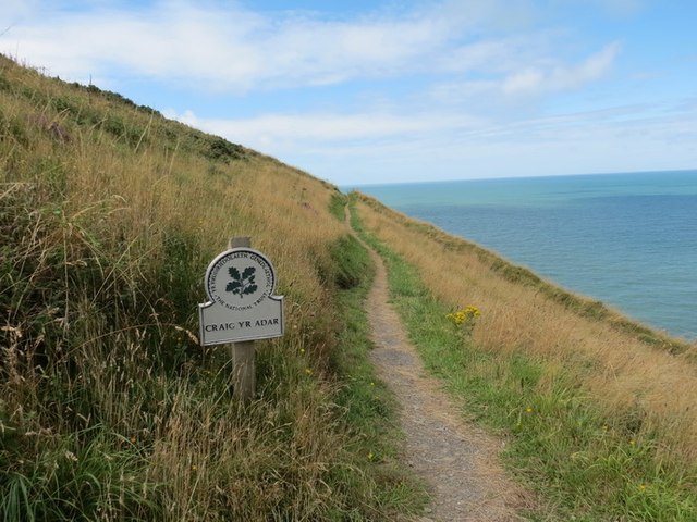
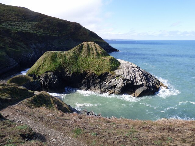
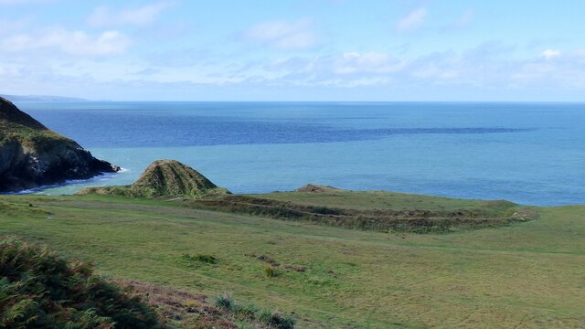
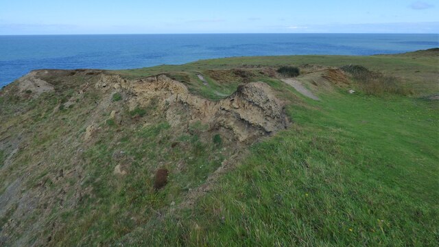
Castell Bach is a historical site located in Cardiganshire, Wales. It is a small-scale Iron Age hillfort dating back to the 1st century BC. The site is situated on a promontory overlooking the Teifi estuary, providing strategic control over the surrounding landscape.

The hillfort consists of a circular enclosure with a diameter of approximately 50 meters. The outer defensive walls, constructed with dry-stone techniques, reach a height of about 3 meters in some places. The walls enclose an area of around 0.15 hectares, containing several roundhouses that would have served as living quarters for the inhabitants.

Excavations at Castell Bach have revealed evidence of occupation during the Iron Age and Roman periods. The site is believed to have been inhabited by the Demetae, a Celtic tribe native to the area. Artifacts such as pottery, metalwork, and animal bones have been discovered, shedding light on the daily lives and activities of the ancient inhabitants.

Castell Bach is a significant heritage site due to its well-preserved defensive structures and the insights it provides into Iron Age settlement patterns and cultural practices. It offers visitors a glimpse into the past, allowing them to visualize the layout and construction techniques of an ancient hillfort. The site's location also offers panoramic views of the surrounding countryside, enhancing the visitor experience.

Managed by Cadw, the Welsh government's historic environment service, Castell Bach is open to the public and provides interpretation panels to give visitors a deeper understanding of its historical significance.

If you have any feedback on the listing, please let us know in the comments section below.
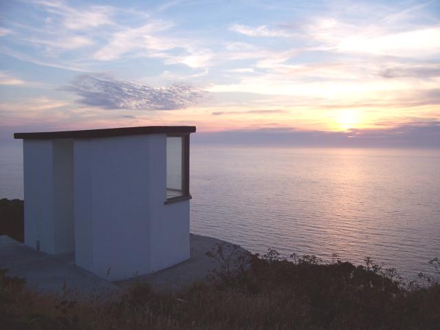
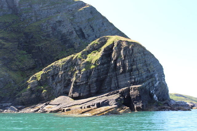
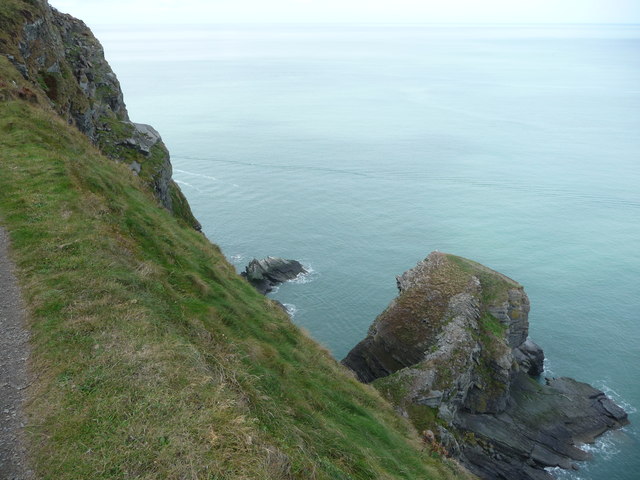
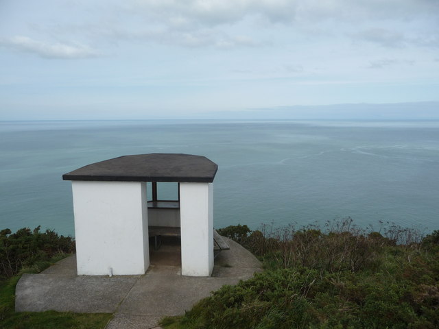
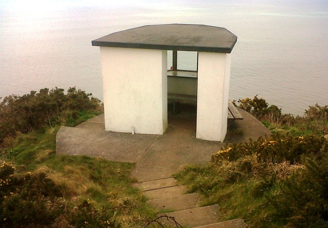
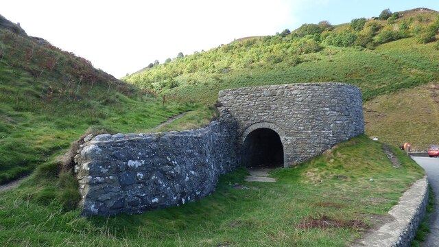
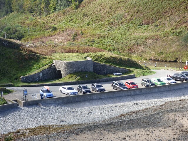
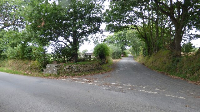
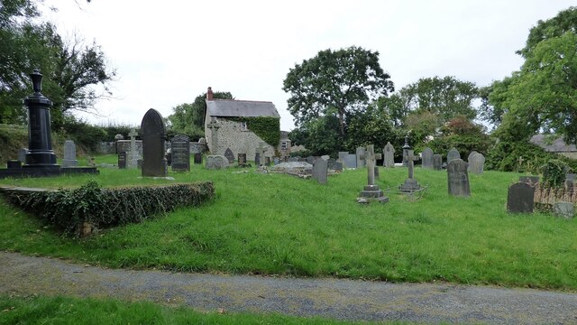
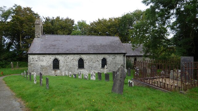
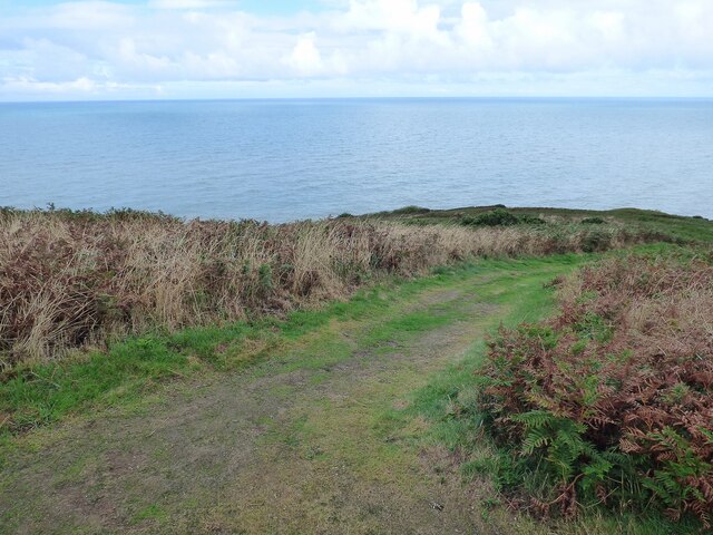
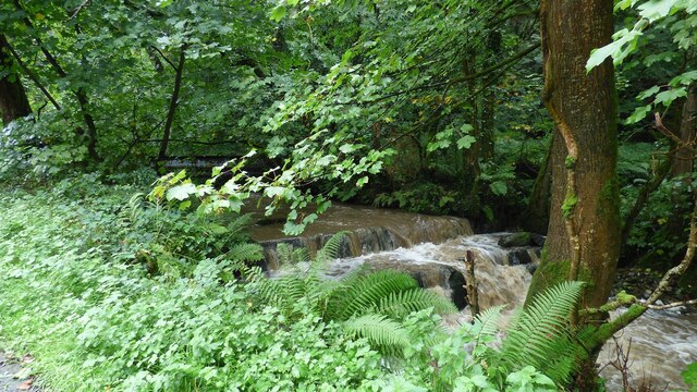
Castell Bach Images

Images are sourced within 2km of 52.2/-4.392 or Grid Reference SN3658. Thanks to Geograph Open Source API. All images are credited.

Lookout Shelter Cardigan Bay Lookout Shelter.
Inside the shelter are identification boards for local wildlife as well as a panorama identifying places on the coast.
Lookout Shelter
Cardigan Bay Lookout Shelter. Inside the shelter are identification boards for local wildlife as well as a panorama identifying places on the coast.
Birds Rock from the sea
Carreg Draenog from the Ceredigion Coast Path The drop here is precipitous - don't go too close to the...edgeeeeeee...!
Carreg Draenog from the Ceredigion Coast Path
The drop here is precipitous - don't go too close to the...edgeeeeeee...!
Lookout building above the Ceredigion coast Ideal for birdwatching, ocean watching in the hope of spotting harbour porpoise or bottle nosed dolphins, or for watching boats pass, or for maybe eating and taking a rest or brew on during a coastal walk.
Lookout building above the Ceredigion coast
Ideal for birdwatching, ocean watching in the hope of spotting harbour porpoise or bottle nosed dolphins, or for watching boats pass, or for maybe eating and taking a rest or brew on during a coastal walk.
Part of the Ceredigion Coast Path between New Quay and Llangrannog One of the best sections of the coast path is laid out ahead, with Ynys Lochtyn stretching out into the bay and still more distant views disappearing off beyond that.
Part of the Ceredigion Coast Path between New Quay and Llangrannog
One of the best sections of the coast path is laid out ahead, with Ynys Lochtyn stretching out into the bay and still more distant views disappearing off beyond that.
Lookout Building
Lookout Building
Craig yr Adar Llwybr yr arfordir yn agosau at diriogaeth o eiddo'r Ymddiriedolaeth Genedlaethol a elwir Craig yr Adar.

Coastal path approaching National Trust owned land called Craig yr Adar (trans. birds rock)
Craig yr Adar
Llwybr yr arfordir yn agosau at diriogaeth o eiddo'r Ymddiriedolaeth Genedlaethol a elwir Craig yr Adar. Coastal path approaching National Trust owned land called Craig yr Adar (trans. birds rock)
Parting of the Ways At this point the Ceredigion Coast Path offers an alternative route for those who are not good on steep slopes.  The route ahead offers spectacular sea views and a walk along a very steep cliff side slope.
Parting of the Ways
At this point the Ceredigion Coast Path offers an alternative route for those who are not good on steep slopes. The route ahead offers spectacular sea views and a walk along a very steep cliff side slope.
Lime Kiln at Cwmtydu
Lime Kiln and Car Park at Cwmtydu
Rocky Island at Castell Bach
Milk Churn Stand at Penllwyn
Original Churchyard Boundary The churchyard at St. Tysilio was originally circular.  The western part of the circuit now survives as an earthwork.
Original Churchyard Boundary
The churchyard at St. Tysilio was originally circular. The western part of the circuit now survives as an earthwork.
St. Tysilio's Church <span class="nowrap"><a title="https://www.dyfedarchaeology.org.uk/wp/discovery/projects/churches/st-tysilio-llandysiliogogo-ceredigion/" rel="nofollow ugc noopener" href="https://www.dyfedarchaeology.org.uk/wp/discovery/projects/churches/st-tysilio-llandysiliogogo-ceredigion/">Link</a><img style="margin-left:2px;" alt="External link" title="External link - shift click to open in new window" src="https://s1.geograph.org.uk/img/external.png" width="10" height="10"/></span>
St. Tysilio's Church
Castell Bach Promontory Fort <span class="nowrap"><a title="https://www.megalithic.co.uk/article.php?sid=18844" rel="nofollow ugc noopener" href="https://www.megalithic.co.uk/article.php?sid=18844">Link</a><img style="margin-left:2px;" alt="External link" title="External link - shift click to open in new window" src="https://s1.geograph.org.uk/img/external.png" width="10" height="10"/></span>
Castell Bach Promontory Fort
Exposed ramparts at Castell Bach Promontory Fort Coastal erosion has provided a section through the ramparts. The dark layer represents the original land surfaces <span class="nowrap"><a title="https://www.megalithic.co.uk/article.php?sid=18844" rel="nofollow ugc noopener" href="https://www.megalithic.co.uk/article.php?sid=18844">Link</a><img style="margin-left:2px;" alt="External link" title="External link - shift click to open in new window" src="https://s1.geograph.org.uk/img/external.png" width="10" height="10"/></span>
Exposed ramparts at Castell Bach Promontory Fort
Coastal erosion has provided a section through the ramparts. The dark layer represents the original land surfaces LinkExternal link
Ceredigion Coast Path There is only a very short length of the path within this square.
Ceredigion Coast Path
There is only a very short length of the path within this square.
Polluted Afon Soden Following heavy rain the river resembled and smelt like a sewer.
Polluted Afon Soden
Following heavy rain the river resembled and smelt like a sewer.
Show me another place!

Castell Bach is located at Grid Ref: SN3658 (Lat: 52.2, Lng: -4.392)

Unitary Authority: Ceredigion

Police Authority: Dyfed Powys

What 3 Words

///condense.cobbled.lemons. Near Llanllwchaiarn, Ceredigion

Nearby Locations

Castell Bach

Related Wikis

Maen-y-groes

Maen-y-groes is a hamlet in the community of Llanllwchaiarn, Ceredigion, Wales, which is 71 miles (114.3 km) from Cardiff and 187 miles (300.9 km) from...

New Quay

New Quay (Welsh: Cei Newydd) is a seaside town and electoral ward in Ceredigion, Wales; it had a resident population of 1,045 at the 2021 census. Located...

Llanllwchaiarn, Ceredigion

Llanllwchaiarn is a community in Ceredigion, Wales, surrounding New Quay and had a population of 848 at the 2011 UK census. The community council uses...

Llanwchaiarn, Ceredigion

Llanwchaiarn is a village in the community of Llanllwchaiarn, in Ceredigion, Wales, near to New Quay. There is also a Llanwchaiarn in Newtown, Powys....

Nearby Amenities

Located within 500m of 52.2,-4.392
Source: PGS
Lat/Long: 52.2044272/-4.3911046
Source: PGS
Lat/Long: 52.2042366/-4.391684
Source: PGS
Lat/Long: 52.203769/-4.392687
Source: PGS
Lat/Long: 52.2035139/-4.392966
Source: PGS
Lat/Long: 52.2030464/-4.3934113
Source: PGS
Lat/Long: 52.2027966/-4.3938941
Source: PGS
Lat/Long: 52.2023823/-4.3942804
Source: PGS
Lat/Long: 52.202083/-4.394512
Source: PGS
Lat/Long: 52.2018892/-4.3948168
Source: PGS
Lat/Long: 52.2001992/-4.3965059
Source: PGS
Lat/Long: 52.1998358/-4.3960832
Source: PGS
Lat/Long: 52.1995646/-4.3963681
Source: PGS
Lat/Long: 52.1994233/-4.3967695
Source: PGS
Lat/Long: 52.1993772/-4.3971343
Source: PGS
Lat/Long: 52.1986778/-4.3973395
Source: PGS
Lat/Long: 52.1982636/-4.3977815
Source: PGS
Lat/Long: 52.1982883/-4.3985618
Source: PGS
Lat/Long: 52.1983269/-4.3988075
The data included in this document is from www.openstreetmap.org. The data is made available under ODbL.

Have you been to Castell Bach?

Leave your review of Castell Bach below (or comments, questions and feedback).