Carneddau and Glyderau

Heritage Site in Caernarfonshire

Wales

Carneddau and Glyderau

The West face of Tryfan from Cwm Idwal
The West face of Tryfan from Cwm Idwal Credit: Eric Jones

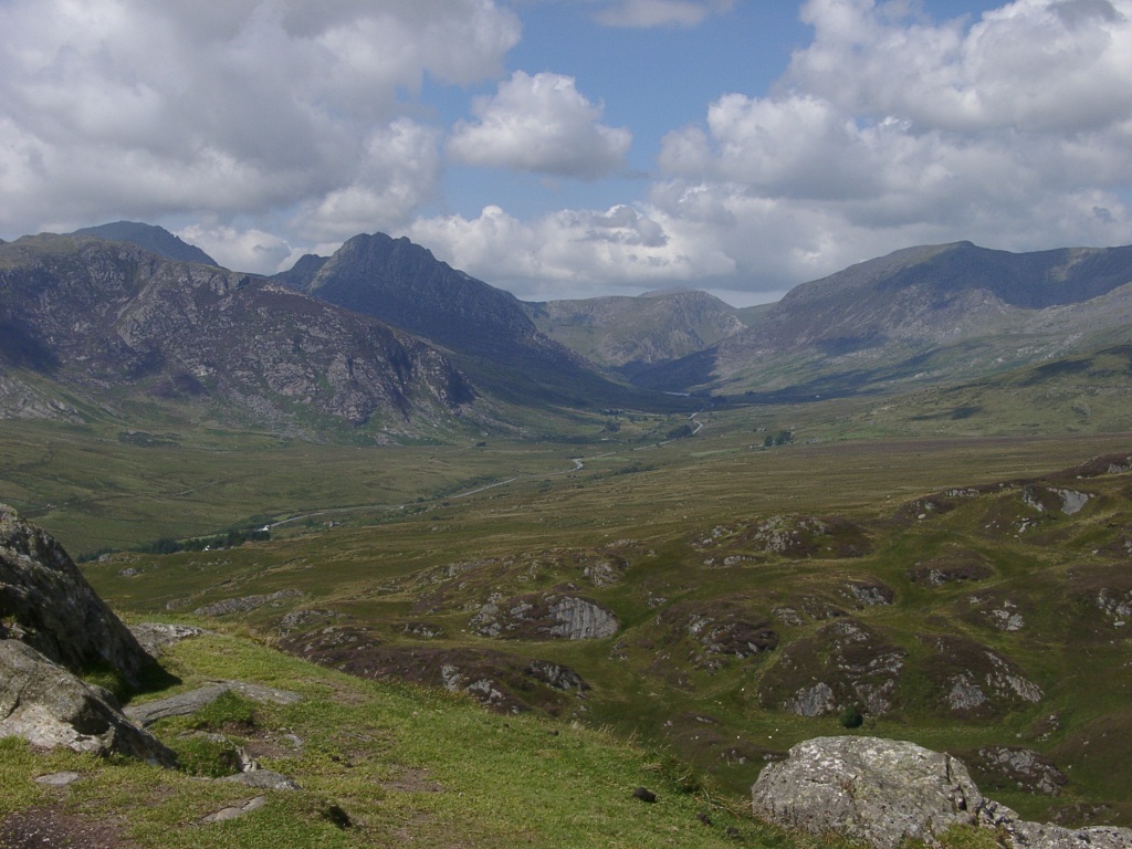
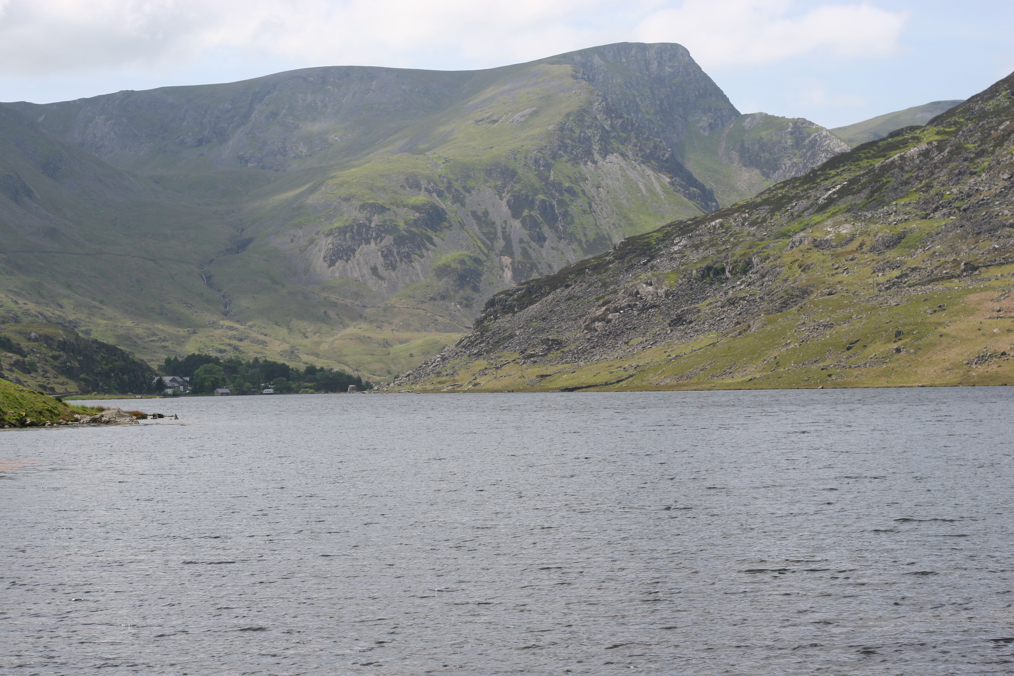
Carneddau and Glyderau, located in Caernarfonshire, Wales, are two mountain ranges that form part of Snowdonia National Park, a designated UNESCO World Heritage Site. These ranges are renowned for their scenic beauty, diverse landscapes, and rich cultural history.

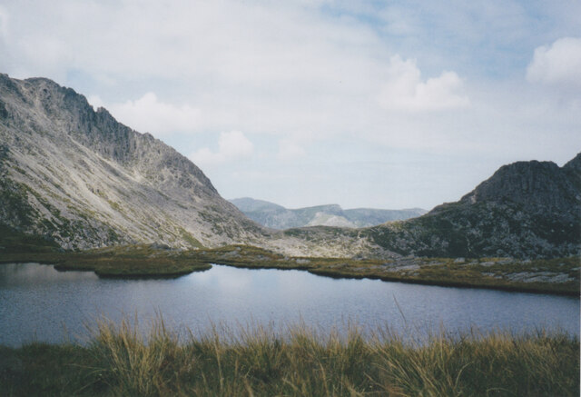
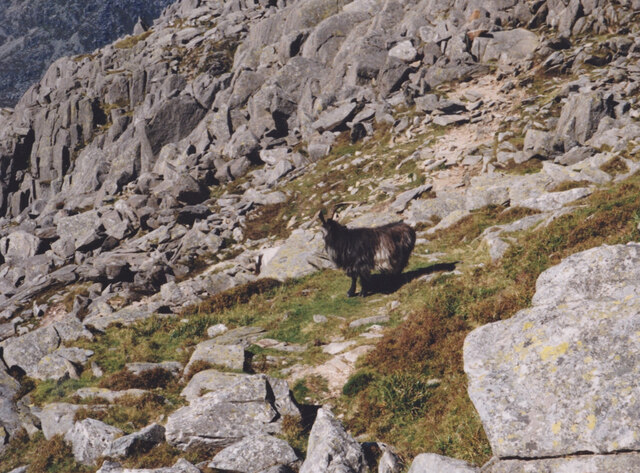
Carneddau, the larger of the two ranges, stretches over an area of approximately 200 square kilometers. It boasts a number of majestic peaks, including Carnedd Llewelyn, Carnedd Dafydd, and Pen yr Ole Wen, with elevations reaching over 1,000 meters. The range is characterized by its rugged terrain, extensive moorland, and winding rivers, providing a haven for various wildlife species, including wild ponies and rare birds.

Glyderau, located to the southwest of Carneddau, covers an area of around 100 square kilometers. This range is famous for its distinct rocky landscape, dominated by the iconic peaks of Glyder Fach and Glyder Fawr. The area is a paradise for rock climbers, with numerous challenging routes and breathtaking views from the summits.

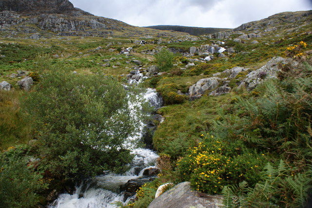
Both Carneddau and Glyderau offer a range of outdoor activities, including hiking, mountaineering, and photography. The landscape is a tapestry of heather-covered moors, sparkling lakes, and steep cliffs, providing endless opportunities for exploration and adventure.

In addition to their natural beauty, these ranges hold significant cultural value. They are home to several ancient burial sites, stone circles, and remnants of old mining operations, reflecting the human presence in the area throughout history. The combination of stunning scenery and historical significance makes Carneddau and Glyderau a must-visit destination for nature enthusiasts and history buffs alike.

If you have any feedback on the listing, please let us know in the comments section below.

Carneddau and Glyderau Images

Images are sourced within 2km of 53.121/-3.989 or Grid Reference SH6660. Thanks to Geograph Open Source API. All images are credited.

The West face of Tryfan from Cwm Idwal
Llyn Caseg Fraith with Bwlch Tryfan in the middle ground Llyn Caseg Fraith, (meaning 'Lake of the Brindled Mare') is a shallow lake on the edge of a precipice. Bwlch Tryfan is the col which separates the semi-detached Tryfan from the rest of the Glyderau.
Llyn Caseg Fraith with Bwlch Tryfan in the middle ground
Llyn Caseg Fraith, (meaning 'Lake of the Brindled Mare') is a shallow lake on the edge of a precipice. Bwlch Tryfan is the col which separates the semi-detached Tryfan from the rest of the Glyderau.
Path on the North West face of Tryfan
Preparing to jump between Adam and Eve on the summit of Y Tryfan Adam and Eve are two exposed boulders on the summit of Tryfan surrounded by steep precipices on all sides. A visit to the summit is not complete without a leap between the two boulders.
Preparing to jump between Adam and Eve on the summit of Y Tryfan
Adam and Eve are two exposed boulders on the summit of Tryfan surrounded by steep precipices on all sides. A visit to the summit is not complete without a leap between the two boulders.
Feral goat high on Tryfan's rocky slopes
The Eastern flank of Tryfan from the Miners'Path
The NE slopes of Glyder Fach from the shores of Llyn Caseg Fraith
Grib Bigod/Bristly Ridge on the Glyder Fach The image was taken from Llyn Caseg Fraith.
Grib Bigod/Bristly Ridge on the Glyder Fach
The image was taken from Llyn Caseg Fraith.
Tryfan from Llyn Caseg Fraith The smaller peak, nearest the camera is Tryfan's Far South Peak.
Tryfan from Llyn Caseg Fraith
The smaller peak, nearest the camera is Tryfan's Far South Peak.
Tryfan from the col between Glyder Fach and Foel Goch
Tryfan viewed across Cwm Bochlwyd
Tryfan reflected in the waters of Llyn Caseg Fraith Llyn Caseg Fraith is situated on the edge of a precipice over looking Cwm Tryfan.
Tryfan reflected in the waters of Llyn Caseg Fraith
Llyn Caseg Fraith is situated on the edge of a precipice over looking Cwm Tryfan.
Llyn Caseg Fraith with Y Glyderau in the background
Nant yr Ogof between Gallt yr Ogof and Tryfan Bach Directly ahead, across the Llugwy Valley, is the Dwr Cymru (Welsh Water) road leading to the Llyn Llugwy Reservoir high in the Carneddau. Nant yr Ogof means 'valley of the cave'.
Nant yr Ogof between Gallt yr Ogof and Tryfan Bach
Directly ahead, across the Llugwy Valley, is the Dwr Cymru (Welsh Water) road leading to the Llyn Llugwy Reservoir high in the Carneddau. Nant yr Ogof means 'valley of the cave'.
Bwlch Tryfan Looking down on the pass between Tryfan and Glyder Fach at near the start of a hair raising climb up Bristly Ridge. The col between the two mountains marks the point where the 'tourist route' to the summit of Tryfan branches off, the path to the summit being clear in this photo. When a considerably younger man, this contributor decided that Tryfan's north ridge was by far the best way up.
Bwlch Tryfan
Looking down on the pass between Tryfan and Glyder Fach at near the start of a hair raising climb up Bristly Ridge. The col between the two mountains marks the point where the 'tourist route' to the summit of Tryfan branches off, the path to the summit being clear in this photo. When a considerably younger man, this contributor decided that Tryfan's north ridge was by far the best way up.
Mountain path above Llyn Bochlwyd Looking back down the path to this small lake from the path that ascends to Bwlch Tryfan.
Mountain path above Llyn Bochlwyd
Looking back down the path to this small lake from the path that ascends to Bwlch Tryfan.
Path towards Tryfan
Path towards Tryfan
Summit to Tryfan
Summit to Tryfan
Show me another place!

Carneddau and Glyderau is located at Grid Ref: SH6660 (Lat: 53.121, Lng: -3.989)

What 3 Words

///stands.pixel.basket. Near Bethesda, Gwynedd

Nearby Locations

Carneddau and Glyderau

Related Wikis

Afon Lloer

Afon Lloer is a small river in Snowdonia in north-west Wales. It is the outflow from Ffynnon Lloer, a lake in the Carneddau mountains, and it flows into...

Dyffryn Ogwen

Dyffryn Ogwen, or Ogwen Valley, is a valley mostly located in the Welsh county of Gwynedd. The upper section of the valley, east of Llyn Ogwen, lies in...

Llyn Ogwen

Llyn Ogwen (; Welsh: [ˈɬɪn ˈɔɡʊɛn]) is a ribbon lake in north-west Wales. It lies alongside the A5 road between two mountain ranges of Snowdonia, the Carneddau...
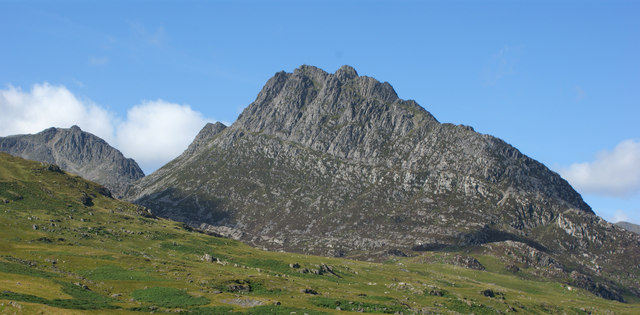
Tryfan

Tryfan (Welsh pronunciation: [ˈtrəvan]) is a mountain in the Ogwen Valley, Snowdonia, Wales. It forms part of the Glyderau group, and is one of the most...

Nearby Amenities

Located within 500m of 53.121,-3.989
Barrier: stile
Lat/Long: 53.1239171/-3.9842088
Tryfan Fach
Alt Name: Little Tryfan
Name Cy: Tryfan Fach
Name En: Tryfan Fach
Place: locality
Lat/Long: 53.1208095/-3.9869158
Creigiau'r Dena
Place: locality
Lat/Long: 53.121412/-3.9952538
Shower
Lat/Long: 53.1240192/-3.9850995
Barrier: stile
Lat/Long: 53.1237392/-3.9848958
Barrier: stile
Lat/Long: 53.1233359/-3.985186
Barrier: stile
Lat/Long: 53.1241672/-3.9904769
Drinking Water
Lat/Long: 53.1240623/-3.9851101
The data included in this document is from www.openstreetmap.org. The data is made available under ODbL.

Have you been to Carneddau and Glyderau?

Leave your review of Carneddau and Glyderau below (or comments, questions and feedback).