Carneddau Hengwm

Heritage Site in Merionethshire

Wales

Carneddau Hengwm

Trawsdir Farm This photograph shows clearly the contrast between the coastal lowlands and the steep hill slopes leading up to the plateau.
Trawsdir Farm Credit: Eric Jones

The requested URL returned error: 429 Too Many Requests

If you have any feedback on the listing, please let us know in the comments section below.

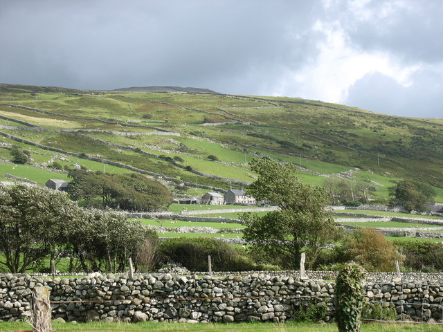
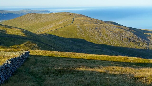
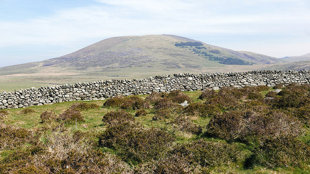
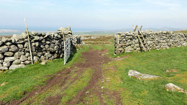
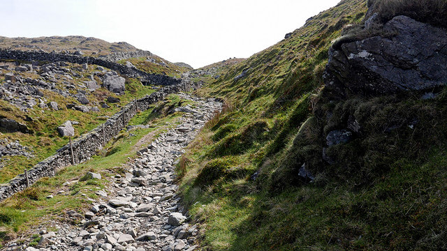
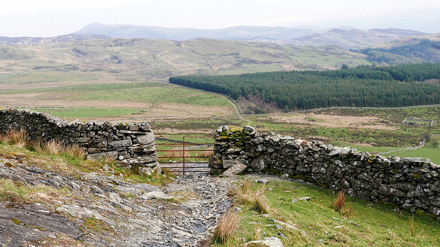
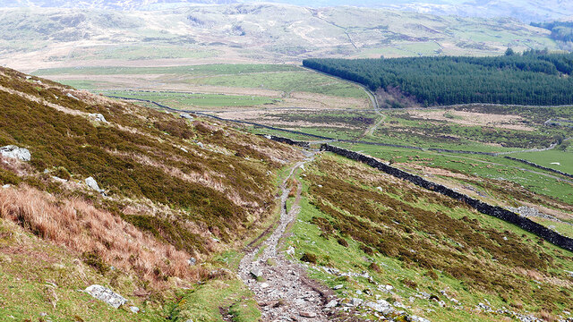
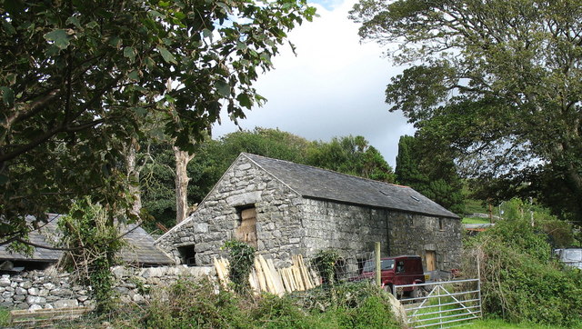
Carneddau Hengwm Images

Images are sourced within 2km of 52.763/-4.053 or Grid Reference SH6120. Thanks to Geograph Open Source API. All images are credited.

Trawsdir Farm This photograph shows clearly the contrast between the coastal lowlands and the steep hill slopes leading up to the plateau.
Trawsdir Farm
This photograph shows clearly the contrast between the coastal lowlands and the steep hill slopes leading up to the plateau.
Summit cairn of Craig y Grut Craig y Grut is a 500m Dewey top on the ridge of the southern Rhinogydd.
The Mawddach estuary is seen beyond.
Summit cairn of Craig y Grut
Craig y Grut is a 500m Dewey top on the ridge of the southern Rhinogydd. The Mawddach estuary is seen beyond.
Approaching Bwlch y Rhiwgyr The ridge path drops to cross Bwlch y Rhiwgyr, an old drovers road, and ascends to the next top seen here in the background - Mynydd Egryn.

Walking north to south, the ridge path has been on the western seaward side of the ridge wall for miles but, if continuing on to Mynydd Egryn, at Bwlch y Rhiwgyr you should switch to the eastern side: there are no stiles or gaps in the cross walls on the western side.
Approaching Bwlch y Rhiwgyr
The ridge path drops to cross Bwlch y Rhiwgyr, an old drovers road, and ascends to the next top seen here in the background - Mynydd Egryn. Walking north to south, the ridge path has been on the western seaward side of the ridge wall for miles but, if continuing on to Mynydd Egryn, at Bwlch y Rhiwgyr you should switch to the eastern side: there are no stiles or gaps in the cross walls on the western side.
Gate on the track from Llyn Irddyn to Afon Ysgethin The Llŷn Peninsula can be seen in the distance.
Gate on the track from Llyn Irddyn to Afon Ysgethin
The Llŷn Peninsula can be seen in the distance.
Looking towards Moelfre Viewing one of the fine dry-stone walls which criss-cross the area, from the path and access land above Pont Fadog.
Looking towards Moelfre
Viewing one of the fine dry-stone walls which criss-cross the area, from the path and access land above Pont Fadog.
Open gate and ladder stile This uplands path passes through several dry-stone walls. The ladder stile is probably redundant as the gate is not locked.
Open gate and ladder stile
This uplands path passes through several dry-stone walls. The ladder stile is probably redundant as the gate is not locked.
Path heading towards Bwlch y Rhiwgyr The path just clips the north-east corner of the square.
Path heading towards Bwlch y Rhiwgyr
The path just clips the north-east corner of the square.
Ascending in Bwlch y Rhiwgyr The summit of the pass reaches about 1500' ASL.
Ascending in Bwlch y Rhiwgyr
The summit of the pass reaches about 1500' ASL.
Gate on the path descending from Bwlch y Rhiwgyr Forestry on Cerrig y Cledd is seen ahead.
Gate on the path descending from Bwlch y Rhiwgyr
Forestry on Cerrig y Cledd is seen ahead.
Dry-stone wall on the lower slopes of Craig y Grut No shortage of construction materials in this area!
Dry-stone wall on the lower slopes of Craig y Grut
No shortage of construction materials in this area!
Descending from Bwlch y Rhiwgyr On the slopes of Craig y Grut.
Descending from Bwlch y Rhiwgyr
On the slopes of Craig y Grut.
Abaty Egryn Abbey Ty Ia, efallai, ar fferm sy'n berchen i'r Ymddiriedolaeth Genedlaethol / Ice House, perhaps, on a farm that belongs to the National Trust.
Abaty Egryn Abbey
Ty Ia, efallai, ar fferm sy'n berchen i'r Ymddiriedolaeth Genedlaethol / Ice House, perhaps, on a farm that belongs to the National Trust.
Ffermdy Hendre-Eirian Farmhouse Hendre Eirian means "Eirian's winter dwelling". Eirian is a personal name, which can be either m. or f. and means "bright/splendid". The architectural style is typical of that of farmhouses in Western Meirionnydd.
Ffermdy Hendre-Eirian Farmhouse
Hendre Eirian means "Eirian's winter dwelling". Eirian is a personal name, which can be either m. or f. and means "bright/splendid". The architectural style is typical of that of farmhouses in Western Meirionnydd.
Traditional farm buildings at Hendre-Eirian
Farm track leading to the mountain from Hendre-Eirian
Shearing sheds at Hendre-Eirian
Egryn Abbey Farm from the hillside. In the 14thC Egryn was granted the right to have masses and other divine offices celebrated in its oratory, the establishment being then the Hospital of St Mary the Virgin which served the local poor and wayfarers. A Papal Letter of 1391 describes the place as being "situate between two arms of the sea called Traeth urtro (Artro) and Abermo (Barmouth)..in which the tide ebbs and flows twice a day as far as the mountains.." At the same time the land was farmed by Gruffudd ap Llywelyn ap Cynwrig a direct descendant of Osbwrn Wyddel (Osborn the Irishman). It is now owned by the National Trust.

<span class="nowrap"><a title="http://yba.llgc.org.uk/en/s-OSBW-WYD-1293.html" rel="nofollow ugc noopener" href="http://yba.llgc.org.uk/en/s-OSBW-WYD-1293.html">Link</a><img style="margin-left:2px;" alt="External link" title="External link - shift click to open in new window" src="https://s1.geograph.org.uk/img/external.png" width="10" height="10"/></span>
Egryn Abbey Farm from the hillside.
In the 14thC Egryn was granted the right to have masses and other divine offices celebrated in its oratory, the establishment being then the Hospital of St Mary the Virgin which served the local poor and wayfarers. A Papal Letter of 1391 describes the place as being "situate between two arms of the sea called Traeth urtro (Artro) and Abermo (Barmouth)..in which the tide ebbs and flows twice a day as far as the mountains.." At the same time the land was farmed by Gruffudd ap Llywelyn ap Cynwrig a direct descendant of Osbwrn Wyddel (Osborn the Irishman). It is now owned by the National Trust. LinkExternal link
Boundary wall on ridge leading to Diffwys Diffwys in far distance.
Boundary wall on ridge leading to Diffwys
Diffwys in far distance.
Show me another place!

Carneddau Hengwm is located at Grid Ref: SH6120 (Lat: 52.763, Lng: -4.053)

What 3 Words

///tonality.feuds.meant. Near Dyffryn Ardudwy, Gwynedd

Nearby Locations

Carneddau Hengwm

Related Wikis

Llanaber railway station

Llanaber railway station serves the village of Llanaber near Barmouth in Gwynedd, Wales. The station is an unstaffed halt on the Cambrian Coast Railway...

St Mary and St Bodfan Church, Llanaber

St Mary's Church or its full name St Mary and St Bodfan Church is a church located in the village of Llanaber in Wales. St Mary and Bodfan is a Grade I...

Llanaber

Llanaber is a linear coastal village in north west Wales, about 0.7 miles (1.1 km) north of Barmouth on the A496 road. The Irish Sea lies directly to the...

Tal-y-bont, Dyffryn Ardudwy

Tal-y-bont (otherwise Talybont) is a village north of the town of Barmouth in north Wales. Tal-y-bont has a railway station on the Cambrian Line and has...

Nearby Amenities

Located within 500m of 52.763,-4.053
Carneddau Hengwm Southern Tumulus
Historic: archaeological_site
Lat/Long: 52.7645757/-4.0568132
Carneddau Hengwm Northern Tumulus
Historic: archaeological_site
Lat/Long: 52.7650513/-4.0565322
Ford: yes
Lat/Long: 52.7592453/-4.0489556
Iron-Age Settlement
Archaeological Site: settlement
Historic: archaeological_site
Historic Civilization: iron-age
Lat/Long: 52.7627343/-4.0522311
Barrier: stile
Bicycle: no
Foot: yes
Material: wood
Stile: ladder
Lat/Long: 52.7605399/-4.0489758
Disused: yes
Hazard: pit
Man Made: mineshaft
Lat/Long: 52.7621904/-4.0480282
Disused: yes
Hazard: pit
Man Made: mineshaft
Lat/Long: 52.7624698/-4.0478353
Iron Age Hut Circle
Archaeological Site: hut_circle
Historic: archaeological_site
Historic Civilization: iron-age
Lat/Long: 52.763463/-4.0543754
Man Made: mineshaft
Lat/Long: 52.7631836/-4.0483312
Man Made: mineshaft
Lat/Long: 52.7632653/-4.0483064
Man Made: mineshaft
Lat/Long: 52.7631091/-4.0482977
Man Made: mineshaft
Lat/Long: 52.7630724/-4.0482984
Man Made: adit
Lat/Long: 52.7609015/-4.0483358
Mynydd Egryn Mine Ropeway Tower
Archaeological Site: mineral_extraction
Historic: archaeological_site
Historic Civilization: modern
Lat/Long: 52.7634936/-4.0580051
Ropeway Terminus
Historic: archaeological_site
Lat/Long: 52.7640594/-4.048747
Man Made: adit
Lat/Long: 52.7623193/-4.0480101
Man Made: adit
Lat/Long: 52.7622815/-4.0480183
Man Made: adit
Lat/Long: 52.762252/-4.0480226
Hut Circles
Archaeological Site: settlement
Historic: archaeological_site
Historic Civilization: iron-age
Lat/Long: 52.7626439/-4.0505687
The data included in this document is from www.openstreetmap.org. The data is made available under ODbL.

Have you been to Carneddau Hengwm?

Leave your review of Carneddau Hengwm below (or comments, questions and feedback).