Carn Fadrun

Heritage Site in Caernarfonshire

Wales

Carn Fadrun

Post Box at Rhos-ddu LL53 104. Royal Mail list this box as 'Rhosddu'.
Post Box at Rhos-ddu Credit: David Bremner

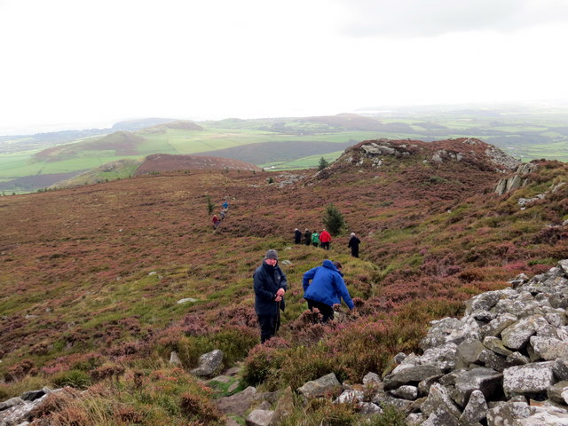
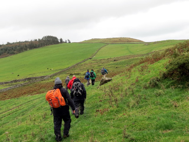
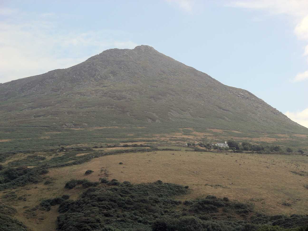
Carn Fadrun is a prominent hill located in Caernarfonshire, North Wales, and is renowned for its historical and cultural significance. Standing at an impressive height of 206 meters (676 feet), the hill offers breathtaking panoramic views of the surrounding countryside and the Irish Sea.

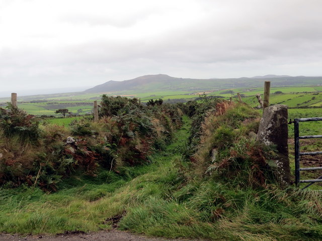
This ancient site holds great historical importance, dating back to the Iron Age. Archaeological excavations have revealed evidence of a hillfort on the summit, believed to have been constructed around 600 BC. The hillfort's strategic location allowed its inhabitants to have a commanding view of the landscape, making it an ideal defensive position.

Visitors to Carn Fadrun can explore the remains of the hillfort, including the remnants of defensive ditches and ramparts. These structures provide a glimpse into the lives of the people who once inhabited the fort, offering insights into their daily activities and social organization.

Aside from its historical significance, Carn Fadrun is also known for its rich biodiversity. The hill is home to a variety of plant and animal species, including rare orchids, heather, and numerous bird species. Nature enthusiasts can enjoy walks and hikes through the surrounding countryside, immersing themselves in the beauty of the Welsh landscape.

Carn Fadrun's cultural and historical significance, combined with its stunning natural beauty, make it a popular destination for tourists and locals alike. Whether one is interested in history, nature, or simply enjoying the breathtaking views, Carn Fadrun offers a unique and enriching experience.

If you have any feedback on the listing, please let us know in the comments section below.
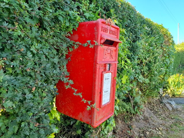
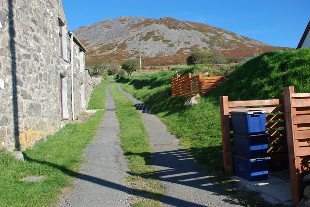
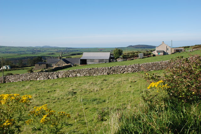
Carn Fadrun Images

Images are sourced within 2km of 52.888/-4.563 or Grid Reference SH2735. Thanks to Geograph Open Source API. All images are credited.

Post Box at Rhos-ddu LL53 104. Royal Mail list this box as 'Rhosddu'.
Post Box at Rhos-ddu
LL53 104. Royal Mail list this box as 'Rhosddu'.
On Carn Fadryn - view towards Yr Eifl
On Carn Fadryn - view to Mynydd Rhiw
Llwybr i Garn Fadryn - Path to Carn Fadryn
Garnfadryn Looking from the village towards Rhiw and the sea
Garnfadryn
Looking from the village towards Rhiw and the sea
Garnfadryn
Garnfadryn
Capel Garnfadryn Planning has been granted for conversion to a house and art studio, but the work appears to have come to a halt.
Capel Garnfadryn
Planning has been granted for conversion to a house and art studio, but the work appears to have come to a halt.
Mynwent Llaniestyn Llaniestyn churchyard Looking across the churchyard of St Iestyn's towards the former school.
Mynwent Llaniestyn Llaniestyn churchyard
Looking across the churchyard of St Iestyn's towards the former school.
Hen ysgol Llaniestyn - Former Llaniestyn school Now the village community centre
Hen ysgol Llaniestyn - Former Llaniestyn school
Now the village community centre
Plac ar Ganolfan Llaniestyn - Plaque on the Llaniestyn Community Centre Taken from the Llaniestyn National School which was founded in 1843
Plac ar Ganolfan Llaniestyn - Plaque on the Llaniestyn Community Centre
Taken from the Llaniestyn National School which was founded in 1843
Ordnance Survey Cut Mark This OS cut mark can be found at the road junction on the NE facing wall. It marks a point 156.101m above mean sea level.
Ordnance Survey Cut Mark
This OS cut mark can be found at the road junction on the NE facing wall. It marks a point 156.101m above mean sea level.
Llwybr Garnfadryn / Path to Garnfadryn Llwybr yn arwain i lawr y waered at bentre Carnfadryn a enwyd ar ol bryn gerllaw. 

A path descending towards Carnfadryn village [trans. Madrun's cairn], named after a nearby hill.
Llwybr Garnfadryn / Path to Garnfadryn
Llwybr yn arwain i lawr y waered at bentre Carnfadryn a enwyd ar ol bryn gerllaw. A path descending towards Carnfadryn village [trans. Madrun's cairn], named after a nearby hill.
Llwybr Ceffyl Garnfadryn / Garnfadryn Bridleway Hen heol sy bellach yn llwybr ceffyl ger pentre Garnfadryn.

An old road now downgraded to a bridleway near Garnfadryn (trans. Madrun's cairn)
Llwybr Ceffyl Garnfadryn / Garnfadryn Bridleway
Hen heol sy bellach yn llwybr ceffyl ger pentre Garnfadryn. An old road now downgraded to a bridleway near Garnfadryn (trans. Madrun's cairn)
Bryngaer Carn Fadrun / Caer Fadrun Hillfort Cerddwr o fewn Bryngaer Carn Fadrun, amddiffynfa sy'n dyddio o'r Oes Haearn.

Walkers within Carn Fadrun hillfort (trans. Madrun's cairn), an Iron Age fortification.
Bryngaer Carn Fadrun / Caer Fadrun Hillfort
Cerddwr o fewn Bryngaer Carn Fadrun, amddiffynfa sy'n dyddio o'r Oes Haearn. Walkers within Carn Fadrun hillfort (trans. Madrun's cairn), an Iron Age fortification.
Sticil / Stile Cerddwr yn dringo sticil ger Ffarm Caeau Gwynion.

Walkers climbing a stile near Caeau Gwynion (trans. white / fair fields)
Sticil / Stile
Cerddwr yn dringo sticil ger Ffarm Caeau Gwynion. Walkers climbing a stile near Caeau Gwynion (trans. white / fair fields)
Tuag at Foel Caerau / Towards Moel Caerau Cerddwyr yn mynd I gyfeiriad Moel Caearau, y bryn yn y pellter.

Walkers heading towards Moel Caearau (trans. bare hilltop of the forts), the hill in the distance.
Tuag at Foel Caerau / Towards Moel Caerau
Cerddwyr yn mynd I gyfeiriad Moel Caearau, y bryn yn y pellter. Walkers heading towards Moel Caearau (trans. bare hilltop of the forts), the hill in the distance.
Llwybr Caerau Uchaf / Upper Caerau Path Cerddwyr yn dilyn llwybr cyhoeddus tuag at Ffarm Caerau Uchaf.

Walkers following a public footpath towards Caerau Uchaf Farm (trans. upper forts).
Llwybr Caerau Uchaf / Upper Caerau Path
Cerddwyr yn dilyn llwybr cyhoeddus tuag at Ffarm Caerau Uchaf. Walkers following a public footpath towards Caerau Uchaf Farm (trans. upper forts).
Tuag at Garn Bach / Towards Garn Bach Cerddwyr yn dilyn llwybr cyhoeddus tuag at Garn Bach, y bryncyn yn y pellter.

Walkers following a public footpath towards Garn Fach (trans. little rock), the hillock in the distance.
Tuag at Garn Bach / Towards Garn Bach
Cerddwyr yn dilyn llwybr cyhoeddus tuag at Garn Bach, y bryncyn yn y pellter. Walkers following a public footpath towards Garn Fach (trans. little rock), the hillock in the distance.
Show me another place!

Carn Fadrun is located at Grid Ref: SH2735 (Lat: 52.888, Lng: -4.563)

Unitary Authority: Gwynedd

Police Authority: North Wales

What 3 Words

///theme.branched.tricycle. Near Nefyn, Gwynedd

Nearby Locations

Carn Fadrun Carn Fadryn

Related Wikis

Carn Fadryn

Carn Fadryn, sometimes Carn Fadrun or Garn Fadryn, is a five-hectare Iron Age hillfort and is the name of the mountain on which the fort is situated. It...

Llaniestyn, Gwynedd

Llaniestyn is a village and former civil parish in the Welsh county of Gwynedd. The parish was abolished in 1934, and divided between Tudweiliog and Botwnnog...

Cors Geirch National Nature Reserve

Cors Geirch National Nature Reserve is an extensive wetland site on the Llŷn Peninsula, in the central part of the valley that runs between Nefyn and Pwllheli...

Llandudwen

Llandudwen is a former civil parish in the Welsh county of Gwynedd. It was abolished in 1934, and divided between Buan and Tudweiliog. == References ==

Nearby Amenities

Located within 500m of 52.888,-4.563
Garn Fadryn
Ele: 371
Name Cy: Carn Fadryn
Natural: peak
Source: NPE
Wikidata: Q5043758
Lat/Long: 52.8866022/-4.5599457
Carn Fadryn
Description: OS trig pillar
Ele: 371.551
Man Made: survey_point
Ref: S8325
Source: Ordnance Survey and Trigpointing.uk
Survey Point: pillar
Tpuk Ref: TP1951
Lat/Long: 52.886468/-4.559863
Power: pole
Source: bing
Lat/Long: 52.8913168/-4.565569
Power: pole
Source: bing
Lat/Long: 52.891015/-4.566481
Power: pole
Source: bing
Lat/Long: 52.890731/-4.5669235
Power: pole
Source: bing
Lat/Long: 52.8902585/-4.5677644
Power: pole
Source: bing
Lat/Long: 52.8896977/-4.5680413
Power: pole
Source: bing
Lat/Long: 52.8889428/-4.5683746
Power: pole
Source: bing
Lat/Long: 52.8882137/-4.5687421
Power: pole
Source: bing
Lat/Long: 52.8874895/-4.5691028
Power: pole
Source: bing
Lat/Long: 52.8868599/-4.569426
Power: pole
Source: bing
Lat/Long: 52.8863056/-4.5696755
The data included in this document is from www.openstreetmap.org. The data is made available under ODbL.

Have you been to Carn Fadrun ?

Leave your review of Carn Fadrun below (or comments, questions and feedback).