Carn Fadryn

Hill, Mountain in Caernarfonshire

Wales

Carn Fadryn

Post Box at Rhos-ddu LL53 104. Royal Mail list this box as 'Rhosddu'.
Post Box at Rhos-ddu Credit: David Bremner

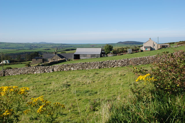
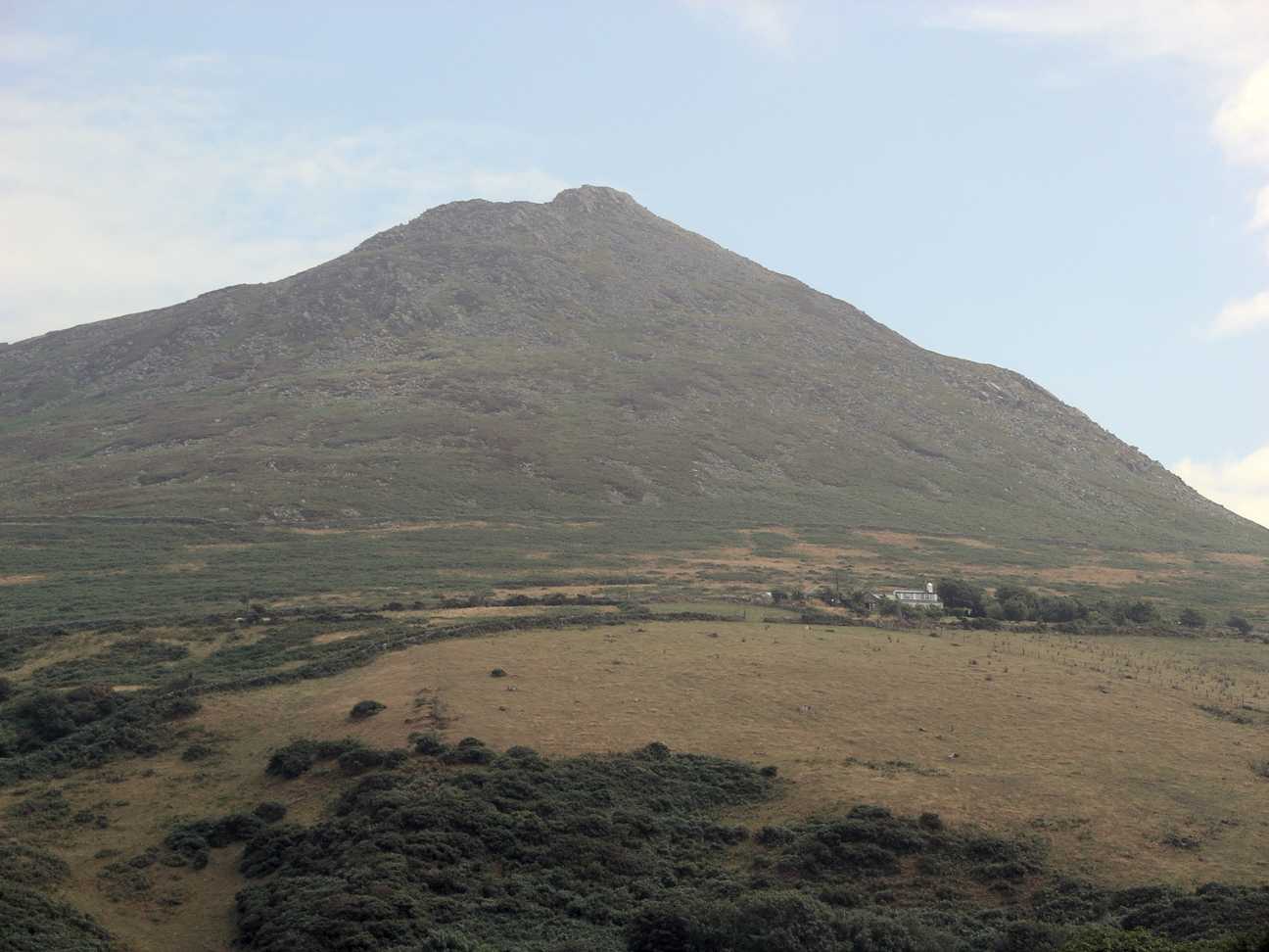
Carn Fadryn is a notable hill located in the historic county of Caernarfonshire, Wales. Rising to an elevation of 371 meters (1,217 feet), it offers captivating panoramic views of the surrounding countryside and coastline. Situated near the town of Pwllheli, Carn Fadryn is a prominent landmark in the region and is easily recognizable due to its distinctive conical shape.

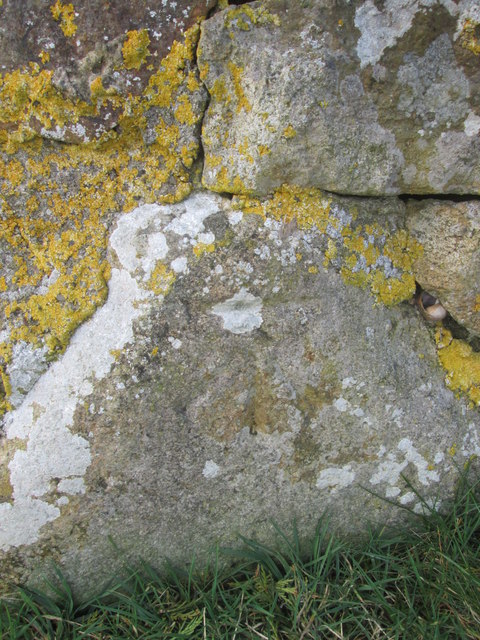
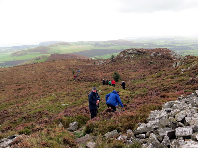
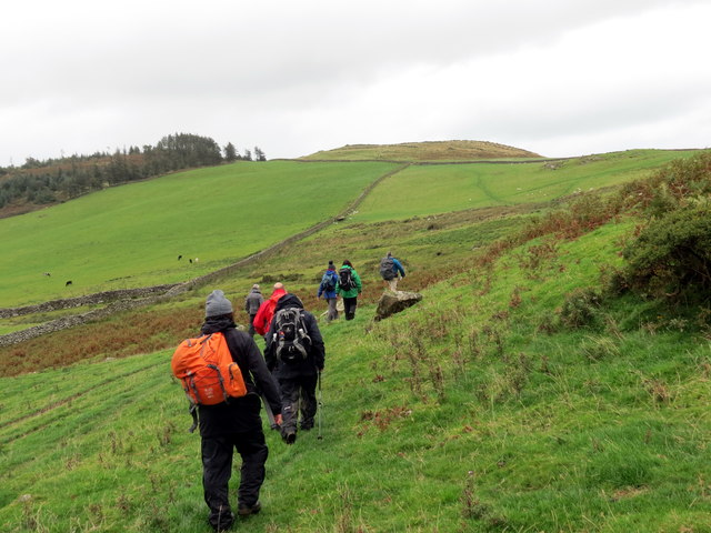
The hill is composed mainly of granite and is known for its rugged and rocky terrain. It is a popular destination for hikers and nature enthusiasts, who are drawn to its scenic beauty and rich biodiversity. Carn Fadryn is home to a variety of flora and fauna, including heather, gorse, and several species of birds.

At the summit of Carn Fadryn, visitors are rewarded with breathtaking vistas that stretch across the Llŷn Peninsula, Cardigan Bay, and Snowdonia National Park. On clear days, it is even possible to catch a glimpse of the Irish Sea and the distant peaks of Ireland.

The hill has cultural significance as well, with evidence of human settlement dating back to the Iron Age. Ruins of an ancient hillfort can still be seen at the summit, offering a glimpse into the area's historical past.

Carn Fadryn is a cherished natural landmark in Caernarfonshire, attracting visitors from near and far who seek to immerse themselves in the beauty and tranquility of the Welsh countryside.

If you have any feedback on the listing, please let us know in the comments section below.
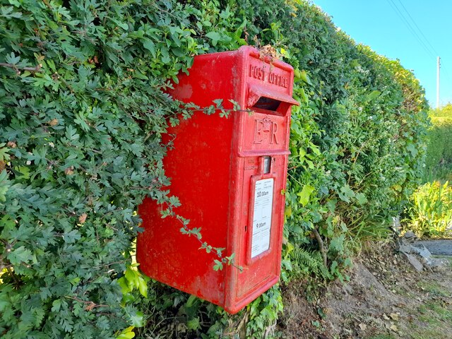
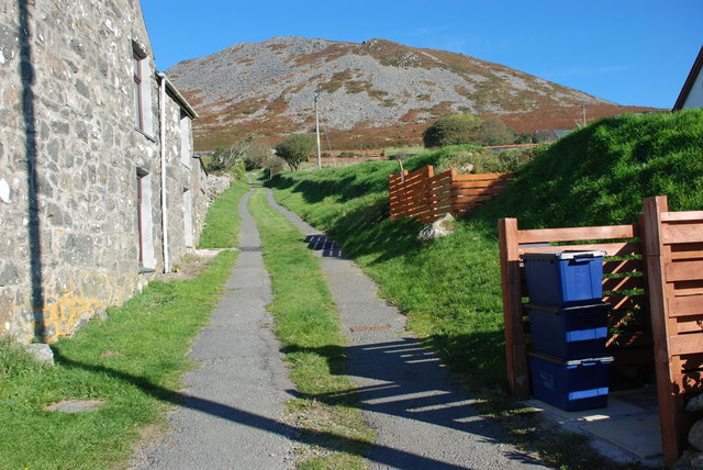
Carn Fadryn Images

Images are sourced within 2km of 52.886468/-4.5598629 or Grid Reference SH2735. Thanks to Geograph Open Source API. All images are credited.
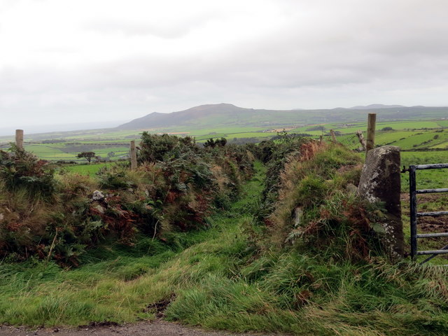
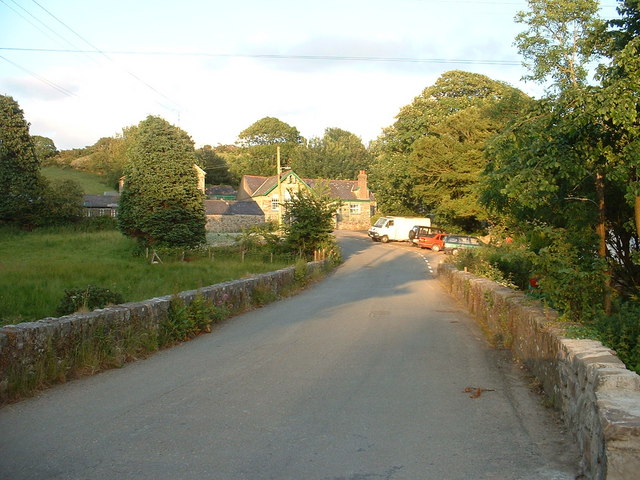
Post Box at Rhos-ddu LL53 104. Royal Mail list this box as 'Rhosddu'.
Post Box at Rhos-ddu
LL53 104. Royal Mail list this box as 'Rhosddu'.
On Carn Fadryn - view towards Yr Eifl
On Carn Fadryn - view to Mynydd Rhiw
Llwybr i Garn Fadryn - Path to Carn Fadryn
Garnfadryn Looking from the village towards Rhiw and the sea
Garnfadryn
Looking from the village towards Rhiw and the sea
Garnfadryn
Garnfadryn
Capel Garnfadryn Planning has been granted for conversion to a house and art studio, but the work appears to have come to a halt.
Capel Garnfadryn
Planning has been granted for conversion to a house and art studio, but the work appears to have come to a halt.
Mynwent Llaniestyn Llaniestyn churchyard Looking across the churchyard of St Iestyn's towards the former school.
Mynwent Llaniestyn Llaniestyn churchyard
Looking across the churchyard of St Iestyn's towards the former school.
Hen ysgol Llaniestyn - Former Llaniestyn school Now the village community centre
Hen ysgol Llaniestyn - Former Llaniestyn school
Now the village community centre
Plac ar Ganolfan Llaniestyn - Plaque on the Llaniestyn Community Centre Taken from the Llaniestyn National School which was founded in 1843
Plac ar Ganolfan Llaniestyn - Plaque on the Llaniestyn Community Centre
Taken from the Llaniestyn National School which was founded in 1843
Ordnance Survey Cut Mark This OS cut mark can be found at the road junction on the NE facing wall. It marks a point 156.101m above mean sea level.
Ordnance Survey Cut Mark
This OS cut mark can be found at the road junction on the NE facing wall. It marks a point 156.101m above mean sea level.
Llwybr Garnfadryn / Path to Garnfadryn Llwybr yn arwain i lawr y waered at bentre Carnfadryn a enwyd ar ol bryn gerllaw. 

A path descending towards Carnfadryn village [trans. Madrun's cairn], named after a nearby hill.
Llwybr Garnfadryn / Path to Garnfadryn
Llwybr yn arwain i lawr y waered at bentre Carnfadryn a enwyd ar ol bryn gerllaw. A path descending towards Carnfadryn village [trans. Madrun's cairn], named after a nearby hill.
Llwybr Ceffyl Garnfadryn / Garnfadryn Bridleway Hen heol sy bellach yn llwybr ceffyl ger pentre Garnfadryn.

An old road now downgraded to a bridleway near Garnfadryn (trans. Madrun's cairn)
Llwybr Ceffyl Garnfadryn / Garnfadryn Bridleway
Hen heol sy bellach yn llwybr ceffyl ger pentre Garnfadryn. An old road now downgraded to a bridleway near Garnfadryn (trans. Madrun's cairn)
Bryngaer Carn Fadrun / Caer Fadrun Hillfort Cerddwr o fewn Bryngaer Carn Fadrun, amddiffynfa sy'n dyddio o'r Oes Haearn.

Walkers within Carn Fadrun hillfort (trans. Madrun's cairn), an Iron Age fortification.
Bryngaer Carn Fadrun / Caer Fadrun Hillfort
Cerddwr o fewn Bryngaer Carn Fadrun, amddiffynfa sy'n dyddio o'r Oes Haearn. Walkers within Carn Fadrun hillfort (trans. Madrun's cairn), an Iron Age fortification.
Sticil / Stile Cerddwr yn dringo sticil ger Ffarm Caeau Gwynion.

Walkers climbing a stile near Caeau Gwynion (trans. white / fair fields)
Sticil / Stile
Cerddwr yn dringo sticil ger Ffarm Caeau Gwynion. Walkers climbing a stile near Caeau Gwynion (trans. white / fair fields)
Tuag at Foel Caerau / Towards Moel Caerau Cerddwyr yn mynd I gyfeiriad Moel Caearau, y bryn yn y pellter.

Walkers heading towards Moel Caearau (trans. bare hilltop of the forts), the hill in the distance.
Tuag at Foel Caerau / Towards Moel Caerau
Cerddwyr yn mynd I gyfeiriad Moel Caearau, y bryn yn y pellter. Walkers heading towards Moel Caearau (trans. bare hilltop of the forts), the hill in the distance.
Llwybr Caerau Uchaf / Upper Caerau Path Cerddwyr yn dilyn llwybr cyhoeddus tuag at Ffarm Caerau Uchaf.

Walkers following a public footpath towards Caerau Uchaf Farm (trans. upper forts).
Llwybr Caerau Uchaf / Upper Caerau Path
Cerddwyr yn dilyn llwybr cyhoeddus tuag at Ffarm Caerau Uchaf. Walkers following a public footpath towards Caerau Uchaf Farm (trans. upper forts).
Tuag at Garn Bach / Towards Garn Bach Cerddwyr yn dilyn llwybr cyhoeddus tuag at Garn Bach, y bryncyn yn y pellter.

Walkers following a public footpath towards Garn Fach (trans. little rock), the hillock in the distance.
Tuag at Garn Bach / Towards Garn Bach
Cerddwyr yn dilyn llwybr cyhoeddus tuag at Garn Bach, y bryncyn yn y pellter. Walkers following a public footpath towards Garn Fach (trans. little rock), the hillock in the distance.
Show me another place!

Carn Fadryn is located at Grid Ref: SH2735 (Lat: 52.886468, Lng: -4.5598629)

Unitary Authority: Gwynedd

Police Authority: North Wales

What 3 Words

///grinning.jelly.choppers. Near Nefyn, Gwynedd

Nearby Locations

Carn Fadryn Carn Fadrun

Related Wikis

Carn Fadryn

Carn Fadryn, sometimes Carn Fadrun or Garn Fadryn, is a five-hectare Iron Age hillfort and is the name of the mountain on which the fort is situated. It...

Llaniestyn, Gwynedd

Llaniestyn is a village and former civil parish in the Welsh county of Gwynedd. The parish was abolished in 1934, and divided between Tudweiliog and Botwnnog...

Cors Geirch National Nature Reserve

Cors Geirch National Nature Reserve is an extensive wetland site on the Llŷn Peninsula, in the central part of the valley that runs between Nefyn and Pwllheli...

Llanfihangel Bachellaeth

Llanfihangel Bachellaeth is a former civil parish in the Welsh county of Gwynedd. It was abolished in 1934, and incorporated into Buan. == References ==

Llandudwen

Llandudwen is a former civil parish in the Welsh county of Gwynedd. It was abolished in 1934, and divided between Buan and Tudweiliog. == References ==

Ceidio

Ceidio is a former civil parish in the Welsh county of Gwynedd. It was abolished in 1934, and incorporated into Buan. == References ==

Capel Newydd, Nanhoron

Capel Newydd in Nanhoron, near Llanengan, Gwynedd, is probably the oldest surviving Nonconformist chapel in North Wales. The chapel dates from 1770–1772...

Tudweiliog

Tudweiliog is a small, predominantly Welsh-speaking village, community and electoral ward on the northern coast of the Llŷn Peninsula in the Welsh county...

Nearby Amenities

Located within 500m of 52.886468,-4.5598629
Garn Fadryn
Ele: 371
Name Cy: Carn Fadryn
Natural: peak
Source: NPE
Wikidata: Q5043758
Lat/Long: 52.8866022/-4.5599457
Carn Fadryn
Description: OS trig pillar
Ele: 371.551
Man Made: survey_point
Ref: S8325
Source: Ordnance Survey and Trigpointing.uk
Survey Point: pillar
Tpuk Ref: TP1951
Lat/Long: 52.886468/-4.559863
Direction: SSE
Generator Method: photovoltaic
Generator Output Electricity: yes
Generator Solar Modules: 8
Generator Source: solar
Generator Type: solar_photovoltaic_panel
Location: roof
Power: generator
Lat/Long: 52.8829075/-4.5630142
The data included in this document is from www.openstreetmap.org. The data is made available under ODbL.

Have you been to Carn Fadryn?

Leave your review of Carn Fadryn below (or comments, questions and feedback).