Carberry Tower

Heritage Site in Midlothian

Scotland

Carberry Tower

A68 The Dalkeith bypass with its one layby. The overtaking lane is on a long climb. The collection of white buildings in the distance is Queen Margaret University with eastern Edinburgh to its left.
A68 Credit: Richard Webb

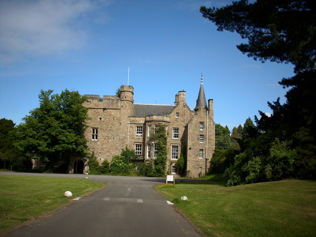
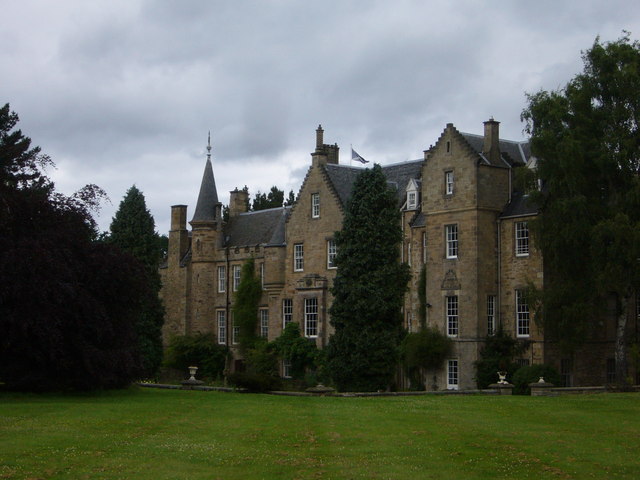
Carberry Tower is a historic mansion located in East Lothian, Scotland. Situated in the small village of Carberry, it is a well-known heritage site in Midlothian. The tower was originally built in the 15th century as a fortified home for the Carberry family, and it has since undergone various renovations and expansions.

The tower is set within a beautiful estate and surrounded by extensive grounds, including lush gardens and woodlands. The architecture of the tower reflects a mix of styles, showcasing its long history and the influence of different periods. The original tower features a traditional Scottish tower house design, with thick stone walls and narrow windows, while later additions introduced more ornate elements.

Over the years, Carberry Tower has had several notable owners, including the Archbishop of St Andrews and the Douglas family. It is most famously associated with the Battle of Carberry Hill, which took place nearby in 1567. Mary, Queen of Scots, was briefly held captive at the tower before being taken to Lochleven Castle.

Today, Carberry Tower operates as a luxury hotel and event venue. The interior of the tower has been meticulously restored to preserve its historic charm while providing modern amenities and comfort. The estate offers a range of facilities, including conference rooms, wedding venues, and spacious accommodation. Visitors can also explore the surrounding grounds, taking in the scenic beauty and historic significance of this remarkable heritage site.

If you have any feedback on the listing, please let us know in the comments section below.

Carberry Tower Images

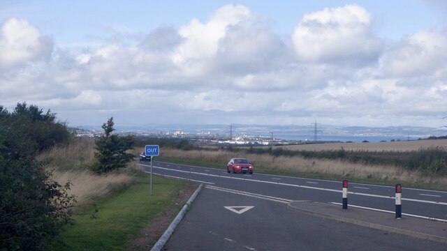
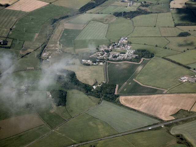
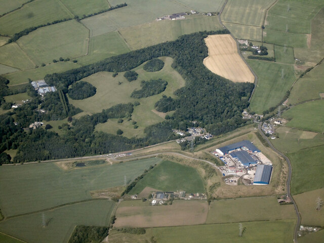
Images are sourced within 2km of 55.913/-3.015 or Grid Reference NT3669. Thanks to Geograph Open Source API. All images are credited.

A68 The Dalkeith bypass with its one layby. The overtaking lane is on a long climb. The collection of white buildings in the distance is Queen Margaret University with eastern Edinburgh to its left.
A68
The Dalkeith bypass with its one layby. The overtaking lane is on a long climb. The collection of white buildings in the distance is Queen Margaret University with eastern Edinburgh to its left.
Cousland from the air The A68 Dalkeith Bypass road is in the foreground.
Cousland from the air
The A68 Dalkeith Bypass road is in the foreground.
Smeaton Shaw from the air The recycling facility has greatly expanded over the years <a href="https://www.geograph.org.uk/photo/3595822">NT3668 : Former Smeaton Bing from the air</a>.

Carberry Tower House and estate can be seen in the background <span class="nowrap"><a title="https://www.carberrytower.com/" rel="nofollow ugc noopener" href="https://www.carberrytower.com/">Link</a><img style="margin-left:2px;" alt="External link" title="External link - shift click to open in new window" src="https://s1.geograph.org.uk/img/external.png" width="10" height="10"/></span> .
Smeaton Shaw from the air
The recycling facility has greatly expanded over the years NT3668 : Former Smeaton Bing from the air. Carberry Tower House and estate can be seen in the background LinkExternal link .
Whitecraig from the air On the southern outskirts of Musselburgh.
Whitecraig from the air
On the southern outskirts of Musselburgh.
Northfield Farm, Cousland Working Farm in the pretty village of Cousland near Dalkeith, at nearly 500 feet above sea level it is very wintry on the roads hereabouts.
Northfield Farm, Cousland
Working Farm in the pretty village of Cousland near Dalkeith, at nearly 500 feet above sea level it is very wintry on the roads hereabouts.
Pylon 10 Pylon no.10 on the line from Smeaton substation to Torness power station. Curious that the pylons are numbered from substation to power station, though the power is going in opposite direction. Taken from the Pencaitland Railway Path near its west end. Another 2 power lines can be seen in this picture, each with a different vintage of pylons!
Pylon 10
Pylon no.10 on the line from Smeaton substation to Torness power station. Curious that the pylons are numbered from substation to power station, though the power is going in opposite direction. Taken from the Pencaitland Railway Path near its west end. Another 2 power lines can be seen in this picture, each with a different vintage of pylons!
L12 Pylon Detail Close up from directly underneath pylon 10 seen here:-
<a title="https://www.geograph.org.uk/photo/7386451" href="https://www.geograph.org.uk/photo/7386451">Link</a>
This pylon is an L12 style and D60 (I think) for the angle of deviation - they are mighty beasts to resist the resultant force from the conductors which tends to pull the whole thing over to the inside of the angle.
The voltage is 400,000.
L12 Pylon Detail
Close up from directly underneath pylon 10 seen here:- Link This pylon is an L12 style and D60 (I think) for the angle of deviation - they are mighty beasts to resist the resultant force from the conductors which tends to pull the whole thing over to the inside of the angle. The voltage is 400,000.
Lay-by on the A68 near Dalkeith
A68 Dalkeith bypass
A68 Dalkeith bypass
Track, Carberry Passing through fields surrounded by woodland.
Track, Carberry
Passing through fields surrounded by woodland.
Field at Cousland Stubble field just east of Cousland. The tramlines left by farm machinery lead the eye to distant Traprain Law.
Field at Cousland
Stubble field just east of Cousland. The tramlines left by farm machinery lead the eye to distant Traprain Law.
Harvest fields from Carberry Hill View from Queen Mary's Mount, Carberry Hill, across East Lothian farmland.
Carberry Hill, near Cousland, is famous as the place where Mary, Queen of Scots (1542-87) surrendered to her Protestant Lords in 1567.
Harvest fields from Carberry Hill
View from Queen Mary's Mount, Carberry Hill, across East Lothian farmland. Carberry Hill, near Cousland, is famous as the place where Mary, Queen of Scots (1542-87) surrendered to her Protestant Lords in 1567.
New woodland The valley of the Puddle Burn, below and south of Elphinstone is a mix of farmland, wetland and scrub. It is, like many abandoned industrial sites rich in wildlife. Here some new woodland has been planted.
New woodland
The valley of the Puddle Burn, below and south of Elphinstone is a mix of farmland, wetland and scrub. It is, like many abandoned industrial sites rich in wildlife. Here some new woodland has been planted.
Wetlands, Backhill A sizeable marsh, and wonderful wetland habitat. When I took this picture there was a brass band playing to the south, in Cousland I presume.
Wetlands, Backhill
A sizeable marsh, and wonderful wetland habitat. When I took this picture there was a brass band playing to the south, in Cousland I presume.
Giants amongst giants Bulls graze amongst the pylons radiating from Cockenzie Power Station.
Giants amongst giants
Bulls graze amongst the pylons radiating from Cockenzie Power Station.
Colliery waste, Smeaton Shaw. The last remains of Dalkeith Colliery, closed around 1978.
Colliery waste, Smeaton Shaw.
The last remains of Dalkeith Colliery, closed around 1978.
Substation, Smeaton Part of a large complex of electrical installations, part of the grid used to (usually) export electricity to England.
Substation, Smeaton
Part of a large complex of electrical installations, part of the grid used to (usually) export electricity to England.
Flytipping A curse of the urban fringe. This looks like waste from a commercial source, numerous car wheels etc. The state of wear on some of the tyres is frightening, they were once driven on. A farm near here is completely surrounded by a high electric fence, to keep such vermin out.
Flytipping
A curse of the urban fringe. This looks like waste from a commercial source, numerous car wheels etc. The state of wear on some of the tyres is frightening, they were once driven on. A farm near here is completely surrounded by a high electric fence, to keep such vermin out.
Show me another place!

Carberry Tower is located at Grid Ref: NT3669 (Lat: 55.913, Lng: -3.015)

What 3 Words

///penny.gadget.portfolio. Near Whitecraig, East Lothian

Nearby Locations

Carberry Tower

Related Wikis

Carberry Tower

Carberry Tower is a historic house in East Lothian, Scotland. The house is situated off the A6124 road, 2 miles (3.2 km) south-east of Musselburgh. Carberry...

Carberry, East Lothian

Carberry is a village in East Lothian, Scotland, United Kingdom is situated off the A6124 road, a mile east of Whitecraig, two miles south east of Musselburgh...

Smeaton railway station

Smeaton railway station served the village of Smeaton, south of Musselburgh in East Lothian, Scotland, from 1872 to 1930 on the Macmerry Branch. ��2�...

Cousland

Cousland is a village in Midlothian, Scotland. It is located 4 kilometres (2.5 mi) east of Dalkeith and 3 kilometres (1.9 mi) west of Ormiston, on a hill...

Nearby Amenities

Located within 500m of 55.913,-3.015
Traffic Signals
Lat/Long: 55.9092156/-3.012868
Bus Stop
Crossgatehall
Naptan AtcoCode: 627001030120
Naptan Bearing: NE
Naptan BusStopType: CUS
Naptan CommonName: Crossgatehall
Naptan Indicator: east of bridge
Naptan NaptanCode: 58234893
Naptan Street: A6124
Naptan Verified: no
Public Transport: platform
Source: naptan_import
Lat/Long: 55.9088991/-3.0118485
Bus Stop
Crossgatehall
Naptan AtcoCode: 627001060120
Naptan Bearing: NE
Naptan BusStopType: CUS
Naptan CommonName: Crossgatehall
Naptan Indicator: east of Bridge
Naptan NaptanCode: 58234895
Naptan Street: B6414
Naptan Verified: no
Public Transport: platform
Source: naptan_import
Lat/Long: 55.9095053/-3.0124242
Bus Stop
Crossgatehall
Naptan AtcoCode: 627001070120
Naptan Bearing: SW
Naptan BusStopType: CUS
Naptan CommonName: Crossgatehall
Naptan Indicator: east of Bridge
Naptan NaptanCode: 58234896
Naptan Street: B6414
Naptan Verified: no
Public Transport: platform
Source: naptan_import
Lat/Long: 55.9094171/-3.0122138
Design: three-level
Power: tower
Lat/Long: 55.9098727/-3.0182904
Bus Stop
Crossgatehall
Naptan AtcoCode: 627001050120
Naptan Bearing: NW
Naptan CommonName: Crossgatehall
Naptan Indicator: at Station House
Naptan NaptanCode: 58232686
Naptan PlusbusZoneRef: EDINBUR
Naptan Street: A6124
Naptan Verified: no
Public Transport: platform
Source: naptan_import
Lat/Long: 55.9102091/-3.016018
Traffic Signals
Traffic Signals Direction: backward
Lat/Long: 55.9088627/-3.0124876
Traffic Signals
Traffic Signals Direction: forward
Lat/Long: 55.908897/-3.0131249
Carberry
Place: hamlet
Wikidata: Q5037846
Wikipedia: en:Carberry, East Lothian
Lat/Long: 55.9169556/-3.0186405
Crossgatehall
Place: hamlet
Lat/Long: 55.9092139/-3.012745
Springfield Cottages
Place: hamlet
Lat/Long: 55.9105399/-3.0165913
Post Box
Collection Times: Mo-Fr 17:00; Sa 12:15
Operator: Royal Mail
Post Box Design: hovis
Post Box Type: lamp
Ref: EH21 232
Royal Cypher: GR
Royal Cypher Wikidata: Q33102273
Lat/Long: 55.9105719/-3.0170976
Bench
Backrest: yes
Material: wood
Seats: 1
Lat/Long: 55.9136289/-3.0196148
Power: pole
Lat/Long: 55.908733/-3.0128019
The data included in this document is from www.openstreetmap.org. The data is made available under ODbL.

Have you been to Carberry Tower?

Leave your review of Carberry Tower below (or comments, questions and feedback).