Cairn Lee

Heritage Site in Banffshire

Scotland

Cairn Lee

Mains of Melrose Fields of ripening barley on the undulating fields at the top of the cliffs at Melrose.
Mains of Melrose Credit: Anne Burgess

Cairn Lee, located in Banffshire, Scotland, is a significant heritage site that holds historical and archaeological importance. This ancient monument stands on a hilltop in the parish of Fordyce, offering breathtaking views of the surrounding countryside.

The site is recognized for its impressive cairn, a man-made mound of stones, which dates back to the Neolithic period, around 3000 BC. The cairn is believed to have been a burial chamber or possibly a ceremonial site during this era. It is constructed from large boulders and covers a central chamber, which has unfortunately been largely destroyed over time.

The remains of the cairn indicate that it was once a substantial structure, standing around 7 meters in diameter. Excavations in the 19th century uncovered fragments of pottery, stone tools, and human bones, providing valuable insights into the lives and rituals of the people who inhabited the area thousands of years ago.

Today, Cairn Lee stands as a testament to the ancient civilizations that once thrived in the region. It serves as a popular destination for history enthusiasts, archaeologists, and tourists alike, who come to explore and appreciate the rich heritage of this site. The hilltop location also makes it a perfect spot for panoramic views of the picturesque Scottish landscape.

Cairn Lee is protected as a scheduled monument by Historic Environment Scotland, ensuring its preservation for future generations. Its historical significance, combined with its scenic location, makes it a must-visit destination for those interested in delving into Scotland's ancient past.

If you have any feedback on the listing, please let us know in the comments section below.

Cairn Lee Images

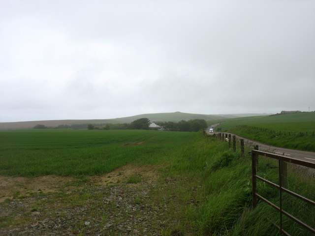
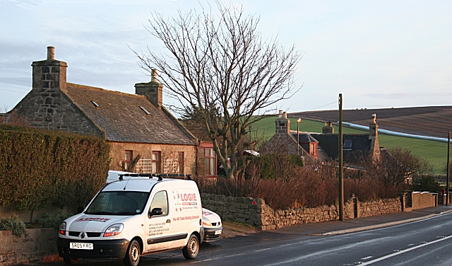
Images are sourced within 2km of 57.652/-2.41 or Grid Reference NJ7562. Thanks to Geograph Open Source API. All images are credited.

Mains of Melrose Fields of ripening barley on the undulating fields at the top of the cliffs at Melrose.
Mains of Melrose
Fields of ripening barley on the undulating fields at the top of the cliffs at Melrose.
Scurrs of Greenside Scurrs of Greenside is the name given to the flat rocks and shore here. It's an interesting word. I imagined at first that it was related to the Gaelic Sgùrr, meaning a conical hill, and I couldn't see the relevance. It turns out, however, that it is from Latin scurra, meaning a buffoon, from which English gets the word scurrilous. In Scots the meaning was extended to mean a low rascal or a sheriff's officer! Over time it came to mean anything low, which makes far more sense.
Scurrs of Greenside
Scurrs of Greenside is the name given to the flat rocks and shore here. It's an interesting word. I imagined at first that it was related to the Gaelic Sgùrr, meaning a conical hill, and I couldn't see the relevance. It turns out, however, that it is from Latin scurra, meaning a buffoon, from which English gets the word scurrilous. In Scots the meaning was extended to mean a low rascal or a sheriff's officer! Over time it came to mean anything low, which makes far more sense.
Sea Mayweed (Tripleurospermum maritimum) The large daisy-like flowers are plentiful along the back of the beach here.
Sea Mayweed (Tripleurospermum maritimum)
The large daisy-like flowers are plentiful along the back of the beach here.
Sea Sandwort |(Honckenya peploides) There's a large carpet of this plant on the sandy upper part of the beach. The green balls are seeds.
Sea Sandwort |(Honckenya peploides)
There's a large carpet of this plant on the sandy upper part of the beach. The green balls are seeds.
Rusting Metal There is quite a selection of rusting metal on the rocks here, presumably the remains of a ship that had come to grief. These large chunks haven't moved since <a href="https://www.geograph.org.uk/photo/2956451">NJ7564 : Rusting Remains</a> was taken ten years ago.
Rusting Metal
There is quite a selection of rusting metal on the rocks here, presumably the remains of a ship that had come to grief. These large chunks haven't moved since NJ7564 : Rusting Remains was taken ten years ago.
Winding Gear The steel hawsers are rusted almost solid. I have yet to find out which ship it was that was wrecked here.
Winding Gear
The steel hawsers are rusted almost solid. I have yet to find out which ship it was that was wrecked here.
Rusting Engine Block The engine has eight cylinders. I have not discovered the name of the vessel.
Rusting Engine Block
The engine has eight cylinders. I have not discovered the name of the vessel.
Cross-cutting Veins It's easy to see that the vein from right to left cuts across the more vertical one, so it's not difficult to work out which vein was there first.
Cross-cutting Veins
It's easy to see that the vein from right to left cuts across the more vertical one, so it's not difficult to work out which vein was there first.
Oyster Plant (Mertensia maritima) This is an uncommon plant, and it is close to the southern edge of its range here. The name is said to be because it tastes like oysters.
Oyster Plant (Mertensia maritima)
This is an uncommon plant, and it is close to the southern edge of its range here. The name is said to be because it tastes like oysters.
Oyster Plant (Mertensia maritima) A close-up shot of the flowers of this is an uncommon plant, which is close to the southern edge of its range here. The name is said to be because it tastes like oysters.
Oyster Plant (Mertensia maritima)
A close-up shot of the flowers of this is an uncommon plant, which is close to the southern edge of its range here. The name is said to be because it tastes like oysters.
Scurrs of Greenside Scurrs of Greenside is the name given to the flat rocks and shore here. It's an interesting word. I imagined at first that it was related to the Gaelic Sgùrr, meaning a conical hill, and I couldn't see the relevance. It turns out, however, that it is from Latin scurra, meaning a buffoon, from which English gets the word scurrilous. In Scots the meaning was extended to mean a low rascal or a sheriff's officer! Over time it came to mean anything low, which makes far more sense.
Scurrs of Greenside
Scurrs of Greenside is the name given to the flat rocks and shore here. It's an interesting word. I imagined at first that it was related to the Gaelic Sgùrr, meaning a conical hill, and I couldn't see the relevance. It turns out, however, that it is from Latin scurra, meaning a buffoon, from which English gets the word scurrilous. In Scots the meaning was extended to mean a low rascal or a sheriff's officer! Over time it came to mean anything low, which makes far more sense.
Mains of Melrose Fields of ripening barley on the undulating fields at the top of the cliffs at Melrose.
Mains of Melrose
Fields of ripening barley on the undulating fields at the top of the cliffs at Melrose.
Quarry at Melrose The sheen on the quarry face is because of the slaty fabric of the metamorphic rock being quarried.
Quarry at Melrose
The sheen on the quarry face is because of the slaty fabric of the metamorphic rock being quarried.
Catsear (Hypochaeris radicata) Not all plants with dandelion-like flowers are dandelions. Many of them - in fact most of those around here - are Catsear, which is very common indeed.
Catsear (Hypochaeris radicata)
Not all plants with dandelion-like flowers are dandelions. Many of them - in fact most of those around here - are Catsear, which is very common indeed.
The B9031 heading for Fraserburgh The 'bump' of Law Hill <a href="https://www.geograph.org.uk/gridref/NJ7564">NJ7564</a> on the horizon.
The B9031 heading for Fraserburgh
The 'bump' of Law Hill NJ7564 on the horizon.
Show me another place!

Cairn Lee is located at Grid Ref: NJ7562 (Lat: 57.652, Lng: -2.41)

Unitary Authority: Aberdeenshire

Police Authority: North East

What 3 Words

///thud.gender.tanks. Near Macduff, Aberdeenshire

Nearby Locations

Hill of Cairnlee Cairn Lee

Related Wikis

Cairn Lee

Cairn Lee is a prehistoric monument in Aberdeenshire, Scotland. Cairn Lee and proximate Longman Hill are the oldest prehistoric features in the local area...

Longmanhill

Longmanhill is a settlement in the Aberdeenshire parish of Gamrie; it is located along the A98 road connecting Fraserburgh to Macduff. This hamlet was...

Longman Hill

Longmanhill is a Bronze Age long barrow situated atop a prominent rounded landform in northern Aberdeenshire, Scotland near Banff Bay. Due to the low-lying...

St John's Church, Gamrie

St John's Church is a ruined church and kirkyard in the parish of Gamrie, Aberdeenshire, Scotland. The church, dedicated to St John the Evangelist, was...

Nearby Amenities

Located within 500m of 57.652,-2.41
Power: pole
Lat/Long: 57.6479093/-2.4072555
Power: pole
Lat/Long: 57.6478806/-2.4089775
Power: pole
Lat/Long: 57.647872/-2.4105868
Power: pole
Lat/Long: 57.6478634/-2.4122284
Power: pole
Lat/Long: 57.6558623/-2.4078917
Power: pole
Lat/Long: 57.6547088/-2.407108
Power: pole
Lat/Long: 57.6543317/-2.4068463
Power: pole
Lat/Long: 57.6538664/-2.4063292
Power: pole
Lat/Long: 57.6533647/-2.4057767
Power: pole
Lat/Long: 57.6529059/-2.4052693
Power: pole
Lat/Long: 57.6528196/-2.4043008
Power: pole
Lat/Long: 57.6527472/-2.4034716
Power: pole
Lat/Long: 57.6526744/-2.4026566
Power: pole
Lat/Long: 57.6526045/-2.4018377
Power: pole
Lat/Long: 57.6552835/-2.4075079
Power: pole
Lat/Long: 57.6481336/-2.4078244
Power: pole
Lat/Long: 57.6492064/-2.4034537
Power: pole
Lat/Long: 57.6492502/-2.4044019
Power: pole
Lat/Long: 57.6489761/-2.4052522
Power: pole
Lat/Long: 57.6487134/-2.4074569
Power: pole
Lat/Long: 57.6491196/-2.4061614
Power: pole
Lat/Long: 57.649289/-2.4071002
Power: pole
Lat/Long: 57.6499061/-2.4067944
Power: pole
Lat/Long: 57.6505247/-2.4064913
Power: pole
Lat/Long: 57.6511382/-2.4061655
Power: pole
Lat/Long: 57.6517604/-2.4058463
Power: pole
Lat/Long: 57.6523758/-2.405531
The data included in this document is from www.openstreetmap.org. The data is made available under ODbL.

Have you been to Cairn Lee?

Leave your review of Cairn Lee below (or comments, questions and feedback).