Broughty Castle

Heritage Site in Angus

Scotland

Broughty Castle

Broughty Ferry Beach Broughty Ferry beach on the mouth of the Firth of Tay, with Tayport in the distance.
Broughty Ferry Beach Credit: Scott Cormie

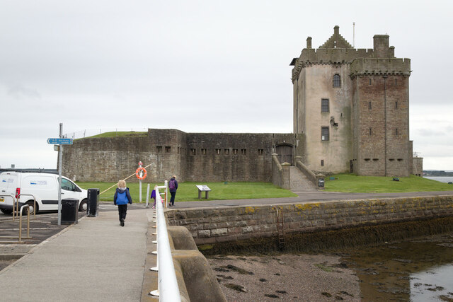
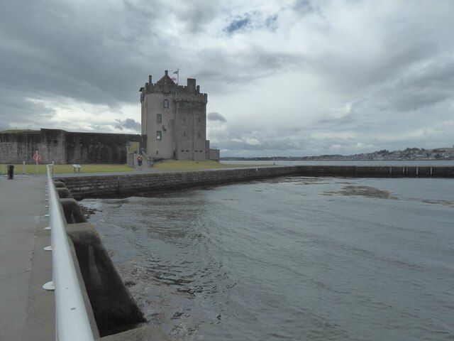
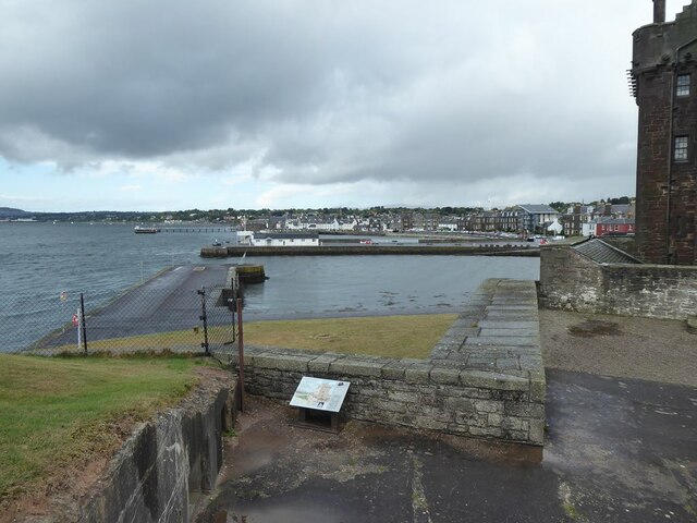
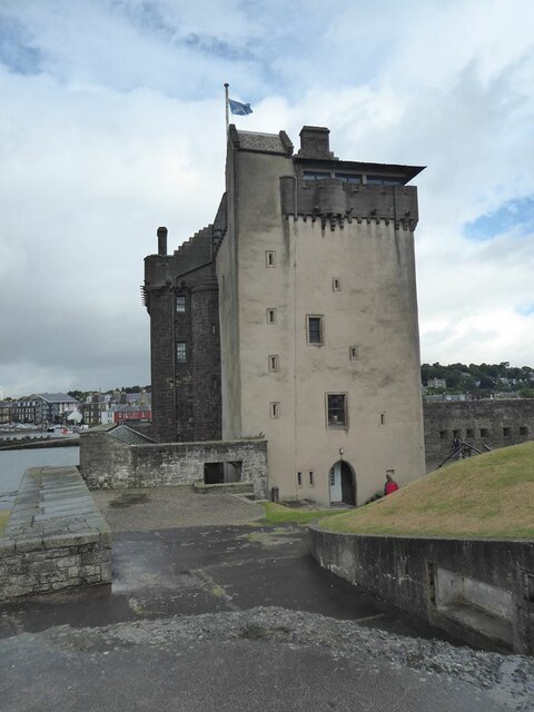
Broughty Castle, located in the town of Broughty Ferry in Angus, Scotland, is a historic fortress that has stood on the banks of the River Tay for over 500 years. Originally built in 1496 by the Gray family, the castle served as a strategic defense against potential invasions from the sea, protecting the nearby city of Dundee.

The castle is a fine example of a coastal fortification, featuring a distinctive round tower design. Over the centuries, it has witnessed numerous battles and sieges, including conflicts between the Scottish and English forces during the 16th and 17th centuries. In the 19th century, Broughty Castle was transformed into a military barracks, housing troops during the Napoleonic Wars and both World Wars.

Today, Broughty Castle is a popular heritage site and museum, managed by Dundee City Council. Visitors can explore the castle's rich history through its various exhibits and displays. Inside, the museum showcases a diverse collection of artifacts, including weapons, armor, and maritime-related objects. The castle's rooms have been meticulously restored to reflect different periods of its history, providing an immersive experience for visitors.

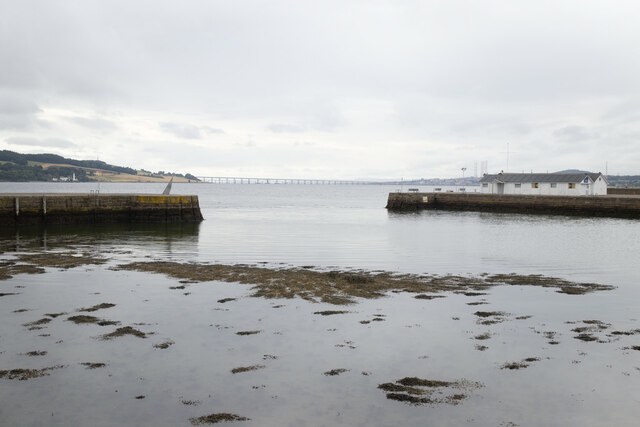
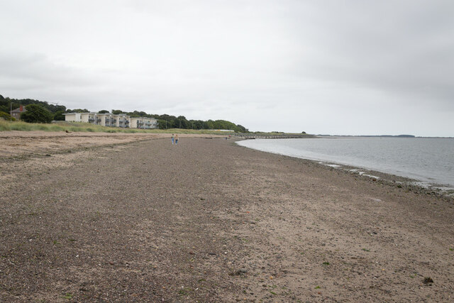
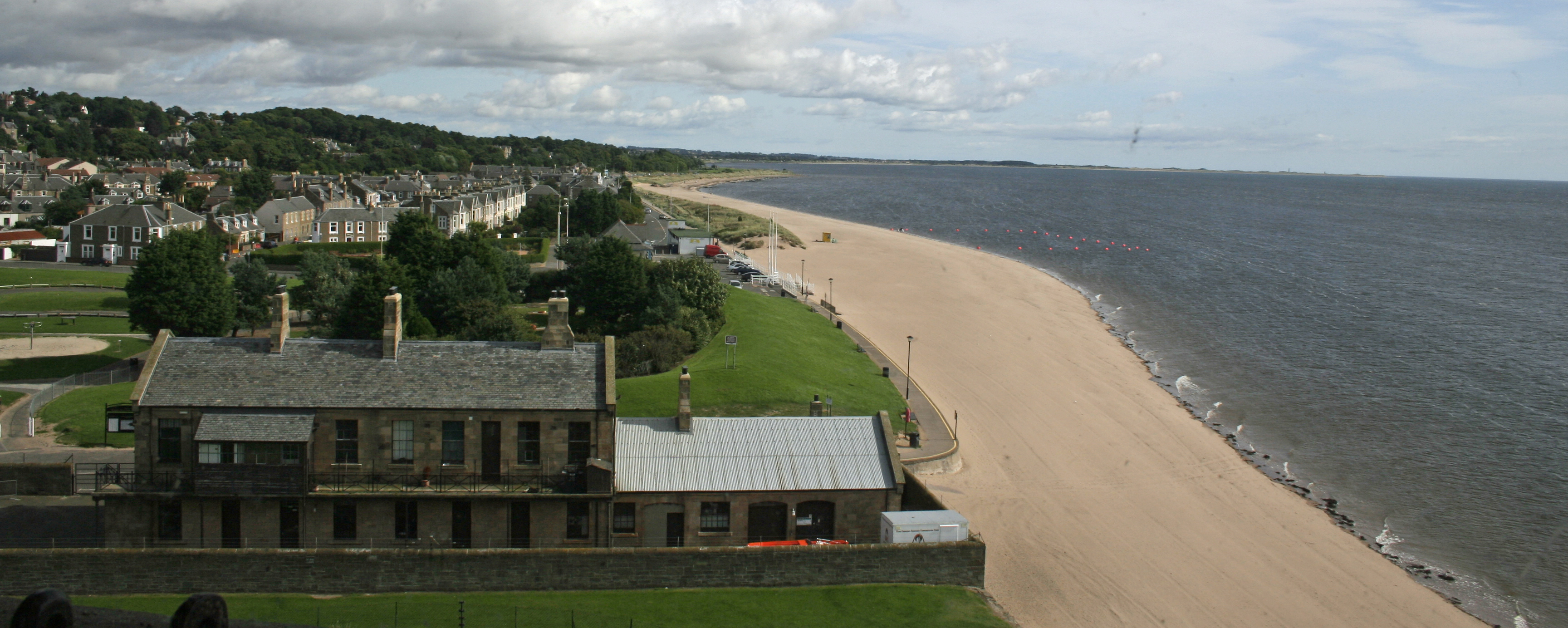
The castle's location also offers breathtaking views of the River Tay and the surrounding coastline. The nearby gardens provide a tranquil setting for a leisurely stroll, and there is a café where visitors can relax and enjoy refreshments.

With its fascinating history, stunning architecture, and picturesque surroundings, Broughty Castle stands as a testament to Scotland's rich cultural heritage, attracting both history enthusiasts and casual visitors alike.

If you have any feedback on the listing, please let us know in the comments section below.

Broughty Castle Images

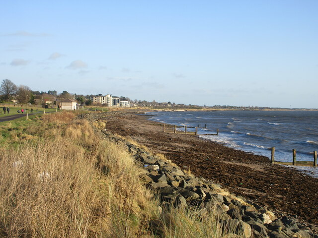
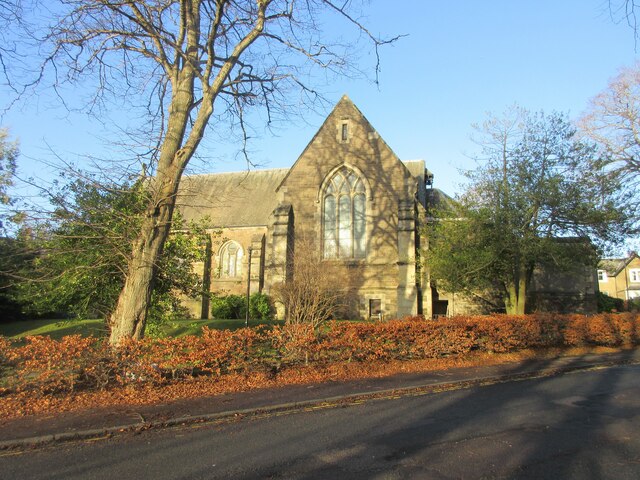
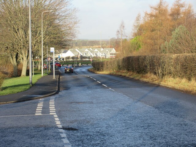
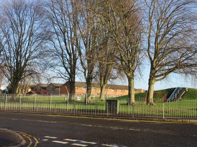
Images are sourced within 2km of 56.463/-2.868 or Grid Reference NO4630. Thanks to Geograph Open Source API. All images are credited.

Broughty Ferry Beach Broughty Ferry beach on the mouth of the Firth of Tay, with Tayport in the distance.
Broughty Ferry Beach
Broughty Ferry beach on the mouth of the Firth of Tay, with Tayport in the distance.
Coastline at Barnhill Looking along the coast at Barnhill towards Monifieth.
Coastline at Barnhill
Looking along the coast at Barnhill towards Monifieth.
Barnhill St Margaret's Church The south elevation of Barnhill St Margaret's Church viewed from Guthrie Terrace.
Barnhill St Margaret's Church
The south elevation of Barnhill St Margaret's Church viewed from Guthrie Terrace.
East Balgillo Road East Balgillo Road heading north towards the roundabout on the A92.
East Balgillo Road
East Balgillo Road heading north towards the roundabout on the A92.
Woodland on the play park Trees on the play park on Forthill Road, looking from Fintry Place.
Woodland on the play park
Trees on the play park on Forthill Road, looking from Fintry Place.
Former Queen Street Church Church and steeple of the former Queen Street United Presbyterian Church in Broughty Ferry, now a restaurant.
Former Queen Street Church
Church and steeple of the former Queen Street United Presbyterian Church in Broughty Ferry, now a restaurant.
Broughty Ferry Library The public library in Broughty Ferry viewed across Queen Street.
Broughty Ferry Library
The public library in Broughty Ferry viewed across Queen Street.
1E11 Aberdeen to London Kings Cross passing through Broughty Ferry Station Unit 800102
1E11 Aberdeen to London Kings Cross passing through Broughty Ferry Station
Unit 800102
Construction of flood defences, Broughty Ferry
Broughty Castle
Broughty Castle
Harbour, Broughty Ferry
Broughty Ferry Beach
Promenade at James Place, Broughty Ferry
Firth of Tay Seen from the promenade at James Place, Broughty Ferry. The Tay Road Bridge can be seen on the horizon.
Firth of Tay
Seen from the promenade at James Place, Broughty Ferry. The Tay Road Bridge can be seen on the horizon.
Broughty Castle 15th Century, now housing a local museum.
Broughty Castle
15th Century, now housing a local museum.
The Harbour at Broughty Ferry Seen from the Castle.
The Harbour at Broughty Ferry
Seen from the Castle.
The Keep at Broughty Castle 15th Century, now housing a local museum.
The Keep at Broughty Castle
15th Century, now housing a local museum.
Show me another place!

Broughty Castle is located at Grid Ref: NO4630 (Lat: 56.463, Lng: -2.868)

Unitary Authority: City of Dundee

Police Authority: Tayside

What 3 Words

///guises.collected.petal. Near Tayport, Fife

Related Wikis

Broughty Castle

Broughty Castle is a historic castle on the banks of the River Tay in Broughty Ferry, Dundee, Scotland. It was completed around 1495, although the site...

Broughty Ferry Pier railway station

Broughty Ferry Pier railway station served the suburb of Broughty Ferry, Dundee, Scotland from 1848 to 1887 on the Dundee and Arbroath Railway. == History... ==

Broughty Ferry

Broughty Ferry (; Scottish Gaelic: Bruach Tatha; Scots: Brochtie) is a suburb of Dundee, Scotland. It is situated four miles east of the city centre on...

Broughty Ferry railway station

Broughty Ferry railway station is a railway station serving the suburb of Broughty Ferry in Dundee, Scotland. It is sited 3 miles 38 chains (5.6 km) from...

Nearby Amenities

Located within 500m of 56.463,-2.868
Broughty Ferry
Burgh: police
Burgh End Date: 1913
Burgh Start Date: 1864
Is In: Dundee, Scotland, UK
Loc Name: The Ferry
Name Ga: Bruach Tatha
Name Gd: Port Bhruachaidh
Name Sco: Brochtie
Note: Broughty Ferry was incorporated into Dundee in 1913
Place: suburb
Population: 13155
Source: NPE
Wikidata: Q459773
Wikipedia: en:Broughty Ferry
Lat/Long: 56.4666461/-2.8727725
Traffic Signals
Lat/Long: 56.4673875/-2.8692965
Traffic Signals
Lat/Long: 56.467408/-2.8691042
Place Of Worship
East Church
Religion: christian
Lat/Long: 56.4672573/-2.8700016
Pub
Papa Jacques
Addr City: Dundee
Addr Housenumber: 314-316
Addr Postcode: DD5 2AN
Addr Street: Brook Street
Addr Suburb: Broughty Ferry
Fhrs Id: 186498
Source Addr: FHRS Open Data
Lat/Long: 56.4666372/-2.8716355
Pub
The Old Anchor Inn
Lat/Long: 56.466151/-2.8732591
Pub
The Ferry Inn
Lat/Long: 56.4655263/-2.8739079
Restaurant
The Peking Garden
Lat/Long: 56.4659918/-2.8733467
Restaurant
Vissochis
Addr City: Dundee
Addr Housenumber: 40
Addr Postcode: DD5 2BJ
Addr Street: Gray Street
Addr Suburb: Broughty Ferry
Cuisine: ice_cream
Fhrs Id: 186057
Lat/Long: 56.4658476/-2.8734261
Restaurant
Bombay Joe's
Addr City: Dundee
Addr Housenumber: 44
Addr Postcode: DD5 2BJ
Addr Street: Gray Street
Addr Suburb: Broughty Ferry
Cuisine: indian
Website: https://www.bombayjoe.com/
Lat/Long: 56.4659374/-2.8733766
Fast Food
Murray's Fish and Chips
Wheelchair: yes
Lat/Long: 56.465387/-2.8739562
Bank
Bank of Scotland
Atm: yes
Brand: Bank of Scotland
Brand Wikidata: Q627381
Operator: Bank of Scotland
Lat/Long: 56.4668248/-2.871777
Bank
RBS
Atm: yes
Brand: RBS
Brand Wikidata: Q160126
Brand Wikipedia: en:Royal Bank of Scotland
Official Name: Royal Bank of Scotland
Operator: Royal Bank of Scotland
Lat/Long: 56.4667138/-2.8722591
Bus Stop
Peking Garden
Naptan AtcoCode: 6400PT1913
Naptan CommonName: Peking Garden
Naptan Indicator: at
Naptan NaptanCode: 36325723
Operator: Strathtay
Public Transport: platform
Route Ref: 69
Shelter: no
Towards: Broughty Ferry;Ninewells Hospital
Lat/Long: 56.4660777/-2.8734672
Cafe
Toast
Addr City: Dundee
Addr Housenumber: 31
Addr Postcode: DD5 2BJ
Addr Street: Gray Street
Addr Suburb: Broughty Ferry
Lat/Long: 56.4657674/-2.8738247
Homeshaper
Shop: gift
Lat/Long: 56.4658451/-2.8737845
Topsy Turvy
Shop: furniture
Lat/Long: 56.4657058/-2.8738502
The Bride
Lat/Long: 56.4657103/-2.87394
Hairdresser
Lat/Long: 56.4662385/-2.87359
Smart Gallery
Lat/Long: 56.466157/-2.8736397
Millars
Shop: clothes
Lat/Long: 56.465934/-2.8737443
Unipart
Shop: car_repair
Lat/Long: 56.4653336/-2.8745946
Kindergarten
Nursery Rhymes
Addr City: Dundee
Addr Housenumber: 333
Addr Postcode: DD5 2DS
Addr Street: Brook Street
Addr Suburb: Broughty Ferry
Fhrs Id: 160295
Source Addr: FHRS Open Data
Lat/Long: 56.4670256/-2.8713545
Clinton Dailly Hair Design
Shop: hairdresser
Lat/Long: 56.4667767/-2.8714283
CIC Computers
Shop: computer
Lat/Long: 56.4667678/-2.8713264
Ferry Potty
Shop: gift
Lat/Long: 56.4667559/-2.8712352
Dentist
Baird
Lat/Long: 56.4666641/-2.8705915
Smarty Pants
Shop: clothes
Lat/Long: 56.4668545/-2.8719567
Mayfayre Salon
Shop: hairdresser
Lat/Long: 56.4668152/-2.871659
William Ree
Shop: hardware
Lat/Long: 56.4668004/-2.8715785
Pet Mate
Shop: pet
Lat/Long: 56.4666815/-2.8720619
Hosies
Shop: electronics
Lat/Long: 56.4666638/-2.8718788
Beauty Within
Phone: +44 1382 731000
Shop: beauty
Lat/Long: 56.4665029/-2.8705875
Boyz Own
Shop: hairdresser
Lat/Long: 56.4663051/-2.8733113
Ferry Flowers
Shop: florist
Lat/Long: 56.4663673/-2.8732737
The Wool Shop
Shop: fabric
Lat/Long: 56.4664206/-2.8732469
Post Box
Collection Times: Mo-Fr 09:00; Sa 07:00
Operator: Royal Mail
Post Box Type: pillar
Ref: DD5 102D
Royal Cypher: scottish_crown
Lat/Long: 56.4652782/-2.8652107
Post Box
Collection Times: Mo-Fr 09:00; Sa 07:00
Operator: Royal Mail
Post Box Type: wall
Ref: DD5 97D
Royal Cypher: GR
Royal Cypher Wikidata: Q33102273
Lat/Long: 56.4667567/-2.8698217
Cafe
Café Royale
Addr City: Dundee
Addr Housenumber: 231
Addr Postcode: DD5 2AX
Addr Street: King Street
Addr Suburb: Broughty Ferry
Internet Access: wlan
Phone: +44 1382 770907
Lat/Long: 56.4657373/-2.8742642
Barrier: bollard
Lat/Long: 56.4638856/-2.8717555
Barrier: bollard
Lat/Long: 56.4639382/-2.8718465
Barrier: bollard
Lat/Long: 56.4639582/-2.8718841
Barrier: bollard
Lat/Long: 56.4638664/-2.8717179
Historic: cannon
Lat/Long: 56.4629388/-2.8700141
Historic: cannon
Lat/Long: 56.4629387/-2.8699772
Historic: cannon
Lat/Long: 56.4629385/-2.8699471
Bicycle Parking
Bicycle Parking: stands
Capacity: 16
Lat/Long: 56.4635944/-2.8701831
Bicycle Parking
Bicycle Parking: wall_loops
Capacity: 10
Lat/Long: 56.4637622/-2.8703746
Bicycle Parking
Bicycle Parking: wall_loops
Capacity: 10
Lat/Long: 56.4638722/-2.870555
Bicycle Parking
Bicycle Parking: stands
Capacity: 6
Lat/Long: 56.4641132/-2.8714321
SPAR
Brand: Spar
Brand Wikidata: Q610492
Shop: convenience
Lat/Long: 56.4654474/-2.8734159
Eduardo Allesandro Studios
Shop: art
Website: https://www.eastudios.com/
Lat/Long: 56.4656994/-2.8735421
Atm
Opening Hours: 24/7
Operator: Royal Bank of Scotland
Lat/Long: 56.4667341/-2.8721978
Access: customers
Barrier: lift_gate
Motorcar: yes
Lat/Long: 56.4668901/-2.87208
Atm
Bank of Scotland
Brand: Bank of Scotland
Brand Wikidata: Q627381
Opening Hours: 24/7
Operator: Bank of Scotland
Operator Wikidata: Q627381
Lat/Long: 56.4668086/-2.8717436
Entrance: yes
Lat/Long: 56.4660656/-2.873649
Wind Dial
Addr City: Broughty Ferry
Addr Street: Beach Crescent
Artist Name: Adrienne McStay
Artwork Type: sculpture
Tourism: artwork
Lat/Long: 56.4630511/-2.8715265
Addr City: Dundee
Addr Postcode: DD5 2TF
Email: broughty@leisureandculturedundee.com
Phone: +44 138 243 6916
Tourism: museum
Website: https://www.leisureandculturedundee.com/culture/broughty-castle
Lat/Long: 56.4629123/-2.8702038
Toilets
Lat/Long: 56.462905/-2.8701555
Crossing
Crossing: traffic_signals
Lat/Long: 56.4673995/-2.8691639
Crossing
Crossing: traffic_signals
Lat/Long: 56.4674473/-2.8688475
Bicycle Rental
Capacity: 20
Fee: yes
Network: Embark Dundee
Operator: Ride On
Operator Type: private
Payment Credit Cards: yes
Payment Debit Cards: yes
Website: https://rideondundee.com/
Lat/Long: 56.4641537/-2.8666221
Generator Method: photovoltaic
Generator Output Electricity: yes
Generator Source: solar
Generator Type: solar_photovoltaic_panel
Power: generator
Lat/Long: 56.4669441/-2.8700734
Barrier: bollard
Lat/Long: 56.4662792/-2.8733875
Telephone
Booth: K6
Covered: booth
Listed Status: Category B
Lat/Long: 56.4649756/-2.8740646
Bus Stop
Brook Street
Naptan AtcoCode: 640014120
Naptan CommonName: Brook Street
Naptan Indicator: near
Naptan NaptanCode: 36326258
Naptan Verified: no
Public Transport: platform
Lat/Long: 56.4651405/-2.863781
Broughty Ferry Pier
Historic Railway: station
Railway: site
Wikidata: Q56755069
Wikipedia: en:Broughty Ferry Pier railway station
Lat/Long: 56.4638085/-2.8718635
Stop
Direction: backward
Lat/Long: 56.4650735/-2.8706681
Crossing
Crossing: uncontrolled
Crossing Markings: yes
Lat/Long: 56.4657936/-2.8621303
Bench
Backrest: yes
Lat/Long: 56.4648678/-2.8739204
Bench
Backrest: yes
Lat/Long: 56.4648353/-2.8737035
Bench
Backrest: yes
Lat/Long: 56.4647905/-2.8733578
Bench
Backrest: yes
Lat/Long: 56.464768/-2.8731898
Bench
Backrest: yes
Lat/Long: 56.4647418/-2.8730498
Bench
Backrest: yes
Lat/Long: 56.4646691/-2.8727769
Bench
Backrest: yes
Lat/Long: 56.464608/-2.8726201
Bench
Backrest: yes
Lat/Long: 56.4645469/-2.8724886
Bench
Backrest: yes
Lat/Long: 56.4644703/-2.8723584
Bench
Backrest: yes
Lat/Long: 56.4644069/-2.8722562
Bench
Backrest: yes
Lat/Long: 56.4643389/-2.8721331
Bench
Backrest: yes
Lat/Long: 56.4642755/-2.8720323
Crossing
Crossing: uncontrolled
Crossing Markings: yes
Lat/Long: 56.4647111/-2.8647691
Stop
Direction: forward
Lat/Long: 56.4651709/-2.8706153
Crossing
Crossing: uncontrolled
Crossing Markings: yes
Lat/Long: 56.4648414/-2.8644159
Railway: signal
Railway Signal Direction: forward
Railway Signal Main: GB-NR:main
Railway Signal Main Form: light
Ref: D1002
Lat/Long: 56.4670705/-2.8692165
The data included in this document is from www.openstreetmap.org. The data is made available under ODbL.

Have you been to Broughty Castle?

Leave your review of Broughty Castle below (or comments, questions and feedback).