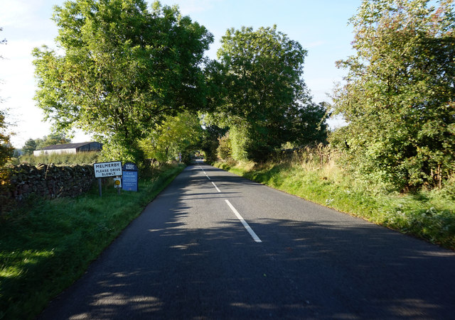
Melmerby

Settlement in Cumberland Eden

England

Melmerby

Across the green at Melmerby If travelling east on the A686 from Penrith, Melmerby is the last village in the Vale of Eden before the long climb to Hartside Cross. The view is east across the village green with the western flank of the Pennines in the background.
Across the green at Melmerby Credit: Gordon Hatton

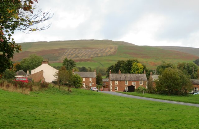
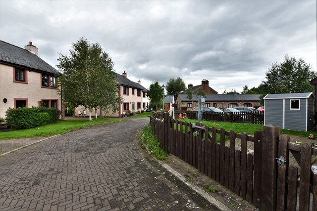
Melmerby is a village located in the county of Cumberland, England. Situated in the northern part of the county, it lies just a few miles east of the larger town of Penrith. With its picturesque setting at the foot of the Pennines, Melmerby is surrounded by stunning natural beauty and offers a tranquil escape from the hustle and bustle of city life.

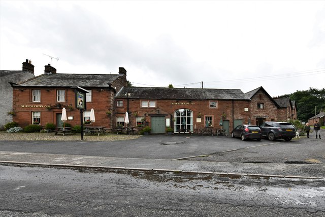
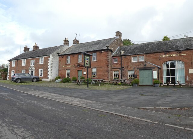
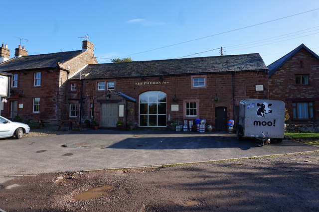
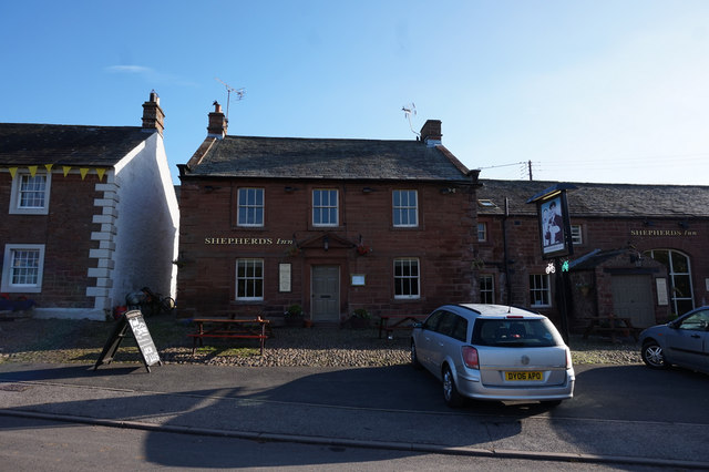
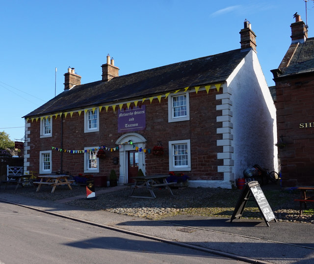
The village itself is small, with a population of around 500 residents. It has a charming and quaint atmosphere, with traditional stone cottages lining its narrow streets. The village is centered around a village green, which serves as a gathering place for locals and visitors alike.

One of the main attractions in Melmerby is its famous ice cream parlour. Renowned for its delicious homemade ice cream, the parlour has become a popular destination for tourists and locals seeking a sweet treat. The ice cream is made using locally sourced ingredients, capturing the flavors of the surrounding countryside.

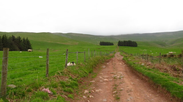
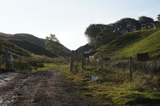
Melmerby also boasts a number of picturesque walks and hiking trails, making it a haven for outdoor enthusiasts. The surrounding countryside offers breathtaking views of the Pennines and the Eden Valley, providing ample opportunities for exploration and relaxation.

Overall, Melmerby is a charming village in Cumberland that offers a peaceful and idyllic setting. With its stunning natural surroundings, delightful ice cream parlour, and warm community atmosphere, it is a destination that truly captures the essence of rural England.

If you have any feedback on the listing, please let us know in the comments section below.

Melmerby Images

Images are sourced within 2km of 54.728793/-2.594691 or Grid Reference NY6137. Thanks to Geograph Open Source API. All images are credited.
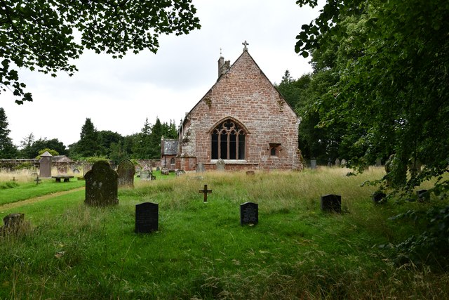
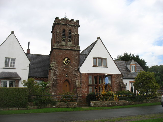
Across the green at Melmerby If travelling east on the A686 from Penrith, Melmerby is the last village in the Vale of Eden before the long climb to Hartside Cross. The view is east across the village green with the western flank of the Pennines in the background.
Across the green at Melmerby
If travelling east on the A686 from Penrith, Melmerby is the last village in the Vale of Eden before the long climb to Hartside Cross. The view is east across the village green with the western flank of the Pennines in the background.
Church of St John the Baptist, Melmerby Not a very interesting looking church from the outside, and Pevsner [Buildings of England - Cumberland & Westmorland] describes it in just 7 lines, but even he seemed unsure if most of the building is of 1849 or 1895.
Church of St John the Baptist, Melmerby
Not a very interesting looking church from the outside, and Pevsner [Buildings of England - Cumberland & Westmorland] describes it in just 7 lines, but even he seemed unsure if most of the building is of 1849 or 1895.
Heading NE on track at Little Awfell above Melmerby
OS benchmark OS benchmark on corner of private house.  Melmerby House
OS benchmark
OS benchmark on corner of private house. Melmerby House
Vardo on the village green Vardo/gypsy caravan on Melmerby village green
Vardo on the village green
Vardo/gypsy caravan on Melmerby village green
Melmerby: Townhead Court
Melmerby: The Shepherds Inn PH
Melmerby: Church Road
Melmerby, St. John the Baptist's Church: Eastern aspect
Shepherds Inn, Melmerby
Old Boundary Marker north of Sunnygill Bridge Parish Boundary Marker at a wall corner on the east side of the road north of Sunnygill Bridge. Inscribed PARISH / OF / OUSBY and PARISH / OF / MELMERBY on adjacent faces. On the boundary of Ousby and Melmerby parishes. An eroded stone to the left could be an older marker.

Milestone Society National ID: CU_OUSMEL01pb
Old Boundary Marker north of Sunnygill Bridge
Parish Boundary Marker at a wall corner on the east side of the road north of Sunnygill Bridge. Inscribed PARISH / OF / OUSBY and PARISH / OF / MELMERBY on adjacent faces. On the boundary of Ousby and Melmerby parishes. An eroded stone to the left could be an older marker. Milestone Society National ID: CU_OUSMEL01pb
The Tower House, Melmerby This was the village school from 1862 until 1974.
The Tower House, Melmerby
This was the village school from 1862 until 1974.
Deep Slack off the A686
Entering Melmerby on the A686
The Shepherds Inn, Melmerby
Melmerby Stores & Tearooms, Melmerby
Show me another place!

Melmerby is located at Grid Ref: NY6137 (Lat: 54.728793, Lng: -2.594691)

Administrative County: Cumbria

District: Eden

Police Authority: Cumbria

What 3 Words

///putts.shade.ordinary. Near Penrith, Cumbria

Related Wikis

Melmerby, Cumbria

Melmerby is a village and civil parish in the Eden district, in the county of Cumbria, England. It is a small village with a population of around 200....

St John's Church, Gamblesby

St. John's Church was a Victorian parish Church of England church in the village of Gamblesby, Cumbria, England. The Gothic Revival-style church, with...

Gamblesby

Gamblesby is a village near Melmerby, and former civil parish, now in the parish of Glassonby, in the Westmorland and Furness district, in the ceremonial...

Ousby

Ousby is a village and civil parish in Eden district, in the English county of Cumbria. It is a Thankful Village, one of 52 parishes in England and Wales...

Nearby Amenities

Located within 500m of 54.728793,-2.594691
Melmerby
Is In Country Code: GB
Is In County: Cumbria
Place: village
Source: NPE
Wikidata: Q3243913
Wikipedia: en:Melmerby, Cumbria
Lat/Long: 54.7282994/-2.5989706
Bus Stop
The New Inn (W bound)
Covered: yes
Naptan AtcoCode: 090074542065
Naptan Bearing: W
Naptan CommonName: The New Inn (W bound)
Naptan Indicator: opp
Naptan Landmark: Post Office
Naptan NaptanCode: cumdawag
Naptan Street: No name
Naptan Verified: no
Shelter: yes
Source: naptan_import
Lat/Long: 54.7297791/-2.5992939
The New Inn (N bound)
Naptan AtcoCode: 090074543658
Naptan Bearing: N
Naptan BusStopType: CUS
Naptan CommonName: The New Inn (N bound)
Naptan Indicator: opp
Naptan Landmark: Post Office
Naptan NaptanCode: cumdawat
Naptan Street: No name
Naptan Verified: no
Source: naptan_import
Lat/Long: 54.7299504/-2.59939
Note: 30 mph speed limit sign SW-bound
Lat/Long: 54.7318097/-2.5981229
Post Box
Post Box Type: wall
Ref: CA10 252
Source: survey
Lat/Long: 54.7299715/-2.5989282
Waste Basket
Lat/Long: 54.7298055/-2.5992349
Grit Bin
Lat/Long: 54.7298117/-2.5991678
Bench
Lat/Long: 54.7298224/-2.5991174
Telephone
Defibrillator
Booth: K6
Covered: booth
Defibrillator Location: inside old red phone box in Melmerby
Emergency: defibrillator
Man Made: telephone_box
Source: survey
Lat/Long: 54.7296768/-2.5990444
Shop: yes
Lat/Long: 54.7298582/-2.5987704
Cafe
Melmerby Stores And Tearoom
Lat/Long: 54.7298946/-2.5987986
Shelter
Lat/Long: 54.729828/-2.5992093
Give Way
Direction: forward
Lat/Long: 54.7300787/-2.5990816
Give Way
Direction: forward
Lat/Long: 54.7298865/-2.5992707
Give Way
Direction: backward
Lat/Long: 54.7298605/-2.5994937
Give Way
Direction: forward
Lat/Long: 54.7299428/-2.6001362
Give Way
Direction: forward
Lat/Long: 54.7291545/-2.6011428
Give Way
Direction: forward
Lat/Long: 54.7302938/-2.5991766
Give Way
Direction: backward
Lat/Long: 54.7308772/-2.5992065
Leisure: picnic_table
Lat/Long: 54.7295193/-2.6010329
Bench
Backrest: yes
Seats: 2
Lat/Long: 54.7296996/-2.6007373
Bench
Backrest: yes
Seats: 2
Lat/Long: 54.7297785/-2.6007207
Bench
Backrest: yes
Seats: 2
Lat/Long: 54.7297508/-2.6011844
Bench
Backrest: yes
Seats: 2
Lat/Long: 54.7298137/-2.5998542
Holberrie
Addr City: Melmerby
Addr Housename: The Old Village Bakery
Addr Postcode: CA10 1HE
Clothes: women
Level: 1
Shop: clothes
Website: https://www.facebook.com/Hollberrie/
Lat/Long: 54.7301964/-2.5998593
Entrance: main
Wheelchair: yes
Lat/Long: 54.7301346/-2.5999022
Bicycle Parking
Access: customers
Bicycle Parking: bollard
Capacity: 12
Covered: no
Fee: no
Operator: The Old Village Bakery
Operator Type: business
Lat/Long: 54.7301076/-2.5999585
Generator Method: photovoltaic
Generator Output Electricity: yes
Generator Source: solar
Generator Type: solar_photovoltaic_panel
Location: roof
Power: generator
Lat/Long: 54.7280021/-2.5987459
Generator Method: photovoltaic
Generator Output Electricity: yes
Generator Source: solar
Generator Type: solar_photovoltaic_panel
Location: roof
Power: generator
Lat/Long: 54.7280114/-2.5985983
Generator Method: photovoltaic
Generator Output Electricity: yes
Generator Source: solar
Generator Type: solar_photovoltaic_panel
Location: roof
Power: generator
Lat/Long: 54.7302837/-2.6008179
Give Way
Direction: forward
Lat/Long: 54.7298739/-2.6018868
Give Way
Direction: backward
Lat/Long: 54.729886/-2.5990726
Advertising: board
Lat/Long: 54.72964/-2.5990244
Melmerby Washfold
Artist Name: Andy Goldsworthy
Artwork Type: installation
Tourism: artwork
Website: http://www.sheepfoldscumbria.co.uk/html/info/info04.htm
Lat/Long: 54.7290508/-2.6007808
Power: pole
Lat/Long: 54.7277831/-2.6010389
Power: pole
Lat/Long: 54.7261461/-2.6005799
Power: pole
Lat/Long: 54.7261767/-2.5988144
Power: pole
Lat/Long: 54.7262145/-2.5971044
Power: pole
Lat/Long: 54.7262437/-2.5956037
Power: pole
Lat/Long: 54.7262597/-2.5942796
Power: pole
Lat/Long: 54.726283/-2.5926175
Power: pole
Lat/Long: 54.726315/-2.5917348
Power: pole
Lat/Long: 54.7256844/-2.5908672
Power: pole
Lat/Long: 54.7319367/-2.5981814
Power: pole
Lat/Long: 54.7310556/-2.5977324
Power: pole
Lat/Long: 54.729924/-2.5979418
Power: pole
Lat/Long: 54.7301978/-2.5964966
Power: pole
Lat/Long: 54.729391/-2.5959039
Power: pole
Lat/Long: 54.728389/-2.5950993
Power: pole
Lat/Long: 54.7279055/-2.5938887
Power: pole
Lat/Long: 54.727017/-2.5926705
Power: pole
Lat/Long: 54.732308/-2.5993642
Man Made: utility_pole
Lat/Long: 54.7302006/-2.6018272
Man Made: utility_pole
Lat/Long: 54.730263/-2.6013311
Man Made: utility_pole
Lat/Long: 54.7302831/-2.6010429
The data included in this document is from www.openstreetmap.org. The data is made available under ODbL.

Have you been to Melmerby?

Leave your review of Melmerby below (or comments, questions and feedback).