Brilley

Heritage Site in Herefordshire

England

Brilley

Bridleway near Brilley This bridleway near Brilley leads to the National Trust property, Cwmmau Farmhouse.
Bridleway near Brilley Credit: Philip Halling

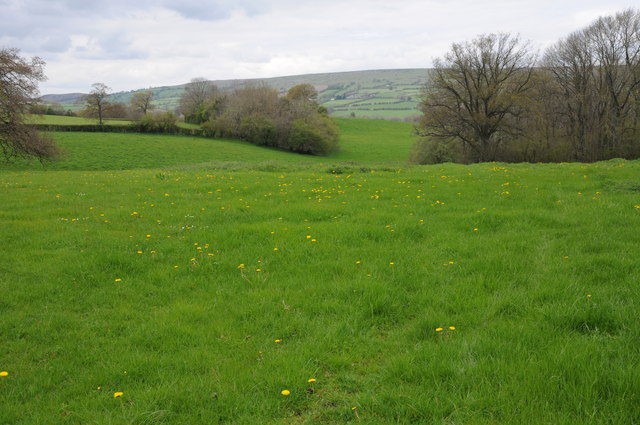
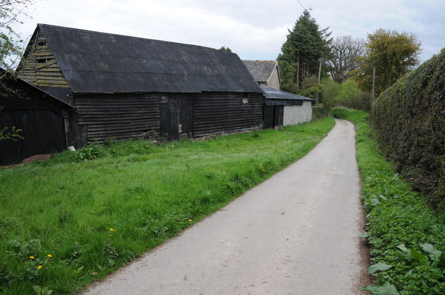
Brilley is a small village located in the county of Herefordshire, England. Situated just south of the England-Wales border, the village is set amidst stunning countryside with rolling hills and picturesque landscapes. Brilley is known for its rich history and heritage, making it an attractive destination for tourists and history enthusiasts.

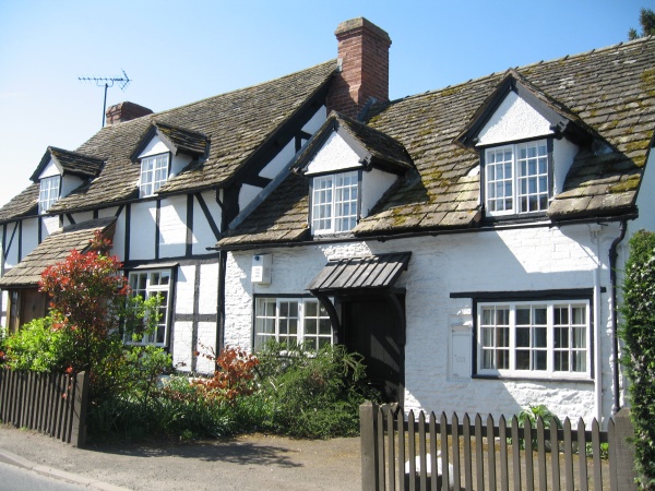
The village has a population of around 400 people, and its origins can be traced back to medieval times. Brilley has several historical buildings that showcase its heritage, including a 12th-century church, St. Mary's, which features beautiful stained glass windows and intricate stonework. The church is a popular attraction for visitors who appreciate its architectural splendor and serene atmosphere.

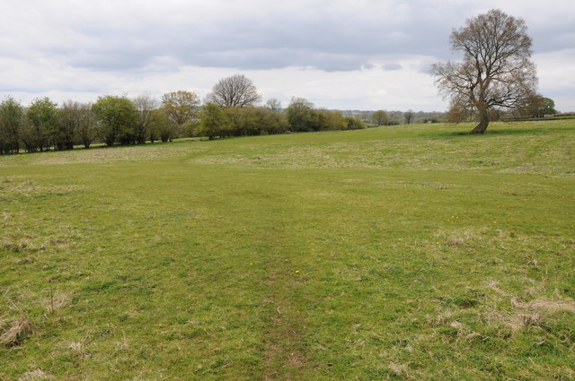
In addition to its historical sites, Brilley offers visitors the opportunity to explore the surrounding natural beauty. The village is surrounded by lush green landscapes, making it an ideal location for hiking and walking enthusiasts. The nearby River Wye also provides opportunities for water-based activities such as fishing and kayaking.

Brilley is a close-knit community that values its heritage and traditions. The village hosts various events throughout the year, including a summer fair and a Christmas market, which attract both locals and visitors alike. These events provide a glimpse into the village's vibrant community spirit.

Overall, Brilley is a charming heritage site that offers a combination of historical landmarks, natural beauty, and a warm community atmosphere. Whether it's exploring the medieval church, taking in the scenic countryside, or immersing oneself in the village's cultural events, Brilley offers a delightful experience for all who visit.

If you have any feedback on the listing, please let us know in the comments section below.
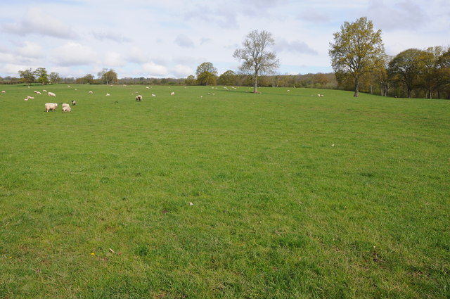
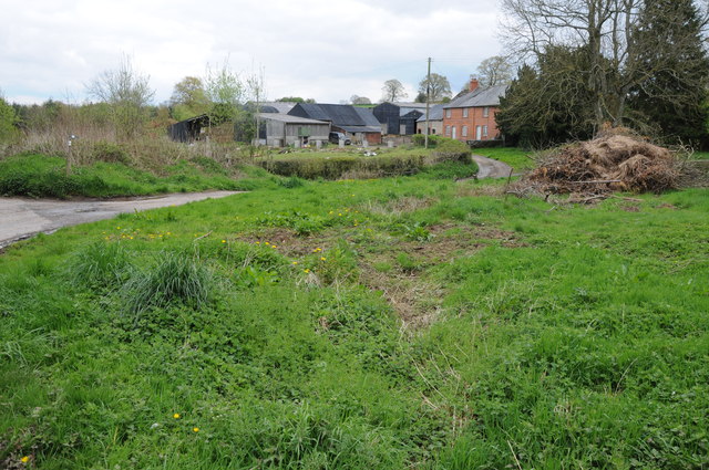
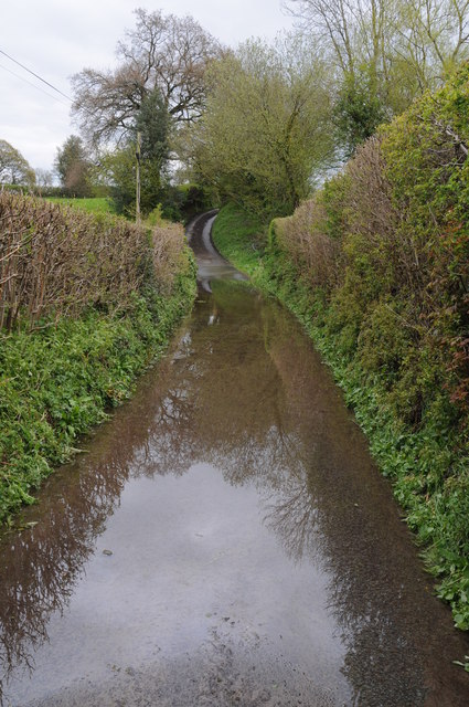
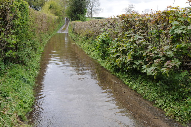
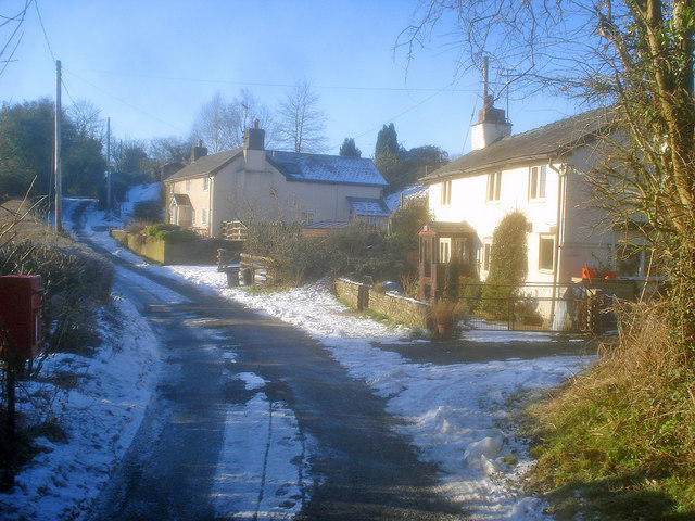
Brilley Images

Images are sourced within 2km of 52.157/-3.054 or Grid Reference SO2751. Thanks to Geograph Open Source API. All images are credited.

Bridleway near Brilley This bridleway near Brilley leads to the National Trust property, Cwmmau Farmhouse.
Bridleway near Brilley
This bridleway near Brilley leads to the National Trust property, Cwmmau Farmhouse.
Grazing land near Cwmma Moor Sheep grazing in a field near Cwmma Moor near the England/Wales border.
Grazing land near Cwmma Moor
Sheep grazing in a field near Cwmma Moor near the England/Wales border.
Road to Upper Welson No through road to Upper Welson.
Road to Upper Welson
No through road to Upper Welson.
Farmland beside Apostles Lane Farmland to the south of Apostles Lane to the south of Kingswood.  In the distance is the rolling Herefordshire and the Wye valley.
Farmland beside Apostles Lane
Farmland to the south of Apostles Lane to the south of Kingswood. In the distance is the rolling Herefordshire and the Wye valley.
Farmland at Brilley Mountain Farmland at Brilley Mountain with Hergest Ridge on the horizon in the distance.
Farmland at Brilley Mountain
Farmland at Brilley Mountain with Hergest Ridge on the horizon in the distance.
Farmland near Burnt Hengoed A noticeable feature in the Arrow valley on the Welsh border are knolls such as this one near Burnt Hengoed to the north of Brilley Mountain.
Farmland near Burnt Hengoed
A noticeable feature in the Arrow valley on the Welsh border are knolls such as this one near Burnt Hengoed to the north of Brilley Mountain.
Chickward Farm, Chickward The hamlet of Chickward is no more than a couple of farms.
Chickward Farm, Chickward
The hamlet of Chickward is no more than a couple of farms.
Herefordshire Trail near Apostles Farm The Herefordshire Trail follows this track near Apostles Farm to the west of Kingswood.
Herefordshire Trail near Apostles Farm
The Herefordshire Trail follows this track near Apostles Farm to the west of Kingswood.
View over the Wye valley View across the Wye valley and the English/Welsh border, across the valley are the Black Mountains and to the right are the Brecon Beacons.
View over the Wye valley
View across the Wye valley and the English/Welsh border, across the valley are the Black Mountains and to the right are the Brecon Beacons.
Little Penllan One of the farmhouses in the area with the name Penllan, clearly a farmhouse of some age though I haven't been able to find any information as to its age.
Little Penllan
One of the farmhouses in the area with the name Penllan, clearly a farmhouse of some age though I haven't been able to find any information as to its age.
Farmland near Great Penllan View across farmland near Great Penllan Farm, some of the farm buildings are beyond the hedge to the left.  Colva Hill can be seen in the distance.
Farmland near Great Penllan
View across farmland near Great Penllan Farm, some of the farm buildings are beyond the hedge to the left. Colva Hill can be seen in the distance.
Farm buildings, Great Penllan Farm buildings at Great Penllan viewed from the passing country road.
Farm buildings, Great Penllan
Farm buildings at Great Penllan viewed from the passing country road.
Road to Brilley Mountain Narrow country road to Brilley Mountain on the Herefordshire and Powys border.
Road to Brilley Mountain
Narrow country road to Brilley Mountain on the Herefordshire and Powys border.
Standing water on a country road After heavy recent rainfall, water is flowing onto this country road and flooding it.
Standing water on a country road
After heavy recent rainfall, water is flowing onto this country road and flooding it.
Water on the road After heavy recent rainfall, water is flowing onto this country road and flooding it.
Water on the road
After heavy recent rainfall, water is flowing onto this country road and flooding it.
Farmland near Huntington View across farmland near Huntington, with Hergest Ridge in the background.
Farmland near Huntington
View across farmland near Huntington, with Hergest Ridge in the background.
Farm buildings at Chickward Roadside farm buildings at Chickward.
Farm buildings at Chickward
Roadside farm buildings at Chickward.
The Herefordshire Trail The Herefordshire Trail to the south of Chickward.
The Herefordshire Trail
The Herefordshire Trail to the south of Chickward.
Show me another place!

Brilley is located at Grid Ref: SO2751 (Lat: 52.157, Lng: -3.054)

Unitary Authority: County of Herefordshire

Police Authority: West Mercia

What 3 Words

///washed.trainers.headlines. Near Kington, Herefordshire

Related Wikis

Brilley

Brilley is a small village and civil parish in Herefordshire, England, close to the border with Wales, and about 8 km (5 mi) north-east of the Welsh border...

Eardisley Park

Eardisley Park is a country house and estate to the southwest of the village of Eardisley in Herefordshire, England, and approximately 14 miles (23 km...

Eardisley

Eardisley () is a village and civil parish in Herefordshire about 5 miles (8.0 km) south of the centre of Kington. Eardisley is in the Wye valley in the...

Huntington, Herefordshire

Huntington is a village and civil parish in Herefordshire, England, and on the border with Wales. == History == Huntington was a Medieval borough founded...

Upper Hergest

Upper Hergest is a hamlet in Herefordshire, England. == References ==

Huntington Castle

Huntington Castle was situated in the village of Huntington in Herefordshire, England, 2+1⁄2 miles south-west of Kington (grid reference SO249539). �...

Lower Hergest

Lower Hergest is a hamlet in Herefordshire, England.The local manor house, Hergest Court, is a Grade II* listed building built of a mixture of stone and...

Eardisley Castle

Eardisley Castle was in the village of Eardisley in Herefordshire, England, 11 km north-east of Hay-on-Wye (grid reference SO311491). The site of the castle...

Have you been to Brilley?

Leave your review of Brilley below (or comments, questions and feedback).