Bramfieldbury

Heritage Site in Hertfordshire East Hertfordshire

England

Bramfieldbury

Main Road, Bramfield
Main Road, Bramfield Credit: David Howard

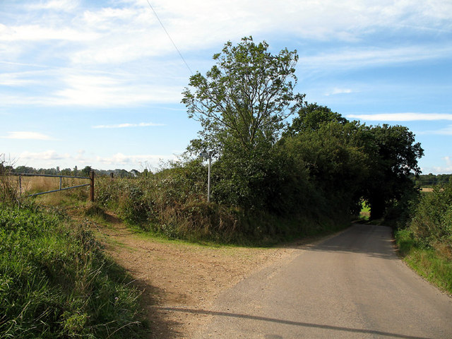
Bramfieldbury, located in the county of Hertfordshire, England, is a charming heritage site that holds significant historical and architectural importance. Situated in the rural village of Bramfield, this site is renowned for its picturesque landscapes and well-preserved structures.

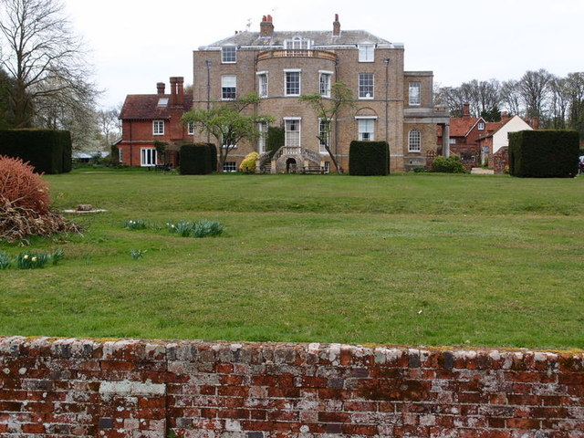
The centerpiece of Bramfieldbury is a magnificent manor house that dates back to the 16th century. This grand residence boasts a unique Tudor architectural style, characterized by its timber-framed construction and ornate detailing. The manor house is surrounded by beautifully landscaped gardens, featuring well-manicured lawns, vibrant flowerbeds, and meandering pathways.

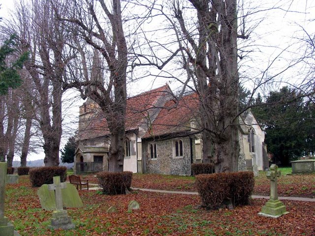
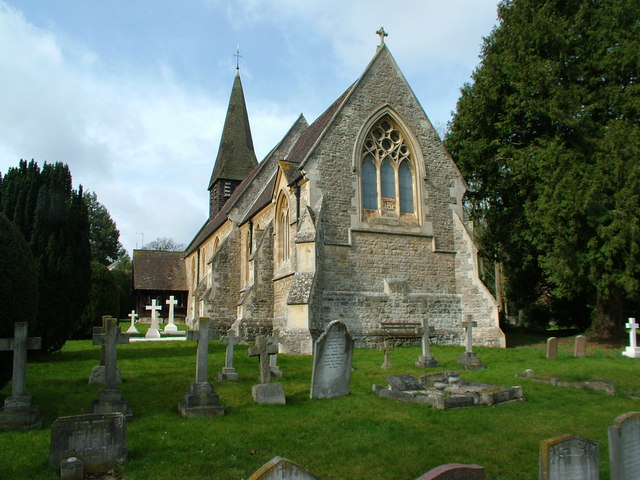
Adjacent to the manor house, visitors can also explore the historic Bramfieldbury Church, which dates back to the 12th century. This charming place of worship showcases stunning stained-glass windows and intricate stone carvings, providing a glimpse into the region's rich religious heritage.

Additionally, Bramfieldbury offers visitors the opportunity to delve into the local history through its informative exhibitions and guided tours. The site's museum houses a collection of artifacts, documents, and photographs that document the area's past, allowing visitors to gain a deeper understanding of Bramfieldbury's significance within the wider context of Hertfordshire.

Whether it be for history enthusiasts, architectural admirers, or nature lovers, Bramfieldbury offers a unique and enriching experience. Its serene surroundings, well-preserved structures, and rich history make it a must-visit destination for those seeking to explore the heritage of Hertfordshire.

If you have any feedback on the listing, please let us know in the comments section below.

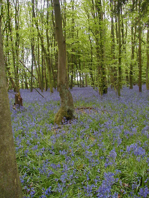
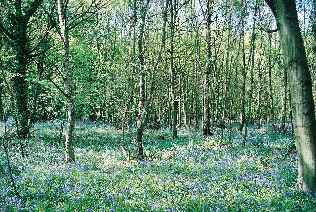
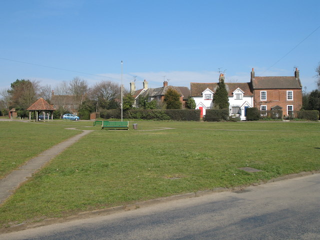
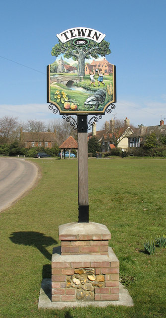
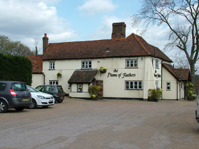
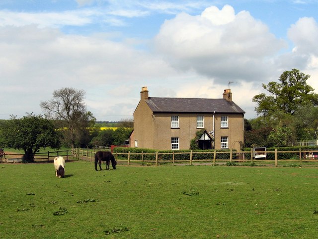
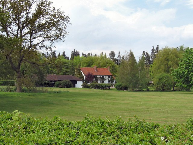
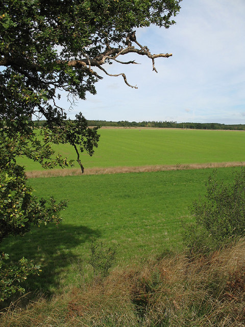
Bramfieldbury Images

Images are sourced within 2km of 51.823/-0.135 or Grid Reference TL2815. Thanks to Geograph Open Source API. All images are credited.

Main Road, Bramfield
Looking towards Priest Wood, Bramfield
Main Road, Bramfield
Bramfield Village Looking north from the village church.
Bramfield Village
Looking north from the village church.
Bluebells in Row Wood
Hazeldell Wood Sally & I were out for a walk to celebrate Beltane and the arrival of Spring. The woods were beautiful. There was a carpet of bluebells in almost every one.
Hazeldell Wood
Sally & I were out for a walk to celebrate Beltane and the arrival of Spring. The woods were beautiful. There was a carpet of bluebells in almost every one.
Tewin Village Green View north across the village green.
Tewin Village Green
View north across the village green.
Tewin Village Sign
Tewin Village Sign
Bramfield Shelter Built 2 June 1953 to commemorate Queen Elizabeth's Coronation it was originally the village well house.
Bramfield Shelter
Built 2 June 1953 to commemorate Queen Elizabeth's Coronation it was originally the village well house.
Bramfield Village Post Office A rare sight these days, a working, village post office and store.
Bramfield Village Post Office
A rare sight these days, a working, village post office and store.
The Plume of Feathers Public House A Pub & Restaurant in the village of Tewin
The Plume of Feathers Public House
A Pub & Restaurant in the village of Tewin
Bacon's Farm On the other side of the farmhouse there live a flock of chickens.
The eggs are sold from an honesty-box by the gate.
Bacon's Farm
On the other side of the farmhouse there live a flock of chickens. The eggs are sold from an honesty-box by the gate.
Bramfieldbury This house may be on the site of the dwelling-house said to have been built by Robert Ware, bursar of St. Albans, at Bramfield. It is generally called Bramfieldbury or Nancy Bury.
Bramfieldbury
This house may be on the site of the dwelling-house said to have been built by Robert Ware, bursar of St. Albans, at Bramfield. It is generally called Bramfieldbury or Nancy Bury.
Greenhill This house stands just to the south of Bramfield Woods.
It is the only house in this grid-square apart from the Lodge-house at the end of the drive.
Greenhill
This house stands just to the south of Bramfield Woods. It is the only house in this grid-square apart from the Lodge-house at the end of the drive.
Westend Farmland Farmland to the south of Bramfield.  The oak tree in the foreground has fully developed acorns.  Beyond the near boundary, the field has a new crop, possibly winter wheat, growing.   The small dot near the centre of the photo is a pair of joggers on the bridleway that cuts diagonally across the field.
Westend Farmland
Farmland to the south of Bramfield. The oak tree in the foreground has fully developed acorns. Beyond the near boundary, the field has a new crop, possibly winter wheat, growing. The small dot near the centre of the photo is a pair of joggers on the bridleway that cuts diagonally across the field.
Bridleway and road near Westend Farm On the road between Bramfield and the B1000.  The road hugs the east side of the shallow valley.   On the left is a bridleway to Goldings Plantation.
Bridleway and road near Westend Farm
On the road between Bramfield and the B1000. The road hugs the east side of the shallow valley. On the left is a bridleway to Goldings Plantation.
Veteran Hornbeam Pollard along old green lane Veteran trees like this provide a really important wildlife habitat.
Veteran Hornbeam Pollard along old green lane
Veteran trees like this provide a really important wildlife habitat.
St Andrew, Bramfield, Herts
Show me another place!

Bramfieldbury is located at Grid Ref: TL2815 (Lat: 51.823, Lng: -0.135)

Administrative County: Hertfordshire

District: East Hertfordshire

Police Authority: Hertfordshire

What 3 Words

///normal.hood.fried. Near Datchworth, Hertfordshire

Related Wikis

Bramfield, Hertfordshire

Bramfield is a village and civil parish in the East Hertfordshire district, in the county of Hertfordshire, England. Nearby settlements include Hertford...

Tewin

Tewin is an English village and civil parish in Hertfordshire, England between the towns of Welwyn Garden City, Stevenage, Welwyn (village) and the county...

Marden Hill

Marden Hill is a Grade II* listed country house close to the village of Tewin, Hertfordshire.The house, originally Jacobean but substantially rebuilt in...

Tewin Orchard and Hopkyns Wood

Tewin Orchard and Hopkyns Wood is a 4.3-hectare (11-acre) nature reserve in Tewin in Hertfordshire. It is managed by the Herts and Middlesex Wildlife Trust...

Panshanger

Panshanger was a large country house located between the outer edge of Hertford and Welwyn Garden City in Hertfordshire, England. == History == Earl Cowper...

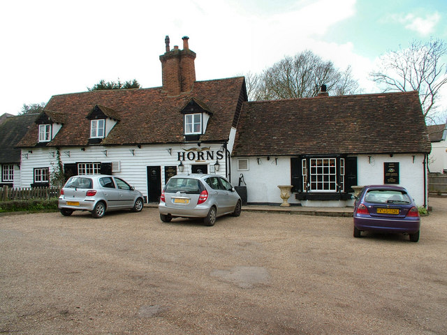
The Horns, Bull's Green

The Horns is a public house in Datchworth, Hertfordshire, England. It is situated on Bramfield Road in Bull's Green, a hamlet in the parish of Datchworth...

Waterford, Hertfordshire

Waterford is a village in the East Hertfordshire district of Hertfordshire, England. It is located on the A119 road, around 2.5 km (1.6 miles) north of...

Pishiobury

Pishiobury, sometimes spelled Pishobury, was a manor and estate in medieval Sawbridgeworth, Hertfordshire. Its denomination as "Pishiobury" only emerged...

Nearby Amenities

Located within 500m of 51.823,-0.135
Created By: YahooApplet 1.0
Lat/Long: 51.8255359/-0.1405843
Created By: YahooApplet 1.0
Lat/Long: 51.8252707/-0.1399835
Created By: YahooApplet 1.0
Lat/Long: 51.8252176/-0.1393398
Created By: YahooApplet 1.0
Lat/Long: 51.8256155/-0.1383527
Created By: YahooApplet 1.0
Lat/Long: 51.8263581/-0.1374515
Created By: YahooApplet 1.0
Lat/Long: 51.8202057/-0.1376492
Created By: YahooApplet 1.0
Lat/Long: 51.8209355/-0.1368682
Created By: YahooApplet 1.0
Lat/Long: 51.8213762/-0.1364947
Created By: YahooApplet 1.0
Lat/Long: 51.821955/-0.1374515
Created By: YahooApplet 1.0
Lat/Long: 51.8225386/-0.1374086
Created By: YahooApplet 1.0
Lat/Long: 51.822963/-0.137194
Created By: YahooApplet 1.0
Lat/Long: 51.8229365/-0.1364644
Created By: YahooApplet 1.0
Lat/Long: 51.8225386/-0.1355632
Created By: YahooApplet 1.0
Lat/Long: 51.822459/-0.1350053
Created By: YahooApplet 1.0
Lat/Long: 51.823016/-0.1343187
Created By: YahooApplet 1.0
Lat/Long: 51.8245014/-0.1342328
Created By: YahooApplet 1.0
Lat/Long: 51.8255094/-0.1326021
Created By: YahooApplet 1.0
Lat/Long: 51.8265969/-0.1380094
Bench
Backrest: yes
Source: GPS
Lat/Long: 51.8239025/-0.1282391
Leisure: picnic_table
Source: GPS, observation
Lat/Long: 51.8244972/-0.1283216
Leisure: picnic_table
Source: GPS, observation
Lat/Long: 51.8245125/-0.1283222
Power: pole
Lat/Long: 51.8188624/-0.1323643
Power: pole
Lat/Long: 51.8198953/-0.132021
Power: pole
Lat/Long: 51.8205718/-0.1313558
Power: pole
Lat/Long: 51.821288/-0.1306772
Power: pole
Lat/Long: 51.8222148/-0.1297438
Power: pole
Lat/Long: 51.8230818/-0.1288828
Power: pole
Lat/Long: 51.8237499/-0.1300952
Power: pole
Lat/Long: 51.8245904/-0.1308623
Power: pole
Lat/Long: 51.8253945/-0.1318896
Power: pole
Lat/Long: 51.8260377/-0.1328123
Power: pole
Lat/Long: 51.8267372/-0.1337349
Power: pole
Lat/Long: 51.8274335/-0.1346362
The data included in this document is from www.openstreetmap.org. The data is made available under ODbL.

Have you been to Bramfieldbury?

Leave your review of Bramfieldbury below (or comments, questions and feedback).