Bourne Mill

Heritage Site in Essex Colchester

England

Bourne Mill

GreyFriars Hotel, Colchester The dinning terraces behind GreyFriars Hotel.
GreyFriars Hotel, Colchester Credit: Rebecca A Wills

Bourne Mill is a historic heritage site located in the town of Colchester, Essex, England. It is a well-preserved watermill that dates back to the 16th century and is now managed by the National Trust. The mill is situated on the River Colne and offers visitors a glimpse into the region's rich industrial past.

The mill itself is an impressive structure made of red brick, with a timber-framed upper floor. It operated as a working mill until the mid-20th century and was primarily used for grinding corn and wheat. Today, it stands as a testament to the technological advancements of its time and provides a fascinating insight into the milling industry of the past.

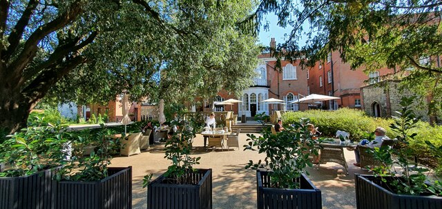
Visitors to Bourne Mill can explore the various rooms and machinery within the building, including the grinding floor, where the millstones are still intact. The mill also houses a small museum displaying artifacts and information about its history. The surrounding area offers scenic views, with a picturesque mill pond and a beautiful garden that adds to the overall charm of the site.

In addition to the historical significance of the mill, Bourne Mill is also known for its natural beauty and wildlife. The river and surrounding wetlands provide a habitat for a variety of birds and other wildlife, making it a popular spot for nature enthusiasts.

Overall, Bourne Mill is a must-visit destination for history buffs, nature lovers, and anyone interested in exploring the industrial heritage of Essex. With its well-preserved architecture, informative displays, and stunning surroundings, it offers a unique and educational experience for visitors of all ages.

If you have any feedback on the listing, please let us know in the comments section below.

Bourne Mill Images

Images are sourced within 2km of 51.877/0.913 or Grid Reference TM0023. Thanks to Geograph Open Source API. All images are credited.

GreyFriars Hotel, Colchester The dinning terraces behind GreyFriars Hotel.
GreyFriars Hotel, Colchester
The dinning terraces behind GreyFriars Hotel.
The 1327 from Colchester arriving at Colchester Town station
Lots of vans, Colchester
Joining the main line from the Colchester Town chord
Merville Barracks, Colchester A statue of Pegasus and Bellerophon (the symbol of airborne forces) in front of the Headquarters 16 Air Assault Brigade.
Merville Barracks, Colchester
A statue of Pegasus and Bellerophon (the symbol of airborne forces) in front of the Headquarters 16 Air Assault Brigade.
Bellerophon on Pegasus - the official symbol of the Parachute Regiment Overlooking the parade ground at Merville Barracks, Colchester. 
The statue is surrounded by the Parachute Regiment Flag, the Union Flag 
and the Pegasus Airborne Flag.
Bellerophon on Pegasus - the official symbol of the Parachute Regiment
Overlooking the parade ground at Merville Barracks, Colchester. The statue is surrounded by the Parachute Regiment Flag, the Union Flag and the Pegasus Airborne Flag.
Parachute Regiment march onto Parade Square Presentation of Colours Parade begins.
Parachute Regiment march onto Parade Square
Presentation of Colours Parade begins.
Old Colours are marched off the square To be kept in a chapel of remembrance.
Old Colours are marched off the square
To be kept in a chapel of remembrance.
Prince Charles is invited to inspect the front ranks Of the assembled Paratroopers by the Officer Commanding the Parade.
Prince Charles is invited to inspect the front ranks
Of the assembled Paratroopers by the Officer Commanding the Parade.
Prince Charles talks with the Paras The drums await the presentation of new colours.
Prince Charles talks with the Paras
The drums await the presentation of new colours.
The new Colours are formally presented By Prince Charles on behalf of the Queen.
The new Colours are formally presented
By Prince Charles on behalf of the Queen.
The march past with New Colours Past Prince Charles on the dais.
The march past with New Colours
Past Prince Charles on the dais.
Prince Charles takes the salute As the New Colours are paraded past.
Prince Charles takes the salute
As the New Colours are paraded past.
The Regimental Mascot - Pegasus V The pony had been causing problems at the dress rehearsal but a good talking to cured the problem!
The Regimental Mascot - Pegasus V
The pony had been causing problems at the dress rehearsal but a good talking to cured the problem!
The Red Devils arrive overhead With smoke trailing from cannisters on their ankles.
The Red Devils arrive overhead
With smoke trailing from cannisters on their ankles.
Red Devils  In freefall display.
Red Devils
In freefall display.
Red Devil Landing on the parade ground.
Red Devil
Landing on the parade ground.
Red Devil  With an advert for the Parachute Regiment.
Red Devil
With an advert for the Parachute Regiment.
Show me another place!

Bourne Mill is located at Grid Ref: TM0023 (Lat: 51.877, Lng: 0.913)

Administrative County: Essex

District: Colchester

Police Authority: Essex

What 3 Words

///apply.feed.ranch. Near Colchester, Essex

Nearby Locations

Bourne Pond Bourne Mill

Related Wikis

Bourne Mill, Colchester

Bourne Mill is a Grade I listed former fishing lodge and then in turn a fulling mill and cornmill in the city of Colchester in Essex and is owned by the...

Garrison A Cricket Ground

Garrison A Cricket Ground is a cricket ground in Colchester, Essex. The first recorded match on the ground was in 1924, when Essex played their first...

Colchester Corporation Tramways

Colchester Corporation Tramways served the town of Colchester in Essex from 28 July 1904 until 8 December 1929. == History == In 1901, Colchester Corporation...

The Hythe, Essex

The Hythe is an area in the southeastern part of Colchester in Essex, England, on the River Colne. Historically it was a hamlet. The Hythe is home to the...

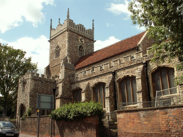
Church of St Leonard at the Hythe, Colchester

The Church of St Leonard at the Hythe is a redundant Anglican church in Hythe, Colchester, Essex, England. It is recorded in the National Heritage List...

School of Computer Science and Electronic Engineering, Essex University

The School of Computer Science and Electronic Engineering at the University of Essex is an academic department that focuses on educating and researching...

Colchester power station

Colchester power station supplied electricity to the city of Colchester, Essex, England and the surrounding area from 1900 to 1960. It was owned and operated...
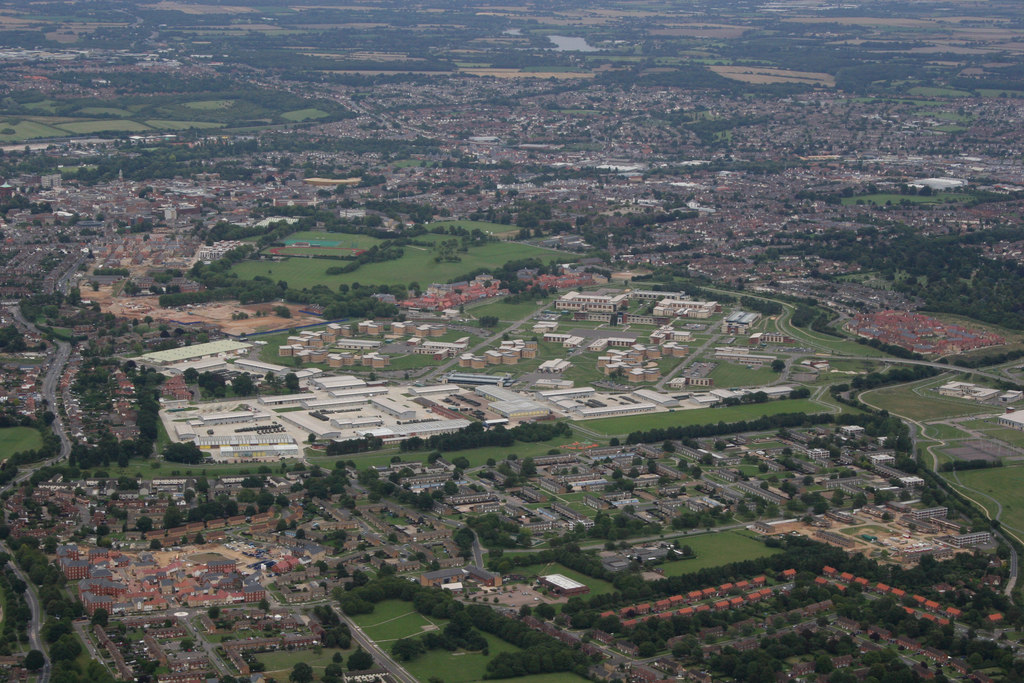
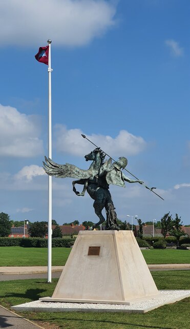
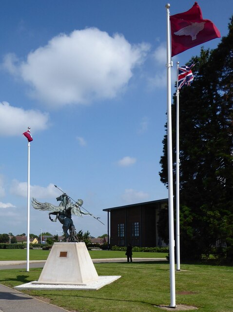
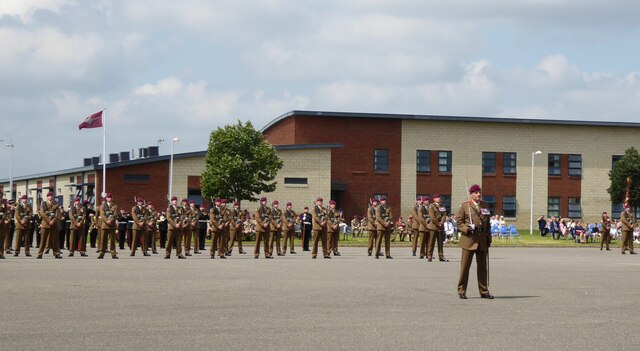
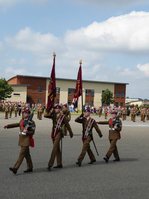
Colchester Garrison

Colchester Garrison is a major garrison located in Colchester in the county of Essex, eastern England. It has been an important military base since the...

Nearby Amenities

Located within 500m of 51.877,0.913
Traffic Signals
Lat/Long: 51.8806232/0.913872
Crossing
Crossing Island: yes
Lat/Long: 51.8729463/0.9128873
Crossing
Crossing: unmarked
Crossing Island: no
Kerb: lowered
Lat/Long: 51.8729708/0.9136022
Post Box
Operator: Royal Mail
Post Box Type: pillar
Ref: CO2 167
Lat/Long: 51.8747212/0.9121822
Post Box
Operator: Royal Mail
Ref: CO2 14
Lat/Long: 51.8786759/0.9067592
Barrier: cycle_barrier
Bicycle: yes
Foot: yes
Lat/Long: 51.8767/0.9085052
Barrier: cycle_barrier
Bicycle: yes
Foot: yes
Lat/Long: 51.8762404/0.9130127
Barrier: cycle_barrier
Lat/Long: 51.8772785/0.9100025
Bench
Lat/Long: 51.8764806/0.917903
Bourne Valley
Information: board
Tourism: information
Lat/Long: 51.8767983/0.9195127
Bus Stop
Bench: no
Bin: no
Bus: yes
Note: not marked request stop
Public Transport: platform
Shelter: no
Tactile Paving: no
Lat/Long: 51.8737476/0.9144041
Barrier: cycle_barrier
Lat/Long: 51.8730523/0.9129429
Bus Stop
Bench: no
Bin: no
Bus: yes
Note: not marked request stop
Public Transport: platform
Shelter: no
Tactile Paving: no
Lat/Long: 51.873654/0.9144028
Bus Stop
Stalin Road
Bench: no
Bin: no
Bus: yes
Public Transport: platform
Route: 66
Shelter: no
Tactile Paving: no
Lat/Long: 51.874666/0.9119246
Barrier: cycle_barrier
Lat/Long: 51.8747013/0.9114496
Barrier: cycle_barrier
Lat/Long: 51.8753479/0.9114421
Barrier: cycle_barrier
Lat/Long: 51.8746632/0.9103
Barrier: bollard
Bicycle: no
Bollard: fixed
Foot: yes
Lat/Long: 51.8754671/0.9101859
Crossing
Crossing: uncontrolled
Crossing Ref: zebra
Lat/Long: 51.8787859/0.906497
Barrier: cycle_barrier
Lat/Long: 51.8729401/0.910506
Barrier: kissing_gate
Lat/Long: 51.8769843/0.9164609
Barrier: cycle_barrier
Lat/Long: 51.8768018/0.9194062
Barrier: cycle_barrier
Lat/Long: 51.8767604/0.9131318
Barrier: cycle_barrier
Lat/Long: 51.8784611/0.9074369
Barrier: cycle_barrier
Lat/Long: 51.8778155/0.9129394
Post Box
Operator: Royal Mail
Ref: CO2 92
Lat/Long: 51.8798444/0.9092227
Post Box
Operator: Royal Mail
Ref: CO1 43
Lat/Long: 51.8790214/0.9166447
Barrier: stile
Lat/Long: 51.8728728/0.9128919
Bench
Backrest: yes
Lat/Long: 51.87607/0.9084165
Cemetery Opening Hours
Information: board
Tourism: information
Lat/Long: 51.8762593/0.9083081
Cemetery Map
Information: map
Tourism: information
Lat/Long: 51.8762716/0.9083415
Bus Stop
Recreation Ground
Bus: yes
Naptan AtcoCode: 1500IM1868
Naptan Bearing: SE
Naptan CommonName: Recreation Ground
Naptan Indicator: o/s
Naptan Landmark: Recreation Ground
Naptan NaptanCode: esxjawjt
Naptan PlusbusZoneRef: CLCHSTR
Naptan Street: Old Heath Road
Naptan Verified: no
Public Transport: platform
Source: GPS;naptan_import
Lat/Long: 51.8803175/0.9145414
Post Box
Operator: Royal Mail
Ref: CO1 24
Source: GPS
Lat/Long: 51.8811411/0.9137976
Bus Stop
Recreation Ground
Bus: yes
Naptan AtcoCode: 1500IM1868A
Naptan Bearing: NW
Naptan CommonName: Recreation Ground
Naptan Indicator: Opp
Naptan Landmark: Recreation Ground
Naptan NaptanCode: esxampda
Naptan PlusbusZoneRef: CLCHSTR
Naptan Street: Old Heath Road
Naptan Verified: no
Public Transport: platform
Source: GPS;naptan_import
Lat/Long: 51.8800882/0.9147856
Barrier: bollard
Bicycle: yes
Foot: yes
Lat/Long: 51.8792544/0.916249
Bench
Lat/Long: 51.8764631/0.9171849
Bourne Valley Footpath
Information: board
Tourism: information
Lat/Long: 51.8769712/0.9198976
Bus Stop
Worsnop House
Bus: yes
Naptan AtcoCode: 150033043009
Naptan Bearing: SE
Naptan CommonName: Worsnop House
Naptan Crossing: Recreation Road
Naptan Indicator: o/s
Naptan Landmark: Worsnop House
Naptan NaptanCode: esxampdj
Naptan PlusbusZoneRef: CLCHSTR
Naptan Street: Old Heath Road
Naptan Verified: no
Public Transport: platform
Source: naptan_import
Lat/Long: 51.8793405/0.9164479
Bus Stop
Worsnop House
Bus: yes
Naptan AtcoCode: 150033043010
Naptan Bearing: NW
Naptan BusStopType: CUS
Naptan CommonName: Worsnop House
Naptan Crossing: Recreation Road
Naptan Indicator: Opp
Naptan Landmark: Worsnop House
Naptan NaptanCode: esxampdg
Naptan PlusbusZoneRef: CLCHSTR
Naptan Street: Old Heath Road
Naptan Verified: no
Public Transport: platform
Source: naptan_import
Lat/Long: 51.8791996/0.9164146
Bus Stop
Scarletts Road
Bus: yes
Naptan AtcoCode: 150033043011
Naptan Bearing: SE
Naptan CommonName: Scarletts Road
Naptan Crossing: Scarletts Road
Naptan Indicator: Adj
Naptan Landmark: Scarletts Road
Naptan NaptanCode: esxampdm
Naptan PlusbusZoneRef: CLCHSTR
Naptan Street: Old Heath Road
Naptan Verified: no
Public Transport: platform
Source: naptan_import
Lat/Long: 51.8775124/0.9192464
Bus Stop
Scarletts Road
Bus: yes
Naptan AtcoCode: 150033043012
Naptan Bearing: NW
Naptan CommonName: Scarletts Road
Naptan Crossing: Scarletts Road
Naptan Indicator: Opp
Naptan Landmark: Scarletts Road
Naptan NaptanCode: esxampdp
Naptan PlusbusZoneRef: CLCHSTR
Naptan Street: Old Heath Road
Naptan Verified: no
Public Transport: platform
Source: naptan_import
Lat/Long: 51.876948/0.9200031
Bus Stop
Unity Close
Bus: yes
Naptan AtcoCode: 150033049002
Naptan Bearing: E
Naptan CommonName: Unity Close
Naptan Crossing: Unity Close
Naptan Indicator: Adj
Naptan Landmark: Unity Close
Naptan NaptanCode: esxamtwg
Naptan PlusbusZoneRef: CLCHSTR
Naptan Street: Barn Hall Avenue
Naptan Verified: no
Public Transport: platform
Source: naptan_import
Lat/Long: 51.875278/0.9179537
Bus Stop
Unity Close
Bus: yes
Naptan AtcoCode: 150033049003
Naptan Bearing: W
Naptan CommonName: Unity Close
Naptan Crossing: Unity Close
Naptan Indicator: Opp
Naptan Landmark: Unity Close
Naptan NaptanCode: esxamtwj
Naptan PlusbusZoneRef: CLCHSTR
Naptan Street: Barn Hall Avenue
Naptan Verified: no
Public Transport: platform
Source: naptan_import
Lat/Long: 51.8751516/0.917248
Bus Stop
Churchill Way
Bus: yes
Naptan AtcoCode: 150033049004
Naptan Bearing: SW
Naptan CommonName: Churchill Way
Naptan Crossing: Barn Hall Avenue
Naptan Indicator: SW-bound
Naptan Landmark: Churchill Way
Naptan NaptanCode: esxamtwm
Naptan PlusbusZoneRef: CLCHSTR
Naptan Street: Churchill Way
Naptan Verified: no
Public Transport: platform
Source: naptan_import
Lat/Long: 51.8747966/0.9160139
Bus Stop
Normandy Avenue
Bus: yes
Naptan AtcoCode: 150033049008
Naptan Bearing: W
Naptan CommonName: Normandy Avenue
Naptan Crossing: Horrocks Close
Naptan Indicator: W-bound
Naptan Landmark: Normandy Avenue
Naptan NaptanCode: esxamwaj
Naptan PlusbusZoneRef: CLCHSTR
Naptan Street: Normandy Avenue
Naptan Verified: no
Public Transport: platform
Source: naptan_import
Lat/Long: 51.8738239/0.9105799
Bus Stop
Normandy Avenue
Bus: yes
Naptan AtcoCode: 150033049009
Naptan Bearing: E
Naptan CommonName: Normandy Avenue
Naptan Crossing: Horrocks Close
Naptan Indicator: E-bound
Naptan Landmark: Normandy Avenue
Naptan NaptanCode: esxamwag
Naptan PlusbusZoneRef: CLCHSTR
Naptan Street: Normandy Avenue
Naptan Verified: no
Public Transport: platform
Source: naptan_import
Lat/Long: 51.8737984/0.9097936
Bus Stop
Cemetery Gates
Bench: no
Naptan AtcoCode: 150033050001
Naptan Bearing: N
Naptan CommonName: Dudley Close
Naptan Crossing: Dudley Close
Naptan Indicator: Adj
Naptan Landmark: Dudley Close
Naptan NaptanCode: esxamwpm
Naptan PlusbusZoneRef: CLCHSTR
Naptan Street: Mersea Road
Naptan Verified: no
Public Transport: platform
Shelter: no
Source: naptan_import
Lat/Long: 51.8764958/0.9083019
Bus Stop
Cemetery Gates
Bench: no
Naptan AtcoCode: 150033050002
Naptan Bearing: S
Naptan CommonName: Dudley Close
Naptan Crossing: Dudley Close
Naptan Indicator: Opp
Naptan Landmark: Dudley Close
Naptan NaptanCode: esxamwpt
Naptan PlusbusZoneRef: CLCHSTR
Naptan Street: Mersea Road
Naptan Verified: no
Public Transport: platform
Shelter: no
Source: naptan_import
Lat/Long: 51.8765042/0.9084806
Brittany Way
Naptan AtcoCode: 1500BRITCOL
Naptan Bearing: W
Naptan BusStopType: CUS
Naptan CommonName: Brittany Way
Naptan Crossing: Brittany Way
Naptan Indicator: Opp
Naptan Landmark: Brittany Way
Naptan NaptanCode: esxjgawj
Naptan Street: Churchill Way
Naptan Verified: no
Public Transport: platform
Source: naptan_import
Lat/Long: 51.874601/0.9143512
Bus Stop
Pownall Crescent
Naptan AtcoCode: 1500IM1344
Naptan Bearing: NW
Naptan CommonName: Pownall Crescent
Naptan Crossing: Pownall Crescent
Naptan Indicator: Adj
Naptan Landmark: Pownall Crescent
Naptan NaptanCode: esxadjma
Naptan PlusbusZoneRef: CLCHSTR
Naptan Street: Mersea Road
Naptan Verified: no
Public Transport: platform
Source: naptan_import
Lat/Long: 51.8785873/0.9067171
Bus Stop
Pownall Crescent
Naptan AtcoCode: 1500IM1344B
Naptan Bearing: SE
Naptan CommonName: Pownall Crescent
Naptan Crossing: Pownall Crescent
Naptan Indicator: Opp
Naptan Landmark: Pownall Crescent
Naptan NaptanCode: esxadtwg
Naptan PlusbusZoneRef: CLCHSTR
Naptan Street: Mersea Road
Naptan Verified: no
Public Transport: platform
Source: naptan_import
Lat/Long: 51.8784224/0.9072005
Bus Stop
Stalin Road
Bus: yes
Naptan AtcoCode: 1500IM136
Naptan Bearing: N
Naptan CommonName: Stalin Road
Naptan Crossing: Churchill Way
Naptan Indicator: N-bound
Naptan Landmark: Stalin Road
Naptan NaptanCode: esxamtwp
Naptan PlusbusZoneRef: CLCHSTR
Naptan Street: Stalin Road
Naptan Verified: no
Public Transport: platform
Source: naptan_import
Lat/Long: 51.8749364/0.9125543
Bus Stop
Roosevelt Way
Bus: yes
Naptan AtcoCode: 1500IM137
Naptan Bearing: E
Naptan CommonName: Roosevelt Way
Naptan Crossing: Barn Hall Avenue
Naptan Indicator: E-bound
Naptan Landmark: Roosevelt Way
Naptan NaptanCode: esxamtwt
Naptan PlusbusZoneRef: CLCHSTR
Naptan Street: Roosevelt Way
Naptan Verified: no
Public Transport: platform
Source: naptan_import
Lat/Long: 51.8755989/0.91517
Bus Stop
Stalin Road
Bench: no
Bin: no
Bus: yes
Naptan AtcoCode: 1500IM1871
Naptan Bearing: W
Naptan CommonName: Stalin Road
Naptan Crossing: Stalin Road
Naptan Indicator: W-bound
Naptan Landmark: Stalin Road
Naptan NaptanCode: esxamwad
Naptan PlusbusZoneRef: CLCHSTR
Naptan Street: Churchill Way
Naptan Verified: no
Public Transport: platform
Shelter: no
Source: naptan_import
Tactile Paving: no
Lat/Long: 51.8746022/0.9118362
Bus Stop
Avignon Close
Bus: yes
Naptan AtcoCode: 1500IM2486
Naptan Bearing: E
Naptan BusStopType: CUS
Naptan CommonName: Avignon Close
Naptan Indicator: Adj
Naptan Landmark: Avignon Close
Naptan NaptanCode: esxadpta
Naptan PlusbusZoneRef: CLCHSTR
Naptan Street: Mountbatten Drive
Naptan Verified: no
Public Transport: platform
Source: naptan_import
Lat/Long: 51.8740335/0.9177278
Bus Stop
Avignon Close
Bus: yes
Naptan AtcoCode: 1500IM2486AA
Naptan Bearing: W
Naptan BusStopType: CUS
Naptan CommonName: Avignon Close
Naptan Crossing: Avignon Close
Naptan Indicator: Opp
Naptan Landmark: Avignon Close
Naptan NaptanCode: esxjajpd
Naptan PlusbusZoneRef: CLCHSTR
Naptan Street: Mountbatten Drive
Naptan Verified: no
Public Transport: platform
Source: naptan_import
Lat/Long: 51.8740155/0.9173633
Traffic Calming: hump
Lat/Long: 51.8798911/0.9082313
Traffic Calming: hump
Lat/Long: 51.8799387/0.9089788
Traffic Calming: hump
Lat/Long: 51.8799579/0.9092516
Traffic Calming: table
Lat/Long: 51.8804505/0.9090228
Traffic Calming: table
Lat/Long: 51.8805102/0.9089171
Traffic Calming: table
Lat/Long: 51.8805196/0.9091022
Traffic Calming: table
Lat/Long: 51.8792309/0.9068771
Traffic Calming: table
Lat/Long: 51.8792362/0.9067328
Traffic Calming: hump
Lat/Long: 51.8792777/0.9076233
Traffic Calming: hump
Lat/Long: 51.8793226/0.908314
Traffic Calming: hump
Lat/Long: 51.879684/0.9131223
Traffic Calming: hump
Lat/Long: 51.8797421/0.9124908
Traffic Calming: hump
Lat/Long: 51.8798175/0.9116587
Traffic Calming: hump
Lat/Long: 51.8798337/0.9075328
Traffic Calming: hump
Lat/Long: 51.8799026/0.9107185
Traffic Calming: hump
Lat/Long: 51.8802477/0.9133697
Traffic Calming: hump
Lat/Long: 51.8804098/0.912658
Traffic Calming: hump
Lat/Long: 51.8805774/0.9119266
Traffic Calming: hump
Lat/Long: 51.8807258/0.9104575
Traffic Calming: hump
Lat/Long: 51.8807616/0.9111248
Traffic Calming: table
Lat/Long: 51.8809771/0.9097581
Traffic Calming: table
Lat/Long: 51.8810571/0.9098518
Traffic Calming: hump
Lat/Long: 51.8813087/0.912254
Saint George's
Place: locality
Lat/Long: 51.8794778/0.9101795
Speed Camera
Lat/Long: 51.8766764/0.9082389
Crossing
Crossing: traffic_signals
Crossing Ref: pelican
Supervised: no
Lat/Long: 51.8804921/0.9138428
Crossing
Crossing: traffic_signals
Crossing Ref: pelican
Supervised: no
Lat/Long: 51.8805148/0.9140422
Crossing
Crossing: traffic_signals
Crossing Ref: pelican
Supervised: no
Lat/Long: 51.8807149/0.9136854
Crossing
Crossing: traffic_signals
Crossing Ref: pelican
Supervised: no
Lat/Long: 51.8807282/0.9139018
Entrance: main
Lat/Long: 51.8798643/0.9087385
Russell Stores
Addr City: Colchester
Addr Housename: Russell Court
Addr Housenumber: 19
Addr Postcode: CO2 8SR
Addr Street: Stalin Road
Shop: convenience
Lat/Long: 51.8751035/0.9127483
C H Canterbury Place 1889
Addr City: Colchester
Addr Housenumber: 30
Addr Postcode: CO2 7LT
Addr Street: Bourne Road
Information: sign
Tourism: information
Lat/Long: 51.8796003/0.9132877
The Grapes
Defibrillator
Defibrillator Location: On outside wall of The Grapes at entrance to car park
Emergency: defibrillator
Ref GB The Circuit: 06AF89C6-B6A8-4A49-A542-AEA3008D2300
Lat/Long: 51.8787741/0.9066594
Defibrillator
Defibrillator Location: As at 24/04/2024 AED box was on floor to the left when facing entrance, with the rear of the box visible. Possibly out of service
Emergency: defibrillator
Lat/Long: 51.8731056/0.9104519
Crossing
Crossing: unmarked
Crossing Island: no
Kerb: lowered
Tactile Paving: no
Lat/Long: 51.8737318/0.914948
Waste Basket
Lat/Long: 51.8785806/0.9067429
Waste Basket
Lat/Long: 51.8786389/0.9069065
Waste Basket
Lat/Long: 51.8730643/0.9129194
Street Lamp
Lat/Long: 51.8771203/0.9063236
Street Lamp
Lat/Long: 51.877057/0.906582
Street Lamp
Lat/Long: 51.876938/0.9070176
Barrier: bollard
Lat/Long: 51.8769697/0.9068864
Crossing
Crossing: unmarked
Crossing Island: no
Kerb: lowered
Tactile Paving: no
Lat/Long: 51.8734649/0.9137621
Traffic Calming: island
Lat/Long: 51.8771919/0.9083695
Street Lamp
Direction: 305
Lamp Type: electric
Operator: Essex County Council
Ref: 2
Lat/Long: 51.873248/0.9149767
Street Lamp
Direction: 305
Operator: Essex County Council
Ref: 3
Lat/Long: 51.8729988/0.9147079
Street Lamp
Direction: 110
Lamp Type: electric
Operator: Essex County Council
Ref: 1
Lat/Long: 51.8731899/0.9136128
Street Lamp
Direction: 300
Lamp Type: electric
Operator: Essex County Council
Ref: 2
Lat/Long: 51.8733995/0.9138788
Street Lamp
Direction: 130
Lamp Type: electric
Operator: Essex County Council
Ref: 3
Lat/Long: 51.8736336/0.9140981
Street Lamp
Lamp Type: electric
Operator: Essex County Council
Ref: 4
Lat/Long: 51.8737482/0.9144366
Street Lamp
Direction: 170
Lamp Type: electric
Operator: Essex County Council
Ref: 5
Lat/Long: 51.8738278/0.9148763
Street Lamp
Direction: 170
Lamp Type: electric
Operator: Essex County Council
Ref: 7
Lat/Long: 51.8739106/0.9156634
Street Lamp
Direction: 170
Lamp Type: electric
Operator: Essex County Council
Ref: 9
Lat/Long: 51.8740158/0.9165356
Street Lamp
Direction: 350
Lamp Type: electric
Operator: Essex County Council
Ref: 10
Lat/Long: 51.8739857/0.9168762
Street Lamp
Direction: 260
Lamp Type: electric
Operator: Essex County Council
Ref: 1
Lat/Long: 51.8737377/0.9166602
Street Lamp
Direction: 260
Lamp Type: electric
Operator: Essex County Council
Ref: 2
Lat/Long: 51.8734533/0.9167709
Street Lamp
Direction: 350
Lamp Type: electric
Operator: Essex County Council
Ref: 8
Lat/Long: 51.873904/0.916147
Street Lamp
Direction: 350
Lamp Type: electric
Operator: Essex County Council
Ref: 6
Lat/Long: 51.8738108/0.9152683
Street Lamp
Direction: 260
Lamp Type: electric
Operator: Essex County Council
Ref: 1
Lat/Long: 51.8735518/0.9150508
Street Lamp
Direction: 260
Lamp Type: electric
Operator: Essex County Council
Ref: 1
Lat/Long: 51.8741403/0.9152163
Barrier: fence
Bicycle: no
Foot: yes
Horse: no
Motor Vehicle: no
Lat/Long: 51.8770443/0.9065919
Generator Method: photovoltaic
Generator Output Electricity: yes
Generator Source: solar
Generator Type: solar_photovoltaic_panel
Location: roof
Power: generator
Lat/Long: 51.8741952/0.9158939
Generator Method: photovoltaic
Generator Output Electricity: yes
Generator Source: solar
Generator Type: solar_photovoltaic_panel
Location: roof
Power: generator
Lat/Long: 51.8742681/0.9158536
Generator Method: photovoltaic
Generator Output Electricity: yes
Generator Source: solar
Generator Type: solar_photovoltaic_panel
Location: roof
Power: generator
Lat/Long: 51.8738963/0.9122581
Generator Method: photovoltaic
Generator Output Electricity: yes
Generator Source: solar
Generator Type: solar_photovoltaic_panel
Location: roof
Power: generator
Lat/Long: 51.8739493/0.912285
Generator Method: photovoltaic
Generator Output Electricity: yes
Generator Source: solar
Generator Type: solar_photovoltaic_panel
Location: roof
Power: generator
Lat/Long: 51.8735088/0.9123681
Generator Method: photovoltaic
Generator Output Electricity: yes
Generator Source: solar
Generator Type: solar_photovoltaic_panel
Location: roof
Power: generator
Lat/Long: 51.8736429/0.9125854
Generator Method: photovoltaic
Generator Output Electricity: yes
Generator Source: solar
Generator Type: solar_photovoltaic_panel
Location: roof
Power: generator
Lat/Long: 51.8729905/0.9120932
Generator Method: photovoltaic
Generator Output Electricity: yes
Generator Source: solar
Generator Type: solar_photovoltaic_panel
Location: roof
Power: generator
Lat/Long: 51.8729466/0.9124164
Generator Method: photovoltaic
Generator Output Electricity: yes
Generator Source: solar
Generator Type: solar_photovoltaic_panel
Location: roof
Power: generator
Lat/Long: 51.8732496/0.9109693
Generator Method: photovoltaic
Generator Output Electricity: yes
Generator Source: solar
Generator Type: solar_photovoltaic_panel
Location: roof
Power: generator
Lat/Long: 51.8733143/0.9113998
Generator Method: photovoltaic
Generator Output Electricity: yes
Generator Source: solar
Generator Type: solar_photovoltaic_panel
Location: roof
Power: generator
Lat/Long: 51.8730849/0.9115634
Generator Method: photovoltaic
Generator Output Electricity: yes
Generator Source: solar
Generator Type: solar_photovoltaic_panel
Location: roof
Power: generator
Lat/Long: 51.8731014/0.9112309
Generator Method: photovoltaic
Generator Output Electricity: yes
Generator Source: solar
Generator Type: solar_photovoltaic_panel
Location: roof
Power: generator
Lat/Long: 51.8731353/0.9106971
Generator Method: photovoltaic
Generator Output Electricity: yes
Generator Source: solar
Generator Type: solar_photovoltaic_panel
Location: roof
Power: generator
Lat/Long: 51.8731661/0.9100829
Generator Method: photovoltaic
Generator Output Electricity: yes
Generator Source: solar
Generator Type: solar_photovoltaic_panel
Location: roof
Power: generator
Lat/Long: 51.8731396/0.9098522
Generator Method: photovoltaic
Generator Output Electricity: yes
Generator Source: solar
Generator Type: solar_photovoltaic_panel
Location: roof
Power: generator
Lat/Long: 51.873118/0.9097556
Generator Method: photovoltaic
Generator Output Electricity: yes
Generator Source: solar
Generator Type: solar_photovoltaic_panel
Location: roof
Power: generator
Lat/Long: 51.8730899/0.9096403
Generator Method: photovoltaic
Generator Output Electricity: yes
Generator Source: solar
Generator Type: solar_photovoltaic_panel
Location: roof
Power: generator
Lat/Long: 51.8734326/0.9094365
Generator Method: photovoltaic
Generator Output Electricity: yes
Generator Source: solar
Generator Type: solar_photovoltaic_panel
Location: roof
Power: generator
Lat/Long: 51.8734509/0.9095679
Generator Method: photovoltaic
Generator Output Electricity: yes
Generator Source: solar
Generator Type: solar_photovoltaic_panel
Location: roof
Power: generator
Lat/Long: 51.8735718/0.9102948
Generator Method: photovoltaic
Generator Output Electricity: yes
Generator Source: solar
Generator Type: solar_photovoltaic_panel
Location: roof
Power: generator
Lat/Long: 51.8737103/0.9112153
Generator Method: photovoltaic
Generator Output Electricity: yes
Generator Source: solar
Generator Type: solar_photovoltaic_panel
Location: roof
Power: generator
Lat/Long: 51.8754635/0.9112816
Generator Method: photovoltaic
Generator Output Electricity: yes
Generator Source: solar
Generator Type: solar_photovoltaic_panel
Location: roof
Power: generator
Lat/Long: 51.8759355/0.9101631
Generator Method: photovoltaic
Generator Output Electricity: yes
Generator Source: solar
Generator Type: solar_photovoltaic_panel
Location: roof
Power: generator
Lat/Long: 51.8758808/0.9101497
Generator Method: photovoltaic
Generator Output Electricity: yes
Generator Source: solar
Generator Type: solar_photovoltaic_panel
Location: roof
Power: generator
Lat/Long: 51.8782452/0.9122993
Generator Method: photovoltaic
Generator Output Electricity: yes
Generator Source: solar
Generator Type: solar_photovoltaic_panel
Location: roof
Power: generator
Lat/Long: 51.8777971/0.9200467
Generator Method: photovoltaic
Generator Output Electricity: yes
Generator Source: solar
Generator Type: solar_photovoltaic_panel
Location: roof
Power: generator
Lat/Long: 51.8778021/0.9199796
Waste Basket
Lat/Long: 51.8730672/0.9104017
Cemetery Chapel
Board Type: name
Information: board
Tourism: information
Lat/Long: 51.8751207/0.907096
Waste Basket
Material: wood
Waste: trash
Lat/Long: 51.8751474/0.9071161
Bench
Backrest: yes
Material: wood
Lat/Long: 51.8749917/0.9071781
Generator Method: photovoltaic
Generator Output Electricity: yes
Generator Source: solar
Generator Type: solar_photovoltaic_panel
Location: roof
Power: generator
Lat/Long: 51.8744724/0.9106582
Generator Method: photovoltaic
Generator Output Electricity: yes
Generator Source: solar
Generator Type: solar_photovoltaic_panel
Location: roof
Power: generator
Lat/Long: 51.8749808/0.9105617
Generator Method: photovoltaic
Generator Output Electricity: yes
Generator Source: solar
Generator Type: solar_photovoltaic_panel
Location: roof
Power: generator
Lat/Long: 51.8749609/0.9104678
Generator Method: photovoltaic
Generator Output Electricity: yes
Generator Source: solar
Generator Type: solar_photovoltaic_panel
Location: roof
Power: generator
Lat/Long: 51.8750387/0.9104946
Generator Method: photovoltaic
Generator Output Electricity: yes
Generator Source: solar
Generator Type: solar_photovoltaic_panel
Location: roof
Power: generator
Lat/Long: 51.8749775/0.9099904
Generator Method: photovoltaic
Generator Output Electricity: yes
Generator Source: solar
Generator Type: solar_photovoltaic_panel
Location: roof
Power: generator
Lat/Long: 51.8749725/0.9098536
Generator Method: photovoltaic
Generator Output Electricity: yes
Generator Source: solar
Generator Type: solar_photovoltaic_panel
Location: roof
Power: generator
Lat/Long: 51.8749675/0.9096095
Generator Method: photovoltaic
Generator Output Electricity: yes
Generator Source: solar
Generator Type: solar_photovoltaic_panel
Location: roof
Power: generator
Lat/Long: 51.8749477/0.9095129
Defibrillator
Defibrillator Location: on wall to left of Cannock Mill entrance straight ahead as you turn off main road
Emergency: defibrillator
Lat/Long: 51.8766465/0.9201174
The data included in this document is from www.openstreetmap.org. The data is made available under ODbL.

Have you been to Bourne Mill?

Leave your review of Bourne Mill below (or comments, questions and feedback).