Ben Lomond

Heritage Site in Stirlingshire

Scotland

Ben Lomond

Loch Lomond and the War Memorial
Loch Lomond and the War Memorial Credit: Richard Law

Ben Lomond, located in Stirlingshire, Scotland, is a prominent mountain known for its stunning natural beauty and historical significance. Standing at 974 meters (3,196 feet), it is the most southerly of the Munros, a group of Scottish mountains over 3,000 feet in height.

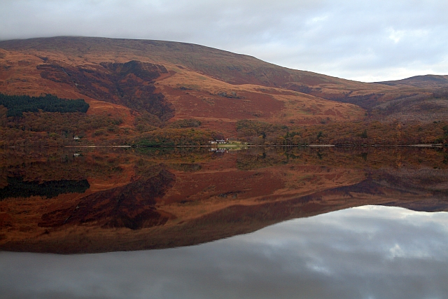
The mountain is situated on the eastern shore of Loch Lomond, offering breathtaking panoramic views of the surrounding landscape. It is part of the Loch Lomond and The Trossachs National Park, a protected area renowned for its diverse wildlife and pristine environment.

Ben Lomond holds great historical and cultural significance. It has been a popular destination for outdoor enthusiasts since the 18th century when it became increasingly popular to climb mountains for leisure. The mountain is also associated with Scottish folklore and has been mentioned in various literary works, including Sir Walter Scott's "Lady of the Lake."

The ascent to the summit of Ben Lomond is a challenging yet rewarding experience. Several well-marked paths cater to different levels of hiking ability, allowing visitors to enjoy its natural beauty at their own pace. The summit provides breathtaking views of Loch Lomond, the Trossachs, and the surrounding mountains, making it a photographer's paradise.

Ben Lomond is not only a haven for nature lovers and hikers but also a habitat for a variety of wildlife, including red deer, golden eagles, and ptarmigans. The mountain also offers opportunities for other outdoor activities such as mountain biking, fishing, and camping.

Overall, Ben Lomond in Stirlingshire is a cherished heritage site that combines natural splendor, historical significance, and recreational activities, making it a must-visit destination for both locals and tourists alike.

If you have any feedback on the listing, please let us know in the comments section below.

Ben Lomond Images

Images are sourced within 2km of 56.158/-4.64 or Grid Reference NS3699. Thanks to Geograph Open Source API. All images are credited.

Loch Lomond and the War Memorial
Sheepfanks above Rowardennan Old sheep fanks on the hillside, adjacent to the path from the Ptarmigan ridge of Ben Lomond.
Sheepfanks above Rowardennan
Old sheep fanks on the hillside, adjacent to the path from the Ptarmigan ridge of Ben Lomond.
The path towards Ptarmigan Looking up the path towards the Ptarmigan ridge of Ben Lomond, with the waterfall of Spùt Ban on the right
The path towards Ptarmigan
Looking up the path towards the Ptarmigan ridge of Ben Lomond, with the waterfall of Spùt Ban on the right
Footbridge across a minor burn The main path onto Ben Lomond crosses a small burn in the forests.
Footbridge across a minor burn
The main path onto Ben Lomond crosses a small burn in the forests.
Forest felling allows a view to Ptarmigan
Gate at the edge of the forest A gateway in the deer fence between the forests of the lower slopes and the open upper slopes of Ben Lomond
Gate at the edge of the forest
A gateway in the deer fence between the forests of the lower slopes and the open upper slopes of Ben Lomond
Footpath ascending Ben Lomond Part of the main tourist track up the southernmost Munro, with one of the burns draining into Coire Corrach on the left.
Footpath ascending Ben Lomond
Part of the main tourist track up the southernmost Munro, with one of the burns draining into Coire Corrach on the left.
Loch Lomond A wet morning at Rowardennan
Loch Lomond
A wet morning at Rowardennan
Glaciated rocks on the shore of Loch Lomond at Rowardennan
Looking towards Inverbeg jetty from Loch Lomond lakeside
A82 north The A82 is a trunk road in Scotland. It is the principal route from Lowland Scotland to the western Scottish Highlands, running from Glasgow to Inverness, going by Loch Lomond, Glen Coe, Fort William and the Great Glen. It is 167 miles long.
<span class="nowrap"><a title="https://www.sabre-roads.org.uk/wiki/index.php?title=A82" rel="nofollow ugc noopener" href="https://www.sabre-roads.org.uk/wiki/index.php?title=A82">Link</a><img style="margin-left:2px;" alt="External link" title="External link - shift click to open in new window" src="https://s1.geograph.org.uk/img/external.png" width="10" height="10"/></span>
A82 north
The A82 is a trunk road in Scotland. It is the principal route from Lowland Scotland to the western Scottish Highlands, running from Glasgow to Inverness, going by Loch Lomond, Glen Coe, Fort William and the Great Glen. It is 167 miles long. LinkExternal link
A82 northwards The A82 is a trunk road in Scotland. It is the principal route from Lowland Scotland to the western Scottish Highlands, running from Glasgow to Inverness, going by Loch Lomond, Glen Coe, Fort William and the Great Glen. It is 167 miles long.
<span class="nowrap"><a title="https://www.sabre-roads.org.uk/wiki/index.php?title=A82" rel="nofollow ugc noopener" href="https://www.sabre-roads.org.uk/wiki/index.php?title=A82">Link</a><img style="margin-left:2px;" alt="External link" title="External link - shift click to open in new window" src="https://s1.geograph.org.uk/img/external.png" width="10" height="10"/></span>
A82 northwards
The A82 is a trunk road in Scotland. It is the principal route from Lowland Scotland to the western Scottish Highlands, running from Glasgow to Inverness, going by Loch Lomond, Glen Coe, Fort William and the Great Glen. It is 167 miles long. LinkExternal link
A82 at Rubha Mor The A82 is a trunk road in Scotland. It is the principal route from Lowland Scotland to the western Scottish Highlands, running from Glasgow to Inverness, going by Loch Lomond, Glen Coe, Fort William and the Great Glen. It is 167 miles long.
<span class="nowrap"><a title="https://www.sabre-roads.org.uk/wiki/index.php?title=A82" rel="nofollow ugc noopener" href="https://www.sabre-roads.org.uk/wiki/index.php?title=A82">Link</a><img style="margin-left:2px;" alt="External link" title="External link - shift click to open in new window" src="https://s1.geograph.org.uk/img/external.png" width="10" height="10"/></span>
A82 at Rubha Mor
The A82 is a trunk road in Scotland. It is the principal route from Lowland Scotland to the western Scottish Highlands, running from Glasgow to Inverness, going by Loch Lomond, Glen Coe, Fort William and the Great Glen. It is 167 miles long. LinkExternal link
Ben Lomond from the Pier, Rowardennan
Leaving the forest and ascending Ben Lomond
A82 just north of Inverbeg
A82 northwards south of Rubha Mor The A82 is a three lane carriageway here
A82 northwards south of Rubha Mor
The A82 is a three lane carriageway here
Rowardennan car park Information centre and toilet facility located in the main car park for access to Ben Lomond.
Rowardennan car park
Information centre and toilet facility located in the main car park for access to Ben Lomond.
Show me another place!

Ben Lomond is located at Grid Ref: NS3699 (Lat: 56.158, Lng: -4.64)

What 3 Words

///builders.nosedive.grass. Near Garelochhead, Argyll & Bute

Nearby Locations

Ben Lomond

Related Wikis

Rowardennan

Rowardennan (Gaelic: Rubha Aird Eònain) is a small rural community on the eastern shore of Loch Lomond in Stirling council, Scotland. It is mainly known...

Eilean nan Deargannan

Eilean nan Deargannan (sometimes written as Eilean Deargannan) is a small island in Loch Lomond, in west central Scotland. It lies between Rowardennan...

Inverbeg

Inverbeg is a settlement in Argyll and Bute, Scotland. Its Ordnance Survey grid reference is NS3497.It is on the western shore of Loch Lomond. There has...

Ben Lomond

Ben Lomond (Scottish Gaelic: Beinn Laomainn, 'Beacon Mountain'), 974 metres (3,196 ft), is a mountain in the Scottish Highlands. Situated on the eastern...

Nearby Amenities

Located within 500m of 56.158,-4.64
Ferry Terminal
Lat/Long: 56.157249/-4.6440269
Ford: yes
Lat/Long: 56.1586932/-4.6361664
Rowardennan Lodge Youth Hostel
Addr City: Glasgow
Addr Country: GB
Addr Place: By Drymen
Addr Postcode: G63 0AR
Email: rowardennan@syha.org.uk
Phone: +44 1360 870259
Source: https://www.syha.org.uk/where-to-stay/lowlands/rowardennan-lodge.aspx
Tourism: hostel
Wikidata: Q111114344
Lat/Long: 56.1579782/-4.643502
Tom Beithe
Natural: peak
Lat/Long: 56.1590368/-4.6439093
Ardess Cottages
Place: isolated_dwelling
Lat/Long: 56.1580582/-4.639703
Ben Lomond Bunkhouse
Name En: Ben Lomond Bunkhouse
Tourism: hostel
Website: https://www.nts.org.uk/Holidays/Accommodation/Ben-Lomond-Bunk-House-Ben-Lomond/
Lat/Long: 56.15878/-4.6404718
Ardchoil
Place: isolated_dwelling
Lat/Long: 56.157482/-4.6409471
Ben Lomond Cottage
Guest House: bed_and_breakfast
Tourism: guest_house
Lat/Long: 56.1595868/-4.6412681
Power: pole
Lat/Long: 56.1621706/-4.6425697
Power: pole
Lat/Long: 56.1619181/-4.6415771
Power: pole
Lat/Long: 56.1610353/-4.6414538
Power: pole
Lat/Long: 56.1602113/-4.6413544
Power: pole
Lat/Long: 56.159375/-4.6408671
Power: pole
Lat/Long: 56.1586273/-4.639974
Power: pole
Lat/Long: 56.1579538/-4.6391445
Power: pole
Lat/Long: 56.1573324/-4.6384344
Power: pole
Lat/Long: 56.1568505/-4.6378994
Power: pole
Lat/Long: 56.1564384/-4.6374538
Power: pole
Lat/Long: 56.1557893/-4.6376806
Power: pole
Lat/Long: 56.1552343/-4.6378795
Power: pole
Lat/Long: 56.1547612/-4.6380227
Power: pole
Lat/Long: 56.1542007/-4.6379272
Power: pole
Lat/Long: 56.1537022/-4.6378536
Rowardennan Lodge Youth Hostel
Tourism: camp_site
Lat/Long: 56.1586592/-4.6448057
Fast Food
Honesty Box (self-service)
Addr Street: Ben Lomond Cottage
Lat/Long: 56.1594258/-4.6419059
Ford: yes
Lat/Long: 56.1594548/-4.6360761
Ford: yes
Lat/Long: 56.1608067/-4.6406989
The data included in this document is from www.openstreetmap.org. The data is made available under ODbL.

Have you been to Ben Lomond?

Leave your review of Ben Lomond below (or comments, questions and feedback).