Ben Lawers National Nature Reserve

Heritage Site in Perthshire

Scotland

Ben Lawers National Nature Reserve

Frisbee golf at Loch Tay This is a part of the frisbee golf course on the grounds of Loch Tay Highland Lodges. Loch Tay visible in the background.
Frisbee golf at Loch Tay Credit: Aleks Scholz

Ben Lawers National Nature Reserve is a renowned heritage site located in Perthshire, Scotland. It encompasses the Ben Lawers mountain range, which is part of the southern slopes of the Scottish Highlands. The reserve covers an expansive area of approximately 4,000 hectares and has been designated as a National Nature Reserve since 1950.

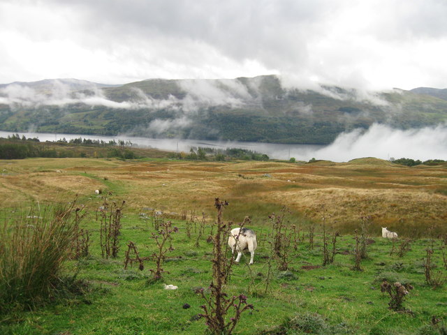
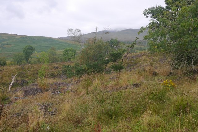
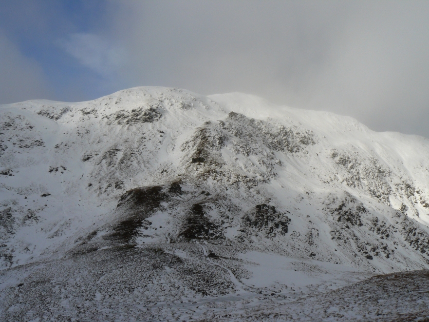
One of the main attractions of Ben Lawers National Nature Reserve is its breathtaking landscape, dominated by rugged mountains, picturesque valleys, and glacial lochs. The highest peak in the range, also called Ben Lawers, stands tall at an impressive height of 1,214 meters, offering awe-inspiring panoramic views of the surrounding countryside.

The reserve is a haven for a diverse range of flora and fauna. It is particularly renowned for its rich plant life, with over 600 species of flowering plants recorded within its boundaries. This includes rare alpine plants that thrive in the harsh mountain environment. The reserve is also home to a variety of wildlife, including red deer, mountain hares, and golden eagles.

Visitors to Ben Lawers National Nature Reserve can explore a network of well-maintained trails that wind through the reserve, providing opportunities for hiking, birdwatching, and nature photography. The reserve also offers educational facilities, with informative displays and exhibits that provide insights into the natural and cultural history of the area.

In recognition of its outstanding natural beauty and ecological importance, Ben Lawers National Nature Reserve has been designated as a Site of Special Scientific Interest and a Special Area of Conservation. It is a popular destination for nature enthusiasts, hikers, and those seeking a tranquil escape in the heart of Scotland's stunning countryside.

If you have any feedback on the listing, please let us know in the comments section below.

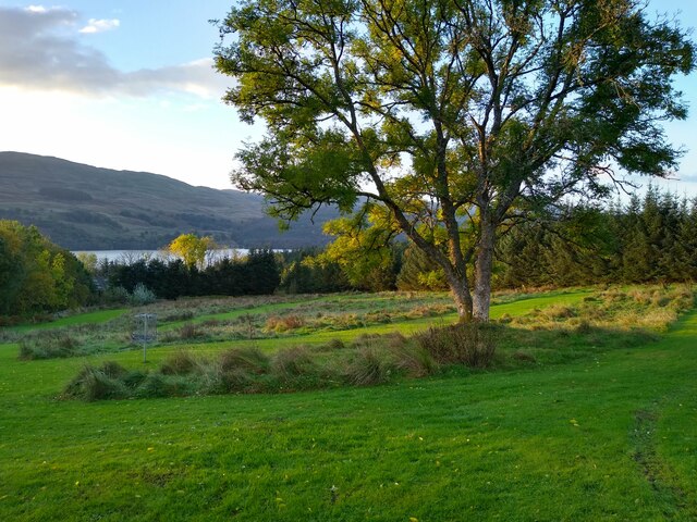
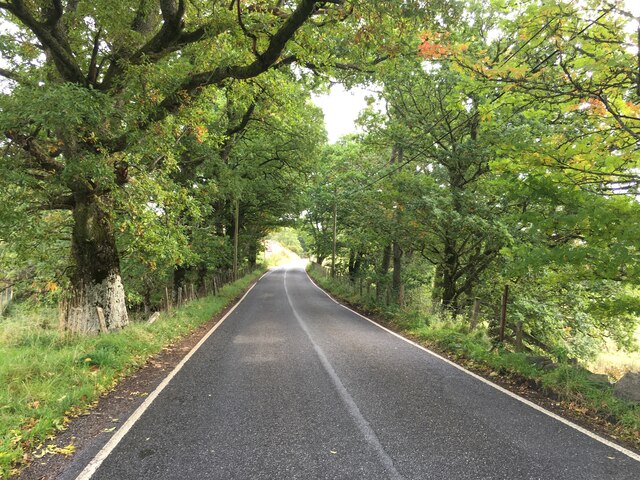
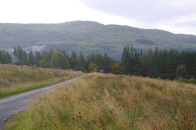
Ben Lawers National Nature Reserve Images

Images are sourced within 2km of 56.512/-4.263 or Grid Reference NN6037. Thanks to Geograph Open Source API. All images are credited.

Frisbee golf at Loch Tay This is a part of the frisbee golf course on the grounds of Loch Tay Highland Lodges. Loch Tay visible in the background.
Frisbee golf at Loch Tay
This is a part of the frisbee golf course on the grounds of Loch Tay Highland Lodges. Loch Tay visible in the background.
Looking over to the ridge Looking west over the Burn of Edramucky to the end of the knobbly ridge that extends south from Meall Corranaich, with Meall nan Tarmachan beyond.
Looking over to the ridge
Looking west over the Burn of Edramucky to the end of the knobbly ridge that extends south from Meall Corranaich, with Meall nan Tarmachan beyond.
Burn of Edramucky The Burn of Edramucky flowing down through the Ben Lawers Nature Reserve.
Burn of Edramucky
The Burn of Edramucky flowing down through the Ben Lawers Nature Reserve.
All Becomes Clear On the south-west ridge of Beinn Ghlas and at c750m we have come out of the clag and into a different world. Set off from the car park with a waterproof on and now it's taps aff weather! Hill in the centre is Meall Corranaich.
All Becomes Clear
On the south-west ridge of Beinn Ghlas and at c750m we have come out of the clag and into a different world. Set off from the car park with a waterproof on and now it's taps aff weather! Hill in the centre is Meall Corranaich.
Hydro Power Lawers Dam, part of the Breadalbane Hydro Scheme which started producing power in 1956. Behind is the impressive Creag an Lochain.
Hydro Power
Lawers Dam, part of the Breadalbane Hydro Scheme which started producing power in 1956. Behind is the impressive Creag an Lochain.
High Level Road The single track road from Loch Tay to Glen Lyon rises to a height of over 550m. This is just below the high point near Lawers Dam with the impressive crags of Creag an Lochain seen above the road, part of the Munro of Meall nan Tarmachan.
High Level Road
The single track road from Loch Tay to Glen Lyon rises to a height of over 550m. This is just below the high point near Lawers Dam with the impressive crags of Creag an Lochain seen above the road, part of the Munro of Meall nan Tarmachan.
A827 near Morenish
A827 near Morenish
A827 near Edramucky
A827 near Edramucky
Looking west
Looking west
View along the road towards Meall nan Tarmachan
Looking along the burn towards Ben Lawers
Slopes of Meall Corranaich
Felled area, Edramuchty The horribly windthrown woodland at the foot of the Lairig an Lochain  road has been felled.
Felled area, Edramuchty
The horribly windthrown woodland at the foot of the Lairig an Lochain road has been felled.
Woodland, Edramuchty Remaining trees after the conifers were clear felled.
Woodland, Edramuchty
Remaining trees after the conifers were clear felled.
A tangle of trees, Edramuchty Some of the windthrown chaos which was probably too tangled to clear when this block was felled.
A tangle of trees, Edramuchty
Some of the windthrown chaos which was probably too tangled to clear when this block was felled.
Path from Beinn Ghlas Loch Tay is in the distance.
Path from Beinn Ghlas
Loch Tay is in the distance.
Edramucky Intake for Finlarig Hydro Dam, Scotland This concrete intake structure collects water from the Burn of Edramucky watercourse at an altitude of about 542m and diverts it via a tunnel to the Lochan na Lairige reservoir at 521m, from where it is used to supply the Finlarig hydro-electric power station at 106m.
Edramucky Intake for Finlarig Hydro Dam, Scotland
This concrete intake structure collects water from the Burn of Edramucky watercourse at an altitude of about 542m and diverts it via a tunnel to the Lochan na Lairige reservoir at 521m, from where it is used to supply the Finlarig hydro-electric power station at 106m.
The start of the path to Ben Lawers A well made, bog avoiding, path leaving the car park and heading towards Beinn Ghlas.
The start of the path to Ben Lawers
A well made, bog avoiding, path leaving the car park and heading towards Beinn Ghlas.
Show me another place!

Ben Lawers National Nature Reserve is located at Grid Ref: NN6037 (Lat: 56.512, Lng: -4.263)

What 3 Words

///custom.grumbling.suspends. Near Pubil, Perth & Kinross

Related Wikis

Meall nan Tarmachan

Meall nan Tarmachan (Scottish Gaelic: [ˈmjaul̪ˠ nən̪ˠ ˈt̪aɾaməxan]) is a mountain in the Southern Highlands of Scotland near Killin just west of Ben Lawers...

Beinn Ghlas

Beinn Ghlas is a mountain in the Breadalbane region of the Scottish Highlands. It lies on the north shore of Loch Tay and is part of the Ben Lawers Range...

Meall Corranaich

Meall Corranaich (Scottish Gaelic: Meall Choire Inich) is a mountain with a height of 1,069 metres (3,507 ft) in the Grampian Mountains of Scotland. It...

River Dochart

The River Dochart (Scottish Gaelic: Dochard) is in Perthshire, Scotland. Coming from Ben Lui, it flows east out of Loch Dochart and through the glen of...

Nearby Amenities

Located within 500m of 56.512,-4.263
Passing Place
Lat/Long: 56.511449/-4.2624866
Passing Place
Lat/Long: 56.5092705/-4.2574661
Historic Amenity: public_building
Historic Name: Ben Lawers Visitor Centre
Note: visitor centre & rescue post now closed
Lat/Long: 56.5123638/-4.2629656
Passing Place
Lat/Long: 56.5140741/-4.265034
Passing Place
Lat/Long: 56.5107777/-4.2613042
Passing Place
Lat/Long: 56.5100528/-4.260265
Barrier: cattle_grid
Lat/Long: 56.5110946/-4.2622825
The data included in this document is from www.openstreetmap.org. The data is made available under ODbL.

Have you been to Ben Lawers National Nature Reserve?

Leave your review of Ben Lawers National Nature Reserve below (or comments, questions and feedback).