Basildon Park

Heritage Site in Berkshire

England

Basildon Park

Country lane, Lower Basildon, Berkshire
Country lane, Lower Basildon, Berkshire Credit: Oswald Bertram

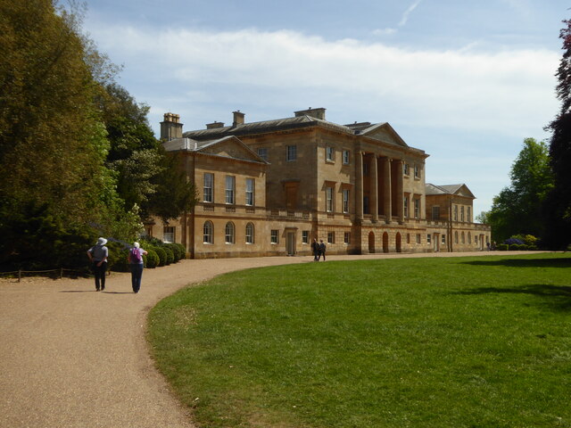
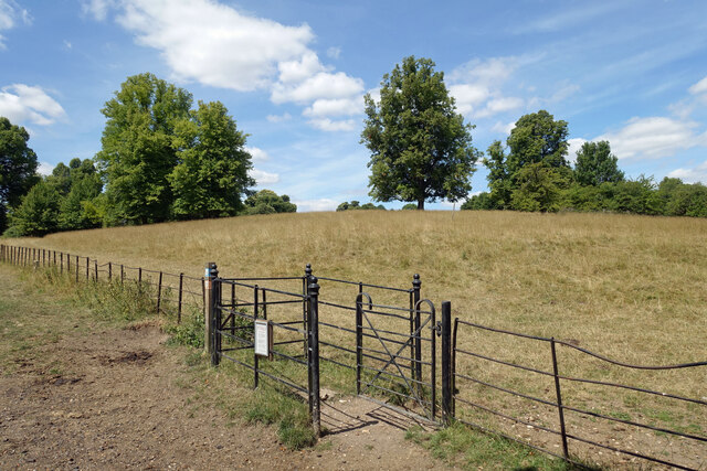
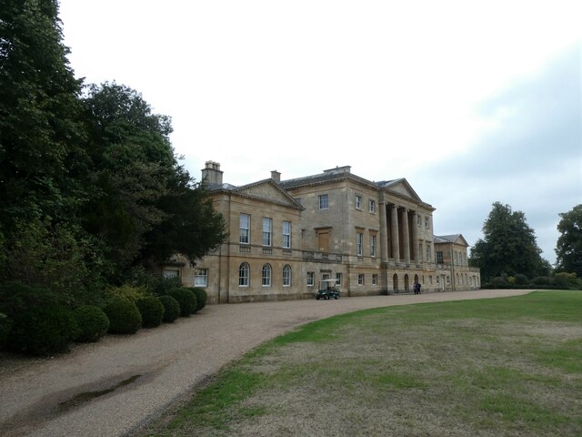
Basildon Park is a magnificent Georgian mansion located in Berkshire, England. Situated within a sprawling estate spanning 400 acres, the house is surrounded by picturesque parkland, offering visitors a glimpse into the opulence of the past.

Originally built in 1776 for Sir Francis Sykes, a wealthy East India Company official, Basildon Park underwent extensive renovations in the 1950s. It was acquired by Lord and Lady Iliffe, who restored the house to its former glory, capturing the essence of its Georgian heritage. The interior is adorned with stunning period features, including intricate plasterwork, elegant furnishings, and a magnificent collection of artwork.

Visitors to Basildon Park can explore the grand state rooms, including the lavish Saloon, Drawing Room, and Library, which showcase the exquisite craftsmanship and attention to detail typical of Georgian architecture. The rooms are filled with a diverse collection of art, including paintings, sculptures, and decorative objects, providing an insight into the tastes and interests of the various occupants throughout the mansion's history.

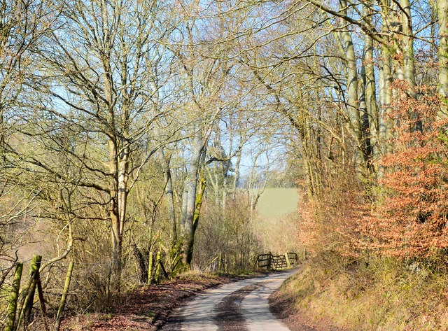
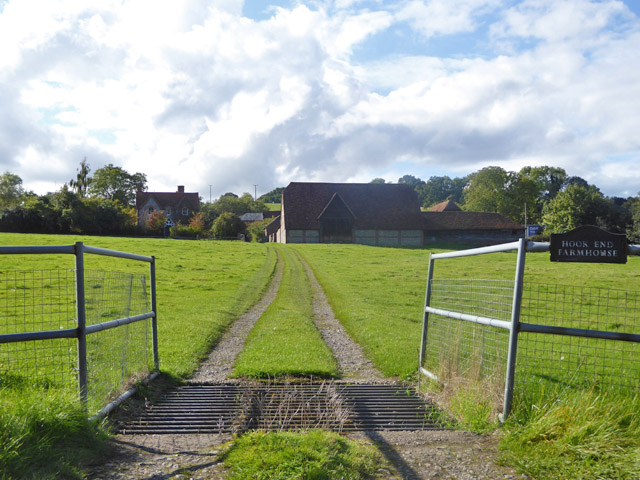
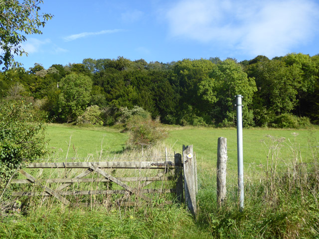
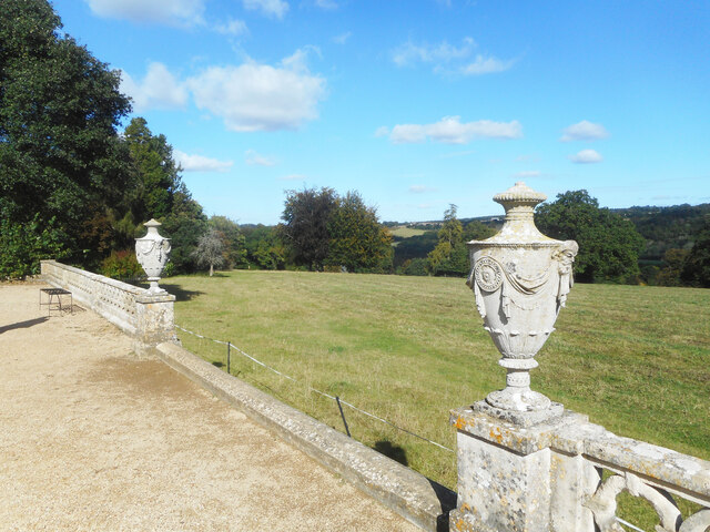
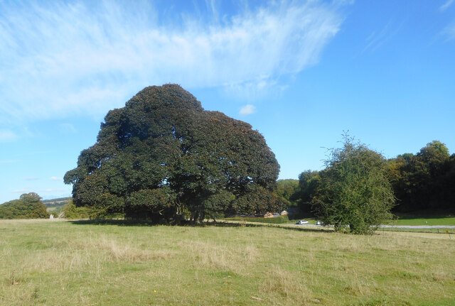
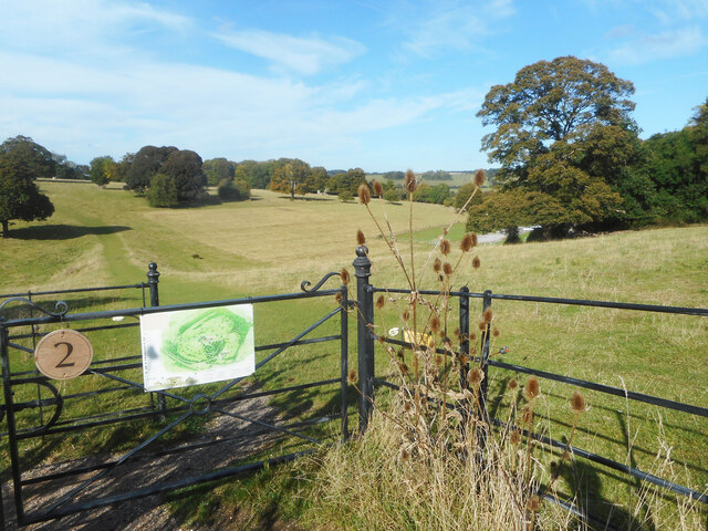
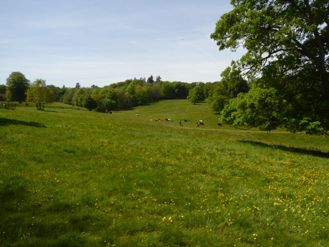
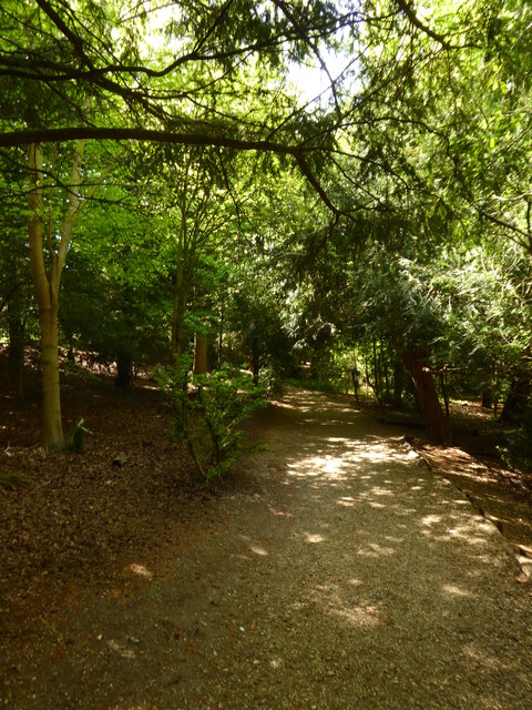
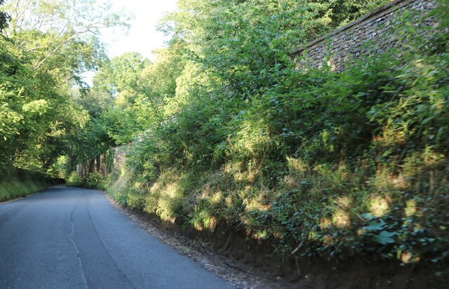
The surrounding parkland offers visitors the opportunity to enjoy leisurely walks, taking in the serene beauty of the English countryside. The estate features a walled garden, a tranquil lake, and a charming woodland area, creating a peaceful and idyllic setting. Additionally, Basildon Park is well-known for its vibrant display of bluebells during the springtime, attracting nature enthusiasts and photographers alike.

As a heritage site, Basildon Park offers guided tours, educational programs, and special events throughout the year. It provides a fascinating glimpse into the elegance and grandeur of the Georgian era, making it a must-visit destination for history enthusiasts and those seeking a tranquil escape in the heart of Berkshire.

If you have any feedback on the listing, please let us know in the comments section below.

Basildon Park Images

Images are sourced within 2km of 51.499/-1.121 or Grid Reference SU6178. Thanks to Geograph Open Source API. All images are credited.

Country lane, Lower Basildon, Berkshire
Track to Hook End Farmhouse The farm buildings have a separate entrance, some way to the right.
Track to Hook End Farmhouse
The farm buildings have a separate entrance, some way to the right.
Footpath towards Harley Hill Wood No stile, just a narrow gap past the gate.
Footpath towards Harley Hill Wood
No stile, just a narrow gap past the gate.
A329, Reading Road towards Streatley
Edge of the Terrace, Basildon Park An ornamental wall at the edge of the formal garden on the east side of Basildon House.
Edge of the Terrace, Basildon Park
An ornamental wall at the edge of the formal garden on the east side of Basildon House.
Basildon Park A traditional bit of country house parkland with grazing and strategically placed trees.
This is actually several closely planted trees all growing together into a single canopy.
Basildon Park
A traditional bit of country house parkland with grazing and strategically placed trees. This is actually several closely planted trees all growing together into a single canopy.
View across Basildon Park The north west bit of the park viewed from near the house.
View across Basildon Park
The north west bit of the park viewed from near the house.
The approach to Basildon House
Parkland at Basildon Park
Path through the woods at Basildon Park
Petrol station on the A329, Lower Basildon
Gate in Basildon Park The gates in Basildon Park are a mixture of sturdy new wooden ones put in by the National Trust, and some of these older ironwork ones with varying amounts of decorative curls and knobs depending on their importance.
Gate in Basildon Park
The gates in Basildon Park are a mixture of sturdy new wooden ones put in by the National Trust, and some of these older ironwork ones with varying amounts of decorative curls and knobs depending on their importance.
Harecroft Wood near Streatley
Park Wall Lane, Lower Basildon Running along the edge of Basildon Park behind the wall.
Park Wall Lane, Lower Basildon
Running along the edge of Basildon Park behind the wall.
Jolly boating weather? Taken at Shootewrs Hill
Jolly boating weather?
Taken at Shootewrs Hill
Basildon House: September 2022
Basildon Park: the most important bits Being usually either a school teacher or a chauffeur for my mother, the shop and the café !
Basildon Park: the most important bits
Being usually either a school teacher or a chauffeur for my mother, the shop and the café !
Basildon Park: signs of summer and autumn The grass is not really back to luscious green but the leaves have started to fall...
Basildon Park: signs of summer and autumn
The grass is not really back to luscious green but the leaves have started to fall...
Show me another place!

Basildon Park is located at Grid Ref: SU6178 (Lat: 51.499, Lng: -1.121)

Unitary Authority: West Berkshire

Police Authority: Thames Valley

What 3 Words

///wagers.divide.huts. Near Upper Basildon, Berkshire

Related Wikis

Basildon Park

Basildon Park is a country house situated 2 miles (3 kilometres) south of Goring-on-Thames and Streatley in Berkshire, between the villages of Upper Basildon...

A329 road

The A329 is an east–west road in Southern England that runs from Wentworth in Surrey to Thame in Oxfordshire. == Route == The A329 starts at the A30 in...

Lower Basildon

Lower Basildon is a small English village in the civil parish of Basildon, near Pangbourne, in the county of Berkshire. == Amenities == === Shops and... ===

Beale Wildlife Park

Beale Wildlife Park is situated by the River Thames, between the villages of Pangbourne and Lower Basildon in Berkshire, England. It has three main areas...

St Bartholomew's Church, Lower Basildon

St Bartholomew's Church is the redundant Church of England parish church of Basildon in the English county of Berkshire. It lies in the hamlet of Lower...

Basildon, Berkshire

Basildon is a civil parish in the English county of Berkshire. It comprises the small villages of Upper Basildon and Lower Basildon, named for their respective...

Hartslock

Hartslock, also known as Hartslock Woods, is a 41.8-hectare (103-acre) biological Site of Special Scientific Interest (SSSI) in a wooded area on the north...

Gatehampton Railway Bridge

Gatehampton Railway Bridge, otherwise referred to as Gatehampton Viaduct, is a railway bridge carrying the Great Western Main Line over the River Thames...

Nearby Amenities

Located within 500m of 51.499,-1.121
Barrier: kissing_gate
Bicycle: no
Foot: yes
Horse: no
Material: metal
Motor Vehicle: no
Wheelchair: limited
Lat/Long: 51.4993539/-1.1249333
Cafe
National Trust Tea Rooms
Toilets Wheelchair: yes
Wheelchair: yes
Wheelchair Description: Ramp from front, steps from gardens, step-free from house. Inside and outside seating. Low serving counters. Toilets off courtyard seating area.
Lat/Long: 51.4991892/-1.1215871
National Trust Shop
Shop: kiosk
Wheelchair: limited
Wheelchair Description: Uneven low step entrance from courtyard with plant sales. Nearby accessible toilet not checked today.
Lat/Long: 51.5012545/-1.1228156
Entrance: yes
Foot: yes
Lat/Long: 51.5015033/-1.1228613
Toilets
Access: customers
Changing Table: yes
Fee: no
Not Operator Wikidata: Q333515
Operator: National Trust
Toilets Disposal: flush
Wheelchair: yes
Wheelchair Description: Small lobby with right angle turn between courtyard and toilet. Not yet checked for internal arrangements.
Lat/Long: 51.501353/-1.1227002
Barrier: entrance
Lat/Long: 51.5020268/-1.1189778
Tourism: picnic_site
Lat/Long: 51.5003587/-1.1223369
Tourism: viewpoint
Wheelchair: limited
Wheelchair Description: Sloping gravel paths from house (down) and on down to car park.
Lat/Long: 51.500923/-1.1214426
Barrier: kissing_gate
Foot: yes
Lat/Long: 51.4955279/-1.1170026
Barrier: kissing_gate
Foot: yes
Lat/Long: 51.4973683/-1.1167704
Tourism: viewpoint
Lat/Long: 51.499275/-1.1207982
Toilets
Toilets Wheelchair: yes
Wheelchair: yes
Lat/Long: 51.4992927/-1.1216675
Barrier: kissing_gate
Bicycle: no
Foot: yes
Horse: no
Material: metal
Motor Vehicle: no
Wheelchair: limited
Lat/Long: 51.4992826/-1.1248807
Barrier: kissing_gate
Foot: yes
Lat/Long: 51.499986/-1.1209095
Bench
Backrest: no
Material: wood
Seats: 2
Lat/Long: 51.5000415/-1.120856
Tourism: picnic_site
Lat/Long: 51.5010993/-1.1231188
Entrance: yes
Foot: yes
Lat/Long: 51.5014241/-1.1228545
Material: wood
Power: pole
Lat/Long: 51.4996851/-1.1138691
Material: wood
Power: pole
Lat/Long: 51.5003204/-1.1146496
Material: wood
Power: pole
Lat/Long: 51.501652/-1.1162683
Bike Parking
Lat/Long: 51.5018267/-1.1222696
Bench: yes
Leisure: picnic_table
Material: wood
Lat/Long: 51.4996117/-1.1229853
Bench: yes
Leisure: picnic_table
Material: wood
Lat/Long: 51.4996364/-1.122979
Bench
Backrest: yes
Material: wood
Seats: 3
Lat/Long: 51.4999711/-1.1219504
The data included in this document is from www.openstreetmap.org. The data is made available under ODbL.

Have you been to Basildon Park?

Leave your review of Basildon Park below (or comments, questions and feedback).