Back to Backs

Heritage Site in Warwickshire

England

Back to Backs

Under-station passage The Eastern labyrinth of passages underneath Birmingham New Street station
Under-station passage Credit: Martin

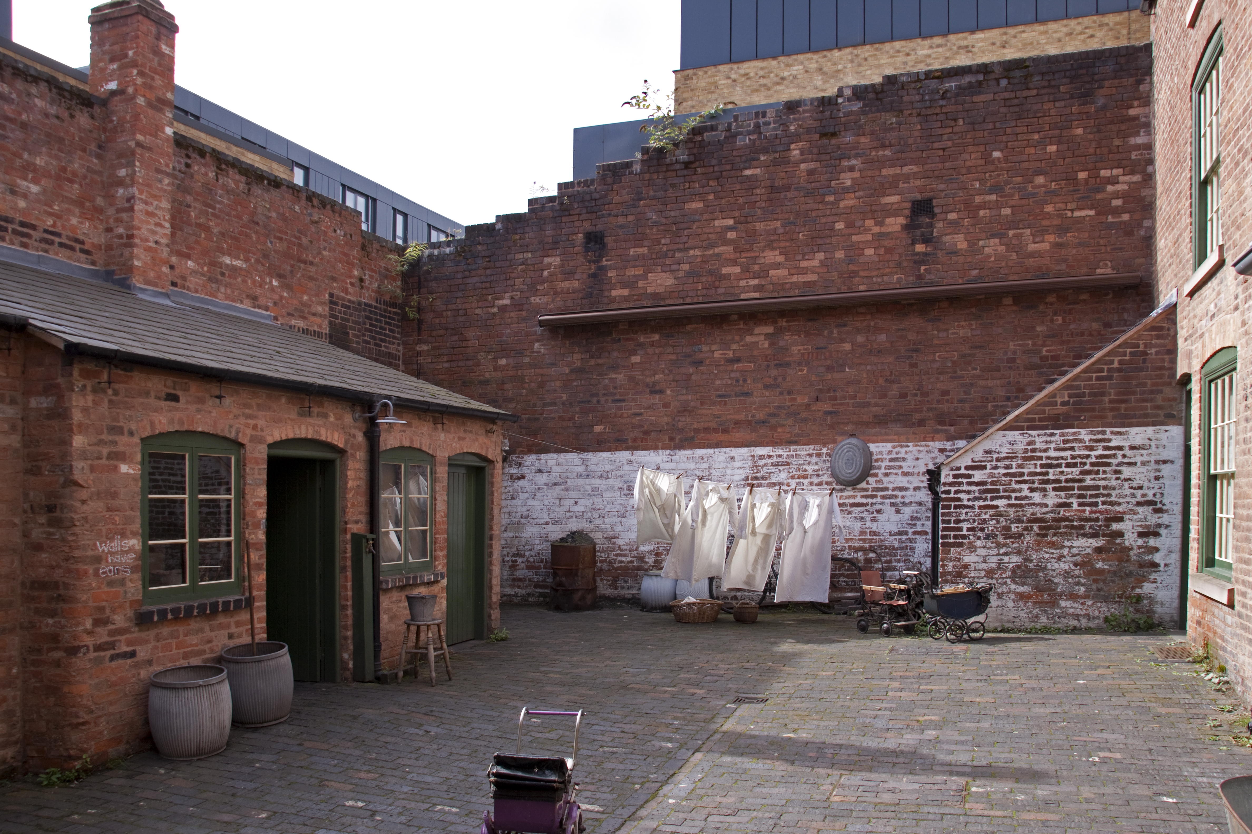
Back to Backs is a notable heritage site located in Birmingham, Warwickshire, England. This site consists of a group of terraced houses built in the 19th century, representing a unique architectural style and providing insight into the working-class life of the time.

The Back to Backs were originally constructed during the Industrial Revolution to accommodate the growing population of workers in the city. The houses were designed in a distinctive back-to-back layout, with each dwelling sharing a common back wall and facing a small courtyard. This design maximized the use of limited space in the inner-city areas.

Today, the Back to Backs have been restored and preserved to showcase the living conditions and daily lives of the working-class families who once inhabited them. Visitors can explore these houses and experience the cramped and modest living spaces, furnished with authentic period furniture and belongings. The rooms are decorated to reflect different time periods, allowing visitors to see the changes in lifestyle and domestic arrangements over the years.

Guided tours are available, led by knowledgeable guides who provide historical context and personal stories about the families who lived in these houses. The tours offer a glimpse into the challenges and hardships faced by the working class during the industrial era.

Back to Backs is a fascinating heritage site that offers a vivid portrayal of the social and architectural history of Birmingham. It provides an invaluable opportunity for visitors to learn about the past and gain a deeper understanding of the city's industrial heritage.

If you have any feedback on the listing, please let us know in the comments section below.

Back to Backs Images

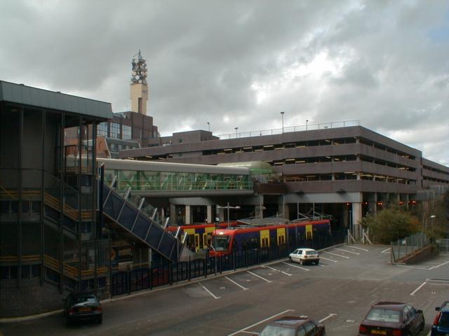
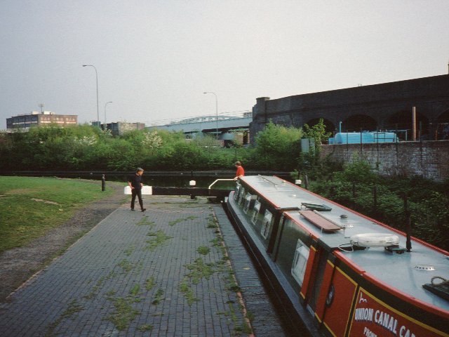
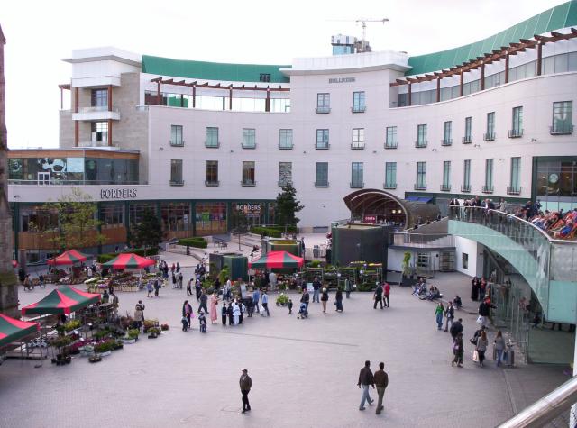
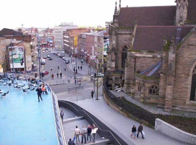
Images are sourced within 2km of 52.474/-1.898 or Grid Reference SP0786. Thanks to Geograph Open Source API. All images are credited.

Under-station passage The Eastern labyrinth of passages underneath Birmingham New Street station
Under-station passage
The Eastern labyrinth of passages underneath Birmingham New Street station
Birmingham New Street A pseudo-regressive image of Birmingham's main station
Birmingham New Street
A pseudo-regressive image of Birmingham's main station
Birmingham City Centre Tony Hancock Memorial in the Old Square, Corporation Street.  

The memorial stands on the filled in island that once had pedestrian underpasses and public toilets, that gave pedestrian access to the various roads off this island.  All changed during the city redevelopment and removal of elevated roads.
Birmingham City Centre
Tony Hancock Memorial in the Old Square, Corporation Street. The memorial stands on the filled in island that once had pedestrian underpasses and public toilets, that gave pedestrian access to the various roads off this island. All changed during the city redevelopment and removal of elevated roads.
Canal Roundabout The junction of the Birmingham and Fazeley Canal and the Birmingham Canal Navigations between the National Indoor Arena and Gas Street Basin. In the distance is Cambrian Wharf.  Narrowboats line the canal for the Birmingham Canal Festival.
Canal Roundabout
The junction of the Birmingham and Fazeley Canal and the Birmingham Canal Navigations between the National Indoor Arena and Gas Street Basin. In the distance is Cambrian Wharf. Narrowboats line the canal for the Birmingham Canal Festival.
Narrowboats in Brum Moored on the approaches to Cambrian Wharf alongside the NIA for the Birmingham Canal Festival in 2003.
Narrowboats in Brum
Moored on the approaches to Cambrian Wharf alongside the NIA for the Birmingham Canal Festival in 2003.
Birmingham Snow Hill Birmingham Snow Hill station, or more precisely the car park above it.  In the middle foreground is the current Birmingham terminus of the Midland Metro.  On the skyline is the Birmingham BT Tower.
Birmingham Snow Hill
Birmingham Snow Hill station, or more precisely the car park above it. In the middle foreground is the current Birmingham terminus of the Midland Metro. On the skyline is the Birmingham BT Tower.
Sampson Road Wharf The warehouses on the right were the limit of navigation for broad-beamed boats from the South following the widening of the Grand Union canal in the 1930s.  The narrow lock on the right leads up from the extensive Birmingham Canal Navigations.
Sampson Road Wharf
The warehouses on the right were the limit of navigation for broad-beamed boats from the South following the widening of the Grand Union canal in the 1930s. The narrow lock on the right leads up from the extensive Birmingham Canal Navigations.
Bordesley The canal used to go straight ahead here through another lock and on towards the railway viaduct in the distance. When the Birmingham Middle ring road was built in the 1990s the canal was diverted to the left with dog-leg to use a brand new lock so as to make space for the road
Bordesley
The canal used to go straight ahead here through another lock and on towards the railway viaduct in the distance. When the Birmingham Middle ring road was built in the 1990s the canal was diverted to the left with dog-leg to use a brand new lock so as to make space for the road
Cambrian Wharf The basin full of working narrowboats at the heart of the canal network.
Cambrian Wharf
The basin full of working narrowboats at the heart of the canal network.
The Bullring, Birmingham Part of the Bullring shopping centre in Birmingham, recently rebuilt. The shell-like café right of centre has been praised by architectural commentators. At the very left edge of the image, part of St Martin's church is visible.
The Bullring, Birmingham
Part of the Bullring shopping centre in Birmingham, recently rebuilt. The shell-like café right of centre has been praised by architectural commentators. At the very left edge of the image, part of St Martin's church is visible.
View south from the Bullring, Birmingham The church is St Martin's.
View south from the Bullring, Birmingham
The church is St Martin's.
Moor St Station, post-refurbishment Steam Engine Parked at Moor St Station to show off the refurbishment of the station in the style of the late 1940s, Birmingham's New Bull Ring Selfridges "pillow thing" building can be seen in the background!
Moor St Station, post-refurbishment
Steam Engine Parked at Moor St Station to show off the refurbishment of the station in the style of the late 1940s, Birmingham's New Bull Ring Selfridges "pillow thing" building can be seen in the background!
Icknield Street A4540 ...looking north from the junction with Vyse Street. On the right is the Birmingham Mint.
Icknield Street A4540
...looking north from the junction with Vyse Street. On the right is the Birmingham Mint.
The Farm Driving through on the main road, Sparkbrook looks like one of the grottiest places in Birmingham, but it's not such a bad place to live. There are lots of quiet streets, on one of which can be found one of the city's hidden gems: The Farm, the oddly named residence of the bank-founding Lloyd family. This is the rear view.
The Farm
Driving through on the main road, Sparkbrook looks like one of the grottiest places in Birmingham, but it's not such a bad place to live. There are lots of quiet streets, on one of which can be found one of the city's hidden gems: The Farm, the oddly named residence of the bank-founding Lloyd family. This is the rear view.
Victoria Square, Birmingham This is a popular point to rendezvous in Birmingham.
Victoria Square, Birmingham
This is a popular point to rendezvous in Birmingham.
From above New Street Station Looking west from the top of the multi-storey car park. In the foreground, the bridges that carry Hill Street and Navigation Street over the platforms. In the distance, the Holiday Inn and Hyatt hotels and Alpha Tower.
From above New Street Station
Looking west from the top of the multi-storey car park. In the foreground, the bridges that carry Hill Street and Navigation Street over the platforms. In the distance, the Holiday Inn and Hyatt hotels and Alpha Tower.
The start of the Aston Expressway Road sign warning of start of motorway restrictions (A38M).  The location is also above / alongside the junctions of two canals - Birmingham and Fazeley, and Digbeth Branch Canal.
The start of the Aston Expressway
Road sign warning of start of motorway restrictions (A38M). The location is also above / alongside the junctions of two canals - Birmingham and Fazeley, and Digbeth Branch Canal.
Aston canalside On the Birmingham & Fazeley Canal at the junction with the Digbeth Branch Canal, behind Mill Street. Waterlinks office building beyond.
Aston canalside
On the Birmingham & Fazeley Canal at the junction with the Digbeth Branch Canal, behind Mill Street. Waterlinks office building beyond.
Show me another place!

Back to Backs is located at Grid Ref: SP0786 (Lat: 52.474, Lng: -1.898)

Unitary Authority: Birmingham

Police Authority: West Midlands

What 3 Words

///gone.leave.bake. Near Birmingham, West Midlands

Related Wikis

Birmingham Back to Backs

The Birmingham Back to Backs (also known as Court 15) are the city's last surviving court of back-to-back houses. They are preserved as examples of the...

Patrick Centre

The Patrick Centre for the Performing Arts is a studio theatre located on Thorp Street in the Chinese Quarter of Birmingham, England, next to the headquarters...

Birmingham Hippodrome

The Birmingham Hippodrome is a theatre situated on Hurst Street in the Chinese Quarter of Birmingham, England. Although best known as the home stage of...

Hurst Street

Hurst Street is a street located along the edge of the Chinese Quarter of Birmingham, England.The Birmingham Back to Backs, a complex of four restored...

Southside, Birmingham

Southside is a new name for the district in the city centre of Birmingham, England. It contains the Chinese Quarter, the city's Gay Village, The Arcadian...

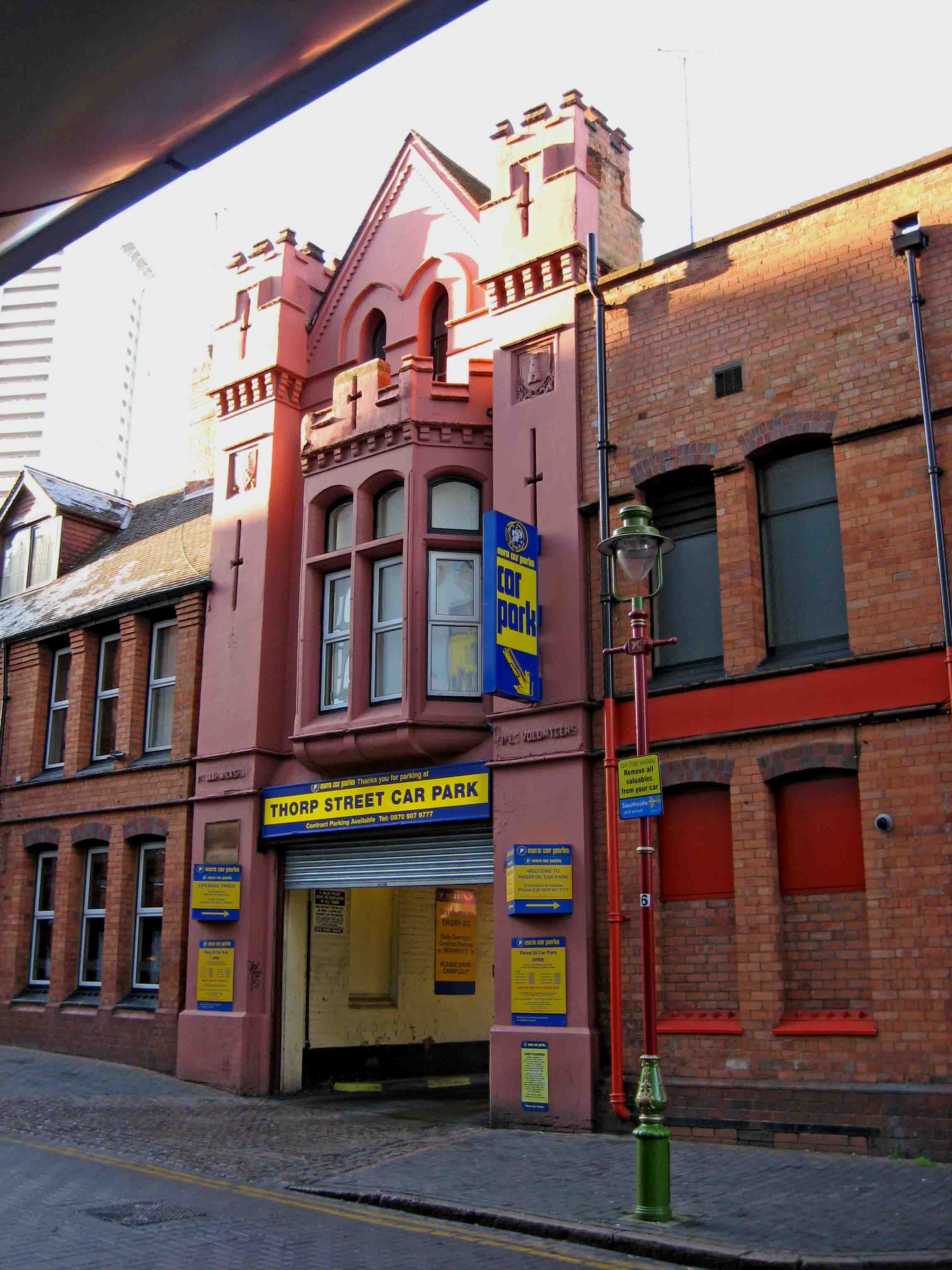
Thorp Street drill hall, Birmingham

The Thorp street drill hall is a former military installation in Birmingham, England. == History == The building was designed by Frank Barlow Osborn as...

O2 Academy Birmingham

O2 Academy Birmingham is a music venue located in Birmingham, West Midlands, England. == Former venue (until 2009) == Live music on the site of the O2...

Chinese Quarter, Birmingham

The Chinese Quarter of Birmingham, England is located in the city centre's Southside. It is an area with a predominantly Chinese influence as a result...

Nearby Amenities

Located within 500m of 52.474,-1.898
Cycleway: asl
Direction: forward
Lat/Long: 52.4763211/-1.8922322
Traffic Signals
Crossing: traffic_signals
Ref: E0603
Source: survey
Lat/Long: 52.4770258/-1.8926899
Motorway Junction
Holloway Circus
Lat/Long: 52.4722986/-1.8998811
Operator: Network Rail
Railway: switch
Lat/Long: 52.477683/-1.8972187
Crossing
Button Operated: yes
Crossing: traffic_signals
Crossing Ref: pelican
Tactile Paving: yes
Lat/Long: 52.4710747/-1.8999915
Mini Roundabout
Source: survey
Lat/Long: 52.4762696/-1.8963987
Traffic Signals
Crossing: traffic_signals
Traffic Signals: signal
Traffic Signals Direction: forward
Lat/Long: 52.4716059/-1.8937344
Traffic Signals
Crossing: traffic_signals
Ref: E0603
Source: survey
Lat/Long: 52.4769446/-1.8925647
Barrier: bollard
Source: survey
Lat/Long: 52.4772009/-1.8929678
Lord Nelson
PMSA Ref: WMbiBIxx246
Artist Name: Richard Westmacott
Artwork Type: statue
Heritage: 2
Heritage Operator: Historic England
Historic: monument
Listed Status: Grade II*
Material: bronze
Operator: Birmingham City Council
Source: survey
Start Date: 1809
Subject Wikidata: Q83235
Tourism: artwork
Url: http://www.birmingham.gov.uk/nelson
Wikidata: Q7604486
Wikimedia Commons: Category:Statue of Horatio Nelson, Birmingham
Wikipedia: en:Statue of Horatio Nelson, Birmingham
Lat/Long: 52.4774257/-1.893986
Crossing
Crossing: traffic_signals
Ref: E0120
Tactile Paving: yes
Lat/Long: 52.4771413/-1.8964828
Barrier: lift_gate
Source: survey
Lat/Long: 52.4772497/-1.8968057
Birmingham New Street
Network: National Rail
Operator: Network Rail
Public Transport: stop_position
Railway: stop
Train: yes
Lat/Long: 52.477658/-1.8986665
Operator: Network Rail
Railway: switch
Lat/Long: 52.4779363/-1.8959581
Operator: Network Rail
Railway: switch
Lat/Long: 52.4776532/-1.8965451
Entrance: yes
Level: 2
Source: survey
Lat/Long: 52.4779635/-1.8952002
Birmingham New Street
Local Ref: 9
Public Transport: stop_position
Railway: stop
Train: yes
Lat/Long: 52.4774395/-1.8987048
Traffic Signals
Crossing: traffic_signals
Ref: E0614
Source: survey
Lat/Long: 52.4754428/-1.8956352
Crossing
Button Operated: yes
Crossing: traffic_signals
Source: survey
Tactile Paving: yes
Traffic Signals Sound: no
Lat/Long: 52.4754164/-1.8958256
Source: survey
Traffic Calming: table
Lat/Long: 52.4708131/-1.9010454
Check Date: 2022-07-12
Source: survey
Traffic Calming: table
Lat/Long: 52.4703565/-1.9012125
Source: survey
Traffic Calming: table
Lat/Long: 52.4710358/-1.9010265
Bicycle Parking
Edgbaston Street Markets
Bcc Ref: 183
Bicycle Parking: stands
Capacity: 20
Covered: no
Lat/Long: 52.4765693/-1.8941209
Crossing
Crossing: traffic_signals
Ref: E0203
Tactile Paving: yes
Lat/Long: 52.4751803/-1.8996807
Crossing
Crossing: traffic_signals
Ref: E0202
Tactile Paving: yes
Lat/Long: 52.4752495/-1.8997024
Entrance: main
Source: visual survey;estimate
Lat/Long: 52.4766761/-1.9033252
Post Box
Postal Code: B5
Ref: B5 1088
Lat/Long: 52.4766517/-1.8974579
Turning Circle
Lat/Long: 52.4770991/-1.9013812
Nightclub
Club Retro
Source: survey
Lat/Long: 52.477251/-1.9012158
Casino
Grosvenor G Casino
Alt Name: Grosvenor Casino Hill Street
Source: survey
Lat/Long: 52.4775279/-1.9013316
Bicycle Parking
John Bright Street
Bcc Ref: 71
Bicycle Parking: stands
Capacity: 12
Covered: no
Mapillary: 315279703551671
Survey Date: 2018-08-30
Lat/Long: 52.4763774/-1.9012069
Fast Food
No 1
Source: survey
Lat/Long: 52.4750228/-1.8995917
Restaurant
Spices of India
Source: survey
Lat/Long: 52.475072/-1.8994102
Fast Food
Caspian Pizza
Source: survey
Lat/Long: 52.4751464/-1.8992901
Restaurant
The Royal Bengal
Source: survey
Lat/Long: 52.4750931/-1.8992603
Telephone
Colour: black
Note: not BT
Source: survey
Lat/Long: 52.475008/-1.8997475
Restaurant
Taj Mahal
Lat/Long: 52.476434/-1.8980058
Cafe
The Little Tea Shop
Addr City: Birmingham
Addr Housenumber: 1
Addr Postcode: B5 4EJ
Addr Street: Theatre Approach
Source: visual survey; estimate
Lat/Long: 52.4763473/-1.8979118
Pub
Sunflower Lounge
Addr City: Birmingham
Addr Housenumber: 76
Addr Street: Smallbrook Queensway
Source: survey
Lat/Long: 52.4762647/-1.8974742
Fast Food
Subway
Addr City: Birmingham
Addr Housenumber: 80
Addr Street: Smallbrook Queensway
Brand: Subway
Brand Wikidata: Q244457
Brand Wikipedia: en:Subway (restaurant)
Contact Website: https://restaurants.subway.com/united-kingdom/en/birmingham/80-smallbrook-queensway
Cuisine: sandwich
Source: survey
Takeaway: yes
Lat/Long: 52.4763464/-1.8973321
Man Made: surveillance
Source: survey
Lat/Long: 52.4765208/-1.8937493
Man Made: surveillance
Source: survey
Lat/Long: 52.4759989/-1.8934609
Restaurant
Big Wok
Cuisine: asian
Source: survey
Wheelchair: yes
Lat/Long: 52.4755703/-1.8971548
Restaurant
Chung Ying
Source: survey
Lat/Long: 52.4753983/-1.8968091
Restaurant
Le Truc
Cuisine: french
Source: survey
Lat/Long: 52.475051/-1.8966997
Restaurant
China Court
Source: survey
Lat/Long: 52.4756169/-1.8964855
Restaurant
Tung Lok
Addr City: Birmingham
Addr Postcode: B5 4SZ
Addr Street: Bath Passage
Cuisine: chinese
Phone: +44 121 622 3086
Source: survey
Lat/Long: 52.4758645/-1.8965437
Restaurant
Peach Garden
Addr City: Birmingham
Addr Housenumber: 34
Addr Postcode: B5 4ST
Addr Street: Ladywell Walk
Cuisine: chinese;asian
Opening Hours: Mo-Su 11:00-22:00
Phone: +44 121 666 7502
Source: survey
Website: https://peachgardenbirmingham.cafecityguide.website/
Lat/Long: 52.4758058/-1.8967204
Restaurant
China Town Noodle Bar
Addr City: Birmingham
Addr Housenumber: 2
Addr Postcode: B5 4SZ
Addr Street: Bath Passage
Phone: +44 121 622 4746
Source: survey
Takeaway: yes
Lat/Long: 52.475622/-1.8967478
Nightclub
Bambu
Source: survey
Lat/Long: 52.4751149/-1.8972149
Restaurant
Malaysian Delight
Source: survey
Lat/Long: 52.4750428/-1.8972993
Fast Food
Mr Egg
Addr City: Birmingham
Addr Postcode: B5 4BN
Addr Street: Hurst Street
Source: survey
Wheelchair: limited
Lat/Long: 52.4750236/-1.8974848
Crossing
Crossing: traffic_signals
Source: survey
Tactile Paving: yes
Lat/Long: 52.4756325/-1.8983977
Restaurant
Chung Ying Garden
Source: survey
Lat/Long: 52.4750177/-1.8982465
Bar
Rabbean
Source: survey
Lat/Long: 52.474787/-1.8985649
Restaurant
Stageside
Source: survey
Lat/Long: 52.4745295/-1.8989377
Nightclub
101 Nightclub
Addr City: Birmingham
Addr Housenumber: 70
Addr Postcode: B5 4TD
Addr Street: Hurst Street
Phone: +44 7376 412594
Source: survey
Wheelchair: no
Lat/Long: 52.4747679/-1.8972386
Nightclub
Reflex
Source: survey
Lat/Long: 52.4748499/-1.8970722
Pub
Old Fox
Real Ale: yes
Real Cider: yes
Source: survey
Wheelchair: yes
Lat/Long: 52.4745187/-1.8969633
Fast Food
Santorini tapas bar and grill
Addr City: Birmingham
Addr Postcode: B5 4BN
Addr Street: Hurst Street
Cuisine: international
Source: survey
Wheelchair: yes
Lat/Long: 52.4753721/-1.8979218
Bus Stop
MK3
Bench: yes
Bin: yes
Bus: yes
Local Ref: MK3
Mapillary: 218370662985303
Name On Sign: Upper Dean Street
Naptan AtcoCode: 43000203903
Naptan Bearing: NE
Naptan BusStopType: MKD
Naptan CommonName: Markets
Naptan Indicator: Stop MK3
Naptan NaptanCode: nwmajawg
Naptan PlusbusZoneRef: West Midlands
Naptan Status: ACT
Naptan StopType: BCT
Naptan Street: UPPER DEAN ST
Naptan Towards: Moor Street, Bull Street/Prior
Passenger Information Display: yes
Public Transport: platform
Route Ref: 16;16A;16W;424;424E
Shelter: yes
Source: WMCA
Survey Date: 2019-02-17
Towards: Solihull
Lat/Long: 52.4761819/-1.8929449
Bus Stop
MK2
Bench: yes
Bin: no
Bus: yes
Local Ref: MK2
Mapillary: 506315770407821
Name On Sign: Upper Dean Street
Naptan AtcoCode: 43000203902
Naptan Bearing: NE
Naptan BusStopType: MKD
Naptan CommonName: Markets
Naptan Indicator: Stop MK2
Naptan NaptanCode: nwmajawd
Naptan PlusbusZoneRef: West Midlands
Naptan Status: ACT
Naptan StopType: BCT
Naptan Street: UPPER DEAN ST
Naptan Towards: New Street Interchange, Five W
Public Transport: platform
Route Ref: 35;45;47;80
Shelter: yes
Source: WMCA
Survey Date: 2019-02-17
Lat/Long: 52.4759975/-1.8933805
Bus Stop
MK1
Bench: yes
Bin: yes
Bus: yes
Local Ref: MK1
Mapillary: 577946513180518
Name On Sign: Upper Dean Street
Naptan AtcoCode: 43000203901
Naptan Bearing: NE
Naptan BusStopType: MKD
Naptan CommonName: Markets
Naptan Indicator: Stop MK1
Naptan NaptanCode: nwmajawa
Naptan PlusbusZoneRef: West Midlands
Naptan Status: ACT
Naptan StopType: BCT
Naptan Street: UPPER DEAN ST
Naptan Towards: Bearwood, Warley and Dudley
Passenger Information Display: yes
Public Transport: platform
Route Ref: 10H;34;126
Shelter: yes
Source: WMCA
Survey Date: 2019-02-17
Tactile Paving: no
Lat/Long: 52.4758939/-1.8937444
Nightclub
Scarlets
Source: survey
Lat/Long: 52.4742518/-1.8993229
Car Rental
Avis
Addr City: Birmingham
Addr Housenumber: 17
Addr Postcode: B1 1DB
Addr Street: Horsefair
Brand: Avis
Brand Wikidata: Q791136
Brand Wikipedia: en:Avis Car Rental
Official Name: Avis Car Rental
Source: survey
Lat/Long: 52.4738716/-1.9002082
Traffic Signals
Ref: E0614
Lat/Long: 52.4751119/-1.8954166
Pub
The Green Room
Source: survey
Wheelchair: yes
Lat/Long: 52.4746932/-1.8970555
Pub
The Dragon Inn
Brand: Wetherspoon
Brand Wikidata: Q6109362
Brand Wikipedia: en:Wetherspoons
Toilets: yes
Toilets Wheelchair: yes
Website: https://www.jdwetherspoon.com/pubs/all-pubs/england/west-midlands/the-dragon-inn-birmingham
Wheelchair: limited
Lat/Long: 52.4743083/-1.8967181
Restaurant
Red Hot
Source: survey
Lat/Long: 52.47475/-1.8977094
Restaurant
Legend
Source: survey
Wheelchair: yes
Lat/Long: 52.4736846/-1.8964298
Restaurant
Festival Balti
Layer: 1
Source: survey
Lat/Long: 52.4744573/-1.8964129
Restaurant
Las Iguanas
Alt Name: Las Iguanas Arcadian Centre
Cuisine: brazilian
Layer: 1
Outdoor Seating: no
Source: survey
Website: https://www.iguanas.co.uk/locations/birmingham
Lat/Long: 52.474368/-1.89645
Bar
Missoula
Source: survey
Lat/Long: 52.4746519/-1.8958633
Bar
indi
Source: survey
Lat/Long: 52.4744137/-1.8961689
Bar
Sobar
Level: 0
Source: survey
Lat/Long: 52.474853/-1.8962009
Bar
Poppy Red
Source: survey
Lat/Long: 52.4745813/-1.8965974
Bar
Arca Bar
Level: 0
Source: survey
Lat/Long: 52.4747011/-1.8966251
Restaurant
Sum Ye
Source: survey
Lat/Long: 52.4750953/-1.8956323
Cafe
Café Soya
Opening Hours: Tu-Su 12:00-21:00
Source: survey
Lat/Long: 52.4750471/-1.8956755
Restaurant
Arcadian Palace
Source: survey
Lat/Long: 52.4749024/-1.8958053
Day In Supermarket
Addr City: Birmingham
Addr Postcode: B5 4TD
Addr Street: Hurst Street
Fhrs Id: 598839
Opening Hours: Mo-Sa 09:00-18:00, Su 10:00-18:00
Operator: Day In
Phone: +44 121 622 6182
Shop: supermarket
Source: survey
Website: https://www.dayin.co.uk/
Lat/Long: 52.4752358/-1.8958827
Man Made: surveillance
Source: survey
Lat/Long: 52.4763999/-1.8982626
Give Way
Lat/Long: 52.4707077/-1.8948448
Telephone
Booth: KX100
Covered: booth
Source: survey
Lat/Long: 52.46988/-1.8954477
Restaurant
Jacky's Kitchen
Source: survey
Lat/Long: 52.4732829/-1.8968728
Restaurant
The Loft Lounge
Addr City: Birmingham
Addr Postcode: B5 6RG
Addr Street: Bromsgrove Street
Source: survey
Wheelchair: yes
Lat/Long: 52.4732052/-1.8963264
Bus Stop
Sherlock St / Lower Essex St
Bus: yes
Naptan AtcoCode: 43000213201
Naptan Bearing: NE
Naptan BusStopType: MKD
Naptan CommonName: Lower Essex St
Naptan Indicator: adj
Naptan NaptanCode: nwmajmwm
Naptan PlusbusZoneRef: BHAMNWS
Naptan Status: ACT
Naptan StopType: BCT
Naptan Street: SHERLOCK ST
Naptan Towards: Birmingham
Public Transport: platform
Route Ref: 35;45;47
Shelter: no
Source: WMCA
Lat/Long: 52.4714198/-1.8943187
Bus Stop
Pershore St / Birmingham Wholesale Market
Bus: yes
Naptan AtcoCode: 43000209501
Naptan Bearing: NW
Naptan BusStopType: MKD
Naptan CommonName: Birmingham Wholesale Market
Naptan Indicator: opp
Naptan NaptanCode: nwmtdpap
Naptan PlusbusZoneRef: BHAMNWS
Naptan Status: ACT
Naptan StopType: BCT
Naptan Street: PERSHORE ST
Naptan Towards: Birmingham
Naptan Verified: no
Public Transport: platform
Route Ref: 34;35;45;47;424
Shelter: no
Source: WMCA
Lat/Long: 52.4730328/-1.8938242
Traffic Signals
Ref: E0747
Source: survey
Lat/Long: 52.4735593/-1.8958689
Crossing
Bicycle: yes
Crossing: traffic_signals
Crossing Ref: toucan
Source: survey
Lat/Long: 52.4718304/-1.8939307
Restaurant
Wagamama
Addr City: Birmingham
Addr Postcode: B5 4QL
Addr Street: Edgbaston Street
Brand: Wagamama
Brand Wikidata: Q503715
Brand Wikipedia: en:Wagamama
Contact Facebook: wagamama
Contact Instagram: wagamama_uk
Contact Twitter: wagamama_uk
Contact Website: https://www.wagamama.com/restaurants/birmingham/birmingham-bullring
Cuisine: asian
Delivery: yes
Entrance: yes
Internet Access: wlan
Internet Access Fee: no
Level: 0
Opening Hours: Mo-Th 11:30-22:00; Fr 11:30-23:00; Sa 11:00-23:00; Su 11:30-22:00
Operator Wikidata: Q503715
Phone: +44 121 6333033
Source: survey
Wheelchair: yes
Lat/Long: 52.4767577/-1.8939201
Tree of Life War Memorial
Artist Name: Lorenzo Quinn
Artwork Material: bronze
Historic: memorial
Memorial: war_memorial
Start Date: 2005-10-08
Tourism: artwork
Wheelchair: yes
Lat/Long: 52.4766633/-1.8939114
Meridian
Entrance: yes
Foot: yes
Source: visual survey; estimate
Lat/Long: 52.4759404/-1.8973033
Tesco Express
Alt Name: Tesco Hurst Street
Brand: Tesco Express
Brand Wikidata: Q98456772
Brand Wikipedia: en:Tesco
Contact Website: https://www.tesco.com/store-locator/birmingham/hurst-st
Shop: convenience
Source: survey
Wheelchair: yes
Lat/Long: 52.4735152/-1.8963066
Restaurant
Teppanyaki
Addr City: Birmingham
Addr Housename: Teppanyaki Restaurant
Addr Postcode: B5 4ST
Addr Street: Ladywell Walk
Cuisine: japanese
Layer: 1
Source: survey
Website: https://www.miyakoteppanyaki.com/
Lat/Long: 52.4747107/-1.8959051
Bar
Mono
Layer: 1
Source: survey
Lat/Long: 52.4745379/-1.8959171
Bar
The Glee Club
Source: survey
Lat/Long: 52.4745382/-1.8965422
Bar
Apartment 101
Source: survey
Lat/Long: 52.4746481/-1.8967935
Bus Stop
MK7
NaPTANAreaCode: 43009222001
Bus: yes
Local Ref: MK7
Name On Sign: Edgbaston Street
Naptan AtcoCode: 43009222001
Naptan Bearing: W
Naptan BusStopType: MKD
Naptan CommonName: Gloucester Street
Naptan Indicator: Stop MK7
Naptan NaptanCode: nwmwgagw
Naptan PlusbusZoneRef: BHAMNWS
Naptan Status: ACT
Naptan StopType: BCT
Naptan Street: EDGBASTON ST
Public Transport: platform
Route Ref: Ring and Ride
Shelter: yes
Shelter Ref: 5074144
Source: WMCA
Lat/Long: 52.4764355/-1.8954923
Restaurant
Café Soya
Addr City: Birmingham
Addr Postcode: B5 4SG
Addr Street: Upper Dean Street
Source: survey
Lat/Long: 52.4754524/-1.8943012
Spar
Addr City: Birmingham
Addr Postcode: B5 4SG
Addr Street: Upper Dean Street
Brand: Spar
Brand Wikidata: Q610492
Brand Wikipedia: en:SPAR (retailer)
Shop: supermarket
Source: survey
Lat/Long: 52.4755259/-1.8940614
NS5
Local Ref: NS5
Name On Sign: Smallbrook Q'way / Hill Street
Naptan AtcoCode: 43000203502
Naptan Bearing: SW
Naptan BusStopType: MKD
Naptan CommonName: Smallbrook Queensway
Naptan Indicator: Stop NS7
Naptan NaptanCode: nwmajatd
Naptan PlusbusZoneRef: BHAMNWS
Naptan Status: DEL
Naptan StopType: BCT
Naptan Street: SMALLBROOK QUEENSWAY
Naptan Towards: Alvechurch, Redditch
Note: removed between initial NaPTAN import 2009 and WMCA refresh 2017. Any errors just re-instate bus_stop tag
Shelter: yes
Source: WMCA
Towards: Worcester
Lat/Long: 52.4762927/-1.8968195
Bus Stop
NS5
Bus: yes
Local Ref: NS5
Name On Sign: Smallbrook Queensway
Naptan AtcoCode: 43000203503
Naptan Bearing: SW
Naptan BusStopType: MKD
Naptan CommonName: Smallbrook Queensway
Naptan Indicator: Stop NS5
Naptan NaptanCode: nwmajatg
Naptan PlusbusZoneRef: BHAMNWS
Naptan Status: ACT
Naptan StopType: BCT
Naptan Street: SMALLBROOK QUEENSWAY
Naptan Towards: Bromsgrove, Droitwich and Worc
Public Transport: platform
Route Ref: 144;146
Shelter: yes
Source: WMCA
Towards: Wythall
Lat/Long: 52.4762312/-1.8969012
Bus Stop
NS6
Bus: yes
Local Ref: NS6
Name On Sign: Smallbrook Queensway
Naptan AtcoCode: 43000203504
Naptan Bearing: SW
Naptan BusStopType: MKD
Naptan CommonName: Smallbrook Queensway
Naptan Indicator: Stop NS6
Naptan NaptanCode: nwmajatj
Naptan PlusbusZoneRef: BHAMNWS
Naptan Status: ACT
Naptan StopType: BCT
Naptan Street: SMALLBROOK QUEENSWAY
Naptan Towards: Five Ways, Selly Oak and Queen
Public Transport: platform
Route Ref: 63;80;98;99;126;X61;X64
Shelter: yes
Source: WMCA
Lat/Long: 52.4761495/-1.8970165
Post Box
Brand: Royal Mail
Brand Wikidata: Q638098
Brand Wikipedia: en:Royal Mail
Collection Times: Mo-Fr 17:00; Sa 12:00
Operator: Royal Mail
Operator Wikidata: Q638098
Post Box Type: pillar
Ref: B1 660
Royal Cypher: EIIR
Royal Cypher Wikidata: Q33102113
Source: survey
Lat/Long: 52.4758307/-1.904662
Malmaison
Addr City: Birmingham
Addr Housenumber: 1
Addr Postcode: B1 1RD
Addr Street: Wharfside Street
Brand: Malmaison
Brand Wikidata: Q6744343
Fhrs Id: 601394
Tourism: hotel
Website: https://www.malmaison.com/locations/birmingham/
Lat/Long: 52.4768489/-1.9036938
Post Box
Ref: B1 61D
Source: survey
Lat/Long: 52.4736929/-1.9034287
Restaurant
Pad Thai
Addr City: Birmingham
Addr Postcode: B1 1NB
Addr Street: Holloway Head
Cuisine: thai
Fhrs Id: 601952
Source: survey
Lat/Long: 52.4734711/-1.9036334
Nightclub
King VN
Source: survey
Lat/Long: 52.4737345/-1.9039923
Telephone
Booth: KX100
Check Date: 2022-07-18
Covered: booth
Source: survey
Lat/Long: 52.4713266/-1.9020333
Crossing
Button Operated: yes
Check Date Crossing: 2022-09-04
Crossing: traffic_signals
Crossing Ref: pelican
Source: survey
Tactile Paving: yes
Lat/Long: 52.4708339/-1.8997299
Internet Access: wlan
Operator: BT
Service: Birmingham FIZ
Source: survey
Lat/Long: 52.4768152/-1.8929218
Internet Access: wlan
Operator: BT
Service: Birmingham FIZ
Source: survey
Lat/Long: 52.4752179/-1.8953225
Internet Access: wlan
Operator: BT
Service: Birmingham FIZ
Source: survey
Lat/Long: 52.4763606/-1.8967234
John Freeth, poet
Historic: memorial
Memorial: plaque
Openplaques Id: 1562
Source: survey
Lat/Long: 52.4776008/-1.8939359
Restaurant
BananaTree
Addr City: Birmingham
Addr Postcode: B5 4BG
Addr Unit: SU744
Entrance: yes
Level: 1
Source: survey
Lat/Long: 52.4778277/-1.8945541
Fast Food
Five Guys
Brand: Five Guys
Brand Wikidata: Q1131810
Brand Wikipedia: en:Five Guys
Contact Facebook: https://www.facebook.com/FiveGuysBirminghamBullring
Contact Website: https://restaurants.fiveguys.co.uk/west-midlands/unit-su528
Cuisine: burger
Delivery: yes
Entrance: yes
Level: 1
Official Name: Five Guys Burgers and Fries
Opening Hours: 11:00-23:00
Operator Wikidata: Q1131810
Outdoor Seating: yes
Payment American Express: yes
Payment Cash: yes
Payment Mastercard: yes
Payment Visa: yes
Phone: +44 121 6430215
Takeaway: yes
Wheelchair: yes
Lat/Long: 52.4776664/-1.8943695
Fast Food
Baguette Du Monde
Email: info@baguettedumonde.ie
Level: 1
Outdoor Seating: yes
Smoking: no
Takeaway: yes
Website: http://baguettedumonde.ie/
Wheelchair: yes
Lat/Long: 52.4779039/-1.8943348
Entrance: yes
Level: 1
Source: survey
Was Amenity: fast_food
Was Name: Urban Pie
Wheelchair: yes
Lat/Long: 52.4777873/-1.8942176
Cafe
Starbucks
Brand: Starbucks
Brand Wikidata: Q37158
Brand Wikipedia: en:Starbucks
Cuisine: coffee_shop
Level: 2
Official Name: Starbucks Coffee
Source: survey
Takeaway: yes
Website: https://www.starbucks.com/store-locator/store/2743/birmingham-bullring-middle-bullring-shopping-centre-birmingham-eng-b-2-4-xj-g
Lat/Long: 52.4774916/-1.8942711
Restaurant
Nando's
Brand: Nando's
Brand Wikidata: Q3472954
Brand Wikipedia: en:Nando's
Cuisine: chicken;portuguese
Level: 0
Opening Hours: Mo-Sa 11:00-22:00; Su 11:00-20:00
Operator Wikidata: Q3472954
Phone: +441216 326 866
Source: survey
Website: https://www.nandos.co.uk/restaurants/birmingham-bullring
Lat/Long: 52.4773509/-1.8940338
Power: substation
Ref: 01124
Source: survey
Lat/Long: 52.4739459/-1.8979397
Fast Food
Subway
Brand: Subway
Brand Wikidata: Q244457
Brand Wikipedia: en:Subway (restaurant)
Cuisine: sandwich
Source: survey
Takeaway: yes
Lat/Long: 52.4741026/-1.8976396
Man Made: surveillance
Source: survey
Lat/Long: 52.4755549/-1.8960091
Telephone
Colour: black
Note: not BT
Source: survey
Lat/Long: 52.4753466/-1.8959627
Man Made: surveillance
Source: survey
Lat/Long: 52.4748438/-1.8976347
Bus Stop
NS1
NaPTANAreaCode: 43000201701
Bus: yes
Local Ref: NS1
Name On Sign: St Martins Q'way / New Street Station
Naptan AtcoCode: 43000201701
Naptan Bearing: NE
Naptan BusStopType: MKD
Naptan CommonName: New Street Station
Naptan Indicator: Stop NS1
Naptan NaptanCode: nwmagwap
Naptan PlusbusZoneRef: BHAMNWS
Naptan Status: ACT
Naptan StopType: BCT
Naptan Street: ST. MARTINS QUEENSWAY
Naptan Towards: Selly Oak, Northfield
Public Transport: platform
Route Ref: 63;X61
Shelter: yes
Shelter Ref: 0201701
Source: WMCA
Lat/Long: 52.4777417/-1.8963326
Bus Stop
NS2
NaPTANAreaCode: 43000201702
Bus: yes
Local Ref: NS2
Name On Sign: St Martins Q'way / New Street Station
Naptan AtcoCode: 43000201702
Naptan Bearing: NE
Naptan BusStopType: MKD
Naptan CommonName: New Street Station
Naptan Indicator: Stop NS2
Naptan NaptanCode: nwmagwat
Naptan PlusbusZoneRef: BHAMNWS
Naptan Status: ACT
Naptan StopType: BCT
Naptan Street: ST. MARTINS QUEENSWAY
Naptan Towards: City Hospital
Public Transport: platform
Route Ref: 82;87;98;99;X64
Shelter: yes
Shelter Ref: 0098090
Source: WMCA
Lat/Long: 52.4778947/-1.8960938
Bus Stop
NS3
Bench: yes
Bin: no
Bus: yes
Lit: yes
Local Ref: NS
Name On Sign: St Martins Queensway
Naptan AtcoCode: 43000201703
Naptan Bearing: NE
Naptan BusStopType: MKD
Naptan CommonName: New St Station
Naptan Indicator: Stop NS3
Naptan NaptanCode: nwmagwaw
Naptan PlusbusZoneRef: BHAMNWS
Naptan Status: ACT
Naptan StopType: BCT
Naptan Street: ST. MARTINS QUEENSWAY
Naptan Towards: Five Ways, Selly Oak and Queen
Public Transport: platform
Route Ref: 63;80;98;99;X61;X64
Shelter: yes
Source: WMCA
Tactile Paving: no
Lat/Long: 52.4777108/-1.896048
Bus Stop
Moat Lane / Park St
Bench: no
Bin: no
Bus: yes
Local Ref: MK6
Mapillary: 1384737845235161
Name On Sign: Moat Lane
Naptan AtcoCode: 43000202301
Naptan Bearing: NE
Naptan BusStopType: MKD
Naptan CommonName: Park St
Naptan Indicator: Stop MK6
Naptan Landmark: St Martin's Church
Naptan NaptanCode: nwmagwjt
Naptan PlusbusZoneRef: BHAMNWS
Naptan Status: ACT
Naptan StopType: BCT
Naptan Street: MOAT LANE
Public Transport: platform
Route Ref: 2;3;5;6;6A;17;31;50;50A;73;150
Shelter: no
Source: WMCA
Survey Date: 2020-07-09
Towards: Birmingham Airport
Lat/Long: 52.4767373/-1.8929242
NS13
Local Ref: NS14
Name On Sign: Station St / Dudley St
Naptan AtcoCode: 43000202603
Naptan Bearing: NE
Naptan BusStopType: MKD
Naptan CommonName: Old Repertory Theatre
Naptan Indicator: Stop NS13
Naptan NaptanCode: nwmajadw
Naptan PlusbusZoneRef: West Midlands
Naptan Status: ACT
Naptan StopType: BCT
Naptan Street: STATION ST
Naptan Towards: xxx
Naptan Refresh: query
Route Ref: 10H;80;126
Shelter: yes
Source: WMCA
Lat/Long: 52.4765713/-1.8970975
Bus Stop
PS3
Asset Ref: 507492
Bench: yes
Bin: yes
Bus: yes
Local Ref: PS3
Name On Sign: Pershore Street
Naptan AtcoCode: 43000202901
Naptan Bearing: SE
Naptan BusStopType: MKD
Naptan CommonName: Bromsgrove St
Naptan Indicator: Stop PS3
Naptan NaptanCode: nwmajagp
Naptan PlusbusZoneRef: West Midlands
Naptan Status: ACT
Naptan StopType: BCT
Naptan Street: PERSHORE ST
Naptan Towards: Stirchley, Cotteridge, Kings Norton and West Heath
Public Transport: platform
Route Ref: 45;47
Shelter: yes
Source: WMCA
Tactile Paving: no
Lat/Long: 52.4748524/-1.895077
Bus Stop
NS7
Bus: yes
Local Ref: NS7
Name On Sign: Smallbrook Queensway
Naptan AtcoCode: 43000203501
Naptan Bearing: NE
Naptan BusStopType: MKD
Naptan CommonName: Smallbrook Queensway
Naptan Indicator: Stop NS7
Naptan NaptanCode: nwmajata
Naptan PlusbusZoneRef: BHAMNWS
Naptan Status: ACT
Naptan StopType: BCT
Naptan Street: SMALLBROOK QUEENSWAY
Naptan Towards: Moor Street, Bull Street/Prior
Public Transport: platform
Route Ref: 63;82;87;98;99;144;146;X61;X64
Shelter: yes
Source: WMCA
Lat/Long: 52.4759256/-1.8980703
Bus Stop
MK4
Bus: yes
Local Ref: MK4
Name On Sign: Upper Dean Street
Naptan AtcoCode: 43000203907
Naptan Bearing: SW
Naptan BusStopType: MKD
Naptan CommonName: Markets
Naptan Indicator: Stop MK4
Naptan NaptanCode: nwmajawt
Naptan PlusbusZoneRef: BHAMNWS
Naptan Status: ACT
Naptan StopType: BCT
Naptan Street: UPPER DEAN ST
Naptan Towards: xxx
Naptan Verified: no
Public Transport: platform
Route Ref: NOT IN USE
Shelter: yes
Source: WMCA
Tactile Paving: no
Lat/Long: 52.4757599/-1.8937266
Bus Stop
SF1
Bench: no
Bin: yes
Bus: yes
Local Ref: SF1
Mapillary: 328664511941816
Name On Sign: Suffolk Street Queensway
Naptan AtcoCode: 43000204401
Naptan Bearing: SE
Naptan BusStopType: MKD
Naptan CommonName: Alexandra Theatre
Naptan Indicator: Stop SF1
Naptan NaptanCode: nwmajdga
Naptan PlusbusZoneRef: BHAMNWS
Naptan Status: ACT
Naptan StopType: BCT
Naptan Street: SUFFOLK ST QUEENSWAY
Naptan Towards: New Street, Moor Street and Bu
Public Transport: platform
Route Ref: 10H;82;87;126
Shelter: no
Source: WMCA
Survey Date: 2019-05-28
Lat/Long: 52.4755774/-1.9008374
Bus Stop
HF1
NaPTANAreaCode: 43000204701
Bench: yes
Bin: no
Bus: yes
Lit: yes
Local Ref: HF1
Mapillary: 1680547032136907
Name On Sign: Holloway Circus / O2 Academy
Naptan AtcoCode: 43000204701
Naptan Bearing: S
Naptan BusStopType: MKD
Naptan CommonName: O2 Academy
Naptan Indicator: Stop HF1
Naptan NaptanCode: nwmajdjd
Naptan PlusbusZoneRef: West Midlands
Naptan Status: ACT
Naptan StopType: BCT
Naptan Street: HOLLOWAY CIRCUS QWAY
Naptan Towards: Selly Oak, Northfield
Naptan Verified: no
Public Transport: platform
Route Ref: 63;144;146;X61;X64
Shelter: yes
Shelter Ref: 5073138
Source: WMCA
Survey Date: 2019-09-05
Tactile Paving: no
Lat/Long: 52.4743287/-1.8996921
Bus Stop
HF2
Bench: no
Bin: no
Bus: yes
Lit: yes
Mapillary: 1208928116201018
Naptan AtcoCode: 43000204702
Naptan Bearing: N
Naptan BusStopType: MKD
Naptan CommonName: O2 Academy
Naptan Indicator: Stop HF2
Naptan NaptanCode: nwmajdjg
Naptan PlusbusZoneRef: West Midlands
Naptan Status: ACT
Naptan StopType: BCT
Naptan Street: HOLLOWAY CIRCUS QWAY
Naptan Towards: City Centre
Naptan Verified: no
Public Transport: platform
Route Ref: 63;144;146;X61;X64
Shelter: no
Source: WMCA
Survey Date: 2019-09-04
Tactile Paving: no
Lat/Long: 52.4738533/-1.8999461
Bus Stop
Sherlock St / Lower Essex St
Bus: yes
Naptan AtcoCode: 43000213202
Naptan Bearing: SW
Naptan BusStopType: MKD
Naptan CommonName: Lower Essex St
Naptan Indicator: opp
Naptan NaptanCode: nwmajmwp
Naptan PlusbusZoneRef: BHAMNWS
Naptan Status: ACT
Naptan StopType: BCT
Naptan Street: SHERLOCK ST
Naptan Towards: Moseley, Cotteridge
Public Transport: platform
Route Ref: 35;45;47
Shelter: no
Source: WMCA
Tactile Paving: no
Lat/Long: 52.4710559/-1.8942302
Bus Stop
Bristol Street / Wrentham St
NaPTANAreaCode: 43000213301
Bench: yes
Bin: yes
Bus: yes
Lit: yes
Naptan AtcoCode: 43000213301
Naptan Bearing: N
Naptan BusStopType: MKD
Naptan CommonName: Wrentham St
Naptan Indicator: opp
Naptan Landmark: Bristol Street Motors
Naptan NaptanCode: nwmajmwt
Naptan PlusbusZoneRef: BHAMNWS
Naptan Status: ACT
Naptan StopType: BCT
Naptan Street: BRISTOL STREET
Naptan Towards: Birmingham
Naptan Verified: no
Public Transport: platform
Route Ref: 63;146
Shelter: yes
Shelter Ref: 607329
Source: WMCA
Tactile Paving: no
Lat/Long: 52.4706596/-1.9001694
Bus Stop
Bristol Street / Wrentham St
NaPTANAreaCode: 43000213302
Bench: yes
Bin: no
Bus: yes
Lit: yes
Naptan AtcoCode: 43000213302
Naptan Bearing: S
Naptan BusStopType: MKD
Naptan CommonName: Wrentham St
Naptan Indicator: adj
Naptan Landmark: Bristol Street Motors
Naptan NaptanCode: nwmajpad
Naptan PlusbusZoneRef: BHAMNWS
Naptan Status: ACT
Naptan StopType: BCT
Naptan Street: BRISTOL STREET
Naptan Towards: Selly Oak
Naptan Verified: no
Public Transport: platform
Route Ref: 63;146
Shelter: yes
Shelter Ref: 607332
Source: WMCA
Tactile Paving: yes
Lat/Long: 52.4700448/-1.8998611
Bus Stop
HH1
NaPTANAreaCode: 43000214101
Bench: yes
Bin: no
Bus: yes
Mapillary: 818722515427135
Naptan AtcoCode: 43000214101
Naptan Bearing: SW
Naptan BusStopType: MKD
Naptan CommonName: Ernest St
Naptan Indicator: Stop HH1
Naptan NaptanCode: nwmajpdp
Naptan PlusbusZoneRef: West Midlands
Naptan Status: ACT
Naptan StopType: BCT
Naptan Street: HOLLOWAY HEAD
Naptan Towards: Five Ways
Naptan Verified: no
Public Transport: platform
Route Ref: 80;98;99
Shelter: yes
Shelter Ref: 507360
Source: WMCA
Survey Date: 2019-05-28
Lat/Long: 52.4739903/-1.9025223
Bus Stop
HH2
NaPTANAreaCode: 43000214102
Bench: yes
Bin: yes
Bus: yes
Mapillary: 810688529571192
Naptan AtcoCode: 43000214102
Naptan Bearing: NE
Naptan BusStopType: MKD
Naptan CommonName: Ernest St
Naptan Indicator: Stop HH2
Naptan NaptanCode: nwmtdpmw
Naptan PlusbusZoneRef: West Midlands
Naptan Status: ACT
Naptan StopType: BCT
Naptan Street: HOLLOWAY HEAD
Naptan Towards: City Centre
Public Transport: platform
Route Ref: 80;98;99
Shelter: yes
Shelter Ref: 5073139
Source: WMCA
Survey Date: 2019-05-28
Lat/Long: 52.4740255/-1.9028445
Bus Stop
Sherlock St / Bishop St
Bus: yes
Naptan AtcoCode: 43000211101
Naptan Bearing: NW
Naptan BusStopType: MKD
Naptan CommonName: Bishop St
Naptan Indicator: adj
Naptan NaptanCode: nwmajmgp
Naptan PlusbusZoneRef: BHAMNWS
Naptan Status: ACT
Naptan StopType: BCT
Naptan Street: SHERLOCK ST
Naptan Towards: Moseley, Kings Heath
Naptan Verified: no
Public Transport: platform
Route Ref: 34;35;424
Source: WMCA
Lat/Long: 52.472447/-1.8925054
Station Approach / New Street Station Forecourt
Naptan AtcoCode: 43002104601
Naptan Bearing: E
Naptan BusStopType: MKD
Naptan CommonName: New Street Station Forecourt
Naptan NaptanCode: nwmtptag
Naptan PlusbusZoneRef: BHAMNWS
Naptan Status: DEL
Naptan StopType: BCT
Naptan Street: STATION APPROACH
Note: removed between initial NaPTAN import 2009 and WMCA refresh 2017. Any errors just re-instate bus_stop tag
Source: WMCA
Lat/Long: 52.4775713/-1.8982384
Man Made: surveillance
Source: survey
Lat/Long: 52.4707553/-1.8945153
Millennium Milepost John Bright Street
Description: 1) Bromsgrove 18.5, Redditch 26.5 2) West Bromwich 4.75, Walsall 11.5
Information: guidepost
Ncn Milepost: rowe
Sustrans Ref: MP506
Tourism: information
Lat/Long: 52.4764184/-1.9010871
Millennium Milepost Hurst Street
Description: 1) Bromsgrove 18.5, Redditch 26.25 2) West Bromwich 5, Walsall 11.75
Information: guidepost
Ncn Milepost: mills
Source: survey
Sustrans Ref: MP507
Tourism: information
Lat/Long: 52.4744453/-1.8970643
Car Rental
Europcar / National
Lat/Long: 52.4732297/-1.8991815
Restaurant
Ulysses Greek Restaurant
Addr City: Birmingham
Addr Housenumber: 42A
Addr Postcode: B5 7AA
Addr Street: Bristol Street
Fhrs Id: 598494
Lat/Long: 52.4726045/-1.8992581
Man Made: surveillance
Lat/Long: 52.4729201/-1.9041562
Man Made: surveillance
Lat/Long: 52.4729621/-1.9041727
Man Made: surveillance
Lat/Long: 52.4731484/-1.9042086
Blue Plaque: Sir Barry Jackson; 1897-1991; Founded this Theatre, Feb. 1913
Historic: memorial
Lat/Long: 52.4767817/-1.8983146
ReactFast
Office: company
Lat/Long: 52.4725802/-1.893772
Old Phone: +44 121 622 5318
Removed Amenity: telephone
Source: GPS Survey
Lat/Long: 52.4751173/-1.8952682
Old Phone: +44 121 622 7030
Removed Amenity: telephone
Source: GPS Survey
Lat/Long: 52.4750796/-1.8952465
Telephone
Colour: black
Note: not BT
Phone: +44 121 622 7289
Source: GPS Survey
Lat/Long: 52.4751613/-1.897797
Brand: National Grid
Brand Wikidata: Q1465461
Operator: National Grid Electricity Distribution
Operator Old: Western Power Distribution
Operator Wikidata: Q7988183
Owner: National Grid Electricity Distribution (West Midlands) Plc
Owner Wikidata: Q114397791
Power: substation
Ref: 5211
Source: survey
Lat/Long: 52.4753656/-1.8986511
Brand: National Grid
Brand Wikidata: Q1465461
Operator: National Grid Electricity Distribution Plc
Operator Old: Western Power Distribution
Operator Wikidata: Q7988183
Owner: National Grid Electricity Distribution (West Midlands) Plc
Owner Wikidata: Q114397791
Power: substation
Ref: 01434
Source: survey
Lat/Long: 52.4735615/-1.9017866
Bicycle Parking
Smallbrook Queensway
Bcc Ref: 422
Bicycle Parking: stands
Capacity: 8
Covered: yes
Lat/Long: 52.4768439/-1.8964245
Bicycle Parking
Bullring
Bcc Ref: 366
Bicycle Parking: stands
Capacity: 8
Covered: yes
Lat/Long: 52.4772064/-1.8962788
Restaurant
Mount Fuji
Source: survey
Lat/Long: 52.4772677/-1.894391
Bus Stop
PS1
NaPTANAreaCode: 43000203801
Bus: yes
Naptan AtcoCode: 43000203801
Naptan Bearing: SE
Naptan BusStopType: MKD
Naptan CommonName: Markets
Naptan Indicator: Stop PS1
Naptan NaptanCode: nwmajatw
Naptan PlusbusZoneRef: West Midlands
Naptan Status: ACT
Naptan StopType: BCT
Naptan Street: PERSHORE ST
Naptan Towards: xxx
Note: Not in use
Public Transport: platform
Route Ref: NOT IN USE
Shelter: yes
Shelter Ref: 507495
Source: WMCA
Tactile Paving: no
Towards: suburbs
Lat/Long: 52.4757907/-1.8958559
Crossing
Crossing: uncontrolled
Tactile Paving: yes
Lat/Long: 52.4763926/-1.8998566
Man Made: surveillance
Source: survey
Lat/Long: 52.4771081/-1.9014636
Man Made: surveillance
Source: survey
Lat/Long: 52.4769634/-1.9014964
Man Made: surveillance
Source: survey
Lat/Long: 52.4771658/-1.9012913
Taxi
Source: survey
Lat/Long: 52.4766417/-1.9029665
Access: delivery
Entrance: service
Source: survey
Lat/Long: 52.4759229/-1.9044957
B Delivery Point
Access: delivery
Entrance: service
Source: survey
Lat/Long: 52.4762839/-1.9036259
Brand: National Grid
Brand Wikidata: Q1465461
Operator: National Grid Electricity Distribution
Operator Old: Western Power Distribution
Operator Wikidata: Q7988183
Owner: National Grid Electricity Distribution (West Midlands) Plc
Owner Wikidata: Q114397791
Power: substation
Ref: 01289
Source: survey
Lat/Long: 52.4760925/-1.9036101
Brand: National Grid
Brand Wikidata: Q1465461
Operator: National Grid Electricity Distribution
Operator Old: Western Power Distribution
Operator Wikidata: Q7988183
Owner: National Grid Electricity Distribution (West Midlands) Plc
Owner Wikidata: Q114397791
Power: substation
Ref: 63284
Source: survey
Lat/Long: 52.4762811/-1.9037259
Addr City: Birmingham
Addr Housename: Seal
Addr Housenumber: 10
Addr Postcode: B1 1RH
Addr Street: Commercial Street
Source: survey
Lat/Long: 52.4754789/-1.9043825
Addr City: Birmingham
Addr Housename: The Spires
Addr Postcode: B1 1RR
Addr Street: Commercial Street
Source: survey
Lat/Long: 52.4754013/-1.9045601
Cafe
Caffe Vergnano 1882
Source: survey
Lat/Long: 52.4763569/-1.9039751
Birmingham New Street
Public Transport: stop_position
Railway: stop
Train: yes
Lat/Long: 52.4778168/-1.8986372
Birmingham New Street
Local Ref: 5
Public Transport: stop_position
Railway: stop
Train: yes
Lat/Long: 52.4778506/-1.8986508
Operator: Network Rail
Railway: railway_crossing
Lat/Long: 52.4780035/-1.8961198
Railway: buffer_stop
Source: visual survey;estimate
Lat/Long: 52.4781098/-1.9006476
Operator: Network Rail
Railway: switch
Lat/Long: 52.4777335/-1.8966982
Birmingham New Street
Local Ref: 3
Public Transport: stop_position
Railway: stop
Train: yes
Lat/Long: 52.4780085/-1.8986108
Operator: Network Rail
Railway: switch
Lat/Long: 52.4776482/-1.8972321
Birmingham New Street
Local Ref: 10
Public Transport: stop_position
Railway: stop
Train: yes
Lat/Long: 52.4773606/-1.8987191
Birmingham New Street
Local Ref: 8
Public Transport: stop_position
Railway: stop
Train: yes
Lat/Long: 52.4775794/-1.8986842
Operator: Network Rail
Railway: railway_crossing
Lat/Long: 52.4779114/-1.8960498
Birmingham New Street
Local Ref: 7
Public Transport: stop_position
Railway: stop
Train: yes
Lat/Long: 52.4776666/-1.8987603
Man Made: surveillance
Source: survey
Lat/Long: 52.4780911/-1.8956949
Crossing
Crossing: traffic_signals
Source: survey
Tactile Paving: yes
Lat/Long: 52.4771657/-1.896653
Entrance: main
Level: 2
Source: survey
Lat/Long: 52.4776075/-1.8943111
Entrance: yes
Level: 0
Source: survey
Lat/Long: 52.4773133/-1.8962403
Entrance: yes
Lat/Long: 52.4762992/-1.8961007
Barrier: bollard
Lat/Long: 52.4754386/-1.8966263
Crossing
Button Operated: yes
Crossing: traffic_signals
Tactile Paving: yes
Traffic Signals Sound: no
Lat/Long: 52.4755126/-1.8959319
Man Made: surveillance
Source: survey
Lat/Long: 52.4741087/-1.8948076
Old Rep Stage Door
Bicycle: no
Entrance: yes
Foot: yes
Stage Door: yes
Lat/Long: 52.4765543/-1.8980925
Man Made: surveillance
Source: survey
Lat/Long: 52.4750661/-1.9036585
Give Way
Source: survey
Lat/Long: 52.4730332/-1.8969503
Man Made: surveillance
Source: survey
Lat/Long: 52.4720004/-1.8994639
Brand: National Grid
Brand Wikidata: Q1465461
Operator: National Grid Electricity Distribution Plc
Operator Old: Western Power Distribution
Operator Wikidata: Q7988183
Owner: National Grid Electricity Distribution (West Midlands) Plc
Owner Wikidata: Q114397791
Power: substation
Ref: 01584
Source: survey
Lat/Long: 52.4729058/-1.9001262
Restaurant
The Urban Kitchen
Source: survey
Wheelchair: yes
Lat/Long: 52.4733023/-1.8960578
First House
Office: company
Source: survey
Lat/Long: 52.472562/-1.9038764
Bench
Source: survey
Lat/Long: 52.4735402/-1.9022364
BudoKan Martial Arts Centre
Leisure: sports_centre
Source: survey
Lat/Long: 52.4731161/-1.9040713
Cartel Communications
Office: it
Source: survey
Lat/Long: 52.472824/-1.9039506
Halfords Autocentre
Brand: Halfords Autocentre
Brand Wikidata: Q5641894
Brand Wikipedia: en:Halfords Autocentre
Shop: car_repair
Source: survey
Website: https://www.halfords.com/locations/birmingham-holloway-head-autocentre/
Lat/Long: 52.4734199/-1.904863
Dutton Glass & Mirrors
Shop: glaziery
Source: survey
Lat/Long: 52.4736589/-1.9028646
Man Made: surveillance
Source: survey
Lat/Long: 52.4712787/-1.902245
Pagoda
PMSA Ref: WMbiBIxx263
Artist Name: unknown
Artwork Material: marble
Building: pagoda
Lit: yes
Source: visual survey;estimate
Start Date: 1998-05
Tourism: artwork
Wheelchair: yes
Wikidata: Q5100576
Wikipedia: en:Chinese Pagoda
Lat/Long: 52.4748981/-1.9004213
Conference
SBQ3 Conference Centre
Addr City: Birmingham
Addr Housenumber: 66
Addr Postcode: B5 4HQ
Addr Street: Smallbrook Queensway
Foot: yes
Source: visual survey;estimate
Url: http://www.sbqconference.co.uk/
Lat/Long: 52.4755276/-1.8982063
Addr City: Birmingham
Addr Postcode: B5 4HP
Addr Street: Smallbrook Queensway
Shop: vacant
Source: gps survey
Lat/Long: 52.4759468/-1.8971192
Everyday Loans
Addr City: Birmingham
Addr Housenumber: 69
Addr Postcode: B5 4HX
Addr Street: Smallbrook Queensway
Shop: money_lender
Source: visual survey; estimate
Url: http://www.everyday-loans.co.uk/large_text/Birmingham_L/localbranch-Birmingham_L.htm
Lat/Long: 52.4757863/-1.8975132
Shop: vacant
Source: gps survey
Lat/Long: 52.4761298/-1.8968152
Note: Vacant store
Source: visual survey; estimate
Lat/Long: 52.4762558/-1.8966658
Addr City: Birmingham
Addr Housenumber: 79-83
Addr Postcode: B5 4HX
Addr Street: Smallbrook Queensway
Shop: vacant
Source: gps survey
Url: http://www.fairdealmusic.com/
Lat/Long: 52.4760057/-1.8970054
Superfi
Addr City: Birmingham
Addr Housenumber: 67
Addr Postcode: B5 4HX
Addr Street: Smallbrook Queensway
Shop: hifi
Source: visual survey; estimate
Url: http://www.superfi.co.uk/index.cfm/page/pages.cfm/id/16
Lat/Long: 52.4757509/-1.8976173
Addr City: Birmingham
Addr Housenumber: 87-89
Addr Postcode: B5 4JL
Addr Street: Smallbrook Queensway
Shop: vacant
Source: gps survey Nov 2017
Lat/Long: 52.4760671/-1.8969005
Fly Girls
Addr City: Birmingham
Addr Housenumber: 3
Addr Postcode: B5 4EJ
Addr Street: Theatre Approach
Shop: hairdresser
Source: visual survey; estimate
Lat/Long: 52.4762429/-1.8977914
Post Box
Brand: Royal Mail
Brand Wikidata: Q638098
Brand Wikipedia: en:Royal Mail
Collection Times: Mo-Fr 17:00; Sa 12:00
Note: One of only ~120 Edward VIII boxes erected before his abdication
Operator: Royal Mail
Operator Wikidata: Q638098
Post Box Design: type_a
Post Box Type: pillar
Ref: B5 22
Royal Cypher: EVIIIR
Royal Cypher Wikidata: Q33102195
Source: visual survey;estimate
Wikidata: Q108784483
Lat/Long: 52.4766107/-1.8920262
Door: no
Level: 0
Lat/Long: 52.4779164/-1.9004347
Door: no
Level: 0
Lat/Long: 52.4774593/-1.9007292
Door: no
Level: 0
Lat/Long: 52.4781048/-1.9003839
Door: no
Level: 0
Lat/Long: 52.4777368/-1.9004807
Level: 0
Lat/Long: 52.4782427/-1.9003505
Water Feature
Artist Name: Gross Max
Artwork Material: glass
Artwork Type: fountain
Start Date: 2003
Tourism: artwork_removed
Lat/Long: 52.4771879/-1.8939244
Crossing
Bicycle: yes
Crossing: traffic_signals
Crossing Ref: toucan
Mapillary: 329093208827644
Ref: E0200
Source: survey
Survey Date: 2019-09-04
Tactile Paving: yes
Lat/Long: 52.4752899/-1.9010438
PMSA Ref: WMbiBIxx120
Artist Name: Lee Grandjean
Artwork Material: Stone, Lepine Lime
Artwork Type: sculpture
Start Date: 1986
Tourism: artwork
Lat/Long: 52.4777802/-1.9016239
Vanti
Addr City: Birmingham
Addr Housenumber: 44
Addr Postcode: B1 1JL
Addr Street: Upper Gough Street
Office: it
Source: local knowledge
Lat/Long: 52.474169/-1.9049837
Grit Bin
Source: survey
Lat/Long: 52.47581/-1.90175
Man Made: surveillance
Source: survey
Lat/Long: 52.4765518/-1.9028256
Crossing
Bicycle: yes
Crossing: traffic_signals
Ref: E0199
Source: survey
Tactile Paving: yes
Lat/Long: 52.4744868/-1.9011734
Crossing
Bicycle: yes
Crossing: traffic_signals
Ref: E0199
Source: survey
Tactile Paving: yes
Lat/Long: 52.4745113/-1.9013114
Bull
Artist Name: Laurence Broderick
Artwork Material: bronze
Artwork Size: c 2m
Artwork Type: sculpture
Inscription: The Bronze Bull unveiled on the opening of Bullring on 4th September 2003, was sculpted by Laurence Broderick. Commissioned to celebrate the history and future of Bullring and Birmingham, the bull has become the recognised symbol of the city and the ...
Source: George_T_Noszlopy;Fiona_Waterhouse
Start Date: 2003-09-04
Tourism: artwork
Wheelchair: yes
Wikidata: Q47489116
Lat/Long: 52.4781259/-1.8950918
Man Made: tower
Source: visual survey; estimate
Tower Type: communication
Lat/Long: 52.4762193/-1.891614
Grand Central Entrance
Entrance: main
Level: 1
Source: survey
Lat/Long: 52.4784438/-1.8981532
Pub
Station Bar
Lat/Long: 52.4767759/-1.8980835
Brand: National Grid
Brand Wikidata: Q1465461
Operator: National Grid Electricity Distribution
Operator Old: Western Power Distribution
Operator Wikidata: Q7988183
Owner: National Grid Electricity Distribution (West Midlands) Plc
Owner Wikidata: Q114397791
Power: substation
Ref: 01476
Source: visual survey; estimate
Lat/Long: 52.4766501/-1.901697
Bench
Source: visual survey; estimate
Lat/Long: 52.4776091/-1.9015324
Brand: National Grid
Brand Wikidata: Q1465461
Operator: National Grid Electricity Distribution
Operator Old: Western Power Distribution
Operator Wikidata: Q7988183
Owner: National Grid Electricity Distribution (West Midlands) Plc
Owner Wikidata: Q114397791
Power: substation
Ref: 63812
Source: visual survey; estimate
Lat/Long: 52.4767285/-1.9018817
Bench
Source: visual survey; estimate
Lat/Long: 52.477606/-1.9016131
Bench
Source: visual survey; estimate
Lat/Long: 52.4776715/-1.9016248
Bench
Source: visual survey; estimate
Lat/Long: 52.4776787/-1.9015416
Brand: National Grid
Brand Wikidata: Q1465461
Operator: National Grid Electricity Distribution
Operator Old: Western Power Distribution
Operator Wikidata: Q7988183
Owner: National Grid Electricity Distribution (West Midlands) Plc
Owner Wikidata: Q114397791
Power: substation
Ref: 00162
Source: visual survey; estimate
Lat/Long: 52.4773555/-1.9028112
Fast Food
moo:baa
Source: survey
Lat/Long: 52.4757168/-1.9008616
Londis
Brand: Londis
Brand Wikidata: Q21008564
Brand Wikipedia: en:Costcutter
Shop: convenience
Source: survey
Lat/Long: 52.4756047/-1.9007209
Sainsbury's Local
Addr City: Birmingham
Addr Housenumber: 89
Addr Postcode: B5 4AX
Addr Street: Navigation Street
Brand: Sainsbury's Local
Brand Wikidata: Q13218434
Brand Wikipedia: en:Sainsbury's Local
Shop: convenience
Website: https://stores.sainsburys.co.uk/4984/birmingham-navigation-street-local
Lat/Long: 52.4776318/-1.9023192
Internet Access: wlan
Operator: BT
Service: Birmingham FIZ
Source: survey
Lat/Long: 52.4732496/-1.8992734
Bar
Rhapsody
Old Name: RSVP
Source: survey
Lat/Long: 52.473224/-1.8953967
Nightclub
The Core
Addr City: Birmingham
Addr Postcode: B5 6NG
Addr Street: Sherlock Street
Lat/Long: 52.4712323/-1.8944214
Motorway Junction
Holloway Circus
Lat/Long: 52.4771128/-1.9029355
Bicycle Parking
Gloucester Street
Bcc Ref: 180
Bicycle Parking: stands
Capacity: 24
Covered: yes
Lat/Long: 52.4763275/-1.8950384
Bicycle Parking
Upper Dean Street
Bcc Ref: 178
Bicycle Parking: stands
Capacity: 8
Covered: no
Lat/Long: 52.4758407/-1.8939816
Bicycle Parking
Gloucester Street
Bcc Ref: 179
Bicycle Parking: stands
Capacity: 10
Covered: no
Lat/Long: 52.4758603/-1.8947755
Bicycle Parking
Hurst Street outside Arcadian
Bcc Ref: 185
Bicycle Parking: stands
Capacity: 6
Covered: no
Lat/Long: 52.4742125/-1.8965708
Bicycle Parking
Hurst Street outside Glee Club
Bcc Ref: 186
Bicycle Parking: stands
Capacity: 4
Covered: no
Lat/Long: 52.4742995/-1.8967713
Operator: Network Rail
Railway: switch
Lat/Long: 52.4780501/-1.896051
Operator: Network Rail
Railway: switch
Lat/Long: 52.4780059/-1.8965612
Operator: Network Rail
Railway: switch
Lat/Long: 52.4778998/-1.8968506
Operator: Network Rail
Railway: switch
Lat/Long: 52.4779044/-1.9013781
Operator: Network Rail
Railway: switch
Lat/Long: 52.4778715/-1.9013948
Operator: Network Rail
Railway: switch
Lat/Long: 52.4779405/-1.896366
Operator: Network Rail
Railway: switch
Lat/Long: 52.4779826/-1.8961041
Birmingham New Street
Local Ref: 11
Public Transport: stop_position
Railway: stop
Train: yes
Lat/Long: 52.4772333/-1.8988626
Birmingham New Street
Local Ref: 12
Public Transport: stop_position
Railway: stop
Train: yes
Lat/Long: 52.4771954/-1.8988224
Operator: Network Rail
Railway: switch
Lat/Long: 52.4776071/-1.8969121
Railway: switch
Lat/Long: 52.4775221/-1.8975423
Operator: Network Rail
Railway: switch
Lat/Long: 52.4777977/-1.8963835
Operator: Network Rail
Railway: switch
Lat/Long: 52.4781264/-1.8956122
Operator: Network Rail
Railway: switch
Lat/Long: 52.4781079/-1.8955996
Operator: Network Rail
Railway: switch
Lat/Long: 52.4780313/-1.89545
Operator: Network Rail
Railway: switch
Lat/Long: 52.4778118/-1.896126
Brand: National Grid
Brand Wikidata: Q1465461
Operator: National Grid Electricity Distribution
Operator Old: Western Power Distribution
Operator Wikidata: Q7988183
Owner: National Grid Electricity Distribution (West Midlands) Plc
Owner Wikidata: Q114397791
Power: substation
Ref: 724894
Source: visual survey; estimate
Lat/Long: 52.4745772/-1.8954255
Pub
The Railway
Addr City: Birmingham
Addr Postcode: B1 1PU
Addr Street: Lower Severn Street
Operator: Mitchells & Butlers
Phone: +44 1216 437 167
Source: survey;website
Website: http://www.thebrighthousebirmingham.co.uk/
Lat/Long: 52.4773377/-1.9010419
Glass Artwork Entrance Feature
Artist Name: Martin Donlin
Artwork Location: above entrance
Artwork Material: glass, screen-printed and hand-painted
Artwork Size: 120 sq m
Artwork Type: glass mural
Source: George_T_Noszlopy;Fiona_Waterhouse
Start Date: 2003
Tourism: artwork
Lat/Long: 52.4772828/-1.8962299
Entrance: yes
Source: survey
Lat/Long: 52.4764339/-1.8963969
Entrance: main
Lat/Long: 52.4765198/-1.8960139
Man Made: surveillance
Source: visual survey,estimate
Lat/Long: 52.4774425/-1.8962012
Entrance: main
Level: 2
Source: survey
Lat/Long: 52.4776756/-1.8940535
DanceXchange
Check Date: 2023-11-06
Dance Teaching: yes
Leisure: dance
Lat/Long: 52.4744598/-1.8985146
Telephone
Booth: WC
Check Date: 2022-07-15
Covered: booth
Mapillary: 501034067989628
Wheelchair: yes
Lat/Long: 52.4735918/-1.8992977
Nightclub
Chic
Addr City: Birmingham
Addr Postcode: B1 1DD
Addr Street: Horsefair
Source: survey
Lat/Long: 52.4737964/-1.8991419
Nightclub
Honey
Source: survey
Lat/Long: 52.4730136/-1.899206
Restaurant
Shamrock
Cuisine: ethiopian
Lat/Long: 52.4729376/-1.8992157
Nightclub
anjo
Lat/Long: 52.4736861/-1.8987459
Man Made: tower
Source: visuaul survey;estimate
Tower Type: communication
Lat/Long: 52.4732812/-1.9052242
Bar
Jester
Lat/Long: 52.4745524/-1.8997575
Restaurant
Ming Moon
Addr City: Birmingham
Addr Postcode: B5 4BN
Addr Street: Hurst Street
Cuisine: chinese
Wheelchair: limited
Lat/Long: 52.4756529/-1.8978758
Telephone
Booth: KXPlus
Check Date: 2023-06-26
Covered: booth
Mapillary: 2873439086276904
Lat/Long: 52.4744228/-1.901274
48sheetart: yes
Man Made: billboard
Operator: Primesight
Sheets: 96
Lat/Long: 52.4741694/-1.8944838
48sheetart: yes
Man Made: billboard
Operator: Clearchannel
Ref: 404401
Sheets: 96
Lat/Long: 52.4744862/-1.8951906
48sheetart: yes
Man Made: billboard
Operator: Clearchannel
Ref: 404402
Sheets: 96
Lat/Long: 52.4748034/-1.8954499
Bar
Bambu
Phone: +44 7597 127708
Website: https://bambubirmingham.com/
Lat/Long: 52.4752642/-1.8971247
Timbre
Source: visual survey,estimate
Tourism: artwork
Lat/Long: 52.4767938/-1.8937822
Bicycle Parking
Smallbrook Queensway
Bcc Ref: 542
Bicycle Parking: hoops
Capacity: 2
Covered: no
Lat/Long: 52.4757741/-1.8986293
Bicycle Parking
Hill Street o/s Holiday Inn
Bcc Ref: 543
Bicycle Parking: hoops
Capacity: 2
Covered: no
Lat/Long: 52.4757071/-1.8988573
Bus Stop
NS4
Bus: yes
Local Ref: NS4
Name On Sign: St Martins Queensway
Naptan AtcoCode: 43000201704
Naptan Bearing: NE
Naptan BusStopType: MKD
Naptan CommonName: New St Station
Naptan Indicator: Stop NS4
Naptan NaptanCode: nwmagwda
Naptan PlusbusZoneRef: BHAMNWS
Naptan Status: ACT
Naptan StopType: BCT
Naptan Street: ST. MARTINS QUEENSWAY
Naptan Towards: Stirchley, Cotteridge, Kings N
Public Transport: platform
Route Ref: 45;47
Source: WMCA
Lat/Long: 52.4775292/-1.8962483
Bus Stop
PS2
Asset Ref: 507492
Bus: yes
Local Ref: PS2
Name On Sign: Pershore Street
Naptan AtcoCode: 43000202902
Naptan Bearing: NW
Naptan BusStopType: MKD
Naptan CommonName: Bromsgrove St
Naptan Indicator: Stop PS2
Naptan NaptanCode: nwmwdawp
Naptan PlusbusZoneRef: West Midlands
Naptan Status: ACT
Naptan StopType: BCT
Naptan Street: PERSHORE ST
Naptan Towards: City Centre
Public Transport: platform
Route Ref: 35;45;47;424
Shelter: yes
Source: WMCA
Lat/Long: 52.4746581/-1.8951761
Entrance: main
Lat/Long: 52.4722611/-1.9004489
Give Way
Source: bing
Lat/Long: 52.4735697/-1.8987267
Parking Entrance
Parking: multi-storey
Lat/Long: 52.4737015/-1.9005387
Entrance: main
Source: Survey
Lat/Long: 52.4714427/-1.9037565
Barrier: entrance
Source: survey
Lat/Long: 52.4762533/-1.8936015
Water Feature
Note: not sure if this is a new one or the original moved here
Tourism: artwork
Lat/Long: 52.4772275/-1.8938134
Entrance: main
Lat/Long: 52.4771629/-1.901489
Restaurant
Min Min
Source: survey
Lat/Long: 52.4737408/-1.8951387
Restaurant
Miss Korea
Addr City: Birmingham
Addr Postcode: B5 6AB
Addr Street: Bromsgrove Street
Source: survey
Lat/Long: 52.4736162/-1.8953805
Addr City: Birmingham
Addr Housenumber: 156
Addr Street: Bromsgrove Street
Disused Shop: dry_cleaning
Was Name: Pure Island
Lat/Long: 52.4736821/-1.8952486
Give Way
Lat/Long: 52.4707322/-1.8947155
Iron Horse
Source: visual survey; estimate
Tourism: artwork
Wheelchair: yes
Lat/Long: 52.4779656/-1.9008169
Automotive Dreams
Shop: car
Lat/Long: 52.4734175/-1.8985001
Second City Liquor
Addr City: Birmingham
Addr Postcode: B1 1DA
Addr Street: Horsefair
Shop: convenience
Lat/Long: 52.4744255/-1.8996615
Fast Food
Skippers Fish Bar
Addr City: Birmingham
Addr Postcode: B1 1DA
Addr Street: Horsefair
Lat/Long: 52.4743879/-1.8996347
Level: 0
Lat/Long: 52.4771336/-1.9001827
Crossing
Button Operated: yes
Crossing: traffic_signals
Crossing Island: no
Tactile Paving: yes
Traffic Signals Sound: yes
Lat/Long: 52.4769846/-1.9003599
Traffic Signals
Crossing: traffic_signals
Ref: E0120
Source: survey
Lat/Long: 52.4772333/-1.8967314
Traffic Signals
Ref: E0120
Source: survey
Lat/Long: 52.4772542/-1.8964493
Level: 0
Maxheight: 2.2
Lat/Long: 52.4772756/-1.9001247
Traffic Signals
Traffic Signals: signal
Traffic Signals Direction: forward
Lat/Long: 52.471749/-1.8939134
Crossing
Button Operated: yes
Crossing: traffic_signals
Crossing Ref: pelican
Tactile Paving: yes
Traffic Signals Sound: no
Lat/Long: 52.4763251/-1.8923972
Crossing
Button Operated: yes
Crossing: traffic_signals
Crossing Ref: pelican
Tactile Paving: yes
Traffic Signals Sound: no
Lat/Long: 52.4763742/-1.8924929
Crossing
Button Operated: yes
Crossing: traffic_signals
Crossing Ref: pelican
Tactile Paving: yes
Traffic Signals Sound: no
Lat/Long: 52.4763916/-1.8923671
Post Box
Post Box Type: pillar
Ref: B1 248
Royal Cypher: EVIIR
Royal Cypher Wikidata: Q33102324
Source: survey
Wikimedia Commons: File:Edward VII Pillarbox on Station Street - geograph.org.uk - 869863.jpg
Lat/Long: 52.4759835/-1.9007506
Restaurant
Caffe di Milano
Cuisine: italian
Email: bookings@caffedimilano.co.uk
Fax: +44 0121 622 3999
Level: 1
Opening Hours: Mo-Su 12:00-22:00
Outdoor Seating: yes
Phone: +44 0121 622 3999
Source: survey
Website: https://caffedimilano.co.uk/
Lat/Long: 52.4747191/-1.8967198
Level: 0
Man Made: surveillance
Source: survey
Lat/Long: 52.4780707/-1.8967169
Level: 0
Man Made: surveillance
Source: survey
Lat/Long: 52.478094/-1.8969485
Restaurant
Ocean Dragon
Cuisine: japanese
Layer: 1
Website: http://www.ocean-dragon.com/
Lat/Long: 52.4744286/-1.8960733
Entrance: main
Lat/Long: 52.4738287/-1.9026302
Door: no
Level: 0
Lat/Long: 52.4774137/-1.8997431
Elevator
12b
Bottom: level_-1
Level: 0
Top: level_0
Lat/Long: 52.4772326/-1.8996531
Elevator
4b 4c 5b
Bottom: level_-1
Level: 0
Top: level_0
Lat/Long: 52.4779739/-1.899423
Door: no
Level: 0
Lat/Long: 52.4779885/-1.8995553
Door: no
Level: -1
Lat/Long: 52.4776574/-1.8998651
Elevator
8b 9b
Bottom: level_-1
Level: 0
Top: level_0
Lat/Long: 52.47762/-1.8995281
Door: no
Lat/Long: 52.4772717/-1.8999814
Door: no
Lat/Long: 52.477249/-1.899796
Elevator
6b 7b
Bottom: level_-1
Level: 0
Top: level_0
Lat/Long: 52.4778244/-1.8994641
Door: no
Level: -1
Lat/Long: 52.4781901/-1.8996932
Door: no
Level: 0
Lat/Long: 52.4778396/-1.8996016
Door: no
Level: 0
Lat/Long: 52.4782943/-1.8994607
Elevator
2b 3b
Bottom: level_-1
Level: 0
Top: level_0
Lat/Long: 52.4781547/-1.8993731
Door: no
Level: 0
Lat/Long: 52.4776357/-1.8996693
Door: no
Level: 0
Lat/Long: 52.478169/-1.8995024
Elevator
10b 11b
Bottom: level_-1
Level: 0
Top: level_0
Lat/Long: 52.4773974/-1.8995963
Elevator
1b
Bottom: level_-1
Level: 0
Top: level_0
Lat/Long: 52.4782836/-1.899334
Door: no
Level: -1
Lat/Long: 52.4778615/-1.8997989
Door: no
Level: -1
Lat/Long: 52.4774349/-1.8999345
Door: no
Level: -1
Lat/Long: 52.4780102/-1.8997509
Barrier: turnstile
Level: 0
Lat/Long: 52.4780898/-1.8993535
Toilets
Check Date: 2023-06-06
Fee: no
Level: 0
Wheelchair: yes
Lat/Long: 52.4773438/-1.899923
Bench: yes
Bin: yes
Lit: yes
Public Transport: platform
Ref: 2a
Shelter: yes
Tactile Paving: yes
Wheelchair: yes
Lat/Long: 52.4780557/-1.8983202
Bench: yes
Bin: yes
Lit: yes
Public Transport: platform
Ref: 3a
Shelter: yes
Tactile Paving: yes
Wheelchair: yes
Lat/Long: 52.4780213/-1.8983319
Public Transport: platform
Ref: 3b
Wheelchair: yes
Lat/Long: 52.4781994/-1.9000023
Public Transport: platform
Ref: 5a
Shelter: yes
Wheelchair: yes
Lat/Long: 52.4778482/-1.8983756
Public Transport: platform
Ref: 11a
Shelter: yes
Wheelchair: yes
Lat/Long: 52.4772883/-1.8985172
Public Transport: platform
Ref: 4a
Shelter: yes
Wheelchair: yes
Lat/Long: 52.4779137/-1.8983591
Public Transport: platform
Ref: 9a
Shelter: yes
Wheelchair: yes
Lat/Long: 52.4774974/-1.8984643
Public Transport: platform
Ref: 5b
Wheelchair: yes
Lat/Long: 52.4780535/-1.900066
Bench: yes
Bin: yes
Lit: yes
Public Transport: platform
Ref: 10a
Shelter: yes
Tactile Paving: yes
Wheelchair: yes
Lat/Long: 52.4773352/-1.8985053
10b
Bench: yes
Bin: no
Covered: yes
Lit: yes
Public Transport: platform
Ref: 10b
Tactile Paving: yes
Wheelchair: yes
Lat/Long: 52.4775046/-1.9001867
Public Transport: platform
Ref: 6a
Shelter: yes
Lat/Long: 52.4777345/-1.8984044
Public Transport: platform
Ref: 4b
Wheelchair: yes
Lat/Long: 52.4781009/-1.9000499
Public Transport: platform
Ref: 12a
Shelter: yes
Wheelchair: yes
Lat/Long: 52.4771616/-1.8985492
Public Transport: platform
Ref: 7a
Shelter: yes
Wheelchair: yes
Lat/Long: 52.4777019/-1.8984126
Public Transport: platform
Ref: 8a
Shelter: yes
Lat/Long: 52.4775466/-1.8984519
11b
Bench: yes
Bin: no
Covered: yes
Lit: yes
Public Transport: platform
Ref: 11b
Tactile Paving: yes
Wheelchair: yes
Lat/Long: 52.4774622/-1.9001947
12b
Bench: yes
Bin: no
Covered: yes
Lit: yes
Public Transport: platform
Ref: 12b
Tactile Paving: yes
Wheelchair: yes
Lat/Long: 52.4773527/-1.9002189
Public Transport: platform
Ref: 4c
Wheelchair: yes
Lat/Long: 52.4781583/-1.9007604
Level: 0
Shop: ticket
Tickets: bus
Lat/Long: 52.4783444/-1.8994108
Betfred
Addr City: Birmingham
Addr Postcode: B2 4DH
Addr Street: Stephenson Street
Brand: Betfred
Brand Wikidata: Q4897425
Brand Wikipedia: en:Betfred
Level: 0
Opening Hours: Mo-Sa 08:00-22:00; Su 09:00-22:00
Shop: bookmaker
Lat/Long: 52.4783742/-1.8986442
CLC
Addr City: Birmingham
Addr Postcode: B2 4DH
Addr Street: Stephenson Street
Books: christian
Level: 0
Shop: books
Lat/Long: 52.4783698/-1.8985764
Hat Man
Addr City: Birmingham
Addr Postcode: B2 4DH
Addr Street: Stephenson Street
Level: 0
Shop: clothes
Lat/Long: 52.4783627/-1.8984601
Stitches
Addr City: Birmingham
Addr Postcode: B2 4DH
Addr Street: Stephenson Street
Level: 0
Shop: dry_cleaning
Lat/Long: 52.4783588/-1.8984019
The Perfume Shop
Brand: The Perfume Shop
Brand Wikidata: Q7756719
Brand Wikipedia: en:The Perfume Shop
Layer: 1
Level: 1
Opening Hours: Mo-Th,Sa 09:00-20:00; Fr 08:00-20:00; Su 11:00-17:00
Shop: perfumery
Lat/Long: 52.4783349/-1.8982552
William Hill
Addr City: Birmingham
Addr Postcode: B2 4DH
Addr Street: Stephenson Street
Brand: William Hill
Brand Wikidata: Q4053147
Brand Wikipedia: en:William Hill (bookmaker)
Level: 0
Shop: bookmaker
Lat/Long: 52.4783524/-1.8983319
Door: no
Level: 0
Lat/Long: 52.4783672/-1.8997731
3D news
Addr City: Birmingham
Addr Postcode: B2 4DH
Addr Street: Stephenson Street
Check Date Opening Hours: 2022-10-09
Level: 0
Opening Hours Signed: no
Shop: newsagent
Lat/Long: 52.4783661/-1.8985269
Accord Lets
Office: estate_agent
Lat/Long: 52.4764915/-1.9018774
Asset Residential
Office: estate_agent
Lat/Long: 52.477225/-1.9015853
Biothecare Estétika
Shop: beauty
Lat/Long: 52.4775451/-1.9016976
Birmingham Master Locksmiths
Craft: shoemaker
Lat/Long: 52.4762537/-1.8965985
Formal Affair & Francesca
Addr City: Birmingham
Addr Postcode: B5 4EN
Addr Street: Smallbrook Queensway
Opening Hours: Mo-Sa 09:00-20:00; Su 10:00-17:00
Shop: clothes
Lat/Long: 52.4754853/-1.8995549
Emily Eve Bridal
Addr City: Birmingham
Addr Housenumber: 78
Addr Street: Smallbrook Queensway
Shop: clothes
Source: survey
Lat/Long: 52.4763071/-1.8974017
Hair @ 82 Smallbrook
Addr City: Birmingham
Addr Housenumber: 82
Addr Street: Smallbrook Queensway
Shop: hairdresser
Lat/Long: 52.4763888/-1.897265
Panda Fresh
Addr City: Birmingham
Addr Housenumber: 72-74
Addr Street: Smallbrook Queensway
Fhrs Id: 1393194
Shop: convenience
Lat/Long: 52.4761898/-1.8976232
Juliets Hair & Beauty
Shop: hairdresser
Lat/Long: 52.476432/-1.8971971
blackhairbirmingham.com
Shop: hairdresser
Lat/Long: 52.4769194/-1.9021204
Bar
Majestic Snooker & Pool
Lat/Long: 52.4765765/-1.8990148
Money Transfer
Money Transfer
Lat/Long: 52.475655/-1.9007783
Music & Video Exchange
Addr City: Birmingham
Addr Postcode: B5 4EN
Addr Street: Smallbrook Queensway
Shop: music
Lat/Long: 52.4755569/-1.8994015
Karaoke
My.K
Lat/Long: 52.4765873/-1.8989675
Nostalgia & Comics
Addr City: Birmingham
Addr Postcode: B5 4EN
Addr Street: Smallbrook Queensway
Opening Hours: Mo-Sa 09:30-17:30; Su 11:00-16:00
Shop: comic
Lat/Long: 52.4756387/-1.899138
Pub
Platform 13
Lat/Long: 52.4767523/-1.8979731
Richer Sounds
Addr City: Birmingham
Addr Postcode: B5 4EN
Addr Street: Smallbrook Queensway
Brand: Richer Sounds
Brand Wikidata: Q7330409
Brand Wikipedia: en:Richer Sounds
Shop: hifi
Lat/Long: 52.4755953/-1.8993031
Salon Revolution
Addr City: Birmingham
Addr Postcode: B5 4EN
Addr Street: Smallbrook Queensway
Female: yes
Male: yes
Shop: hairdresser
Lat/Long: 52.4754049/-1.8998042
Restaurant
Shangri-La
Cuisine: chinese
Lat/Long: 52.4766055/-1.8988874
Fast Food
Tasty Delight
Lat/Long: 52.4766721/-1.8986557
Restaurant
Tasty Restaurant
Cuisine: chinese
Lat/Long: 52.4765567/-1.8991017
Restaurant
The Han Dynasty
Cuisine: chinese
Lat/Long: 52.4765422/-1.8991764
Vivid Ink
Addr City: Birmingham
Addr Postcode: B5 4EN
Addr Street: Smallbrook Queensway
Shop: tattoo
Lat/Long: 52.4754496/-1.8996618
Level: 1
Note: Vacant shop
Lat/Long: 52.4775688/-1.8947293
Becky's Bazaar
Check Date Opening Hours: 2022-11-12
Opening Hours Signed: no
Shop: clothes
Lat/Long: 52.476791/-1.8970654
Ann Summers
Brand: Ann Summers
Brand Wikidata: Q579524
Brand Wikipedia: en:Ann Summers
Level: 0
Shop: erotic
Lat/Long: 52.4776204/-1.894313
Disused Shop: yes
Lat/Long: 52.4769682/-1.8976403
Driftroom
Opening Hours: Mo-Sa 10:00-19:00; Su 11:00-17:00
Shop: gift
Lat/Long: 52.4769079/-1.8973782
Level: 0
Note: Vacant shop
Lat/Long: 52.4776507/-1.8944152
Cafe
Chatime
Brand: Chatime
Brand En: Chatime
Brand Wikidata: Q16829306
Brand Wikipedia: en:Chatime
Brand Zh: 日出茶太
Cuisine: bubble_tea
Name En: Chatime
Name Zh: 日出茶太
Takeaway: yes
Lat/Long: 52.4776329/-1.8951597
Yours
Level: 1
Shop: clothes
Lat/Long: 52.4775139/-1.8948993
Boots
Brand: Boots
Brand Wikidata: Q6123139
Brand Wikipedia: en:Boots (company)
Level: 1
Shop: chemist
Lat/Long: 52.4774147/-1.8952399
Bose
Brand: Bose
Brand Wikidata: Q328568
Brand Wikipedia: en:Bose Corporation
Level: 2
Shop: hifi
Lat/Long: 52.4775866/-1.8951134
Boutique. Goldsmiths
Level: 2
Shop: jewelry
Lat/Long: 52.4775044/-1.8951146
Boux Avenue
Brand: Boux Avenue
Brand Wikidata: Q4950489
Brand Wikipedia: en:Boux Avenue
Clothes: underwear
Level: 1
Shop: clothes
Lat/Long: 52.4774823/-1.8949753
Restaurant
Browns
Addr City: Birmingham
Addr Housenumber: 7
Addr Postcode: B5 4BH
Addr Street: Spiceal Street
Brand: Browns
Brand Wikidata: Q4976672
Brand Wikipedia: en:Browns Restaurants
Contact Facebook: brownsrestaurants
Contact Instagram: brownsbrasserie
Contact Twitter: BrownsBrasserie
Cuisine: british
Level: 0
Opening Hours: Mo-Sa 09:00-23:00; Su 09:00-21:00
Opening Hours Kitchen: Mo-Sa 09:00-22:00; Su 09:00-20:00
Outdoor Seating: yes
Phone: +44 121 6438708
Source: visual survey
Website: https://www.browns-restaurants.co.uk/restaurants/eastandwestmidlands/birmingham
Wheelchair: yes
Lat/Long: 52.4769629/-1.8940341
Build-A-Bear Workshop
Brand: Build-A-Bear Workshop
Brand Wikidata: Q1002992
Brand Wikipedia: en:Build-A-Bear Workshop
Contact Website: https://www.buildabear.co.uk/locations?StoreID=2027
Level: 0
Shop: toys
Wheelchair: yes
Lat/Long: 52.4773267/-1.8947861
Fast Food
Burger King
Addr City: Birmingham
Addr Postcode: B5 4BA
Addr Street: Lower Level
Addr Suburb: The Bullring
Brand: Burger King
Brand Wikidata: Q177054
Brand Wikipedia: en:Burger King
Cuisine: burger
Fhrs Id: 600588
Level: 0
Opening Hours: Mo-Sa 09:00-20:00; Su 11:00-17:00
Source Addr: FHRS Open Data
Takeaway: yes
Website: https://locations.burgerking.co.uk/birmingham/bullring
Lat/Long: 52.4775043/-1.8942682
Cafe
Caffè Nero
Brand: Caffè Nero
Brand Wikidata: Q675808
Brand Wikipedia: en:Caffè Nero
Contact Website: https://caffenero.com/uk/store/birmingham-bullring-274/
Cuisine: coffee_shop
Opening Hours: Mo-Fr 07:00-21:00; Sa 07:30-21:00; Su 09:00-21:00
Takeaway: yes
Lat/Long: 52.4767695/-1.8969642
Card Factory
Brand: Card Factory
Brand Wikidata: Q5038192
Brand Wikipedia: en:Card Factory
Opening Hours: Mo-Sa 09:00-17:30
Shop: gift
Lat/Long: 52.4769229/-1.8974437
Restaurant
Chaophraya
Addr City: Birmingham
Addr Housenumber: 6
Addr Postcode: B5 4BH
Addr Street: Spiceal Street
Contact Instagram: chaophrayathai
Contact Twitter: ChaophrayaThai
Cuisine: thai
Email: reservations@thaileisuregroup.co.uk
Level: 0
Opening Hours: Su-Th 12:00-22:00; Fr-Sa 12:00-22:30
Outdoor Seating: yes
Phone: +44 121 6432424
Reservation: yes
Smoking: no
Source: visual survey
Website: https://chaophraya.co.uk/birmingham/
Wheelchair: yes
Lat/Long: 52.4771841/-1.8939924
Clarks
Brand: Clarks
Brand Wikidata: Q1095857
Brand Wikipedia: en:C. & J. Clark
Level: 2
Shop: shoes
Lat/Long: 52.4776398/-1.8955179
Cafe
Coffee!
Level: 2
Lat/Long: 52.4775826/-1.8947621
Cafe
Costa
Brand: Costa
Brand Wikidata: Q608845
Brand Wikipedia: en:Costa Coffee
Cuisine: coffee_shop
Level: 0
Takeaway: yes
Lat/Long: 52.4776548/-1.8938821
Pretty Green
Level: 2
Shop: clothes
Lat/Long: 52.4779702/-1.8954053
Disney
Level: 0
Shop: toys
Wheelchair: yes
Lat/Long: 52.4771846/-1.8952004
Chinese Medicine
Dr & Herbs
Lat/Long: 52.4768339/-1.8972679
Cafe
Druckers
Level: 2
Lat/Long: 52.4776205/-1.8946617
EE
Brand: EE
Brand Wikidata: Q5322942
Brand Wikipedia: en:EE Limited
Level: 2
Shop: mobile_phone
Lat/Long: 52.4779705/-1.8949345
Ernest Jones
Branch: Diamonds
Brand: Ernest Jones
Brand Wikidata: Q5393358
Brand Wikipedia: en:Ernest Jones (retailer)
Level: 1
Shop: jewelry
Lat/Long: 52.4776008/-1.894642
Estilo
Check Date Opening Hours: 2022-11-12
Opening Hours Signed: no
Shop: clothes
Lat/Long: 52.4768626/-1.8971817
Bureau De Change
Eurochange
Brand: Eurochange
Brand Wikidata: Q86525249
Level: 1
Website: https://www.eurochange.co.uk/branches/birmingham/bullring-shopping-centre
Lat/Long: 52.4774537/-1.8951932
Note: Vacant shop
Lat/Long: 52.4769531/-1.8975748
Foot Asylum
Level: 0
Shop: shoes
Wheelchair: yes
Lat/Long: 52.4774392/-1.8950756
Victoria's Secret
Brand: Victoria's Secret
Brand Wikidata: Q332477
Brand Wikipedia: en:Victoria's Secret
Clothes: underwear;women
Level: 2
Shop: clothes
Wheelchair: yes
Lat/Long: 52.4771713/-1.8949093
Fossil
Level: 0
Shop: bag
Lat/Long: 52.4774333/-1.8944754
Fast Food
Fuel
Cuisine: smoothie
Level: 2
Lat/Long: 52.4775067/-1.8949631
G-Star Raw
Brand: G-Star Raw
Brand Wikidata: Q1484081
Brand Wikipedia: en:G-Star Raw
Level: 2
Shop: clothes
Lat/Long: 52.4777509/-1.8954801
Game
Brand: Game
Brand Wikidata: Q5519813
Brand Wikipedia: en:Game (retailer)
Level: 0
Shop: video_games
Lat/Long: 52.4776663/-1.8941089
Goldsmiths
Brand: Goldsmiths
Brand Wikidata: Q16993095
Brand Wikipedia: en:Goldsmiths (retailer)
Level: 2
Shop: jewelry
Lat/Long: 52.4774567/-1.8951415
Fast Food
Greggs
Brand: Greggs
Brand Wikidata: Q3403981
Brand Wikipedia: en:Greggs
Cuisine: sandwich;bakery
Level: 0
Opening Hours: Mo-Sa 07:00-20:00; Su 08:30-17:00
Operator Wikidata: Q3403981
Takeaway: yes
Lat/Long: 52.4775613/-1.8937829
H&M
Brand: H&M
Brand Wikidata: Q188326
Brand Wikipedia: en:H&M
Level: 0
Shop: clothes
Wheelchair: yes
Lat/Long: 52.4773887/-1.8952601
H&M
Brand: H&M
Brand Wikidata: Q188326
Brand Wikipedia: en:H&M
Level: 2
Shop: clothes
Lat/Long: 52.4775287/-1.8955557
H.Samuel
Brand: H.Samuel
Brand Wikidata: Q5628558
Brand Wikipedia: en:H. Samuel
Check Date Opening Hours: 2022-11-12
Level: 0
Opening Hours: Mo-Fr 10:00-20:00; Sa 09:00-20:00; Su 11:00-17:00
Operator Wikidata: Q5628558
Shop: jewelry
Website: https://www.hsamuel.co.uk/store/HS4647-Birmingham
Wheelchair: yes
Lat/Long: 52.4773622/-1.8946825
HMV
Brand: HMV
Brand Wikidata: Q10854572
Brand Wikipedia: en:HMV
Level: 1
Opening Hours: Mo-Sa 09:00-20:00; Su 11:00-17:00
Shop: music
Wheelchair: yes
Lat/Long: 52.4770978/-1.8953164
Bank
Halifax
Atm: yes
Brand: Halifax
Brand Wikidata: Q3310164
Brand Wikipedia: en:Halifax (bank)
Level: 1
Lat/Long: 52.4774576/-1.895074
Holland & Barrett
Brand: Holland & Barrett
Brand Wikidata: Q5880870
Brand Wikipedia: en:Holland & Barrett
Level: 0
Opening Hours: Mo-Sa 09:00-20:00; Su 11:00-17:00
Operator Wikidata: Q5880870
Organic: yes
Shop: health_food
Lat/Long: 52.4775394/-1.8947364
Hotel Chocolat
Brand: Hotel Chocolat
Brand Wikidata: Q5911369
Brand Wikipedia: en:Hotel Chocolat
Level: 1
Shop: confectionery
Wheelchair: yes
Lat/Long: 52.4773027/-1.8947823
Hugo Boss
Brand: Hugo Boss
Brand Wikidata: Q491627
Brand Wikipedia: en:Hugo Boss
Level: 2
Shop: clothes
Short Name: Boss
Lat/Long: 52.4776306/-1.8936613
JD Sports
Brand: JD Sports
Brand Wikidata: Q6108019
Brand Wikipedia: en:JD Sports
Level: 0
Shop: sports
Wheelchair: yes
Lat/Long: 52.4773064/-1.8945711
PME Cake
Check Date Opening Hours: 2022-11-12
Opening Hours Signed: no
Shop: bakery
Lat/Long: 52.4768984/-1.8975717
Harper & Lewis
Level: 1
Shop: clothes
Wheelchair: yes
Lat/Long: 52.4771798/-1.8951027
Ladbrokes
Brand: Ladbrokes
Brand Wikidata: Q1799875
Brand Wikipedia: en:Ladbrokes Coral
Entrance: yes
Level: 0
Opening Hours: Mo-Fr 08:00-22:00; Sa 08:00-21:00; Su 09:30-20:30
Shop: bookmaker
Website: https://sports.ladbrokes.com/
Wheelchair: yes
Lat/Long: 52.4766469/-1.8943981
Ladbrokes
Brand: Ladbrokes
Brand Wikidata: Q1799875
Brand Wikipedia: en:Ladbrokes Coral
Entrance: yes
Level: 0
Opening Hours: Mo-Fr 08:00-22:00; Sa 08:00-21:00; Su 09:30-20:30
Shop: bookmaker
Website: https://sports.ladbrokes.com/
Wheelchair: yes
Lat/Long: 52.4766649/-1.8941886
Pandora
Brand: Pandora
Brand Wikidata: Q2241604
Brand Wikipedia: en:Pandora (jewelry)
Contact Website: https://stores.pandora.net/gb-bir/birmingham/pandora-jewellery-gb2ed50476.html
Level: 0
Shop: jewelry
Lat/Long: 52.477618/-1.8942598
Disused Shop: yes
Lat/Long: 52.4768928/-1.8973127
Millies Cookis
Shop: confectionery
Lat/Long: 52.4777425/-1.8951138
Kipling
Brand: Kipling
Brand Wikidata: Q6414641
Brand Wikipedia: en:Kipling (brand)
Shop: bag
Lat/Long: 52.4777624/-1.8950315
Miss Selfridge
Brand: Miss Selfridge
Brand Wikidata: Q6877374
Brand Wikipedia: en:Miss Selfridge
Clothes: women
Level: 2
Shop: clothes
Lat/Long: 52.4776745/-1.8950724
Disused Shop: yes
Lat/Long: 52.4768777/-1.8972472
H&M
Brand: H&M
Brand Wikidata: Q188326
Brand Wikipedia: en:H&M
Level: 1
Shop: clothes
Lat/Long: 52.477431/-1.8951533
Level: 1
Note: Vacant shop
Lat/Long: 52.4775381/-1.8948086
Cafe
Muffin Break
Brand: Muffin Break
Brand Wikidata: Q16964876
Brand Wikipedia: en:Muffin Break
Cuisine: coffee_shop
Level: 2
Takeaway: yes
Lat/Long: 52.4775446/-1.8948626
New Look
Brand: New Look
Brand Wikidata: Q12063852
Brand Wikipedia: en:New Look (company)
Level: 0
Shop: clothes
Lat/Long: 52.477149/-1.895304
Newspoint
Check Date Opening Hours: 2022-11-12
Opening Hours Signed: no
Shop: newsagent
Lat/Long: 52.4768769/-1.8974705
O2
Brand: O2
Brand Wikidata: Q1759255
Brand Wikipedia: en:O2 (brand)
Fixme: Check if this O2 store is still here. (Website is 404.)
Level: 0;1
Opening Hours: Mo-Fr 10:00-20:00; Sa 09:30-20:00; Su 11:00-17:00
Operator Wikidata: Q7072245
Shop: mobile_phone
Website: https://stores.o2.co.uk/o2-store-birmingham-bullring
Wheelchair: yes
Lat/Long: 52.4773927/-1.8945742
Level: 0
Note: Vacant shop
Lat/Long: 52.4777818/-1.8940554
Luke
Level: 0
Shop: clothes
Wheelchair: yes
Lat/Long: 52.4772201/-1.8950968
River Island
Brand: River Island
Brand Wikidata: Q2670328
Brand Wikipedia: en:River Island
Contact Website: https://www.riverisland.com/how-can-we-help/find-a-store/birmingham-bullring
Level: 2
Shop: clothes
Wheelchair: yes
Lat/Long: 52.4770976/-1.8950838
Cafe
Little Desert Shop
Opening Hours: Mo-Sa 11:00-21:00; Su 11:00-18:00
Lat/Long: 52.4770066/-1.897697
Bank
Santander
Brand: Santander
Brand Wikidata: Q7420065
Brand Wikipedia: en:Santander UK
Level: 2
Lat/Long: 52.4778502/-1.8949906
Savers
Brand: Savers
Brand Wikidata: Q7428189
Brand Wikipedia: en:Savers (UK retailer)
Entrance: yes
Level: 0
Official Name: Savers Health & Beauty
Opening Hours: Mo-Th 09:00-18:00; Fr,Sa 09:00-19:00; Su 11:00-17:00
Shop: chemist
Website: https://www.savers.co.uk/
Wheelchair: yes
Lat/Long: 52.4766554/-1.894299
Schuh
Brand: Schuh
Brand Wikidata: Q7432952
Brand Wikipedia: en:Schuh
Level: 0
Shop: shoes
Lat/Long: 52.4776202/-1.8945216
Santoro
Check Date Opening Hours: 2022-11-12
Opening Hours Signed: no
Shop: clothes
Lat/Long: 52.476938/-1.8975092
Sports Direct
Brand: Sports Direct
Brand Wikidata: Q7579661
Brand Wikipedia: en:SportsDirect.com
Entrance: yes
Level: 0
Shop: sports
Wheelchair: yes
Lat/Long: 52.4766386/-1.8944955
St Martin's News
Shop: newsagent
Lat/Long: 52.4773076/-1.894282
Fast Food
Subway
Brand: Subway
Brand Wikidata: Q244457
Brand Wikipedia: en:Subway (restaurant)
Contact Website: https://restaurants.subway.com/united-kingdom/en/birmingham/unit-k9middle-mall-westbullring
Cuisine: sandwich
Takeaway: yes
Lat/Long: 52.4775353/-1.8951728
Supercuts
Brand: Supercuts
Brand Wikidata: Q7643239
Brand Wikipedia: en:Supercuts
Opening Hours: Mo-Fr 09:30-18:00; Su 11:00-17:00; Sa 09:00-18:00
Shop: hairdresser
Lat/Long: 52.4769413/-1.8977742
Superdrug
Brand: Superdrug
Brand Wikidata: Q7643261
Brand Wikipedia: en:Superdrug
Contact Website: https://www.superdrug.com/store/bullring-birmingham
Level: 0
Opening Hours: Mo-Sa 09:30-20:00; Su 11:00-17:00
Operator Wikidata: Q7643261
Shop: chemist
Lat/Long: 52.4774705/-1.8949758
Superdry
Brand: Superdry
Brand Wikidata: Q1684445
Brand Wikipedia: en:Superdry
Contact Website: https://stores.superdry.com/gb/birmingham/unit-su303
Level: 0
Shop: clothes
Lat/Long: 52.4774066/-1.8951906
The Body Shop
Brand: The Body Shop
Brand Wikidata: Q837851
Brand Wikipedia: en:The Body Shop
Level: 1
Shop: cosmetics
Lat/Long: 52.4774256/-1.8944618
The Entertainer
Brand: The Entertainer
Brand Wikidata: Q7732289
Brand Wikipedia: en:The Entertainer (retailer)
Level: 0
Shop: toys
Wheelchair: yes
Lat/Long: 52.47737/-1.8953276
Ben Hard Boutiques
Opening Hours: Mo-Sa 11:00-19:00; Su 11:00-17:00
Shop: clothes
Lat/Long: 52.4769198/-1.897673
Restaurant
Vietnamese Street Kitchen
Addr City: Birmingham
Addr Postcode: B5 4BW
Addr Street: St Martins Square
Building: yes
Cuisine: vietnamese
Fhrs Id: 1315596
Opening Hours: Su-Th 12:00-21:30; Fr-Sa 12:00-22:30
Phone: +44 121 679 8872
Source: visual survey;estimate
Website: https://vietnamesestreetkitchen.com
Lat/Long: 52.4772993/-1.8930263
Foot Locker
Brand: Foot Locker
Brand Wikidata: Q63335
Brand Wikipedia: en:Foot Locker
Level: 0
Shop: shoes
Lat/Long: 52.4775826/-1.8946259
The Perfume Shop
Level: 1
Shop: travel_agency
Lat/Long: 52.4774666/-1.894355
TUI
Brand: TUI
Brand Wikidata: Q7795876
Brand Wikipedia: en:Thomson Travel Group
Level: 1
Shop: travel_agency
Wheelchair: yes
Lat/Long: 52.4773437/-1.8946754
Scribbler
Brand: Scribbler
Brand Wikidata: Q28457455
Brand Wikipedia: en:Scribbler (card shop)
Clothes: tie
Level: 2
Shop: gift
Lat/Long: 52.4774818/-1.8950737
Timberland
Brand: Timberland
Brand Wikidata: Q1539185
Brand Wikipedia: en:The Timberland Company
Level: 2
Shop: clothes
Lat/Long: 52.4780557/-1.8953762
Disused Shop: yes
Lat/Long: 52.4769893/-1.8978483
Level: 2
Old Name: Ugg
Shop: yes
Lat/Long: 52.4778619/-1.8954422
Vero Moda / Jack & Jones
Level: 2
Shop: clothes
Lat/Long: 52.4780259/-1.8949087
Virgin Media
Level: 0
Shop: mobile_phone
Lat/Long: 52.4775122/-1.8948454
Vision Express
Brand: Vision Express
Brand Wikidata: Q7936150
Brand Wikipedia: en:Vision Express
Level: 1
Shop: optician
Wheelchair: yes
Lat/Long: 52.4772207/-1.8949959
Vodafone
Brand: Vodafone
Brand Wikidata: Q122141
Brand Wikipedia: en:Vodafone
Layer: 2
Shop: mobile_phone
Lat/Long: 52.4776401/-1.8945499
Warren James
Brand: Warren James
Brand Wikidata: Q19604616
Brand Wikipedia: en:Warren James Jewellers
Check Date Opening Hours: 2022-11-12
Opening Hours Signed: no
Shop: jewelry
Lat/Long: 52.4768124/-1.8971667
Fast Food
Burger & Sauce
Check Date Opening Hours: 2022-11-12
Cuisine: burger
Opening Hours Signed: no
Lat/Long: 52.4768554/-1.8973692
Atm
Lat/Long: 52.4770277/-1.8977884
Toilets
Level: 2
Lat/Long: 52.4773925/-1.8943857
Atm
Operator: Coventry
Lat/Long: 52.4778521/-1.8950679
Bank
BOC
Addr City: Birmingham
Addr Postcode: B1 1DD
Addr Street: Horsefair
Brand: BOC
Brand Wikidata: Q790068
Brand Wikipedia: en:Bank of China
Official Name: Bank of China
Lat/Long: 52.4740062/-1.899291
Social Facility
Birmingham LGBT Centre
Social Facility For: gay
Lat/Long: 52.4746548/-1.8997921
Restaurant
CC Karaoke
Lat/Long: 52.4758147/-1.8961966
CL Salon
Shop: hairdresser
Lat/Long: 52.4757352/-1.8965259
CZ
Clothes: underwear
Shop: clothes
Wheelchair: yes
Lat/Long: 52.4739192/-1.896177
Cafe
Caffe Chino
Source: survey
Lat/Long: 52.4749989/-1.8957188
Fast Food
Caribana
Lat/Long: 52.4748652/-1.8997298
Charlie's Axis
Shop: hairdresser
Lat/Long: 52.4748876/-1.8958744
Chinese Medicine
Chinese Herbal Medicine & Health Care
Lat/Long: 52.475331/-1.8988272
Fast Food
Chop Chop
Addr City: Birmingham
Addr Postcode: B5 4BN
Addr Street: Hurst Street
Source: survey
Lat/Long: 52.4750784/-1.8975565
Bar
Circle Centre
Lat/Long: 52.4749362/-1.8996757
Day In Supermarket
Addr City: Birmingham
Addr Housename: Unit 1
Addr Postcode: B5 4RT
Addr Street: Wrottesley Street
Opening Hours: Mo-Sa 09:00-18:00, Su 10:00-18:00
Operator: Day In
Phone: +44121 622 6055
Shop: supermarket
Website: https://www.dayin.co.uk/
Lat/Long: 52.4754296/-1.8973812
Fast Food
Deep
Addr City: Birmingham
Addr Postcode: B5 7AA
Addr Street: Bristol Street
Fhrs Id: 1106312
Lat/Long: 52.4728997/-1.8992205
Fast Food
Disco Chicken Box
Lat/Long: 52.4751044/-1.899444
Fast Food
Dixy Chicken
Addr City: Birmingham
Addr Postcode: B5 4AS
Addr Street: Hurst Street
Brand: Dixy Chicken
Brand Wikidata: Q5285003
Brand Wikipedia: en:Dixy Chicken
Cuisine: chicken
Diet Halal: yes
Takeaway: yes
Wheelchair: no
Lat/Long: 52.4751314/-1.8981853
Eliza Wheeler
Shop: wine_making
Lat/Long: 52.4742939/-1.8971011
FHL
Fixme: What is this?
Lat/Long: 52.4725697/-1.8992625
Restaurant
Good Friends
Lat/Long: 52.4753355/-1.8972291
Hair
Shop: hairdresser
Lat/Long: 52.4748776/-1.8978792
Restaurant
Wing Wah
Addr City: Birmingham
Addr Housenumber: 8
Addr Postcode: B5 4RT
Addr Street: Wrottesley Street
Lat/Long: 52.4754619/-1.8974297
Social Facility
Healthy Gay Life
Addr City: Birmingham
Addr Postcode: B5 6RG
Addr Street: Bromsgrove Street
Social Facility For: gay
Lat/Long: 52.4732557/-1.8962389
Restaurant
Hou Mei
Cuisine: chinese
Previous Name: Circus Casino
Source: survey
Lat/Long: 52.4751469/-1.8976302
Hurst St Nws Off License
Shop: newsagent
Lat/Long: 52.4747925/-1.897766
I-convenience
Shop: convenience
Lat/Long: 52.4732244/-1.8976523
Ian Henery
Office: lawyer
Lat/Long: 52.4749506/-1.895762
Bar
Iguanas
Lat/Long: 52.4744333/-1.896191
Innervation Telecommunications
Office: it
Lat/Long: 52.475098/-1.8958967
J's Hair Studio
Shop: hairdresser
Lat/Long: 52.4751204/-1.8958731
Jake's tattoo
Addr City: Birmingham
Addr Postcode: B5 6RG
Addr Street: Bromsgrove Street
Shop: tattoo
Lat/Long: 52.4732876/-1.8961536
Joyce & Chris
Shop: hairdresser
Lat/Long: 52.4748542/-1.8958485
Restaurant
Ken Ho
Lat/Long: 52.474665/-1.8975961
King's
Shop: hairdresser
Lat/Long: 52.4749837/-1.8996469
Restaurant
Kohinoor
Addr City: Birmingham
Addr Postcode: B1 1DD
Addr Street: Horsefair
Lat/Long: 52.4738945/-1.8992027
Ladbrokes
Brand: Ladbrokes
Brand Wikidata: Q1799875
Brand Wikipedia: en:Ladbrokes Coral
Shop: bookmaker
Lat/Long: 52.4739871/-1.8963198
Ladbrokes
Brand: Ladbrokes
Brand Wikidata: Q1799875
Brand Wikipedia: en:Ladbrokes Coral
Level: 0
Shop: bookmaker
Lat/Long: 52.47466/-1.8966658
Restaurant
Maharaja
Addr City: Birmingham
Addr Postcode: B5 4BB
Addr Street: Hurst Street
Wheelchair: no
Lat/Long: 52.4750992/-1.8981431
Marcus & Company
Office: accountant
Lat/Long: 52.472841/-1.899228
Cafe
Matchbox Cafe
Lat/Long: 52.474723/-1.899817
Mushtaq & Co
Office: lawyer
Lat/Long: 52.473391/-1.8990937
Newbridge
Shop: car_repair
Lat/Long: 52.472773/-1.8957435
Night Trips
Addr City: Birmingham
Addr Postcode: B1 1DA
Addr Street: Horsefair
Shop: erotic
Lat/Long: 52.4742761/-1.8995344
Northwood UK
Office: estate_agent
Lat/Long: 52.4729384/-1.8976252
Omega
Shop: travel_agency
Source: survey
Lat/Long: 52.4751093/-1.8976049
Restaurant
Pepper Chef
Wheelchair: yes
Lat/Long: 52.4741033/-1.8969294
Fast Food
Piri Piri Chicken
Lat/Long: 52.4749201/-1.8979359
Fast Food
Pizza Planet
Addr City: Birmingham
Addr Postcode: B1 1DA
Addr Street: Horsefair
Lat/Long: 52.474324/-1.8995774
Print & Promotions
Office: communications
Lat/Long: 52.4727241/-1.8992429
RSCW
Office: accountant
Lat/Long: 52.4743317/-1.899239
Restaurant
Kyoto Sushi & Grill
Addr City: Birmingham
Addr Housenumber: 72
Addr Postcode: B5 4TD
Addr Street: Hurst Street
Cuisine: japanese
Fhrs Id: 865291
Website: https://kyotosushi.co.uk/
Lat/Long: 52.474118/-1.8964417
Saint Salons
Shop: hairdresser
Lat/Long: 52.4739849/-1.8978458
Nightclub
Secret's
Lat/Long: 52.474835/-1.8978226
Restaurant
Shanghai
Lat/Long: 52.4751637/-1.8958355
Natural Healing
Someway Natural Healing Centre
Lat/Long: 52.4750592/-1.8981907
The Goldery
Shop: jewelry
Lat/Long: 52.474493/-1.8959542
Herbal Medicine
Tong Xin Tan
Lat/Long: 52.475051/-1.8957121
Restaurant
Topokki
Cuisine: korean
Wheelchair: yes
Lat/Long: 52.4740511/-1.89685
Tsang & Co
Office: accountant
Lat/Long: 52.4749864/-1.8957765
Turkish
Shop: convenience
Lat/Long: 52.4754076/-1.8986115
Training
UK Pathway Edu
Lat/Long: 52.4751623/-1.8975897
United Travel Alliance
Shop: travel_agency
Lat/Long: 52.4756915/-1.8963564
Vanguard
Shop: supermarket
Wheelchair: limited
Lat/Long: 52.4738728/-1.8966806
Wah Kee
Shop: bakery
Lat/Long: 52.4750303/-1.8959727
William Hill
Brand: William Hill
Brand Wikidata: Q4053147
Brand Wikipedia: en:William Hill (bookmaker)
Shop: bookmaker
Lat/Long: 52.4740372/-1.8977393
William Hill
Brand: William Hill
Brand Wikidata: Q4053147
Brand Wikipedia: en:William Hill (bookmaker)
Shop: bookmaker
Lat/Long: 52.4747075/-1.8976528
Nightclub
Woo Woo
Lat/Long: 52.4753279/-1.8984145
York Laurent
Office: estate_agent
Wheelchair: yes
Lat/Long: 52.4738354/-1.8960735
Atm
NatWest
Brand: NatWest
Brand Wikidata: Q2740021
Brand Wikipedia: en:NatWest
Operator: NatWest
Operator Wikidata: Q2740021
Lat/Long: 52.4748712/-1.8967638
Note: Vacant shop
Lat/Long: 52.4748916/-1.8997094
Leisure: sports_centre
Sport: thai_boxing
Lat/Long: 52.4749914/-1.8974066
Note: Vacant shop
Lat/Long: 52.4753486/-1.8987881
Atm
Lat/Long: 52.4756053/-1.893992
Fast Food
4 Seasons
Lat/Long: 52.4754376/-1.8985283
Emporio Armani
Brand: Emporio Armani
Brand Wikidata: Q3497483
Brand Wikipedia: ast:Emporio Armani
Shop: clothes
Lat/Long: 52.4765907/-1.903303
Car Rental
Green Motion
Lat/Long: 52.4762186/-1.9023462
Harvey Nichols
Addr City: Birmingham
Addr Postcode: B1 1RE
Addr Street: Wharfside Street
Shop: clothes
Lat/Long: 52.4765519/-1.9033815
Car Rental
Hertz
Brand: Hertz
Brand Wikidata: Q1543874
Brand Wikipedia: en:The Hertz Corporation
Lat/Long: 52.4740549/-1.9051926
Intercity
Office: telecommunication
Lat/Long: 52.4734918/-1.9046202
Interstate Europe
Tourism: hotel
Lat/Long: 52.4755035/-1.9044067
Restaurant
Karma
Lat/Long: 52.4763276/-1.9024723
Samsung Customer Centre
Office: electronics
Lat/Long: 52.473464/-1.9046944
Cafe
Starbucks
Brand: Starbucks
Brand Wikidata: Q37158
Brand Wikipedia: en:Starbucks
Cuisine: coffee_shop
Official Name: Starbucks Coffee
Takeaway: yes
Lat/Long: 52.4767263/-1.9034558
The Spires
Tourism: hotel
Lat/Long: 52.4755124/-1.9043734
Viva Aspire
Office: communication
Lat/Long: 52.4758254/-1.9042173
Yoga Sweat
Leisure: sports_centre
Lat/Long: 52.4761549/-1.9035141
Man Made: tower
Operator: BBC
Source: Birmingham City Council
Tower Type: radio
Lat/Long: 52.4741697/-1.9008572
Attwood Green
Place: village
Lat/Long: 52.470879/-1.9032377
Place Of Worship
Rickman Drive Hall
Religion: christian
Lat/Long: 52.4714496/-1.9013114
Grit Bin
Seasonal: no
Lat/Long: 52.4727119/-1.9004774
Rhinoceros
Artwork Location: roof
Tourism: artwork
Wheelchair: no
Lat/Long: 52.4733499/-1.8960468
Atm
Check Date: 2022-07-16
Source: survey
Wheelchair: limited
Lat/Long: 52.4734627/-1.8962815
Atm
Check Date: 2022-07-16
Source: survey
Wheelchair: limited
Lat/Long: 52.473551/-1.8961933
Parking Entrance
Maxheight: 2.15
Lat/Long: 52.4761396/-1.8960701
Taxi
Lat/Long: 52.47642/-1.89571
Internet Access: wlan
Operator: BT
Service: Birmingham FIZ
Source: survey
Lat/Long: 52.4730653/-1.8968242
Power: substation
Ref: 01350
Source: survey
Lat/Long: 52.4727702/-1.897921
Fast Food
Bite Sandwiches
Lat/Long: 52.4738379/-1.9017689
Car Rental
K2
Addr City: Birmingham
Addr Postcode: B1 1NX
Addr Street: Florence Street
Lat/Long: 52.4732948/-1.9034461
Restaurant
Shanghai Ye
Addr City: Birmingham
Addr Postcode: B1 1NB
Addr Street: Holloway Head
Lat/Long: 52.4734913/-1.9035499
Atm
Source: survey
Lat/Long: 52.4766889/-1.8936257
Telephone
Booth: KXPlus
Covered: booth
Source: survey
Lat/Long: 52.4766032/-1.8933378
Charging Station
Dudley Street Electric Charge Point
Access: yes
Fuel Electricity: yes
Operator: Birmingham City Council
Operator Wikidata: Q4916650
Ref: APT-2028-0003/12P
Source: National Charge Point Register
Lat/Long: 52.4762699/-1.8966956
Maxheight: 2.1
Source: survey
Lat/Long: 52.4762839/-1.8965238
Atm
Source: survey
Lat/Long: 52.4763075/-1.8960567
Dixons
Addr City: Birmingham
Addr Housename: Apartment 2, Westside Two
Addr Postcode: B1 1LW
Addr Street: Suffolk Street Queensway
Office: estate_agent
Phone: +44 121 371 9119
Website: https://www.dixonsestateagents.co.uk/forsaleoffice/Birmingham-City-Centre/1710
Lat/Long: 52.476458/-1.9018197
Market Cross
Historic: memorial
Memorial: plaque
Memorial Project: Blue plaque
Source: survey
Lat/Long: 52.4765148/-1.8937767
Source: survey
Tourism: artwork
Lat/Long: 52.4731267/-1.8965066
Aceface
Shop: hairdresser
Lat/Long: 52.4713923/-1.8994107
Alsure
Industry: yes
Lat/Long: 52.4710451/-1.8961452
Restaurant
Casablanca
Fixme: What is this?
Lat/Long: 52.4708628/-1.8952797
Bar
Cobbs Bar
Lat/Long: 52.4715305/-1.8942535
Eriks
Industry: W.G. Eaton Ltd
Lat/Long: 52.4713083/-1.8952934
Eriks
Industry: yes
Lat/Long: 52.4716742/-1.8957072
Fast Food
Hotstuff Pizza
Addr City: Birmingham
Addr Housenumber: 76
Addr Postcode: B5 7AH
Addr Street: Bristol Street
Cuisine: pizza
Fhrs Id: 764581
Source Addr: FHRS Open Data
Lat/Long: 52.4717521/-1.8993903
Keyhunter
Leisure: escape_game
Lat/Long: 52.4708337/-1.8947058
Lebara
Shop: mobile_phone
Lat/Long: 52.4739167/-1.8947396
Li & Hiew Accountants
Office: accountant
Lat/Long: 52.4720087/-1.8960232
Lin & Co Sollicitors
Office: lawyer
Lat/Long: 52.4720442/-1.8960692
Matthews Electronics
Shop: electronics
Lat/Long: 52.4716771/-1.894148
New Harvest
Industry: yes
Lat/Long: 52.471898/-1.8966062
Order Express
Office: company
Lat/Long: 52.471958/-1.8959462
Peters Library Service
Office: company
Lat/Long: 52.4717878/-1.8969494
Bar
Medusa
Lat/Long: 52.4726599/-1.8953267
Signs
Office: company
Lat/Long: 52.4721879/-1.8962102
Fast Food
Home Time China Noodles
Cuisine: chinese
Lat/Long: 52.4738132/-1.8949653
The Annexe
Shop: furniture
Lat/Long: 52.4718457/-1.8970046
The Betting Shop
Shop: bookmaker
Lat/Long: 52.4715996/-1.8941967
Tyre City
Industry: yes
Lat/Long: 52.4710191/-1.8952307
Restaurant
Miss Vietnam
Addr Street: Bromsgrove Street
Cuisine: vietnamese
Opening Hours: Mo-Su 12:00-21:30
Source: survey
Website: http://www.missvietnam.co.uk
Wheelchair: limited
Lat/Long: 52.4734696/-1.8957046
Restaurant
Great Food Everyday
Cuisine: chinese
Note: name is primary shown in Chinese characters, might not correspond with (descriptive) English text displayed
Lat/Long: 52.4738545/-1.8948729
Place Of Worship
Betel City Centre Church
Religion: christian
Lat/Long: 52.4711556/-1.8939968
Bettel International Furniture
Shop: furniture
Lat/Long: 52.4712896/-1.8938875
Money Transfer
APS International
Addr City: Birmingham
Addr Housename: City Gate House
Addr Housenumber: 26
Addr Postcode: B5 5BD
Addr Street: Moat Lane
Brand: APS International Limited
Lat/Long: 52.4765155/-1.8922487
College
Birmingham Management Training College
Lat/Long: 52.4763071/-1.8917527
Credit Crunchers
Shop: clothes
Lat/Long: 52.4763228/-1.891836
Inogroup
Office: company
Lat/Long: 52.4765402/-1.892299
Premier Leathers
Shop: bag
Lat/Long: 52.4764907/-1.8921984
Dojo
Temple Martial Arts
Addr City: Birmingham
Addr Housenumber: 16
Addr Postcode: B5 6BJ
Addr Street: Digbeth
Opening Hours: Mo-Fr 10:00-21:00; Sa 10:00-16:00
Phone: +44 121 6161169
Sport: martial_arts;kickboxing;kung_fu
Website: https://www.temple-martialarts.co.uk
Lat/Long: 52.4764042/-1.8918241
Place Of Worship
The Potter's House Christian Fellowship Church
Addr City: Birmingham
Addr Housename: Wolverley House
Addr Housenumber: 18
Addr Postcode: B5 6BJ
Addr Street: Digbeth
Religion: christian
Service Times: We 19:00; Su 11:00,18:30
Lat/Long: 52.4762471/-1.8916046
CB4
Shop: clothes
Lat/Long: 52.476288/-1.8946278
Fast Food
Café Neo
Addr City: Birmingham
Addr Postcode: B5 4SH
Addr Street: Gloucester Street
Lat/Long: 52.4762556/-1.8947976
Chilly Billy
Shop: convenience
Lat/Long: 52.4760175/-1.8935197
City News Ltd
Shop: newsagent
Lat/Long: 52.4761617/-1.893606
Discount 2000
Shop: variety_store
Lat/Long: 52.4763204/-1.8944579
Koko
Addr City: Birmingham
Addr Postcode: B5 4SH
Addr Street: Gloucester Street
Shop: beauty
Lat/Long: 52.4761671/-1.8947427
Markets Customer Centre
Office: yes
Lat/Long: 52.4764501/-1.8937785
Neon
Shop: clothes
Lat/Long: 52.4763853/-1.8941182
Passion 4 Fashion
Shop: clothes
Lat/Long: 52.4764177/-1.8939483
Shaz Electronics & Mobiles
Addr City: Birmingham
Addr Postcode: B5 4SH
Addr Street: Gloucester Street
Shop: electronics
Lat/Long: 52.4760787/-1.8946878
Sheila's Nets
Shop: fabric
Lat/Long: 52.4763059/-1.8936922
Stockmaster
Addr City: Birmingham
Addr Postcode: B5 4SH
Addr Street: Gloucester Street
Shop: bag
Lat/Long: 52.4759902/-1.8946329
The Glove
Addr City: Birmingham
Addr Postcode: B5 4SH
Addr Street: Gloucester Street
Shop: sports
Lat/Long: 52.4759018/-1.894578
Urban Style
Addr City: Birmingham
Addr Postcode: B5 4SH
Addr Street: Gloucester Street
Shop: clothes
Lat/Long: 52.4758133/-1.894523
Yashe
Shop: beauty
Lat/Long: 52.4765546/-1.8961643
Note: No name indicated
Shop: clothes
Lat/Long: 52.4763528/-1.8942881
Foot Locker
Brand: Foot Locker
Brand Wikidata: Q63335
Brand Wikipedia: en:Foot Locker
Layer: 1
Level: 1
Shop: shoes
Lat/Long: 52.4781045/-1.898182
Fixme: Continue
Lat/Long: 52.476878/-1.8975402
Arts Centre
Birmingham Open Media
Addr City: Birmingham
Addr Housenumber: 1
Addr Postcode: B5 4EG
Addr Street: Dudley Street
Website: https://www.bom.org.uk/
Lat/Long: 52.4765772/-1.897502
Cafe
BOM Cafe
Addr City: Birmingham
Addr Housenumber: 1
Addr Postcode: B5 4EG
Addr Street: Dudley Street
Internet Access: wlan
Internet Access Fee: no
Opening Hours: We-Sa 11:00-16:00
Phone: +44 121 517 0422
Smoking: no
Website: https://www.bom.org.uk/bom-cafe/
Wheelchair: yes
Lat/Long: 52.476547/-1.8974269
Parking Entrance
Lat/Long: 52.4772491/-1.8957559
Artwork Type: lighting_installation
Note: Under A38 !
Tourism: artwork
Lat/Long: 52.4770942/-1.9031758
Source: survey
Tourism: artwork
Lat/Long: 52.4722626/-1.9004756
Restaurant
Turtle Bay
Addr City: Birmingham
Addr Housenumber: 81-91
Addr Postcode: B1 1BL
Addr Street: John Bright Street
Cuisine: caribbean
Email: birmingham@turtlebay.co.uk
Fhrs Id: 865316
Fhrs Local Authority Id: PI/000610904
Phone: +44 121 643 1303
Website: https://www.turtlebay.co.uk/find-book/birmingham/
Lat/Long: 52.4768965/-1.901505
Government Agency
Kensington House Passport Interview offices
Addr City: Birmingham
Addr Housename: 6th Floor Kensington House
Addr Housenumber: 6th Floor
Addr Postcode: B1 1LN
Addr Street: Suffolk Street Queensway
Lat/Long: 52.4755065/-1.9016373
Post Box
Post Box Type: pillar
Ref: B5 475
Royal Cypher: EIIR
Royal Cypher Wikidata: Q33102113
Source: survey
Lat/Long: 52.4722535/-1.8944114
Post Box
Mail Meter: yes
Post Box Type: meter
Ref: B5 9002
Royal Cypher: no
Source: survey
Lat/Long: 52.4734616/-1.8936632
Post Box
Post Box Type: pillar
Ref: B5 1285
Royal Cypher: EIIR
Royal Cypher Wikidata: Q33102113
Source: survey
Lat/Long: 52.4734903/-1.8937016
A Meteorite lands in Birmingham’s BullRing
Artist Name: Cornelia Parker
Source: visual survey;estimate
Start Date: 2004
Tourism: artwork
Lat/Long: 52.4772789/-1.8933569
claire's
Brand: claire's
Brand Wikidata: Q2974996
Brand Wikipedia: en:Claire's
Contact Website: https://stores.claires.com/gb-bir/birmingham/479.html
Level: 0
Shop: fashion_accessories
Lat/Long: 52.4774808/-1.8943804
Door: no
Level: -1
Lat/Long: 52.4767833/-1.8994128
Man Made: street_cabinet
Source: survey
Lat/Long: 52.4763505/-1.8967236
Man Made: street_cabinet
Source: survey
Lat/Long: 52.4763565/-1.8967412
Entrance: yes
Lat/Long: 52.4764214/-1.8951499
Man Made: street_cabinet
Source: survey
Lat/Long: 52.4764405/-1.8952753
Grit Bin
Source: survey
Lat/Long: 52.4765686/-1.8967674
Man Made: street_cabinet
Source: survey
Lat/Long: 52.4767041/-1.8935363
Man Made: street_cabinet
Source: survey
Lat/Long: 52.4767127/-1.8935995
Man Made: street_cabinet
Source: survey
Lat/Long: 52.4768671/-1.8926016
Man Made: street_cabinet
Source: survey
Lat/Long: 52.4769196/-1.8965221
Man Made: street_cabinet
Source: survey
Lat/Long: 52.4769492/-1.8966936
Traffic Signals
Crossing: traffic_signals
Ref: E0615
Source: survey
Tactile Paving: yes
Lat/Long: 52.4763373/-1.8925083
Traffic Signals
Crossing: traffic_signals
Ref: E0615
Tactile Paving: yes
Lat/Long: 52.4763543/-1.8922967
New Street Station Bull Ring Entrance
Door: yes
Entrance: main
Level: 0
Lat/Long: 52.4776704/-1.8976261
Crossing
Crossing: traffic_signals
Source: survey
Tactile Paving: yes
Traffic Signals Sound: no
Lat/Long: 52.4763268/-1.8995784
Crossing
Button Operated: yes
Crossing: traffic_signals
Source: survey
Tactile Paving: yes
Traffic Signals Sound: no
Lat/Long: 52.4765505/-1.8995003
Door: yes
Entrance: yes
Level: 0
Source: survey
Lat/Long: 52.4770761/-1.8988635
Traffic Signals
Ref: E0163
Source: survey
Lat/Long: 52.4772788/-1.9003756
Bicycle Parking
drop off A
Capacity: 20
Covered: yes
Level: 0
Source: survey
Lat/Long: 52.4773806/-1.9001843
Bicycle Parking
drop off A
Bicycle Parking: stands
Capacity: 6
Covered: yes
Level: 0
Mapillary: 2937173163194943
Source: survey
Survey Date: 2019-08-21
Lat/Long: 52.4774615/-1.9001612
Bicycle Parking
drop off B
Capacity: 28
Covered: yes
Level: 0
Source: survey
Lat/Long: 52.4775549/-1.9001346
Bicycle Parking
drop off B
Capacity: 6
Covered: yes
Level: 0
Source: survey
Lat/Long: 52.4776479/-1.9001082
Bicycle Parking
drop off C
Capacity: 32
Covered: yes
Level: 0
Source: survey
Lat/Long: 52.4777225/-1.9000869
Bicycle Parking
drop off C
Capacity: 6
Covered: yes
Level: 0
Source: survey
Lat/Long: 52.4778128/-1.9000612
Bicycle Parking
drop off D
Capacity: 28
Covered: yes
Level: 0
Source: survey
Lat/Long: 52.4778872/-1.9000401
Bicycle Parking
drop off D
Capacity: 6
Covered: yes
Level: 0
Source: survey
Lat/Long: 52.4779593/-1.9000195
Bicycle Parking
drop off E
Capacity: 20
Covered: yes
Level: 0
Source: survey
Lat/Long: 52.4780396/-1.8999966
Bicycle Parking
drop off E
Capacity: 6
Covered: yes
Level: 0
Source: survey
Lat/Long: 52.4781035/-1.8999785
New Street Station Hill Street Entrance
Entrance: main
Level: 0
Source: survey
Lat/Long: 52.4771949/-1.8998697
Door: no
Level: 0
Lat/Long: 52.4769175/-1.8993685
Bench
Level: 0
Source: survey;estimate
Lat/Long: 52.4769804/-1.8986604
Bench
Level: 0
Source: survey;estimate
Lat/Long: 52.4770008/-1.8986527
Bench
Level: 0
Source: survey;estimate
Lat/Long: 52.4770176/-1.8986451
Bench
Level: 0
Source: survey;estimate
Lat/Long: 52.4770362/-1.8986435
Bench
Level: 0
Source: survey;estimate
Lat/Long: 52.4770559/-1.8985578
Bench
Level: 0
Source: survey;estimate
Lat/Long: 52.4770646/-1.8984976
Bench
Level: 0
Source: survey;estimate
Lat/Long: 52.4770723/-1.8984441
Bench
Level: 0
Source: survey;estimate
Lat/Long: 52.4770792/-1.8983968
Bench
Level: 0
Source: survey;estimate
Lat/Long: 52.4770859/-1.8983499
Bench
Level: 0
Source: survey;estimate
Lat/Long: 52.4770921/-1.8983071
Bench
Level: 0
Source: survey;estimate
Lat/Long: 52.4770974/-1.8982704
Bench
Level: 0
Source: survey;estimate
Lat/Long: 52.4771046/-1.8982207
Bench
Level: 0
Source: survey;estimate
Lat/Long: 52.4771098/-1.8981846
Bench
Level: 0
Source: survey;estimate
Lat/Long: 52.4771145/-1.8981525
Bench
Level: 0
Source: survey;estimate
Lat/Long: 52.4771229/-1.8980944
Bench
Level: 0
Source: survey;estimate
Lat/Long: 52.4771319/-1.8980318
Crossing
Crossing: traffic_signals
Ref: E0120
Tactile Paving: yes
Lat/Long: 52.4772693/-1.8966163
Barrier: bollard
Level: 0
Source: visual survey,estimate
Lat/Long: 52.4772087/-1.8977453
Barrier: bollard
Level: 0
Source: visual survey,estimate
Lat/Long: 52.4772264/-1.8976625
Barrier: bollard
Level: 0
Source: visual survey,estimate
Lat/Long: 52.477244/-1.8975825
Barrier: bollard
Level: 0
Source: visual survey,estimate
Lat/Long: 52.4772617/-1.8975107
Barrier: bollard
Level: 0
Source: visual survey,estimate
Lat/Long: 52.4772819/-1.8974458
Barrier: bollard
Level: 0
Source: visual survey,estimate
Lat/Long: 52.4773079/-1.8973741
Man Made: surveillance
Source: visual survey,estimate
Lat/Long: 52.4773243/-1.8967937
Barrier: bollard
Level: 0
Source: visual survey,estimate
Lat/Long: 52.4773256/-1.8972871
Barrier: bollard
Level: 0
Source: visual survey,estimate
Lat/Long: 52.4773441/-1.897196
Barrier: bollard
Level: 0
Source: visual survey,estimate
Lat/Long: 52.4773508/-1.8968607
Barrier: bollard
Level: 0
Source: visual survey,estimate
Lat/Long: 52.4773542/-1.8969918
Barrier: bollard
Level: 0
Source: visual survey,estimate
Lat/Long: 52.4773542/-1.8970967
Barrier: bollard
Level: 0
Source: visual survey,estimate
Lat/Long: 52.47736/-1.8968041
Barrier: bollard
Level: 0
Source: visual survey,estimate
Lat/Long: 52.4773853/-1.8967599
Level: 0
Man Made: surveillance
Source: visual survey,estimate
Lat/Long: 52.4773991/-1.8970214
Barrier: bollard
Level: 0
Source: visual survey,estimate
Lat/Long: 52.4774105/-1.8967378
Barrier: bollard
Level: 0
Source: visual survey,estimate
Lat/Long: 52.4774349/-1.8967116
Level: 0
Man Made: surveillance
Source: visual survey,estimate
Lat/Long: 52.4774462/-1.8968862
Barrier: bollard
Level: 0
Source: visual survey,estimate
Lat/Long: 52.477471/-1.8967019
Barrier: bollard
Level: 0
Source: visual survey,estimate
Lat/Long: 52.4774903/-1.8966812
Barrier: bollard
Level: 0
Source: visual survey,estimate
Lat/Long: 52.4775122/-1.8966743
Level: 0
Man Made: surveillance
Source: visual survey,estimate
Lat/Long: 52.477521/-1.8966985
Level: 0
Man Made: surveillance
Source: visual survey,estimate
Lat/Long: 52.4775597/-1.8969938
Police
Britsh Transport Police
Addr City: Birmingham
Addr Housename: 52 Grand Central
Addr Postcode: B2 4BW
Addr Street: Navigation Street
Email: Birmingham.npt@btp.pnn.police.uk
Level: 0
Operator: British Transport Police
Operator Wikidata: Q174588
Phone: +44 121 706 8100
Website: https://www.btp.police.uk/
Lat/Long: 52.4773148/-1.8995116
Local Travel information
Addr City: Birmingham
Addr Postcode: B2 4ND
Addr Street: New Street Station
Information: office
Level: 0
Tourism: information
Lat/Long: 52.4783612/-1.8994072
Information: office
Level: 0
Tourism: information
Lat/Long: 52.4777223/-1.8994423
New Street Station Stephenson Street Entrance
Door: yes
Entrance: main
Level: 0
Source: visual survey;estimate
Lat/Long: 52.4784268/-1.8987737
Barrier: turnstile
Level: 0
Wheelchair: no
Lat/Long: 52.4774229/-1.8989262
Barrier: turnstile
Level: 0
Lat/Long: 52.4780195/-1.8987559
Barrier: turnstile
Level: 0
Lat/Long: 52.477391/-1.8983915
Door: no
Level: 0
Lat/Long: 52.4780573/-1.8985752
Barrier: turnstile
Level: 0
Lat/Long: 52.4779611/-1.8982254
Door: no
Level: -1
Lat/Long: 52.4777375/-1.8987419
Door: no
Level: -1
Lat/Long: 52.4775413/-1.8987938
Door: no
Level: 0
Lat/Long: 52.4775817/-1.8991719
Door: no
Level: 1
Lat/Long: 52.4777492/-1.8991239
Door: no
Level: 1
Lat/Long: 52.4778051/-1.8991094
Door: no
Level: 0
Lat/Long: 52.4779767/-1.8990535
Door: no
Level: 0
Lat/Long: 52.4770794/-1.8993176
Door: no
Level: 1
Lat/Long: 52.4771727/-1.899288
Place Of Worship
Multi-faith Room
Level: 0
Religion: multifaith
Lat/Long: 52.4772348/-1.8981565
New Street Station Bull Ring Entrance
Door: yes
Entrance: main
Level: 0
Lat/Long: 52.4776225/-1.8976404
Toilets
Fee: no
Level: 0
Wheelchair: yes
Lat/Long: 52.4772256/-1.8983992
Elevator
6a 7a
Bottom: level_-1
Level: 0
Top: level_0
Lat/Long: 52.4776864/-1.8982774
Elevator
4a 5a
Bottom: level_-1
Level: 0
Top: level_0
Lat/Long: 52.4778698/-1.8982343
Toilets
Check Date: 2022-11-12
Level: 0
Wheelchair: yes
Lat/Long: 52.4780789/-1.8982174
Barrier: turnstile
Level: 0
Wheelchair: no
Lat/Long: 52.4774906/-1.8995498
Restaurant
Karen's Diner
Addr City: Birmingham
Addr Postcode: B2 4BF
Addr Street: Stephenson Place
Addr Unit: 11 Grand Central
Layer: 1
Level: 1
Opening Hours: Tu-Su 12:00-15:00,05:00-22:00; Mo off
Lat/Long: 52.4783303/-1.8995121
Disused Shop: yes
Layer: 2
Level: 1
Lat/Long: 52.4773508/-1.8986734
Cafe
Costa
Brand: Costa
Brand Wikidata: Q608845
Brand Wikipedia: en:Costa Coffee
Cuisine: coffee_shop
Layer: 1
Level: 1
Opening Hours: Mo-Sa 09:00-18:00; Su 09:00-17:00
Takeaway: yes
Lat/Long: 52.4772916/-1.8981481
Foyles
Brand: Foyles
Brand Wikidata: Q1440267
Layer: 1
Level: 1
Shop: books
Lat/Long: 52.4775826/-1.8994864
Fast Food
Fuel
Shop: beverages
Lat/Long: 52.4773012/-1.8979906
Gobstopprs
Layer: 1
Level: 1
Shop: confectionery
Lat/Long: 52.4773742/-1.8980469
Cafe
Kitty Cafe
Layer: 1
Level: 1
Opening Hours: Su-Fr 10:00-18:00; Sa 10:00-20:00
Theme: cat
Website: https://www.kittycafe.co.uk/
Lat/Long: 52.4782931/-1.8994095
Love Aroma
Shop: perfumery
Lat/Long: 52.4773438/-1.8980164
Newsflow
Layer: 1
Level: 1
Shop: newsagent
Lat/Long: 52.4772466/-1.897956
Disused Shop: yes
Layer: 1
Level: 1
Lat/Long: 52.4782925/-1.8981339
Tesco Express
Addr Housename: Grand Central
Addr Postcode: B2 4BF
Addr Unit: Unit 43
Brand: Tesco Express
Brand Wikidata: Q98456772
Contact Website: https://www.tesco.com/store-locator/birmingham/shopping-centre
Fhrs Id: 830103
Layer: 1
Level: 1
Shop: convenience
Wheelchair: yes
Lat/Long: 52.477354/-1.8985202
Flying Tiger Copenhagen
Brand: Flying Tiger Copenhagen
Brand Wikidata: Q2786319
Brand Wikipedia: en:Flying Tiger Copenhagen
Layer: 1
Level: 1
Opening Hours: Mo-Sa 09:00-20:00; Su 11:00-17:00
Shop: variety_store
Short Name: Flying Tiger
Lat/Long: 52.4782102/-1.8981524
Restaurant
Tortilla
Brand: Tortilla
Brand Wikidata: Q21006828
Brand Wikipedia: en:Tortilla (restaurant chain)
Cuisine: tex-mex
Layer: 1
Level: 1
Smoking: no
Lat/Long: 52.4776775/-1.8983176
Vodafone
Brand: Vodafone
Brand Wikidata: Q122141
Brand Wikipedia: en:Vodafone
Layer: 1
Level: 1
Shop: mobile_phone
Lat/Long: 52.4772315/-1.8981124
Whittard of Chelsea
Brand: Whittard of Chelsea
Brand Wikidata: Q7996831
Layer: 1
Level: 1
Opening Hours: Mo-Sa 10:00-19:00; Su 11:00-18:00
Shop: tea
Lat/Long: 52.4773567/-1.8983432
Layer: 1
Level: 1
Shop: yes
Lat/Long: 52.4773544/-1.8988087
T.M.Lewin
Brand: T.M.Lewin
Brand Wikidata: Q16933755
Brand Wikipedia: en:T. M. Lewin
Layer: 1
Level: 1
Shop: clothes
Lat/Long: 52.4773622/-1.8989823
Elevator
Grand Central
Level: 0;1
Lat/Long: 52.4773393/-1.8982498
Fat Face
Brand: Fat Face
Brand Wikidata: Q5437186
Brand Wikipedia: en:Fat Face
Layer: 1
Level: 1
Opening Hours: Mo-Sa 09:00-20:00; Su 11:00-17:00
Shop: clothes
Lat/Long: 52.4780092/-1.8981854
Jones Bootmaker
Brand: Jones Bootmaker
Brand Wikidata: Q6275139
Brand Wikipedia: en:Jones Bootmaker
Layer: 1
Level: 1
Shop: shoes
Short Name: Jones
Lat/Long: 52.4775883/-1.8981462
Restaurant
Nando's
Brand: Nando's
Brand Wikidata: Q3472954
Brand Wikipedia: en:Nando's
Cuisine: chicken;portuguese
Layer: 1
Level: 1
Website: https://www.nandos.co.uk/restaurants/birmingham-grand-central
Lat/Long: 52.4774155/-1.8980729
Paperchase
Brand: Paperchase
Brand Wikidata: Q7132739
Brand Wikipedia: en:Paperchase
Layer: 1
Level: 1
Opening Hours: Mo-Sa 09:00-20:00; Su 11:00-17:00
Shop: stationery
Lat/Long: 52.4777089/-1.898176
Paul
Brand: Paul
Brand Wikidata: Q3370417
Brand Wikipedia: en:Paul (bakery)
Layer: 1
Level: 1
Shop: bakery
Lat/Long: 52.4775053/-1.8981223
Layer: 1
Level: 1
Shop: yes
Lat/Long: 52.4777938/-1.8981784
Steel & Jelly
Layer: 1
Level: 1
Shop: clothes
Lat/Long: 52.4778995/-1.8981848
Disused Shop: yes
Layer: 1
Level: 1
Lat/Long: 52.4783817/-1.8981054
New Street Station Southside Entrance
Entrance: main
Level: 0
Lat/Long: 52.4769784/-1.8993496
Emergency Exit
Door: yes
Entrance: exit
Level: 0
Lat/Long: 52.4770917/-1.8985983
Door: no
Level: -1
Lat/Long: 52.4770983/-1.9002423
Door: no
Level: 0
Lat/Long: 52.4780358/-1.8983513
Door: no
Level: -1
Lat/Long: 52.4780487/-1.8984886
Toilets
Indoor: yes
Level: 0
Lat/Long: 52.4780286/-1.8980034
Elevator
1a
Bottom: level -1
Level: 0
Top: level_0
Lat/Long: 52.4781467/-1.8981605
Door: no
Level: 0
Lat/Long: 52.4781642/-1.898324
Door: no
Level: -1
Lat/Long: 52.4781758/-1.8984567
Door: no
Level: 0
Lat/Long: 52.4781836/-1.8985372
Door: no
Level: 1
Lat/Long: 52.4783238/-1.8996382
Elevator
Bottom: level_0
Ref: Grand Central
Top: level_1
Lat/Long: 52.4783645/-1.8996037
Public Transport: platform
Ref: 2b
Wheelchair: yes
Lat/Long: 52.4782394/-1.8999892
Door: no
Level: -1
Lat/Long: 52.4783172/-1.8996646
Entrance: main
Level: 0
Lat/Long: 52.4784509/-1.8990425
Door: no
Level: -1
Lat/Long: 52.4773767/-1.9004936
Door: no
Level: 0
Lat/Long: 52.4775973/-1.9006054
Door: no
Level: -1
Lat/Long: 52.4777039/-1.9003302
Door: no
Level: -1
Lat/Long: 52.4779314/-1.9006051
Barrier: turnstile
Level: 0
Lat/Long: 52.4779994/-1.89938
Barrier: turnstile
Level: 0
Lat/Long: 52.4780203/-1.8993739
Barrier: turnstile
Level: 0
Lat/Long: 52.4780381/-1.8993687
Barrier: turnstile
Level: 0
Lat/Long: 52.4780553/-1.8993636
Barrier: turnstile
Level: 0
Lat/Long: 52.4780737/-1.8993582
Barrier: turnstile
Level: 0
Lat/Long: 52.4781055/-1.8993489
Barrier: turnstile
Level: 0
Lat/Long: 52.4781338/-1.8993407
Barrier: turnstile
Level: 0
Lat/Long: 52.4781493/-1.8993361
Disused Shop: yes
Layer: -1
Level: -1
Lat/Long: 52.4767085/-1.899807
Disused Shop: yes
Layer: -1
Level: -1
Lat/Long: 52.4767225/-1.8996976
Layer: -1
Level: -1
Shop: yes
Lat/Long: 52.4767485/-1.8991925
Door: no
Level: 0
Lat/Long: 52.4771144/-1.8985947
Elevator
12a
Bottom: level_-1
Level: 0
Top: level_0
Lat/Long: 52.4771292/-1.8984306
Door: no
Level: -1
Lat/Long: 52.4771323/-1.8987346
Elevator
10a 11a
Bottom: level_-1
Level: 0
Top: level_0
Lat/Long: 52.4773096/-1.8983885
Barrier: turnstile
Level: 0
Wheelchair: yes
Lat/Long: 52.4774605/-1.89956
Barrier: turnstile
Level: 0
Wheelchair: no
Lat/Long: 52.4774752/-1.899555
Elevator
8a 9a
Bottom: level_-1
Level: 0
Top: level_0
Lat/Long: 52.4774885/-1.8983481
Barrier: turnstile
Level: 0
Wheelchair: no
Lat/Long: 52.4775075/-1.8995441
Barrier: turnstile
Level: 0
Wheelchair: no
Lat/Long: 52.4775242/-1.8995384
Barrier: turnstile
Level: 0
Wheelchair: no
Lat/Long: 52.4775342/-1.899535
Door: no
Level: 0
Lat/Long: 52.477885/-1.8983819
Door: no
Level: -1
Lat/Long: 52.4778978/-1.8985223
Barrier: turnstile
Level: 0
Lat/Long: 52.4779129/-1.8982364
Door: no
Level: -1
Lat/Long: 52.4779141/-1.8986855
Barrier: turnstile
Level: 0
Lat/Long: 52.4779295/-1.8982327
Barrier: turnstile
Level: 0
Lat/Long: 52.4779481/-1.8982286
Barrier: turnstile
Level: 0
Lat/Long: 52.477979/-1.8982217
Elevator
2a 3a
Bottom: level_-1
Level: 0
Top: level_0
Lat/Long: 52.4780077/-1.8982084
Bench: yes
Bin: yes
Lit: yes
Public Transport: platform
Ref: 1a
Shelter: yes
Tactile Paving: yes
Wheelchair: yes
Lat/Long: 52.4781551/-1.8982919
Door: no
Level: -1
Lat/Long: 52.4781907/-1.8986121
Emergency Exit
Entrance: exit
Level: 0
Lat/Long: 52.4777953/-1.8998205
Emergency Exit
Entrance: exit
Level: 0
Lat/Long: 52.4779297/-1.8997776
Barrier: turnstile
Level: 0
Lat/Long: 52.4773461/-1.8984026
Barrier: turnstile
Level: 0
Lat/Long: 52.4773612/-1.898399
Barrier: turnstile
Level: 0
Lat/Long: 52.4773803/-1.8983944
Barrier: turnstile
Level: 0
Lat/Long: 52.4774121/-1.8983867
Barrier: turnstile
Level: 0
Lat/Long: 52.4774334/-1.8983815
Barrier: turnstile
Level: 0
Lat/Long: 52.4774518/-1.8983771
Door: no
Level: 0
Lat/Long: 52.4779071/-1.8986157
Door: no
Level: -1
Lat/Long: 52.4780646/-1.8986446
Door: no
Level: 0
Lat/Long: 52.4771406/-1.8988105
Door: no
Level: -1
Lat/Long: 52.4771487/-1.8988997
Door: no
Level: 0
Lat/Long: 52.4772753/-1.8985471
Door: no
Level: -1
Lat/Long: 52.4772904/-1.8986877
Door: no
Level: 0
Lat/Long: 52.4773015/-1.8987611
Door: no
Level: -1
Lat/Long: 52.4773098/-1.8988529
Barrier: turnstile
Level: 0
Wheelchair: yes
Lat/Long: 52.4773843/-1.8989383
Barrier: turnstile
Level: 0
Wheelchair: no
Lat/Long: 52.4774352/-1.8989224
Barrier: turnstile
Level: 0
Wheelchair: no
Lat/Long: 52.4774454/-1.8989192
Barrier: turnstile
Level: 0
Wheelchair: no
Lat/Long: 52.4774597/-1.8989147
Barrier: turnstile
Level: 0
Wheelchair: no
Lat/Long: 52.4774717/-1.898911
Door: no
Level: 0
Lat/Long: 52.4775031/-1.8984862
Door: no
Level: -1
Lat/Long: 52.4775191/-1.8986275
Door: no
Level: 0
Lat/Long: 52.4775338/-1.8987239
Elevator
Grand Central
Level: 0;1
Lat/Long: 52.4773427/-1.8981747
Left Luggage
Level: 0
Shop: left_luggage
Lat/Long: 52.4773007/-1.8982572
Door: no
Level: 0
Lat/Long: 52.4777039/-1.898435
Door: no
Level: -1
Lat/Long: 52.4777193/-1.8985706
Door: no
Level: 0
Lat/Long: 52.4777296/-1.8986691
Barrier: turnstile
Level: 0
Lat/Long: 52.4779595/-1.8987716
Barrier: turnstile
Level: 0
Lat/Long: 52.4779715/-1.8987684
Barrier: turnstile
Level: 0
Lat/Long: 52.4779799/-1.8987662
Barrier: turnstile
Level: 0
Lat/Long: 52.4779907/-1.8987634
Barrier: turnstile
Level: 0
Lat/Long: 52.477999/-1.8987612
Barrier: turnstile
Level: 0
Lat/Long: 52.478009/-1.8987586
Barrier: turnstile
Level: 0
Lat/Long: 52.4780295/-1.8987533
Barrier: turnstile
Level: 0
Lat/Long: 52.4780438/-1.8987495
Network Rail
Information: office
Level: 0
Tourism: information
Lat/Long: 52.4772688/-1.8995189
Atm
Level: 0
Lat/Long: 52.4771561/-1.8995246
First Aid Kit
Emergency: first_aid_kit
Level: 0
Lat/Long: 52.4772884/-1.8996073
Atm
NatWest
Brand: NatWest
Brand Wikidata: Q2740021
Brand Wikipedia: en:NatWest
Count Atm: 2
Level: 0
Operator: NatWest
Operator Wikidata: Q2740021
Lat/Long: 52.4775156/-1.8982425
Atm
NatWest
Brand: NatWest
Brand Wikidata: Q2740021
Brand Wikipedia: en:NatWest
Count Atm: 2
Level: 0
Operator: NatWest
Operator Wikidata: Q2740021
Lat/Long: 52.4775973/-1.8982209
Atm
NatWest
Brand: NatWest
Brand Wikidata: Q2740021
Brand Wikipedia: en:NatWest
Cash In: no
Check Date: 2021-10-07
Level: 0
Operator: NatWest
Operator Wikidata: Q2740021
Lat/Long: 52.4780139/-1.8975243
Elevator
Car Park
Level: 1
Lat/Long: 52.4778907/-1.8996453
Disused Shop: yes
Layer: 1
Level: 1
Lat/Long: 52.4777935/-1.8994349
Joules
Brand: Joules
Brand Wikidata: Q25351738
Brand Wikipedia: en:Joules (clothing)
Contact Website: https://www.joules.com/store-locator/store/joules-of-birmingham
Layer: 1
Level: 1
Opening Hours: Mo-Sa 09:00-20:00; Su 11:00-17:00
Shop: clothes
Lat/Long: 52.4777125/-1.8994485
The White Company
Brand: The White Company
Brand Wikidata: Q48814470
Layer: 1
Level: 1
Opening Hours: Mo-Fr 09:30-19:00; Sa 09:00-19:00; Su 11:00-17:00
Shop: interior_decoration
Lat/Long: 52.4776487/-1.8994651
Toilets
Layer: 1
Level: 1
Source: survey
Lat/Long: 52.478307/-1.8996805
Miniso
Layer: 1
Level: 1
Opening Hours: Mo-Sa 10:00-19:00; Su 11:00-17:00
Shop: variety_store
Lat/Long: 52.4781234/-1.8982883
Disused Shop: yes
Layer: 1
Level: 1
Lat/Long: 52.4782168/-1.8993317
Restaurant
Giraffe
Brand: Giraffe
Brand Wikidata: Q5564102
Brand Wikipedia: en:Giraffe World Kitchen
Cuisine: international;burger
Diet Vegan: yes
Diet Vegetarian: yes
Layer: 1
Level: 1
Smoking: no
Wheelchair: yes
Lat/Long: 52.4775913/-1.8984268
Hobbs
Brand: Hobbs
Brand Wikidata: Q25108740
Brand Wikipedia: en:Hobbs Ltd
Layer: 1
Level: 1
Opening Hours: Mo-Sa 09:30-18:00; Su 11:00-17:00
Shop: clothes
Lat/Long: 52.4780819/-1.8993661
Holland & Barrett
Brand: Holland & Barrett
Brand Wikidata: Q5880870
Brand Wikipedia: en:Holland & Barrett
Level: 1
Opening Hours: Mo-Sa 09:00-19:00; Su 11:00-17:00
Shop: health_food
Lat/Long: 52.4782032/-1.8982769
Rituals...
Check Date Opening Hours: 2022-11-12
Layer: 1
Level: 1
Opening Hours Signed: no
Shop: beauty
Lat/Long: 52.4781651/-1.8994039
Laser Clinics United Kingdom
Layer: 1
Level: 1
Opening Hours: Mo-Th 10:00-20:00; Fr,Sa 10:00-19:00; Su 11:00-17:00
Shop: cosmetics
Lat/Long: 52.4782762/-1.8982648
Jo Malone
Brand: Jo Malone
Brand Wikidata: Q28940761
Layer: 1
Level: 1
Opening Hours: Mo-Sa 10:00-18:00; Su 11:00-16:00
Shop: perfumery
Lat/Long: 52.4780117/-1.8993874
Kiehl's
Brand: Kiehl's
Brand Wikidata: Q3196447
Brand Wikipedia: en:Kiehl's
Layer: 1
Level: 1
Opening Hours: Mo-Sa 09:00-18:00; Su 11:00-17:00
Shop: cosmetics
Lat/Long: 52.4778607/-1.8994223
L'Occitane
Brand: L'Occitane
Brand Wikidata: Q1880676
Brand Wikipedia: en:L'Occitane en Provence
Layer: 1
Level: 1
Opening Hours: Mo-Fr 10:00-18:00; Sa 09:00-20:00; Su 11:00-17:00
Shop: cosmetics
Lat/Long: 52.4780637/-1.898306
Monsoon Accessorize
Layer: 1
Level: 1
Shop: clothes
Lat/Long: 52.4781634/-1.8988308
Disused Shop: yes
Layer: 1
Level: 1
Lat/Long: 52.4782739/-1.8995192
Bank
NatWest
Brand: NatWest
Brand Wikidata: Q2740021
Brand Wikipedia: en:NatWest
Layer: 1
Level: 1
Opening Hours: Mo,Tu,Th,Fr 09:30-16:30; We 10:00-16:30; Sa 09:30-15:00
Website: https://www.natwest.com/search-results/locator/branch.html?sortcode=600637&name=Grand%20Central%20Birmingham
Lat/Long: 52.4783949/-1.8982443
Neal's Yard
Layer: 1
Level: 1
Opening Hours: Mo-Sa 10:00-19:00; Su 11:00-17:00
Shop: beauty
Lat/Long: 52.4780969/-1.8984887
Disused Shop: yes
Layer: 1
Level: 1
Lat/Long: 52.4781775/-1.8990389
Disused Shop: yes
Layer: 1
Level: 1
Lat/Long: 52.4781395/-1.8986877
Disused Shop: yes
Layer: 1
Level: 1
Lat/Long: 52.4782238/-1.8994518
Fast Food
Herman ze German
Cuisine: german
Layer: 1
Level: 1
Lat/Long: 52.4775386/-1.8982484
Disused Shop: yes
Layer: 1
Level: 1
Lat/Long: 52.4781678/-1.8991745
Disused Shop: yes
Layer: 1
Level: 1
Lat/Long: 52.4782594/-1.8993702
MAC
Layer: 1
Level: 1
Opening Hours: Mo-Sa 10:00-18:00; Su 11:00-16:00
Shop: cosmetics
Lat/Long: 52.4779379/-1.8994045
Man Made: surveillance
Source: visual survey,estimate
Lat/Long: 52.4776004/-1.897424
Cafe
Caffe Concerto
Layer: 1
Level: 1
Lat/Long: 52.4780986/-1.8987844
Cafe
Cocomacs
Layer: 1
Level: 1
Lat/Long: 52.4775155/-1.8986551
Cafe
Crepe Affaire
Layer: 1
Level: 1
Lat/Long: 52.4774294/-1.89867
Restaurant
Ed's Diner
Layer: 1
Level: 1
Lat/Long: 52.4774271/-1.8984397
Cafe
Joe & The Juice
Brand: Joe & The Juice
Brand Wikidata: Q26221514
Brand Wikipedia: en:Joe & The Juice
Cuisine: coffee_shop
Layer: 1
Level: 1
Takeaway: yes
Lat/Long: 52.4774632/-1.8990265
Disused Shop: yes
Layer: 1
Level: 1
Lat/Long: 52.4774671/-1.8988481
Disused Shop: yes
Layer: 1
Level: 1
Lat/Long: 52.4775081/-1.8992332
Restaurant
Pho
Addr City: Birmingham
Addr Housename: Grand Central
Addr Postcode: B2 4BQ
Addr Street: Stephenson Place
Layer: 1
Level: 1
Smoking: no
Lat/Long: 52.4776319/-1.8985029
Restaurant
Tapas Revolution
Layer: 1
Level: 1
Lat/Long: 52.4779344/-1.8983495
Restaurant
YO! Sushi
Brand: YO! Sushi
Brand Wikidata: Q3105441
Brand Wikipedia: en:YO! Sushi
Cuisine: sushi
Layer: 1
Level: 1
Website: https://yosushi.com/restaurants/birmingham-grand-central
Lat/Long: 52.4777443/-1.8983957
Layer: 1
Level: 1
Shop: yes
Lat/Long: 52.4774336/-1.8982619
Obey your Body
Layer: 1
Level: 1
Shop: beauty
Lat/Long: 52.4774861/-1.8987438
Barrier: turnstile
Level: 0
Wheelchair: no
Lat/Long: 52.477395/-1.898935
Barrier: turnstile
Level: 0
Wheelchair: no
Lat/Long: 52.477405/-1.8989318
Barrier: turnstile
Level: 0
Wheelchair: no
Lat/Long: 52.4774118/-1.8989297
Barrier: turnstile
Level: 0
Wheelchair: no
Lat/Long: 52.4774532/-1.8989168
Barrier: turnstile
Level: 0
Wheelchair: no
Lat/Long: 52.4774686/-1.8995572
Barrier: turnstile
Level: 0
Wheelchair: no
Lat/Long: 52.4774827/-1.8995525
Barrier: turnstile
Level: 0
Wheelchair: no
Lat/Long: 52.4774989/-1.899547
Barrier: turnstile
Level: 0
Wheelchair: no
Lat/Long: 52.4775153/-1.8995414
Barrier: turnstile
Level: 0
Lat/Long: 52.4781201/-1.8993447
Door: yes
Level: 1
Lat/Long: 52.4783055/-1.8997477
Disused Shop: yes
Layer: 1
Level: 1
Lat/Long: 52.4775531/-1.8993004
Bar
Frizzenti
Check Date Opening Hours: 2022-11-12
Layer: 1
Level: 1
Opening Hours Signed: no
Lat/Long: 52.4777322/-1.8993355
La Belle
Layer: 1
Level: 1
Shop: yes
Lat/Long: 52.4780283/-1.8992679
Lebara
Layer: 1
Level: 1
Shop: mobile_phone
Lat/Long: 52.4778011/-1.8993281
Disused Shop: yes
Layer: 1
Level: 1
Lat/Long: 52.4776003/-1.8993688
Opulent Perfumes
Layer: 1
Level: 1
Shop: perfumery
Lat/Long: 52.4779036/-1.8993014
Level: 0
Man Made: surveillance
Source: visual survey,estimate
Lat/Long: 52.4772074/-1.8977319
Level: 0
Man Made: surveillance
Source: visual survey,estimate
Lat/Long: 52.4772987/-1.897328
Internet Access: wlan
Operator: BT
Service: Birmingham FIZ
Source: survey
Lat/Long: 52.4775008/-1.8962344
Man Made: surveillance
Note: 2 services on one streetlight
Source: survey
Lat/Long: 52.4777161/-1.8963724
Internet Access: wlan
Note: 2 services on one streetlight
Operator: BT
Service: Birmingham FIZ
Source: survey
Lat/Long: 52.4777195/-1.8963677
Pharmacy
Boots
Addr City: Birmingham
Addr Country: GB
Addr Postcode: B5 4BE
Alt Name: Bullring Boots
Brand: Boots
Brand Wikidata: Q6123139
Brand Wikipedia: en:Boots (company)
Healthcare: pharmacy
Level: 1
Phone: +44 121 632 6418
Source: survey
Website: https://www.boots.com/
Lat/Long: 52.4774506/-1.8961485
Man Made: street_cabinet
Source: visual survey,estimate
Lat/Long: 52.4774034/-1.8962484
Man Made: street_cabinet
Source: visual survey,estimate
Lat/Long: 52.47787/-1.8957222
Fast Food
Wrapchic
Brand: Wrapchic
Brand Wikidata: Q20539361
Cuisine: indian;burrito
Delivery: yes
Drive Through: no
Level: 2
Opening Hours: 9:00-20:00
Takeaway: yes
Website: https://wrapchic.co.uk/
Lat/Long: 52.4773306/-1.8961727
Virgin First Class Lounge
Addr City: Birmingham
Addr Parentstreet: Stephenson Place
Addr Postcode: B2 4BF
Addr Street: Grand Central
Fhrs Id: 604940
Level: 0
Room: lounge
Lat/Long: 52.4780299/-1.8981571
Vending Machine
Level: 0
Vending: tickets
Lat/Long: 52.4771618/-1.8995849
Door: no
Level: -1
Lat/Long: 52.4775452/-1.9004191
Vending Machine
Level: 0
Vending: tickets
Lat/Long: 52.4776502/-1.8976558
Door: no
Level: -1
Lat/Long: 52.4781197/-1.900531
Vending Machine
Check Date: 2021-11-03
Level: 0
Vending: tickets
Lat/Long: 52.4783853/-1.8987262
Vending Machine
Level: 0
Vending: tickets
Lat/Long: 52.4784166/-1.8990257
Traffic Signals
Ref: E0126
Source: survey
Lat/Long: 52.4779196/-1.9015129
Joy
Indoor: yes
Level: 0
Shop: clothes
Lat/Long: 52.4781152/-1.8987552
The Body Shop
Brand: The Body Shop
Brand Wikidata: Q837851
Brand Wikipedia: en:The Body Shop
Indoor: yes
Level: 0
Shop: cosmetics
Lat/Long: 52.4781878/-1.8987331
Man Made: surveillance
Source: visual survey,estimate
Surveillance: bus lane enforcement
Lat/Long: 52.4778412/-1.8958501
Man Made: monitoring_station
Monitoring Traffic: yes
Operator: bcc
Traffic Scoot Node Ref: E0754
Traffic Scoot Region Ref: C3
Traffic Sensor: loop
Traffic Sensor Ref: N33131Y
Lat/Long: 52.4715837/-1.8996369
Man Made: monitoring_station
Monitoring Traffic: yes
Operator: bcc
Traffic Scoot Node Ref: E0743
Traffic Scoot Region Ref: C3
Traffic Sensor: loop
Traffic Sensor Ref: N33121A
Lat/Long: 52.4710709/-1.8997083
Man Made: monitoring_station
Monitoring Traffic: yes
Operator: bcc
Traffic Scoot Node Ref: E0755
Traffic Scoot Region Ref: C3
Traffic Sensor: loop
Traffic Sensor Ref: N33132Z
Lat/Long: 52.4703463/-1.9000834
Man Made: monitoring_station
Monitoring Traffic: yes
Operator: bcc
Traffic Scoot Node Ref: E0614
Traffic Scoot Region Ref: G1
Traffic Sensor: loop
Traffic Sensor Ref: N17131U/Y/X
Lat/Long: 52.4760684/-1.8962072
Man Made: monitoring_station
Monitoring Traffic: yes
Operator: bcc
Traffic Scoot Node Ref: E0614
Traffic Scoot Region Ref: G1
Traffic Sensor: loop
Traffic Sensor Ref: N17131Z
Lat/Long: 52.4762709/-1.8925475
Cycleway: asl
Direction: forward
Lat/Long: 52.4763167/-1.892519
Man Made: monitoring_station
Monitoring Traffic: yes
Operator: bcc
Traffic Scoot Node Ref: E0135
Traffic Scoot Region Ref: G3
Traffic Sensor: loop
Traffic Sensor Ref: N37121M
Lat/Long: 52.4756206/-1.8987485
Man Made: monitoring_station
Monitoring Traffic: yes
Operator: bcc
Traffic Scoot Node Ref: E0200
Traffic Scoot Region Ref: G3
Traffic Sensor: loop
Traffic Sensor Ref: N37131A
Lat/Long: 52.4752893/-1.9005264
Bicycle Parking
Hurst Street at Ladywell Walk
Bcc Ref: 184
Bicycle Parking: stands
Capacity: 6
Source: survey
Lat/Long: 52.4747745/-1.8973755
Traffic Signals
Ref: E0199
Source: survey
Lat/Long: 52.4745257/-1.9003603
Man Made: monitoring_station
Monitoring Traffic: yes
Operator: bcc
Traffic Scoot Node Ref: E0615
Traffic Scoot Region Ref: G1
Traffic Sensor: loop
Traffic Sensor Ref: N17141A
Lat/Long: 52.4755551/-1.8944236
Elevator
10a 11a
Bottom: level_-1
Level: -1
Top: level_0
Lat/Long: 52.4773096/-1.8983885
Elevator
10b 11b
Bottom: level_-1
Level: -1
Top: level_0
Lat/Long: 52.4773974/-1.8995963
Elevator
12a
Bottom: level_-1
Level: -1
Top: level_0
Lat/Long: 52.4771292/-1.8984306
Elevator
12b
Bottom: level_-1
Level: -1
Top: level_0
Lat/Long: 52.4772326/-1.8996531
Elevator
1a
Bottom: level -1
Level: -1
Top: level_0
Lat/Long: 52.4781467/-1.8981605
Elevator
1b
Bottom: level_-1
Level: -1
Top: level_0
Lat/Long: 52.4782836/-1.899334
Elevator
2a 3a
Bottom: level_-1
Level: -1
Top: level_0
Lat/Long: 52.4780077/-1.8982084
Elevator
2b 3b
Bottom: level_-1
Level: -1
Top: level_0
Lat/Long: 52.4781547/-1.8993731
Elevator
4a 5a
Bottom: level_-1
Level: -1
Top: level_0
Lat/Long: 52.4778698/-1.8982343
Elevator
4b 4c 5b
Bottom: level_-1
Level: -1
Top: level_0
Lat/Long: 52.4779739/-1.899423
Elevator
6a 7a
Bottom: level_-1
Level: -1
Top: level_0
Lat/Long: 52.4776864/-1.8982774
Elevator
6b 7b
Bottom: level_-1
Level: -1
Top: level_0
Lat/Long: 52.4778244/-1.8994641
Elevator
8a 9a
Bottom: level_-1
Level: -1
Top: level_0
Lat/Long: 52.4774885/-1.8983481
Elevator
8b 9b
Bottom: level_-1
Level: -1
Top: level_0
Lat/Long: 52.47762/-1.8995281
Birmingham New Street
Public Transport: stop_position
Railway: stop
Train: yes
Lat/Long: 52.4773998/-1.898708
Birmingham New Street
Local Ref: 1
Public Transport: stop_position
Railway: stop
Train: yes
Lat/Long: 52.4781423/-1.8985655
Elevator
Level: 1;2;3;4
Source: estimate
Lat/Long: 52.4769038/-1.898871
Toilets
Level: 2
Lat/Long: 52.4768474/-1.898904
Toilets
Level: 4
Lat/Long: 52.4774602/-1.899769
Door: no
Level: 2
Lat/Long: 52.4770775/-1.8993016
Door: no
Level: 2
Lat/Long: 52.4770826/-1.8993479
Door: no
Level: 4
Lat/Long: 52.4770832/-1.8993535
Door: no
Level: 3
Lat/Long: 52.477171/-1.899272
Door: no
Level: 3
Lat/Long: 52.4771766/-1.8993267
Door: no
Level: 1
Lat/Long: 52.4771757/-1.8993184
Elevator
Car Park
Level: 1
Lat/Long: 52.4779299/-1.8996337
Door: no
Level: 4
Lat/Long: 52.4770751/-1.8992799
Door: no
Level: 2
Lat/Long: 52.4770757/-1.8992854
Door: no
Level: 2
Lat/Long: 52.4770813/-1.8993364
Door: no
Level: 3
Lat/Long: 52.477169/-1.8992515
Door: no
Level: 1
Lat/Long: 52.4771694/-1.8992557
Door: no
Level: 3
Lat/Long: 52.4771746/-1.8993068
Door: yes
Lat/Long: 52.4778772/-1.8996803
Door: yes
Lat/Long: 52.4778866/-1.8997708
Vending Machine
Source: visual survey;estimate
Vending: ?
Lat/Long: 52.4782296/-1.8994683
Vending Machine
Source: visual survey;estimate
Vending: ?
Lat/Long: 52.4782504/-1.899464
Waiting Area
Blue Lounge
Level: 0
Lat/Long: 52.4779712/-1.898475
Waiting Area
Red Lounge
Level: 0
Lat/Long: 52.4779007/-1.8996088
Waiting Area
Yellow Lounge
Level: 0
Lat/Long: 52.4774102/-1.8985872
Casino
Genting Casino
Addr City: Birmingham
Addr Postcode: B5 4BN
Addr Street: Hurst Street
Source: survey
Wheelchair: no
Lat/Long: 52.4751259/-1.8976789
Maxheight: 2.15
Lat/Long: 52.4764172/-1.8969272
Elevator
Lat/Long: 52.4771968/-1.8958129
Birmingham New Street
Public Transport: stop_position
Railway: stop
Train: yes
Lat/Long: 52.4776131/-1.8986759
Birmingham New Street
Local Ref: 6
Public Transport: stop_position
Railway: stop
Train: yes
Lat/Long: 52.4777867/-1.8986501
Birmingham New Street
Local Ref: 4
Public Transport: stop_position
Railway: stop
Train: yes
Lat/Long: 52.4779727/-1.8986223
Birmingham New Street
Local Ref: 2
Public Transport: stop_position
Railway: stop
Train: yes
Lat/Long: 52.47811/-1.8985718
Traffic Signals
Crossing: traffic_signals
Ref: E0135
Source: survey
Lat/Long: 52.4755177/-1.8984601
Traffic Signals
Button Operated: yes
Crossing: traffic_signals
Ref: E0135
Source: survey
Tactile Paving: yes
Traffic Signals Sound: no
Lat/Long: 52.4755749/-1.8988692
Traffic Signals
Crossing: traffic_signals
Ref: E0135
Source: survey
Lat/Long: 52.4756602/-1.8983314
Atm
Source: survey
Lat/Long: 52.4762945/-1.8960509
Man Made: street_cabinet
Source: survey
Lat/Long: 52.474789/-1.897571
Man Made: street_cabinet
Source: survey
Lat/Long: 52.4747956/-1.8974074
Telephone
Colour: black
Note: not BT
Source: survey
Lat/Long: 52.4748046/-1.897351
Telephone
Booth: KXPlus
Covered: booth
Source: survey
Lat/Long: 52.4748078/-1.8975897
Telephone
Atm: yes
Source: survey
Lat/Long: 52.4748225/-1.8976152
Man Made: street_cabinet
Source: survey
Lat/Long: 52.4748291/-1.8975871
Man Made: surveillance
Source: survey
Lat/Long: 52.4755218/-1.8986023
Power: substation
Ref: John Lewis 1 725644
Source: survey
Lat/Long: 52.4768018/-1.9000198
Power: substation
Ref: Stephenson Tower 01658
Source: survey
Lat/Long: 52.4768622/-1.9000923
Man Made: street_cabinet
Operator: bcc
Ref: E0163
Street Cabinet: traffic_signals
Lat/Long: 52.4768892/-1.9001513
Power: substation
Ref: John Lewis 1 725531
Source: survey
Lat/Long: 52.4769194/-1.9001607
Noexit: yes
Source: survey
Lat/Long: 52.4747489/-1.8960556
Door: no
Level: 1
Lat/Long: 52.4772886/-1.8951987
Door: no
Level: 1
Lat/Long: 52.4772942/-1.8952058
Door: no
Level: 1
Lat/Long: 52.4773109/-1.8952255
Door: no
Level: 1
Lat/Long: 52.4773203/-1.8952369
Door: no
Level: 2
Lat/Long: 52.4773591/-1.8949865
Door: no
Level: 0
Lat/Long: 52.4773652/-1.8949922
Door: no
Level: 2
Lat/Long: 52.4773856/-1.895014
Door: no
Level: 0
Lat/Long: 52.4773938/-1.8950254
Door: yes
Entrance: yes
Indoor: yes
Lat/Long: 52.4770626/-1.8957264
Milano
Door: yes
Entrance: yes
Level: 1
Lat/Long: 52.4747841/-1.8965771
Parking Entrance
Entrance: yes
Maxheight: 2.05
Parking: multi-storey
Lat/Long: 52.4739238/-1.8952209
Entrance: yes
Level: 1
Lat/Long: 52.4744449/-1.8959459
Barrier: bollard
Lat/Long: 52.4767109/-1.8930017
Barrier: bollard
Bollard: removable
Lat/Long: 52.4766985/-1.8929944
Barrier: bollard
Lat/Long: 52.4766748/-1.8929766
Bus Stop
NS10
Bus: yes
Naptan AtcoCode: 43000202603
Naptan Indicator: NS10
Naptan Refresh: query
Public Transport: platform
Route Ref: 10H;80;126
Shelter: yes
Source: survey
Lat/Long: 52.4769624/-1.8981384
Power: substation
Source: survey
Lat/Long: 52.4768113/-1.8975494
Entrance: yes
Source: survey
Lat/Long: 52.4768931/-1.8985822
Gay Village
Place: locality
Wikidata: Q4916700
Lat/Long: 52.4728222/-1.8952461
Anglepoise Lamp
Source: survey
Tourism: artwork
Wheelchair: yes
Lat/Long: 52.4758624/-1.9045711
Man Made: surveillance
Source: survey
Lat/Long: 52.4757982/-1.9046652
Unit 2
Addr City: Birmingham
Addr Housenumber: 78
Addr Postcode: B5 6SN
Addr Street: Lower Essex Street
Leisure: sauna
Opening Hours: Mo-Su 12:00-23:00
Phone: +44 121 622 7070
Lat/Long: 52.4720838/-1.8960631
Turning Circle
Lat/Long: 52.476501/-1.8953035
Restaurant
Look In Takeaway & Restaurant
Addr City: Birmingham
Addr Housenumber: 6
Addr Postcode: B5 4ST
Addr Street: Ladywell Walk
Contact Facebook: https://www.facebook.com/lookinrestaurant/
Cuisine: chinese
Name Zh: 樂意焼味飯店
Opening Hours: Mo-Su 11:00-21:00
Phone: +44 121 666 7587
Lat/Long: 52.4750142/-1.8973592
Parking Entrance
Access: yes
Maxheight: 2.3
Parking: multi-storey
Lat/Long: 52.4740075/-1.8943845
Traffic Signals
Ref: E0614
Lat/Long: 52.4753854/-1.895277
Barrier: bollard
Source: survey
Lat/Long: 52.4764656/-1.8952597
Taxi
Lat/Long: 52.4764876/-1.8958377
Barrier: bollard
Bollard: removable
Source: survey
Lat/Long: 52.4765056/-1.895261
Barrier: bollard
Source: survey
Lat/Long: 52.4765448/-1.8952771
Give Way
Lat/Long: 52.4710871/-1.8996075
Give Way
Lat/Long: 52.4717636/-1.9000273
Give Way
Lat/Long: 52.4721426/-1.8994492
Give Way
Lat/Long: 52.4727896/-1.8999025
Give Way
Lat/Long: 52.4740632/-1.8995042
Traffic Signals
Lat/Long: 52.4698049/-1.8953522
Give Way
Lat/Long: 52.4704642/-1.8935926
Give Way
Lat/Long: 52.4705606/-1.8935175
Give Way
Lat/Long: 52.4706815/-1.8945529
Traffic Signals
Traffic Signals: signal
Traffic Signals Direction: backward
Lat/Long: 52.471532/-1.8939776
Crossing
Crossing: traffic_signals
Lat/Long: 52.471737/-1.8939963
Crossing
Lat/Long: 52.4717378/-1.8938153
Give Way
Lat/Long: 52.4737815/-1.8944967
Traffic Signals
Ref: EO748
Source: survey
Traffic Signals: signal
Traffic Signals Direction: forward
Lat/Long: 52.4739665/-1.8944954
Traffic Signals
Source: survey
Traffic Signals: signal
Traffic Signals Direction: forward
Lat/Long: 52.4740105/-1.8948292
Traffic Signals
Source: survey
Traffic Signals: signal
Traffic Signals Direction: forward
Lat/Long: 52.4743316/-1.8948104
Give Way
Source: bing
Lat/Long: 52.4733198/-1.9043832
Give Way
Source: bing
Lat/Long: 52.4736605/-1.9034752
Give Way
Source: bing
Lat/Long: 52.4739062/-1.9027786
Give Way
Source: bing
Lat/Long: 52.474144/-1.9024406
Give Way
Source: bing
Lat/Long: 52.4721487/-1.8913181
Give Way
Source: bing
Lat/Long: 52.4722998/-1.8919592
Give Way
Source: bing
Lat/Long: 52.4727916/-1.9007152
Give Way
Barrier: block
Bicycle: yes
Foot: yes
Motor Vehicle: yes
Source: survey Nov 2017
Lat/Long: 52.4734326/-1.9023951
Traffic Signals
Ref: E0200
Lat/Long: 52.4752241/-1.9005167
Atm
Note: convertedphone box with phone on outside
Source: survey
Lat/Long: 52.475438/-1.8961247
Man Made: street_cabinet
Operator: bcc
Ref: E0614
Street Cabinet: traffic_signals
Lat/Long: 52.47533/-1.8960093
Fire Hydrant
Emergency: fire_hydrant
Fire Hydrant Diameter: 100
Fire Hydrant Type: underground
Operator: WMFS
Lat/Long: 52.47533/-1.8961287
Fire Hydrant
Emergency: fire_hydrant
Fire Hydrant Diameter: 100
Fire Hydrant Type: underground
Operator: WMFS
Lat/Long: 52.4753839/-1.8962842
Fire Hydrant
Emergency: fire_hydrant
Fire Hydrant Type: underground
Operator: WMFS
Source: survey
Lat/Long: 52.4762766/-1.8964739
Vending Machine
Vending: parking_tickets
Lat/Long: 52.4763111/-1.8985516
Fire Hydrant
Emergency: fire_hydrant
Fire Hydrant Diameter: 100
Fire Hydrant Type: underground
Operator: WMFS
Source: survey
Lat/Long: 52.4762369/-1.8989581
Fire Hydrant
Emergency: fire_hydrant
Fire Hydrant Diameter: 100
Fire Hydrant Type: underground
Operator: WMFS
Source: survey
Lat/Long: 52.4763602/-1.8984336
Fire Hydrant
Emergency: fire_hydrant
Fire Hydrant Diameter: 100
Fire Hydrant Type: underground
Operator: WMFS
Source: survey
Lat/Long: 52.4766803/-1.8977006
Fire Hydrant
Emergency: fire_hydrant
Fire Hydrant Diameter: 100
Fire Hydrant Type: underground
Operator: WMFS
Source: survey
Lat/Long: 52.4766602/-1.8975394
Fire Hydrant
Emergency: fire_hydrant
Fire Hydrant Diameter: 100
Fire Hydrant Type: underground
Operator: WMFS
Source: survey
Lat/Long: 52.4767149/-1.8974844
Fire Hydrant
Emergency: fire_hydrant
Fire Hydrant Diameter: 125
Fire Hydrant Type: underground
Operator: WMFS
Source: survey
Lat/Long: 52.4781942/-1.8960863
Fire Hydrant
Emergency: fire_hydrant
Fire Hydrant Diameter: 125
Fire Hydrant Type: underground
Operator: WMFS
Source: survey
Lat/Long: 52.4781842/-1.8961018
Fire Hydrant
Emergency: fire_hydrant
Fire Hydrant Diameter: 125
Fire Hydrant Type: underground
Operator: WMFS
Source: survey
Lat/Long: 52.4781687/-1.8961095
Man Made: monitoring_station
Monitoring Traffic: yes
Operator: bcc
Traffic Scoot Node Ref: E0603
Traffic Scoot Region Ref: J1
Traffic Sensor: loop
Traffic Sensor Ref: N17111C
Lat/Long: 52.4765573/-1.8926695
Man Made: monitoring_station
Monitoring Traffic: yes
Operator: bcc
Traffic Scoot Node Ref: E0730
Traffic Sensor: loop
Traffic Sensor Ref: N38111G
Lat/Long: 52.4706012/-1.8947369
Man Made: monitoring_station
Monitoring Traffic: yes
Operator: bcc
Traffic Scoot Node Ref: E0731
Traffic Sensor: loop
Traffic Sensor Ref: N38121J
Lat/Long: 52.4724513/-1.8932881
Man Made: monitoring_station
Monitoring Traffic: yes
Operator: bcc
Traffic Scoot Node Ref: E0731
Traffic Sensor: loop
Traffic Sensor Ref: N38121L
Lat/Long: 52.4709599/-1.8944427
Fire Hydrant
Emergency: fire_hydrant
Fire Hydrant Type: underground
Operator: WMFS
Source: survey
Lat/Long: 52.4767985/-1.8936811
Fire Hydrant
Emergency: fire_hydrant
Fire Hydrant Type: underground
Operator: WMFS
Source: survey
Lat/Long: 52.4767377/-1.8936738
Fire Hydrant
Emergency: fire_hydrant
Fire Hydrant Type: underground
Operator: WMFS
Source: survey
Lat/Long: 52.4767364/-1.8936556
Fire Hydrant
Emergency: fire_hydrant
Fire Hydrant Type: underground
Operator: WMFS
Source: survey
Lat/Long: 52.4764722/-1.8950155
Fire Hydrant
Emergency: fire_hydrant
Fire Hydrant Type: underground
Operator: WMFS
Source: survey
Lat/Long: 52.4751349/-1.8977594
Fire Hydrant
Emergency: fire_hydrant
Fire Hydrant Type: underground
Operator: WMFS
Source: survey
Lat/Long: 52.4750295/-1.8979257
Taxi
Capacity: 1
Lat/Long: 52.4759044/-1.8990885
Fire Hydrant
Emergency: fire_hydrant
Fire Hydrant Type: underground
Operator: WMFS
Source: survey
Lat/Long: 52.4760956/-1.8993366
Vending Machine
Source: survey
Vending: parking_tickets
Lat/Long: 52.4762246/-1.9002726
Fire Hydrant
Emergency: fire_hydrant
Fire Hydrant Type: underground
Operator: WMFS
Source: survey
Lat/Long: 52.4762214/-1.9003236
Fire Hydrant
Emergency: fire_hydrant
Fire Hydrant Type: underground
Operator: WMFS
Source: survey
Lat/Long: 52.4759224/-1.9008547
Fire Hydrant
Emergency: fire_hydrant
Fire Hydrant Type: underground
Operator: WMFS
Source: survey
Lat/Long: 52.4760988/-1.9010478
Man Made: street_cabinet
Source: survey
Lat/Long: 52.4771969/-1.9013193
Bicycle Parking
Capacity: 4
Source: estimate
Lat/Long: 52.4777393/-1.9016421
Bicycle Parking
Capacity: 4
Source: estimate
Lat/Long: 52.4777435/-1.901566
Restaurant
The Stable
Addr City: Birmingham
Addr Housenumber: 115
Addr Postcode: B1 1BE
Addr Street: John Bright Street
Cuisine: pizza
Diet Gluten Free: yes
Diet Vegan: yes
Diet Vegetarian: yes
Fhrs Id: 947551
Fhrs Local Authority Id: PI/000628140
Real Cider: yes
Lat/Long: 52.4776558/-1.9017368
Vending Machine
New Street Interchange
Category: Interchange
Fixme: check position near NS9?
Operator: TfWM
Payment: no
Public Transport Ticket: Swift Card
Source: TfWM
Top Up: yes
Vending: public_transport_tickets
Lat/Long: 52.476061/-1.897141
Vending Machine
Markets Interchange
Category: Interchange
Operator: TfWM
Payment: no
Public Transport Ticket: Swift Card
Source: TfWM
Top Up: yes
Vending: public_transport_tickets
Lat/Long: 52.476058/-1.893166
John Lewis Ground Breaking June 2012
Historic: memorial
Level: 0
Lat/Long: 52.4777362/-1.8984602
Entrance: yes
Level: 0
Lat/Long: 52.4773168/-1.9005839
Dudley St / Old Bus Station
Naptan AtcoCode: 43000203701
Naptan Bearing: SE
Naptan BusStopType: CUS
Naptan CommonName: Old Bus Station
Naptan NaptanCode: nwmtdwgj
Naptan Status: ACT
Naptan StopType: BCT
Naptan Street: DUDLEY ST
Source: WMCA
Lat/Long: 52.4766096/-1.897228
Bus Stop
NS14
Bench: no
Bin: no
Bus: yes
Lit: yes
Naptan AtcoCode: 43001320201
Naptan Bearing: SE
Naptan BusStopType: MKD
Naptan CommonName: Hinckley Street
Naptan Indicator: Stop NS14
Naptan NaptanCode: nwmwtwmp
Naptan Status: ACT
Naptan StopType: BCT
Naptan Street: DUDLEY ST
Public Transport: platform
Shelter: no
Source: WMCA
Tactile Paving: no
Lat/Long: 52.4767062/-1.8974084
Bus Stop
NS9
Bus: yes
Naptan AtcoCode: 43000202602
Naptan Bearing: NE
Naptan BusStopType: MKD
Naptan CommonName: Old Repertory Theatre
Naptan Indicator: Stop NS9
Naptan NaptanCode: nwmajadt
Naptan Status: ACT
Naptan StopType: BCT
Naptan Street: STATION ST
Naptan Towards: xxx
Public Transport: platform
Route Ref: 16;16A;16W
Shelter: yes
Source: WMCA
Lat/Long: 52.4768794/-1.8985116
Bus Stop
NS8
Bus: yes
Naptan AtcoCode: 43000202601
Naptan Bearing: NE
Naptan BusStopType: MKD
Naptan CommonName: Old Repertory Theatre
Naptan Indicator: Stop NS8
Naptan NaptanCode: nwmajadp
Naptan Status: ACT
Naptan StopType: BCT
Naptan Street: STATION ST
Naptan Towards: xxx
Public Transport: platform
Route Ref: 45;47
Shelter: yes
Source: WMCA
Lat/Long: 52.4767326/-1.8989948
Bus Stop
SF2
Bus: yes
Naptan AtcoCode: 43000204403
Naptan Bearing: NW
Naptan BusStopType: MKD
Naptan CommonName: Alexandra Theatre
Naptan Indicator: Stop SF2
Naptan NaptanCode: nwmajdgj
Naptan Status: ACT
Naptan StopType: BCT
Naptan Street: SUFFOLK ST QUEENSWAY
Public Transport: platform
Route Ref: 22;23;24;29;126
Shelter: no
Source: WMCA
Lat/Long: 52.4755811/-1.9015357
Fire Hydrant
Emergency: fire_hydrant
Fire Hydrant Type: underground
Operator: WMFS
Source: survey
Lat/Long: 52.4766143/-1.894582
Fire Hydrant
Emergency: fire_hydrant
Fire Hydrant Diameter: 100
Fire Hydrant Type: underground
Operator: WMFS
Source: survey
Lat/Long: 52.4764599/-1.8962037
Bull Ring Link Street Entrance
Delivery: yes
Entrance: yes
Foot: no
Lat/Long: 52.4768692/-1.8977388
Advertising: column
Source: survey
Lat/Long: 52.4769419/-1.8979816
Barrier: turnstile
Level: 0
Lat/Long: 52.4773617/-1.9006289
Traffic Signals
Button Operated: yes
Crossing: traffic_signals
Ref: E0163
Tactile Paving: yes
Lat/Long: 52.476948/-1.9003158
Traffic Signals
Crossing: traffic_signals
Ref: E0163
Source: survey
Lat/Long: 52.4772719/-1.9006966
Crossing
Button Operated: yes
Tactile Paving: yes
Traffic Signals Sound: yes
Lat/Long: 52.4772405/-1.9006547
Fire Hydrant
Emergency: fire_hydrant
Fire Hydrant Type: underground
Operator: WMFS
Source: survey
Lat/Long: 52.4768643/-1.9001521
Entrance: yes
Source: survey
Lat/Long: 52.4767766/-1.8988685
Cafe
Quarter Horse Coffee Roasters
Addr City: Birmingham
Addr Housenumber: 88-90
Addr Postcode: B5 7AH
Addr Street: Bristol Street
Cuisine: coffee_shop
Internet Access: wlan
Opening Hours: Mo-Fr 08:00-16:00; Sa-Su 09:00-15:00
Opening Hours Url: https://quarterhorsecoffee.com/pages/bristol-street
Phone: +44 121 448 9660
Website: https://quarterhorsecoffee.com
Lat/Long: 52.4715894/-1.8994522
Bench
Backrest: no
Level: 0
Source: visual estimate
Lat/Long: 52.4777848/-1.8975542
Bench
Backrest: no
Level: 0
Source: visual estimate
Lat/Long: 52.4779596/-1.8975066
Bench
Backrest: no
Level: 0
Source: visual estimate
Lat/Long: 52.4778579/-1.8975368
Bench
Backrest: yes
Level: 0
Source: visual estimate
Lat/Long: 52.4773919/-1.8972498
Bench
Backrest: yes
Level: 0
Source: visual estimate
Lat/Long: 52.4774001/-1.8970943
Doddle
Level: 2
Office: yes
Shop: kiosk
Source: survey
Lat/Long: 52.4772978/-1.8954735
Customer Services
Information: desk
Level: 2
Source: survey
Tourism: information
Lat/Long: 52.4772988/-1.8954635
Vending Machine
Level: 2
Source: survey
Vending: drinks
Lat/Long: 52.4772947/-1.8958712
Photo Booth
Level: 2
Operator: Photo-me
Source: survey
Lat/Long: 52.4772792/-1.8957531
Photo Booth
Level: 2
Operator: Photo-me
Source: survey
Lat/Long: 52.4773208/-1.8960308
Parcel Locker
Amazon Hub Locker
Brand: Amazon Hub
Brand Wikidata: Q100274430
Brand Wikipedia: en:Amazon Locker
Level: 2
Operator: Amazon
Parcel Mail In: yes
Source: survey
Lat/Long: 52.4773331/-1.8960911
A meteorite fell
Historic: memorial
Source: survey
Lat/Long: 52.4769476/-1.8939266
Motorcycle Parking
Covered: no
Source: survey
Lat/Long: 52.4764615/-1.8960026
Fire Hydrant
Emergency: fire_hydrant
Fire Hydrant Type: underground
Operator: WMFS
Source: survey
Lat/Long: 52.4760506/-1.8961072
Fire Hydrant
Emergency: fire_hydrant
Fire Hydrant Type: underground
Operator: WMFS
Source: survey
Lat/Long: 52.4760719/-1.8961072
Man Made: street_cabinet
Ref: E0748
Source: survey
Street Cabinet: traffic_signals
Lat/Long: 52.4739447/-1.8943463
Vending Machine
Source: survey
Vending: parking_tickets
Lat/Long: 52.4735959/-1.894339
Fire Hydrant
Emergency: fire_hydrant
Fire Hydrant Type: underground
Operator: WMFS
Source: survey
Lat/Long: 52.4737136/-1.8944255
Fire Hydrant
Emergency: fire_hydrant
Fire Hydrant Type: underground
Operator: WMFS
Source: survey
Lat/Long: 52.4731401/-1.8939105
Fire Hydrant
Emergency: fire_hydrant
Fire Hydrant Type: underground
Operator: WMFS
Source: survey
Lat/Long: 52.4724784/-1.8933901
Power: substation
Lat/Long: 52.4719752/-1.893889
Fire Hydrant
Emergency: fire_hydrant
Fire Hydrant Type: underground
Operator: WMFS
Source: survey
Lat/Long: 52.4718837/-1.8938649
Alcmy
Office: company
Lat/Long: 52.4725356/-1.8937656
Entrance: yes
Source: survey
Lat/Long: 52.4727039/-1.8930146
Fire Hydrant
Emergency: fire_hydrant
Fire Hydrant Type: underground
Operator: WMFS
Source: survey
Lat/Long: 52.4723902/-1.8946722
Fire Hydrant
Emergency: fire_hydrant
Fire Hydrant Type: underground
Operator: WMFS
Source: survey
Lat/Long: 52.4730874/-1.8954038
Man Made: street_cabinet
Ref: E0747
Street Cabinet: traffic_signals
Lat/Long: 52.4735224/-1.8958229
Traffic Signals
Ref: E0747
Source: survey
Lat/Long: 52.4734109/-1.8962138
Traffic Signals
Ref: E0747
Source: survey
Lat/Long: 52.473578/-1.8961381
Traffic Signals
Ref: E0747
Source: survey
Lat/Long: 52.4734011/-1.8959135
Fire Hydrant
Emergency: fire_hydrant
Fire Hydrant Type: underground
Operator: WMFS
Source: survey
Lat/Long: 52.4735882/-1.8959022
Fire Hydrant
Emergency: fire_hydrant
Fire Hydrant Type: underground
Operator: WMFS
Source: survey
Lat/Long: 52.4738368/-1.8951144
Pub
Glamorous Birmingham
Wheelchair: no
Lat/Long: 52.474869/-1.8979479
Vending Machine
Check Date: 2022-11-12
Level: 0
Vending: drinks
Lat/Long: 52.4781266/-1.8984836
Vending Machine
Check Date: 2022-11-12
Level: 0
Vending: drinks
Lat/Long: 52.4781336/-1.8984803
Vending Machine
Check Date: 2022-11-12
Level: 0
Vending: drinks
Lat/Long: 52.4781409/-1.8984789
Fast Food
Benugo
Level: 0
Lat/Long: 52.4781471/-1.8983945
Addr City: Birmingham
Addr Housenumber: 10
Addr Postcode: B1 1BY
Addr Street: Holloway Circus
Lat/Long: 52.4753972/-1.9004376
Fire Hydrant
Emergency: fire_hydrant
Fire Hydrant Type: underground
Operator: WMFS
Source: survey
Lat/Long: 52.4768238/-1.8928906
Fire Hydrant
Emergency: fire_hydrant
Fire Hydrant Type: underground
Operator: WMFS
Source: survey
Lat/Long: 52.4768079/-1.8928946
Barrier: bollard
Lat/Long: 52.4756475/-1.8945856
Barrier: bollard
Bollard: removable
Lat/Long: 52.4760062/-1.8934079
Barrier: bollard
Bollard: fixed
Lat/Long: 52.4767345/-1.893747
Operator: Network Rail
Railway: signal
Source: visual survey
Lat/Long: 52.4780544/-1.8971251
Operator: Network Rail
Railway: signal
Source: visual survey
Lat/Long: 52.4776872/-1.8964653
Operator: Network Rail
Railway: signal
Source: visual survey
Lat/Long: 52.4777056/-1.89648
Operator: Network Rail
Railway: signal
Source: visual survey
Lat/Long: 52.4776966/-1.8967576
Operator: Network Rail
Railway: signal
Source: visual survey
Lat/Long: 52.4777113/-1.8967657
Operator: Network Rail
Railway: signal
Source: visual survey
Lat/Long: 52.4777627/-1.8968126
Operator: Network Rail
Railway: signal
Source: visual survey
Lat/Long: 52.4777783/-1.8968274
Operator: Network Rail
Railway: signal
Ref: NS176
Source: visual survey
Lat/Long: 52.4778722/-1.8967228
Operator: Network Rail
Railway: signal
Ref: NS177
Source: visual survey
Lat/Long: 52.4778947/-1.8967288
Operator: Network Rail
Railway: signal
Ref: NS178
Source: visual survey
Lat/Long: 52.4779572/-1.8971298
Operator: Network Rail
Railway: signal
Ref: NS179
Source: visual survey
Lat/Long: 52.4779853/-1.8971217
Level: -1
Railway: signal
Ref: NS192
Source: visual survey
Lat/Long: 52.4777464/-1.8985654
Level: -1
Railway: signal
Ref: NS194
Source: visual survey
Lat/Long: 52.4777497/-1.898609
Operator: Network Rail
Railway: signal
Source: visual survey
Lat/Long: 52.477835/-1.9008856
Railway: signal
Source: visual survey
Lat/Long: 52.4777485/-1.9010746
Operator: Network Rail
Railway: signal
Source: visual survey
Lat/Long: 52.4777636/-1.9010612
Operator: Network Rail
Railway: signal
Source: visual survey
Lat/Long: 52.477922/-1.9013751
Operator: Network Rail
Railway: signal
Ref: NS225
Source: visual survey
Lat/Long: 52.4779727/-1.900736
Operator: Network Rail
Railway: signal
Source: visual survey
Lat/Long: 52.4779992/-1.9012195
Operator: Network Rail
Railway: signal
Source: visual survey
Lat/Long: 52.4780258/-1.9012014
Operator: Network Rail
Railway: signal
Ref: NS228
Source: visual survey
Lat/Long: 52.4780821/-1.9009164
Level: -1
Railway: signal
Ref: NS193
Source: visual survey
Lat/Long: 52.4776907/-1.8985842
Level: -1
Railway: signal
Ref: NS195
Source: visual survey
Lat/Long: 52.4776939/-1.8986245
Shop: vacant
Source: gps survey
Lat/Long: 52.4758947/-1.8972317
Restaurant
Family Restaurant
Cuisine: chinese
Lat/Long: 52.4708023/-1.894758
Atm
Operator: dcatm
Lat/Long: 52.4707974/-1.8948814
Fire Hydrant
Building Levels: 5
Emergency: fire_hydrant
Fire Hydrant Type: underground
Operator: WMFS
Source: survey
Lat/Long: 52.4698053/-1.899924
Fire Hydrant
Building Levels: 5
Emergency: fire_hydrant
Fire Hydrant Type: underground
Operator: WMFS
Source: survey
Lat/Long: 52.4710438/-1.8995646
Bar
Cloude Nine
Source: survey
Lat/Long: 52.4712791/-1.8965498
Fire Hydrant
Building Levels: 5
Emergency: fire_hydrant
Fire Hydrant Type: underground
Operator: WMFS
Source: survey
Lat/Long: 52.4713866/-1.8967476
Bcc Ref: BIRM-V033
Operator: Birmingham City Council
Ref: CCCPS12
Source: bcc;survey
Traffic Sign: variable_message
Variable Message Information: parking
Lat/Long: 52.4722807/-1.9000393
Bcc Ref: BIRM-V047
Operator: Birmingham City Council
Ref: CCCPS4
Source: bcc;survey
Traffic Sign: variable_message
Variable Message Information: parking
Lat/Long: 52.4731875/-1.8993285
Man Made: surveillance
Source: survey
Lat/Long: 52.4728542/-1.8951778
Fire Hydrant
Building Levels: 5
Emergency: fire_hydrant
Fire Hydrant Type: underground
Operator: WMFS
Source: survey
Lat/Long: 52.472828/-1.8953562
Fire Hydrant
Building Levels: 5
Emergency: fire_hydrant
Fire Hydrant Type: underground
Operator: WMFS
Source: survey
Lat/Long: 52.476223/-1.8968824
Fire Hydrant
Building Levels: 5
Emergency: fire_hydrant
Fire Hydrant Type: underground
Operator: WMFS
Source: survey
Lat/Long: 52.4760707/-1.8971238
Fire Hydrant
Building Levels: 5
Emergency: fire_hydrant
Fire Hydrant Type: underground
Operator: WMFS
Source: survey
Lat/Long: 52.4740518/-1.8994197
Fire Hydrant
Building Levels: 5
Emergency: fire_hydrant
Fire Hydrant Type: underground
Operator: WMFS
Source: survey
Lat/Long: 52.4728476/-1.8993741
Fire Hydrant
Building Levels: 5
Emergency: fire_hydrant
Fire Hydrant Type: underground
Operator: WMFS
Source: survey
Lat/Long: 52.472114/-1.899118
Fire Hydrant
Building Levels: 5
Emergency: fire_hydrant
Fire Hydrant Type: underground
Operator: WMFS
Source: survey
Lat/Long: 52.4719025/-1.899472
Man Made: street_cabinet
Operator: bcc
Ref: E0754;E0755
Source: survey
Street Cabinet: traffic_signals
Lat/Long: 52.4708568/-1.8995793
Vending Machine
Check Date: 2022-09-04
Source: survey
Vending: parking_tickets
Lat/Long: 52.470985/-1.8986097
Fire Hydrant
Emergency: fire_hydrant
Fire Hydrant Type: underground
Level: -1
Source: survey
Lat/Long: 52.4781585/-1.8983522
ShortDescription: VMS26 Moat Lane Between Bradford
Bcc Ref: V021
Operator: Birmingham City Council
Ref: VMS26
Traffic Sign: variable_message
Traffic Sign Location: roadside
Lat/Long: 52.4760915/-1.891868
ShortDescription: CCCPS4 Bristol Street approach B
Bcc Ref: BIRM-V047
Operator: Birmingham City Council
Ref: CCCPS4
Traffic Sign: variable_message
Traffic Sign Location: roadside
Variable Message Information: parking
Lat/Long: 52.4728133/-1.8993688
Conference Centre
Birmingham Conference & Exhibition Centre
Source: survey
Lat/Long: 52.4758848/-1.899527
Bicycle Parking
Digbeth
Bicycle Parking: stands
Capacity: 8
Covered: no
Source: bcc
Lat/Long: 52.4768254/-1.8923314
Bar
Olivia's
Lat/Long: 52.4749338/-1.8969175
Fire Hydrant
Emergency: fire_hydrant
Fire Hydrant Type: underground
Operator: WMFS
Source: survey
Lat/Long: 52.4744788/-1.9011012
Traffic Signals
Ref: E0199
Source: survey
Lat/Long: 52.474575/-1.9003516
Restaurant
Jungle Bird
Addr City: Birmingham
Addr Housename: Westside Two
Addr Housenumber: 20
Addr Postcode: B1 1LW
Addr Street: Suffolk Street Queensway
Fhrs Id: 1198131
Fhrs Local Authority Id: PI/000652040
Lat/Long: 52.4763031/-1.9015923
Fire Hydrant
Emergency: fire_hydrant
Fire Hydrant Type: underground
Operator: WMFS
Source: survey
Lat/Long: 52.4760417/-1.901367
Traffic Signals
Button Operated: yes
Crossing: traffic_signals
Ref: E0200
Tactile Paving: yes
Traffic Signals Sound: no
Traffic Signals Vibration: yes
Lat/Long: 52.4752759/-1.9005114
Crossing
Bicycle: yes
Crossing: traffic_signals
Crossing Ref: toucan
Mapillary: 598089417833741
Ref: E0200
Survey Date: 2019-09-05
Tactile Paving: yes
Lat/Long: 52.4752648/-1.900498
Man Made: street_cabinet
Ref: E0202
Street Cabinet: traffic_signals
Lat/Long: 52.4751739/-1.8996344
Fire Hydrant
Emergency: fire_hydrant
Fire Hydrant Type: underground
Operator: WMFS
Source: survey
Lat/Long: 52.4751447/-1.8996288
Fire Hydrant
Emergency: fire_hydrant
Fire Hydrant Type: underground
Operator: WMFS
Source: survey
Lat/Long: 52.4751398/-1.8996438
Fire Hydrant
Emergency: fire_hydrant
Fire Hydrant Type: underground
Operator: WMFS
Source: survey
Lat/Long: 52.4749074/-1.8999441
Man Made: street_cabinet
Operator: bcc
Ref: E0199
Street Cabinet: traffic_signals
Lat/Long: 52.4744402/-1.9011116
Fire Hydrant
Emergency: fire_hydrant
Fire Hydrant Type: underground
Operator: WMFS
Source: survey
Lat/Long: 52.47448/-1.9010824
Bicycle Repair Station
Level: 0
Source: survey
Lat/Long: 52.4768433/-1.8923621
Fire Hydrant
Emergency: fire_hydrant
Fire Hydrant Type: underground
Operator: WMFS
Source: survey
Lat/Long: 52.473988/-1.8980143
Birmingham Royal Ballet
Entrance: yes
Lat/Long: 52.4739243/-1.8993071
Addr City: Birmingham
Addr Housenumber: 31
Addr Postcode: B1 1DD
Addr Street: Horsefair
Lat/Long: 52.4739398/-1.899244
Fire Hydrant
Emergency: fire_hydrant
Fire Hydrant Type: underground
Operator: WMFS
Source: survey
Lat/Long: 52.4745133/-1.8998583
Fire Hydrant
Emergency: fire_hydrant
Fire Hydrant Type: underground
Operator: WMFS
Source: survey
Lat/Long: 52.4744831/-1.8998382
Fast Food
Hungry Hut
Addr City: Birmingham
Addr Housenumber: 48
Addr Postcode: B1 1NG
Addr Street: Holloway Head
Fhrs Id: 734407
Lat/Long: 52.4739505/-1.9022521
24/7 Launderette
Indoor Seating: no
Laundry Service: no
Operator: Photo-Me International Plc
Payment Contactless: only
Ref: 2TXB
Self Service: yes
Shop: laundry
Wheelchair: yes
Lat/Long: 52.4740117/-1.9023715
Barrier: bollard
Lat/Long: 52.4743916/-1.9014066
Telephone
Booth: KXPlus
Check Date: 2023-06-26
Covered: booth
Mapillary: 2873439086276904
Lat/Long: 52.4744308/-1.9012383
ShortDescription: CCCPS19 Holloway Head
Bcc Ref: BIRM-V032
Operator: Birmingham City Council
Ref: CCCPS19
Traffic Sign: variable_message
Variable Message Information: parking
Lat/Long: 52.4742897/-1.9020875
Ultimate Fitness
Leisure: fitness_centre
Lat/Long: 52.4732626/-1.9039949
Atm
Source: survey
Lat/Long: 52.4732742/-1.9042485
Fair Deal Music
Shop: musical_instrument
Lat/Long: 52.4738861/-1.9035716
Parking Entrance
Lat/Long: 52.4735149/-1.8937602
Bicycle Parking
Bicycle Parking: stands
Capacity: 8
Covered: no
Source: survey
Lat/Long: 52.4753917/-1.8947035
Bicycle Parking
Capacity: 4
Source: survey
Lat/Long: 52.4756125/-1.8941382
Entrance: yes
Lat/Long: 52.4753329/-1.8946464
Entrance: yes
Lat/Long: 52.4755561/-1.8941618
Entrance: yes
Source: survey
Lat/Long: 52.4743102/-1.8946642
Remember the 21
Historic: memorial
Level: 0
Memorial: to the 21 victims od the Bitmingham Pub Bombings 21.11.1974
Source: survey
Lat/Long: 52.4773948/-1.8968535
Traffic Signals
Crossing: traffic_signals
Note: traffic signal for bicycles contraflow
Ref: E0135
Source: survey
Tactile Paving: yes
Lat/Long: 52.4757337/-1.8987868
Crossing
Button Operated: yes
Crossing: traffic_signals
Ref: E0135
Tactile Paving: yes
Lat/Long: 52.4755209/-1.898725
Crossing
Lat/Long: 52.4772269/-1.8967006
Traffic Signals
Crossing: traffic_signals
Ref: E0120
Tactile Paving: yes
Lat/Long: 52.4771473/-1.8966571
Parking Entrance
Parking: multi-storey
Lat/Long: 52.475721/-1.9000758
Parking Entrance
Parking: multi-storey
Lat/Long: 52.4755252/-1.9021491
Taxi
Lat/Long: 52.4772589/-1.8973206
Parking Entrance
Lat/Long: 52.475585/-1.8972497
Parking Entrance
Lat/Long: 52.4750732/-1.8961732
Crossing
Crossing: unmarked
Crossing Markings: no
Kerb: flush
Tactile Paving: yes
Lat/Long: 52.476978/-1.9033222
Give Way
Lat/Long: 52.4766909/-1.902235
Traffic Signals
Traffic Signals: signal
Lat/Long: 52.4753874/-1.8957116
Traffic Signals
Traffic Signals: signal
Lat/Long: 52.4753912/-1.8960634
Addr City: Birmingham
Addr Housenumber: ?
Addr Postcode: B5 6AA
Addr Street: Henstead Street
Lat/Long: 52.4718543/-1.8989262
Give Way
Fee: yes
Source: survey
Lat/Long: 52.4723489/-1.8964127
Give Way
Source: survey
Lat/Long: 52.4718265/-1.8971989
Give Way
Source: survey
Lat/Long: 52.4719359/-1.8973142
Give Way
Source: survey
Lat/Long: 52.4710185/-1.8985467
Give Way
Barrier: kerb
Source: survey
Lat/Long: 52.4710275/-1.8987036
Social Facility
APS Home Care Ltd
Addr City: Birmingham
Addr Housenumber: 25b
Addr Postcode: B5 5BD
Addr Street: Moat Lane
Operator: APS Home Care Ltd
Phone: +44 121 6439752
Website: https://www.apshomecare.co.uk
Lat/Long: 52.4765669/-1.8923625
Stanfords Training Ltd
Addr City: Birmingham
Addr Housename: Wolverley House
Addr Housenumber: 18
Addr Postcode: B5 6BJ
Addr Street: Digbeth
Office: educational_institution
Lat/Long: 52.4763662/-1.8918036
Focus 4 Learning Ltd
Addr City: Birmingham
Addr Housename: Wolverley House
Addr Housenumber: 18
Addr Postcode: B5 6BJ
Addr Street: Digbeth
Office: educational_institution
Phone: +44 121 6380588
Website: https://focus4learning.co.uk
Lat/Long: 52.4763515/-1.8917233
Restaurant
Mowgli Street Food
Brand: Mowgli
Brand Wikidata: Q108443388
Check Date Opening Hours: 2023-09-19
Cuisine: indian
Opening Hours: Mo-Th 11:30-21:00; Fr,Sa 11:30-22:00; Su 11:30-20:30
Phone: +44 121 643 7094
Website: https://www.mowglistreetfood.com/restaurants/birmingham/
Lat/Long: 52.4777684/-1.8981751
Operator: Network Rail
Railway: switch
Lat/Long: 52.4779295/-1.8975258
Operator: Network Rail
Railway: switch
Lat/Long: 52.4781134/-1.8952856
Operator: Network Rail
Railway: switch
Lat/Long: 52.4779513/-1.8957944
Restaurant
Gaijin Sushi
Addr City: Birmingham
Addr Housenumber: 78
Addr Postcode: B5 7AH
Addr Street: Bristol Street
Phone: +44 121 448 4250
Website: https://www.gaijinsushi.co.uk/
Lat/Long: 52.4717765/-1.8994231
Barrier: lift_gate
Lat/Long: 52.4753794/-1.9037253
Birmingham New Street
Alt Name: Birmingham New Street railway station;Birmingham New Street train station
Naptan AtcoCode: 9100BHAMNWS
Network: National Rail
Network Website: https://www.nationalrail.co.uk/stations/bhm/
Network Wikidata: Q26334
Operator: Network Rail
Public Transport: station
Railway: station
Ref Crs: BHM
Train: yes
West Midlands Fare Zone: 1
Wheelchair: yes
Wikidata: Q683063
Wikipedia: en:Birmingham New Street railway station
Lat/Long: 52.4776459/-1.898694
Addr City: Birmingham
Addr Postcode: B1 1QJ
Addr Street: Blucher Street
Lat/Long: 52.4753073/-1.9040827
Addr City: Birmingham
Addr Housename: Lee Bank Business Centre
Addr Postcode: B1 1HR
Addr Street: Blucher Street
Lat/Long: 52.4742274/-1.9028986
Addr City: Birmingham
Addr Housename: Cleveland Tower
Addr Postcode: B1 1UE
Addr Street: Holloway Head
Lat/Long: 52.4748409/-1.9016191
Addr City: Birmingham
Addr Housename: Cleveland Tower
Addr Postcode: B1 1UD
Addr Street: Holloway Head
Lat/Long: 52.4748801/-1.9016138
Addr City: Birmingham
Addr Housename: Cleveland Tower
Addr Postcode: B1 1UB
Addr Street: Holloway Head
Lat/Long: 52.4749209/-1.9016084
Addr City: Birmingham
Addr Housename: Clydesdale Tower
Addr Postcode: B1 1UJ
Addr Street: Holloway Head
Lat/Long: 52.4741645/-1.900954
Addr City: Birmingham
Addr Housename: Clydesdale Tower
Addr Postcode: B1 1UH
Addr Street: Holloway Head
Lat/Long: 52.4742021/-1.900954
Addr City: Birmingham
Addr Housename: Clydesdale Tower
Addr Postcode: B1 1UG
Addr Street: Holloway Head
Lat/Long: 52.4742364/-1.900954
Fast Food
@Pizza
Addr City: Birmingham
Addr Housename: Grand Central
Addr Postcode: B2 4BF
Addr Street: Stephenson Place
Cuisine: italian_pizza
Opening Hours: Mo-Th 11:00-21:00; Fr-Sa 11:00-22:00; Su 11:00-20:00
Website: https://www.atpizza.com/
Lat/Long: 52.4774188/-1.8977766
Restaurant
The Meat Shack
Addr City: Birmingham
Addr Housenumber: 17
Addr Postcode: B5 4AT
Addr Street: Thorp Street
Contact Facebook: https://www.facebook.com/themeatshackburgers/
Cuisine: american;local
Email: paul@themeatshack.co.uk
Opening Hours: Su 13:00-18:00; Th-Fr 17:00-22:00; Sa 12:00-22:00
Phone: +44 7756 913454
Lat/Long: 52.4747111/-1.8986139
Restaurant
Savanna Restaurant
Addr City: Birmingham
Addr Housenumber: 32
Addr Postcode: B5 7AA
Addr Street: Bristol Street
Cuisine: ethiopian
Email: info@savannarestaurantbirmingham.co.uk
Fhrs Id: 976034
Opening Hours: Su-Mo, We-Fr 14:00-23:00; Sa 14:00-04:00
Phone: +44 121 293 2174
Website: http://savannarestaurantbirmingham.co.uk/
Lat/Long: 52.4730836/-1.8992183
Restaurant
Dezhou Style Braised Chicken
Addr City: Birmingham
Addr Street: The Arcadian Park
Contact Facebook: https://www.facebook.com/dezhoustyle
Cuisine: chinese;asian
Phone: +44 121 622 3283
Lat/Long: 52.4751057/-1.8959679
Restaurant
Formosa Izakaya
Addr City: Birmingham
Addr Housenumber: 115-117
Addr Postcode: B5 6SE
Addr Street: Hurst Street
Contact Facebook: https://www.facebook.com/Formosaizakaya/
Cuisine: asian
Opening Hours: Tu-Su 12:00-22:00
Phone: +44 7880 585977
Lat/Long: 52.4730943/-1.8957328
Restaurant
重庆小面
Addr City: Birmingham
Addr Housenumber: 155
Addr Postcode: B5 6AB
Addr Street: Bromsgrove Street
Cuisine: chinese
Fhrs Id: 1224302
Name En: Chongqing Noodles - 80’s Canteen
Opening Hours: Fr-We 11:30-22:00
Phone: +44 121 622 2992
Website: https://80s-canteen.business.site/
Lat/Long: 52.4737727/-1.8950556
Addr City: Birmingham
Addr Postcode: B5 4AW
Addr Street: Navigation Street
Lat/Long: 52.477628/-1.9021784
Addr City: Birmingham
Addr Postcode: B5 4AJ
Addr Street: Navigation Street
Lat/Long: 52.4776394/-1.9021781
Addr City: Birmingham
Addr Postcode: B5 4AF
Addr Street: Navigation Street
Lat/Long: 52.4776509/-1.9021777
Addr City: Birmingham
Addr Postcode: B5 4AE
Addr Street: Navigation Street
Lat/Long: 52.4776607/-1.9021775
Addr City: Birmingham
Addr Postcode: B5 4AB
Addr Street: Navigation Street
Lat/Long: 52.4776753/-1.902177
Addr City: Birmingham
Addr Postcode: B5 4TJ
Addr Street: St John's Walk
Lat/Long: 52.4736776/-1.8970621
Addr City: Birmingham
Addr Postcode: B5 4TL
Addr Street: St John's Walk
Lat/Long: 52.4737658/-1.8973303
Addr City: Birmingham
Addr Postcode: B5 4TN
Addr Street: St John's Walk
Lat/Long: 52.4738132/-1.8972605
Addr City: Birmingham
Addr Postcode: B5 4TH
Addr Street: St John's Walk
Lat/Long: 52.4736466/-1.8971157
Staycity
Tourism: hotel
Lat/Long: 52.4743591/-1.8959292
Zara
Brand: Zara
Brand Wikidata: Q147662
Brand Wikipedia: en:Zara (retailer)
Clothes: man
Phone: +44 121 6160600
Shop: clothes
Website: https://www.zara.com/uk/
Wheelchair: yes
Lat/Long: 52.4780482/-1.8949183
Restaurant
Bill's
Addr City: Birmingham
Addr Postcode: B5 4BE
Brand: Bill's
Brand Wikidata: Q47012702
Brand Wikipedia: en:Bill's
Contact Facebook: billsrestaurants
Contact Instagram: billsrestaurant
Contact Twitter: BillsRestaurant
Cuisine: british
Entrance: yes
Fhrs Id: 1035370
Opening Hours: Mo-Sa 08:00-23:00; Su 09:00-22:30
Outdoor Seating: yes
Phone: +44 121 6437125
Website: https://bills-website.co.uk/
Wheelchair: yes
Lat/Long: 52.4775906/-1.8938828
Information: map
Map Size: site
Map Type: street
Tourism: information
Lat/Long: 52.4767834/-1.893838
Waste Basket
Lat/Long: 52.4768585/-1.8937871
Entrance: main
Lat/Long: 52.4769413/-1.8935936
Operator: Network Rail
Railway: railway_crossing
Lat/Long: 52.4779876/-1.8956836
Restaurant
Asia Asia Food Hall
Addr City: Birmingham
Addr Housenumber: 10
Addr Postcode: B5 4RX
Addr Street: Pershore Street
Cuisine: chinese
Lat/Long: 52.4761058/-1.8964841
Addr City: Birmingham
Addr Postcode: B5 4UU
Addr Street: Hill Street
Lat/Long: 52.4762067/-1.8983549
Addr City: Birmingham
Addr Postcode: B5 4US
Addr Street: Hill Street
Lat/Long: 52.4761185/-1.898253
Addr City: Birmingham
Addr Postcode: B5 4TW
Addr Street: Essex Street
Lat/Long: 52.4729898/-1.8982449
Addr City: Birmingham
Addr Postcode: B5 4TU
Addr Street: Essex Street
Lat/Long: 52.4729506/-1.8982717
Addr City: Birmingham
Addr Postcode: B5 6AL
Addr Street: Bromsgrove Street
Lat/Long: 52.4725258/-1.8986687
Addr City: Birmingham
Addr Postcode: B5 6AF
Addr Street: Bromsgrove Street
Lat/Long: 52.4736907/-1.8950316
Generator Method: photovoltaic
Generator Output Electricity: yes
Generator Source: solar
Generator Type: solar_photovoltaic_panel
Location: roof
Power: generator
Lat/Long: 52.471061/-1.9018659
Generator Method: photovoltaic
Generator Output Electricity: yes
Generator Source: solar
Generator Type: solar_photovoltaic_panel
Location: roof
Power: generator
Lat/Long: 52.4708037/-1.9019598
Generator Method: photovoltaic
Generator Output Electricity: yes
Generator Source: solar
Generator Type: solar_photovoltaic_panel
Location: roof
Power: generator
Lat/Long: 52.4707424/-1.9019879
Generator Method: photovoltaic
Generator Output Electricity: yes
Generator Source: solar
Generator Type: solar_photovoltaic_panel
Location: roof
Power: generator
Lat/Long: 52.4706877/-1.9019987
Generator Method: photovoltaic
Generator Output Electricity: yes
Generator Source: solar
Generator Type: solar_photovoltaic_panel
Location: roof
Power: generator
Lat/Long: 52.4706133/-1.9020389
Generator Method: photovoltaic
Generator Output Electricity: yes
Generator Source: solar
Generator Type: solar_photovoltaic_panel
Location: roof
Power: generator
Lat/Long: 52.4705602/-1.9020805
Generator Method: photovoltaic
Generator Output Electricity: yes
Generator Source: solar
Generator Type: solar_photovoltaic_panel
Location: roof
Power: generator
Lat/Long: 52.4704663/-1.902118
Generator Method: photovoltaic
Generator Output Electricity: yes
Generator Source: solar
Generator Type: solar_photovoltaic_panel
Location: roof
Power: generator
Lat/Long: 52.4703519/-1.9021918
Generator Method: photovoltaic
Generator Output Electricity: yes
Generator Source: solar
Generator Type: solar_photovoltaic_panel
Location: roof
Power: generator
Lat/Long: 52.4703952/-1.9021744
Addr City: Birmingham
Addr Postcode: B1 1GB
Addr Street: Windmill Stret
Lat/Long: 52.4732594/-1.90235
Addr City: Birmingham
Addr Postcode: B1 1BA
Addr Street: Holloway Circus Queensway
Lat/Long: 52.4753661/-1.9001774
Addr City: Birmingham
Addr Postcode: B1 1LY
Addr Street: Suffolk Street Queensway
Lat/Long: 52.4763639/-1.9016587
Cycleway: asl
Direction: forward
Lat/Long: 52.4770161/-1.8926975
Traffic Signals
Traffic Signals: signal
Lat/Long: 52.4708337/-1.8997067
Crossing
Lat/Long: 52.4730129/-1.8954322
Barrier: bollard
Bollard: removable
Lat/Long: 52.4772723/-1.9008848
Barrier: bollard
Lat/Long: 52.4774654/-1.9015129
Bicycle Parking
Bicycle Parking: rack
Capacity: 6
Covered: no
Fee: no
Lat/Long: 52.4769512/-1.901278
Bicycle Parking
Bicycle Parking: stands
Capacity: 4
Covered: no
Fee: no
Lat/Long: 52.4756755/-1.9042007
Bicycle Parking
Bicycle Parking: stands
Capacity: 2
Covered: no
Fee: no
Lat/Long: 52.4756266/-1.9044989
Bicycle Parking
Bicycle Parking: stands
Capacity: 2
Covered: no
Fee: no
Lat/Long: 52.4745536/-1.8987278
Bicycle Parking
Bicycle Parking: stands
Capacity: 2
Covered: no
Fee: no
Lat/Long: 52.4744502/-1.8988919
Bicycle Parking
Bicycle Parking: stands
Capacity: 2
Covered: no
Fee: no
Lat/Long: 52.4747968/-1.8983891
Bicycle Parking
Bicycle Parking: stands
Capacity: 4
Covered: no
Fee: no
Lat/Long: 52.4729022/-1.8954332
Crossing
Lat/Long: 52.4724561/-1.8948122
Addr City: Birmingham
Addr Postcode: B5 4RU
Addr Street: Pershore Street
Lat/Long: 52.4762344/-1.8965779
Mini Roundabout
Direction: clockwise
Lat/Long: 52.4725662/-1.8932635
Bicycle Parking
Bicycle Parking: stands
Capacity: 12
Covered: no
Fee: no
Lat/Long: 52.4770999/-1.8965768
Bicycle Rental
John Bright Street
Capacity: 15
Email: support@beryl.cc
Fee: yes
Network: West Midlands Cycle Hire
Network Regional: Starley
Official Name: John Bright Street
Operator: Beryl
Operator Wikidata: Q106575369
Payment App: yes
Payment Cash: no
Payment Credit Cards: no
Payment Cryptocurrencies: no
Payment Debit Cards: no
Payment Electronic Purses: no
Phone: +44 20 3003 5044
Ref Gbfs: beryl_west_midlands:2767
Ref Wmch: 52
Rental: city_bike;ebike
Source: tfwm/serco
Website: https://beryl.cc/scheme/west-midlands
Lat/Long: 52.4776175/-1.9014676
Bicycle Rental
Smallbrook Debenhams
Capacity: 15
Email: support@beryl.cc
Fee: yes
Network: West Midlands Cycle Hire
Network Regional: Starley
Official Name: Smallbrook Debenhams
Operator: Beryl
Operator Wikidata: Q106575369
Payment App: yes
Payment Cash: no
Payment Credit Cards: no
Payment Cryptocurrencies: no
Payment Debit Cards: no
Payment Electronic Purses: no
Phone: +44 20 3003 5044
Ref Gbfs: beryl_west_midlands:2839
Ref Wmch: 102
Rental: city_bike;ebike
Source: tfwm/serco
Website: https://beryl.cc/scheme/west-midlands
Lat/Long: 52.4768926/-1.8963292
Bicycle Rental
Severn St
Bicycle Rental: docking_station
Capacity: 12
Email: support@beryl.cc
Fee: yes
Network: West Midlands Cycle Hire
Network Regional: Starley
Official Name: Severn St
Operator: Beryl
Operator Wikidata: Q106575369
Payment App: yes
Payment Cash: no
Payment Credit Cards: no
Payment Cryptocurrencies: no
Payment Debit Cards: no
Payment Electronic Purses: no
Phone: +44 20 3003 5044
Ref Gbfs: beryl_west_midlands:2796
Ref Wmch: 33
Rental: city_bike;ebike
Source: tfwm/serco
Website: https://beryl.cc/scheme/west-midlands
Lat/Long: 52.4757378/-1.9043167
Bicycle Rental
Ladywell Walk
Capacity: 9
Email: support@beryl.cc
Fee: yes
Network: West Midlands Cycle Hire
Network Regional: Starley
Official Name: Ladywell Walk
Operator: Beryl
Operator Wikidata: Q106575369
Payment App: yes
Payment Cash: no
Payment Credit Cards: no
Payment Cryptocurrencies: no
Payment Debit Cards: no
Payment Electronic Purses: no
Phone: +44 20 3003 5044
Ref Gbfs: beryl_west_midlands:2789
Ref Wmch: 35
Rental: city_bike;ebike
Source: tfwm/serco
Website: https://beryl.cc/scheme/west-midlands
Lat/Long: 52.4754684/-1.8957833
Crossing
Crossing: traffic_signals
Lat/Long: 52.4715761/-1.8939454
Crossing
Lat/Long: 52.4716207/-1.8939095
Crossing
Lat/Long: 52.4708913/-1.894581
Crossing
Lat/Long: 52.470623/-1.8947783
Telephone
Booth: KXPlus
Covered: booth
Lat/Long: 52.4751575/-1.8980789
Bicycle Parking
New Street Cycle Pod
Access: yes
Bicycle Parking: building
Capacity: 46
Covered: yes
Lit: yes
Operator: tfwm
Secure: yes
Source: survey
Lat/Long: 52.4773404/-1.900529
Restaurant
The Ark
Lat/Long: 52.4767131/-1.9010706
Restaurant
Babylon
Lat/Long: 52.4767956/-1.9010948
Parking
Access: customers
Operator: Voi
Parking: e-scooter
Source: survey
Lat/Long: 52.476602/-1.8997134
Bicycle Parking
Capacity: 8
Source: survey
Lat/Long: 52.4763692/-1.8964385
Parking
Access: customers
Operator: Voi
Parking: e-scooter
Source: survey
Lat/Long: 52.4769598/-1.8963097
Parking
Access: customers
Operator: Voi
Parking: e-scooter
Source: survey
Lat/Long: 52.4770607/-1.8965464
Crossing
Lat/Long: 52.4755381/-1.8984924
Crossing
Crossing: traffic_signals
Tactile Paving: yes
Lat/Long: 52.4757182/-1.8987686
Crossing
Button Operated: yes
Crossing: traffic_signals
Tactile Paving: yes
Traffic Signals Sound: no
Lat/Long: 52.4755908/-1.898829
Crossing
Button Operated: yes
Crossing: traffic_signals
Tactile Paving: yes
Lat/Long: 52.4757149/-1.8985031
Nightclub
Village Later
Lat/Long: 52.4725443/-1.8946333
KTREW Tattoo
Shop: tattoo
Lat/Long: 52.4727061/-1.8936892
Shop: vacant
Lat/Long: 52.4730346/-1.8952355
Shop: vacant
Lat/Long: 52.473425/-1.8942752
Shop: vacant
Lat/Long: 52.4729676/-1.8951818
Shop: vacant
Lat/Long: 52.472881/-1.8951041
Shop: vacant
Lat/Long: 52.472814/-1.895037
Shop: vacant
Lat/Long: 52.4728597/-1.8944389
Shop: vacant
Lat/Long: 52.4727405/-1.8949485
Shop: vacant
Lat/Long: 52.4731962/-1.8940955
Shop: vacant
Lat/Long: 52.4736815/-1.8945086
Shop: vacant
Lat/Long: 52.4726408/-1.894742
Naj & Sam Flowers (N S Flowers Imports Ltd)
Shop: florist
Lat/Long: 52.4724234/-1.8935671
School
Options Skills
Lat/Long: 52.4723009/-1.8937093
Fine Art Picture Framing
Shop: yes
Lat/Long: 52.4726506/-1.893657
Maxstone Coop Ltd
Office: yes
Lat/Long: 52.4720721/-1.8940701
Atm
Operator: note: inside Nightingale Club
Lat/Long: 52.4726424/-1.8959771
R A F Engineering & Hydraulic Services
Office: yes
Lat/Long: 52.4721024/-1.8938796
space-play creative skills studio
Office: yes
Lat/Long: 52.4723753/-1.8936503
Pharmaid Ltd
Office: yes
Lat/Long: 52.4722233/-1.8937817
National Probation Service
Office: yes
Lat/Long: 52.4722698/-1.8958832
National Probation Service
Office: government
Lat/Long: 52.4723573/-1.8960039
Taxi
Lat/Long: 52.4727363/-1.8956083
National Probation Service
Office: yes
Lat/Long: 52.4720803/-1.895729
Leisure: outdoor_seating
Lat/Long: 52.4727252/-1.8963473
Leisure: outdoor_seating
Lat/Long: 52.4724128/-1.8944724
Restaurant
Formos
Lat/Long: 52.4732224/-1.8959074
Southside Business Improvement District
Office: yes
Lat/Long: 52.4732191/-1.8959583
Saint's Above
Shop: hairdresser
Lat/Long: 52.4733106/-1.8960267
Southside Cabs
Office: yes
Lat/Long: 52.4731905/-1.8959302
GB Holdings Ltd
Office: yes
Lat/Long: 52.4731856/-1.8964103
Leisure: outdoor_seating
Lat/Long: 52.4732071/-1.8960831
Taxi
Lat/Long: 52.4732559/-1.8958457
Leisure: outdoor_seating
Smoking: yes
Lat/Long: 52.4729384/-1.8955131
The Fountain Inn
Tourism: guest_house
Lat/Long: 52.4710661/-1.8981108
Miart Music
Shop: hifi
Lat/Long: 52.4709991/-1.8970983
Leisure: outdoor_seating
Lat/Long: 52.4710733/-1.8967912
Bar
The Fountain Inn
Lat/Long: 52.4711029/-1.8982798
Shop: convenience
Lat/Long: 52.4720946/-1.896586
Leisure: outdoor_seating
Lat/Long: 52.4711411/-1.8980706
Wrentham Tyres
Shop: car_repair
Lat/Long: 52.4709632/-1.8956378
Shircon consultancy company
Office: yes
Lat/Long: 52.4720889/-1.896138
Central Auto Services
Shop: car_repair
Lat/Long: 52.4710163/-1.8952931
Leisure: outdoor_seating
Lat/Long: 52.4709801/-1.8949565
Chasing Clouds
Shop: tobacco
Lat/Long: 52.4709322/-1.8950437
Offices: yes
Lat/Long: 52.4711209/-1.8950705
Rhode's Health Club
Leisure: fitness_centre
Lat/Long: 52.4714281/-1.8954045
Costcutter
Brand: Costcutter
Brand Wikidata: Q5175072
Brand Wikipedia: en:Costcutter
Contact Website: https://store-locator.costcutter.co.uk/costcutter-4f4f3d1bf898
Shop: convenience
Lat/Long: 52.4712924/-1.8994908
Racketline
Shop: sports
Lat/Long: 52.4716279/-1.8994438
Sequin Show Stoppers
Shop: clothes
Lat/Long: 52.4715269/-1.8994519
The Workshop Below
Shop: furniture
Lat/Long: 52.4711764/-1.8994975
Glocal Residential
Office: yes
Lat/Long: 52.4718648/-1.899425
Patrica & Trevor
Shop: photography
Lat/Long: 52.471342/-1.8994599
Danceique
Shop: clothes
Lat/Long: 52.4716715/-1.8994372
Bristol St Tattoo
Shop: tattoo
Lat/Long: 52.4717219/-1.8994304
Post Office
Bristol Street Post Office
Addr City: Birmingham
Addr Postcode: B5 7AH
Addr Street: Bristol Street
Branch: Bristol Street
Brand: Post Office
Brand Wikidata: Q1783168
Check Date: 2020-02-20
Operator: Costcutter
Ref Pol Id: 149119
Website: https://www.postoffice.co.uk/branch-finder/5702011/bristol-street
Lat/Long: 52.47125/-1.8995015
Pub
The Wellington
Lat/Long: 52.4719141/-1.8993714
The Wellington
Addr City: Birmingham
Addr Country: GB
Addr Housenumber: 72
Addr Postcode: B5 7AH
Addr Street: Bristol Street
Fhrs Id: 1399176
Tourism: guest_house
Lat/Long: 52.4719631/-1.8992709
Addr City: Birmingham
Addr Postcode: B5 6QR
Addr Street: Wrentham Street
Lat/Long: 52.4710667/-1.8975154
Dance Hub
Check Date: 2023-11-06
Dance: studio
Leisure: dance
Lat/Long: 52.4742445/-1.8988471
Dance Hub
Check Date: 2023-11-06
Office: company
Lat/Long: 52.4741996/-1.8989168
Brand: National Grid
Brand Wikidata: Q1465461
Operator: National Grid Electricity Distribution
Operator Old: Western Power Distribution
Operator Wikidata: Q7988183
Owner: National Grid Electricity Distribution (West Midlands) Plc
Owner Wikidata: Q114397791
Power: substation
Ref: 726151
Source: survey
Lat/Long: 52.4746166/-1.8948358
Bar
Chill
Lat/Long: 52.4744149/-1.8946286
Bicycle Parking
Bicycle Parking: stands
Capacity: 4
Covered: no
Lat/Long: 52.4735518/-1.8957404
Bleed Control Kit
Emergency: bleed_control_kit
Location: wall mouted below AED box
Source: survey
Lat/Long: 52.4733349/-1.8959713
Disused Emergency: defibrillator
Indoor: no
Source: survey
Lat/Long: 52.4733353/-1.8959684
Bicycle Parking
Capacity: 2
Source: survey
Lat/Long: 52.4714185/-1.8939994
Bicycle Parking
Capacity: 2
Source: survey
Lat/Long: 52.4713275/-1.8940614
Source: survey
Tourism: artwork
Lat/Long: 52.4755891/-1.8974
Source: survey
Tourism: artwork
Lat/Long: 52.4746654/-1.8981293
Restaurant
Indian Streatery
Source: survey
Lat/Long: 52.4778448/-1.8942404
Fast Food
Wingstop
Brand: Wingstop
Brand Wikidata: Q8025339
Cuisine: wings
Level: 1
Source: bing
Takeaway: yes
Lat/Long: 52.4777824/-1.8941338
Restaurant
Haidilao Hot Pot
Brand: Haidilao Hot Pot
Brand En: Haidilao Hot Pot
Brand Wikidata: Q5638920
Brand Zh: 海底捞火锅
Cuisine: chinese;hot_pot
Level: 1
Name En: Haidilao Hot Pot
Name Zh: 海底捞火锅
Source: bing
Lat/Long: 52.4767948/-1.8941519
TreeTop Adventure Golf
Leisure: sports_centre
Lat/Long: 52.4769288/-1.894573
Source: survey
Tourism: artwork
Lat/Long: 52.4760868/-1.8967021
Fast Food
Chu Jiang Takeaway
Source: survey
Lat/Long: 52.4760841/-1.8963955
Restaurant
Ruga Bistro
Cuisine: chinese
Source: survey
Lat/Long: 52.4760074/-1.8963157
Cycleway: asl
Lat/Long: 52.4735927/-1.8961541
Cycleway: asl
Lat/Long: 52.4733774/-1.8958913
Source: survey
Tourism: artwork
Lat/Long: 52.4716182/-1.8944429
Man Made: surveillance
Mapillary: 763318080979314
Source Position: Mapillary 2020-07-09
Survey Date: 2020-07-09
Lat/Long: 52.4765622/-1.8924315
Man Made: surveillance
Mapillary: 471375600626122
Source Position: Mapillary 2020-07-09
Survey Date: 2020-07-09
Lat/Long: 52.4766737/-1.8930135
Chinese Quarter
Place: neighbourhood
Wikidata: Q2059902
Wikipedia: en:Chinese Quarter, Birmingham
Lat/Long: 52.4748521/-1.897469
Motorcycle Parking
Access: yes
Capacity: 10
Covered: no
Lat/Long: 52.4760771/-1.8971959
Crossing
Source: survey
Lat/Long: 52.4770472/-1.892674
Crossing
Source: bing
Lat/Long: 52.4769426/-1.8925271
Restaurant
Tokyo Izakaya
Addr City: Birmingham
Addr Housenumber: 4
Addr Postcode: B1 1PU
Addr Street: Lower Severn Street
Cuisine: japanese
Opening Hours: Su-Th 12:00-22:00; Fr-Sa 12:00-23:00
Phone: +44 121 616 2627
Website: https://www.tokyoizakaya.co.uk/
Lat/Long: 52.4770394/-1.9017603
Man Made: street_cabinet
Source: survey
Utility: telecom
Lat/Long: 52.4742756/-1.9027054
Social Facility
Change Grow Live
Operator: Birmingham City Council
Social Facility: Drug and Alcohol Service
Lat/Long: 52.4746579/-1.9033451
Fire Hydrant
Emergency: fire_hydrant
Fire Hydrant Type: underground
Operator: WMFS
Source: survey
Lat/Long: 52.4742543/-1.9026545
Parking
Operator: Voi
Parking: e_scooter
Source: survey
Lat/Long: 52.4751897/-1.9035436
Fire Hydrant
Emergency: fire_hydrant
Fire Hydrant Type: underground
Operator: WMFS
Source: survey
Lat/Long: 52.4753849/-1.9038615
Parking
Capacity: 6
Fee: yes
Parking: street_side
Lat/Long: 52.4751848/-1.9038802
Man Made: street_cabinet
Source: survey
Utility: telecom
Lat/Long: 52.4758816/-1.9042799
Man Made: street_cabinet
Source: survey
Utility: telecom
Lat/Long: 52.4759191/-1.9042169
Man Made: street_cabinet
Source: survey
Utility: telecom
Lat/Long: 52.4759036/-1.9042464
Bicycle Parking
Capacity: 6
Source: survey
Lat/Long: 52.4735502/-1.9041967
Fire Hydrant
Emergency: fire_hydrant
Fire Hydrant Type: underground
Operator: WMFS
Source: survey
Lat/Long: 52.473426/-1.9045052
Fire Hydrant
Emergency: fire_hydrant
Fire Hydrant Type: underground
Operator: WMFS
Source: survey
Lat/Long: 52.4734472/-1.904422
Give Way
Source: bing
Lat/Long: 52.4744904/-1.9045199
Neomidas House Apartments & Suites
Addr City: Birmingham
Addr Housenumber: 32
Addr Postcode: B1 1LE
Addr Street: Marshall Street
Source Addr Postcode: code-point_open
Lat/Long: 52.4738655/-1.9040412
Power: substation
Ref: 724737
Source: survey
Lat/Long: 52.4741812/-1.902687
Restaurant
Seoul Kitchen
Lat/Long: 52.4770399/-1.9023621
Crossing
Crossing: unmarked
Crossing Island: no
Crossing Markings: no
Kerb: lowered
Tactile Paving: no
Lat/Long: 52.4727842/-1.9000006
Entrance: main
Lat/Long: 52.4727918/-1.9021664
Crossing
Crossing: unmarked
Crossing Markings: no
Kerb: lowered
Tactile Paving: yes
Lat/Long: 52.4740713/-1.8994756
Restaurant
Caspian Pizza & Grill
Addr City: Birmingham
Addr Postcode: B1 1DA
Addr Street: Horsefair
Changing Table: no
Takeaway: yes
Toilets: no
Lat/Long: 52.4742053/-1.899492
Pub
The London and North Western
Brand: Wetherspoon
Brand Wikidata: Q6109362
Indoor Seating: yes
Outdoor Seating: no
Website: https://www.jdwetherspoon.com/pubs/all-pubs/england/west-midlands/the-london-and-north-western
Lat/Long: 52.4769243/-1.8997012
Bicycle Rental
Birmingham New Street South
Bicycle Rental: docking_station
Capacity: 12
Email: support@beryl.cc
Fee: yes
Network: West Midlands Cycle Hire
Operator: Beryl
Operator Wikidata: Q106575369
Payment App: yes
Payment Cash: no
Payment Credit Cards: no
Payment Cryptocurrencies: no
Payment Debit Cards: no
Payment Electronic Purses: no
Phone: +44 20 3003 5044
Ref Gbfs: beryl_west_midlands:2760
Rental: city_bike;ebike
Website: https://beryl.cc/scheme/west-midlands
Lat/Long: 52.476638/-1.899434
Bicycle Rental
Birmingham Coach Station
Brand: Beryl
Brand Wikidata: Q106575365
Capacity: 12
Email: support@beryl.cc
Fee: yes
Network: Beryl
Network Wikidata: Q113039575
Operator: Beryl
Operator Wikidata: Q106575369
Payment App: yes
Payment Cash: no
Payment Credit Cards: no
Payment Cryptocurrencies: no
Payment Debit Cards: no
Payment Electronic Purses: no
Phone: +44 20 3003 5044
Ref Gbfs: beryl_west_midlands:2759
Rental: city_bike;ebike
Website: https://beryl.cc/scheme/west-midlands
Lat/Long: 52.4767388/-1.892147
Bicycle Rental
Holloway Circus
Capacity: 9
Email: support@beryl.cc
Fee: yes
Network: West Midlands Cycle Hire
Operator: Beryl
Operator Wikidata: Q106575369
Payment App: yes
Payment Cash: no
Payment Credit Cards: no
Payment Cryptocurrencies: no
Payment Debit Cards: no
Payment Electronic Purses: no
Phone: +44 20 3003 5044
Ref Gbfs: beryl_west_midlands:2956
Rental: city_bike;ebike
Website: https://beryl.cc/scheme/west-midlands
Lat/Long: 52.474604/-1.89977
Restaurant
Cuisine: indian
Name En: James Dahl Indian
Lat/Long: 52.4745036/-1.8963608
Bicycle Parking
Bicycle Parking: stands
Capacity: 2
Lat/Long: 52.4714354/-1.8941612
Bicycle Parking
Bicycle Parking: post_hoop
Capacity: 2
Lat/Long: 52.4752896/-1.8956714
Barrier: block
Source: visual survey
Lat/Long: 52.4750802/-1.8970674
Barrier: block
Source: visual survey
Lat/Long: 52.4750279/-1.8969816
Birmingham AIDS & HIV Memorial
Artist Name: Luke Perry
Artwork Type: sculpture
Source: visual survey
Start Date: 01/12/2022
Tourism: artwork
Lat/Long: 52.4750255/-1.8976535
Barrier: block
Source: visual survey
Lat/Long: 52.475001/-1.897864
Barrier: block
Source: visual survey
Lat/Long: 52.4750377/-1.8977742
Barrier: block
Source: visual survey
Lat/Long: 52.4750663/-1.8977098
St Martin's Square
Board Type: history
Information: board
Network: Bullring Birmingham
Ref: 3
Tourism: information
Lat/Long: 52.4772808/-1.8931031
Cycleway: asl
Direction: backward
Lat/Long: 52.4715569/-1.8939594
Traffic Signals
Traffic Signals: signal
Traffic Signals Direction: forward
Lat/Long: 52.4719241/-1.893672
Traffic Signals
Traffic Signals: signal
Traffic Signals Direction: forward
Lat/Long: 52.4717659/-1.893792
Crossing
Crossing: unmarked
Crossing Island: yes
Crossing Markings: no
Tactile Paving: yes
Lat/Long: 52.4728953/-1.8935534
Traffic Calming: island
Lat/Long: 52.4726784/-1.8933634
Traffic Signals
Ref: E0614
Lat/Long: 52.4753112/-1.8952445
Atm
Lat/Long: 52.4766027/-1.893368
Entrance: main
Lat/Long: 52.4721655/-1.900445
Restaurant
Hong Kong Dining
Addr Street: Cathay Street
Name Zh: 港味茶餐廰
Lat/Long: 52.4751017/-1.8956537
Bershka
Brand: Bershka
Brand Wikidata: Q827258
Level: 2
Shop: clothes
Wheelchair: yes
Lat/Long: 52.4769804/-1.8954105
Pull & Bear
Brand: Pull & Bear
Brand Wikidata: Q691029
Shop: clothes
Lat/Long: 52.4770502/-1.8952127
Lego
Brand: Lego
Brand Wikidata: Q1063455
Shop: toys
Lat/Long: 52.4778208/-1.8950551
H&M HOME
Brand: H&M HOME
Brand Wikidata: Q110226474
Shop: interior_decoration
Lat/Long: 52.4776017/-1.8955621
Levi's
Brand: Levi's
Brand Wikidata: Q127962
Clothes: denim;men;women
Shop: clothes
Lat/Long: 52.4774713/-1.8955844
Nike
Brand: Nike
Brand Wikidata: Q483915
Shop: clothes
Lat/Long: 52.478021/-1.8953837
Marks & Spencer
Brand: Marks & Spencer
Brand Wikidata: Q714491
Level: 0
Shop: department_store
Toilets: no
Wheelchair: yes
Lat/Long: 52.477013/-1.8958535
M&S Foodhall
Brand: M&S Foodhall
Brand Wikidata: Q714491
Level: -1
Shop: supermarket
Wheelchair: yes
Lat/Long: 52.4769804/-1.8957435
The data included in this document is from www.openstreetmap.org. The data is made available under ODbL.

Have you been to Back to Backs?

Leave your review of Back to Backs below (or comments, questions and feedback).