Augmund Howe
Heritage Site in Orkney
Scotland
Augmund Howe

Aughmund Howe is a historical site located in Orkney, a group of islands off the northeastern coast of Scotland. It is a well-preserved chambered tomb, dating back to the Neolithic period, around 3000 BCE. The site is situated on a gently sloping hillside overlooking the Scapa Flow.
The tomb consists of a stone-built mound, measuring approximately 12 meters in diameter, with a central passage leading to a burial chamber. The entrance to the passage is flanked by large upright stones, creating an impressive and imposing entrance. The chamber itself is a rectangular space, constructed with large stone slabs, and it contains several stone shelves believed to have served as burial places.
The construction techniques and architectural design of Aughmund Howe showcase the advanced skills and knowledge of the Neolithic people. The stones used for construction were carefully selected, and the precision with which they were placed indicates a sophisticated understanding of engineering. The site is a testament to the ancient inhabitants' ability to work with large stones and create enduring structures.
Aughmund Howe is not only significant for its historical and architectural value but also for the insights it provides into the burial practices and beliefs of the Neolithic people. Excavations at the site have uncovered human remains, pottery, and various artifacts, shedding light on the lives and customs of the people who lived in the area thousands of years ago.
Today, Aughmund Howe is open to the public, allowing visitors to explore this remarkable heritage site and experience a glimpse of Orkney's ancient past. It stands as a reminder of the rich history and cultural heritage of the region.
If you have any feedback on the listing, please let us know in the comments section below.
Augmund Howe Images
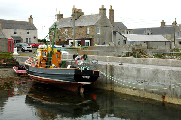
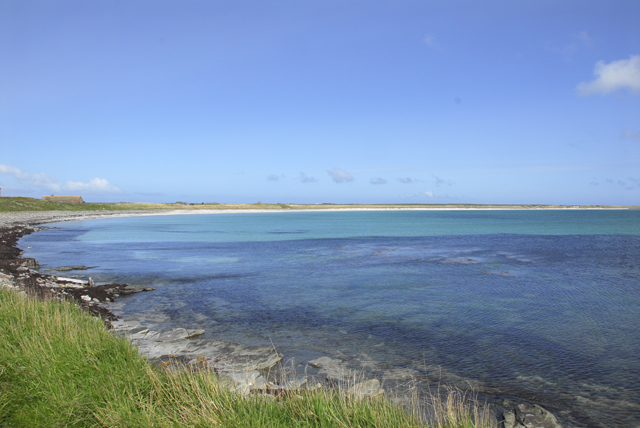
Images are sourced within 2km of 59.223/-2.57 or Grid Reference HY6737. Thanks to Geograph Open Source API. All images are credited.


Augmund Howe is located at Grid Ref: HY6737 (Lat: 59.223, Lng: -2.57)
Unitary Authority: Orkney Islands
Police Authority: Highlands and Islands
What 3 Words
///thinnest.cookery.splash. Near Kettletoft, Orkney Islands
Nearby Locations
Related Wikis

Kettletoft
Kettletoft is a settlement on the island of Sanday in Orkney, Scotland. The B9068 road runs from Kettletoft to Scar and the B9069 from Kettletoft to Northwall...

Sanday, Orkney
Sanday (, Scots: Sandee) is one of the inhabited islands of Orkney that lies off the north coast of mainland Scotland. With an area of 50.43 km2 (19.5...

Sanday Airport
Sanday Airport (IATA: NDY, ICAO: EGES) is located 20 NM (37 km; 23 mi) north northeast of Kirkwall Airport on Sanday, Orkney Islands, Scotland. Sanday...

Broughtown
Broughtown is a village on the island of Sanday, in Orkney, Scotland. The settlement is within the parish of Cross and Burness. Sanday Airport is adjacent...

East Sanday Coast
The East Sanday Coast is a protected wetland area on and around the island of Sanday, the third-largest of the Orkney islands off the north coast of Scotland...

Braeswick
Braeswick is a settlement on the island of Sanday, in Orkney, Scotland. The settlement is within the parish of Cross and Burness, and is situated on the...
Sanday Light Railway
The Sanday Light Railway was a privately owned ridable miniature railway situated in Braeswick, on the island of Sanday, Orkney, Scotland. The railway...

Scar, Orkney
Scar is a village and farm complex on the island of Sanday in Orkney, Scotland. The B9068 road runs from Scar to Kettletoft. The Scar boat burial was found...
Nearby Amenities
Located within 500m of 59.223,-2.57Have you been to Augmund Howe ?
Leave your review of Augmund Howe below (or comments, questions and feedback).