Quoyness

Heritage Site in Orkney

Scotland

Quoyness

Beach at Sty Wick, Sanday
Beach at Sty Wick, Sanday Credit: Alpin Stewart

Quoyness, located in Orkney, Scotland, is a significant heritage site that offers a glimpse into the history and culture of the region. This ancient burial chamber, dating back to the Neolithic period around 3,000 BC, is a prime example of the remarkable architectural achievements of early civilizations.

The site is characterized by a large stone structure, known as a chambered cairn, which was constructed by early inhabitants using massive stones. The chambered cairn comprises a central passage leading to a series of chambers, where human remains and valuable artifacts were interred. The structure is believed to have served both as a burial site and a ceremonial space for rituals, highlighting the spiritual beliefs and practices of the Neolithic people.

Quoyness is particularly renowned for its well-preserved carvings and intricate designs on the stones. These engravings depict various symbols, such as spirals, zigzags, and animal motifs, offering invaluable insights into the artistic expressions and symbolism of the ancient inhabitants.

The site is accessible to visitors, who can explore the chambered cairn and witness its awe-inspiring architecture firsthand. Quoyness provides a unique opportunity to experience the ancient past and appreciate the craftsmanship and ingenuity of our ancestors. It serves as a testament to the rich historical and cultural heritage of Orkney, attracting tourists and researchers alike.

Quoyness is not only a remarkable archaeological site but also a reminder of the enduring legacy left by our predecessors. It stands as a testament to the ingenuity, creativity, and spiritual beliefs of the Neolithic people, offering a fascinating window into the ancient world.

If you have any feedback on the listing, please let us know in the comments section below.
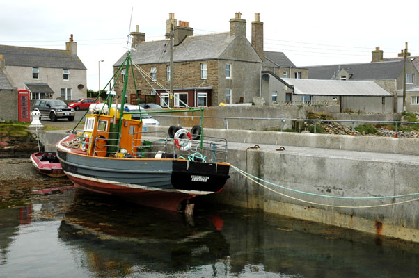
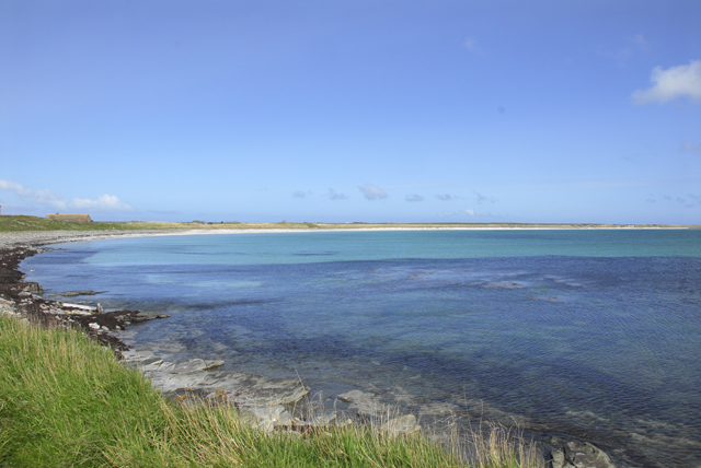
Quoyness Images

Images are sourced within 2km of 59.223/-2.57 or Grid Reference HY6737. Thanks to Geograph Open Source API. All images are credited.

Beach at Sty Wick, Sanday
Path to Quoyness Chambered Cairn, Sanday
Quoyness Chambered Cairn, Sanday
Pier buildings, Kettletoft, Sanday
Harbour at Kettletoft, Sanday
Elsness from the Air Elsness is a peninsula almost cut off from the rest of Sanday.
Elsness from the Air
Elsness is a peninsula almost cut off from the rest of Sanday.
Kettletoft Pier - Sanday, Orkney An exposed mooring.
Kettletoft Pier - Sanday, Orkney
An exposed mooring.
Quoyness Chambered Cairn The Orkney Islands are well provided for in well preserved chambered cairns.
Quoyness Chambered Cairn
The Orkney Islands are well provided for in well preserved chambered cairns.
Dandelions in pasture This field is beside the track which skirts the Peedie Sea.
Dandelions in pasture
This field is beside the track which skirts the Peedie Sea.
Dunes overlooking Sty Wick This is taken from a spot close to the right-angle bend in the track around the Peerie (Little) Sea. The nearer headland across Sty Wick is Lang Taing, and you can see Tres Ness in the distance beyond.
Dunes overlooking Sty Wick
This is taken from a spot close to the right-angle bend in the track around the Peerie (Little) Sea. The nearer headland across Sty Wick is Lang Taing, and you can see Tres Ness in the distance beyond.
Leaving Quoyness Cairn The narrow entrance to the cairn is about 9 metres long, including this open section. My companion is closing the gate which keeps unwelcome intruders out of the central cairn. Beyond the gate you can only progress on hands and knees in the dark, but the box on the wall contains a torch to help you see your way.
Leaving Quoyness Cairn
The narrow entrance to the cairn is about 9 metres long, including this open section. My companion is closing the gate which keeps unwelcome intruders out of the central cairn. Beyond the gate you can only progress on hands and knees in the dark, but the box on the wall contains a torch to help you see your way.
Causeway to Els Ness This bank of sand links Els Ness to Sanday.
Causeway to Els Ness
This bank of sand links Els Ness to Sanday.
Stone breaker, Els Ness This machine sits on metal beams at the side of a bank, although that isn't obvious in the picture. I think it is a stone breaker, similar to the ones on Papa Westray <a href="https://www.geograph.org.uk/photo/176840">HY4953 : Abandoned machine, Papa Westray</a> and North Ronaldsay <a href="https://www.geograph.org.uk/photo/224636">HY7654 : Stone breaker, North Ronaldsay</a>.
Stone breaker, Els Ness
This machine sits on metal beams at the side of a bank, although that isn't obvious in the picture. I think it is a stone breaker, similar to the ones on Papa Westray HY4953 : Abandoned machine, Papa Westray and North Ronaldsay HY7654 : Stone breaker, North Ronaldsay.
Fishing boat at Kettletoft Pier Sanday
Fishing boat at Kettletoft Pier
Sanday
The Belsair, Kettletoft
Quoyness Chambered Cairn
Across Sty Wick
Across Sty Wick
View East along beach of Sty Wick, Sanday
Show me another place!

Quoyness is located at Grid Ref: HY6737 (Lat: 59.223, Lng: -2.57)

Unitary Authority: Orkney Islands

Police Authority: Highlands and Islands

What 3 Words

///thinnest.cookery.splash. Near Kettletoft, Orkney Islands

Related Wikis

Kettletoft

Kettletoft is a settlement on the island of Sanday in Orkney, Scotland. The B9068 road runs from Kettletoft to Scar and the B9069 from Kettletoft to Northwall...

Sanday, Orkney

Sanday (, Scots: Sandee) is one of the inhabited islands of Orkney that lies off the north coast of mainland Scotland. With an area of 50.43 km2 (19.5...

Sanday Airport

Sanday Airport (IATA: NDY, ICAO: EGES) is located 20 NM (37 km; 23 mi) north northeast of Kirkwall Airport on Sanday, Orkney Islands, Scotland. Sanday...

Broughtown

Broughtown is a village on the island of Sanday, in Orkney, Scotland. The settlement is within the parish of Cross and Burness. Sanday Airport is adjacent...

Nearby Amenities

Located within 500m of 59.223,-2.57
Otter Hole
Place: locality
Source: OS Street View
Lat/Long: 59.2205912/-2.5745915
Sivers Geo
Place: locality
Source: OS Street View
Lat/Long: 59.2228061/-2.5777207
The Swarf
Place: locality
Source: OS Street View
Lat/Long: 59.2186535/-2.5710286
Quoyness Chambered Cairn
Archaeological Site: megalith
Historic: archaeological_site
Historic Civilization: neolithic
Megalith Type: passage_grave
Wikidata: Q7272906
Wikipedia: en:Quoyness chambered cairn
Lat/Long: 59.2255626/-2.5683564
Information: board
Tourism: information
Lat/Long: 59.225466/-2.5681052
The data included in this document is from www.openstreetmap.org. The data is made available under ODbL.

Have you been to Quoyness ?

Leave your review of Quoyness below (or comments, questions and feedback).