Melchbourne

Settlement in Bedfordshire

England

Melchbourne

Churchyard and cottage, Melchbourne The cottage dates from the seventeenth century <span class="nowrap"><a title="https://historicengland.org.uk/listing/the-list/list-entry/1321277?section=official-list-entry" rel="nofollow ugc noopener" href="https://historicengland.org.uk/listing/the-list/list-entry/1321277?section=official-list-entry">Link</a><img style="margin-left:2px;" alt="External link" title="External link - shift click to open in new window" src="https://s1.geograph.org.uk/img/external.png" width="10" height="10"/></span>
Churchyard and cottage, Melchbourne Credit: Jonathan Thacker

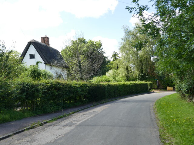
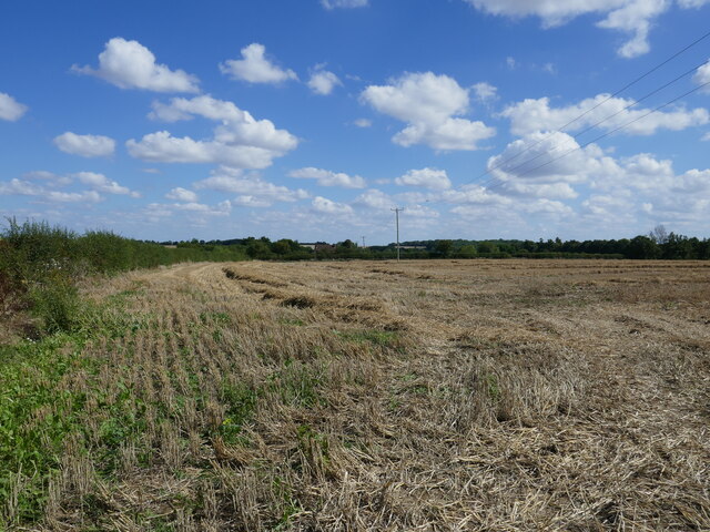
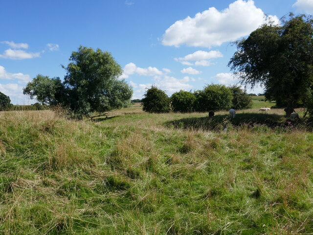
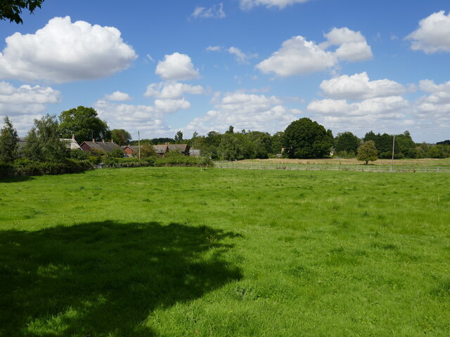
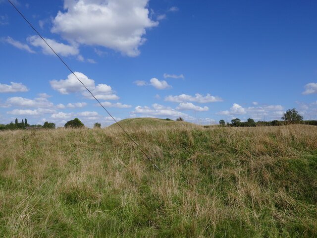
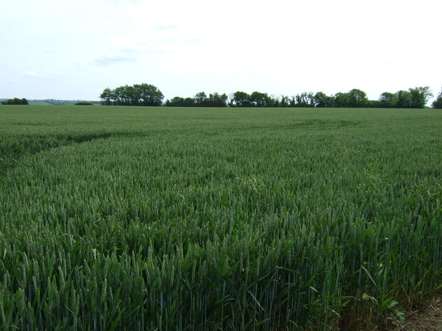
Melchbourne is a small village located in the county of Bedfordshire, England. It is situated approximately 9 miles north of the town of Bedford and about 6 miles south-west of Kimbolton. The village is nestled within a rural landscape, surrounded by picturesque countryside and charming farmland.

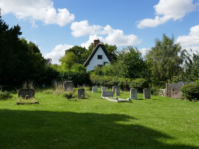
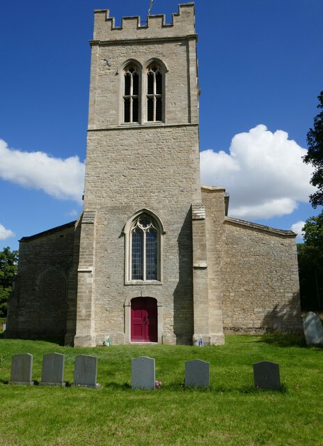
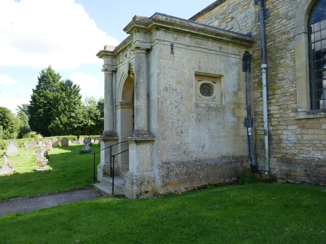
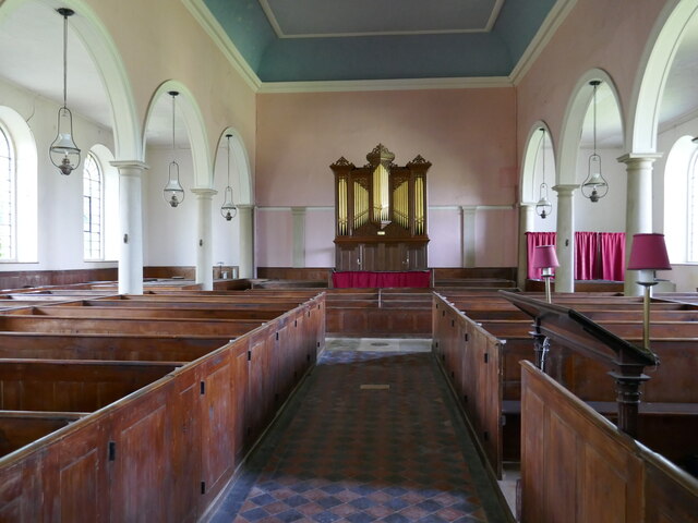
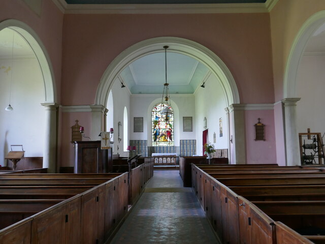
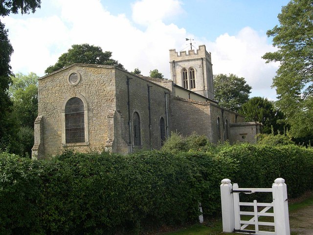
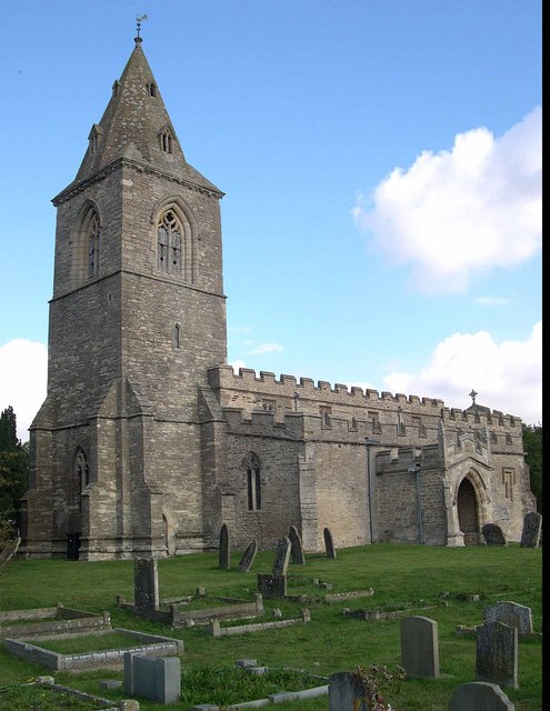
The history of Melchbourne dates back to medieval times, and evidence of this can be seen in the village's architecture. The centerpiece of the village is the All Saints Church, a Grade II listed building that dates back to the 13th century. This beautiful church boasts intricate stained glass windows and a distinctive tower, making it a prominent feature of the village.

Melchbourne is a close-knit community with a small population. The village offers a tranquil and peaceful environment for its residents, with a strong sense of community spirit. It is known for its friendly and welcoming atmosphere, and villagers often come together for various social and cultural events.

Despite its small size, Melchbourne is well-connected to surrounding areas. The village is conveniently located near major road networks, including the A6 and A428, providing easy access to nearby towns and cities. Additionally, the village is surrounded by several nature reserves and country parks, offering residents and visitors ample opportunities for outdoor activities such as walking, cycling, and birdwatching.

In summary, Melchbourne is a charming village in Bedfordshire, known for its historical church, beautiful countryside, and strong community spirit. It provides a peaceful and idyllic living environment, perfect for those seeking a rural retreat.

If you have any feedback on the listing, please let us know in the comments section below.

Melchbourne Images

Images are sourced within 2km of 52.280396/-0.493623 or Grid Reference TL0265. Thanks to Geograph Open Source API. All images are credited.

Churchyard and cottage, Melchbourne The cottage dates from the seventeenth century <span class="nowrap"><a title="https://historicengland.org.uk/listing/the-list/list-entry/1321277?section=official-list-entry" rel="nofollow ugc noopener" href="https://historicengland.org.uk/listing/the-list/list-entry/1321277?section=official-list-entry">Link</a><img style="margin-left:2px;" alt="External link" title="External link - shift click to open in new window" src="https://s1.geograph.org.uk/img/external.png" width="10" height="10"/></span>
Churchyard and cottage, Melchbourne
The cottage dates from the seventeenth century LinkExternal link
Landscape near Melchbourne
Park Road, Melchbourne The cottage dates from the seventeenth century <span class="nowrap"><a title="https://historicengland.org.uk/listing/the-list/list-entry/1321277?section=official-list-entry" rel="nofollow ugc noopener" href="https://historicengland.org.uk/listing/the-list/list-entry/1321277?section=official-list-entry">Link</a><img style="margin-left:2px;" alt="External link" title="External link - shift click to open in new window" src="https://s1.geograph.org.uk/img/external.png" width="10" height="10"/></span>
Park Road, Melchbourne
The cottage dates from the seventeenth century LinkExternal link
Stubble field near Melchbourne
Grazing sheep, Yelden
Church of St Mary Magdalene, Melchbourne Medieval church much altered in 1779 <span class="nowrap"><a title="https://historicengland.org.uk/listing/the-list/list-entry/1312146?section=official-list-entry" rel="nofollow ugc noopener" href="https://historicengland.org.uk/listing/the-list/list-entry/1312146?section=official-list-entry">Link</a><img style="margin-left:2px;" alt="External link" title="External link - shift click to open in new window" src="https://s1.geograph.org.uk/img/external.png" width="10" height="10"/></span>
Church of St Mary Magdalene, Melchbourne
Medieval church much altered in 1779 LinkExternal link
Church of St Mary Magdalene, Melchbourne, north porch The north porch is said to have come from the demolished Woodford House in Northamptonshire <span class="nowrap"><a title="https://historicengland.org.uk/listing/the-list/list-entry/1312146?section=official-list-entry" rel="nofollow ugc noopener" href="https://historicengland.org.uk/listing/the-list/list-entry/1312146?section=official-list-entry">Link</a><img style="margin-left:2px;" alt="External link" title="External link - shift click to open in new window" src="https://s1.geograph.org.uk/img/external.png" width="10" height="10"/></span>
Church of St Mary Magdalene, Melchbourne, north porch
The north porch is said to have come from the demolished Woodford House in Northamptonshire LinkExternal link
Church of St Mary Magdalene, Melchbourne, interior looking west As altered in 1779 <span class="nowrap"><a title="https://historicengland.org.uk/listing/the-list/list-entry/1312146?section=official-list-entry" rel="nofollow ugc noopener" href="https://historicengland.org.uk/listing/the-list/list-entry/1312146?section=official-list-entry">Link</a><img style="margin-left:2px;" alt="External link" title="External link - shift click to open in new window" src="https://s1.geograph.org.uk/img/external.png" width="10" height="10"/></span>
Church of St Mary Magdalene, Melchbourne, interior looking west
As altered in 1779 LinkExternal link
Church of St Mary Magdalene, Melchbourne, interior looking east Largely the work of 1779 <span class="nowrap"><a title="https://historicengland.org.uk/listing/the-list/list-entry/1312146?section=official-list-entry" rel="nofollow ugc noopener" href="https://historicengland.org.uk/listing/the-list/list-entry/1312146?section=official-list-entry">Link</a><img style="margin-left:2px;" alt="External link" title="External link - shift click to open in new window" src="https://s1.geograph.org.uk/img/external.png" width="10" height="10"/></span>
Church of St Mary Magdalene, Melchbourne, interior looking east
Largely the work of 1779 LinkExternal link
Melchbourne, grass field and village
Castle Hill, Yelden Site of a motte and bailey castle probably dating from the early years after the Norman Conquest <span class="nowrap"><a title="https://historicengland.org.uk/listing/the-list/list-entry/1013520?section=official-list-entry" rel="nofollow ugc noopener" href="https://historicengland.org.uk/listing/the-list/list-entry/1013520?section=official-list-entry">Link</a><img style="margin-left:2px;" alt="External link" title="External link - shift click to open in new window" src="https://s1.geograph.org.uk/img/external.png" width="10" height="10"/></span>
Castle Hill, Yelden
Site of a motte and bailey castle probably dating from the early years after the Norman Conquest LinkExternal link
The Chequers, Yelden Unusual single-storey village pub on High Street.
The Chequers, Yelden
Unusual single-storey village pub on High Street.
Yelden Castle According to a nearby explanatory board, this earthwork is considered the finest archaeological monument in Bedfordshire.  It is the remains of a motte and bailey castle in use after the Norman conquest by the de Trailly family who were under-tenants of the Bishop of Coutances. The castle had fallen into disuse by 1360.
Yelden Castle
According to a nearby explanatory board, this earthwork is considered the finest archaeological monument in Bedfordshire. It is the remains of a motte and bailey castle in use after the Norman conquest by the de Trailly family who were under-tenants of the Bishop of Coutances. The castle had fallen into disuse by 1360.
Farmland west of Swineshead
Minor road towards Riseley
Farmland, Eastfields Farm
Track to Eastfields Farm (bridleway)
Farmland near Melchbourne
Show me another place!

Melchbourne is located at Grid Ref: TL0265 (Lat: 52.280396, Lng: -0.493623)

Unitary Authority: Bedford

Police Authority: Bedfordshire

What 3 Words

///basher.slept.candy. Near Swineshead, Bedfordshire

Related Wikis

Melchbourne

Melchbourne is a village and former civil parish, now in the parish of Melchbourne and Yielden, in the Bedford district, in the ceremonial county of Bedfordshire...

Church of St Mary Magdalene, Melchbourne

Church of St Mary Magdalene is a Grade I listed church in Melchbourne, Bedfordshire, England. It became a listed building on 13 July 1964. The church is...

Melchbourne and Yielden

Melchbourne and Yielden is a civil parish in the Borough of Bedford in the county of Bedfordshire, England. The two parishes of Melchbourne and Yelden...

Melchbourne Preceptory

Melchbourne Preceptory was a priory in Melchbourne, Bedfordshire, England. It was established in the 12th century and disestablished around 1550. ��2...

Yelden

Yelden or Yielden is a village and former civil parish, now in the parish of Melchbourne and Yielden, in the Bedford district, in the ceremonial county...

Yielden Castle

Yielden Castle was a twelfth-century castle located in Yelden in the county of Bedfordshire, England. == Details == Yielden Castle has also been known...

Church of St Mary the Virgin, Yielden

Church of St Mary the Virgin is a Grade I listed church in Yelden, Bedfordshire, England. It is a good example of a village church mainly in the Decorated...

Yelden Meadows

Yelden Meadows is a 2.8-hectare (6.9-acre) biological Site of Special Scientific Interest in Yelden (or Yeilden) in Bedfordshire. It was notified under...

Nearby Amenities

Located within 500m of 52.280396,-0.493623
Melchbourne
Place: village
Wikidata: Q1521032
Wikipedia: en:Melchbourne
Lat/Long: 52.2787549/-0.4912469
Created By: Merkaartor 0.12
Lat/Long: 52.284088/-0.489823
Created By: Merkaartor 0.12
Lat/Long: 52.2848459/-0.4926449
Barrier: stile
Lat/Long: 52.2834993/-0.4945872
Barrier: stile
Lat/Long: 52.2820074/-0.4927351
Post Box
Collection Times: Mo-Fr 16:45; Sa 09:00
Operator: Royal Mail
Post Box Type: lamp
Ref: MK44 228
Royal Cypher: EIIR
Royal Cypher Wikidata: Q33102113
Source: survey
Survey Date: 2016-04-30
Lat/Long: 52.2796467/-0.4927915
Community Centre
Melchbourne Village Hall
Addr City: Melchbourne
Addr Country: GB
Addr Postcode: MK44 1BB
Addr Street: Park Road
Lat/Long: 52.2797771/-0.4933387
Kindergarten
Inn Farm Private Day Nursery
Addr City: Melchbourne
Addr Country: GB
Addr Postcode: MK44 1BE
Addr Street: Knotting Road
Fhrs Authority: Bedford
Fhrs Id: 108472
Fhrs Local Authority Id: 38724
Lat/Long: 52.2788319/-0.49851
Power: pole
Lat/Long: 52.279661/-0.4989558
Power: pole
Lat/Long: 52.2803669/-0.4977655
Barrier: kissing_gate
Lat/Long: 52.2785483/-0.4934312
Barrier: kissing_gate
Lat/Long: 52.2781251/-0.4906985
The data included in this document is from www.openstreetmap.org. The data is made available under ODbL.

Have you been to Melchbourne?

Leave your review of Melchbourne below (or comments, questions and feedback).