Adam's Grave

Heritage Site in Wiltshire

England

Adam's Grave

On the White Horse Trail - view to Alton Barnes White Horse The Alton Barnes White Horse is approximately 180 feet high and 160 feet long, and was cut in 1812 under the commission of local farmer Robert Pile. Pile instructed inn sign painter John Thorne to design and cut the horse, although Thorne conned Pile by leaving with his advance sum while employing local resident John Harvey to cut the horse instead. (source Wikipedia)
On the White Horse Trail - view to Alton Barnes White Horse Credit: Colin Park

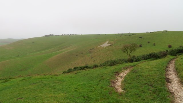
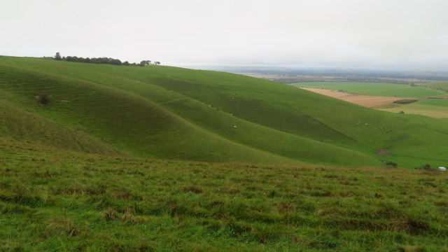
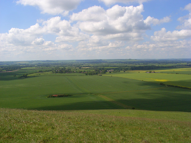
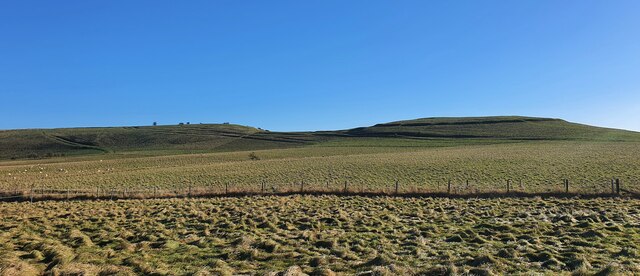
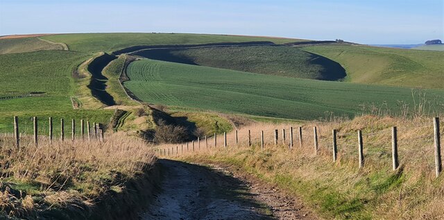
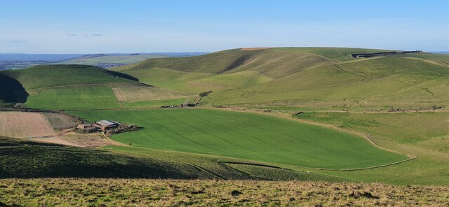
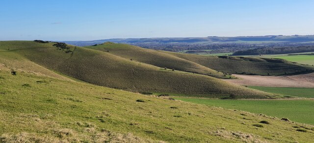
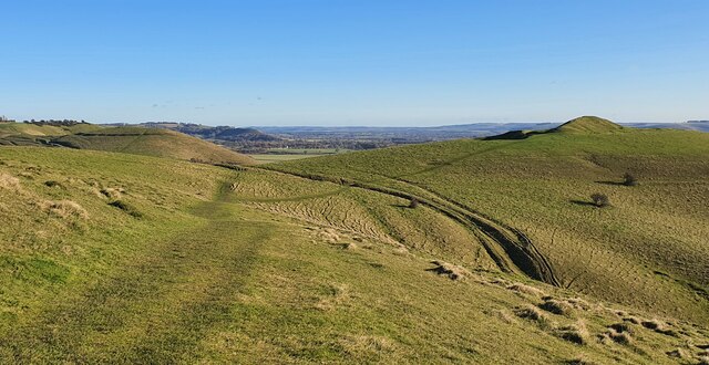
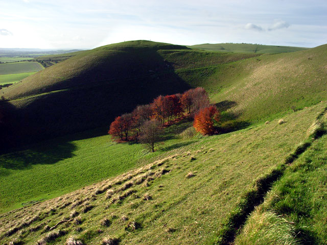
Adam's Grave is a historical monument located in the county of Wiltshire, England. Situated atop a prominent hill in the Pewsey Vale, it is a Neolithic long barrow that dates back to around 3,700 BC. The site is considered to be one of the finest examples of its kind in the region and is protected as a scheduled monument.

The barrow itself is roughly rectangular in shape and measures approximately 57 meters in length. It consists of a stone chamber enclosed by large sarsen stones and covered with earth and turf. Originally, the monument would have been surrounded by a mound of soil, but this has weathered away over time.

The name "Adam's Grave" is believed to have originated from a local legend that Adam, the biblical first man, was buried there. However, there is no historical evidence to support this claim. The site was excavated in the 19th century, revealing the remains of several individuals and artifacts such as pottery and flint tools.

Today, Adam's Grave is a popular destination for visitors interested in prehistoric history and archaeology. The hilltop location offers panoramic views of the surrounding countryside, making it a picturesque spot for picnics and walks. The site is easily accessible by foot and is located near the village of Alton Barnes.

Adam's Grave provides a fascinating insight into the lives and burial practices of Neolithic communities in the area. It stands as a testament to the ingenuity and craftsmanship of our ancient ancestors and serves as a valuable heritage site in Wiltshire.

If you have any feedback on the listing, please let us know in the comments section below.

Adam's Grave Images

Images are sourced within 2km of 51.37/-1.835 or Grid Reference SU1163. Thanks to Geograph Open Source API. All images are credited.

On the White Horse Trail - view to Alton Barnes White Horse The Alton Barnes White Horse is approximately 180 feet high and 160 feet long, and was cut in 1812 under the commission of local farmer Robert Pile. Pile instructed inn sign painter John Thorne to design and cut the horse, although Thorne conned Pile by leaving with his advance sum while employing local resident John Harvey to cut the horse instead. (source Wikipedia)
On the White Horse Trail - view to Alton Barnes White Horse
The Alton Barnes White Horse is approximately 180 feet high and 160 feet long, and was cut in 1812 under the commission of local farmer Robert Pile. Pile instructed inn sign painter John Thorne to design and cut the horse, although Thorne conned Pile by leaving with his advance sum while employing local resident John Harvey to cut the horse instead. (source Wikipedia)
Downland, western side of Milk Hill
Downland view, Stanton St Bernard A view across the Vale of Pewsey towards Salisbury Plain. The group of old farm buildings, left of centre, is beside the footpath between the village and Milk Hill.
Downland view, Stanton St Bernard
A view across the Vale of Pewsey towards Salisbury Plain. The group of old farm buildings, left of centre, is beside the footpath between the village and Milk Hill.
Pillbox between Stanton St Bernard and Alton Barnes
2009 : View over a field of barley Of a distant barn.
The simplicity of this shot appealed to me.
Milk Hill is in the distance to the right.
Had to wait about half an hour for the clouds to be in the right position.
2009 : View over a field of barley
Of a distant barn. The simplicity of this shot appealed to me. Milk Hill is in the distance to the right. Had to wait about half an hour for the clouds to be in the right position.
Farmland north of Stanton St Bernard The farmland is arable. In a few weeks it might be possible to identify the crop that is starting to germinate. The white horse in the background is this one <a href="https://www.geograph.org.uk/photo/1744619">SU1063 : Alton Barnes White Horse</a>. This image has been got at by a blogger but that's OK <span class="nowrap"><a title="http://bakerblinker.files.wordpress.com/2010/03/blueskytest02c.jpg" rel="nofollow ugc noopener" href="http://bakerblinker.files.wordpress.com/2010/03/blueskytest02c.jpg">Link</a><img style="margin-left:2px;" alt="External link" title="External link - shift click to open in new window" src="https://s1.geograph.org.uk/img/external.png" width="10" height="10"/></span>
Farmland north of Stanton St Bernard
The farmland is arable. In a few weeks it might be possible to identify the crop that is starting to germinate. The white horse in the background is this one SU1063 : Alton Barnes White Horse. This image has been got at by a blogger but that's OK LinkExternal link
Stanton St  Bernard - Rapeseed The Alton Barnes white Horse was created in 1821 and is seen here from a field of rapeseed.
Stanton St Bernard - Rapeseed
The Alton Barnes white Horse was created in 1821 and is seen here from a field of rapeseed.
Stanton St  Bernard - Pillbox One of the three pillboxes that line the road between Stanton St Bernard and Alton Barnes.
Stanton St Bernard - Pillbox
One of the three pillboxes that line the road between Stanton St Bernard and Alton Barnes.
Stanton St  Bernard - Pillbox One of the three pillboxes that line the road between Stanton St Bernard and Alton Barnes.
Stanton St Bernard - Pillbox
One of the three pillboxes that line the road between Stanton St Bernard and Alton Barnes.
Stanton St  Bernard - Pillbox One of the three pillboxes that line the road between Stanton St Bernard and Alton Barnes.
Stanton St Bernard - Pillbox
One of the three pillboxes that line the road between Stanton St Bernard and Alton Barnes.
Stanton St  Bernard - Pillbox One of the three pillboxes that line the road between Stanton St Bernard and Alton Barnes.
Stanton St Bernard - Pillbox
One of the three pillboxes that line the road between Stanton St Bernard and Alton Barnes.
Downland north of Stanton St Bernard View west from the flank of Milk Hill. Grazing land on the steep slopes and arable land in the valley bottom.
Downland north of Stanton St Bernard
View west from the flank of Milk Hill. Grazing land on the steep slopes and arable land in the valley bottom.
Downland on Milk Hill View north-west towards Tan Hill. Hill Barn in the valley below.
Downland on Milk Hill
View north-west towards Tan Hill. Hill Barn in the valley below.
Knap Hill, Wiltshire Looking from the eastern edge of Walkers Hill towards Knap Hill (to the right of the image), and Golden Ball Hill (to the left of the image).
Knap Hill, Wiltshire
Looking from the eastern edge of Walkers Hill towards Knap Hill (to the right of the image), and Golden Ball Hill (to the left of the image).
Milk Hill, Wiltshire Looking west along the Wansdyke on Milk Hill. Wansdyke (from Woden's Dyke) is a series of early medieval defensive linear earthworks in the west of England, consisting of a ditch and an embankment.
Milk Hill, Wiltshire
Looking west along the Wansdyke on Milk Hill. Wansdyke (from Woden's Dyke) is a series of early medieval defensive linear earthworks in the west of England, consisting of a ditch and an embankment.
Milk Hill, Wiltshire Looking west over farmland on Milk Hill.
Milk Hill, Wiltshire
Looking west over farmland on Milk Hill.
Milk Hill, Wiltshire Looking from Milk Hill, across pastureland, towards Walkers Hill.
Milk Hill, Wiltshire
Looking from Milk Hill, across pastureland, towards Walkers Hill.
Walkers Hill, Wiltshire Looking over pastureland towards Walkers Hill, the mound on the right of the image (near horizon) is Adam's Grave. Adam's Grave is an imposing Neolithic long barrow.
Walkers Hill, Wiltshire
Looking over pastureland towards Walkers Hill, the mound on the right of the image (near horizon) is Adam's Grave. Adam's Grave is an imposing Neolithic long barrow.
Show me another place!

Adam's Grave is located at Grid Ref: SU1163 (Lat: 51.37, Lng: -1.835)

Unitary Authority: Wiltshire

Police Authority: Wiltshire

What 3 Words

///steadily.escalates.crouching. Near Huish, Wiltshire

Related Wikis

Pewsey Downs

Pewsey Downs (grid reference SU113636) is a 305.3 hectare biological Site of Special Scientific Interest on the southern edge of the Marlborough Downs...

Adam's Grave

Adam's Grave was a Neolithic long barrow near Alton Barnes in Wiltshire, southwest England. Its remains have been scheduled as an ancient monument.The...

Knap Hill

Knap Hill lies on the northern rim of the Vale of Pewsey, in northern Wiltshire, England, about a mile (1.6 km) north of the village of Alton Priors....

Alton Barnes White Horse

Alton Barnes White Horse is a chalk hill figure of a white horse located on Milk Hill some 1,000 metres north of the village of Alton, Wiltshire, England...

Alton, Wiltshire

Alton is a civil parish in Wiltshire, England. The parish includes the adjacent villages of Alton Barnes and Alton Priors, and the nearby hamlet of Honeystreet...

Milk Hill

Milk Hill, located near Alton Priors east of Devizes, is the highest point in the county of Wiltshire, southwest England, at some 295 m (968 ft) above...

All Saints Church, Alton Priors

All Saints Church in Alton Priors, Wiltshire, England, dates from the 12th century. It is recorded in the National Heritage List for England as a Grade...

Battle of Woden's Burg (592)

The Anglo-Saxon Chronicle records a battle fought in the year 592 at Woden's Barrow (Old English "Wōdnesbeorġ"), the neolithic long barrow now known as...

Nearby Amenities

Located within 500m of 51.37,-1.835
Walkers Hill
Ele: 260
Natural: peak
Lat/Long: 51.3694956/-1.8399717
Adam's Grave
Historic: archaeological_site
Wikidata: Q4678577
Lat/Long: 51.3696035/-1.8401467
Barrier: stile
Material: wood
Stile: stepover
Lat/Long: 51.3709901/-1.8366426
The data included in this document is from www.openstreetmap.org. The data is made available under ODbL.

Have you been to Adam's Grave ?

Leave your review of Adam's Grave below (or comments, questions and feedback).