West Shilvinghampton

Settlement in Dorset

England

West Shilvinghampton

Farm Buildings near Rodden
Farm Buildings near Rodden Credit: David Dixon

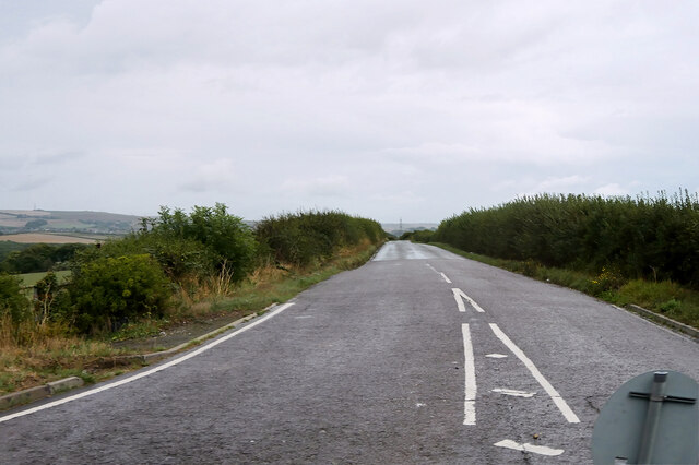
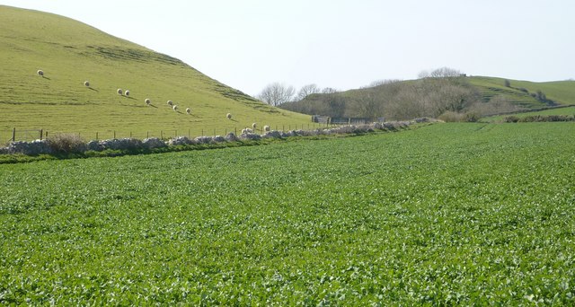
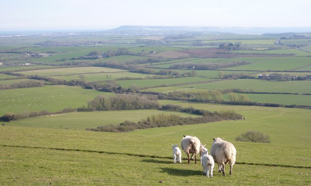
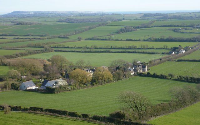
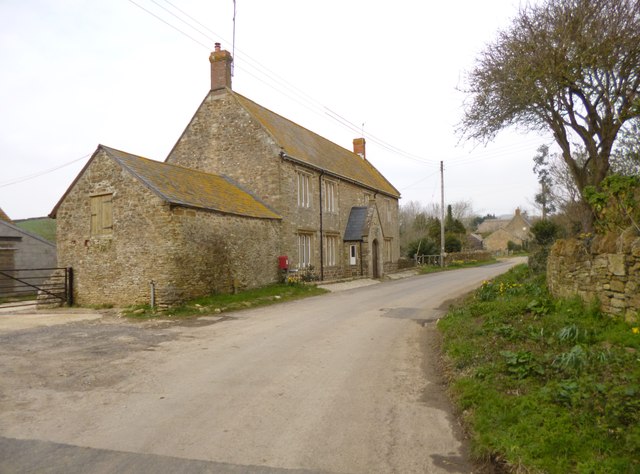
West Shilvinghampton is a small village located in the county of Dorset, England. Situated in the West Dorset district, it lies about 5 miles east of the town of Dorchester and is surrounded by picturesque countryside. The village is nestled in a valley and is characterized by its charming rural atmosphere.

With a population of around 300 residents, West Shilvinghampton is a close-knit community that prides itself on its tranquility and natural beauty. The village is known for its traditional thatched cottages, many of which date back several centuries, giving it a timeless and idyllic appeal.

The heart of West Shilvinghampton is its small parish church, St. Peter's, which stands as a historic landmark in the area. Its architecture showcases a mix of Norman and Gothic styles, and it is well-maintained, attracting visitors interested in the village's heritage.

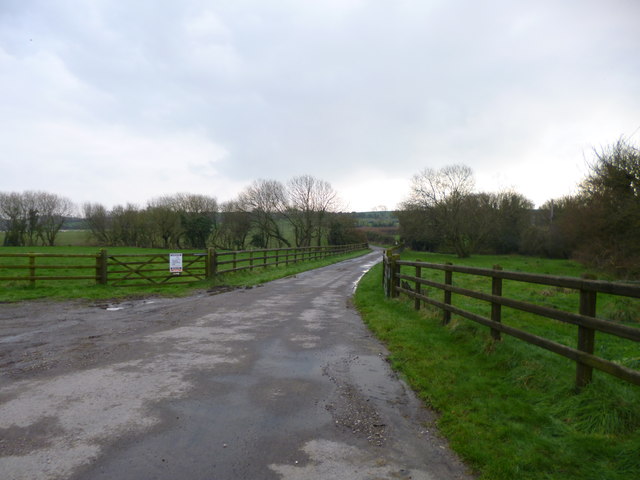
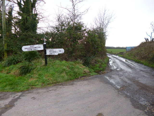
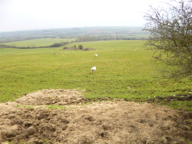
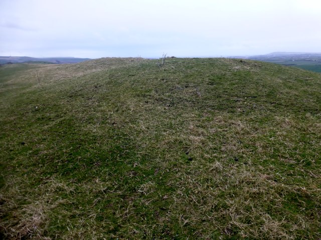
The surrounding countryside offers ample opportunities for outdoor activities, with numerous walking trails and cycling routes that allow residents and visitors to explore the stunning Dorset landscape. The village is also close to the famous Jurassic Coast, a UNESCO World Heritage Site known for its fossil-rich cliffs and picturesque beaches.

While West Shilvinghampton is primarily a residential village, it benefits from its proximity to larger towns and cities. The nearby town of Dorchester provides essential amenities such as shops, schools, and healthcare facilities, ensuring that residents have easy access to all necessary services.

In summary, West Shilvinghampton is a charming and peaceful village in Dorset, offering a tranquil rural lifestyle surrounded by natural beauty and historic landmarks.

If you have any feedback on the listing, please let us know in the comments section below.

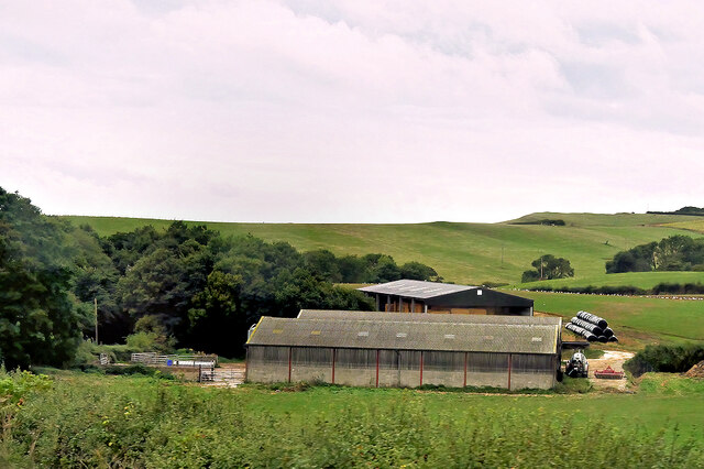
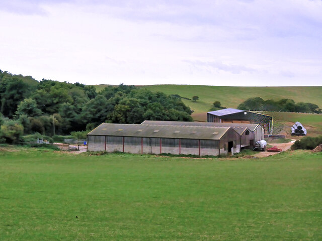
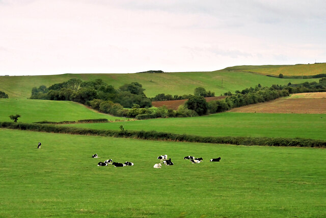
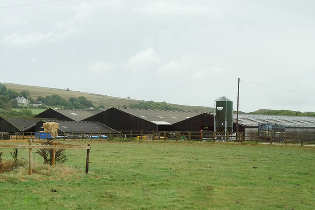
West Shilvinghampton Images

Images are sourced within 2km of 50.660208/-2.5322416 or Grid Reference SY6284. Thanks to Geograph Open Source API. All images are credited.

Farm Buildings near Rodden
Farm near Rodden
Farm near Rodden
Cattle Grazing near Rodden
Clover Farm
Clover Farm
Nottington Lane
Nottington Lane
Direction Sign - Signpost on Cheese Lane near Coryates Located south of Coryates on the southwest side of the junction of Cheese Lane and the road to East Shilvinghampton Farm in Portesham parish. 3 arms and annulus & bar finial. See <a title="https://www.geograph.org.uk/photo/6099271" href="https://www.geograph.org.uk/photo/6099271">Link</a> to compare with its condition in 2013, and <a title="https://www.geograph.org.uk/photo/3308110" href="https://www.geograph.org.uk/photo/3308110">Link</a> and <a title="https://www.geograph.org.uk/photo/1092395" href="https://www.geograph.org.uk/photo/1092395">Link</a> for alternative views

Milestone Society National ID: DO_SY6284
Direction Sign - Signpost on Cheese Lane near Coryates
Located south of Coryates on the southwest side of the junction of Cheese Lane and the road to East Shilvinghampton Farm in Portesham parish. 3 arms and annulus & bar finial. See Link to compare with its condition in 2013, and Link and Link for alternative views Milestone Society National ID: DO_SY6284
Sheep on Corton Hill
Dismantled Railway The line can be traced between Abbotsbury and Upwey Station on the 1:25000 OS map.
Dismantled Railway
The line can be traced between Abbotsbury and Upwey Station on the 1:25000 OS map.
Coryates and Portland
Coryates, farm road Farm road and footpath, from the Portesham to Shilvinghampton road; leading to East Shilvinghampton Farm.
Coryates, farm road
Farm road and footpath, from the Portesham to Shilvinghampton road; leading to East Shilvinghampton Farm.
Coryates, fingerpost Dorset gridded fingerpost, at the junction of the Portesham to Broadwey road, and the road to East Shilvinghampton Farm; bearing grid number "628 847".
Coryates, fingerpost
Dorset gridded fingerpost, at the junction of the Portesham to Broadwey road, and the road to East Shilvinghampton Farm; bearing grid number "628 847".
Rodden Farm The maze would probably be not too visible at this time of year! <span class="nowrap"><a title="http://www.maize-maze.com/locations/family-day-out-in-weymouth.php" rel="nofollow ugc noopener" href="http://www.maize-maze.com/locations/family-day-out-in-weymouth.php">Link</a><img style="margin-left:2px;" alt="External link" title="External link - shift click to open in new window" src="https://s1.geograph.org.uk/img/external.png" width="10" height="10"/></span>
Rodden Farm
The maze would probably be not too visible at this time of year! LinkExternal link
Rodden Farmhouse
Rodden Farmhouse
Portesham, sheep grazing
Corton, Blackacre Farm
Ordnance Survey Flush Bracket G5011 This can be found on a wall at Clover Farm.
For more detail see : <span class="nowrap"><a title="http://www.bench-marks.org.uk/bm14712" rel="nofollow ugc noopener" href="http://www.bench-marks.org.uk/bm14712">Link</a><img style="margin-left:2px;" alt="External link" title="External link - shift click to open in new window" src="https://s1.geograph.org.uk/img/external.png" width="10" height="10"/></span>
Ordnance Survey Flush Bracket G5011
This can be found on a wall at Clover Farm. For more detail see : LinkExternal link
Abandoned farmstead, Hell Bottom
Friar Waddon Hill Walked up the track from the west to the second of two tululi with Alex and Smudge.
Name: Friar Waddon Hill
Hill number: 18233
Height: 132m / 433ft
Parent (Ma/M): 2896  Lewesdon Hill
Section: 41: South Central England
County/UA: Dorset (CoU)
Class: Tump (100-199m))
Grid ref: SY640854 (est)
Drop: 36m
Col: 96m  SY631856
Friar Waddon Hill
Walked up the track from the west to the second of two tululi with Alex and Smudge. Name: Friar Waddon Hill Hill number: 18233 Height: 132m / 433ft Parent (Ma/M): 2896 Lewesdon Hill Section: 41: South Central England County/UA: Dorset (CoU) Class: Tump (100-199m)) Grid ref: SY640854 (est) Drop: 36m Col: 96m SY631856
Show me another place!

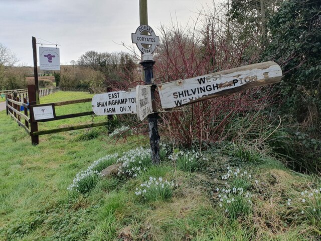
West Shilvinghampton is located at Grid Ref: SY6284 (Lat: 50.660208, Lng: -2.5322416)

Unitary Authority: Dorset

Police Authority: Dorset

What 3 Words

///disbelief.delivers.likening. Near Chickerell, Dorset

Related Wikis

Coryates Halt railway station

Coryates Halt was a small railway station on the Abbotsbury branch railway in the west of the English county of Dorset. It consisted of a single platform...

St Bartholomew's Chapel, Corton

St Bartholomew's Chapel is a Church of England chapel in Corton, near Weymouth, Dorset, England. The chapel has early 13th century origins, with later...

Corton Cutting

Corton Cutting (grid reference SY637855) is a 0.24 hectare geological Site of Special Scientific Interest in Dorset, England, notified in 1997. The site...

Portesham railway station

Portesham was a small railway station serving the village of Portesham in the west of the English county of Dorset. == Location == The station was sited...

Nearby Amenities

Located within 500m of 50.660208,-2.5322416
Power: pole
Source: bing
Lat/Long: 50.6592231/-2.531615
Power: pole
Source: bing
Lat/Long: 50.6591135/-2.5326987
Power: pole
Source: bing
Transformer: distribution
Lat/Long: 50.6594263/-2.5297657
Power: pole
Source: bing
Lat/Long: 50.6593422/-2.5305958
Power: pole
Source: bing
Transformer: distribution
Lat/Long: 50.6574224/-2.5291984
Power: pole
Source: bing
Lat/Long: 50.6580737/-2.5296664
Power: pole
Source: bing
Lat/Long: 50.6581034/-2.5327536
Power: pole
Source: bing
Lat/Long: 50.6585396/-2.5335167
Power: pole
Source: bing
Lat/Long: 50.6589545/-2.5342597
Power: pole
Source: bing
Lat/Long: 50.6593617/-2.5350107
Power: pole
Source: bing
Lat/Long: 50.6597188/-2.5361614
Power: pole
Source: bing
Lat/Long: 50.6600724/-2.5373
Power: pole
Source: bing
Lat/Long: 50.6604134/-2.5383849
Coryates
Historic Railway: halt
Railway: site
Wikidata: Q5173687
Wikipedia: en:Coryates Halt railway station
Lat/Long: 50.6608508/-2.5269099
The data included in this document is from www.openstreetmap.org. The data is made available under ODbL.

Have you been to West Shilvinghampton?

Leave your review of West Shilvinghampton below (or comments, questions and feedback).