West Darlochan

Settlement in Argyllshire

Scotland

West Darlochan

Airport Fire Fighting Equipment being Tested One of two new airport fire appliances being tested at Campbeltown Airport. Seen from the control tower, hence the green tint.
Airport Fire Fighting Equipment being Tested Credit: Steve Partridge

West Darlochan is a small village located in the picturesque region of Argyllshire, Scotland. Situated on the western coast of the country, it offers breathtaking views of the surrounding natural beauty. With a population of approximately 200 residents, it exudes a tranquil and close-knit community atmosphere.

The village is known for its stunning landscapes, encompassing rolling hills, lush green meadows, and serene lochs. It is a haven for outdoor enthusiasts, offering numerous opportunities for hiking, cycling, and fishing. The nearby Darlochan Forest provides a delightful backdrop for nature walks and birdwatching, with its diverse range of flora and fauna.

West Darlochan is also steeped in history, with remnants of ancient settlements and ruins scattered throughout the area. One notable site is the Darlochan Castle, a medieval fortress that dates back to the 13th century. Its imposing stone walls and majestic architecture attract history buffs and tourists alike.

While West Darlochan is primarily a residential village, it does offer a few local amenities to cater to its residents' needs. These include a small grocery store, a post office, and a community center where various events and gatherings take place. For more extensive amenities, residents often travel to the nearby town of Lochgilphead, which is approximately 10 miles away.

Overall, West Darlochan, Argyllshire, is a charming village that showcases the beauty of the Scottish countryside. Its rich history, stunning landscapes, and welcoming community make it an idyllic place to live or visit for those seeking a peaceful and picturesque retreat.

If you have any feedback on the listing, please let us know in the comments section below.

West Darlochan Images

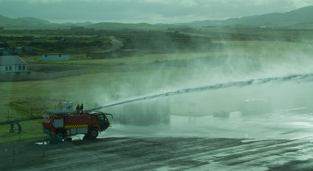
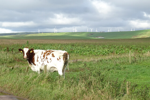
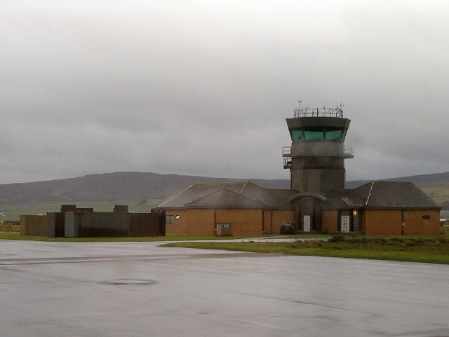
Images are sourced within 2km of 55.450192/-5.6935949 or Grid Reference NR6623. Thanks to Geograph Open Source API. All images are credited.

Airport Fire Fighting Equipment being Tested One of two new airport fire appliances being tested at Campbeltown Airport. Seen from the control tower, hence the green tint.
Airport Fire Fighting Equipment being Tested
One of two new airport fire appliances being tested at Campbeltown Airport. Seen from the control tower, hence the green tint.
Machrihanish Bay shoreline Roughly three miles of beach lies between Machrihanish and Westport. The picture looks north in a comparatively unfrequented stretch rather far from either of these easily accessible points. In the middle foreground a small group of dunlin can be seen close to the waterline.
Machrihanish Bay shoreline
Roughly three miles of beach lies between Machrihanish and Westport. The picture looks north in a comparatively unfrequented stretch rather far from either of these easily accessible points. In the middle foreground a small group of dunlin can be seen close to the waterline.
Burn flows into Machrihanish Bay This wee burn flows onto the beach about a mile south of the car park at Westport.
Burn flows into Machrihanish Bay
This wee burn flows onto the beach about a mile south of the car park at Westport.
Clochkeil stone row Originally there were at least three stones here. Now only two stones remain (Scale 1m).
<span class="nowrap"><a title="https://stonerows.wordpress.com/gazetteer/region/argyll-and-isles/clochkeil/" rel="nofollow ugc noopener" href="https://stonerows.wordpress.com/gazetteer/region/argyll-and-isles/clochkeil/">Link</a><img style="margin-left:2px;" alt="External link" title="External link - shift click to open in new window" src="https://s1.geograph.org.uk/img/external.png" width="10" height="10"/></span>
Clochkeil stone row
Originally there were at least three stones here. Now only two stones remain (Scale 1m). LinkExternal link
Minor road joining the A83 at Drum Farm Looking south-westward.
Minor road joining the A83 at Drum Farm
Looking south-westward.
Ordnance Survey Cut Mark This mark can be found on the roadside wall of a building at Drum Farm. The benchmark height has been recorded as 35.923 metres above sea level.
For more detail see : <span class="nowrap"><a title="https://www.bench-marks.org.uk/bm106629" rel="nofollow ugc noopener" href="https://www.bench-marks.org.uk/bm106629">Link</a><img style="margin-left:2px;" alt="External link" title="External link - shift click to open in new window" src="https://s1.geograph.org.uk/img/external.png" width="10" height="10"/></span>
Ordnance Survey Cut Mark
This mark can be found on the roadside wall of a building at Drum Farm. The benchmark height has been recorded as 35.923 metres above sea level. For more detail see : LinkExternal link
Rhoin Farm
Rhoin Farm
Road junction near Machrihanish Airport
Clochkeil Standing Stones There are two standing stones evident in this grassy hollow which now lies within Machrihanish Dunes Golf Course, with a third in the ground and not visible in this shot.  See Canmore <span class="nowrap"><a title="https://canmore.org.uk/site/38405/clochkeil-kintyre" rel="nofollow ugc noopener" href="https://canmore.org.uk/site/38405/clochkeil-kintyre">Link</a><img style="margin-left:2px;" alt="External link" title="External link - shift click to open in new window" src="https://s1.geograph.org.uk/img/external.png" width="10" height="10"/></span> for expanded details.

This photograph was taken during the Coronavirus (COVID-19) pandemic of 2020/21.
Clochkeil Standing Stones
There are two standing stones evident in this grassy hollow which now lies within Machrihanish Dunes Golf Course, with a third in the ground and not visible in this shot. See Canmore LinkExternal link for expanded details. This photograph was taken during the Coronavirus (COVID-19) pandemic of 2020/21.
Coastal pasture near Clochkeil Rough coastal grazing north of Clochkeil with a distant view across the northern edge of the former RAF Machrihanish base.  The Country Antrim coastline of Northern Ireland can be discerned in the far distance.

This photograph was taken during the Coronavirus (COVID-19) pandemic of 2020/21.
Coastal pasture near Clochkeil
Rough coastal grazing north of Clochkeil with a distant view across the northern edge of the former RAF Machrihanish base. The Country Antrim coastline of Northern Ireland can be discerned in the far distance. This photograph was taken during the Coronavirus (COVID-19) pandemic of 2020/21.
A view from the Machrihanish dunes The view from a seating area viewing platform at the edge of Machrihanish Dunes Golf Course is breathtaking on a clear day.  A wide expanse of sand with the occasional passing dog walker or family group and beyond, the islands of Islay, Jura and Gigha can all be seen.

This photograph was taken during the Coronavirus (COVID-19) pandemic of 2020/21.
A view from the Machrihanish dunes
The view from a seating area viewing platform at the edge of Machrihanish Dunes Golf Course is breathtaking on a clear day. A wide expanse of sand with the occasional passing dog walker or family group and beyond, the islands of Islay, Jura and Gigha can all be seen. This photograph was taken during the Coronavirus (COVID-19) pandemic of 2020/21.
Sand and Sea A view south from the seating area/viewing platform on the edge of Machrihanish Dunes Golf Course.  The area just to the north of the Mull of Kintyre can be seen to the left with the outline of the County Antrim coastline and Rathlin Island in the distance.

This photograph was taken during the Coronavirus (COVID-19) pandemic of 2020/21.
Sand and Sea
A view south from the seating area/viewing platform on the edge of Machrihanish Dunes Golf Course. The area just to the north of the Mull of Kintyre can be seen to the left with the outline of the County Antrim coastline and Rathlin Island in the distance. This photograph was taken during the Coronavirus (COVID-19) pandemic of 2020/21.
Moss Road near Aros Moss Moss Road provides access to Campbeltown Airport and is something of a 'rat run' in the area.  The ground is low-lying, fertile and dominated by arable and dairy farms.

This photograph was taken during the Coronavirus (COVID-19) pandemic of 2020/21.
Moss Road near Aros Moss
Moss Road provides access to Campbeltown Airport and is something of a 'rat run' in the area. The ground is low-lying, fertile and dominated by arable and dairy farms. This photograph was taken during the Coronavirus (COVID-19) pandemic of 2020/21.
Machrihanish Dunes Golf Course This is not to be confused with the older golf course at Machrihanish itself. This is a new course, opened as recently as 2009, and at 7082 yards I gather that it is long. See <span class="nowrap"><a title="https://machrihanishdunes.com/golf/" rel="nofollow ugc noopener" href="https://machrihanishdunes.com/golf/">Link</a><img style="margin-left:2px;" alt="External link" title="External link - shift click to open in new window" src="https://s1.geograph.org.uk/img/external.png" width="10" height="10"/></span> for all the details.
Machrihanish Dunes Golf Course
This is not to be confused with the older golf course at Machrihanish itself. This is a new course, opened as recently as 2009, and at 7082 yards I gather that it is long. See LinkExternal link for all the details.
Black Sheep Well, more dark brown, really. The logo of the Machrihanish Dunes Golf Club is one of these sheep, and a flock of them is in evidence, helping to keep the grass short around the club house. However they are exceptionally inquisitive; just moments after taking this shot all four were nibbling at my jacket!
Black Sheep
Well, more dark brown, really. The logo of the Machrihanish Dunes Golf Club is one of these sheep, and a flock of them is in evidence, helping to keep the grass short around the club house. However they are exceptionally inquisitive; just moments after taking this shot all four were nibbling at my jacket!
A Curious Cow The cow was evidently curious about my presence. Fortunately there was a fence between us. In the background are wind turbines at Tangy Wind Farm.
A Curious Cow
The cow was evidently curious about my presence. Fortunately there was a fence between us. In the background are wind turbines at Tangy Wind Farm.
Dairy Cattle It's very striking, as you travel around Kintyre, that there are far more dairy cattle than in most of the Highlands and Islands. This is probably partly because of the geology; there is a slice of Lowland rock around Campbeltown which yields soil and topography more suitable for dairying.
Dairy Cattle
It's very striking, as you travel around Kintyre, that there are far more dairy cattle than in most of the Highlands and Islands. This is probably partly because of the geology; there is a slice of Lowland rock around Campbeltown which yields soil and topography more suitable for dairying.
Drum Farm House A traditional stone farm house just off the A83.
Drum Farm House
A traditional stone farm house just off the A83.
Show me another place!

West Darlochan is located at Grid Ref: NR6623 (Lat: 55.450192, Lng: -5.6935949)

Unitary Authority: Argyll and Bute

Police Authority: Argyll and West Dunbartonshire

What 3 Words

///stoppage.spent.rods. Near Campbeltown, Argyll & Bute

Nearby Locations

West Darlochan

Related Wikis

RNAS Machrihanish (HMS Landrail)

Royal Naval Air Station Machrihanish, (RNAS Machrihanish; or HMS Landrail), is a former Royal Navy air station, close to Campbeltown in Argyll and Bute...

RAF Machrihanish

Royal Air Force Machrihanish or RAF Machrihanish (formerly ICAO: EGQJ) is a former Royal Air Force station located near the town of Machrihanish and 3...

Campbeltown Airport

Campbeltown Airport (Scottish Gaelic: Port-adhair Cheann Loch Chille Chiarain) (IATA: CAL, ICAO: EGEC) is located at Machrihanish, 3 nautical miles (5...

Kilchenzie

Kilchenzie is a small farming community situated 5 miles (8 km) northwest of Campbeltown on the Kintyre peninsula in Argyll, Scotland. It is reached from...

Nearby Amenities

Located within 500m of 55.450192,-5.6935949
Sound of Kintyre
Name Gd: Caolas Chinn Tìre
Note: Former RAF base at Machrihanish
Place: village
Source: local_knowledge
Lat/Long: 55.4495086/-5.6927261
Clochkeil
Place: locality
Source: OS7
Lat/Long: 55.451175/-5.6999188
Barrier: cattle_grid
Source: Bing
Lat/Long: 55.4514935/-5.696727
Direction: WNW
Generator Method: photovoltaic
Generator Output Electricity: yes
Generator Solar Modules: 10
Generator Source: solar
Generator Type: solar_photovoltaic_panel
Location: roof
Power: generator
Lat/Long: 55.452052/-5.6952769
Direction: ESE
Generator Method: photovoltaic
Generator Output Electricity: yes
Generator Solar Modules: 6
Generator Source: solar
Generator Type: solar_photovoltaic_panel
Location: roof
Power: generator
Lat/Long: 55.4520439/-5.6952351
Direction: NW
Generator Method: photovoltaic
Generator Output Electricity: yes
Generator Source: solar
Generator Type: solar_photovoltaic_panel
Location: roof
Power: generator
Lat/Long: 55.4522863/-5.6943572
Direction: SE
Generator Method: photovoltaic
Generator Output Electricity: yes
Generator Source: solar
Generator Type: solar_photovoltaic_panel
Location: roof
Power: generator
Lat/Long: 55.4522673/-5.6943274
Direction: NW
Generator Method: photovoltaic
Generator Output Electricity: yes
Generator Solar Modules: 6
Generator Source: solar
Generator Type: solar_photovoltaic_panel
Location: roof
Power: generator
Lat/Long: 55.4523906/-5.6941662
Direction: SE
Generator Method: photovoltaic
Generator Output Electricity: yes
Generator Solar Modules: 9
Generator Source: solar
Generator Type: solar_photovoltaic_panel
Location: roof
Power: generator
Lat/Long: 55.4523642/-5.694122
Direction: WNW
Generator Method: photovoltaic
Generator Output Electricity: yes
Generator Solar Modules: 10
Generator Source: solar
Generator Type: solar_photovoltaic_panel
Location: roof
Power: generator
Lat/Long: 55.452422/-5.6956089
Direction: ESE
Generator Method: photovoltaic
Generator Output Electricity: yes
Generator Solar Modules: 6
Generator Source: solar
Generator Type: solar_photovoltaic_panel
Location: roof
Power: generator
Lat/Long: 55.4524139/-5.6955671
Direction: SW
Generator Method: photovoltaic
Generator Output Electricity: yes
Generator Solar Modules: 10
Generator Source: solar
Generator Type: solar_photovoltaic_panel
Location: roof
Power: generator
Lat/Long: 55.4516802/-5.6930918
Direction: SE
Generator Method: photovoltaic
Generator Output Electricity: yes
Generator Solar Modules: 12
Generator Source: solar
Generator Type: solar_photovoltaic_panel
Location: roof
Power: generator
Lat/Long: 55.4483166/-5.6915221
Man Made: mast
Tower Construction: lattice
Lat/Long: 55.4476231/-5.6903225
The data included in this document is from www.openstreetmap.org. The data is made available under ODbL.

Have you been to West Darlochan?

Leave your review of West Darlochan below (or comments, questions and feedback).