Upper Greetland

Settlement in Yorkshire

England

Upper Greetland

Drury Lane footpath, Stainland
Drury Lane footpath, Stainland Credit: Chris Wimbush

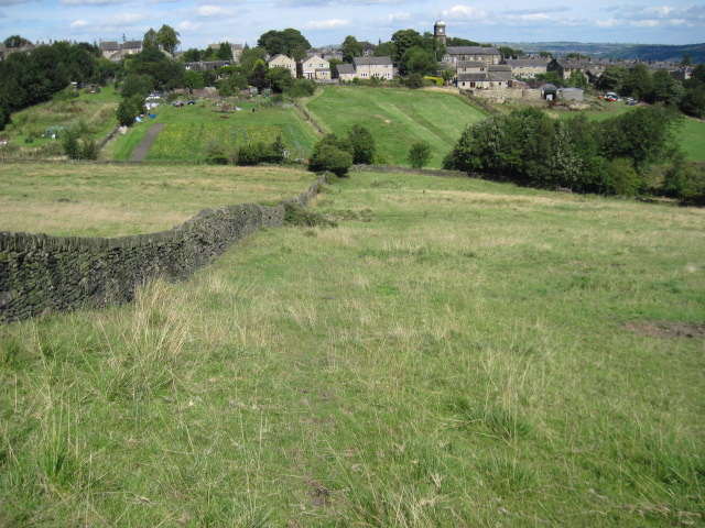
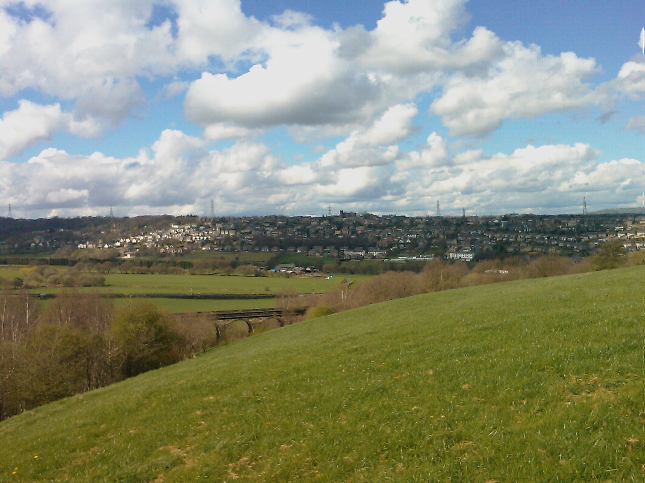
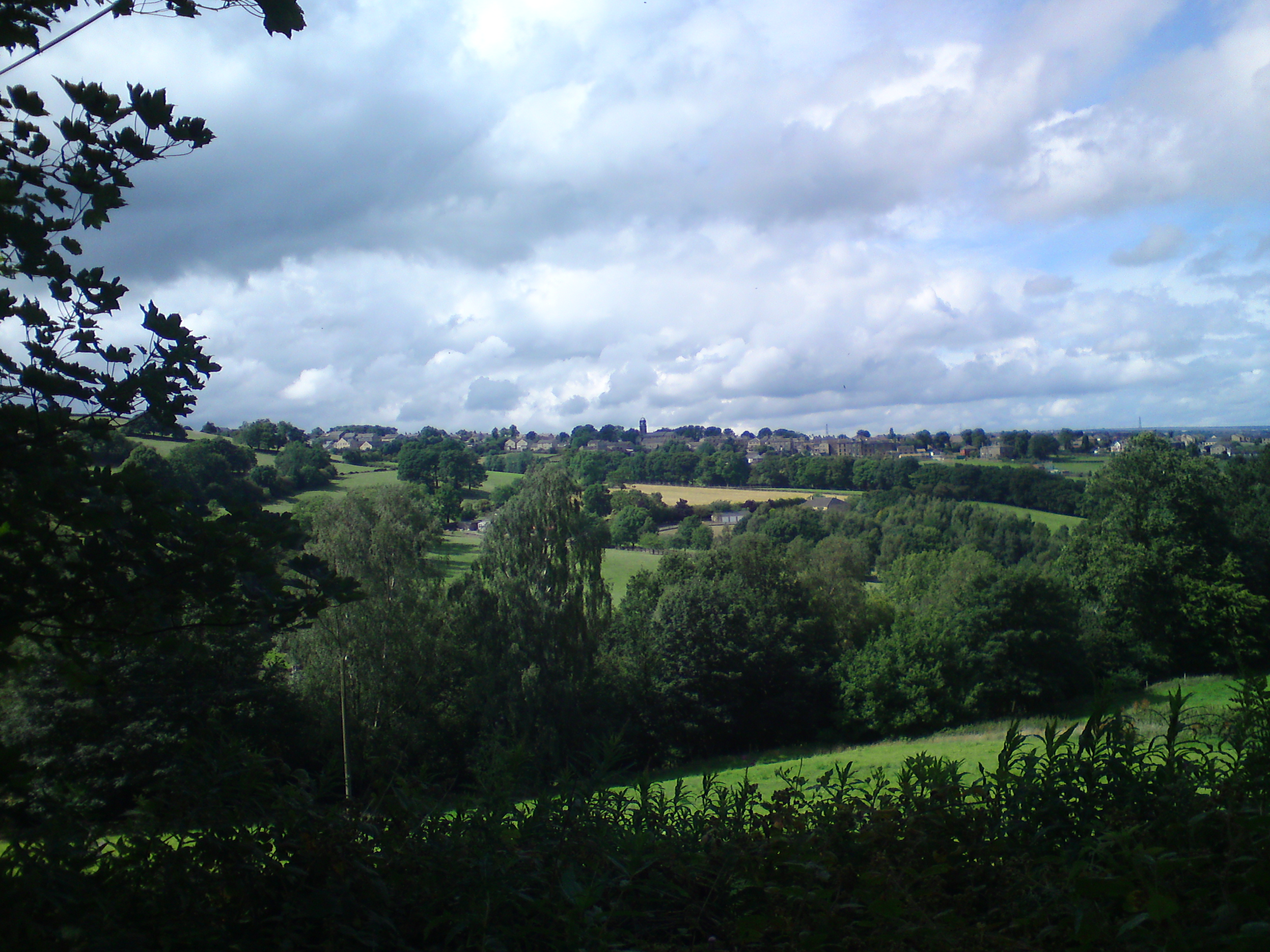
Upper Greetland is a small village located in the metropolitan borough of Calderdale, in West Yorkshire, England. Situated approximately 4 miles west of Halifax, Upper Greetland is nestled in the picturesque Pennine hills, offering stunning views of the surrounding countryside.

The village is primarily residential, with a mix of detached houses, cottages, and some modern developments. The architecture reflects a combination of traditional stone-built homes and more contemporary designs. The population consists mainly of families and professionals who enjoy the peaceful and rural setting while still being within easy reach of nearby towns and cities.

Upper Greetland benefits from a range of local amenities, including a primary school, a village hall, and a small number of local shops and services. The village is well-connected to the wider region, with good transport links to neighboring towns via the A629 road and nearby train stations. This allows residents to easily access employment opportunities, educational institutions, and leisure facilities in the surrounding areas.

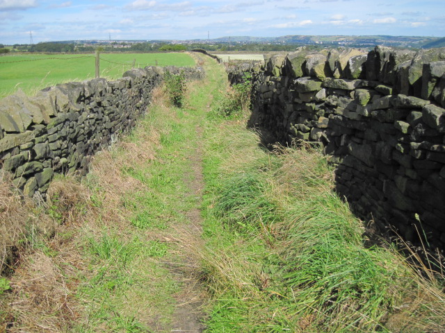
The village is surrounded by beautiful countryside, making it an ideal location for outdoor enthusiasts. There are several scenic walking trails, such as the nearby Stainland Trail, which offers stunning views across the valley. Upper Greetland also benefits from being close to popular tourist attractions, including Shibden Hall and Ogden Water Country Park.

Overall, Upper Greetland offers a charming and tranquil rural lifestyle, with easy access to amenities and stunning natural surroundings, making it an attractive place to live for those seeking a peaceful setting within reach of modern conveniences.

If you have any feedback on the listing, please let us know in the comments section below.

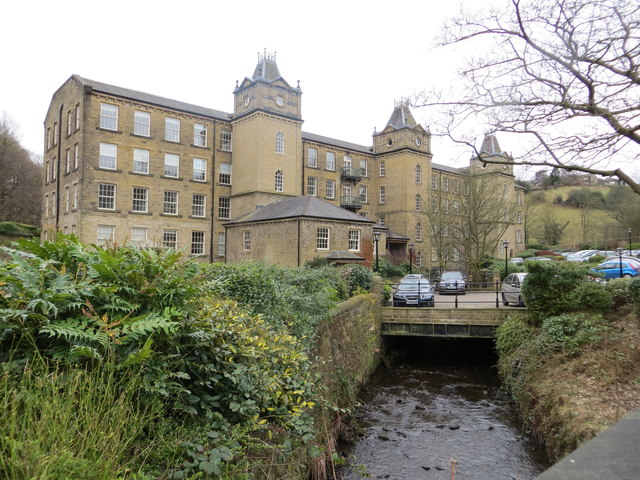
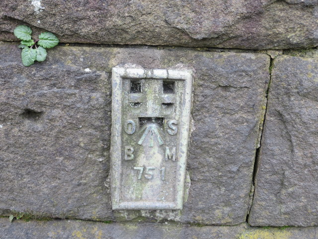
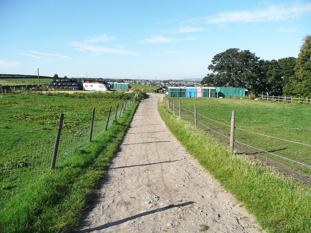
Upper Greetland Images

Images are sourced within 2km of 53.688582/-1.8846077 or Grid Reference SE0721. Thanks to Geograph Open Source API. All images are credited.

Drury Lane footpath, Stainland
Footpath towards Stainland
Water trough, Carr Hall Lane, Stainland This is the inlet end of a long trough, and the walls around it, formed of large stone flags, are presumably to keep animals away from the part used by people collecting water for domestic consumption in the days before piped water supplies.
Water trough, Carr Hall Lane, Stainland
This is the inlet end of a long trough, and the walls around it, formed of large stone flags, are presumably to keep animals away from the part used by people collecting water for domestic consumption in the days before piped water supplies.
Water trough, Carr Hall Lane, Stainland A long trough with a compartment at the inlet end, presumably to keep animals away from the part used by people collecting water for domestic consumption.
Water trough, Carr Hall Lane, Stainland
A long trough with a compartment at the inlet end, presumably to keep animals away from the part used by people collecting water for domestic consumption.
Barkisland Mill This picture was taken looking south from Barkisland Bridge. The former mill has now been converted into apartments.
Barkisland Mill
This picture was taken looking south from Barkisland Bridge. The former mill has now been converted into apartments.
Ordnance Survey Flush Bracket 751 This can be found on the wall of Barkisland Mill Bridge.
For more details see : <span class="nowrap"><a title="http://www.bench-marks.org.uk/log?bm_key=9904" rel="nofollow ugc noopener" href="http://www.bench-marks.org.uk/log?bm_key=9904">Link</a><img style="margin-left:2px;" alt="External link" title="External link - shift click to open in new window" src="https://s1.geograph.org.uk/img/external.png" width="10" height="10"/></span>
Ordnance Survey Flush Bracket 751
This can be found on the wall of Barkisland Mill Bridge. For more details see : LinkExternal link
Houses at Bank House, Stainland Some of these are refurbished millworkers houses, such as the tall block on the left, and some newly built on the site of a mill.
Houses at Bank House, Stainland
Some of these are refurbished millworkers houses, such as the tall block on the left, and some newly built on the site of a mill.
Beestonley Lane at Scar Hill
Rob Royd, Beestonley Lane, Stainland A mid-18C farmhouse and barn, Grade II listed but looking sadly derelict.
Rob Royd, Beestonley Lane, Stainland
A mid-18C farmhouse and barn, Grade II listed but looking sadly derelict.
Drury Lane, Stainland The village still has narrow streets which preserve its character.
Drury Lane, Stainland
The village still has narrow streets which preserve its character.
The Pub, Stainland This is now its name, but it could lead to confusion as there are other pubs in the village.
The Pub, Stainland
This is now its name, but it could lead to confusion as there are other pubs in the village.
Stainland Mechanics' Institute This housed the community centre for a while but it is now considered too expensive to maintain and surplus to the requirements of the local council. It looks like it should have been a non-conformist chapel.
Stainland Mechanics' Institute
This housed the community centre for a while but it is now considered too expensive to maintain and surplus to the requirements of the local council. It looks like it should have been a non-conformist chapel.
Elland FP58 leaving Holywell Green
United Reformed Church, Holywell Green This was built as the Sunday School; the church was next to it on the right, but has been demolished and the site used for houses.
United Reformed Church, Holywell Green
This was built as the Sunday School; the church was next to it on the right, but has been demolished and the site used for houses.
Houses new and old, Holywell Green
Terrace houses, Stainland Road
Church Lane, Stainland This is an unadopted lane of the type classed as a 'Byway open to all Traffic' (BOAT), numbered Elland 98. It is captioned 'Bradley Lane' on the 1850 map.
Church Lane, Stainland
This is an unadopted lane of the type classed as a 'Byway open to all Traffic' (BOAT), numbered Elland 98. It is captioned 'Bradley Lane' on the 1850 map.
Church Lane, Stainland This is the old road from Stainland village to Bradley Hall, shown on the 1850 OS map as 'Bradley Lane' and shown earlier on Myers's map of 1835. It is an unadopted street, but despite its 'pedigree' is not classed as a public right-of-way apart from what is implied by being on the street list. An application was made in 2005 for it to be classed as a public bridleway.
Church Lane, Stainland
This is the old road from Stainland village to Bradley Hall, shown on the 1850 OS map as 'Bradley Lane' and shown earlier on Myers's map of 1835. It is an unadopted street, but despite its 'pedigree' is not classed as a public right-of-way apart from what is implied by being on the street list. An application was made in 2005 for it to be classed as a public bridleway.
Show me another place!

Upper Greetland is located at Grid Ref: SE0721 (Lat: 53.688582, Lng: -1.8846077)

Division: West Riding

Unitary Authority: Calderdale

Police Authority: West Yorkshire

What 3 Words

///grand.plates.happen. Near Holywell Green, West Yorkshire

Related Wikis

Greetland

Greetland is a village in the metropolitan borough of Calderdale in West Yorkshire, England. It lies in the Calderdale Ward of Greetland and Stainland...

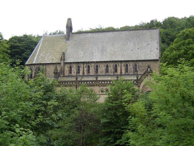
St Stephen's Church, Copley

St Stephen's Church is a redundant Anglican church in the village of Copley, West Yorkshire, England. It is recorded in the National Heritage List for...

Copley, West Yorkshire

Copley is a village in the metropolitan borough of Calderdale, in the county of West Yorkshire, England, south of Halifax and east of Sowerby Bridge. It...

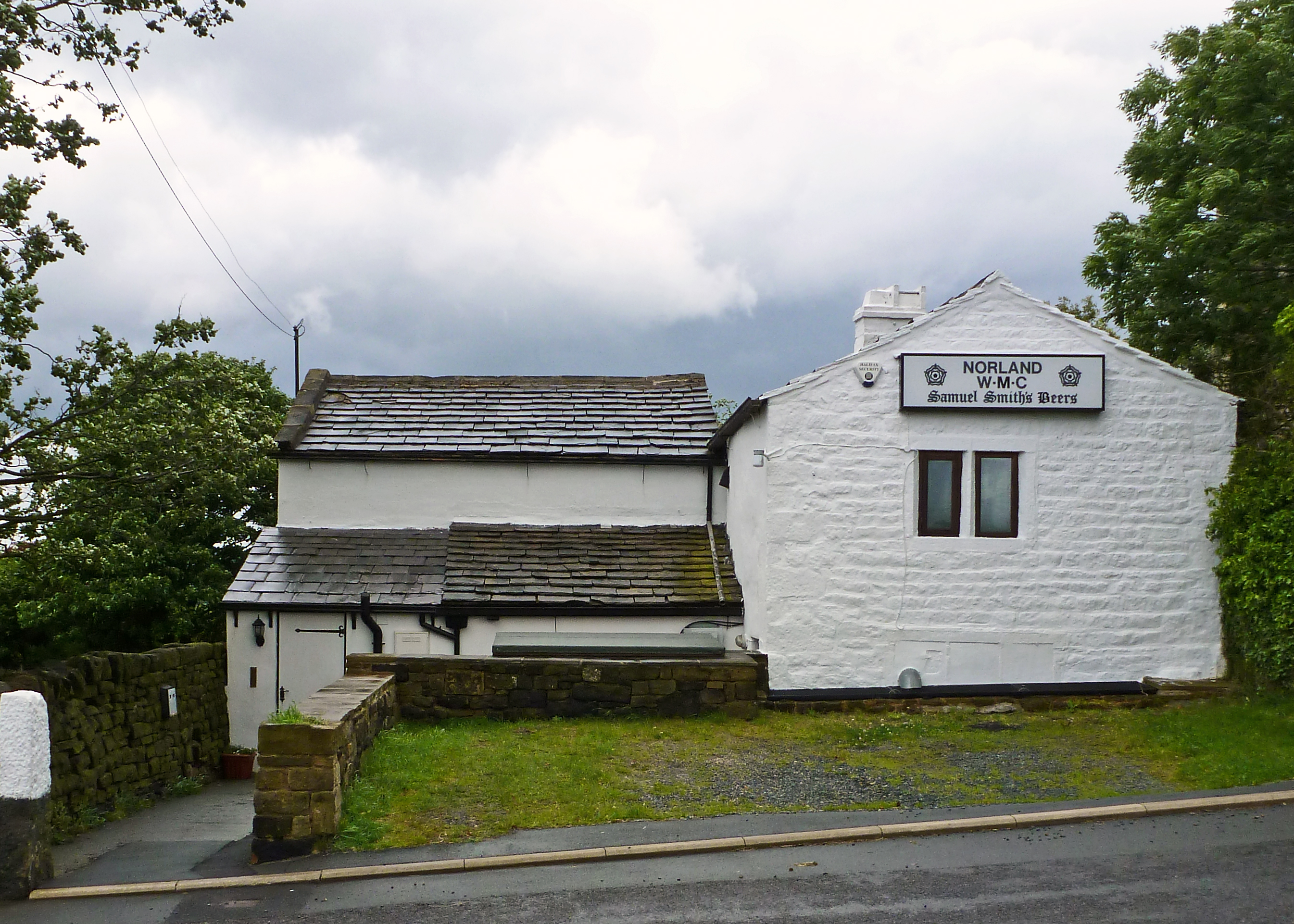
Norland, West Yorkshire

Norland is a dispersed village south of Sowerby Bridge in the metropolitan borough of Calderdale in West Yorkshire, England. == History == Historically...

Copley railway station

Copley railway station was a railway station that served the village of Copley in West Yorkshire, England. == References == Bairstow, Martin (1987). The...

West Vale railway station

West Vale railway station served on the Stainland Branch from 1875 to 1929. == History == The station was opened on New years day 1875, along with the...

Stainland

Stainland is a village in the civil parish of Stainland and District, in Calderdale, West Yorkshire, England. The village is part of the Greetland and...

Rochdale Road Halt railway station

Rochdale Road Halt served the village of Greetland, West Yorkshire, England, on the Stainland Branch from 1907 to 1929. == Location == The halt was located...

Nearby Amenities

Located within 500m of 53.688582,-1.8846077
Design: barrel
Power: tower
Lat/Long: 53.6921765/-1.8832739
Design: barrel
Power: tower
Lat/Long: 53.6916587/-1.8892118
Bus Stop
Saddleworth Road Trenance Gardens
Bench: no
Bin: no
Bus: yes
Lit: no
Local Ref: 45021596
Naptan AtcoCode: 450021596
Naptan Bearing: W
Naptan CommonName: Saddleworth Road Trenance Gardens
Naptan Crossing: Trenance Gardens
Naptan Indicator: Stop 45021596
Naptan Landmark: New Gate Farm
Naptan PlusbusZoneRef: LEEDS
Naptan ShortCommonName: Trenance Gardens
Naptan Street: Saddleworth Road
Naptan Verified: no
Public Transport: platform
Shelter: no
Source: naptan_import
Tactile Paving: no
Lat/Long: 53.6850724/-1.8805936
Bus Stop
Saddleworth Road Scar Bottom Lane
Bench: no
Bin: no
Bus: yes
Lit: no
Local Ref: 45021597
Naptan AtcoCode: 450021597
Naptan Bearing: E
Naptan CommonName: Saddleworth Road Scar Bottom Lane
Naptan Crossing: Scar Bottom Lane
Naptan Indicator: Stop 45021597
Naptan Landmark: Gate Head Farm
Naptan PlusbusZoneRef: LEEDS
Naptan ShortCommonName: Scar Bottom Lane
Naptan Street: Saddleworth Road
Naptan Verified: no
Public Transport: platform
Shelter: no
Source: naptan_import
Tactile Paving: no
Lat/Long: 53.6850666/-1.8838945
Bus Stop
Turbury Lane
Local Ref: 45022962
Naptan AtcoCode: 450022962
Naptan Bearing: SE
Naptan CommonName: Turbury Lane
Naptan Indicator: Stop 45022962
Naptan Landmark: Turberry Hall Farm
Naptan PlusbusZoneRef: LEEDS
Naptan ShortCommonName: Turbury Hall Farm
Naptan Street: Turbury Lane
Naptan Verified: no
Source: naptan_import
Lat/Long: 53.6904983/-1.8866659
Bus Stop
Greetland Moor Bottom
Bench: no
Bus: yes
Lit: no
Local Ref: 45022909
Naptan AtcoCode: 450022909
Naptan Bearing: W
Naptan CommonName: Greetland Moor Bottom
Naptan Crossing: Moor Bottom Lane
Naptan Indicator: Stop 45022909
Naptan PlusbusZoneRef: LEEDS
Naptan ShortCommonName: Moor Bottom Lane
Naptan Street: Rochdale Road
Naptan Verified: no
Public Transport: platform
Shelter: no
Source: naptan_import
Tactile Paving: no
Lat/Long: 53.6877753/-1.8780571
Bus Stop
Rochdale Road
Bench: yes
Bus: yes
Local Ref: 45022910
Naptan AtcoCode: 450022910
Naptan Bearing: E
Naptan CommonName: Rochdale Road
Naptan Crossing: Brian Royd Lane
Naptan Indicator: Stop 45022910
Naptan PlusbusZoneRef: LEEDS
Naptan ShortCommonName: Moor Bottom Lane
Naptan Street: Moorbottom Lane
Naptan Verified: no
Public Transport: platform
Shelter: yes
Source: naptan_import
Tactile Paving: no
Lat/Long: 53.6878469/-1.8777844
Bus Stop
Rochdale Road Scarbottom Lane
Bench: no
Bus: yes
Lit: no
Local Ref: 45022911
Naptan AtcoCode: 450022911
Naptan Bearing: E
Naptan CommonName: Rochdale Road Scarbottom Lane
Naptan Crossing: Scarbottom Lane
Naptan Indicator: Stop 45022911
Naptan PlusbusZoneRef: LEEDS
Naptan ShortCommonName: Scarbottom Lane
Naptan Street: Rochdale Road
Naptan Verified: no
Public Transport: platform
Shelter: no
Source: naptan_import
Tactile Paving: no
Lat/Long: 53.688272/-1.8804028
Bus Stop
Rochdale Road Scar Bottom Lane
Bench: no
Bus: yes
Lit: no
Local Ref: 45022912
Naptan AtcoCode: 450022912
Naptan Bearing: W
Naptan CommonName: Rochdale Road Scar Bottom Lane
Naptan Crossing: Scar Bottom Lane
Naptan Indicator: Stop 45022912
Naptan Landmark: Crawstone Knowl Farm
Naptan PlusbusZoneRef: LEEDS
Naptan ShortCommonName: Scar Bottom Lane
Naptan Street: Rochdale Road
Naptan Verified: no
Public Transport: platform
Shelter: no
Source: naptan_import
Tactile Paving: no
Lat/Long: 53.6882634/-1.8807814
Bus Stop
Rochdale Road Turbury Lane
Bench: no
Bus: yes
Lit: no
Local Ref: 45022913
Naptan AtcoCode: 450022913
Naptan Bearing: W
Naptan CommonName: Rochdale Road Turbury Lane
Naptan Crossing: Turbury Lane
Naptan Indicator: Stop 45022913
Naptan Landmark: Lower Turbury Farm
Naptan PlusbusZoneRef: LEEDS
Naptan ShortCommonName: Turbury Lane
Naptan Street: Rochdale Road
Naptan Verified: no
Public Transport: platform
Shelter: no
Source: naptan_import
Tactile Paving: no
Lat/Long: 53.688513/-1.8842053
Bus Stop
Rochdale Road Turberry Lane
Bench: no
Lit: no
Local Ref: 45022914
Naptan AtcoCode: 450022914
Naptan Bearing: E
Naptan CommonName: Rochdale Road Turberry Lane
Naptan Crossing: Turbury Lane
Naptan Indicator: Stop 45022914
Naptan Landmark: Lower Turbury Farm
Naptan PlusbusZoneRef: LEEDS
Naptan ShortCommonName: Turbury Lane
Naptan Street: Rochdale Road
Naptan Verified: no
Shelter: yes
Source: naptan_import
Tactile Paving: no
Lat/Long: 53.6886098/-1.8841757
Bus Stop
Rochdale Road
Bus: yes
Local Ref: 45022915
Naptan AtcoCode: 450022915
Naptan Bearing: W
Naptan CommonName: Rochdale Road
Naptan Crossing: Nr-Opp Turbury Lane
Naptan Indicator: Stop 45022915
Naptan Landmark: Prospect Farm
Naptan PlusbusZoneRef: LEEDS
Naptan ShortCommonName: Cat Lane
Naptan Street: Rochdale Road
Naptan Verified: no
Ref: 450 22915
Shelter: no
Source: naptan_import
Lat/Long: 53.6886563/-1.8874129
Bus Stop
Rochdale Road Dog Lane
Bench: no
Bus: yes
Lit: no
Local Ref: 45022916
Naptan AtcoCode: 450022916
Naptan Bearing: W
Naptan CommonName: Rochdale Road Dog Lane
Naptan Crossing: Dog Lane
Naptan Indicator: Stop 45022916
Naptan Landmark: Sportsmans Inn PH
Naptan PlusbusZoneRef: LEEDS
Naptan ShortCommonName: Dog Lane
Naptan Street: Rochdale Road
Naptan Verified: no
Public Transport: platform
Shelter: no
Source: naptan_import
Tactile Paving: no
Lat/Long: 53.6886512/-1.8916075
Rochdale Road Dog Lane
Local Ref: 45051229
Naptan AtcoCode: 450051229
Naptan Bearing: E
Naptan BusStopType: CUS
Naptan CommonName: Rochdale Road Dog Lane
Naptan Indicator: Stop 45051229
Naptan PlusbusZoneRef: LEEDS
Naptan ShortCommonName: Dog Lane
Naptan Street: Rochdale Road
Naptan Verified: no
Source: naptan_import
Lat/Long: 53.6887412/-1.8916527
Bus Stop
Turbury Lane
Local Ref: 45051249
Naptan AtcoCode: 450051249
Naptan Bearing: NW
Naptan BusStopType: CUS
Naptan CommonName: Turbury Lane
Naptan Indicator: Stop 45051249
Naptan PlusbusZoneRef: LEEDS
Naptan ShortCommonName: Higher Turbury
Naptan Street: Turbury Lane
Naptan Verified: no
Source: naptan_import
Lat/Long: 53.6904534/-1.8867721
Bus Stop
Saddleworth Road Scar Bottom Lane
Bench: no
Bin: no
Bus: yes
Lit: no
Local Ref: 45051115
Naptan AtcoCode: 450051115
Naptan Bearing: W
Naptan BusStopType: CUS
Naptan CommonName: Saddleworth Road Scar Bottom Lane
Naptan Indicator: Stop 45051115
Naptan PlusbusZoneRef: LEEDS
Naptan ShortCommonName: Gate Head Lane
Naptan Street: Saddleworth Road
Naptan Verified: no
Public Transport: platform
Shelter: no
Source: naptan_import
Tactile Paving: no
Lat/Long: 53.6849677/-1.8838645
Bus Stop
Brian Royd Lane
Bus: yes
Local Ref: 45051116
Naptan AtcoCode: 450051116
Naptan Bearing: E
Naptan BusStopType: CUS
Naptan CommonName: Brian Royd Lane
Naptan Indicator: Stop 45051116
Naptan PlusbusZoneRef: LEEDS
Naptan ShortCommonName: Scar Bottom Lane
Naptan Street: Brian Royd Lane
Naptan Verified: no
Public Transport: platform
Source: naptan_import
Lat/Long: 53.6869263/-1.8829354
Bus Stop
Brian Royd Lane Trenance Gardens
Bus: yes
Local Ref: 45051117
Naptan AtcoCode: 450051117
Naptan Bearing: NE
Naptan BusStopType: CUS
Naptan CommonName: Brian Royd Lane Trenance Gardens
Naptan Indicator: Stop 45051117
Naptan PlusbusZoneRef: LEEDS
Naptan ShortCommonName: Trenance Gdns
Naptan Street: Brian Royd Lane
Naptan Verified: no
Public Transport: platform
Source: naptan_import
Lat/Long: 53.6872847/-1.8818139
Historic Power: tower
Source: OS 1:25k
Lat/Long: 53.6883529/-1.8833111
Post Box
Operator: Royal Mail
Post Box Type: wall
Ref: HX4 123
Lat/Long: 53.6886916/-1.8847273
Barrier: stile
Lat/Long: 53.6918379/-1.8890298
Barrier: stile
Lat/Long: 53.6918823/-1.8888251
Barrier: bollard
Bicycle: yes
Foot: yes
Lat/Long: 53.6868035/-1.8780466
Barrier: stile
Lat/Long: 53.6867607/-1.882294
Barrier: stile
Lat/Long: 53.685848/-1.8818751
Barrier: stile
Lat/Long: 53.6892661/-1.8842397
Barrier: stile
Lat/Long: 53.6906285/-1.8833426
Barrier: stile
Stile: squeezer
Lat/Long: 53.6874042/-1.890624
Booth: K6
Removed Amenity: telephone
Lat/Long: 53.6885343/-1.8847479
Barrier: stile
Lat/Long: 53.6906813/-1.8911174
Waste Basket
Lat/Long: 53.6902479/-1.8776579
Waste Basket
Lat/Long: 53.6889287/-1.8776648
The data included in this document is from www.openstreetmap.org. The data is made available under ODbL.

Have you been to Upper Greetland?

Leave your review of Upper Greetland below (or comments, questions and feedback).