Upper Benter

Settlement in Somerset Mendip

England

Upper Benter

New Direction Sign - Signpost on the B3139 Wells Road in Chilcompton Located on the northeast side of the crossroads of the B3139 Wells Road, Bakers Lane and Stockhill Road, diagonally opposite the Co-op in Chilcompton parish. 4 arms and pyramid finial. A completely new fingerpost in 2021 to replace the one shown in <a title="https://www.geograph.org.uk/photo/6043795" href="https://www.geograph.org.uk/photo/6043795">Link</a>.

Milestone Society National ID: SO_ST6451C
New Direction Sign - Signpost on the B3139 Wells Road in Chilcompton Credit: J Francis

Upper Benter is a small village located in Somerset, England. Situated in the picturesque countryside, Upper Benter is known for its charming rural setting and tranquil atmosphere. The village is surrounded by rolling hills, lush green fields, and scenic woodlands, making it an ideal destination for nature lovers and outdoor enthusiasts.

Upper Benter is home to a tight-knit community of residents who take pride in their village and its surroundings. The village is characterized by its traditional architecture, with many historic buildings and cottages lining the streets. Residents and visitors alike can enjoy peaceful walks along the village lanes, taking in the sights and sounds of the countryside.

Despite its rural setting, Upper Benter is conveniently located near larger towns and cities, providing easy access to amenities and services. The village is also within close proximity to a number of attractions and landmarks, making it a popular destination for tourists looking to explore the beauty of the Somerset countryside.

Overall, Upper Benter offers a peaceful and idyllic retreat for those looking to escape the hustle and bustle of city life and immerse themselves in the natural beauty of the English countryside.

If you have any feedback on the listing, please let us know in the comments section below.
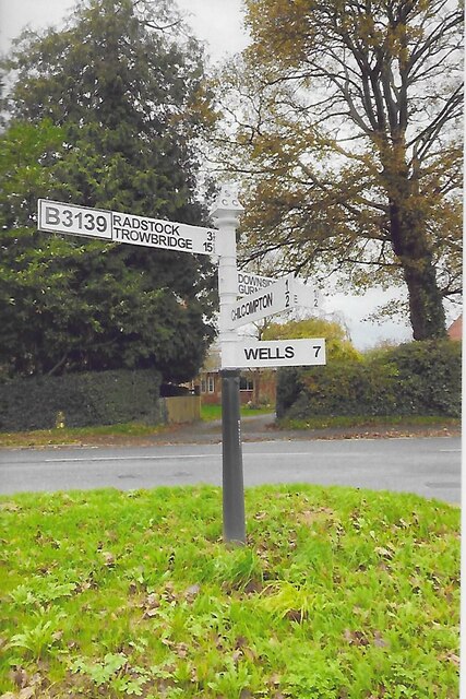
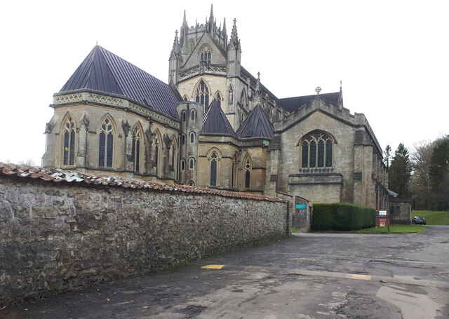
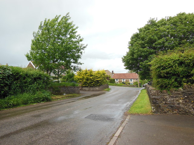
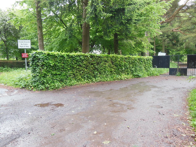
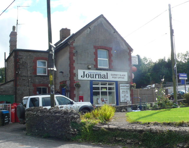
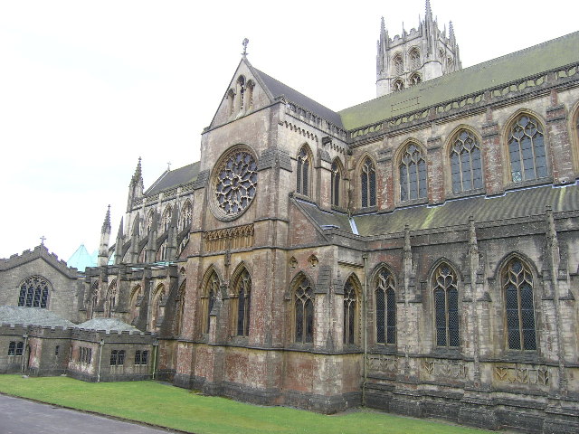
Upper Benter Images

Images are sourced within 2km of 51.241787/-2.5130858 or Grid Reference ST6449. Thanks to Geograph Open Source API. All images are credited.

New Direction Sign - Signpost on the B3139 Wells Road in Chilcompton Located on the northeast side of the crossroads of the B3139 Wells Road, Bakers Lane and Stockhill Road, diagonally opposite the Co-op in Chilcompton parish. 4 arms and pyramid finial. A completely new fingerpost in 2021 to replace the one shown in <a title="https://www.geograph.org.uk/photo/6043795" href="https://www.geograph.org.uk/photo/6043795">Link</a>.

Milestone Society National ID: SO_ST6451C
New Direction Sign - Signpost on the B3139 Wells Road in Chilcompton
Located on the northeast side of the crossroads of the B3139 Wells Road, Bakers Lane and Stockhill Road, diagonally opposite the Co-op in Chilcompton parish. 4 arms and pyramid finial. A completely new fingerpost in 2021 to replace the one shown in Link. Milestone Society National ID: SO_ST6451C
Downside Abbey Despite appearances, most of this abbey was built in the 20th century (see <a href="https://www.geograph.org.uk/photo/4261979">ST6550 : Downside Abbey</a> for full description). The remaining Benedictine monks who have been at Downside since 1814 plan to leave in March 2022.
Downside Abbey
Despite appearances, most of this abbey was built in the 20th century (see ST6550 : Downside Abbey for full description). The remaining Benedictine monks who have been at Downside since 1814 plan to leave in March 2022.
Croft House and the B3356 Croft House stands behind the trees on the left. Taken between heavy showers on a Saturday lunchtime.
Croft House and the B3356
Croft House stands behind the trees on the left. Taken between heavy showers on a Saturday lunchtime.
Keeping pupils and the public apart These gates close off the grounds of Downside School. Two notices tell the public that this is private property with no right of way; a third tells pupils that they are not to go (in the other direction) past this point.
Keeping pupils and the public apart
These gates close off the grounds of Downside School. Two notices tell the public that this is private property with no right of way; a third tells pupils that they are not to go (in the other direction) past this point.
Downside Abbey The Basilica of St Gregory the Great is the largest neo-Gothic church, not a cathedral, in England and home to the senior community of English Benedictines.  The brothers came to Downside from Douai in northern France in 1814, as refugees from the Napoleonic regime, but most of what we see today was built in the 20th century. The cluster of eastern chapels and the transept were constructed between 1882 and 1890, the architects being Archibald Dunn and Edward Hansom.  The quire was designed by Thomas Garner and completed in 1905; the tower beyond, placed over the south transept rather than the central crossing, was completed by Sir Giles Gilbert Scott in 1938.  At 166 feet it is the tallest tower in Somerset after Wells Cathedral at 182 ft (Bath Abbey's tower is 162 ft). The great church is 74 feet high (Bath 75 ft, Exeter Cathedral 69 ft, Wells 73 ft)  and 328 feet long at present (Bristol Cathedral 338 ft), but Scott's nave still awaits its final two western bays.
Downside Abbey
The Basilica of St Gregory the Great is the largest neo-Gothic church, not a cathedral, in England and home to the senior community of English Benedictines. The brothers came to Downside from Douai in northern France in 1814, as refugees from the Napoleonic regime, but most of what we see today was built in the 20th century. The cluster of eastern chapels and the transept were constructed between 1882 and 1890, the architects being Archibald Dunn and Edward Hansom. The quire was designed by Thomas Garner and completed in 1905; the tower beyond, placed over the south transept rather than the central crossing, was completed by Sir Giles Gilbert Scott in 1938. At 166 feet it is the tallest tower in Somerset after Wells Cathedral at 182 ft (Bath Abbey's tower is 162 ft). The great church is 74 feet high (Bath 75 ft, Exeter Cathedral 69 ft, Wells 73 ft) and 328 feet long at present (Bristol Cathedral 338 ft), but Scott's nave still awaits its final two western bays.
Industrial Buildings at Stoke Bottom These buildings are heavily protected with large metal fences and razor wire but have no signage to indicate their use.
Industrial Buildings at Stoke Bottom
These buildings are heavily protected with large metal fences and razor wire but have no signage to indicate their use.
Old Milestone by A367, just South of Stratton on the Fosse Way The Milestone is located on grass verge on the East of the road.  Parish of Stratton On The Fosse (Mendip District). Cast iron post, plated iron casting design, erected by the Shepton Mallet turnpike trust in the 19th century. An earlier photograph can be found here: <a title="https://www.geograph.org.uk/photo/6095973" href="https://www.geograph.org.uk/photo/6095973">Link</a> 

Inscription reads:-
SHEPTON / MALLET / 5 : : BATH / 12 : : CHELT.M / 49 

Grade II listed. List Entry Number: 1058636 <span class="nowrap"><a title="https://historicengland.org.uk/listing/the-list/list-entry/1058636" rel="nofollow ugc noopener" href="https://historicengland.org.uk/listing/the-list/list-entry/1058636">Link</a><img style="margin-left:2px;" alt="External link" title="External link - shift click to open in new window" src="https://s1.geograph.org.uk/img/external.png" width="10" height="10"/></span> 

Milestone Society National ID: SO_CMSM49
Old Milestone by A367, just South of Stratton on the Fosse Way
The Milestone is located on grass verge on the East of the road.  Parish of Stratton On The Fosse (Mendip District). Cast iron post, plated iron casting design, erected by the Shepton Mallet turnpike trust in the 19th century. An earlier photograph can be found here: Link  Inscription reads:- SHEPTON / MALLET / 5 : : BATH / 12 : : CHELT.M / 49 Grade II listed. List Entry Number: 1058636 LinkExternal link Milestone Society National ID: SO_CMSM49
Old Milestone by A367, Fosse Way, outside front of "The George at Nettlebridge" PH The Milestone is located against front wall of inn on the East of the road.  Parish of Stratton On The Fosse (Mendip District). Cast iron post, plated iron casting design, erected by the Shepton Mallet turnpike trust in the 19th century. An earlier photograph can be found here: <a title="https://www.geograph.org.uk/photo/6037563" href="https://www.geograph.org.uk/photo/6037563">Link</a> 

Inscription reads:- 
SHEPTON / MALLET / 4 : : BATH / 13 : : CHELT.M / 50  

Grade II listed. List Entry Number: 1178363 <span class="nowrap"><a title="https://historicengland.org.uk/listing/the-list/list-entry/1178363" rel="nofollow ugc noopener" href="https://historicengland.org.uk/listing/the-list/list-entry/1178363">Link</a><img style="margin-left:2px;" alt="External link" title="External link - shift click to open in new window" src="https://s1.geograph.org.uk/img/external.png" width="10" height="10"/></span> 

Milestone Society National ID: SO_CMSM50
Old Milestone by A367, Fosse Way, outside front of "The George at Nettlebridge" PH
The Milestone is located against front wall of inn on the East of the road.  Parish of Stratton On The Fosse (Mendip District). Cast iron post, plated iron casting design, erected by the Shepton Mallet turnpike trust in the 19th century. An earlier photograph can be found here: Link  Inscription reads:- SHEPTON / MALLET / 4 : : BATH / 13 : : CHELT.M / 50 Grade II listed. List Entry Number: 1178363 LinkExternal link Milestone Society National ID: SO_CMSM50
2011 : View north from Blackey Lane On the other side of Blackey Lane from <a href="https://www.geograph.org.uk/photo/2308116">ST6348 : 2011 : Ashwick Court from Blackley Lane</a> looking up the northern slope of the valley in the direction of West Farm which is out of shot to the right.
2011 : View north from Blackey Lane
On the other side of Blackey Lane from ST6348 : 2011 : Ashwick Court from Blackley Lane looking up the northern slope of the valley in the direction of West Farm which is out of shot to the right.
2011 : Blackey Lane heading east Down the valley toward Benter.
The footpath (see sign) to the right takes the walker to Ashwick, less than half a mile, another path to the left climbs the side of the valley to West Farm and T'other Side The Hill.
2011 : Blackey Lane heading east
Down the valley toward Benter. The footpath (see sign) to the right takes the walker to Ashwick, less than half a mile, another path to the left climbs the side of the valley to West Farm and T'other Side The Hill.
2011 : Up Blackley Lane toward Badger's Cross The lane follows the valley floor between Benter and Badger's Cross becoming steeper further on.
2011 : Up Blackley Lane toward Badger's Cross
The lane follows the valley floor between Benter and Badger's Cross becoming steeper further on.
2011 : Blackey Lane heading east from Badger's Cross Soon to drop into a small valley which it follows to Benter.
2011 : Blackey Lane heading east from Badger's Cross
Soon to drop into a small valley which it follows to Benter.
2011 : Bay's Lane or Simbriss Road Somewhere around here Bay's Lane, from the north, becomes Simbriss Road heading south, or it could be Blackey Lane from the east - who cares.
One thing is for sure, it is near Badger's Cross.
2011 : Bay's Lane or Simbriss Road
Somewhere around here Bay's Lane, from the north, becomes Simbriss Road heading south, or it could be Blackey Lane from the east - who cares. One thing is for sure, it is near Badger's Cross.
2011 : Minor road to Gurney Slade At Badger's Cross.
2011 : Minor road to Gurney Slade
At Badger's Cross.
Path Through Harridge Wood
Post Office, Gurney Slade The post office which doubles up as a general store is open seven days a week. It is just off the A37 which runs through the middle of the village.
Post Office, Gurney Slade
The post office which doubles up as a general store is open seven days a week. It is just off the A37 which runs through the middle of the village.
Downside Abbey, Stratton on the Fosse (Somerset)
Show me another place!

Upper Benter is located at Grid Ref: ST6449 (Lat: 51.241787, Lng: -2.5130858)

Administrative County: Somerset

District: Mendip

Police Authority: Avon and Somerset

What 3 Words

///loads.unframed.fast. Near Chilcompton, Somerset

Related Wikis

Ashwick Court

Ashwick Court is Grade II listed house on Heckley Lane northwest of Ashwick, in Mendip district, eastern Somerset, England, adjacent to the Church of St...

Ashwick

Ashwick is a village in Somerset, England, about three miles north of Shepton Mallet and seven miles east from Wells. It has also been a civil parish since...

Blacker's Hill

Blacker's Hill is an Iron Age hill fort at Chilcompton, 4.5 kilometres (3 mi) south west of Radstock, Somerset, England. It has been designated as a Scheduled...

Christ Church, Downside

Christ Church is a former Church of England church in Downside, Somerset, England. Designed by John Pinch the younger, it was built in 1837–38 and closed...

Nearby Amenities

Located within 500m of 51.241787,-2.5130858
Benter
Is In: Somerset, England, UK
Place: hamlet
Lat/Long: 51.2395753/-2.5088665
Barrier: stile
Foot: yes
Lat/Long: 51.2386559/-2.5150244
Barrier: stile
Foot: yes
Lat/Long: 51.2396718/-2.5161541
Post Box
Operator: Royal Mail
Operator Wikidata: Q638098
Lat/Long: 51.2418553/-2.5129959
Traffic Sign: sharp_left_bend
Lat/Long: 51.2440508/-2.5069695
Roadsign: sharp_right_bend
Lat/Long: 51.2436565/-2.5067974
Upper Benter
Place: locality
Lat/Long: 51.2415541/-2.5114918
Moon's Bottom
Place: locality
Lat/Long: 51.2437967/-2.5187853
Power: pole
Lat/Long: 51.2439875/-2.5073048
Power: pole
Lat/Long: 51.2429985/-2.5073075
Power: pole
Lat/Long: 51.2423101/-2.5087425
Power: pole
Lat/Long: 51.2416166/-2.5101668
Power: pole
Lat/Long: 51.2392959/-2.5086004
Power: pole
Lat/Long: 51.2397124/-2.5095874
Power: pole
Lat/Long: 51.2401758/-2.5106013
Power: pole
Lat/Long: 51.2406678/-2.5116608
Power: pole
Lat/Long: 51.2411229/-2.5127068
Power: pole
Lat/Long: 51.2414016/-2.513651
Power: pole
Lat/Long: 51.2409197/-2.5116608
Power: pole
Lat/Long: 51.2404697/-2.5125808
Power: pole
Lat/Long: 51.2397997/-2.5139406
Barrier: stile
Lat/Long: 51.2390577/-2.5080099
The data included in this document is from www.openstreetmap.org. The data is made available under ODbL.

Have you been to Upper Benter?

Leave your review of Upper Benter below (or comments, questions and feedback).