Upper Belvedere

Settlement in Kent

England

Upper Belvedere

Houses in Avenue Road, Erith
Houses in Avenue Road, Erith Credit: David Martin

Upper Belvedere is a small suburban town located in the borough of Bexley, in the county of Kent, England. Situated around 12 miles southeast of central London, it forms part of the greater London area and is within the DA17 postal code district.

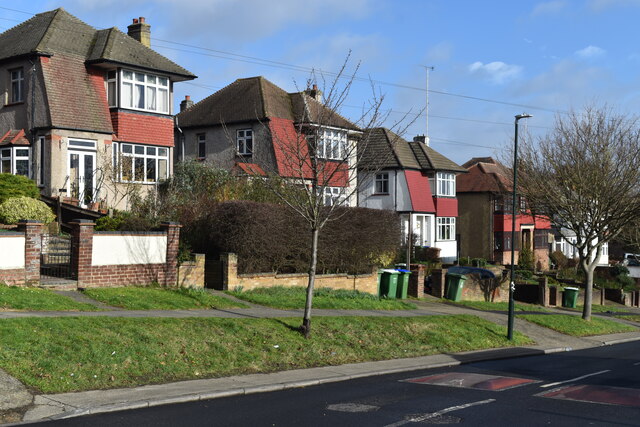
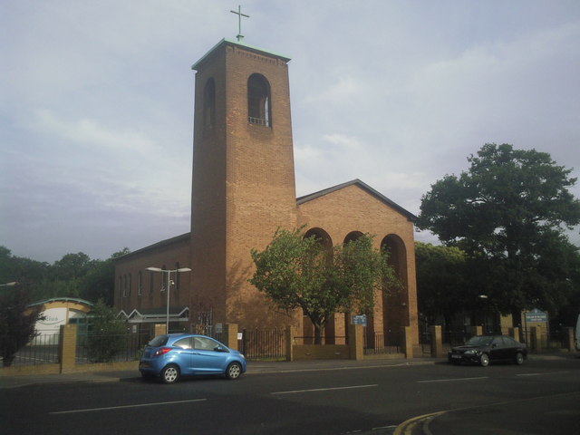
The town is primarily residential, with a mix of housing styles including Victorian terraced houses, mid-20th century semi-detached homes, and modern apartment blocks. The area is known for its family-friendly atmosphere and offers a peaceful and tranquil environment away from the hustle and bustle of the city.

Upper Belvedere benefits from good transport links, with several railway stations nearby providing easy access to London and other parts of Kent. The A2 and M25 motorways are also within close proximity, making it convenient for commuters and travelers.

The town offers a range of amenities and services to its residents. There are local shops, supermarkets, and a variety of dining options available within walking distance. The nearby town of Bexleyheath provides additional shopping and entertainment facilities, including a popular shopping center.

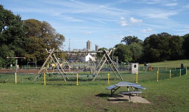
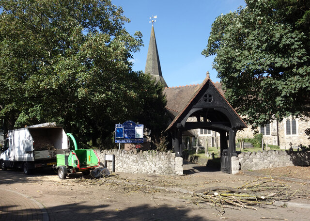
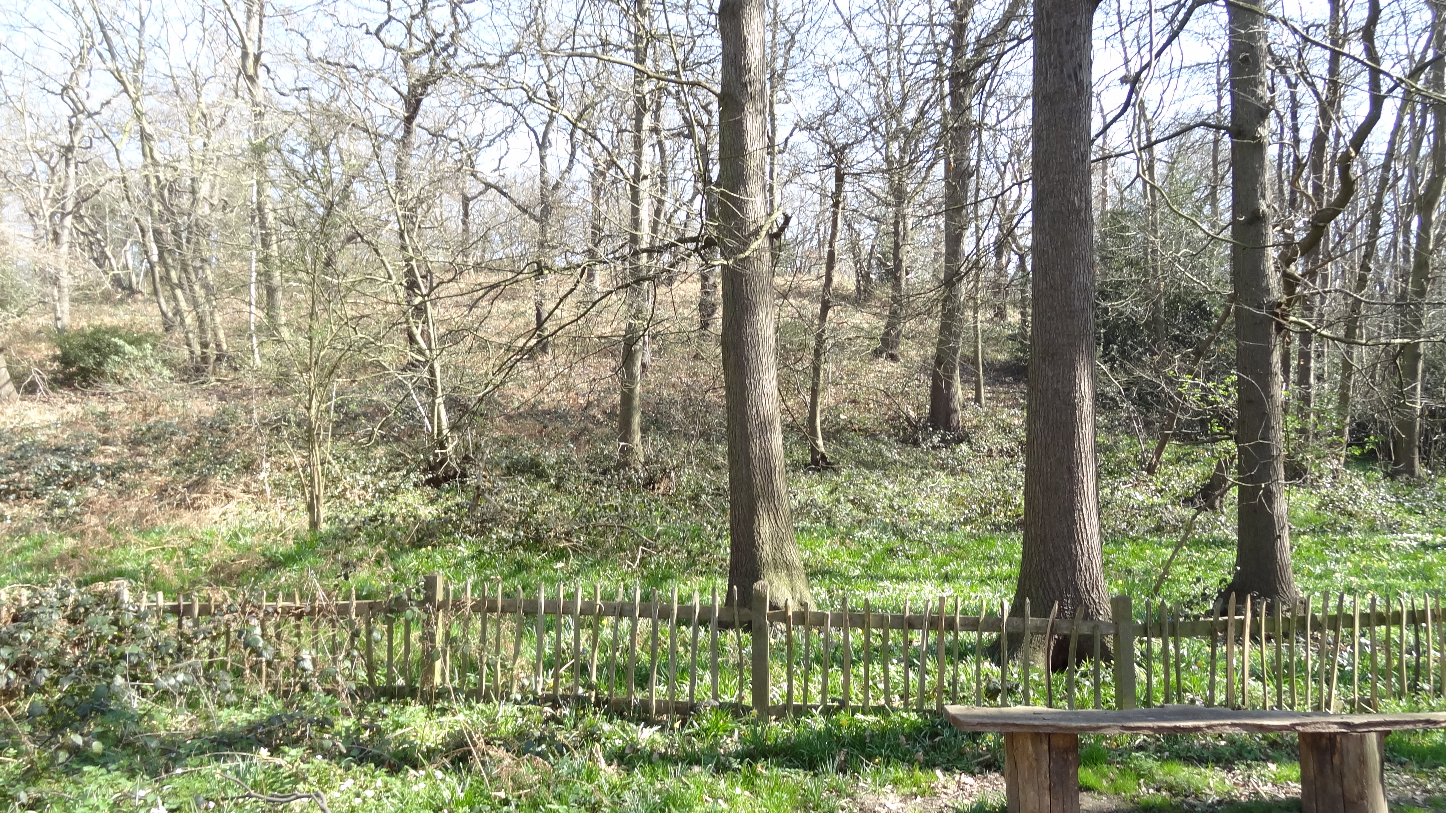
Upper Belvedere is surrounded by green spaces, with Lesnes Abbey Woods, a nature reserve and ancient woodland, located nearby. The area also benefits from several parks and recreational areas, providing opportunities for outdoor activities and relaxation.

Overall, Upper Belvedere offers a peaceful and convenient location for those looking to live in a suburban area within easy reach of London.

If you have any feedback on the listing, please let us know in the comments section below.

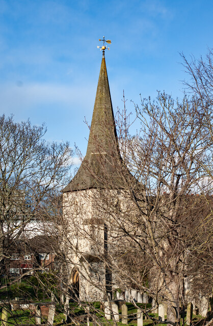
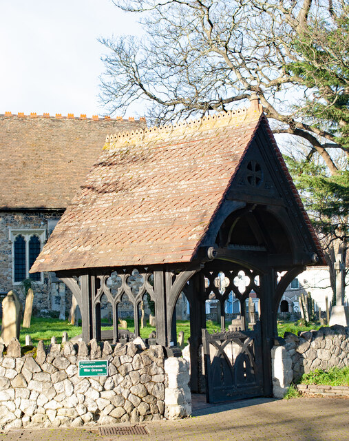
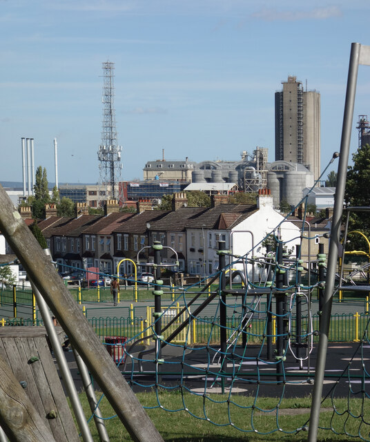
Upper Belvedere Images

Images are sourced within 2km of 51.481477/0.14446859 or Grid Reference TQ4978. Thanks to Geograph Open Source API. All images are credited.

Houses in Avenue Road, Erith
Erith : tower, Church of St John the Baptist The church is Grade II* listed : description at this <span class="nowrap"><a title="https://historicengland.org.uk/listing/the-list/list-entry/1188560?section=official-list-entry" rel="nofollow ugc noopener" href="https://historicengland.org.uk/listing/the-list/list-entry/1188560?section=official-list-entry">Link</a><img style="margin-left:2px;" alt="External link" title="External link - shift click to open in new window" src="https://s1.geograph.org.uk/img/external.png" width="10" height="10"/></span>.
Erith : tower, Church of St John the Baptist
The church is Grade II* listed : description at this LinkExternal link.
Erith : lych-gate, Church of St John the Baptist
Playground, Houses and Industry A play area in Frank's Park in the foreground, with a terraced street beyond and then part of the long line of industrial estates along the Thames Estuary.
Playground, Houses and Industry
A play area in Frank's Park in the foreground, with a terraced street beyond and then part of the long line of industrial estates along the Thames Estuary.
Play Area in Frank's Park Frank's Park was established in 1920 by Erith Council who bought the land with money donated by Frank Beadle, a local philanthropist. <span class="nowrap"><a title="https://group.rspb.org.uk/bexley/local-wild-places/franks-park-belvedere/" rel="nofollow ugc noopener" href="https://group.rspb.org.uk/bexley/local-wild-places/franks-park-belvedere/">Link</a><img style="margin-left:2px;" alt="External link" title="External link - shift click to open in new window" src="https://s1.geograph.org.uk/img/external.png" width="10" height="10"/></span>
Play Area in Frank's Park
Frank's Park was established in 1920 by Erith Council who bought the land with money donated by Frank Beadle, a local philanthropist. LinkExternal link
Clearing up the wood, St John's Church There must have been some tree felling or storm damage here. Bits of wood were all over the place around the lych gate and in the churchyard at St John the Baptist's Church. A team with a shredder was clearing it up.
The Green Chain long distance path passes here.
Clearing up the wood, St John's Church
There must have been some tree felling or storm damage here. Bits of wood were all over the place around the lych gate and in the churchyard at St John the Baptist's Church. A team with a shredder was clearing it up. The Green Chain long distance path passes here.
South Eastern Train This is the railway line between Erith and Belvedere the photo was taken from a footbridge over the line.
South Eastern Train
This is the railway line between Erith and Belvedere the photo was taken from a footbridge over the line.
St John's church parish church of St John the Baptist, Erith (Anglican) with its lych gate
St John's church
parish church of St John the Baptist, Erith (Anglican) with its lych gate
Our Lady of the Angels Roman Catholic Church, Bexley Road, Northumberland Heath, Kent A large and handsome Catholic church serving a large and multi-ethnic population in the surrounding area.
Our Lady of the Angels Roman Catholic Church, Bexley Road, Northumberland Heath, Kent
A large and handsome Catholic church serving a large and multi-ethnic population in the surrounding area.
Lower Road, Belvedere
Bullbanks Road, Belvedere
The Halfway House public house, Belvedere
Post Office, Belvedere
Bexley Road, Northumberland Heath
Catholic cemetery at Northumberland Heath This small cemetery off Bexley Road belongs to Our Lady of the Angels Roman Catholic Church, seen beyond the wall in the distance. For more information about the cemetery see <span class="nowrap"><a title="http://www.londongardensonline.org.uk/gardens-online-record.asp?ID=BEX008" rel="nofollow ugc noopener" href="http://www.londongardensonline.org.uk/gardens-online-record.asp?ID=BEX008">Link</a><img style="margin-left:2px;" alt="External link" title="External link - shift click to open in new window" src="https://s1.geograph.org.uk/img/external.png" width="10" height="10"/></span>  and for more information about the Friary nearby see <span class="nowrap"><a title="http://olaerith.org.uk/" rel="nofollow ugc noopener" href="http://olaerith.org.uk/">Link</a><img style="margin-left:2px;" alt="External link" title="External link - shift click to open in new window" src="https://s1.geograph.org.uk/img/external.png" width="10" height="10"/></span>
Catholic cemetery at Northumberland Heath
This small cemetery off Bexley Road belongs to Our Lady of the Angels Roman Catholic Church, seen beyond the wall in the distance. For more information about the cemetery see LinkExternal link and for more information about the Friary nearby see LinkExternal link
Our Lady of the Angels Roman Catholic Church, Bexley Road When seen from the north, this fine tree hides the church tower. A Friary is attached to the church - see <span class="nowrap"><a title="http://olaerith.org.uk/" rel="nofollow ugc noopener" href="http://olaerith.org.uk/">Link</a><img style="margin-left:2px;" alt="External link" title="External link - shift click to open in new window" src="https://s1.geograph.org.uk/img/external.png" width="10" height="10"/></span>   and a small cemetery lies beyond the church - see <a title="https://www.geograph.org.uk/photo/2009317" href="https://www.geograph.org.uk/photo/2009317">Link</a>
Our Lady of the Angels Roman Catholic Church, Bexley Road
When seen from the north, this fine tree hides the church tower. A Friary is attached to the church - see LinkExternal link and a small cemetery lies beyond the church - see Link
Our Lady of the Angels Roman Catholic Church, Northumberland Heath This view looks across Bexley Road. A Friary is attached to the church - see <span class="nowrap"><a title="http://olaerith.org.uk/" rel="nofollow ugc noopener" href="http://olaerith.org.uk/">Link</a><img style="margin-left:2px;" alt="External link" title="External link - shift click to open in new window" src="https://s1.geograph.org.uk/img/external.png" width="10" height="10"/></span>
Our Lady of the Angels Roman Catholic Church, Northumberland Heath
This view looks across Bexley Road. A Friary is attached to the church - see LinkExternal link
The war memorial, St John the Baptist Churchyard, Erith An attractive display of bluebells sets off the war memorial. The houses beyond the churchyard are in Lower Road.
The war memorial, St John the Baptist Churchyard, Erith
An attractive display of bluebells sets off the war memorial. The houses beyond the churchyard are in Lower Road.
Show me another place!

Upper Belvedere is located at Grid Ref: TQ4978 (Lat: 51.481477, Lng: 0.14446859)

Unitary Authority: Bexley

Police Authority: Metropolitan

What 3 Words

///happy.clean.discrepancy. Near Belvedere, London

Related Wikis

Lessness Heath

Lessness Heath is a district in the London Borough of Bexley, in the area of Belvedere. == History and name == Lessness was recorded in the Domesday Book...

Belvedere, London

Belvedere is a town in south east London, England, within the London Borough of Bexley. It lies close to the River Thames, with Erith to the east, Bexleyheath...

Abbey Wood SSSI

Abbey Wood is a 6.3-hectare (16-acre) geological Site of Special Scientific Interest in Abbey Wood in the London Borough of Bexley. It is located in Lesnes...

Trinity School, Belvedere

Trinity School is a Church of England Secondary Academy located in Belvedere in the London Borough of Bexley. It is a mixed non-selective school located...

Nearby Amenities

Located within 500m of 51.481477,0.14446859
Crossing
Lat/Long: 51.4841456/0.1444341
Mini Roundabout
Lat/Long: 51.4840572/0.1432912
Turning Circle
Lat/Long: 51.4788919/0.1453725
Turning Circle
Lat/Long: 51.4813298/0.1431457
Turning Circle
Lat/Long: 51.4780627/0.1399429
Pub
Eardley Arms
Real Ale: yes
Toilets: yes
Toilets Access: customers
Lat/Long: 51.4841478/0.1430164
Crossing
Crossing: unmarked
Crossing Island: yes
Crossing Markings: no
Lat/Long: 51.4837735/0.1389373
Hayley House
Lat/Long: 51.4809781/0.1484323
Crossing
Crossing: uncontrolled
Crossing Island: no
Crossing Ref: zebra
Tactile Paving: yes
Lat/Long: 51.4813568/0.1445027
Turning Circle
Lat/Long: 51.4826392/0.1432639
Pub
The Village Inn
Lat/Long: 51.4802064/0.143626
Bus Stop
All Saints Church
Bus: yes
Local Ref: N
Naptan AtcoCode: 490003247S
Naptan Bearing: S
Naptan CommonName: All Saints Church Nuxley Rd
Naptan Indicator: Stop N
Naptan Street: NUXLEY ROAD
Naptan Verified: no
Public Transport: platform
Lat/Long: 51.4833979/0.1474455
Bus Stop
Belvedere Police Station
Bench: yes
Bin: no
Bus: yes
Lit: yes
Local Ref: W
Naptan AtcoCode: 490003882N
Naptan Bearing: N
Naptan CommonName: Belvedere Police Station
Naptan Indicator: Stop W
Naptan Street: PICARDY ROAD
Naptan Verified: no
Public Transport: platform
Ref: 57024
Shelter: yes
Tactile Paving: no
Lat/Long: 51.4849078/0.1484044
Bus Stop
Belvedere Police Station
Bus: yes
Local Ref: M
Naptan AtcoCode: 490003882S
Naptan Bearing: S
Naptan CommonName: Belvedere Police Station
Naptan Indicator: Stop M
Naptan Street: PICARDY ROAD
Naptan Verified: no
Public Transport: platform
Ref: 53962
Lat/Long: 51.4848287/0.1485627
Bus Stop
Bedonwell Road / Dryhill Road
Bus: yes
Naptan AtcoCode: 490006206E
Naptan Bearing: N
Naptan CommonName: Bedonwell Road Dryhill Road
Naptan Street: BEDONWELL ROAD
Naptan Verified: no
Public Transport: platform
Ref: 75361
Source Ref: naptan
Lat/Long: 51.4789903/0.1423886
Bus Stop
Bedonwell Road / Streamway
Bench: no
Bin: no
Bus: yes
Lit: no
Naptan AtcoCode: 490006206N
Naptan Bearing: N
Naptan CommonName: Bedonwell Road Dryhill Road
Naptan Street: BEDONWELL ROAD
Naptan Verified: no
Public Transport: platform
Ref: 57144
Shelter: no
Source Ref: naptan
Tactile Paving: no
Lat/Long: 51.4786907/0.1435099
Bus Stop
Nuxley Road / Dryhill Road
Bench: yes
Bin: yes
Bus: yes
Naptan AtcoCode: 490006206S
Naptan Bearing: N
Naptan CommonName: Bedonwell Road Dryhill Road
Naptan Street: NUXLEY ROAD
Naptan Verified: no
Public Transport: platform
Ref: 50474
Shelter: yes
Source Ref: naptan
Lat/Long: 51.4794855/0.1434598
Bus Stop
Hail & Ride The Great Harry
Bus: yes
Naptan AtcoCode: 490006376W
Naptan Bearing: W
Naptan CommonName: Eastry Road
Naptan Indicator: Stop
Naptan Verified: no
Public Transport: platform
Lat/Long: 51.4776795/0.1483202
Bus Stop
Erith Road / Nuxley Road
Bench: yes
Bin: yes
Bus: yes
Local Ref: Q
Naptan AtcoCode: 490010469E
Naptan Bearing: E
Naptan CommonName: Erith Road Nuxley Road
Naptan Indicator: Stop Q
Naptan Verified: no
Public Transport: platform
Ref: 54402
Shelter: yes
Source Ref: naptan
Lat/Long: 51.4842283/0.1487979
Bus Stop
Erith Road / Nuxley Road
Bench: yes
Bus: yes
Local Ref: V
Naptan AtcoCode: 490010469W
Naptan Bearing: W
Naptan CommonName: Erith Road Nuxley Road
Naptan Indicator: Stop V
Naptan Street: ERITH ROAD
Naptan Verified: no
Public Transport: platform
Ref: 58651
Shelter: yes
Source Ref: naptan
Lat/Long: 51.4841068/0.1488952
Bus Stop
Parsonage Manorway
Bus: yes
Naptan AtcoCode: 490010860N1
Naptan Bearing: N
Naptan CommonName: Parsonage Manorway
Naptan Street: BEDONWELL ROAD
Naptan Verified: no
Public Transport: platform
Ref: 55684
Source Ref: naptan
Lat/Long: 51.4776085/0.1453106
Bus Stop
Parsonage Manorway
Bench: no
Bus: yes
Naptan AtcoCode: 490010860N2
Naptan Bearing: N
Naptan CommonName: Parsonage Manorway
Naptan Street: BEDONWELL ROAD
Naptan Verified: no
Public Transport: platform
Ref: 72452
Shelter: no
Source Ref: naptan
Lat/Long: 51.4773876/0.1451623
Bus Stop
Shinglewell Road
Bus: yes
Naptan AtcoCode: 490012088E
Naptan Bearing: N
Naptan CommonName: Shinglewell Road
Naptan Street: PARSONAGE MANORWAY
Naptan Verified: no
Public Transport: platform
Ref: 50683
Source Ref: naptan
Lat/Long: 51.4774819/0.1461173
Bus Stop
Shinglewell Road
Bus: yes
Naptan AtcoCode: 490012088W
Naptan Bearing: N
Naptan CommonName: Shinglewell Road
Naptan Street: PARSONAGE MANORWAY
Naptan Verified: no
Public Transport: platform
Ref: 53492
Source Ref: naptan
Lat/Long: 51.4773377/0.1458702
Bus Stop
Albert Road / Nuxley Road
Bus: yes
Naptan AtcoCode: 490012593N
Naptan Bearing: N
Naptan CommonName: Stapley Road
Naptan Street: ALBERT ROAD
Naptan Verified: no
Public Transport: platform
Ref: 72506
Source Ref: naptan
Lat/Long: 51.4816875/0.1443951
Bus Stop
Stapley Road
Bus: yes
Naptan AtcoCode: 490012593S
Naptan Bearing: S
Naptan CommonName: Stapley Road
Naptan Street: NUXLEY ROAD
Naptan Verified: no
Public Transport: platform
Ref: 51782
Source Ref: naptan
Lat/Long: 51.481869/0.1454458
Bus Stop
The View
Bus: yes
Naptan AtcoCode: 490013583E
Naptan Bearing: E
Naptan CommonName: The View
Naptan Verified: no
Public Transport: platform
Ref: 48980
Lat/Long: 51.4837883/0.1383281
Bus Stop
Victoria Street
Bus: yes
Naptan AtcoCode: 490014074N
Naptan Bearing: N
Naptan CommonName: Victoria Street (DA17)
Naptan Street: ALBERT ROAD
Naptan Verified: no
Public Transport: platform
Ref: 49906
Source Ref: naptan
Lat/Long: 51.4826783/0.1439642
Bus Stop
The Eardley Arms
Bench: yes
Bin: yes
Bus: yes
Lit: yes
Local Ref: P
Naptan AtcoCode: 490013342E
Naptan Bearing: E
Naptan CommonName: The Eardley Arms
Naptan Indicator: Stop P
Naptan Street: WOOLWICH ROAD
Naptan Verified: no
Public Transport: platform
Ref: 74963
Shelter: yes
Tactile Paving: no
Lat/Long: 51.4841696/0.1439798
Bus Stop
The Eardley Arms
Bus: yes
Naptan AtcoCode: 490013342W
Naptan Bearing: W
Naptan CommonName: The Eardley Arms
Naptan Verified: no
Public Transport: platform
Ref: 47767
Lat/Long: 51.4838119/0.1413866
Bus Stop
Hail & Ride The Great Harry
Bus: yes
Naptan AtcoCode: 490013386E
Naptan Bearing: E
Naptan CommonName: The Great Harry
Naptan Street: PARSONAGE MANORWAY
Naptan Verified: no
Public Transport: platform
Lat/Long: 51.477827/0.1486151
Miranda House
Lat/Long: 51.4848874/0.1458692
Ariel Court
Lat/Long: 51.4849007/0.1454674
Alonso House
Lat/Long: 51.4848875/0.1450272
Prospero House
Lat/Long: 51.4848976/0.1462989
Mini Roundabout
Direction: clockwise
Lat/Long: 51.4842176/0.1480549
Traffic Calming: island
Lat/Long: 51.4841774/0.1476903
Ref GB Tflcid: RWG180772
Traffic Calming: cushion
Lat/Long: 51.4856342/0.1434971
Crossing
Crossing: uncontrolled
Crossing Island: no
Crossing Ref: zebra
Tactile Paving: yes
Lat/Long: 51.4814241/0.1446166
Addr Housenumber: 1a
Addr Street: Essenden Road
Building: house
Lat/Long: 51.4848541/0.1466852
Addr Housenumber: 1
Addr Street: Essenden Road
Building: house
Lat/Long: 51.4848449/0.1470057
Doctors
Cairngall Medical Practice
Healthcare: doctor
Opening Hours: Mo,Tu,We,Fr 08:00-18:30; Th 07:00-18:30
Phone: +44 1322 434144
Website: https://www.cairngall.co.uk/
Lat/Long: 51.4843855/0.1487626
Fixme: survey note: get gps middle line position
Lat/Long: 51.4777117/0.1466178
Lessness Heath
Place: suburb
Source: OS Open Names
Wikidata: Q146235
Lat/Long: 51.482569/0.1462903
Barrier: chain
Lat/Long: 51.4806606/0.1433345
Barrier: cycle_barrier
Material: metal
Lat/Long: 51.4787336/0.1396894
Turning Circle
Lat/Long: 51.4829259/0.1431654
Crossing
Crossing: uncontrolled
Crossing Island: no
Crossing Ref: zebra
Tactile Paving: yes
Lat/Long: 51.4813523/0.1446282
Crossing
Lat/Long: 51.48408/0.1435566
Crossing
Lat/Long: 51.4840329/0.1430556
Waste Basket
Waste: dog_excrement
Lat/Long: 51.483931/0.1435371
Waste Basket
Lat/Long: 51.4837707/0.1435974
Waste Basket
Lat/Long: 51.4827468/0.1442063
Waste Basket
Waste: dog_excrement
Lat/Long: 51.4827125/0.1442586
Waste Basket
Waste: dog_excrement
Lat/Long: 51.483992/0.1449908
Waste Basket
Waste: dog_excrement
Lat/Long: 51.4836571/0.1451021
Bench
Direction: SSE
Lat/Long: 51.4840304/0.144504
Bench
Direction: S
Lat/Long: 51.4840162/0.1441781
Bench
Direction: NE
Lat/Long: 51.4838091/0.1435518
Upper Belvedere
Place: suburb
Source: OS Open Names
Lat/Long: 51.4814777/0.1444963
Barrier: cycle_barrier
Cycle Barrier: triple
Height: 1.5
Material: metal
Lat/Long: 51.4802073/0.1487811
Barrier: swing_gate
Locked: yes
Material: metal
Lat/Long: 51.480242/0.1487422
Height: 5
Man Made: mast
Material: metal
Lat/Long: 51.4802946/0.1488157
Waste Basket
Lat/Long: 51.4803598/0.1491094
Waste Basket
Waste: dog_excrement
Lat/Long: 51.4805118/0.1500441
Waste Basket
Lat/Long: 51.4808283/0.1511291
Waste Basket
Waste: trash
Lat/Long: 51.4804889/0.1497682
Barrier: kissing_gate
Lat/Long: 51.4846319/0.1395451
Barrier: entrance
Lat/Long: 51.4846556/0.1404114
Atm
Currency GBP: yes
Drive Through: no
Lat/Long: 51.4832352/0.1472638
Charging Station
Brand: BP Pulse
Brand Wikidata: Q39057719
Operator: BP Pulse
Operator Wikidata: Q39057719
Lat/Long: 51.4827143/0.1464039
Post Box
Brand: Royal Mail
Brand Wikidata: Q638098
Operator: Royal Mail
Operator Wikidata: Q638098
Post Box Type: pillar
Royal Cypher: EIIR
Royal Cypher Wikidata: Q33102113
Lat/Long: 51.4826818/0.1463117
Traffic Calming: island
Lat/Long: 51.4842157/0.1483254
Atm
Lat/Long: 51.4819704/0.1452665
Parcel Locker
Amazon Hub Locker
Brand: Amazon Hub
Brand Wikidata: Q100274430
Parcel Mail In: yes
Ref: Althea
Lat/Long: 51.4819052/0.1451778
Atm
Brand: Sainsbury's Bank
Brand Wikidata: Q7400525
Operator: Sainsbury's Bank
Operator Wikidata: Q7400525
Lat/Long: 51.4816285/0.1447821
Bench
Lat/Long: 51.4827363/0.142324
Bench
Lat/Long: 51.4827593/0.1422635
Bench
Lat/Long: 51.4827334/0.1420413
Bench
Lat/Long: 51.4828136/0.1420428
Bench
Lat/Long: 51.4828957/0.1420837
Bench
Lat/Long: 51.4826693/0.1421316
Bench
Lat/Long: 51.4834557/0.1438157
Bench
Lat/Long: 51.4833768/0.1441097
Bench
Lat/Long: 51.4835629/0.1439755
Bench
Lat/Long: 51.4830356/0.1443572
Bench
Lat/Long: 51.4830802/0.1443734
Leisure: picnic_table
Lat/Long: 51.4832283/0.1440056
Leisure: picnic_table
Lat/Long: 51.4832786/0.1440924
Leisure: picnic_table
Lat/Long: 51.4833073/0.1439945
Leisure: picnic_table
Lat/Long: 51.4833311/0.1442253
Bench
Lat/Long: 51.4829276/0.1441691
Bicycle Parking
Lat/Long: 51.4829377/0.1441393
Bench
Lat/Long: 51.4835751/0.1440251
Leisure: picnic_table
Lat/Long: 51.483548/0.1441852
Leisure: picnic_table
Lat/Long: 51.4834695/0.1442372
Bench
Direction: se
Lat/Long: 51.4816403/0.1448887
Waste Basket
Lat/Long: 51.4816493/0.1449006
Telephone
Booth: KX100
Covered: booth
Lat/Long: 51.4816739/0.1449419
Barrier: bollard
Lat/Long: 51.4816785/0.1450092
Barrier: bollard
Lat/Long: 51.4816692/0.1450253
Barrier: bollard
Lat/Long: 51.4816965/0.1450543
Barrier: bollard
Lat/Long: 51.4816411/0.1450696
Barrier: bollard
Lat/Long: 51.481649/0.1450586
Barrier: bollard
Lat/Long: 51.4816702/0.1450947
Barrier: bollard
Lat/Long: 51.4818381/0.145076
Barrier: bollard
Lat/Long: 51.4818457/0.1450868
Barrier: bollard
Lat/Long: 51.4818558/0.1451023
Barrier: bollard
Lat/Long: 51.4818638/0.1451145
Bicycle Parking
Lat/Long: 51.4815982/0.1450577
Bicycle Parking
Lat/Long: 51.4818777/0.1450807
Bench
Direction: se
Lat/Long: 51.4819332/0.1452902
Waste Basket
Lat/Long: 51.4819627/0.1453835
Man Made: street_cabinet
Utility: telecom
Lat/Long: 51.4819888/0.1455552
Man Made: street_cabinet
Utility: telecom
Lat/Long: 51.4820461/0.1456505
Bench
Direction: nw
Lat/Long: 51.4820465/0.1456924
Waste Basket
Lat/Long: 51.4820482/0.1457052
Man Made: street_cabinet
Utility: telecom
Lat/Long: 51.4822409/0.1457519
Barrier: bollard
Lat/Long: 51.4822378/0.1457813
Barrier: bollard
Lat/Long: 51.4822301/0.1457925
Barrier: bollard
Lat/Long: 51.4822572/0.1458247
Barrier: bollard
Lat/Long: 51.4821989/0.1458521
Barrier: bollard
Lat/Long: 51.4822042/0.1458317
Barrier: bollard
Lat/Long: 51.4822333/0.1458751
Waste Basket
Lat/Long: 51.4826382/0.1463135
Waste Basket
Lat/Long: 51.4827492/0.1466388
Barrier: bollard
Lat/Long: 51.4829726/0.146838
Barrier: bollard
Lat/Long: 51.482979/0.1468124
Barrier: bollard
Lat/Long: 51.4830087/0.1468695
Barrier: bollard
Lat/Long: 51.4829456/0.1469112
Barrier: bollard
Lat/Long: 51.4829594/0.1468882
Barrier: bollard
Lat/Long: 51.4829891/0.1469385
Waste Basket
Lat/Long: 51.4831786/0.1470511
Waste Basket
Lat/Long: 51.4834014/0.1473037
Waste Basket
Lat/Long: 51.4834872/0.1473445
Bench
Direction: se
Lat/Long: 51.4835076/0.147359
Traffic Calming: island
Lat/Long: 51.4840843/0.1479467
Traffic Calming: island
Lat/Long: 51.4843564/0.1481793
Bicycle Parking
Bicycle Parking: upright_stands
Capacity: 5
Ref GB Tflcid: RWG171685
Lat/Long: 51.4818316/0.1451498
Bicycle Parking
Bicycle Parking: stands
Capacity: 2
Ref GB Tflcid: RWG171635
Lat/Long: 51.477734/0.148067
Ref GB Tflcid: RWG180773
Traffic Calming: cushion
Lat/Long: 51.4849751/0.1434086
Ref GB Tflcid: RWG180774
Traffic Calming: cushion
Lat/Long: 51.4843433/0.1433109
Bench
Lat/Long: 51.4815617/0.1450518
Parcel Locker
Brand: InPost
Brand Wikidata: Q3182097
Operator: In-post
Parcel Mail In: yes
Parcel Pickup: yes
Lat/Long: 51.4812678/0.1438575
Post Box
Mapillary: 280538196911233
Operator: Royal Mail
Operator Wikidata: Q638098
Post Box Type: pillar
Lat/Long: 51.4786302/0.1389465
The data included in this document is from www.openstreetmap.org. The data is made available under ODbL.

Have you been to Upper Belvedere?

Leave your review of Upper Belvedere below (or comments, questions and feedback).