College Wood

Wood, Forest in Somerset Mendip

England

College Wood

New Direction Sign - Signpost on the B3139 Wells Road in Chilcompton Located on the northeast side of the crossroads of the B3139 Wells Road, Bakers Lane and Stockhill Road, diagonally opposite the Co-op in Chilcompton parish. 4 arms and pyramid finial. A completely new fingerpost in 2021 to replace the one shown in <a title="https://www.geograph.org.uk/photo/6043795" href="https://www.geograph.org.uk/photo/6043795">Link</a>.

Milestone Society National ID: SO_ST6451C
New Direction Sign - Signpost on the B3139 Wells Road in Chilcompton Credit: J Francis

College Wood is a well-preserved ancient woodland located in Somerset, England. Situated near the village of Wood, this forest boasts a rich history and provides a serene escape for nature enthusiasts. Spanning over 60 acres, College Wood offers a diverse range of plant and animal species, making it a haven for wildlife.

The wood is primarily composed of broadleaf trees, such as oak, beech, and ash, which create a dense canopy and provide shelter for an array of woodland creatures. Bluebells, wood anemones, and other wildflowers carpet the forest floor in spring, adding a burst of color to the already picturesque landscape.

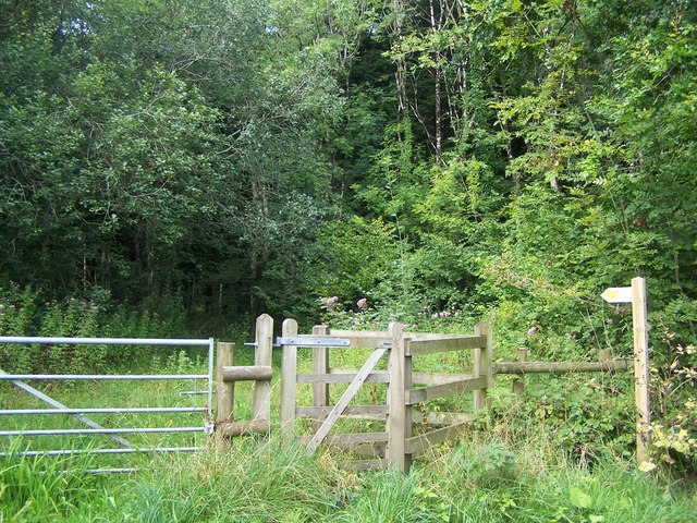
Visitors to College Wood can explore numerous well-maintained footpaths and trails that wind through the forest, allowing for peaceful walks and opportunities to observe the local flora and fauna. The wood is also home to an abundance of birdlife, including great spotted woodpeckers, tawny owls, and various species of songbirds.

The woodland's history is intertwined with a nearby college, hence its name. It is believed that the wood was once managed by the college, and remnants of old boundary walls and stone structures can still be found within the forest. These historical features add a touch of intrigue and charm to the overall experience of exploring College Wood.

Overall, College Wood, Somerset is a cherished natural gem, offering visitors a tranquil and enchanting environment to reconnect with nature and enjoy the beauty of a well-preserved ancient woodland.

If you have any feedback on the listing, please let us know in the comments section below.
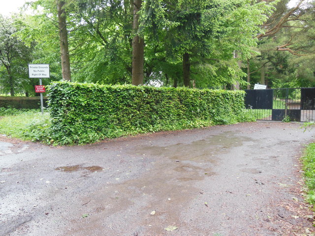
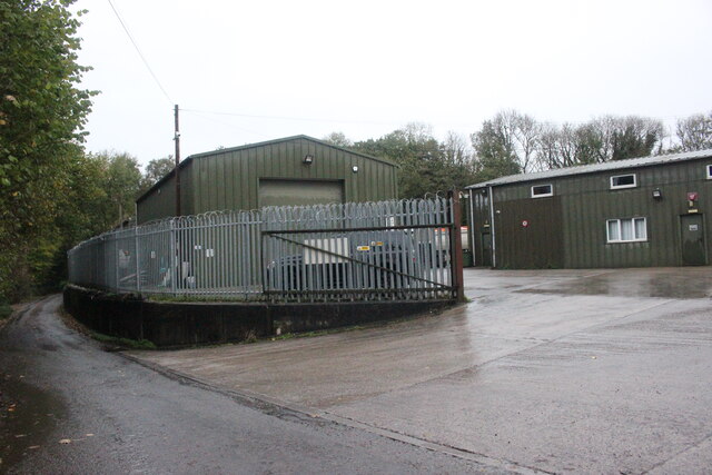
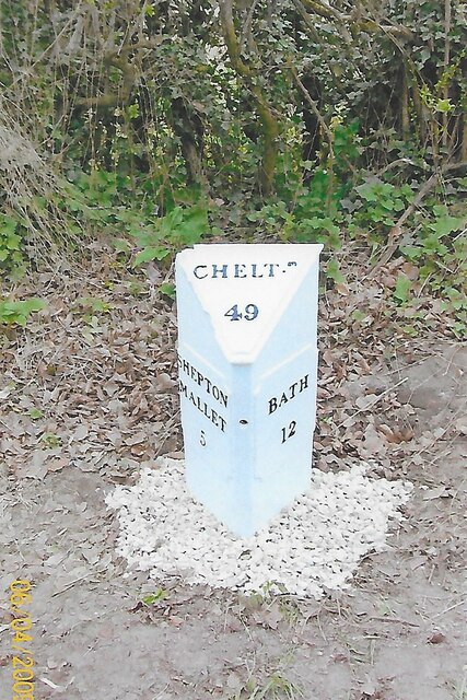
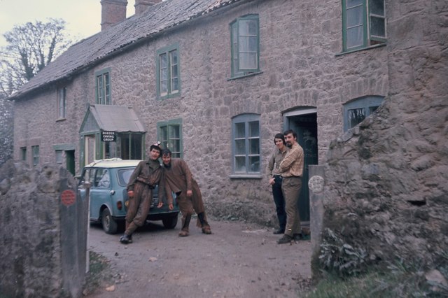
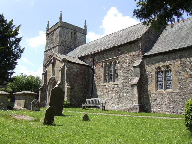
College Wood Images

Images are sourced within 2km of 51.242971/-2.5074832 or Grid Reference ST6449. Thanks to Geograph Open Source API. All images are credited.

New Direction Sign - Signpost on the B3139 Wells Road in Chilcompton Located on the northeast side of the crossroads of the B3139 Wells Road, Bakers Lane and Stockhill Road, diagonally opposite the Co-op in Chilcompton parish. 4 arms and pyramid finial. A completely new fingerpost in 2021 to replace the one shown in <a title="https://www.geograph.org.uk/photo/6043795" href="https://www.geograph.org.uk/photo/6043795">Link</a>.

Milestone Society National ID: SO_ST6451C
New Direction Sign - Signpost on the B3139 Wells Road in Chilcompton
Located on the northeast side of the crossroads of the B3139 Wells Road, Bakers Lane and Stockhill Road, diagonally opposite the Co-op in Chilcompton parish. 4 arms and pyramid finial. A completely new fingerpost in 2021 to replace the one shown in Link. Milestone Society National ID: SO_ST6451C
Downside Abbey Despite appearances, most of this abbey was built in the 20th century (see <a href="https://www.geograph.org.uk/photo/4261979">ST6550 : Downside Abbey</a> for full description). The remaining Benedictine monks who have been at Downside since 1814 plan to leave in March 2022.
Downside Abbey
Despite appearances, most of this abbey was built in the 20th century (see ST6550 : Downside Abbey for full description). The remaining Benedictine monks who have been at Downside since 1814 plan to leave in March 2022.
The church of St Vigor at Stratton-on-the-Fosse One of only two churches named after St Vigor.
The church of St Vigor at Stratton-on-the-Fosse
One of only two churches named after St Vigor.
Croft House and the B3356 Croft House stands behind the trees on the left. Taken between heavy showers on a Saturday lunchtime.
Croft House and the B3356
Croft House stands behind the trees on the left. Taken between heavy showers on a Saturday lunchtime.
Keeping pupils and the public apart These gates close off the grounds of Downside School. Two notices tell the public that this is private property with no right of way; a third tells pupils that they are not to go (in the other direction) past this point.
Keeping pupils and the public apart
These gates close off the grounds of Downside School. Two notices tell the public that this is private property with no right of way; a third tells pupils that they are not to go (in the other direction) past this point.
Downside Abbey The Basilica of St Gregory the Great is the largest neo-Gothic church, not a cathedral, in England and home to the senior community of English Benedictines.  The brothers came to Downside from Douai in northern France in 1814, as refugees from the Napoleonic regime, but most of what we see today was built in the 20th century. The cluster of eastern chapels and the transept were constructed between 1882 and 1890, the architects being Archibald Dunn and Edward Hansom.  The quire was designed by Thomas Garner and completed in 1905; the tower beyond, placed over the south transept rather than the central crossing, was completed by Sir Giles Gilbert Scott in 1938.  At 166 feet it is the tallest tower in Somerset after Wells Cathedral at 182 ft (Bath Abbey's tower is 162 ft). The great church is 74 feet high (Bath 75 ft, Exeter Cathedral 69 ft, Wells 73 ft)  and 328 feet long at present (Bristol Cathedral 338 ft), but Scott's nave still awaits its final two western bays.
Downside Abbey
The Basilica of St Gregory the Great is the largest neo-Gothic church, not a cathedral, in England and home to the senior community of English Benedictines. The brothers came to Downside from Douai in northern France in 1814, as refugees from the Napoleonic regime, but most of what we see today was built in the 20th century. The cluster of eastern chapels and the transept were constructed between 1882 and 1890, the architects being Archibald Dunn and Edward Hansom. The quire was designed by Thomas Garner and completed in 1905; the tower beyond, placed over the south transept rather than the central crossing, was completed by Sir Giles Gilbert Scott in 1938. At 166 feet it is the tallest tower in Somerset after Wells Cathedral at 182 ft (Bath Abbey's tower is 162 ft). The great church is 74 feet high (Bath 75 ft, Exeter Cathedral 69 ft, Wells 73 ft) and 328 feet long at present (Bristol Cathedral 338 ft), but Scott's nave still awaits its final two western bays.
Industrial Buildings at Stoke Bottom These buildings are heavily protected with large metal fences and razor wire but have no signage to indicate their use.
Industrial Buildings at Stoke Bottom
These buildings are heavily protected with large metal fences and razor wire but have no signage to indicate their use.
Old Milestone by A367, just South of Stratton on the Fosse Way The Milestone is located on grass verge on the East of the road.  Parish of Stratton On The Fosse (Mendip District). Cast iron post, plated iron casting design, erected by the Shepton Mallet turnpike trust in the 19th century. An earlier photograph can be found here: <a title="https://www.geograph.org.uk/photo/6095973" href="https://www.geograph.org.uk/photo/6095973">Link</a> 

Inscription reads:-
SHEPTON / MALLET / 5 : : BATH / 12 : : CHELT.M / 49 

Grade II listed. List Entry Number: 1058636 <span class="nowrap"><a title="https://historicengland.org.uk/listing/the-list/list-entry/1058636" rel="nofollow ugc noopener" href="https://historicengland.org.uk/listing/the-list/list-entry/1058636">Link</a><img style="margin-left:2px;" alt="External link" title="External link - shift click to open in new window" src="https://s1.geograph.org.uk/img/external.png" width="10" height="10"/></span> 

Milestone Society National ID: SO_CMSM49
Old Milestone by A367, just South of Stratton on the Fosse Way
The Milestone is located on grass verge on the East of the road.  Parish of Stratton On The Fosse (Mendip District). Cast iron post, plated iron casting design, erected by the Shepton Mallet turnpike trust in the 19th century. An earlier photograph can be found here: Link  Inscription reads:- SHEPTON / MALLET / 5 : : BATH / 12 : : CHELT.M / 49 Grade II listed. List Entry Number: 1058636 LinkExternal link Milestone Society National ID: SO_CMSM49
Old Milestone by A367, Fosse Way, outside front of "The George at Nettlebridge" PH The Milestone is located against front wall of inn on the East of the road.  Parish of Stratton On The Fosse (Mendip District). Cast iron post, plated iron casting design, erected by the Shepton Mallet turnpike trust in the 19th century. An earlier photograph can be found here: <a title="https://www.geograph.org.uk/photo/6037563" href="https://www.geograph.org.uk/photo/6037563">Link</a> 

Inscription reads:- 
SHEPTON / MALLET / 4 : : BATH / 13 : : CHELT.M / 50  

Grade II listed. List Entry Number: 1178363 <span class="nowrap"><a title="https://historicengland.org.uk/listing/the-list/list-entry/1178363" rel="nofollow ugc noopener" href="https://historicengland.org.uk/listing/the-list/list-entry/1178363">Link</a><img style="margin-left:2px;" alt="External link" title="External link - shift click to open in new window" src="https://s1.geograph.org.uk/img/external.png" width="10" height="10"/></span> 

Milestone Society National ID: SO_CMSM50
Old Milestone by A367, Fosse Way, outside front of "The George at Nettlebridge" PH
The Milestone is located against front wall of inn on the East of the road.  Parish of Stratton On The Fosse (Mendip District). Cast iron post, plated iron casting design, erected by the Shepton Mallet turnpike trust in the 19th century. An earlier photograph can be found here: Link  Inscription reads:- SHEPTON / MALLET / 4 : : BATH / 13 : : CHELT.M / 50 Grade II listed. List Entry Number: 1178363 LinkExternal link Milestone Society National ID: SO_CMSM50
2011 : Ashwick Court from Blackley Lane Blackley Lane follows the bottom of a small valley from Benter west to Badger's Cross. About half way along we see Ashwick Court at the top of the hill to the south.
2011 : Ashwick Court from Blackley Lane
Blackley Lane follows the bottom of a small valley from Benter west to Badger's Cross. About half way along we see Ashwick Court at the top of the hill to the south.
2011 : View north from Blackey Lane On the other side of Blackey Lane from <a href="https://www.geograph.org.uk/photo/2308116">ST6348 : 2011 : Ashwick Court from Blackley Lane</a> looking up the northern slope of the valley in the direction of West Farm which is out of shot to the right.
2011 : View north from Blackey Lane
On the other side of Blackey Lane from ST6348 : 2011 : Ashwick Court from Blackley Lane looking up the northern slope of the valley in the direction of West Farm which is out of shot to the right.
2011 : Blackey Lane heading east Down the valley toward Benter.
The footpath (see sign) to the right takes the walker to Ashwick, less than half a mile, another path to the left climbs the side of the valley to West Farm and T'other Side The Hill.
2011 : Blackey Lane heading east
Down the valley toward Benter. The footpath (see sign) to the right takes the walker to Ashwick, less than half a mile, another path to the left climbs the side of the valley to West Farm and T'other Side The Hill.
2011 : Up Blackley Lane toward Badger's Cross The lane follows the valley floor between Benter and Badger's Cross becoming steeper further on.
2011 : Up Blackley Lane toward Badger's Cross
The lane follows the valley floor between Benter and Badger's Cross becoming steeper further on.
2011 : Blackey Lane heading east from Badger's Cross Soon to drop into a small valley which it follows to Benter.
2011 : Blackey Lane heading east from Badger's Cross
Soon to drop into a small valley which it follows to Benter.
2011 : Bay's Lane or Simbriss Road Somewhere around here Bay's Lane, from the north, becomes Simbriss Road heading south, or it could be Blackey Lane from the east - who cares.
One thing is for sure, it is near Badger's Cross.
2011 : Bay's Lane or Simbriss Road
Somewhere around here Bay's Lane, from the north, becomes Simbriss Road heading south, or it could be Blackey Lane from the east - who cares. One thing is for sure, it is near Badger's Cross.
Path Through Harridge Wood
Cottages at Fairy Cave Quarry about 1969 Now in ruins.
Cottages at Fairy Cave Quarry about 1969
Now in ruins.
Show me another place!

College Wood is located at Grid Ref: ST6449 (Lat: 51.242971, Lng: -2.5074832)

Administrative County: Somerset

District: Mendip

Police Authority: Avon and Somerset

What 3 Words

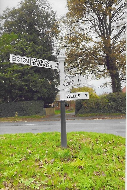
///nooks.bombshell.holds. Near Chilcompton, Somerset

Related Wikis

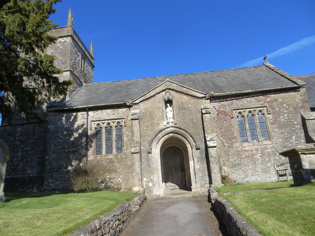
Christ Church, Downside

Christ Church is a former Church of England church in Downside, Somerset, England. Designed by John Pinch the younger, it was built in 1837–38 and closed...

Blacker's Hill

Blacker's Hill is an Iron Age hill fort at Chilcompton, 4.5 kilometres (3 mi) south west of Radstock, Somerset, England. It has been designated as a Scheduled...

Harridge Wood

Harridge Wood is an area of woodland in Somerset, England. From about 1300 AD part of the wood was the scene of coal mining, which continued until around...

Ashwick

Ashwick is a village in Somerset, England, about three miles north of Shepton Mallet and seven miles east from Wells. It has also been a civil parish since...

Stratton-on-the-Fosse

Stratton-on-the-Fosse is a village and civil parish located on the edge of the Mendip Hills, 2 miles (3 km) south-west of Westfield, 6 miles (10 km) north...

Ashwick Court

Ashwick Court is Grade II listed house on Heckley Lane northwest of Ashwick, in Mendip district, eastern Somerset, England, adjacent to the Church of St...

Downside School

Downside School is a co-educational Catholic independent boarding and day school in the English public school tradition for pupils aged 11 to 18. It is...
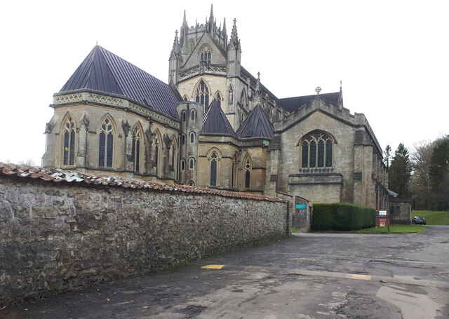
Downside Abbey

Downside Abbey is a Benedictine monastery in England and the senior community of the English Benedictine Congregation. Until 2019, the community had close...

Nearby Amenities

Located within 500m of 51.242971,-2.5074832
Post Box
Brand: Royal Mail
Brand Wikidata: Q638098
Mapillary: 273743531714340
Operator: Royal Mail
Operator Wikidata: Q638098
Post Box Mounting: stone_wall
Post Box Type: wall
Survey Date: 2023-10-22
Lat/Long: 51.2414893/-2.5011362
Benter
Is In: Somerset, England, UK
Place: hamlet
Lat/Long: 51.2395753/-2.5088665
Barrier: stile
Foot: yes
Lat/Long: 51.2407223/-2.5041639
Post Box
Operator: Royal Mail
Operator Wikidata: Q638098
Lat/Long: 51.2418553/-2.5129959
Traffic Sign: sharp_left_bend
Lat/Long: 51.2440508/-2.5069695
Roadsign: sharp_right_bend
Lat/Long: 51.2436565/-2.5067974
Upper Benter
Place: locality
Lat/Long: 51.2415541/-2.5114918
Give Way
Lat/Long: 51.2414153/-2.5009731
Give Way
Lat/Long: 51.2415243/-2.5011034
Power: pole
Lat/Long: 51.2471843/-2.5093165
Power: pole
Lat/Long: 51.246145/-2.508654
Power: pole
Lat/Long: 51.2451158/-2.508029
Power: pole
Lat/Long: 51.2439875/-2.5073048
Power: pole
Lat/Long: 51.2429985/-2.5073075
Power: pole
Lat/Long: 51.2423101/-2.5087425
Power: pole
Lat/Long: 51.2416166/-2.5101668
Power: pole
Lat/Long: 51.2392959/-2.5086004
Power: pole
Lat/Long: 51.2397124/-2.5095874
Power: pole
Lat/Long: 51.2401758/-2.5106013
Power: pole
Lat/Long: 51.2406678/-2.5116608
Power: pole
Lat/Long: 51.2411229/-2.5127068
Power: pole
Lat/Long: 51.2414016/-2.513651
Power: pole
Lat/Long: 51.2409197/-2.5116608
Power: pole
Lat/Long: 51.2404697/-2.5125808
Power: pole
Lat/Long: 51.2431798/-2.5048024
Power: pole
Lat/Long: 51.2433595/-2.5021631
Power: pole
Lat/Long: 51.2436685/-2.5005913
Barrier: stile
Lat/Long: 51.2390577/-2.5080099
The data included in this document is from www.openstreetmap.org. The data is made available under ODbL.

Have you been to College Wood?

Leave your review of College Wood below (or comments, questions and feedback).