Maypole

Settlement in Cornwall

England

Maypole

Church Point
Church Point Credit: David Lally

Maypole is a small village located in the county of Cornwall, situated in the southwestern part of England. The village lies approximately 5 miles south of the town of Penzance and is nestled in the picturesque countryside of the Penwith Peninsula. With a population of around 300 residents, Maypole exudes a tranquil and idyllic charm.

The village takes its name from the ancient tradition of erecting a maypole in the center of the village every May, symbolizing the arrival of spring and celebrating the changing seasons. This tradition continues to this day, attracting locals and visitors alike who gather to witness the festivities and partake in traditional dances and music.

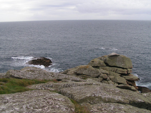
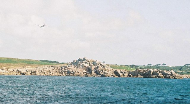
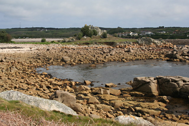
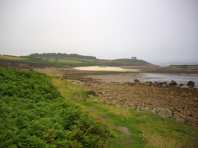
Maypole is surrounded by lush green fields and rolling hills, offering breathtaking views of the surrounding countryside. The area is renowned for its natural beauty, and many visitors come to explore the nearby coastal paths, sandy beaches, and rocky cliffs.

The village itself is characterized by its quaint cottages, many of which date back centuries, giving a glimpse into the rich history and heritage of the area. Maypole is also home to a charming village pub, where locals and tourists can enjoy traditional Cornish cuisine and locally brewed ales.

Overall, Maypole offers a peaceful retreat away from the hustle and bustle of larger towns and cities. With its stunning natural landscapes and rich cultural traditions, this small village is a hidden gem for those seeking a taste of rural Cornwall.

If you have any feedback on the listing, please let us know in the comments section below.
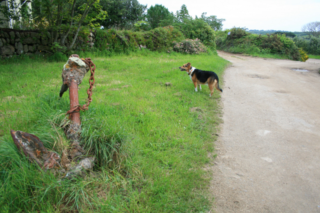
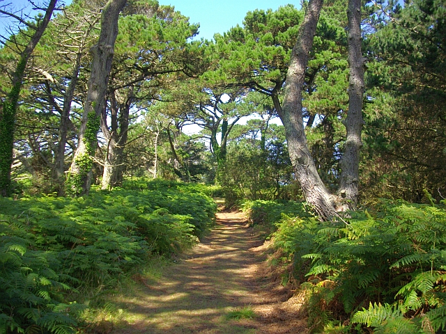
Maypole Images

Images are sourced within 2km of 49.926584/-6.294107 or Grid Reference SV9111. Thanks to Geograph Open Source API. All images are credited.

Church Point
Church Point
Pillbox entrance On Tolman Point.
Pillbox entrance
On Tolman Point.
Tolman Point Viewed from the north on the very edge of the square; note the WW2 pillbox.
Tolman Point
Viewed from the north on the very edge of the square; note the WW2 pillbox.
Church Point The end of Church Point (just below the end of the main runway of St Mary's Airport) looking out to sea; this (and a rock off the end of Giant's Castle) is the only land in the square.
Church Point
The end of Church Point (just below the end of the main runway of St Mary's Airport) looking out to sea; this (and a rock off the end of Giant's Castle) is the only land in the square.
St. Mary’s: plane over Church Point A plane approaches Scilly's airport, viewed from the ferry from Penzance.
St. Mary’s: plane over Church Point
A plane approaches Scilly's airport, viewed from the ferry from Penzance.
Carn Leh Cove The headland of Carn Leh separates this small cove from the larger Old Town Bay.
Carn Leh Cove
The headland of Carn Leh separates this small cove from the larger Old Town Bay.
Carn Leh A peninsular rock used once as a Battery for the protection of Old Town Bay.
Carn Leh
A peninsular rock used once as a Battery for the protection of Old Town Bay.
Carn Leh A rocky outcrop jutting out into Old Town Bay. It was once the site of a battery to protect the harbour.
Carn Leh
A rocky outcrop jutting out into Old Town Bay. It was once the site of a battery to protect the harbour.
Stone south of St Mary's Airport A loose stone on a rock outcrop. taken from the coastal path.
Stone south of St Mary's Airport
A loose stone on a rock outcrop. taken from the coastal path.
Pillbox on Tolman Point WWII remnant protecting Old Town, St Mary's.
Pillbox on Tolman Point
WWII remnant protecting Old Town, St Mary's.
Pillbox on Tolman Point
Pillbox entrance On Tolman Point.

On the hill behind the control tower of St Mary's airport can be seen
Pillbox entrance
On Tolman Point. On the hill behind the control tower of St Mary's airport can be seen
Church Point Immediately below the end of the runway of St Mary's Airport.
Church Point
Immediately below the end of the runway of St Mary's Airport.
The Peninnis Battery
Church Point, St Mary's There is a small area of land in this square, just south of the main runway at St Mary's Airport. The coast path passes through here, but there are lights and a hooter to warn walkers to keep clear if an aircraft is landing or taking off.
There is also a sign "Do not loiter". I confess that I loitered for about one minute, just enough to get from <a href="https://www.geograph.org.uk/gridref/SV9210">SV9210</a> to this square (SV9209) and take this photo. Afterwards I noticed that there was also a CCTV camera aimed at this spot on the coast path - but, a fortnight later, I have not heard any more about my possible transgression.
Church Point, St Mary's
There is a small area of land in this square, just south of the main runway at St Mary's Airport. The coast path passes through here, but there are lights and a hooter to warn walkers to keep clear if an aircraft is landing or taking off. There is also a sign "Do not loiter". I confess that I loitered for about one minute, just enough to get from SV9210 to this square (SV9209) and take this photo. Afterwards I noticed that there was also a CCTV camera aimed at this spot on the coast path - but, a fortnight later, I have not heard any more about my possible transgression.
Old pill box At Tolman Point
Old pill box
At Tolman Point
Mainmark rock Near Old Town, St. Mary's
Mainmark rock
Near Old Town, St. Mary's
Coastpath crosses the airfield Sirens sound when planes are on the runway
Coastpath crosses the airfield
Sirens sound when planes are on the runway
Show me another place!

Maypole is located at Grid Ref: SV9111 (Lat: 49.926584, Lng: -6.294107)

Division: Isles of Scilly

Unitary Authority: Isles of Scilly

Police Authority: Devon and Cornwall

What 3 Words

///reference.pitching.milk. Near St Mary's, Isles of Scilly

Related Wikis

Maypole, Isles of Scilly

Maypole (Cornish: Peul Kala' Me) is a dispersed settlement located on the island of St Mary's, the largest of the Isles of Scilly, England. It is a tourist...

Holy Vale

Holy Vale (Cornish: Hal an Val) is a minor valley and small settlement within, on the island of St Mary's, the largest of the Isles of Scilly, England...

St Mary's, Isles of Scilly

St Mary's (Cornish: Ennor, lit. 'The Mainland') is the largest and most populous island of the Isles of Scilly, an archipelago off the southwest coast...

Pelistry

Pelistry (Cornish: Porth Lystry "cove for ships") is a small settlement, situated east of Maypole and north of Normandy, in the east of the island of St...

Longstone, Isles of Scilly

Longstone is small settlement on the island of St Mary's, the largest of the Isles of Scilly, England. Nearby is Holy Vale and Rocky Hill. Longstone is...

Trenoweth, Isles of Scilly

Trenoweth (; Cornish: Trenoweth "new town") is a small settlement, located in the north of the island of St Mary's in the Isles of Scilly, Cornwall, England...

Telegraph, Isles of Scilly

Telegraph (Cornish: Brebellskrif) is a settlement on St Mary's, the largest of the Isles of Scilly, England. Telegraph is located in the north west of...

Watermill Cove

Watermill Cove is on the north–east coast of St Mary's, Isles of Scilly. It is a historic anchorage, still used today by passing yachts and other small...

Nearby Amenities

Located within 500m of 49.926584,-6.294107
Information: board
Tourism: information
Lat/Long: 49.9233301/-6.2922457
Post Box
Ref: TR21 17
Lat/Long: 49.9262013/-6.2931984
Barrier: stile
Lat/Long: 49.922464/-6.2933917
Holy Vale
Name Kw: Hal an Val
Place: hamlet
Source: Bus timetable and Holiday Cottage addresses
Wikidata: Q11710012
Wikipedia: en:Holy Vale
Lat/Long: 49.9243724/-6.2927806
Maypole
Name Kw: Peul Kala' Me
Place: hamlet
Wikidata: Q11771940
Wikipedia: en:Maypole, Isles of Scilly
Lat/Long: 49.9258174/-6.2915477
Borough
Place: isolated_dwelling
Lat/Long: 49.9279459/-6.2928829
Watermill
Place: isolated_dwelling
Lat/Long: 49.9291315/-6.2943444
Country Guesthouse
Addr Street: High Lane
Tourism: guest_house
Lat/Long: 49.9267073/-6.2985903
Newford
Place: isolated_dwelling
Lat/Long: 49.9286947/-6.2985595
Bench
Lat/Long: 49.9257556/-6.2920385
Silver Carn
Place: isolated_dwelling
Lat/Long: 49.925907/-6.2992468
Bench
Backrest: yes
Lat/Long: 49.9263073/-6.2933247
High Lanes
Place: isolated_dwelling
Lat/Long: 49.926463/-6.2974772
Waste Basket
Lat/Long: 49.9262745/-6.2932764
Bench
Backrest: yes
Lat/Long: 49.9263522/-6.2934105
Power: pole
Lat/Long: 49.9304121/-6.2906076
Power: pole
Transformer: distribution
Lat/Long: 49.927741/-6.292854
Power: pole
Transformer: distribution
Lat/Long: 49.9294099/-6.2905781
Power: pole
Lat/Long: 49.9288953/-6.2905647
Power: pole
Lat/Long: 49.9276538/-6.2917207
Power: pole
Lat/Long: 49.9280648/-6.2913385
Power: pole
Lat/Long: 49.9280579/-6.2911373
Power: pole
Lat/Long: 49.927558/-6.2892531
Power: pole
Lat/Long: 49.9271592/-6.2882647
Power: pole
Transformer: distribution
Lat/Long: 49.9269235/-6.2876666
Power: pole
Transformer: distribution
Lat/Long: 49.9245846/-6.3000329
Power: pole
Lat/Long: 49.9239491/-6.2997445
Power: pole
Lat/Long: 49.9264037/-6.2922196
Power: pole
Lat/Long: 49.9259453/-6.2913063
Power: pole
Lat/Long: 49.9254411/-6.2907162
Location Transition: yes
Power: pole
Lat/Long: 49.9252019/-6.2908061
Power: pole
Transformer: distribution
Lat/Long: 49.9226747/-6.2941039
Power: pole
Lat/Long: 49.9231651/-6.2949407
Power: pole
Lat/Long: 49.9236884/-6.2958285
Power: pole
Lat/Long: 49.9294461/-6.2990338
Power: pole
Lat/Long: 49.929131/-6.2989707
Power: pole
Transformer: distribution
Lat/Long: 49.9285621/-6.2987468
Power: pole
Lat/Long: 49.9282167/-6.2984155
Power: pole
Lat/Long: 49.927596/-6.2980065
Power: pole
Lat/Long: 49.9269735/-6.2975679
Power: pole
Transformer: distribution
Lat/Long: 49.9264797/-6.297415
Power: pole
Lat/Long: 49.9263666/-6.2958848
Power: pole
Lat/Long: 49.9261775/-6.2947328
Power: pole
Lat/Long: 49.9268354/-6.2924999
Power: pole
Lat/Long: 49.9264469/-6.292858
Power: pole
Transformer: distribution
Lat/Long: 49.9257959/-6.2935862
Power: pole
Lat/Long: 49.925353/-6.2941079
Power: pole
Lat/Long: 49.9247072/-6.294993
Power: pole
Lat/Long: 49.9243791/-6.2961638
Power: pole
Lat/Long: 49.9241011/-6.2970918
Power: pole
Lat/Long: 49.9237358/-6.2982626
Location Transition: yes
Power: pole
Transformer: distribution
Lat/Long: 49.9244784/-6.2909442
Power: pole
Lat/Long: 49.9229933/-6.2905553
The data included in this document is from www.openstreetmap.org. The data is made available under ODbL.

Have you been to Maypole?

Leave your review of Maypole below (or comments, questions and feedback).