St Mary's

Island in Cornwall

England

St Mary's

Church Point
Church Point Credit: David Lally

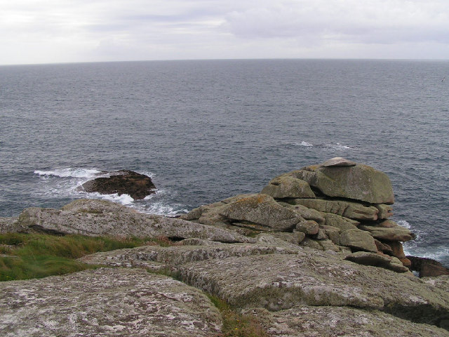
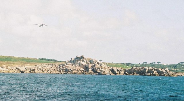
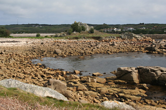
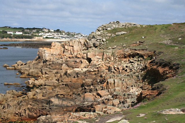
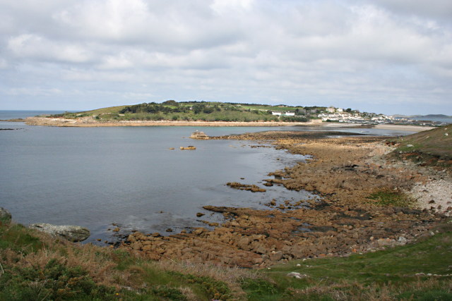
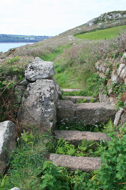
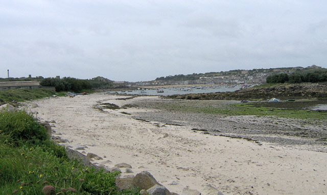
St Mary's is an island located in the Isles of Scilly archipelago, off the southwestern coast of Cornwall, England. It is the largest and most populous island among the Isles of Scilly, covering an area of about 6.5 square miles. The island is known for its stunning natural beauty, with pristine beaches, crystal-clear turquoise waters, and picturesque landscapes.

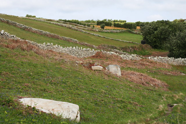
St Mary's has a rich history, dating back to prehistoric times, as evidenced by the presence of ancient burial chambers and standing stones. The island was also a significant trading hub during the Bronze Age and Iron Age. Today, remnants of its historical past can be seen in the form of numerous ancient sites, including the famous Bant's Carn burial chamber and the Old Town Church.

The island is home to the main administrative center of the Isles of Scilly and has a vibrant community. The town of Hugh Town, located on St Mary's, serves as the hub for commercial and social activities. It offers a range of amenities, including shops, restaurants, pubs, and accommodation options for tourists.

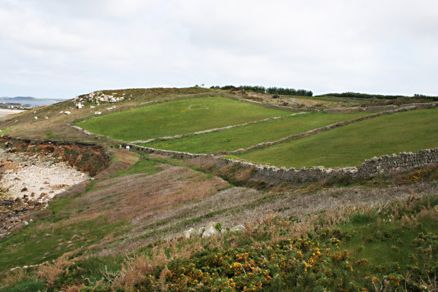
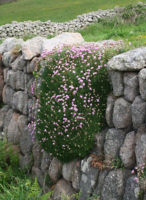
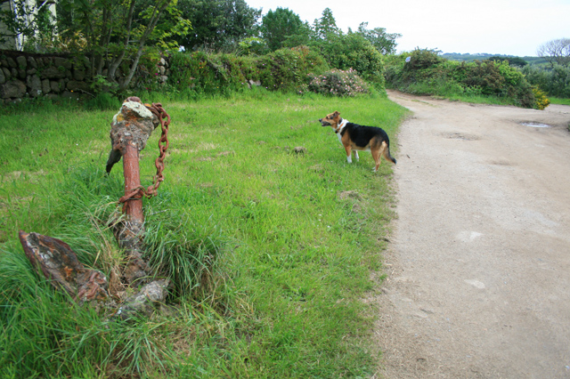
St Mary's is a haven for nature lovers and outdoor enthusiasts. The island boasts an array of wildlife, including seabirds, seals, and rare plant species. Visitors can explore the island's numerous nature reserves and coastal paths, providing opportunities for hiking, birdwatching, and photography.

Transportation to St Mary's is primarily by ferry or air. The island has its own airport with regular flights connecting it to the mainland. Once on the island, visitors can explore its attractions on foot, bicycle, or by using the local taxi service.

Overall, St Mary's is a charming and picturesque island, offering a unique blend of natural beauty, historical sites, and a welcoming community.

If you have any feedback on the listing, please let us know in the comments section below.

St Mary's Images

Images are sourced within 2km of 49.923278/-6.3024244 or Grid Reference SV9111. Thanks to Geograph Open Source API. All images are credited.

Church Point
Church Point
Pillbox entrance On Tolman Point.
Pillbox entrance
On Tolman Point.
Morning Point, the Garrison Looking SE to the offshore rocks Wras and (behind and smaller) Biggal; Inner Head <a href="https://www.geograph.org.uk/gridref/SV908093">SV908093</a> (part of Peninnis Head) is just visible to the far left, on the other side of Porth Cressa bay. Note the passing storm on the horizon...
Morning Point, the Garrison
Looking SE to the offshore rocks Wras and (behind and smaller) Biggal; Inner Head SV908093 (part of Peninnis Head) is just visible to the far left, on the other side of Porth Cressa bay. Note the passing storm on the horizon...
Old Town Bay from Peninnis There is a former Battery on the island to the right of the pine tree.
Old Town Bay from Peninnis
There is a former Battery on the island to the right of the pine tree.
Tolman Point Viewed from the north on the very edge of the square; note the WW2 pillbox.
Tolman Point
Viewed from the north on the very edge of the square; note the WW2 pillbox.
Church Point The end of Church Point (just below the end of the main runway of St Mary's Airport) looking out to sea; this (and a rock off the end of Giant's Castle) is the only land in the square.
Church Point
The end of Church Point (just below the end of the main runway of St Mary's Airport) looking out to sea; this (and a rock off the end of Giant's Castle) is the only land in the square.
St. Mary’s: plane over Church Point A plane approaches Scilly's airport, viewed from the ferry from Penzance.
St. Mary’s: plane over Church Point
A plane approaches Scilly's airport, viewed from the ferry from Penzance.
Carn Leh, St. Mary's, Scilly Isles
Footpath on Peninnis Head, St. Mary's, Scilly Isles
Granite Stone Walls Granite is pretty much the only rock there is on the Scillies and there's plenty of it, so it makes sense to build your field walls out of it.
Granite Stone Walls
Granite is pretty much the only rock there is on the Scillies and there's plenty of it, so it makes sense to build your field walls out of it.
Fields on the eastern side of Peninnis The field at the bottom of the hill on the right is being used for bulb growing, the others look as though they have been left to grass.
Fields on the eastern side of Peninnis
The field at the bottom of the hill on the right is being used for bulb growing, the others look as though they have been left to grass.
Carn Leh Cove The headland of Carn Leh separates this small cove from the larger Old Town Bay.
Carn Leh Cove
The headland of Carn Leh separates this small cove from the larger Old Town Bay.
The Foreshore North of Inner Head Lots of pink granite exposed on the foreshore at low tide.
The Foreshore North of Inner Head
Lots of pink granite exposed on the foreshore at low tide.
Across Porth Cressa from Stony Porth A lot of rock is exposed on the foreshore here at low tide. Over the bay is The Garrison.
Across Porth Cressa from Stony Porth
A lot of rock is exposed on the foreshore here at low tide. Over the bay is The Garrison.
Fields on the North Side of the Peninnis Peninsula Surrounded by granite stone walls, the grass in these fields is in marked contrast to the coastal heathland surrounding them.
Fields on the North Side of the Peninnis Peninsula
Surrounded by granite stone walls, the grass in these fields is in marked contrast to the coastal heathland surrounding them.
Thrift on a Stone Wall A large clump of thrift, aka Sea Pink, latin name Armeria maritima, is draped over this granite stone wall close to the coastline.
Thrift on a Stone Wall
A large clump of thrift, aka Sea Pink, latin name Armeria maritima, is draped over this granite stone wall close to the coastline.
Pulpit Rock, Peninnis One of the most famous of the many fantastic rock formations on Peninnis Head.

Easy to see how it got its name.
Pulpit Rock, Peninnis
One of the most famous of the many fantastic rock formations on Peninnis Head. Easy to see how it got its name.
Cornish Stile On the coastal path between Peninnis Head and Hugh Town.
Cornish Stile
On the coastal path between Peninnis Head and Hugh Town.
Show me another place!

St Mary's is located at Grid Ref: SV9111 (Lat: 49.923278, Lng: -6.3024244)

Division: Isles of Scilly

Unitary Authority: Isles of Scilly

Police Authority: Devon and Cornwall

What 3 Words

///strutted.skewed.snows. Near St Mary's, Isles of Scilly

Related Wikis

Rocky Hill, Isles of Scilly

Rocky Hill (Cornish: Breveynek) is a minor hill with a small settlement, on the island of St Mary's in the Isles of Scilly, England. Nearby are Porthloo...

Porthloo

Porthloo (sometimes spelled and often pronounced Porthlow; Cornish: Porth Logh "cove of the deep water inlet") is a coastal settlement on the island of...

St Mary's, Isles of Scilly

St Mary's (Cornish: Ennor, lit. 'The Mainland') is the largest and most populous island of the Isles of Scilly, an archipelago off the southwest coast...

Longstone, Isles of Scilly

Longstone is small settlement on the island of St Mary's, the largest of the Isles of Scilly, England. Nearby is Holy Vale and Rocky Hill. Longstone is...

St Mary's Lifeboat Station

St Mary's Lifeboat Station is situated in St Mary's Harbour, Isles of Scilly and has been an important station for the Royal National Lifeboat Institution...

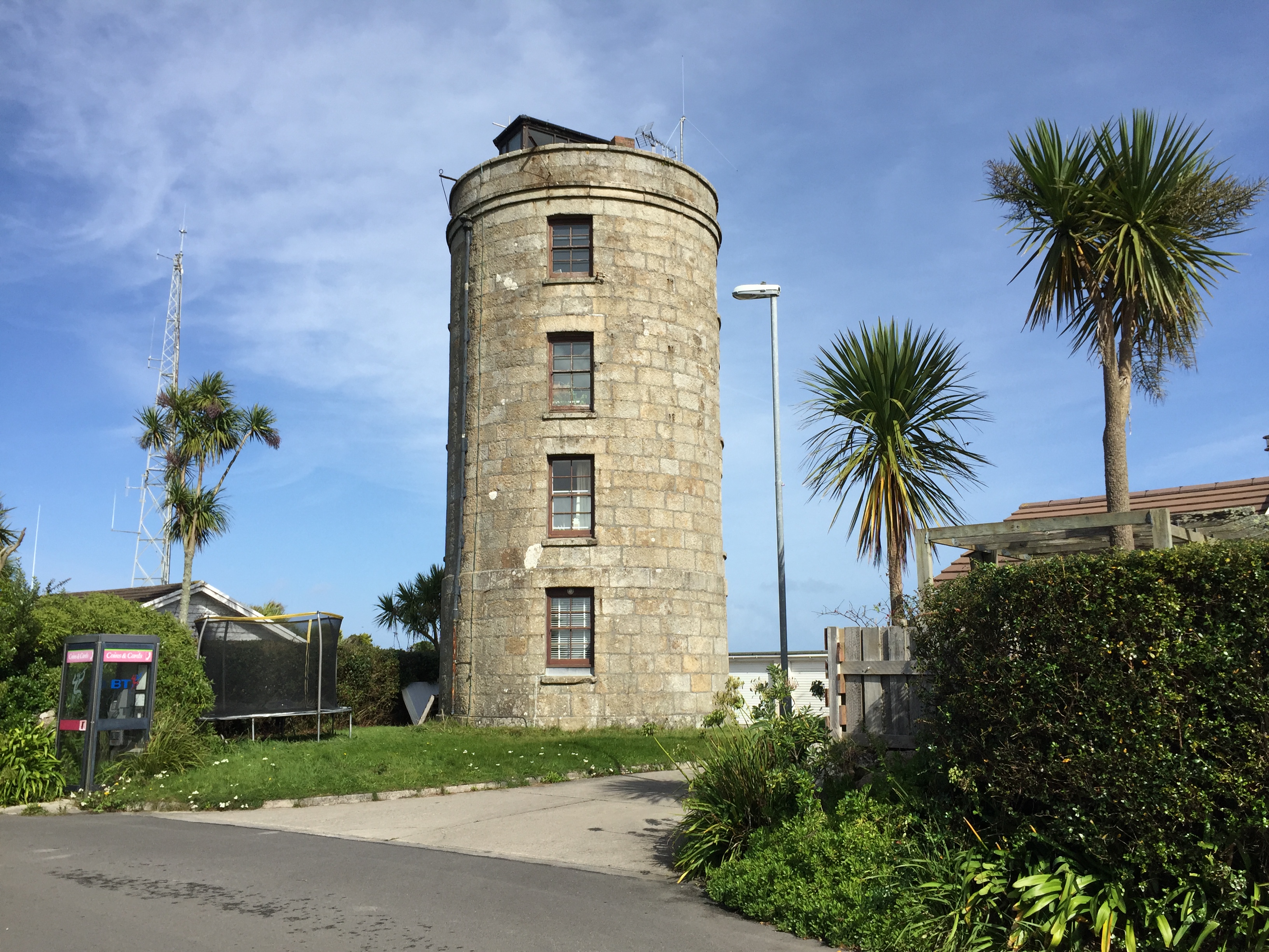
Coastguard's Lookout Tower

Coastguard’s Lookout Tower, now known as Telegraph Tower, is a Grade II listed structure built around 1814-16 on St Mary's, Isles of Scilly as a Signal...

Harry's Walls

Harry's Walls are the remains of an unfinished artillery fort, started in 1551 by the government of Edward VI to defend the island of St Mary's in the...

Telegraph, Isles of Scilly

Telegraph (Cornish: Brebellskrif) is a settlement on St Mary's, the largest of the Isles of Scilly, England. Telegraph is located in the north west of...

Nearby Amenities

Located within 500m of 49.923278,-6.3024244
Source: PGS
Lat/Long: 49.9219656/-6.3081028
Source: PGS
Lat/Long: 49.9235122/-6.308976
Tourism: picnic_site
Lat/Long: 49.9262691/-6.302872
Post Box
Operator: Royal Mail
Operator Wikidata: Q638098
Ref: TR21 180
Lat/Long: 49.9219979/-6.3077967
Porthloo
Alt Name: Porthlow
Place: hamlet
Wikidata: Q7231783
Wikipedia: en:Porthloo
Lat/Long: 49.9223244/-6.3075645
Four Lanes End
Place: isolated_dwelling
Lat/Long: 49.9211107/-6.2992304
Rocky Hill
Place: hamlet
Wikidata: Q7355801
Wikipedia: en:Rocky Hill, Isles of Scilly
Lat/Long: 49.9198512/-6.3022846
Country Guesthouse
Addr Street: High Lane
Tourism: guest_house
Lat/Long: 49.9267073/-6.2985903
Leisure: outdoor_seating
Operator: Juliet's Garden Restaurant & Bar
Lat/Long: 49.9242445/-6.3089448
Porthloo Boat Park
Leisure: marina
Operator: Duchy of Cornwall
Seamark Harbour Category: marina
Seamark Type: harbour
Lat/Long: 49.9213054/-6.3079439
Trewince
Place: isolated_dwelling
Lat/Long: 49.9222586/-6.302655
Porthloo Studios
Shop: gift
Lat/Long: 49.9207323/-6.3078199
Bench
Lat/Long: 49.9247576/-6.3011573
Silver Carn
Place: isolated_dwelling
Lat/Long: 49.925907/-6.2992468
Waste Basket
Lat/Long: 49.926152/-6.3028415
Bench
Lat/Long: 49.9203037/-6.2975588
Power: pole
Transformer: distribution
Lat/Long: 49.9245846/-6.3000329
Power: pole
Lat/Long: 49.9239491/-6.2997445
Power: pole
Lat/Long: 49.9236884/-6.2958285
Power: pole
Lat/Long: 49.9243791/-6.2961638
Power: pole
Lat/Long: 49.9241011/-6.2970918
Power: pole
Lat/Long: 49.9237358/-6.2982626
Power: pole
Lat/Long: 49.9234293/-6.2992014
Power: pole
Lat/Long: 49.9230179/-6.3003047
Power: pole
Transformer: distribution
Lat/Long: 49.9248678/-6.3076839
Power: pole
Lat/Long: 49.9252477/-6.3064528
Power: pole
Lat/Long: 49.9255308/-6.3056079
Power: pole
Lat/Long: 49.9256574/-6.3043253
Power: pole
Transformer: distribution
Lat/Long: 49.9275692/-6.3041326
Power: pole
Lat/Long: 49.9264434/-6.3039462
Power: pole
Lat/Long: 49.9258667/-6.303509
Power: pole
Lat/Long: 49.9251855/-6.3026963
Power: pole
Lat/Long: 49.9245272/-6.3019904
Power: pole
Transformer: distribution
Lat/Long: 49.9205955/-6.3071957
Power: pole
Transformer: distribution
Lat/Long: 49.9212241/-6.3048086
Power: pole
Lat/Long: 49.9208239/-6.3020414
Power: pole
Lat/Long: 49.9238075/-6.3015068
Power: pole
Lat/Long: 49.9232998/-6.3012198
Power: pole
Lat/Long: 49.9226639/-6.3012568
Power: pole
Lat/Long: 49.9213152/-6.3011644
Power: pole
Transformer: distribution
Lat/Long: 49.9207876/-6.3011603
Power: pole
Lat/Long: 49.9194362/-6.2997428
Golf: pin
Lat/Long: 49.9264764/-6.3048714
Golf: pin
Lat/Long: 49.9261533/-6.3040122
The data included in this document is from www.openstreetmap.org. The data is made available under ODbL.

Have you been to St Mary's?

Leave your review of St Mary's below (or comments, questions and feedback).