The Leys

Settlement in Herefordshire

England

The Leys

St Andrew's Church, Pixley Much of the church building is thought to date from the thirteenth century. It is built of local red sandstone on a mound which until fairly recently was surrounded by a moat. The church was extensively restored in 1865. Additional repairs were carried out in the 1980s and again in 2005 when the roof and Victorian turret were renovated.
St Andrew's Church, Pixley Credit: Eirian Evans

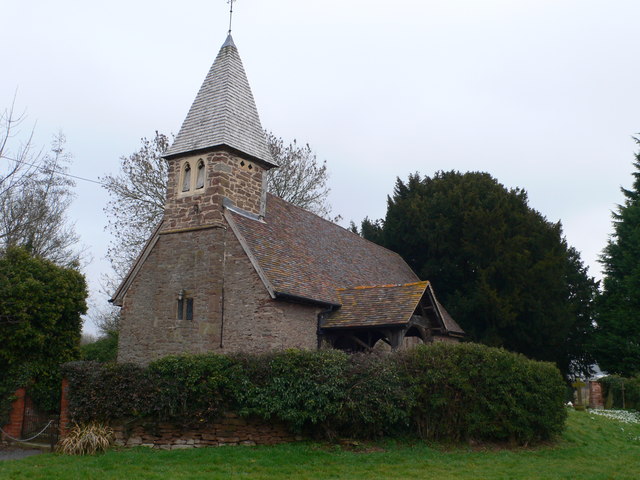
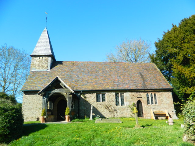
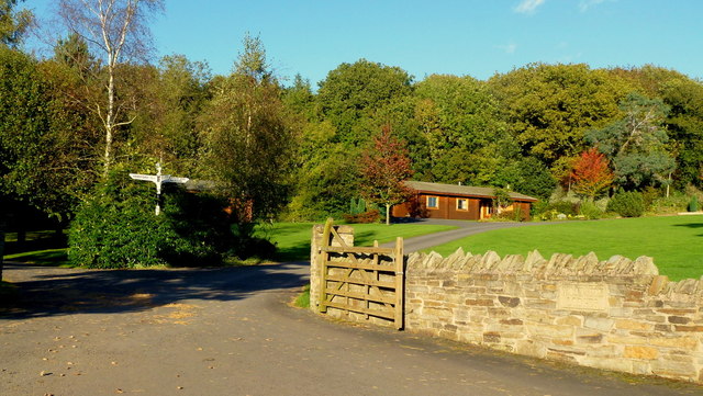
The Leys is a small village located in the county of Herefordshire, England. Situated approximately 6 miles north of the market town of Hereford, The Leys is nestled within the picturesque countryside of the county.

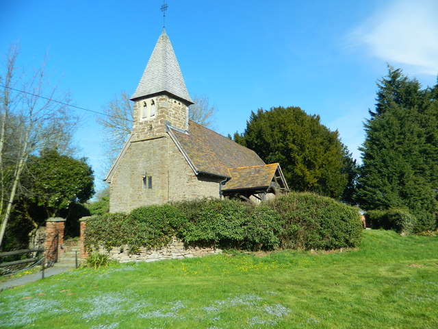
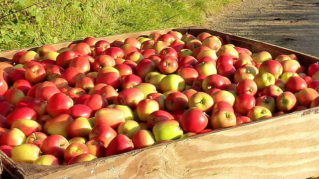
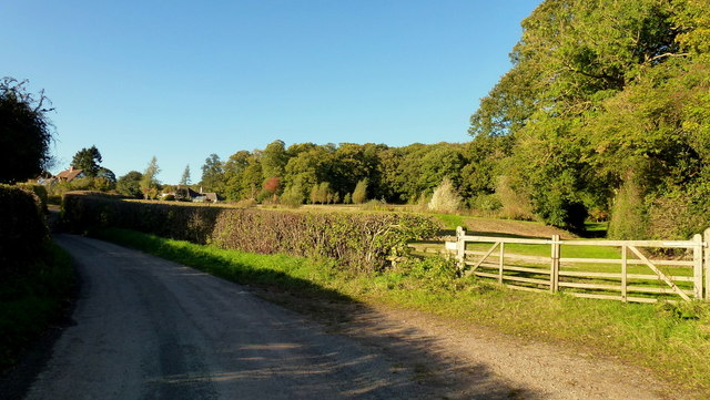
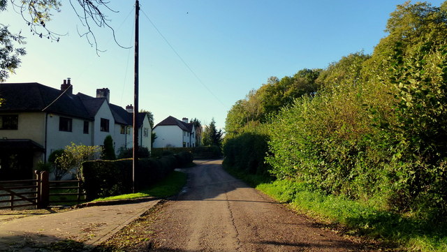
The village is known for its tranquil and rural atmosphere, offering residents and visitors a peaceful retreat from the bustling city life. The Leys is characterized by its charming cottages, rolling hills, and lush green fields that surround the area. The village is also home to a number of small farms, adding to its rustic charm.

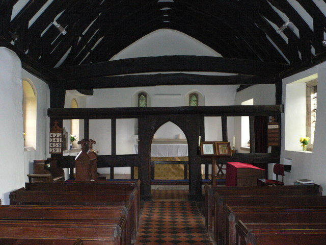
Despite its small size, The Leys has a strong sense of community, with residents often participating in various social events and activities. The village has a local pub, which serves as a popular gathering spot for locals and visitors alike. Additionally, there is a village hall that hosts a range of events, including community meetings and celebrations.

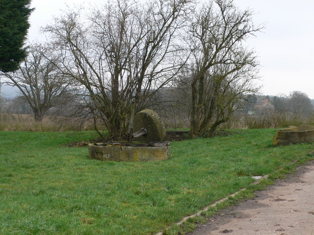
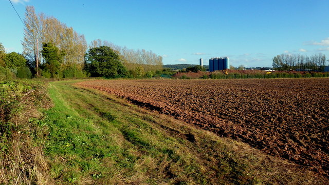
For those seeking outdoor recreation, The Leys is surrounded by beautiful countryside, offering ample opportunities for hiking, cycling, and horseback riding. The village is also conveniently located near the River Wye, providing access to fishing and boating activities.

Overall, The Leys offers a peaceful and idyllic setting, perfect for those looking to escape the hustle and bustle of city life and immerse themselves in the beauty of the Herefordshire countryside.

If you have any feedback on the listing, please let us know in the comments section below.
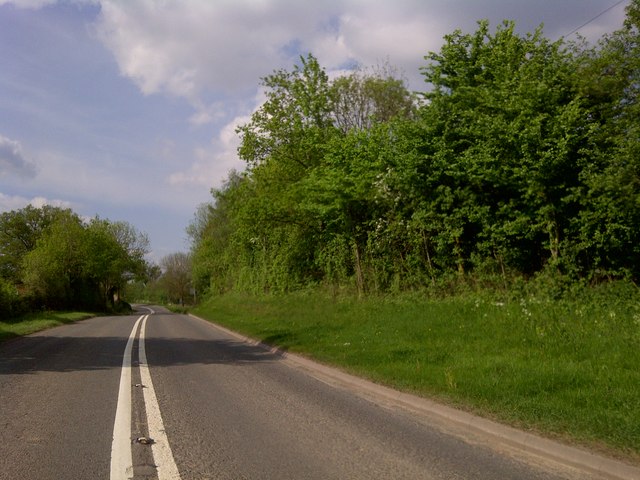
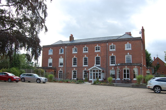
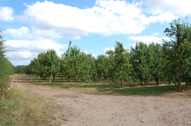
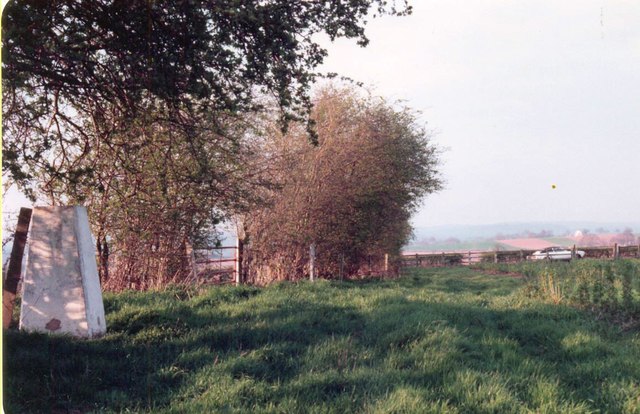
The Leys Images

Images are sourced within 2km of 52.046253/-2.4714216 or Grid Reference SO6738. Thanks to Geograph Open Source API. All images are credited.

St Andrew's Church, Pixley Much of the church building is thought to date from the thirteenth century. It is built of local red sandstone on a mound which until fairly recently was surrounded by a moat. The church was extensively restored in 1865. Additional repairs were carried out in the 1980s and again in 2005 when the roof and Victorian turret were renovated.
St Andrew's Church, Pixley
Much of the church building is thought to date from the thirteenth century. It is built of local red sandstone on a mound which until fairly recently was surrounded by a moat. The church was extensively restored in 1865. Additional repairs were carried out in the 1980s and again in 2005 when the roof and Victorian turret were renovated.
Relics of a cider mill An old millstone from the cider mill which used to be at Pixley Court Farm.
Relics of a cider mill
An old millstone from the cider mill which used to be at Pixley Court Farm.
Benchmark on Pixley Church Flush bracket S9688 on the western face of St Andrew's Church.
Benchmark on Pixley Church
Flush bracket S9688 on the western face of St Andrew's Church.
Inside St Andrew's Church, Pixley The little white-washed nave is divided from the white-washed chancel by a screen, its entrance arch (only six feet high) made of naturally curved timbers from some great tree. The screen has three bays and the cross-beam has a patch of neat carving; So have the roof beams which match these venerable timbers. There are no iron nails in the screen, which is fastened together with pegs.
Inside St Andrew's Church, Pixley
The little white-washed nave is divided from the white-washed chancel by a screen, its entrance arch (only six feet high) made of naturally curved timbers from some great tree. The screen has three bays and the cross-beam has a patch of neat carving; So have the roof beams which match these venerable timbers. There are no iron nails in the screen, which is fastened together with pegs.
A4172 at Pixley
A4172 at Pixley
Verzon House Hotel Boutique Hotel and Restaurant
Verzon House Hotel
Boutique Hotel and Restaurant
Orchard, near The Verzons Apple Orchard
Orchard, near The Verzons
Apple Orchard
Trig  point near A438 at Trumpet Triangulation pillar with Ordnance Survey flush bracket benchmark with serial number S7045 described in detail at <span class="nowrap"><a title="http://trigpointinguk.com/trigs/trig-details.php?t=4616" rel="nofollow ugc noopener" href="http://trigpointinguk.com/trigs/trig-details.php?t=4616">Link</a><img style="margin-left:2px;" alt="External link" title="External link - shift click to open in new window" src="https://s1.geograph.org.uk/img/external.png" width="10" height="10"/></span>
Trig point near A438 at Trumpet
Triangulation pillar with Ordnance Survey flush bracket benchmark with serial number S7045 described in detail at LinkExternal link
St Andrew's Church, Pixley
Entrance to Woodside Lodges, Falcon Lane Luxury scandinavian log cabins
Entrance to Woodside Lodges, Falcon Lane
Luxury scandinavian log cabins
Falcon Lane
Falcon Lane
Open fields west of the UBL factory Arable land to the west of Ladbury.
UBL process fruit as well as can and bottle beverages.
Open fields west of the UBL factory
Arable land to the west of Ladbury. UBL process fruit as well as can and bottle beverages.
Apple harvest Taking picked fruit from orchard to Flights Farm just a few yards away.
The variety is Jazz and is being marketed to Marks & Spencers, apparently.
Apple harvest
Taking picked fruit from orchard to Flights Farm just a few yards away. The variety is Jazz and is being marketed to Marks & Spencers, apparently.
Freshly picked The variety is Jazz, grown at Flights Farm, see <a href="https://www.geograph.org.uk/photo/3181133">SO6837 : Apple harvest</a>.
Freshly picked
The variety is Jazz, grown at Flights Farm, see SO6837 : Apple harvest.
Woodside Lodges Holiday park between Falcon Lane and Wood near Ledbury.
Woodside Lodges
Holiday park between Falcon Lane and Wood near Ledbury.
Falcon Lane Falcon Lane Wood over to the right.
Falcon Lane
Falcon Lane Wood over to the right.
Farmworker's cottages on Falcon Lane Facing Falcon Lane Wood.
Farmworker's cottages on Falcon Lane
Facing Falcon Lane Wood.
Show me another place!

The Leys is located at Grid Ref: SO6738 (Lat: 52.046253, Lng: -2.4714216)

Unitary Authority: County of Herefordshire

Police Authority: West Merica

What 3 Words

///vibrate.preparing.rehearsed. Near Ledbury, Herefordshire

Related Wikis

Pixley, Herefordshire

Pixley is a village and civil parish in Herefordshire, England. The population of the civil parish at the 2011 census was 258. The village consists of...

Aylton

Aylton is a village in eastern Herefordshire, England. It is 5.5 km (3.4 mi) west of Ledbury. The population of this parish at the 2011 Census was 144...

Trumpet, Herefordshire

Trumpet or The Trumpet is a village in Herefordshire, England. The village is named after the timber-framed Trumpet Inn. The inn is located at a major...

Munsley

Munsley is a village and civil parish 9 miles (14 km) east of Hereford, in the county of Herefordshire, England. In 2001 the parish had a population of...

Nearby Amenities

Located within 500m of 52.046253,-2.4714216
Bus Stop
Falcon Lane
Alt Name: Waller's Green
Naptan AltCommonName: Waller's Green
Naptan AltStreet: Not Specified
Naptan AtcoCode: 2090A20202
Naptan Bearing: NW
Naptan CommonName: Falcon Lane
Naptan Indicator: adj
Naptan Landmark: Falcon Lane
Naptan NaptanCode: herapatm
Naptan Street: A438
Shelter: yes
Source: naptan_import;survey
Lat/Long: 52.049571/-2.4749976
Bus Stop
Falcon Lane
Alt Name: Waller's Green
Naptan AltCommonName: Waller's Green
Naptan AltStreet: Not Specified
Naptan AtcoCode: 2090A20204
Naptan Bearing: SE
Naptan BusStopType: CUS
Naptan CommonName: Falcon Lane
Naptan Indicator: opp
Naptan Landmark: Falcon Lane
Naptan NaptanCode: herapatp
Naptan Street: A438
Shelter: no
Source: naptan_import;survey
Lat/Long: 52.049665/-2.4749172
Post Box
Collection Times: Mo-Fr 09:00; Sa 07:00
Description: In layby (NW-bound),
By abandoned phone box.
I think this is the Waller's Green box. update 09.01.2024 It is indeed Wallers Green.
Operator: Royal Mail
Operator Wikidata: Q638098
Post Box Mounting: pier
Post Box Type: lamp
Ref: HR8 329
Royal Cypher: EIIR
Royal Cypher Wikidata: Q33102113
Source: survey+gps
Source Date: 2015-04-09
Lat/Long: 52.0494876/-2.4746231
Power: pole
Lat/Long: 52.0478273/-2.470637
Power: pole
Lat/Long: 52.0479426/-2.4729542
Power: pole
Lat/Long: 52.0478861/-2.472007
Power: pole
Lat/Long: 52.0465191/-2.4779332
Power: pole
Lat/Long: 52.047799/-2.4658762
Power: pole
Lat/Long: 52.0478627/-2.4649035
Power: pole
Lat/Long: 52.0477097/-2.469016
Power: pole
Lat/Long: 52.0476455/-2.4678287
Power: pole
Lat/Long: 52.047489/-2.4766017
Power: pole
Lat/Long: 52.0438673/-2.4728423
Power: pole
Lat/Long: 52.0479947/-2.4740203
Power: pole
Lat/Long: 52.042512/-2.471848
Power: pole
Lat/Long: 52.0486416/-2.475281
Location Transition: yes
Power: pole
Lat/Long: 52.046094/-2.473861
Power: pole
Lat/Long: 52.0451928/-2.4738357
Telephone
Booth: K6
Covered: booth
Note: telephone may have been removed
Lat/Long: 52.0494579/-2.4745023
Power: pole
Lat/Long: 52.0483043/-2.4731271
Power: pole
Lat/Long: 52.0485048/-2.4743935
Power: pole
Lat/Long: 52.04827/-2.4711451
Power: pole
Lat/Long: 52.0482375/-2.4704296
Power: pole
Lat/Long: 52.0481925/-2.4692364
Power: pole
Lat/Long: 52.0481437/-2.46822
Power: pole
Lat/Long: 52.0483887/-2.4672158
Power: pole
Lat/Long: 52.0487675/-2.4656933
Power: pole
Lat/Long: 52.048599/-2.4663708
Power: pole
Lat/Long: 52.0488569/-2.4666349
Power: pole
Lat/Long: 52.0489149/-2.477139
Power: pole
Lat/Long: 52.0478368/-2.4748402
Wallers Green West
Power: pole
Transformer: distribution
Voltage Primary: 11000
Lat/Long: 52.0492048/-2.4744102
Location Transition: yes
Power: pole
Lat/Long: 52.047241/-2.4716261
Power: pole
Lat/Long: 52.0464322/-2.4718568
The Leys
Power: pole
Transformer: distribution
Voltage Primary: 11000
Lat/Long: 52.0458227/-2.4722081
Lakeside Park
Power: pole
Transformer: distribution
Voltage Primary: 11000
Lat/Long: 52.04524/-2.4725374
Power: pole
Lat/Long: 52.0447038/-2.4720781
Power: pole
Lat/Long: 52.0440955/-2.4715664
Power: pole
Lat/Long: 52.0434946/-2.4710722
Baregains Farm
Power: pole
Transformer: distribution
Voltage Primary: 11000
Lat/Long: 52.0428355/-2.4705184
Wallers Green
Power: pole
Transformer: distribution
Voltage Primary: 11000
Lat/Long: 52.0484056/-2.4702749
The data included in this document is from www.openstreetmap.org. The data is made available under ODbL.

Have you been to The Leys?

Leave your review of The Leys below (or comments, questions and feedback).