Maybush

Settlement in Hampshire

England

Maybush

Southampton : Millbrook Road West A33 Heading along Millbrook Road West.
Southampton : Millbrook Road West A33 Credit: Lewis Clarke

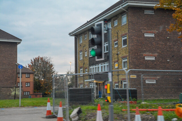
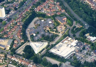
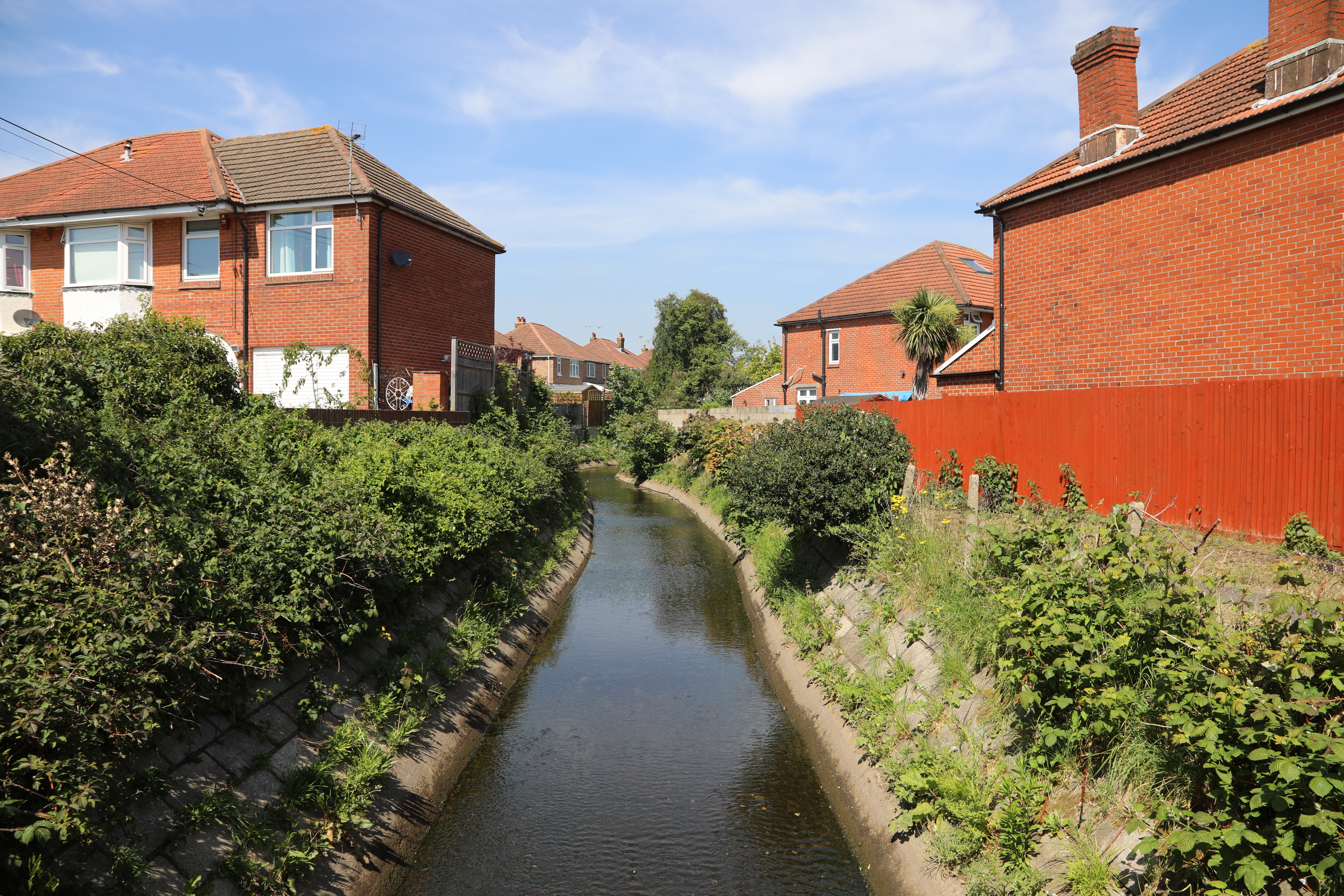
Maybush is a small suburban village located in the county of Hampshire, England. Situated on the outskirts of the city of Southampton, it forms part of the wider Southampton urban area. The village is mainly residential, consisting of a mix of housing types ranging from detached houses to small terraced homes.

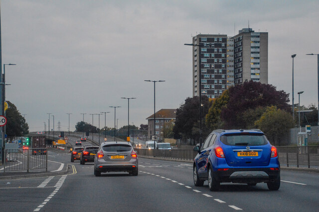
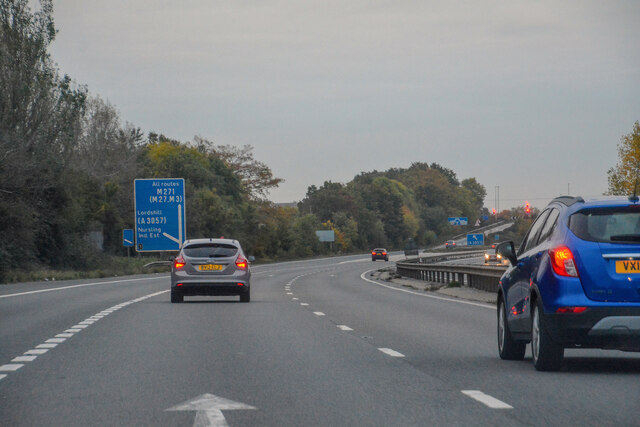
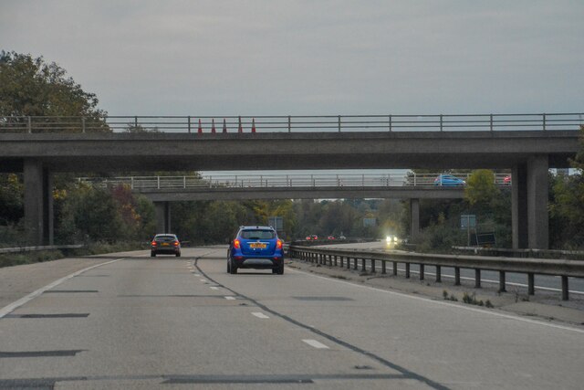
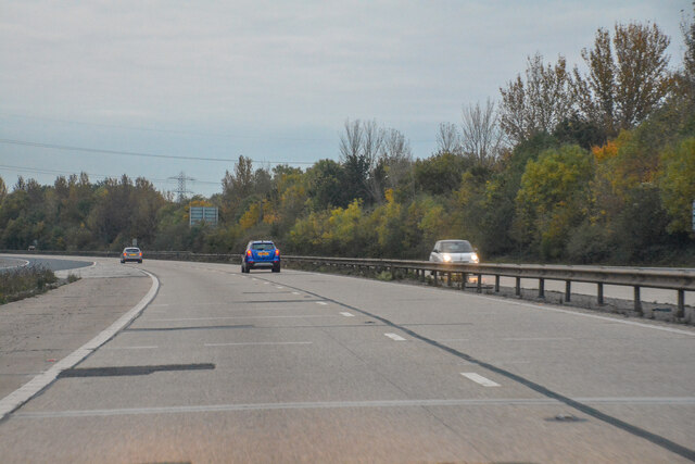
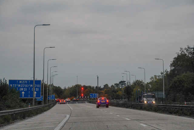
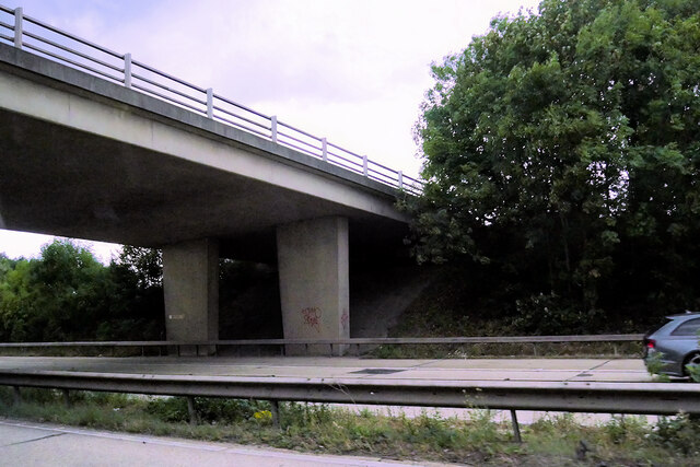
Maybush benefits from its close proximity to major transportation routes. The M27 motorway runs just to the north of the village, providing easy access to Southampton, Portsmouth, and other areas along the south coast. The nearby A35 road connects Maybush to the New Forest National Park, offering residents the opportunity to enjoy the picturesque scenery and outdoor activities the area has to offer.

Within Maybush, there are a few local amenities, including a small shopping center with a supermarket, a post office, and a few local shops. The village also has a primary school and a community center, providing educational and recreational opportunities for residents.

For those seeking green spaces, Maybush is surrounded by several parks and open areas, such as Hinkler Green and Millbrook Park. These provide residents with places to relax, exercise, and enjoy the outdoors.

Overall, Maybush offers a quiet and convenient location for residents, with easy access to major transportation links, nearby natural attractions, and a range of local amenities.

If you have any feedback on the listing, please let us know in the comments section below.

Maybush Images

Images are sourced within 2km of 50.930949/-1.453537 or Grid Reference SU3814. Thanks to Geograph Open Source API. All images are credited.

Southampton : Millbrook Road West A33 Heading along Millbrook Road West.
Southampton : Millbrook Road West A33
Heading along Millbrook Road West.
Southampton : Lok 'n Store Self Storage A self storage business seen from Millbrook Road West.
Southampton : Lok 'n Store Self Storage
A self storage business seen from Millbrook Road West.
Southampton : Millbrook Flyover A33 Looking along the A33.
Southampton : Millbrook Flyover A33
Looking along the A33.
Southampton : Redbridge Road A33 Looking along Redbridge Road.
Southampton : Redbridge Road A33
Looking along Redbridge Road.
Southampton : Redbridge Flyover A33 Looking along the A33.
Southampton : Redbridge Flyover A33
Looking along the A33.
Southampton : Redbridge Looking towards apartments in Redbridge.
Southampton : Redbridge
Looking towards apartments in Redbridge.
Totton : M271 Motorway Looking north along the M271.
Totton : M271 Motorway
Looking north along the M271.
Nursling : M271 Motorway Looking along the M271 motorway.
Nursling : M271 Motorway
Looking along the M271 motorway.
Nursling : M271 Motorway Looking along the M271 motorway.
Nursling : M271 Motorway
Looking along the M271 motorway.
Nursling : M271 Motorway Looking along the M271 motorway.
Nursling : M271 Motorway
Looking along the M271 motorway.
New General Intensive Care Unit, University Hospital Southampton Opened in September 2020, this has been substantially completed during the Covid-19 pandemic: compare <a href="https://www.geograph.org.uk/photo/6472981">SU3915 : Near-empty hospital car park</a>.
New General Intensive Care Unit, University Hospital Southampton
Opened in September 2020, this has been substantially completed during the Covid-19 pandemic: compare SU3915 : Near-empty hospital car park.
New extension, Southampton General Hospital Seen on a Sunday morning, with that rarest of commodities in the foreground: hospital parking spaces!
New extension, Southampton General Hospital
Seen on a Sunday morning, with that rarest of commodities in the foreground: hospital parking spaces!
Bridleway from Rownhams to Lordswood
M271 Motorway, Bridge at Nursling Interchange At just 3 miles in length, the M271 is one of the shortest motorways in the country. It opened in 1975 and provides part of the route to Southampton Docks from the M27.
M271 Motorway, Bridge at Nursling Interchange
At just 3 miles in length, the M271 is one of the shortest motorways in the country. It opened in 1975 and provides part of the route to Southampton Docks from the M27.
Businesses on Shirley High Street
Shirley High Street (A3057)
The Shirley Hotel On Shirley High Street.
See <a href="https://www.geograph.org.uk/photo/7302356">SU3913 : Sign for the Shirley Hotel</a> for sign.
The Shirley Hotel
On Shirley High Street. See SU3913 : Sign for the Shirley Hotel for sign.
Sign for the Shirley Hotel See <a href="https://www.geograph.org.uk/photo/7302355">SU3913 : The Shirley Hotel</a> for context.
Sign for the Shirley Hotel
See SU3913 : The Shirley Hotel for context.
Show me another place!

Maybush is located at Grid Ref: SU3814 (Lat: 50.930949, Lng: -1.453537)

Unitary Authority: Southampton

Police Authority: Hampshire

What 3 Words

///dare.tiger.slug. Near Totton, Hampshire

Related Wikis

Maybush

Maybush is a district in the city of Southampton, England. Located in the western side of the city, Maybush is the former location of the Ordnance Survey...

Millbrook Community School

Millbrook Community School was a secondary school in Southampton, England. The school was situated close to the west border of the city - formerly Millbrook...

Western Community Hospital

The Western Community Hospital is a health facility in William Macleod Way in the Shirley / Millbrook area of Southampton, Hampshire, England. It is managed...

Coxford, Southampton

Coxford is an Electoral Ward in the Unitary Authority of Southampton, England. It had a population of 14,232 at the 2001 census. == References ==

Solent University F.C.

Solent University Football Club was a football club attached to Solent University, based in Southampton, Hampshire. The club was affiliated to the Hampshire...

Millbrook F.C.

Millbrook Football Club is a football club based in Southampton, England. They are currently members of the Wessex League Division One and play at Test...

Oasis Academy Lord's Hill

Oasis Academy Lord's Hill is an Academy situated in the city of Southampton, Hampshire and specialises in Arts. Oasis Academy Lord's Hill replaced Millbrook...

Tanner's Brook

Tanner's Brook is a 7-kilometre (4.3 mi) river that rises in North Baddesley and flows to Southampton Water. The brook's name comes from a 19th-century...

Nearby Amenities

Located within 500m of 50.930949,-1.453537
Crossing
Crossing: traffic_signals
Kerb: lowered
Tactile Paving: yes
Lat/Long: 50.9306316/-1.448043
Traffic Signals
Traffic Signals: signal
Traffic Signals Direction: forward
Lat/Long: 50.9306005/-1.4480797
Mini Roundabout
Direction: clockwise
Lat/Long: 50.9305142/-1.4596626
Mini Roundabout
Direction: clockwise
Lat/Long: 50.9269547/-1.451705
Mini Roundabout
Direction: clockwise
Lat/Long: 50.9269805/-1.452015
Bus Stop
Maybush Corner
Bench: yes
Bus: yes
Covered: yes
Local Ref: Maybush Corner
Name En: Maybush Corner
Naptan AtcoCode: 1980SN120194
Naptan Bearing: N
Naptan NaptanCode: sohagpg
Public Transport: platform
Shelter: yes
Lat/Long: 50.9313573/-1.4478897
Bus Stop
Maybush Corner
Bench: yes
Bin: yes
Bus: yes
Covered: yes
Naptan AtcoCode: 1980SN120196
Naptan Bearing: SE
Naptan NaptanCode: sohagpt
Public Transport: platform
Shelter: yes
Lat/Long: 50.9305633/-1.4475768
The Food Barn
Shop: convenience
Lat/Long: 50.930582/-1.4590041
Post Box
Collection Plate: CP1D
Collection Times: Mo-Fr 09:00; Sa 07:00
Operator: Royal Mail
Operator Wikidata: Q638098
Post Box Type: pillar
Ref: SO16 582D
Royal Cypher: EIIR
Royal Cypher Wikidata: Q33102113
Lat/Long: 50.9304971/-1.4592759
Post Box
Brand: Royal Mail
Brand Wikidata: Q638098
Brand Wikipedia: en:Royal Mail
Collection Times: Mo-Fr 18:30; Sa 11:00
Operator: Royal Mail
Operator Wikidata: Q638098
Ref: SO16 72
Lat/Long: 50.9314372/-1.4483431
Traffic Signals
Traffic Signals: pedestrian_crossing
Traffic Signals Direction: backward
Lat/Long: 50.9347061/-1.451525
Bus Stop
Millbrook Towers
Bus: yes
Naptan AtcoCode: 1980SN120183
Naptan Bearing: NW
Naptan NaptanCode: sohadjw
Public Transport: platform
Lat/Long: 50.9302573/-1.4591558
Fast Food
Roberto's Pizza
Cuisine: italian
Lat/Long: 50.9304755/-1.4588401
Thompson News
Shop: newsagent
Lat/Long: 50.9304003/-1.4587177
Pharmacy
NHS Pharmacy
Healthcare: pharmacy
Lat/Long: 50.9305009/-1.4588844
Bus Stop
Ullswater Road
Bus: yes
Naptan AtcoCode: 1980SN120185
Naptan Bearing: SE
Naptan NaptanCode: sohadtg
Public Transport: platform
Source: Bing
Lat/Long: 50.9285348/-1.4559546
Bus Stop
Ullswater Road
Bus: yes
Naptan AtcoCode: 1980SN120184
Naptan Bearing: NW
Naptan NaptanCode: sohadtd
Public Transport: platform
Source: Bing
Lat/Long: 50.9287597/-1.4564723
Bus Stop
Borrowdale Road
Bus: yes
Naptan AtcoCode: 1980SN120186
Naptan Bearing: SE
Naptan NaptanCode: sohadwt
Public Transport: platform
Source: Bing
Lat/Long: 50.9276773/-1.453941
Bus Stop
Borrowdale Road
Bus: yes
Naptan AtcoCode: 1980SN120187
Naptan Bearing: NW
Naptan NaptanCode: sohadwm
Public Transport: platform
Source: Bing
Lat/Long: 50.9275996/-1.4539436
Bus Stop
Millbrook Towers
Bus: yes
Naptan AtcoCode: 1980SN120182
Naptan Bearing: SE
Naptan NaptanCode: sohadma
Public Transport: platform
Source: Bing
Lat/Long: 50.9301168/-1.4585007
Bus Stop
Crabwood Road
Bus: yes
Naptan AtcoCode: 1980SN120007
Naptan Bearing: SW
Naptan NaptanCode: sohagdj
Public Transport: platform
Lat/Long: 50.9282204/-1.450432
Bus Stop
Maybush Road
Bench: no
Bus: yes
Covered: no
Naptan AtcoCode: 1980SN120188
Naptan Bearing: SW
Naptan NaptanCode: sohagmt
Public Transport: platform
Shelter: no
Lat/Long: 50.9297901/-1.448824
Bus Stop
Timsbury Drive
Bus: yes
Naptan Bearing: NE
Public Transport: platform
Lat/Long: 50.9287487/-1.449976
Mini Roundabout
Direction: clockwise
Lat/Long: 50.9318025/-1.4493038
Barrier: lift_gate
Lat/Long: 50.9318653/-1.4494381
Bus Stop
Pickles Copse
Bus: yes
Public Transport: platform
Lat/Long: 50.9265923/-1.4523751
Bus Stop
Green Lane
Bench: yes
Bus: yes
Naptan Bearing: SE
Public Transport: platform
Shelter: yes
Lat/Long: 50.9342816/-1.4509932
Bus Stop
Maybush Corner
Bench: yes
Bin: yes
Bus: yes
Covered: yes
Naptan AtcoCode: 1980SN121045
Naptan Bearing: NW
Naptan NaptanCode: sohagmp
Public Transport: platform
Shelter: yes
Tactile Paving: no
Lat/Long: 50.9315193/-1.4487044
Bus Stop
Green Lane
Bus: yes
Naptan Bearing: NW
Public Transport: platform
Lat/Long: 50.9348628/-1.4517192
Bicycle Parking
Bicycle Parking: stands
Capacity: 2
Covered: no
Lat/Long: 50.9312906/-1.4481705
Telephone
Addr City: Southampton
Addr Street: Wimpson Lane
Booth: KX100
Covered: booth
Mapillary: 2980297332258614
Operator: BT
Operator Wikidata: Q593786
Payment Coins: yes
Phone: +44 2380 775357
Survey Date: 2020-09-26
Lat/Long: 50.9280231/-1.4507799
Post Box
Brand: Royal Mail
Brand Wikidata: Q638098
Brand Wikipedia: en:Royal Mail
Collection Plate: CP1D
Collection Times: Mo-Fr 09:00; Sa 07:00
Operator: Royal Mail
Operator Wikidata: Q638098
Post Box Type: pillar
Ref: SO16 424D
Royal Cypher: GVIR
Royal Cypher Wikidata: Q33102169
Lat/Long: 50.9280358/-1.4508188
Man Made: survey_point
Source: Bing
Lat/Long: 50.9319318/-1.4530456
Barrier: bollard
Lat/Long: 50.9323408/-1.4532673
Barrier: bollard
Lat/Long: 50.9311712/-1.4511755
Traffic Signals
Traffic Signals: signal
Traffic Signals Direction: backward
Lat/Long: 50.9305736/-1.447734
Crossing
Crossing: traffic_signals
Crossing Island: yes
Kerb: lowered
Tactile Paving: yes
Lat/Long: 50.930604/-1.4477635
Traffic Signals
Traffic Signals: signal
Traffic Signals Direction: forward
Lat/Long: 50.9309848/-1.4481103
Crossing
Crossing: traffic_signals
Crossing Island: yes
Kerb: lowered
Tactile Paving: yes
Lat/Long: 50.9309534/-1.4480867
Traffic Signals
Traffic Signals: signal
Traffic Signals Direction: backward
Lat/Long: 50.9310875/-1.4478476
Crossing
Crossing: traffic_signals
Crossing Island: no
Kerb: lowered
Tactile Paving: yes
Lat/Long: 50.9310444/-1.4478502
Barrier: bollard
Lat/Long: 50.9310818/-1.4507502
Crossing
Crossing: unmarked
Crossing Markings: no
Lat/Long: 50.9323928/-1.4564051
Crossing
Crossing: unmarked
Crossing Markings: no
Lat/Long: 50.9322957/-1.4563687
Entrance: yes
Lat/Long: 50.9333744/-1.4571391
Entrance: yes
Lat/Long: 50.9331722/-1.4571888
Entrance: yes
Lat/Long: 50.9330915/-1.4567251
Entrance: yes
Lat/Long: 50.932893/-1.456774
Entrance: yes
Lat/Long: 50.9336579/-1.4575539
Entrance: yes
Lat/Long: 50.9334619/-1.4576035
Entrance: yes
Lat/Long: 50.9299682/-1.4544293
Entrance: yes
Lat/Long: 50.9298102/-1.4544835
Entrance: yes
Lat/Long: 50.9296523/-1.4545382
Entrance: yes
Lat/Long: 50.9295085/-1.4546216
Noexit: yes
Lat/Long: 50.9311659/-1.4489589
Noexit: yes
Lat/Long: 50.9311304/-1.4489229
Addr Housenumber: 49-56
Entrance: yes
Lat/Long: 50.9335544/-1.4513571
Addr Housenumber: 57-64
Entrance: yes
Lat/Long: 50.9336047/-1.4511723
Addr Housenumber: 65-72
Entrance: yes
Lat/Long: 50.9336865/-1.4510162
Addr Housenumber: 13-20
Entrance: yes
Lat/Long: 50.9341666/-1.4515521
Addr Housenumber: 21-32
Entrance: yes
Lat/Long: 50.9341068/-1.451497
Addr Housenumber: 33-40
Entrance: yes
Lat/Long: 50.9340487/-1.4514436
Crossing
Crossing: unmarked
Crossing Markings: no
Lat/Long: 50.9305735/-1.4596197
Crossing
Crossing: unmarked
Crossing Markings: no
Lat/Long: 50.9310811/-1.4590098
Crossing
Crossing: unmarked
Crossing Markings: no
Lat/Long: 50.9324282/-1.4558719
Crossing
Crossing: unmarked
Crossing Markings: no
Lat/Long: 50.9280495/-1.456988
Crossing
Crossing: unmarked
Crossing Markings: no
Lat/Long: 50.9278211/-1.4574963
Crossing
Crossing: unmarked
Crossing Markings: no
Lat/Long: 50.9277059/-1.4575646
Crossing
Lat/Long: 50.9306047/-1.4599723
Crossing
Lat/Long: 50.9312862/-1.4584348
Crossing
Lat/Long: 50.9291443/-1.4549082
Crossing
Crossing: unmarked
Crossing Markings: no
Lat/Long: 50.9346614/-1.4513809
Crossing
Crossing: unmarked
Crossing Markings: no
Lat/Long: 50.9321198/-1.4604089
Crossing
Crossing: unmarked
Crossing Island: no
Crossing Markings: no
Lat/Long: 50.9316456/-1.4477609
Crossing
Crossing: unmarked
Crossing Markings: no
Lat/Long: 50.9305181/-1.4598159
Traffic Calming: table
Lat/Long: 50.9304282/-1.4594115
Traffic Calming: table
Lat/Long: 50.9302194/-1.4588722
Crossing
Crossing: unmarked
Crossing Markings: no
Lat/Long: 50.9332907/-1.4577691
Entrance: yes
Lat/Long: 50.9308158/-1.4483176
Crossing
Crossing Island: yes
Kerb: lowered
Tactile Paving: yes
Lat/Long: 50.9304461/-1.447611
Crossing
Crossing: unmarked
Crossing Markings: no
Lat/Long: 50.9285967/-1.4498312
Crossing
Crossing: unmarked
Crossing Markings: no
Lat/Long: 50.9284201/-1.4585724
Crossing
Crossing: unmarked
Crossing Markings: no
Lat/Long: 50.9278299/-1.4574006
Waste Basket
Lat/Long: 50.929176/-1.4549826
Waste Basket
Lat/Long: 50.9313781/-1.4478807
Entrance: main
Lat/Long: 50.9306517/-1.4483297
Entrance: main
Lat/Long: 50.9308645/-1.4481534
Traffic Signals
Traffic Signals: pedestrian_crossing
Traffic Signals Direction: forward
Lat/Long: 50.9347699/-1.4515837
Crossing
Crossing: traffic_signals
Lat/Long: 50.934738/-1.4515543
Fast Food
Domino's
Brand: Domino's
Brand Wikidata: Q839466
Check Date: 2024-04-03
Cuisine: pizza
Drive Through: no
Payment Cash: yes
Payment Credit Cards: yes
Payment Debit Cards: yes
Takeaway: yes
Website: https://www.dominos.co.uk/pizza-near-me/southampton/54-mercator-close
Lat/Long: 50.9316831/-1.4495255
Defibrillator
Defibrillator Location: On wall next to Car Park.
Emergency: defibrillator
Indoor: no
Lat/Long: 50.9281825/-1.4497573
The data included in this document is from www.openstreetmap.org. The data is made available under ODbL.

Have you been to Maybush?

Leave your review of Maybush below (or comments, questions and feedback).