Subrosa

Settlement in Surrey Reigate and Banstead

England

Subrosa

Gatton Park A seat with a view across part of Gatton Park.
Gatton Park Credit: Ian Capper

The requested URL returned error: 429 Too Many Requests

If you have any feedback on the listing, please let us know in the comments section below.
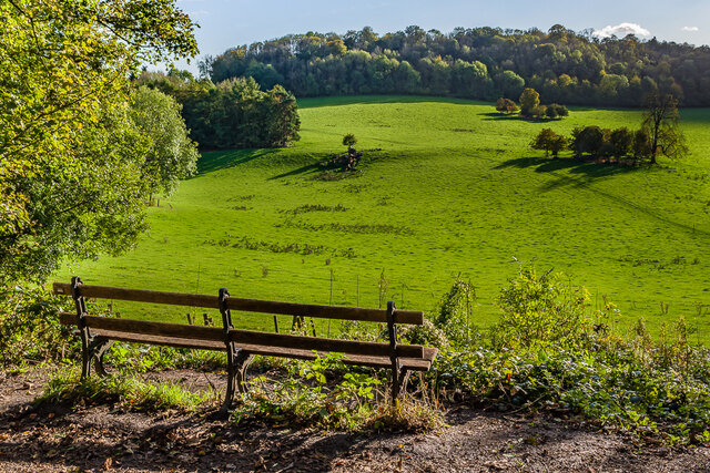
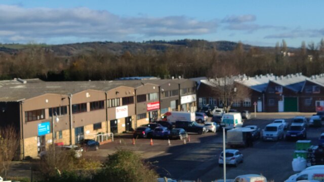
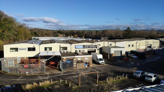
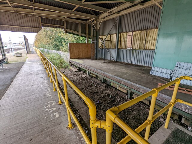
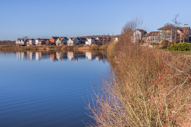
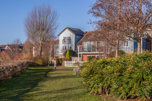
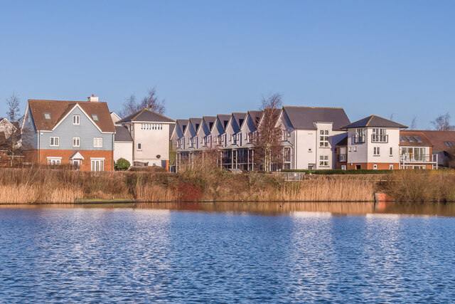
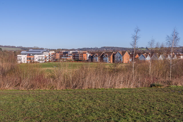
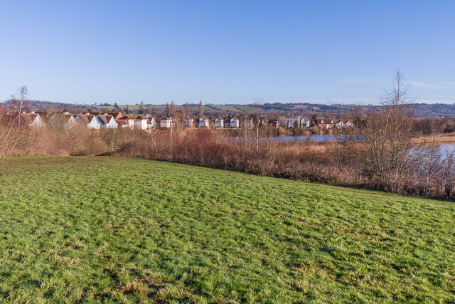
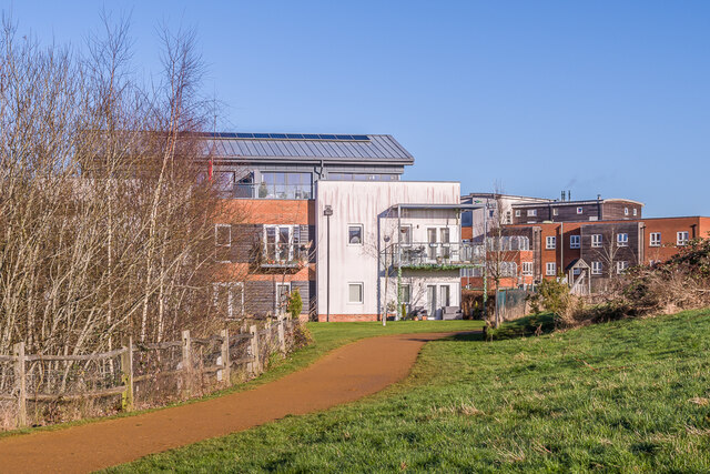
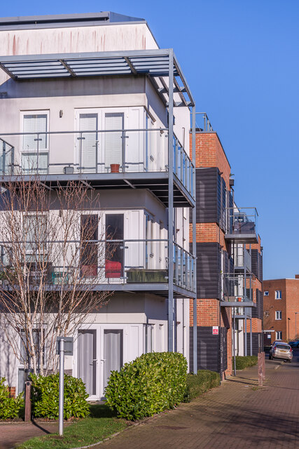
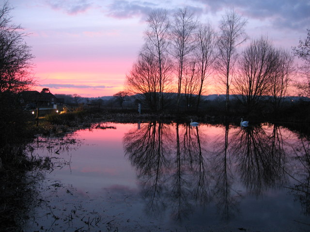
Subrosa Images

Images are sourced within 2km of 51.254722/-0.1555627 or Grid Reference TQ2852. Thanks to Geograph Open Source API. All images are credited.

Gatton Park A seat with a view across part of Gatton Park.
Gatton Park
A seat with a view across part of Gatton Park.
Ormside Way Industrial units Front elevations of some of the units in Ormside Way
Ormside Way Industrial units
Front elevations of some of the units in Ormside Way
Ormside Way Industrial Estate Elevations of some of the units in the Ormside Way Industrial Estate, Redhill
Ormside Way Industrial Estate
Elevations of some of the units in the Ormside Way Industrial Estate, Redhill
Disused platform and surrounding area at Redhill station
Watercolour A major housing development on the site of the old Holmethorpe sand quarry, marketed as Watercolour, built over the first 15 years or so of the 21st Century. The lake was landscaped from the quarry itself and is now a nature reserve.
Watercolour
A major housing development on the site of the old Holmethorpe sand quarry, marketed as Watercolour, built over the first 15 years or so of the 21st Century. The lake was landscaped from the quarry itself and is now a nature reserve.
Watercolour A major housing development on the site of the old Holmethorpe sand quarry, marketed as Watercolour, built over the first 15 years or so of the 21st Century. The houses here are in Lilley Mead and Holmesdale Avenue.
Watercolour
A major housing development on the site of the old Holmethorpe sand quarry, marketed as Watercolour, built over the first 15 years or so of the 21st Century. The houses here are in Lilley Mead and Holmesdale Avenue.
Watercolour A major housing development on the site of the old Holmethorpe sand quarry, marketed as Watercolour, built over the first 15 years or so of the 21st Century. The houses here are in The Moors and Lilley Mead.  The lake was landscaped from the quarry itself and is now a nature reserve.
Watercolour
A major housing development on the site of the old Holmethorpe sand quarry, marketed as Watercolour, built over the first 15 years or so of the 21st Century. The houses here are in The Moors and Lilley Mead. The lake was landscaped from the quarry itself and is now a nature reserve.
Watercolour A major housing development on the site of the old Holmethorpe sand quarry, marketed as Watercolour, built over the first 15 years or so of the 21st Century. This is a view over the western part of the estate, with buildings in The Kilns, one of the last parts to be developed, on the left, and in The Moors on the right.
Watercolour
A major housing development on the site of the old Holmethorpe sand quarry, marketed as Watercolour, built over the first 15 years or so of the 21st Century. This is a view over the western part of the estate, with buildings in The Kilns, one of the last parts to be developed, on the left, and in The Moors on the right.
Watercolour A major housing development on the site of the old Holmethorpe sand quarry, marketed as Watercolour, built over the first 15 years or so of the 21st Century. This is a view over the estate from a landscaped rise to the south west.  The lakes were landscaped from the quarry itself and are now a nature reserve.
Watercolour
A major housing development on the site of the old Holmethorpe sand quarry, marketed as Watercolour, built over the first 15 years or so of the 21st Century. This is a view over the estate from a landscaped rise to the south west. The lakes were landscaped from the quarry itself and are now a nature reserve.
The Kilns Part of a major housing development on the site of the old Holmethorpe sand quarry, marketed as Watercolour, built over the first 15 years or so of the 21st Century.  The large building on the left is 9 The Kilns, one of 3 apartment blocks in that road which were among the last buildings to be completed on the estate, in 2014.  On the right is Acorn Court, a care home opened in 2008.
The Kilns
Part of a major housing development on the site of the old Holmethorpe sand quarry, marketed as Watercolour, built over the first 15 years or so of the 21st Century. The large building on the left is 9 The Kilns, one of 3 apartment blocks in that road which were among the last buildings to be completed on the estate, in 2014. On the right is Acorn Court, a care home opened in 2008.
5, 7 & 9 The Kilns Part of a major housing development on the site of the old Holmethorpe sand quarry, marketed as Watercolour, built over the first 15 years or so of the 21st Century.  These buildings are 5, 7 and 9 The Kilns, 3 apartment blocks in that road which were among the last buildings to be completed on the estate, in 2014.
5, 7 & 9 The Kilns
Part of a major housing development on the site of the old Holmethorpe sand quarry, marketed as Watercolour, built over the first 15 years or so of the 21st Century. These buildings are 5, 7 and 9 The Kilns, 3 apartment blocks in that road which were among the last buildings to be completed on the estate, in 2014.
Play area Play area in Watercolour, a major housing development on the site of the old Holmethorpe sand quarry, built over the first 15 years or so of the 21st Century.  In the background are 5 and 7 The Kilns, 2 out of 3 apartment blocks in that road which were among the last buildings to be completed on the estate, in 2014.
Play area
Play area in Watercolour, a major housing development on the site of the old Holmethorpe sand quarry, built over the first 15 years or so of the 21st Century. In the background are 5 and 7 The Kilns, 2 out of 3 apartment blocks in that road which were among the last buildings to be completed on the estate, in 2014.
48 - 58 The Moors Three pairs of semi-detached houses in The Moors, part of Watercolour, a major housing development on the site of the old Holmethorpe sand quarry, built over the first 15 years or so of the 21st Century.  These buildings were completed in 2009/10.
48 - 58 The Moors
Three pairs of semi-detached houses in The Moors, part of Watercolour, a major housing development on the site of the old Holmethorpe sand quarry, built over the first 15 years or so of the 21st Century. These buildings were completed in 2009/10.
The Moors Houses in The Moors, part of Watercolour, a major housing development on the site of the old Holmethorpe sand quarry, built over the first 15 years or so of the 21st Century.  These buildings were completed in c.2008.
The Moors
Houses in The Moors, part of Watercolour, a major housing development on the site of the old Holmethorpe sand quarry, built over the first 15 years or so of the 21st Century. These buildings were completed in c.2008.
The Moors Houses in The Moors, part of Watercolour, a major housing development on the site of the old Holmethorpe sand quarry, built over the first 15 years or so of the 21st Century.  These buildings were completed in 2009/10.  The blocks in the background are in The Kilns, competed in 2014.
The Moors
Houses in The Moors, part of Watercolour, a major housing development on the site of the old Holmethorpe sand quarry, built over the first 15 years or so of the 21st Century. These buildings were completed in 2009/10. The blocks in the background are in The Kilns, competed in 2014.
The Kilns Apartment blocks in The Moors, part of Watercolour, a major housing development on the site of the old Holmethorpe sand quarry, built over the first 15 years or so of the 21st Century.  These buildings were completed in 2014, the last part of the development.
The Kilns
Apartment blocks in The Moors, part of Watercolour, a major housing development on the site of the old Holmethorpe sand quarry, built over the first 15 years or so of the 21st Century. These buildings were completed in 2014, the last part of the development.
Hylton Place Houses in Hylton Place, part of Watercolour, a major housing development on the site of the old Holmethorpe sand quarry, built over the first 15 years or so of the 21st Century.  These buildings were completed in 2009.
Hylton Place
Houses in Hylton Place, part of Watercolour, a major housing development on the site of the old Holmethorpe sand quarry, built over the first 15 years or so of the 21st Century. These buildings were completed in 2009.
Show me another place!

Subrosa is located at Grid Ref: TQ2852 (Lat: 51.254722, Lng: -0.1555627)

Administrative County: Surrey

District: Reigate and Banstead

Police Authority: Surrey

What 3 Words

///admit.taking.ballots. Near Redhill, Surrey

Related Wikis

Reigate and Banstead

Reigate and Banstead is a local government district with borough status in Surrey, England. Its council is based in Reigate and the borough also includes...

Merstham F.C.

Merstham Football Club is a football club based in Merstham, Surrey, England. Affiliated to the Surrey FA, they are currently members of the Isthmian League...

Gatton, Surrey

Gatton is a former village in the Borough of Reigate and Banstead, Surrey, England. It survives as a sparsely populated, predominantly rural locality,...

Nutfield Marshes

Nutfield Marshes is a 62-hectare (150-acre) nature reserve near Nutfield in Surrey. It is managed by the Surrey Wildlife Trust. These former sand quarries...

Nearby Amenities

Located within 500m of 51.254722,-0.1555627
Mini Roundabout
Direction: clockwise
Lat/Long: 51.2568244/-0.1502308
Traffic Signals
Traffic Signals Direction: backward
Lat/Long: 51.2568045/-0.158069
Traffic Signals
Lat/Long: 51.2552611/-0.1566927
Traffic Signals
Lat/Long: 51.2551802/-0.1561088
Pub
The Jolly Brickmakers
Addr City: Redhill
Addr Housenumber: 58-60
Addr Postcode: RH1 2HP
Addr Street: Frenches Road
Source: survey;https://ratings.food.gov.uk/OpenDataFiles/FHRS309en-GB.xml
Lat/Long: 51.2533529/-0.1577178
Post Office
South Merstham Post Office
Addr City: Redhill
Addr Country: GB
Addr Housenumber: 55
Addr Postcode: RH1 3ER
Addr Street: Nutfield Road
Addr Suburb: Merstham
Brand: Post Office
Brand Wikidata: Q1783168
Contact Website: https://www.postoffice.co.uk/branch-finder/083940x/south-merstham
Note: Post Office now in Pharmacy premises
Ref Pol Id: 866
Lat/Long: 51.2578399/-0.1504604
Turning Circle
Lat/Long: 51.2584153/-0.1517836
Bus Stop
Fairhaven Road
Bus: yes
Naptan AtcoCode: 40004409179B
Naptan NaptanCode: surdjmgt
Public Transport: platform
Lat/Long: 51.2531836/-0.1580721
Priority: forward
Traffic Calming: choker
Lat/Long: 51.253588/-0.1578722
Post Box
Collection Times: Mo-Fr 18:00; Sa 12:00; Su off
Drive Through: no
Note: Collection times taken from corrective sticker effective 21/10/2019
Operator: Royal Mail
Operator Wikidata: Q638098
Post Box Type: pillar
Ref: RH1 63
Royal Cypher: GR
Royal Cypher Wikidata: Q33102273
Source: survey
Lat/Long: 51.2507951/-0.1590232
Bus Stop
South Merstham Church
Bus: yes
Naptan Bearing: W
Public Transport: platform
Toilets Wheelchair: no
Website: http://www.nextbuses.mobi/WebView/BusStopSearch/BusStopSearchResults/surdjmgw?currentPage=0
Wheelchair: yes
Wheelchair Description: Step-free to stop opposite via island refuge at Nutfield Road junction.
Lat/Long: 51.2565732/-0.1510683
Traffic Signals
Lat/Long: 51.255081/-0.1557505
Bus Stop
Fairhaven Road
Bus: yes
Naptan Bearing: S
Public Transport: platform
Lat/Long: 51.2540888/-0.1576129
Crossing
Crossing: unmarked
Crossing Island: yes
Crossing Markings: no
Tactile Paving: yes
Lat/Long: 51.2509535/-0.1556658
Bus Stop
Trowers Way
Bench: yes
Bus: yes
Departures Board: timetable
Naptan AtcoCode: 40004409113A
Naptan NaptanCode: surgmwpj
Operator: Surrey County Council
Public Transport: platform
Shelter: yes
Source: survey
Wheelchair: yes
Wheelchair Description: Step-free to opposite stop via via nearby crossing
Lat/Long: 51.2508124/-0.1570295
Pharmacy
Day Lewis
Addr City: Merstham
Addr Housenumber: 55
Addr Street: Nutfield Road
Healthcare: pharmacy
Wheelchair: no
Wheelchair Description: Two low steps, from pavement and at door.
Lat/Long: 51.2578324/-0.1505192
Fast Food
Cuisine: chinese
Lat/Long: 51.2576399/-0.1507787
Cafe
Village Coffee Shop
Addr City: Merstham
Addr Housenumber: 44
Addr Street: Nutfield Road
Wheelchair: no
Wheelchair Description: Steps from footway
Lat/Long: 51.2577608/-0.1509257
Watercolour
Is In: Surrey,United Kingdom
Place: locality
Lat/Long: 51.2515617/-0.1511337
Bus Stop
South Merstham Church
Bus: yes
Naptan Bearing: E
Public Transport: platform
Toilets Wheelchair: no
Website: http://www.nextbuses.mobi/WebView/BusStopSearch/BusStopSearchResults/surdjmja?currentPage=0
Wheelchair: yes
Wheelchair Description: Step-free to stop opposite via island refuge at Nutfield Road junction.
Lat/Long: 51.2564202/-0.1522872
Bus Stop
Rocky Lane
Bench: yes
Bus: yes
Physically Present: yes
Public Transport: platform
Shelter: yes
Lat/Long: 51.2564667/-0.1589423
Bus Stop
Deans Road
Bench: no
Bus: yes
Naptan AtcoCode: 40004409366A
Naptan Bearing: S
Naptan NaptanCode: surgpmgm
Operator: Metrobus
Public Transport: platform
Shelter: yes
Lat/Long: 51.2555687/-0.149386
Bus Stop
Deans Road
Bench: no
Bus: yes
Naptan AtcoCode: 40004409366B
Naptan Bearing: N
Naptan NaptanCode: surgpmgp
Operator: Metrobus
Public Transport: platform
Shelter: no
Lat/Long: 51.25584/-0.1497037
Post Box
Operator: Royal Mail
Ref: RH1 91
Lat/Long: 51.2577557/-0.1505654
Bus Stop
Trowers Way
Bus: yes
Departures Board: timetable
Naptan AtcoCode: 40004409113B
Naptan NaptanCode: surgmwpm
Operator: Metrobus
Public Transport: platform
Shelter: no
Source: survey
Verified: yes
Wheelchair: yes
Wheelchair Description: Step-free to opposite stop via via nearby crossing
Lat/Long: 51.250946/-0.1567088
Bus Stop
Canalside
Bench: no
Bus: yes
Naptan AtcoCode: 40004409367B
Naptan NaptanCode: surgpmdt
Public Transport: platform
Shelter: no
Wheelchair: yes
Wheelchair Description: Step-free crossing to opposite stop.
Lat/Long: 51.2516829/-0.1526778
Bus Stop
Canalside
Addr City: Merstham
Addr Street: Canalside
Bench: no
Bus: yes
Naptan AtcoCode: 40004409367A
Naptan NaptanCode: surgpjtj
Operator: Metrobus
Public Transport: platform
Shelter: no
Toilets Wheelchair: no
Website: http://www.nextbuses.mobi/WebView/BusStopSearch/BusStopSearchResults/surgpjtj?currentPage=0
Wheelchair: yes
Wheelchair Description: Step-free crossing near opposite stop.
Lat/Long: 51.2514807/-0.15336
Bus Stop
Nutfield Road
Bench: yes
Bus: yes
Naptan AtcoCode: 40004409180C
Naptan Bearing: N
Naptan CommonName: Nutfield Road
Naptan Indicator: On
Naptan Landmark: Nutfield Road
Naptan NaptanCode: surdjmjd
Naptan PlusbusZoneRef: REDHILL
Naptan Street: Nutfield Road
Naptan Verified: no
Operator: Metrobus
Public Transport: platform
Shelter: no
Source: naptan_import
Wheelchair: yes
Lat/Long: 51.2572378/-0.1505351
Post Box
Collection Times: Mo-Fr 09:00; Sa 07:00; Su off
Drive Through: no
Operator: Royal Mail
Operator Wikidata: Q638098
Post Box Type: pillar
Ref: RH1 278D
Royal Cypher: GVIR
Royal Cypher Wikidata: Q33102169
Source: survey
Lat/Long: 51.2537723/-0.1581029
Bus Stop
Rocky Lane
Bench: no
Bus: yes
Physically Present: yes
Public Transport: platform
Shelter: no
Source: gps
Lat/Long: 51.2561438/-0.1592033
Crossing
Crossing: unmarked
Crossing Island: no
Crossing Markings: no
Tactile Paving: no
Lat/Long: 51.2517782/-0.1526678
Noexit: yes
Lat/Long: 51.2519631/-0.1571455
Atm
Canalside
Addr City: Merstham
Addr Street: Canalside
Wheelchair: yes
Wheelchair Description: Level surface, Blue Badge space alongside.
Lat/Long: 51.2517883/-0.1532127
Atm
Addr City: Merstham
Addr Street: Nutfield Road
Wheelchair: yes
Wheelchair Description: Level surface. Nearest Blue Badge space outside pharmacy.
Lat/Long: 51.2577165/-0.1504689
Post Box
Brand: Royal Mail
Brand Wikidata: Q638098
Operator: Royal Mail
Operator Wikidata: Q638098
Ref: RH1 19
Lat/Long: 51.2517429/-0.1528696
Pharmacy
Kamsons Pharmacy
Addr City: Redhill
Addr Housenumber: 14
Addr Postcode: RH1 2NH
Addr Street: Thornton Side
Dispensing: yes
Drive Through: no
Healthcare: pharmacy
Opening Hours: Mo-Fr 08:30-18:30
Operator: Kamsons
Lat/Long: 51.251676/-0.1539334
Access: no
Barrier: bollard
Bicycle: yes
Foot: yes
Motorcar: no
Lat/Long: 51.2517448/-0.1532516
Crossing
Crossing: unmarked
Crossing Island: yes
Crossing Markings: no
Tactile Paving: yes
Lat/Long: 51.2509034/-0.156234
Post Box
Operator: Royal Mail
Operator Wikidata: Q638098
Ref: RH1 178
Lat/Long: 51.2544108/-0.1489091
Bus Stop
Trowers Way (opp) on Frenches Road
Bench: no
Bus: yes
Departures Board: timetable
Naptan AtcoCode: 40004409178B
Naptan NaptanCode: surdjmgm
Operator: Metrobus
Public Transport: platform
Shelter: no
Wheelchair: yes
Wheelchair Description: Step-free to opposite stop via via nearby controlled crossing
Lat/Long: 51.2513034/-0.1588946
Barry Hair Fashions
Addr City: Merstham
Addr Housenumber: 57
Addr Street: Nutfield Road
Shop: hairdresser
Wheelchair: limited
Lat/Long: 51.2577435/-0.1504795
Richfield Firth
Addr City: Merstham
Addr Housenumber: 59
Addr Street: Nutfield Road
Office: financial
Phone: +44 1737 649900
Wheelchair: yes
Lat/Long: 51.2576836/-0.1504428
Affinity Hair & Beauty
Addr City: Merstham
Addr Housenumber: 42
Addr Street: Nutfield Road
Shop: hairdresser
Wheelchair: no
Lat/Long: 51.257815/-0.1509542
Ink Plus
Addr City: Merstham
Addr Housenumber: 46
Addr Street: Nutfield Road
Phone: +44 1737 668200
Shop: toys
Wheelchair: no
Lat/Long: 51.2577029/-0.150894
FAS
Addr City: Merstham
Addr Housenumber: 48
Addr Street: Nutfield Road
Office: yes
Lat/Long: 51.2576495/-0.1508638
Sparkle Launderette
Addr City: Merstham
Addr Housenumber: 50
Addr Street: Nutfield Road
Shop: laundry
Wheelchair: no
Lat/Long: 51.2575861/-0.1508348
Fast Food
The Oriental
Addr City: Merstham
Addr Housenumber: 52
Addr Street: Nutfield Road
Wheelchair: no
Lat/Long: 51.2575316/-0.1508111
Juniors
Addr City: Merstham
Addr Housenumber: 56
Addr Street: Nutfield Road
Shop: hairdresser
Wheelchair: no
Lat/Long: 51.2574196/-0.1507488
Studio
Susy FM Radio
Addr City: Merstham
Addr Housenumber: 54
Addr Street: Nutfield Road
Lat/Long: 51.2574827/-0.1507785
Fast Food
Merstham fish and chips
Addr City: Merstham
Addr Street: Nutfield Road
Cuisine: fish_and_chips
Wheelchair: limited
Lat/Long: 51.2574858/-0.1503405
Crossing
Crossing: unmarked
Crossing Island: yes
Tactile Paving: yes
Wheelchair: yes
Lat/Long: 51.2567834/-0.1504092
WIKA Instruments Limited
Addr City: Redhill
Addr Country: GB
Addr Housenumber: 4
Addr Postcode: RH1 3LG
Addr Street: Wells Place
Addr Suburb: Merstham
Email: info@wika.co.uk
Office: company
Phone: +44 1737 644 008
Website: https://www.wika.co.uk/
Lat/Long: 51.2581367/-0.1544038
Cayman Autos
Car Repair: sunroof
Shop: car_repair
Lat/Long: 51.2529846/-0.1564054
Addr Housenumber: 59
Addr Street: Nutfield Road
Lat/Long: 51.2576666/-0.1505457
Addr Housenumber: 79
Addr Street: Nutfield Road
Lat/Long: 51.2570287/-0.1502144
Addr Housenumber: 81
Addr Street: Nutfield Road
Lat/Long: 51.2569204/-0.1501608
Give Way
Give Way Direction: backward
Lat/Long: 51.2537785/-0.1578911
Traffic Signals
Traffic Signals Direction: backward
Lat/Long: 51.2567388/-0.1584639
Post Box
Collection Times: Mo-Fr 09:00; Sa 07:00; Su off
Drive Through: no
Operator: Royal Mail
Post Box Type: wall
Ref: RH1 14D
Royal Cypher: GR
Royal Cypher Wikidata: Q33102273
Source: streetlevel imagery;survey
Lat/Long: 51.2589044/-0.1560948
Cafe
Pleesecakes
Addr City: Redhill
Addr Country: GB
Addr Housenumber: 17
Addr Postcode: RH1 2LH
Addr Street: Trowers Way
Addr Suburb: Merstham
Cuisine: coffee_shop;cake
Opening Hours: Mo-Fr 09:00-17:00
Phone: +44 20 8090 3565
Website: https://pleesecakes.com/
Lat/Long: 51.2508709/-0.1566016
Post Box
Collection Times: Mo-Fr 09:00; Sa 07:00; Su off
Drive Through: no
Operator: Royal Mail
Operator Wikidata: Q638098
Post Box Type: lamp
Ref: RH1 8D
Royal Cypher: EIIR
Royal Cypher Wikidata: Q33102113
Source: survey
Lat/Long: 51.2549282/-0.1545022
Traffic Signals
Traffic Signals Direction: forward
Lat/Long: 51.257064/-0.1581524
Fixme: contiunes
Lat/Long: 51.2565872/-0.1574779
Crossing
Crossing: unmarked
Crossing Island: no
Crossing Markings: no
Tactile Paving: yes
Lat/Long: 51.2509307/-0.1589621
Crossing
Crossing: unmarked
Crossing Island: yes
Crossing Markings: no
Tactile Paving: yes
Lat/Long: 51.2508784/-0.1590524
Crossing
Crossing: unmarked
Crossing Island: yes
Crossing Markings: no
Tactile Paving: yes
Lat/Long: 51.2507372/-0.1559719
Traffic Signals
Traffic Signals: signal
Traffic Signals Direction: forward
Lat/Long: 51.2508111/-0.1584815
Traffic Signals
Traffic Signals: signal
Traffic Signals Direction: backward
Lat/Long: 51.2508277/-0.159081
Traffic Signals
Traffic Signals: signal
Traffic Signals Direction: forward
Lat/Long: 51.25106/-0.1589459
Defibrillator
Access: yes
Defibrillator Location: 24h access
Emergency: defibrillator
Indoor: no
Lat/Long: 51.2566316/-0.1505044
Defibrillator
Access: permissive
Defibrillator Location: Not 24h access
Emergency: defibrillator
Indoor: no
Lat/Long: 51.2518676/-0.1530775
Barrier: height_restrictor
Fixme: Please confirm height - looks approx 2m but unsigned
Lat/Long: 51.255955/-0.1593495
Bench
Backrest: no
Material: metal
Seats: 4
Lat/Long: 51.2544553/-0.1578981
Entrance: yes
Lat/Long: 51.2548866/-0.1573045
Barrier: height_restrictor
Maxheight: 6'6"
Lat/Long: 51.2556496/-0.1570927
The data included in this document is from www.openstreetmap.org. The data is made available under ODbL.

Have you been to Subrosa?

Leave your review of Subrosa below (or comments, questions and feedback).