Gatton Park

Downs, Moorland in Surrey Reigate and Banstead

England

Gatton Park

London Road Looking south along London Road.  

The milepost on the right is one of a standard design for one along this route, which was built in 1816 as a direct route from Gatton Point south to Povey Cross, near Gatwick.

The post shows the distances to/from Brighton and Westminster Bridge on the two faces, but in a different order according to the direction of travel. On the top face is the locality (here the Parish of Reigate, as it was at the time).  

See  <a href="https://www.geograph.org.uk/photo/6907428">TQ2851 : Milestone</a> for a close up of the face seen here, <a href="https://www.geograph.org.uk/photo/6907425">TQ2851 : Milestone</a> for a close up of the opposite face and <a href="https://www.geograph.org.uk/photo/2917092">TQ2851 : London Road</a> for a wider view in opposite direction.
London Road Credit: Ian Capper

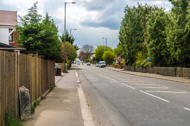
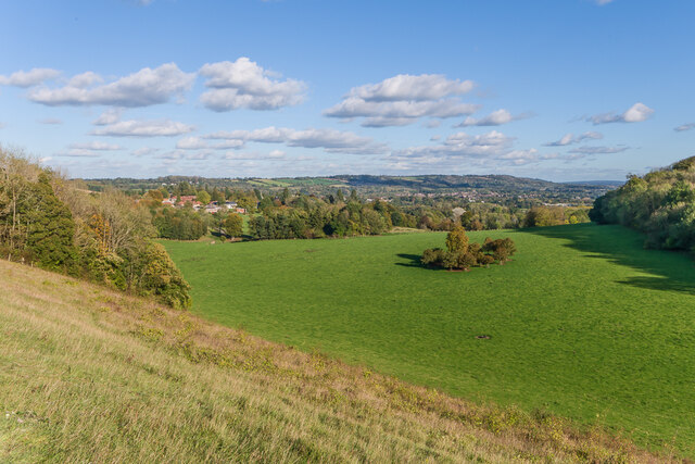
Gatton Park is a picturesque estate located in Surrey, England. Situated on the North Downs, this park spans over 250 acres of stunning countryside, encompassing both downs and moorland landscapes. It is renowned for its natural beauty and rich history.

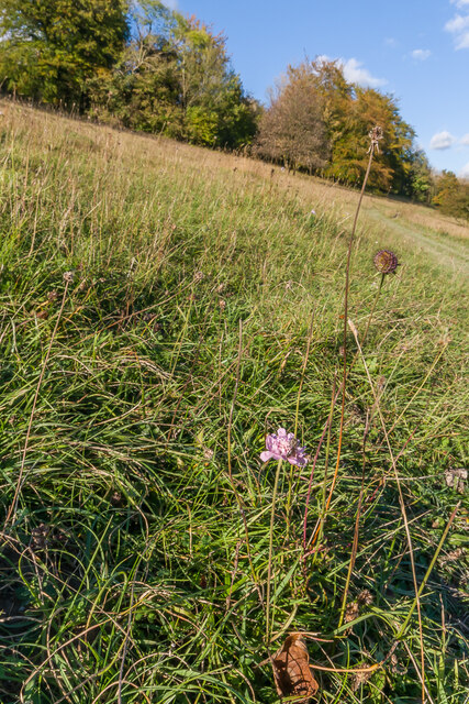
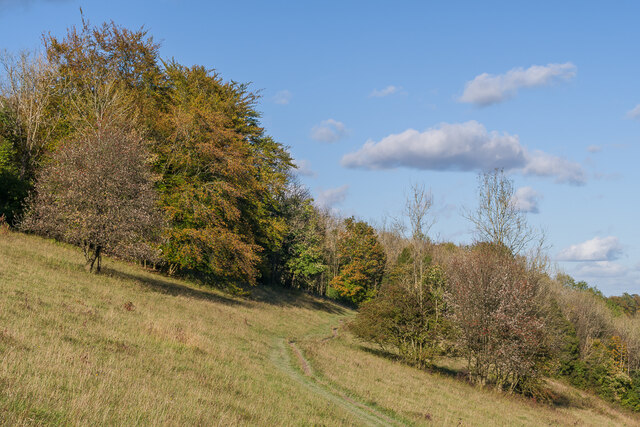
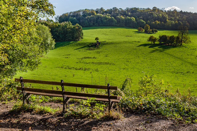
The park features a diverse range of habitats, including rolling hills, open meadows, and ancient woodlands. The downs area offers breathtaking panoramic views, with gentle slopes covered in wildflowers during the summer months. Visitors can enjoy leisurely walks or hikes through the various trails that wind through the downs, immersing themselves in the tranquil surroundings.

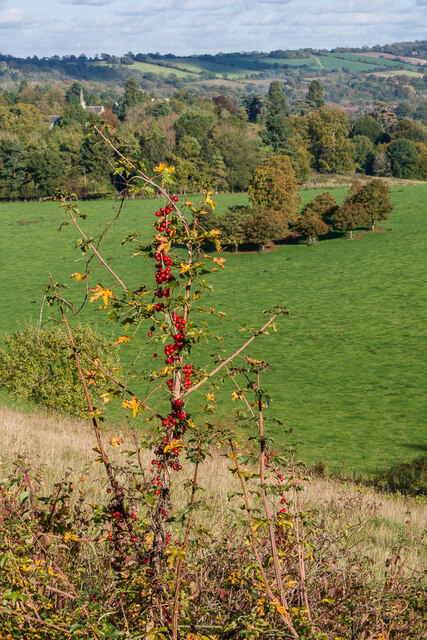
The moorland section of Gatton Park is a haven for wildlife enthusiasts. Here, visitors can observe a wide variety of bird species, including kestrels, buzzards, and skylarks. The moorland is also home to a number of rare plant species, adding to its ecological significance.

In addition to its natural beauty, Gatton Park boasts historical significance. The park is home to Gatton Hall, a Grade II listed mansion that dates back to the 18th century. The hall is surrounded by formal gardens, including a walled garden and an impressive lake. These gardens are meticulously maintained and provide a peaceful setting for visitors to explore.

Gatton Park offers a range of amenities for visitors, including parking facilities, picnic areas, and a visitor center that provides information about the park's history and wildlife. The park also hosts various events and activities throughout the year, such as guided walks, nature workshops, and outdoor concerts.

Overall, Gatton Park in Surrey is a scenic and historically significant destination that offers a delightful experience for nature lovers, history enthusiasts, and families alike.

If you have any feedback on the listing, please let us know in the comments section below.
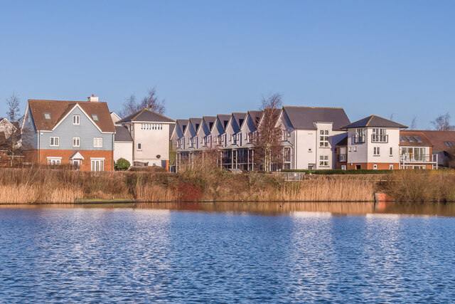
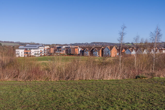
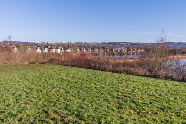
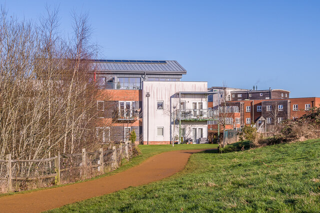
Gatton Park Images

Images are sourced within 2km of 51.260489/-0.16487749 or Grid Reference TQ2852. Thanks to Geograph Open Source API. All images are credited.

London Road Looking south along London Road.  

The milepost on the right is one of a standard design for one along this route, which was built in 1816 as a direct route from Gatton Point south to Povey Cross, near Gatwick.

The post shows the distances to/from Brighton and Westminster Bridge on the two faces, but in a different order according to the direction of travel. On the top face is the locality (here the Parish of Reigate, as it was at the time).  

See  <a href="https://www.geograph.org.uk/photo/6907428">TQ2851 : Milestone</a> for a close up of the face seen here, <a href="https://www.geograph.org.uk/photo/6907425">TQ2851 : Milestone</a> for a close up of the opposite face and <a href="https://www.geograph.org.uk/photo/2917092">TQ2851 : London Road</a> for a wider view in opposite direction.
London Road
Looking south along London Road. The milepost on the right is one of a standard design for one along this route, which was built in 1816 as a direct route from Gatton Point south to Povey Cross, near Gatwick. The post shows the distances to/from Brighton and Westminster Bridge on the two faces, but in a different order according to the direction of travel. On the top face is the locality (here the Parish of Reigate, as it was at the time). See TQ2851 : Milestone for a close up of the face seen here, TQ2851 : Milestone for a close up of the opposite face and TQ2851 : London Road for a wider view in opposite direction.
Milestone Close up of the milestone in <a href="https://www.geograph.org.uk/photo/2917092">TQ2851 : London Road</a>, one of a standard design for one along this route, which was built in 1816 as a direct route from Gatton Point south to Povey Cross, near Gatwick.  For a photo of the opposite face, showing same places and distances but in the other order, see <a href="https://www.geograph.org.uk/photo/6907428">TQ2851 : Milestone</a>.
Milestone
Close up of the milestone in TQ2851 : London Road, one of a standard design for one along this route, which was built in 1816 as a direct route from Gatton Point south to Povey Cross, near Gatwick. For a photo of the opposite face, showing same places and distances but in the other order, see TQ2851 : Milestone.
Milestone Close up of the milestone in <a href="https://www.geograph.org.uk/photo/6907414">TQ2851 : London Road</a>, one of a standard design for one along this route, which was built in 1816 as a direct route from Gatton Point south to Povey Cross, near Gatwick.  For a photo of the opposite face, showing same places and distances but in the other order, see <a href="https://www.geograph.org.uk/photo/6907425">TQ2851 : Milestone</a>.
Milestone
Close up of the milestone in TQ2851 : London Road, one of a standard design for one along this route, which was built in 1816 as a direct route from Gatton Point south to Povey Cross, near Gatwick. For a photo of the opposite face, showing same places and distances but in the other order, see TQ2851 : Milestone.
Gatton Point Road junction where the 1816 direct turnpike to Povey Cross, near Gatwick, (now the A23) met the original route through Reigate (now the A242 for this section).  Perhaps appropriate to what was one a key road junction, it is now the site of an Esso petrol station.
Gatton Point
Road junction where the 1816 direct turnpike to Povey Cross, near Gatwick, (now the A23) met the original route through Reigate (now the A242 for this section). Perhaps appropriate to what was one a key road junction, it is now the site of an Esso petrol station.
Ringwood Avenue Road off London Road first developed in the early 20th Century.  The houses here are from the first stage of development, marked on the 1913 1:2,500 map.  The road is named after a house on London Road called Ringwood, which would appear to have been demolished for the road.
Ringwood Avenue
Road off London Road first developed in the early 20th Century. The houses here are from the first stage of development, marked on the 1913 1:2,500 map. The road is named after a house on London Road called Ringwood, which would appear to have been demolished for the road.
Black Bryony Black Bryony (Dioscorea communis) in berry on Wingate Hill, with Gatton in the background and the North Downs beyond.
Black Bryony
Black Bryony (Dioscorea communis) in berry on Wingate Hill, with Gatton in the background and the North Downs beyond.
Wingate Hill A late flowering Field Scabious (Knautia arvensis) in grass downland on Wingate Hill.
Wingate Hill
A late flowering Field Scabious (Knautia arvensis) in grass downland on Wingate Hill.
Wingate Hill A path across grass downland on Wingate Hill.
Wingate Hill
A path across grass downland on Wingate Hill.
Gatton Park Looking across grass downland on Wingate Hill to Gatton Park with the North Downs in the background.
Gatton Park
Looking across grass downland on Wingate Hill to Gatton Park with the North Downs in the background.
Gatton Park A seat with a view across part of Gatton Park.
Gatton Park
A seat with a view across part of Gatton Park.
Ormside Way Industrial units Front elevations of some of the units in Ormside Way
Ormside Way Industrial units
Front elevations of some of the units in Ormside Way
Ormside Way Industrial Estate Elevations of some of the units in the Ormside Way Industrial Estate, Redhill
Ormside Way Industrial Estate
Elevations of some of the units in the Ormside Way Industrial Estate, Redhill
Watercolour A major housing development on the site of the old Holmethorpe sand quarry, marketed as Watercolour, built over the first 15 years or so of the 21st Century. The lake was landscaped from the quarry itself and is now a nature reserve.
Watercolour
A major housing development on the site of the old Holmethorpe sand quarry, marketed as Watercolour, built over the first 15 years or so of the 21st Century. The lake was landscaped from the quarry itself and is now a nature reserve.
Watercolour A major housing development on the site of the old Holmethorpe sand quarry, marketed as Watercolour, built over the first 15 years or so of the 21st Century. The houses here are in Lilley Mead and Holmesdale Avenue.
Watercolour
A major housing development on the site of the old Holmethorpe sand quarry, marketed as Watercolour, built over the first 15 years or so of the 21st Century. The houses here are in Lilley Mead and Holmesdale Avenue.
Watercolour A major housing development on the site of the old Holmethorpe sand quarry, marketed as Watercolour, built over the first 15 years or so of the 21st Century. The houses here are in The Moors and Lilley Mead.  The lake was landscaped from the quarry itself and is now a nature reserve.
Watercolour
A major housing development on the site of the old Holmethorpe sand quarry, marketed as Watercolour, built over the first 15 years or so of the 21st Century. The houses here are in The Moors and Lilley Mead. The lake was landscaped from the quarry itself and is now a nature reserve.
Watercolour A major housing development on the site of the old Holmethorpe sand quarry, marketed as Watercolour, built over the first 15 years or so of the 21st Century. This is a view over the western part of the estate, with buildings in The Kilns, one of the last parts to be developed, on the left, and in The Moors on the right.
Watercolour
A major housing development on the site of the old Holmethorpe sand quarry, marketed as Watercolour, built over the first 15 years or so of the 21st Century. This is a view over the western part of the estate, with buildings in The Kilns, one of the last parts to be developed, on the left, and in The Moors on the right.
Watercolour A major housing development on the site of the old Holmethorpe sand quarry, marketed as Watercolour, built over the first 15 years or so of the 21st Century. This is a view over the estate from a landscaped rise to the south west.  The lakes were landscaped from the quarry itself and are now a nature reserve.
Watercolour
A major housing development on the site of the old Holmethorpe sand quarry, marketed as Watercolour, built over the first 15 years or so of the 21st Century. This is a view over the estate from a landscaped rise to the south west. The lakes were landscaped from the quarry itself and are now a nature reserve.
The Kilns Part of a major housing development on the site of the old Holmethorpe sand quarry, marketed as Watercolour, built over the first 15 years or so of the 21st Century.  The large building on the left is 9 The Kilns, one of 3 apartment blocks in that road which were among the last buildings to be completed on the estate, in 2014.  On the right is Acorn Court, a care home opened in 2008.
The Kilns
Part of a major housing development on the site of the old Holmethorpe sand quarry, marketed as Watercolour, built over the first 15 years or so of the 21st Century. The large building on the left is 9 The Kilns, one of 3 apartment blocks in that road which were among the last buildings to be completed on the estate, in 2014. On the right is Acorn Court, a care home opened in 2008.
Show me another place!

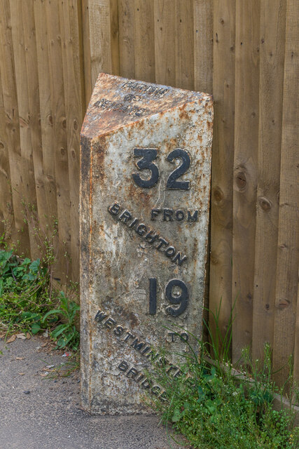
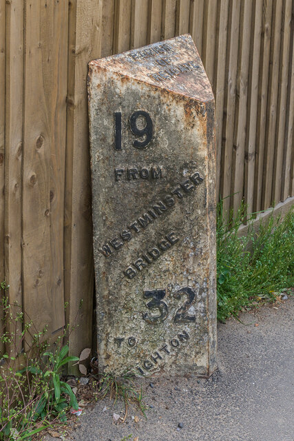
Gatton Park is located at Grid Ref: TQ2852 (Lat: 51.260489, Lng: -0.16487749)

Administrative County: Surrey

District: Reigate and Banstead

Police Authority: Surrey

What 3 Words

///dips.cover.rested. Near Redhill, Surrey

Related Wikis

Gatton Park

Gatton Park is a country estate set in parkland landscaped by Capability Brown at Gatton, near Reigate in Surrey, England. Gatton Park is now partly owned...

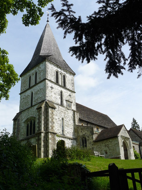
St Andrew's Church, Gatton

The Church of St Andrew, Gatton is a Church of England church in Gatton, near Reigate in Surrey, England. It is a Grade I listed. The earliest record of...

Royal Alexandra and Albert School

The Royal Alexandra and Albert School is an all-through co-educational boarding school near Reigate, Surrey. The headmaster as of 2022 is Morgan Thomas...

Merstham

Merstham is a town in the borough of Reigate and Banstead in Surrey, England. It lies 17 miles south of Charing Cross just beyond the Greater London border...

Merstham railway station

Merstham railway station is in Merstham, Surrey, England. It is on the Brighton Main Line, 20 miles 59 chains (33.4 km) measured from London Charing Cross...

Gatton, Surrey

Gatton is a former village in the Borough of Reigate and Banstead, Surrey, England. It survives as a sparsely populated, predominantly rural locality,...

Merstham F.C.

Merstham Football Club is a football club based in Merstham, Surrey, England. Affiliated to the Surrey FA, they are currently members of the Isthmian League...

Reigate and Banstead

Reigate and Banstead is a local government district with borough status in east Surrey, England. It includes the towns of Reigate, Redhill, Horley and...

Nearby Amenities

Located within 500m of 51.260489,-0.16487749
The data included in this document is from www.openstreetmap.org. The data is made available under ODbL.

Have you been to Gatton Park?

Leave your review of Gatton Park below (or comments, questions and feedback).