The Grove

Wood, Forest in Surrey Reigate and Banstead

England

The Grove

London Road Looking south along London Road.  

The milepost on the right is one of a standard design for one along this route, which was built in 1816 as a direct route from Gatton Point south to Povey Cross, near Gatwick.

The post shows the distances to/from Brighton and Westminster Bridge on the two faces, but in a different order according to the direction of travel. On the top face is the locality (here the Parish of Reigate, as it was at the time).  

See  <a href="https://www.geograph.org.uk/photo/6907428">TQ2851 : Milestone</a> for a close up of the face seen here, <a href="https://www.geograph.org.uk/photo/6907425">TQ2851 : Milestone</a> for a close up of the opposite face and <a href="https://www.geograph.org.uk/photo/2917092">TQ2851 : London Road</a> for a wider view in opposite direction.
London Road Credit: Ian Capper

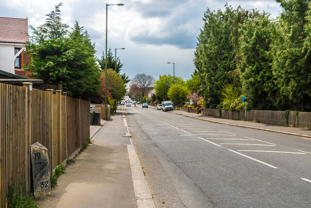
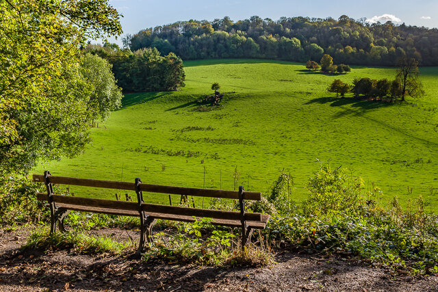
The Grove, Surrey, also known as the Wood or Forest, is a picturesque area located in the county of Surrey, England. Spanning over several hundred acres, it is renowned for its dense woodlands and abundance of natural beauty.

Situated on the outskirts of the bustling town of Esher, The Grove offers a tranquil escape from the urban environment. The area is characterized by its thick canopies of ancient trees, including oak, beech, and chestnut, which create a serene and secluded atmosphere. The woodland floor is carpeted with wildflowers and ferns, adding to the area's charm.

The Grove is a haven for wildlife enthusiasts, as it is home to a diverse range of species. Deer, foxes, rabbits, and squirrels can often be spotted roaming freely among the trees. Birdwatchers can delight in the sight of various species, including woodpeckers, owls, and songbirds.

Visitors to The Grove can enjoy a range of outdoor activities. The area is crisscrossed with walking trails, providing ample opportunities for leisurely strolls or more challenging hikes. Cyclists and horse riders can also explore the woodlands on designated paths.

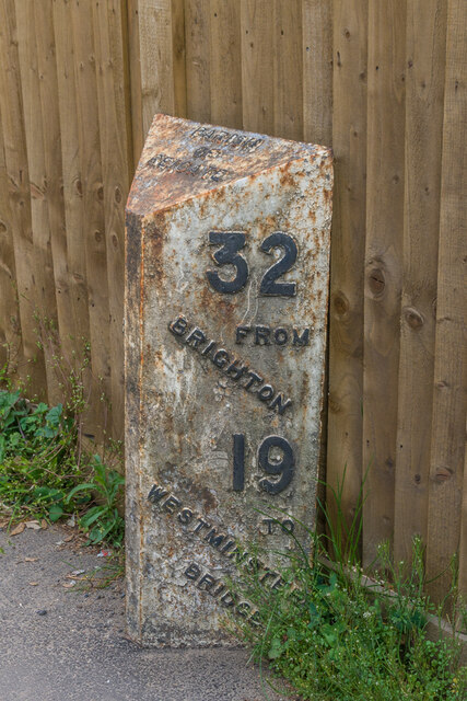
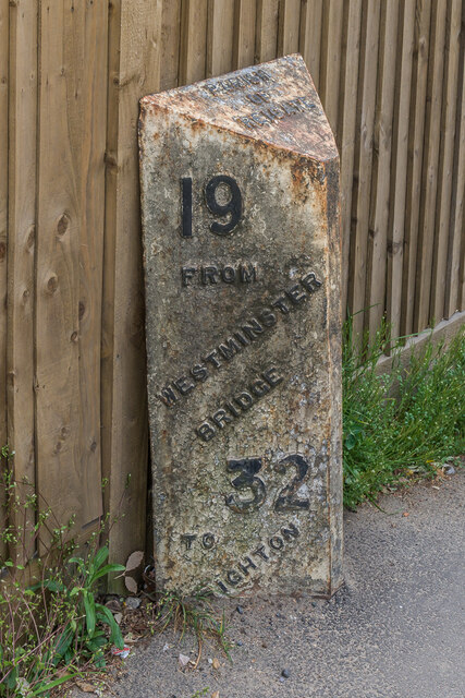
The Grove is not only a natural paradise but also has historical significance. The area has been mentioned in records dating back to the 12th century and has witnessed various events throughout the centuries. It has been a source of timber for construction and played a role in local folklore and legends.

Overall, The Grove in Surrey is a captivating destination for nature lovers, offering a serene retreat and a chance to immerse oneself in the beauty of ancient woodlands.

If you have any feedback on the listing, please let us know in the comments section below.
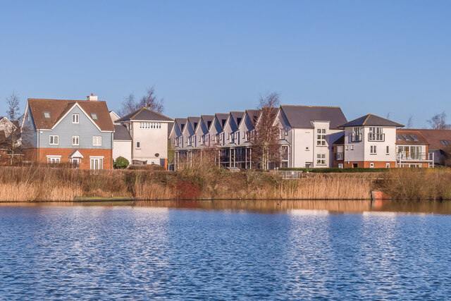
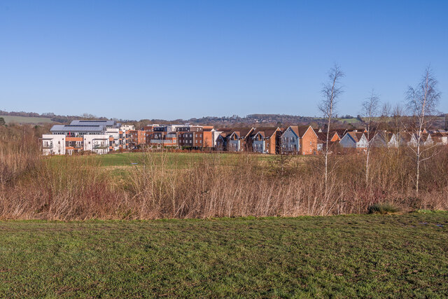
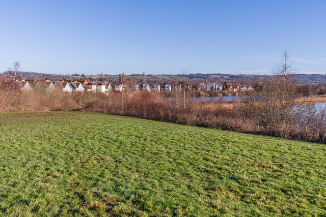
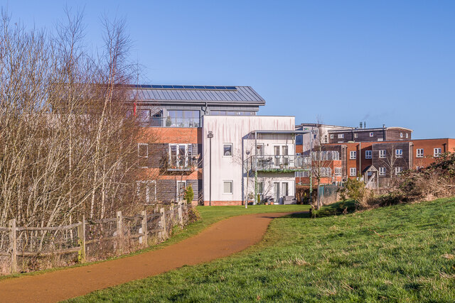
The Grove Images

Images are sourced within 2km of 51.259641/-0.15384657 or Grid Reference TQ2852. Thanks to Geograph Open Source API. All images are credited.

London Road Looking south along London Road.  

The milepost on the right is one of a standard design for one along this route, which was built in 1816 as a direct route from Gatton Point south to Povey Cross, near Gatwick.

The post shows the distances to/from Brighton and Westminster Bridge on the two faces, but in a different order according to the direction of travel. On the top face is the locality (here the Parish of Reigate, as it was at the time).  

See  <a href="https://www.geograph.org.uk/photo/6907428">TQ2851 : Milestone</a> for a close up of the face seen here, <a href="https://www.geograph.org.uk/photo/6907425">TQ2851 : Milestone</a> for a close up of the opposite face and <a href="https://www.geograph.org.uk/photo/2917092">TQ2851 : London Road</a> for a wider view in opposite direction.
London Road
Looking south along London Road. The milepost on the right is one of a standard design for one along this route, which was built in 1816 as a direct route from Gatton Point south to Povey Cross, near Gatwick. The post shows the distances to/from Brighton and Westminster Bridge on the two faces, but in a different order according to the direction of travel. On the top face is the locality (here the Parish of Reigate, as it was at the time). See TQ2851 : Milestone for a close up of the face seen here, TQ2851 : Milestone for a close up of the opposite face and TQ2851 : London Road for a wider view in opposite direction.
Milestone Close up of the milestone in <a href="https://www.geograph.org.uk/photo/2917092">TQ2851 : London Road</a>, one of a standard design for one along this route, which was built in 1816 as a direct route from Gatton Point south to Povey Cross, near Gatwick.  For a photo of the opposite face, showing same places and distances but in the other order, see <a href="https://www.geograph.org.uk/photo/6907428">TQ2851 : Milestone</a>.
Milestone
Close up of the milestone in TQ2851 : London Road, one of a standard design for one along this route, which was built in 1816 as a direct route from Gatton Point south to Povey Cross, near Gatwick. For a photo of the opposite face, showing same places and distances but in the other order, see TQ2851 : Milestone.
Milestone Close up of the milestone in <a href="https://www.geograph.org.uk/photo/6907414">TQ2851 : London Road</a>, one of a standard design for one along this route, which was built in 1816 as a direct route from Gatton Point south to Povey Cross, near Gatwick.  For a photo of the opposite face, showing same places and distances but in the other order, see <a href="https://www.geograph.org.uk/photo/6907425">TQ2851 : Milestone</a>.
Milestone
Close up of the milestone in TQ2851 : London Road, one of a standard design for one along this route, which was built in 1816 as a direct route from Gatton Point south to Povey Cross, near Gatwick. For a photo of the opposite face, showing same places and distances but in the other order, see TQ2851 : Milestone.
Gatton Point Road junction where the 1816 direct turnpike to Povey Cross, near Gatwick, (now the A23) met the original route through Reigate (now the A242 for this section).  Perhaps appropriate to what was one a key road junction, it is now the site of an Esso petrol station.
Gatton Point
Road junction where the 1816 direct turnpike to Povey Cross, near Gatwick, (now the A23) met the original route through Reigate (now the A242 for this section). Perhaps appropriate to what was one a key road junction, it is now the site of an Esso petrol station.
Ringwood Avenue Road off London Road first developed in the early 20th Century.  The houses here are from the first stage of development, marked on the 1913 1:2,500 map.  The road is named after a house on London Road called Ringwood, which would appear to have been demolished for the road.
Ringwood Avenue
Road off London Road first developed in the early 20th Century. The houses here are from the first stage of development, marked on the 1913 1:2,500 map. The road is named after a house on London Road called Ringwood, which would appear to have been demolished for the road.
Gatton Park A seat with a view across part of Gatton Park.
Gatton Park
A seat with a view across part of Gatton Park.
Ormside Way Industrial units Front elevations of some of the units in Ormside Way
Ormside Way Industrial units
Front elevations of some of the units in Ormside Way
Ormside Way Industrial Estate Elevations of some of the units in the Ormside Way Industrial Estate, Redhill
Ormside Way Industrial Estate
Elevations of some of the units in the Ormside Way Industrial Estate, Redhill
Watercolour A major housing development on the site of the old Holmethorpe sand quarry, marketed as Watercolour, built over the first 15 years or so of the 21st Century. The lake was landscaped from the quarry itself and is now a nature reserve.
Watercolour
A major housing development on the site of the old Holmethorpe sand quarry, marketed as Watercolour, built over the first 15 years or so of the 21st Century. The lake was landscaped from the quarry itself and is now a nature reserve.
Watercolour A major housing development on the site of the old Holmethorpe sand quarry, marketed as Watercolour, built over the first 15 years or so of the 21st Century. The houses here are in Lilley Mead and Holmesdale Avenue.
Watercolour
A major housing development on the site of the old Holmethorpe sand quarry, marketed as Watercolour, built over the first 15 years or so of the 21st Century. The houses here are in Lilley Mead and Holmesdale Avenue.
Watercolour A major housing development on the site of the old Holmethorpe sand quarry, marketed as Watercolour, built over the first 15 years or so of the 21st Century. The houses here are in The Moors and Lilley Mead.  The lake was landscaped from the quarry itself and is now a nature reserve.
Watercolour
A major housing development on the site of the old Holmethorpe sand quarry, marketed as Watercolour, built over the first 15 years or so of the 21st Century. The houses here are in The Moors and Lilley Mead. The lake was landscaped from the quarry itself and is now a nature reserve.
Watercolour A major housing development on the site of the old Holmethorpe sand quarry, marketed as Watercolour, built over the first 15 years or so of the 21st Century. This is a view over the western part of the estate, with buildings in The Kilns, one of the last parts to be developed, on the left, and in The Moors on the right.
Watercolour
A major housing development on the site of the old Holmethorpe sand quarry, marketed as Watercolour, built over the first 15 years or so of the 21st Century. This is a view over the western part of the estate, with buildings in The Kilns, one of the last parts to be developed, on the left, and in The Moors on the right.
Watercolour A major housing development on the site of the old Holmethorpe sand quarry, marketed as Watercolour, built over the first 15 years or so of the 21st Century. This is a view over the estate from a landscaped rise to the south west.  The lakes were landscaped from the quarry itself and are now a nature reserve.
Watercolour
A major housing development on the site of the old Holmethorpe sand quarry, marketed as Watercolour, built over the first 15 years or so of the 21st Century. This is a view over the estate from a landscaped rise to the south west. The lakes were landscaped from the quarry itself and are now a nature reserve.
The Kilns Part of a major housing development on the site of the old Holmethorpe sand quarry, marketed as Watercolour, built over the first 15 years or so of the 21st Century.  The large building on the left is 9 The Kilns, one of 3 apartment blocks in that road which were among the last buildings to be completed on the estate, in 2014.  On the right is Acorn Court, a care home opened in 2008.
The Kilns
Part of a major housing development on the site of the old Holmethorpe sand quarry, marketed as Watercolour, built over the first 15 years or so of the 21st Century. The large building on the left is 9 The Kilns, one of 3 apartment blocks in that road which were among the last buildings to be completed on the estate, in 2014. On the right is Acorn Court, a care home opened in 2008.
5, 7 & 9 The Kilns Part of a major housing development on the site of the old Holmethorpe sand quarry, marketed as Watercolour, built over the first 15 years or so of the 21st Century.  These buildings are 5, 7 and 9 The Kilns, 3 apartment blocks in that road which were among the last buildings to be completed on the estate, in 2014.
5, 7 & 9 The Kilns
Part of a major housing development on the site of the old Holmethorpe sand quarry, marketed as Watercolour, built over the first 15 years or so of the 21st Century. These buildings are 5, 7 and 9 The Kilns, 3 apartment blocks in that road which were among the last buildings to be completed on the estate, in 2014.
Play area Play area in Watercolour, a major housing development on the site of the old Holmethorpe sand quarry, built over the first 15 years or so of the 21st Century.  In the background are 5 and 7 The Kilns, 2 out of 3 apartment blocks in that road which were among the last buildings to be completed on the estate, in 2014.
Play area
Play area in Watercolour, a major housing development on the site of the old Holmethorpe sand quarry, built over the first 15 years or so of the 21st Century. In the background are 5 and 7 The Kilns, 2 out of 3 apartment blocks in that road which were among the last buildings to be completed on the estate, in 2014.
48 - 58 The Moors Three pairs of semi-detached houses in The Moors, part of Watercolour, a major housing development on the site of the old Holmethorpe sand quarry, built over the first 15 years or so of the 21st Century.  These buildings were completed in 2009/10.
48 - 58 The Moors
Three pairs of semi-detached houses in The Moors, part of Watercolour, a major housing development on the site of the old Holmethorpe sand quarry, built over the first 15 years or so of the 21st Century. These buildings were completed in 2009/10.
Show me another place!

The Grove is located at Grid Ref: TQ2852 (Lat: 51.259641, Lng: -0.15384657)

Administrative County: Surrey

District: Reigate and Banstead

Police Authority: Surrey

What 3 Words

///bigger.trash.window. Near Redhill, Surrey

Related Wikis

Merstham

Merstham is a town in the borough of Reigate and Banstead in Surrey, England. It lies 17 miles south of Charing Cross just beyond the Greater London border...

Merstham F.C.

Merstham Football Club is a football club based in Merstham, Surrey, England. Affiliated to the Surrey FA, they are currently members of the Isthmian League...

Merstham railway station

Merstham railway station is in Merstham, Surrey, England. It is on the Brighton Main Line, 20 miles 59 chains (33.4 km) measured from London Charing Cross...

Reigate and Banstead

Reigate and Banstead is a local government district with borough status in east Surrey, England. It includes the towns of Reigate, Redhill, Horley and...

Gatton Park

Gatton Park is a country estate set in parkland landscaped by Capability Brown at Gatton, near Reigate in Surrey, England. Gatton Park is now partly owned...

St Andrew's Church, Gatton

The Church of St Andrew, Gatton is a Church of England church in Gatton, near Reigate in Surrey, England. It is a Grade I listed. The earliest record of...

Gatton, Surrey

Gatton is a former village in the Borough of Reigate and Banstead, Surrey, England. It survives as a sparsely populated, predominantly rural locality,...

Royal Alexandra and Albert School

The Royal Alexandra and Albert School is an all-through co-educational boarding school near Reigate, Surrey. The headmaster as of 2022 is Morgan Thomas...

Nearby Amenities

Located within 500m of 51.259641,-0.15384657
Mini Roundabout
Direction: clockwise
Lat/Long: 51.2604258/-0.1492672
Mini Roundabout
Direction: clockwise
Lat/Long: 51.2568244/-0.1502308
Traffic Signals
Traffic Signals Direction: backward
Lat/Long: 51.2568045/-0.158069
Post Office
South Merstham Post Office
Addr City: Redhill
Addr Country: GB
Addr Housenumber: 55
Addr Postcode: RH1 3ER
Addr Street: Nutfield Road
Addr Suburb: Merstham
Brand: Post Office
Brand Wikidata: Q1783168
Contact Website: https://www.postoffice.co.uk/branch-finder/083940x/south-merstham
Note: Post Office now in Pharmacy premises
Ref Pol Id: 866
Lat/Long: 51.2578399/-0.1504604
Turning Circle
Lat/Long: 51.2584153/-0.1517836
Turning Circle
Lat/Long: 51.2584074/-0.1494056
Turning Circle
Lat/Long: 51.260762/-0.1560037
Bus Stop
South Merstham Church
Bus: yes
Naptan Bearing: W
Public Transport: platform
Toilets Wheelchair: no
Website: http://www.nextbuses.mobi/WebView/BusStopSearch/BusStopSearchResults/surdjmgw?currentPage=0
Wheelchair: yes
Wheelchair Description: Step-free to stop opposite via island refuge at Nutfield Road junction.
Lat/Long: 51.2565732/-0.1510683
Albury Manor
Historic: ruins
Lat/Long: 51.2590802/-0.1471846
Merstham
Is In: Surrey,United Kingdom
Place: village
Wikidata: Q6820621
Lat/Long: 51.2607556/-0.1481817
Cafe
Quality Cafe
Lat/Long: 51.2635358/-0.15143
Pharmacy
Day Lewis
Addr City: Merstham
Addr Housenumber: 55
Addr Street: Nutfield Road
Healthcare: pharmacy
Wheelchair: no
Wheelchair Description: Two low steps, from pavement and at door.
Lat/Long: 51.2578324/-0.1505192
Shop: convenience
Wheelchair: no
Lat/Long: 51.2584706/-0.1508257
Fast Food
Cuisine: chinese
Lat/Long: 51.2576399/-0.1507787
Cafe
Village Coffee Shop
Addr City: Merstham
Addr Housenumber: 44
Addr Street: Nutfield Road
Wheelchair: no
Wheelchair Description: Steps from footway
Lat/Long: 51.2577608/-0.1509257
Shop: newsagent
Lat/Long: 51.2633605/-0.1517273
Bus Stop
South Merstham Church
Bus: yes
Naptan Bearing: E
Public Transport: platform
Toilets Wheelchair: no
Website: http://www.nextbuses.mobi/WebView/BusStopSearch/BusStopSearchResults/surdjmja?currentPage=0
Wheelchair: yes
Wheelchair Description: Step-free to stop opposite via island refuge at Nutfield Road junction.
Lat/Long: 51.2564202/-0.1522872
Barrier: cycle_barrier
Bicycle: yes
Foot: yes
Lat/Long: 51.2594522/-0.1475313
Bus Stop
Rocky Lane
Bench: yes
Bus: yes
Physically Present: yes
Public Transport: platform
Shelter: yes
Lat/Long: 51.2564667/-0.1589423
Bus Stop
Southcote Road
Bench: no
Bus: yes
Naptan AtcoCode: 40004409182A
Naptan Bearing: W
Naptan CommonName: Southcote Road
Naptan Indicator: On
Naptan Landmark: Southcote Road
Naptan NaptanCode: surdjmjm
Naptan PlusbusZoneRef: REDHILL
Naptan Street: Southcote Road
Naptan Verified: no
Public Transport: platform
Shelter: no
Source: naptan_import
Wheelchair: yes
Lat/Long: 51.257112/-0.1485696
Post Box
Operator: Royal Mail
Ref: RH1 91
Lat/Long: 51.2577557/-0.1505654
Wine Cellers
Shop: alcohol
Lat/Long: 51.2636651/-0.151941
Bus Stop
Nutfield Road
Bench: yes
Bus: yes
Naptan AtcoCode: 40004409180C
Naptan Bearing: N
Naptan CommonName: Nutfield Road
Naptan Indicator: On
Naptan Landmark: Nutfield Road
Naptan NaptanCode: surdjmjd
Naptan PlusbusZoneRef: REDHILL
Naptan Street: Nutfield Road
Naptan Verified: no
Operator: Metrobus
Public Transport: platform
Shelter: no
Source: naptan_import
Wheelchair: yes
Lat/Long: 51.2572378/-0.1505351
Bus Stop
Manor Road
Bus: yes
Naptan AtcoCode: 40004409181A
Naptan Bearing: E
Naptan CommonName: Manor Road
Naptan Indicator: On
Naptan Landmark: Manor Road
Naptan NaptanCode: surdjmjg
Naptan PlusbusZoneRef: REDHILL
Naptan Street: Manor Road
Naptan Verified: no
Public Transport: platform
Source: naptan_import
Wheelchair: yes
Lat/Long: 51.2590202/-0.15073
Bus Stop
Albury Road
Bus: yes
Naptan AtcoCode: 40004409183B
Naptan Bearing: N
Naptan CommonName: Albury Road
Naptan Indicator: N-bound
Naptan Landmark: Albury Road
Naptan NaptanCode: surdjmjt
Naptan PlusbusZoneRef: REDHILL
Naptan Street: Albury Road
Naptan Verified: yes
Public Transport: platform
Source: naptan_import
Wheelchair: yes
Lat/Long: 51.2600833/-0.1494308
Bus Stop
Albury Road
Bus: yes
Naptan AtcoCode: 40004409183C
Naptan Bearing: S
Naptan CommonName: Albury Road
Naptan Indicator: S-bound
Naptan Landmark: Albury Road
Naptan NaptanCode: surdjmjw
Naptan PlusbusZoneRef: REDHILL
Naptan Street: Albury Road
Naptan Verified: yes
Public Transport: platform
Source: naptan_import
Wheelchair: yes
Lat/Long: 51.259853/-0.1491943
Bus Stop
Merstham / The Grove
Bus: yes
Naptan AtcoCode: 40004409193A
Naptan Bearing: NE
Naptan CommonName: The Grove
Naptan Indicator: Opp
Naptan Landmark: The Grove
Naptan NaptanCode: surdjmwm
Naptan PlusbusZoneRef: REDHILL
Naptan Street: London Road South
Naptan Verified: yes
Public Transport: platform
Source: naptan_import
Website: http://nextbuses.mobi/WebView/BusStopSearch/BusStopSearchResults/surdjmwm?currentPage=0
Wheelchair: limited
Wheelchair Description: NOT Step-free to stop opposite via island, steps to service road and odd numbers.
Lat/Long: 51.259729/-0.1555532
Bus Stop
Merstham / The Grove
Bus: yes
Naptan AtcoCode: 40004409193B
Naptan Bearing: SW
Naptan CommonName: The Grove
Naptan Indicator: adj
Naptan Landmark: The Grove
Naptan NaptanCode: surdjmwp
Naptan PlusbusZoneRef: REDHILL
Naptan Street: London Road South
Naptan Verified: yes
Public Transport: platform
Source: naptan_import
Wheelchair: no
Wheelchair Description: Dangerous slope to service road (odd numbers). Nearby crossing to stop opposite & even numbers via island NOT step-free.
Lat/Long: 51.2598881/-0.1551737
Bus Stop
Merstham Station
Bus: yes
Local Ref: B
Naptan AtcoCode: 40004409194B
Naptan Bearing: S
Naptan CommonName: The Feathers
Naptan Indicator: Just after
Naptan Landmark: The Feathers
Naptan NaptanCode: surdjpad
Naptan PlusbusZoneRef: REDHILL
Naptan Street: High Street
Naptan Verified: yes
Public Transport: platform
Source: naptan_import
Website: http://nextbuses.mobi/WebView/BusStopSearch/BusStopSearchResults/surdjpad?currentPage=0
Wheelchair: yes
Wheelchair Description: Step-free to stop opposite via controlled crossing to north
Lat/Long: 51.2638381/-0.1521106
Post Box
Collection Times: Mo-Fr 17:00; Sa 11:00; Su off
Drive Through: no
Operator: Royal Mail
Operator Wikidata: Q638098
Ref: RH1 310
Lat/Long: 51.263512/-0.152065
Crossing
Crossing Island: yes
Kerb: lowered
Tactile Paving: yes
Lat/Long: 51.2602423/-0.1479332
Post Box
Collection Times: Mo-Fr 09:00; Sa 07:00; Su off
Drive Through: no
Operator: Royal Mail
Operator Wikidata: Q638098
Post Box Type: pillar
Ref: RH1 196D
Royal Cypher: GVIR
Royal Cypher Wikidata: Q33102169
Source: survey
Lat/Long: 51.260306/-0.1473965
Bench
Lat/Long: 51.2604155/-0.1480185
Waste Basket
Waste: trash
Lat/Long: 51.2605996/-0.1480297
Arts Centre
The Gallery
Lat/Long: 51.2635864/-0.1518836
Crossing
Bicycle: yes
Crossing: uncontrolled
Crossing Ref: zebra
Horse: no
Lat/Long: 51.2611225/-0.1505915
Turning Circle
Lat/Long: 51.2625028/-0.1552536
Merstham
Public Transport: stop_position
Railway: stop
Ref: 2
Train: yes
Lat/Long: 51.2634794/-0.1502418
Atm
Addr City: Merstham
Addr Street: Nutfield Road
Wheelchair: yes
Wheelchair Description: Level surface. Nearest Blue Badge space outside pharmacy.
Lat/Long: 51.2577165/-0.1504689
Turning Circle
Lat/Long: 51.2601612/-0.1500152
Turning Circle
Lat/Long: 51.2577236/-0.1500937
Man Made: tower
Tower Type: communication
Lat/Long: 51.260297/-0.1515626
Grit Bin
Lat/Long: 51.2607582/-0.1495298
Waste Basket
Lat/Long: 51.2585081/-0.1478203
Cafe
BICA (Portuguese Cafe)
Addr City: Merstham
Addr Housenumber: 53
Addr Street: Nutfield Road
Wheelchair: no
Wheelchair Description: Steps to outdoor seating and cafe door.
Lat/Long: 51.2580189/-0.1506285
Barry Hair Fashions
Addr City: Merstham
Addr Housenumber: 57
Addr Street: Nutfield Road
Shop: hairdresser
Wheelchair: limited
Lat/Long: 51.2577435/-0.1504795
Richfield Firth
Addr City: Merstham
Addr Housenumber: 59
Addr Street: Nutfield Road
Office: financial
Phone: +44 1737 649900
Wheelchair: yes
Lat/Long: 51.2576836/-0.1504428
Affinity Hair & Beauty
Addr City: Merstham
Addr Housenumber: 42
Addr Street: Nutfield Road
Shop: hairdresser
Wheelchair: no
Lat/Long: 51.257815/-0.1509542
Ink Plus
Addr City: Merstham
Addr Housenumber: 46
Addr Street: Nutfield Road
Phone: +44 1737 668200
Shop: toys
Wheelchair: no
Lat/Long: 51.2577029/-0.150894
FAS
Addr City: Merstham
Addr Housenumber: 48
Addr Street: Nutfield Road
Office: yes
Lat/Long: 51.2576495/-0.1508638
Sparkle Launderette
Addr City: Merstham
Addr Housenumber: 50
Addr Street: Nutfield Road
Shop: laundry
Wheelchair: no
Lat/Long: 51.2575861/-0.1508348
Fast Food
The Oriental
Addr City: Merstham
Addr Housenumber: 52
Addr Street: Nutfield Road
Wheelchair: no
Lat/Long: 51.2575316/-0.1508111
Juniors
Addr City: Merstham
Addr Housenumber: 56
Addr Street: Nutfield Road
Shop: hairdresser
Wheelchair: no
Lat/Long: 51.2574196/-0.1507488
Studio
Susy FM Radio
Addr City: Merstham
Addr Housenumber: 54
Addr Street: Nutfield Road
Lat/Long: 51.2574827/-0.1507785
Fast Food
Merstham fish and chips
Addr City: Merstham
Addr Street: Nutfield Road
Cuisine: fish_and_chips
Wheelchair: limited
Lat/Long: 51.2574858/-0.1503405
Crossing
Crossing: unmarked
Crossing Island: yes
Tactile Paving: yes
Wheelchair: yes
Lat/Long: 51.2567834/-0.1504092
WIKA Instruments Limited
Addr City: Redhill
Addr Country: GB
Addr Housenumber: 4
Addr Postcode: RH1 3LG
Addr Street: Wells Place
Addr Suburb: Merstham
Email: info@wika.co.uk
Office: company
Phone: +44 1737 644 008
Website: https://www.wika.co.uk/
Lat/Long: 51.2581367/-0.1544038
Addr Housenumber: 111
Addr Street: Albury Road
Lat/Long: 51.2572303/-0.1479114
Addr Housenumber: 59
Addr Street: Nutfield Road
Lat/Long: 51.2576666/-0.1505457
Addr Housenumber: 79
Addr Street: Nutfield Road
Lat/Long: 51.2570287/-0.1502144
Addr Housenumber: 81
Addr Street: Nutfield Road
Lat/Long: 51.2569204/-0.1501608
Addr City: Redhill
Addr Country: GB
Addr County: Surrey
Addr Housenumber: 10
Addr Street: Southcote Road
Addr Suburb: Merstham
Lat/Long: 51.2570682/-0.1488183
Addr City: Redhill
Addr Country: GB
Addr County: Surrey
Addr Housenumber: 23
Addr Street: Southcote Road
Addr Suburb: Merstham
Lat/Long: 51.2572117/-0.1486024
Addr Housenumber: 105
Addr Street: Albury Road
Lat/Long: 51.2573695/-0.1479828
Traffic Signals
Traffic Signals Direction: backward
Lat/Long: 51.2567388/-0.1584639
Post Box
Collection Times: Mo-Fr 09:00; Sa 07:00; Su off
Drive Through: no
Operator: Royal Mail
Operator Wikidata: Q638098
Post Box Type: lamp
Ref: RH1 341D
Royal Cypher: EIIR
Royal Cypher Wikidata: Q33102113
Source: survey
Lat/Long: 51.2602667/-0.155099
Post Box
Collection Times: Mo-Fr 09:00; Sa 07:00; Su off
Drive Through: no
Operator: Royal Mail
Post Box Type: wall
Ref: RH1 14D
Royal Cypher: GR
Royal Cypher Wikidata: Q33102273
Source: streetlevel imagery;survey
Lat/Long: 51.2589044/-0.1560948
Traffic Signals
Traffic Signals Direction: forward
Lat/Long: 51.257064/-0.1581524
Fixme: contiunes
Lat/Long: 51.2565872/-0.1574779
Waste Basket
Waste: dog_excrement
Lat/Long: 51.2606543/-0.1480404
Waste Basket
Waste: trash
Lat/Long: 51.2593933/-0.1475643
Defibrillator
Access: permissive
Defibrillator Location: Restrivive Access dueing hours of business operation
Emergency: defibrillator
Lat/Long: 51.2601895/-0.1507828
Defibrillator
Access: yes
Defibrillator Location: 24h access
Emergency: defibrillator
Indoor: no
Lat/Long: 51.2566316/-0.1505044
Barrier: height_restrictor
Maxheight: 6'6"
Lat/Long: 51.2556496/-0.1570927
The data included in this document is from www.openstreetmap.org. The data is made available under ODbL.

Have you been to The Grove?

Leave your review of The Grove below (or comments, questions and feedback).